Highway 407 ETR - Images
<- Page 3 Page 4 - Markham to Pickering Page 5 - >
Photos shown in this table are arranged from West to East:
|
Proper Municipality Name |
Photo Description |
Photo |
||
|
Pictures taken from driver's perspective appear offset from centre-line pictures: |
East- |
West- |
||
| Continued from Page 3 Images Click here for Page 3 images | ||||
|
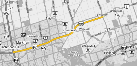
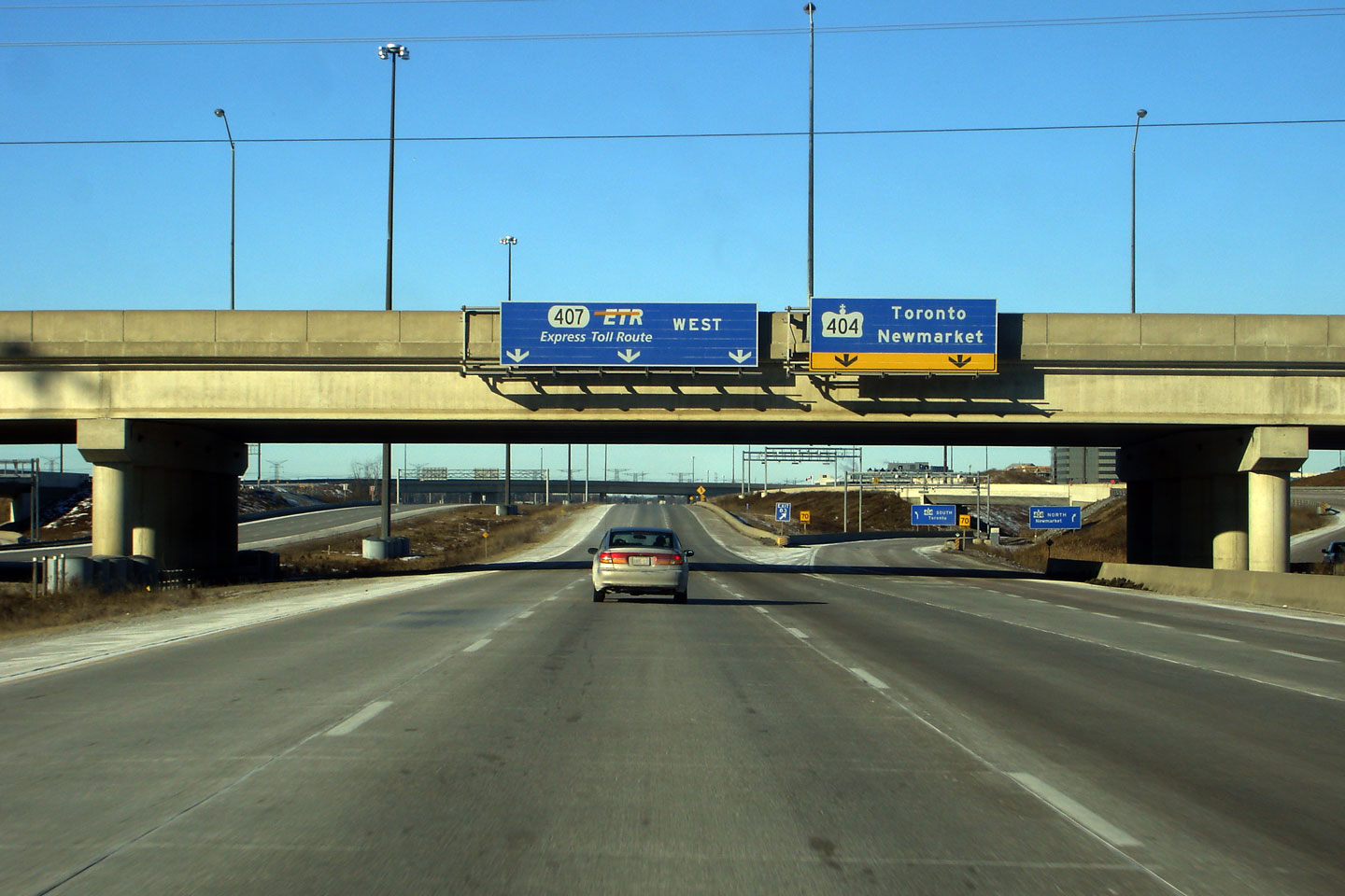
Highway 404 is a major north-south commuter highway between Toronto and Newmarket. Click here for Highway 404 images. |
||||
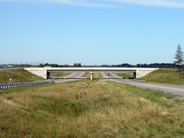
|
Town of Markham Regional Municipality of York |
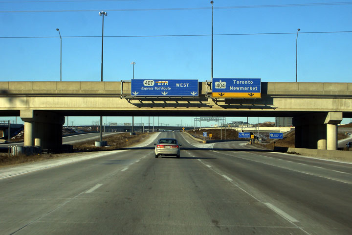
This picture shows Highway 407 looking west from the Woodbine Avenue
overpass in Markham. The west side of the Woodbine Avenue interchange
was opened in 2002, after significant negotiations with area land owners.
The Woodbine Avenue interchange also features braided ramps separating the
Woodbine and
Highway 404 interchanges. |
|||
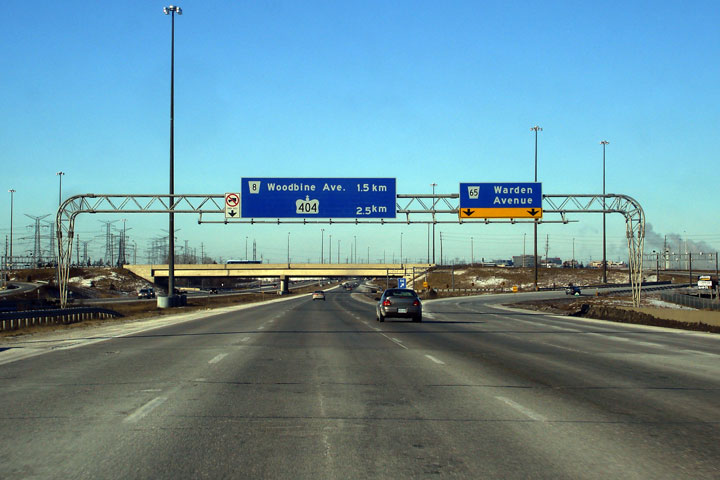
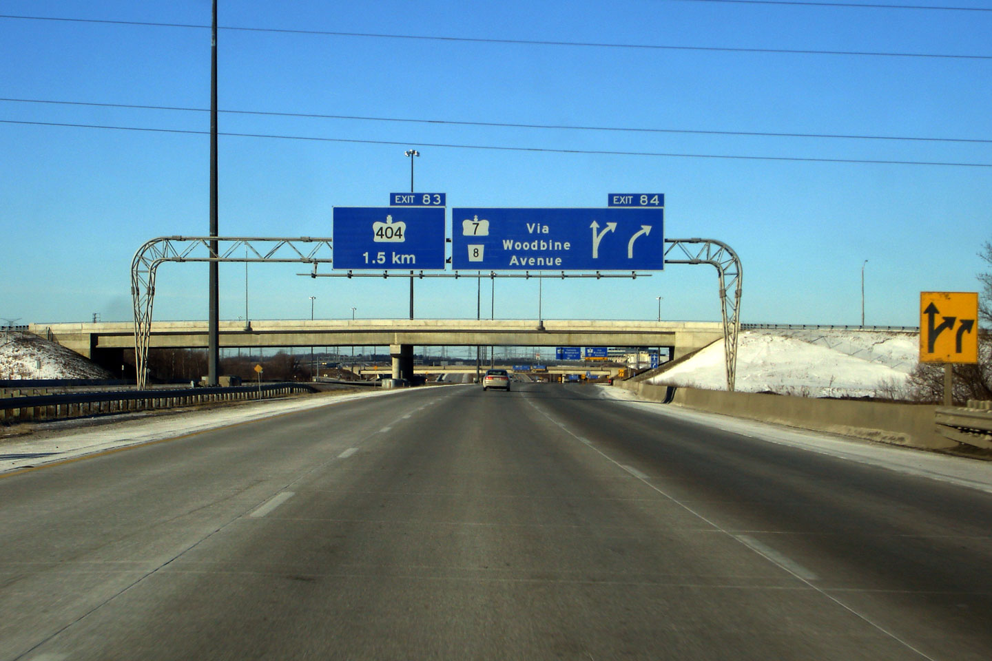
| Town of Markham Regional Municipality of York |
View looking easterly as the ramps to Highway 404 depart from the 407.
This overhead sign is affixed to the Woodbine Avenue overpass. Photo taken: February 24th, 2007. |
 Low
Res Low
ResHigh Res |
||
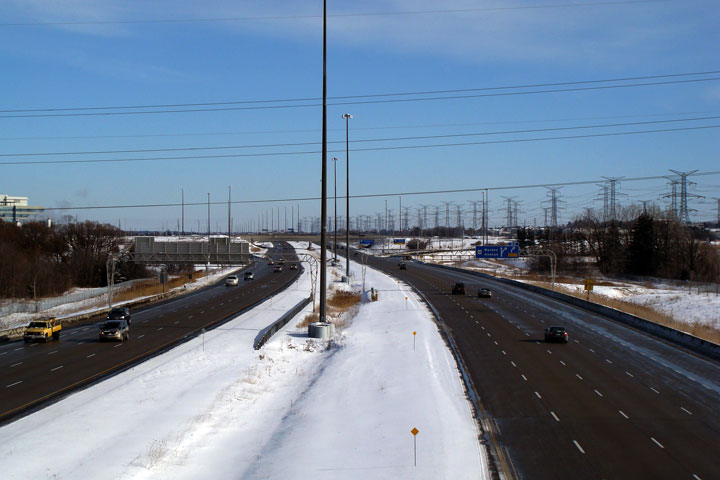
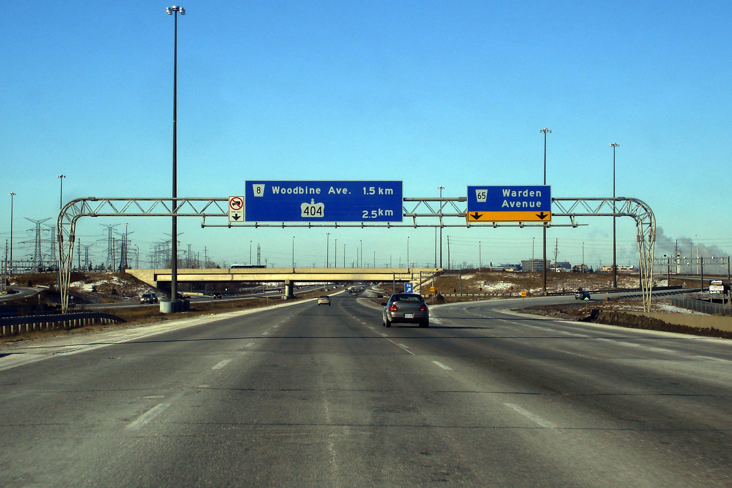
| Town of Markham Regional Municipality of York |
Looking east along Highway 407 from Woodbine Avenue. Woodbine Avenue
is located roughly at kilometre marker 84. From the
Highway 404 interchange easterly to Warden
Avenue, the eastbound Highway 407 carriageway has an auxiliary lane to
improve weaving and traffic flow along the highway. Photo taken: August 28th, 2005. Size: 45kb. |
 Low-res High-res |
||
| Town of Markham Regional Municipality of York |
View looking westerly towards the Woodbine Avenue and Highway 404
interchange from Roddick Road. Photo taken: January 11th, 2009. |
 Low-res High-res |
||
| Town of Markham Regional Municipality of York |
Easterly view from the Roddick Road interchange. The Roddick Road
flyover was completed and opened to traffic in the Fall of 2008. Photo taken: January 11th, 2009. |
 Low-res High-res |
||
| Town of Markham Regional Municipality of York |
Advanced signage for both the Woodbine Avenue and Highway 404 interchanges. Photo taken: February 24th, 2007. |
 Low
Res Low
ResHigh Res |
||
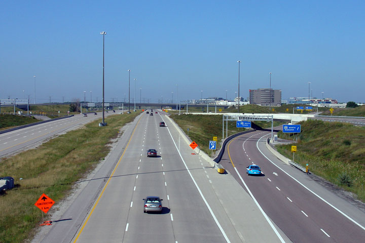
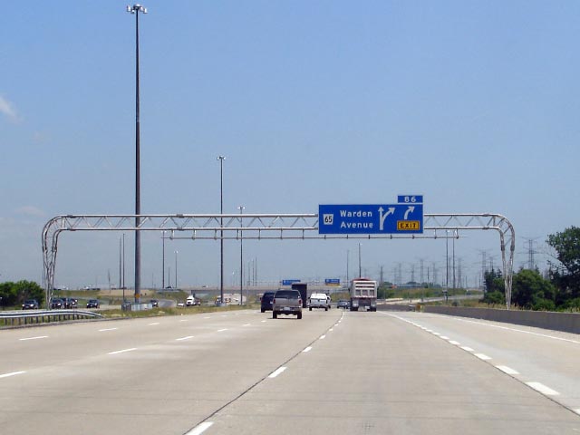
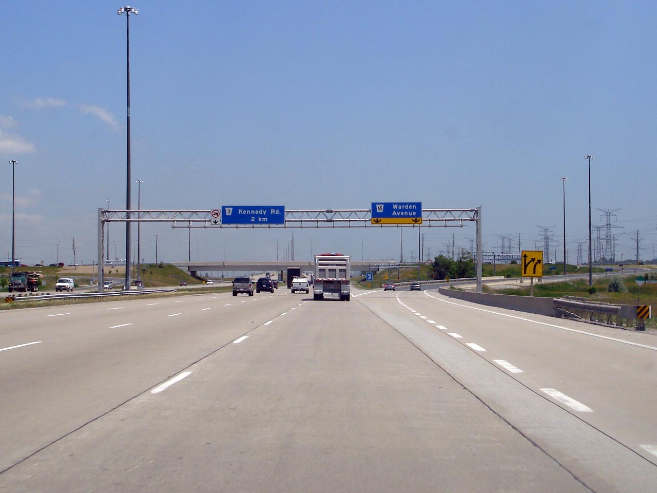
| Town of Markham Regional Municipality of York |
Overhead advanced sign denoting the eastbound off-ramp to Warden Avenue. Photo taken: June 15th, 2007. |
|||
| Town of Markham Regional Municipality of York |
Signage at the off-ramp to Warden Avenue. Notice this sign is
supported on a box-truss gantry, rather than a rounded truss gantry. Photo taken: June 15th, 2007. |
|||
| Town of Markham Regional Municipality of York |
View looking westerly from the Warden Avenue overpass. Note the double
overhead gantries that suspend the video toll cameras and magnetic sensors
over the highway on-ramp. Photo taken: June 15th, 2007. |
 Low-res High-res |
||
| Town of Markham Regional Municipality of York |
Looking east from the Warden Avenue overpass. Notice the eastbound
carriageway still has an extra lane from the Highway 404 on-ramp. Photo taken: June 15th, 2007. |
 Low-res High-res |
||
| Town of Markham Regional Municipality of York |
View looking westerly at the Warden Avenue interchange. I find it
curious how the 404 is centred on the pull-through distance sign. Photo taken: February 24th, 2007. |
 Low
Res Low
ResHigh Res |
||
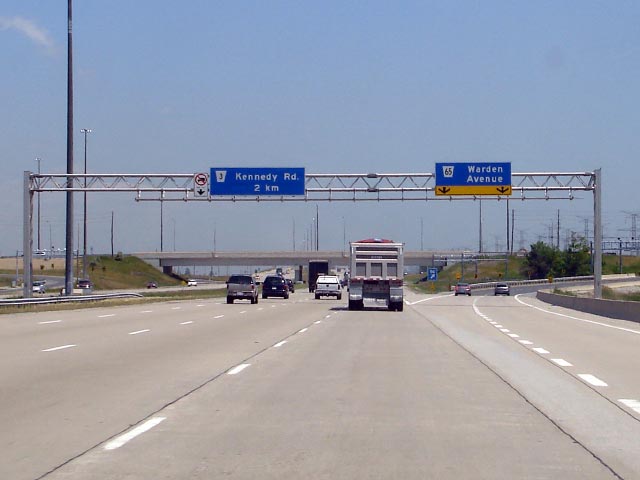
| Town of Markham Regional Municipality of York |
A westerly view from the Kennedy Road overpass. Between Warden and
Kennedy, Highway 407 passes overtop of the Stouffville GO rail line. Photo taken: June 15th, 2007. |
 Low-res High-res |
||
| Town of Markham Regional Municipality of York |
This photo looks east from Kennedy Road. Notice the paved acceleration
lane. When Highway 407 was first constructed, all interchanges east of
Warden were opened as west partial interchanges. Photo taken: June 15th, 2007. |
 Low-res High-res |
||
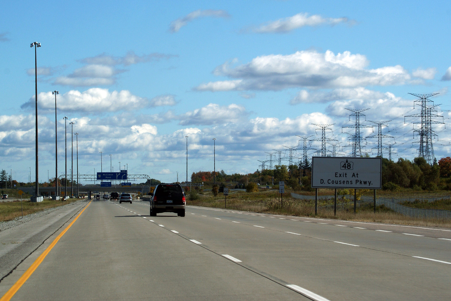
| Town of Markham Regional Municipality of York |
White advanced sign directing Highway 48-bound traffic to take the Donald
Cousens Parkway interchange. Before Donald Cousens Parkway (formerly
the Markham By-pass) was completed Highway 48-bound traffic was directed
northerly along McCowan Road northerly to Major Mackenzie Drive. Photo taken: October 10th, 2009. |
 Low
Res Low
ResHigh Res |
||
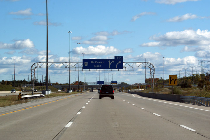
| Town of Markham Regional Municipality of York |
Overhead guide signage in advance of the McCowan Road interchange. You
can still see remnants of the old lane markings that diverted all traffic to
the ramp when the tollway ended at McCowan Road. Highway 407 ended at
McCowan Road between 1998 and 1999. Photo taken: October 10th, 2009. |
 Low
Res Low
ResHigh Res |
||
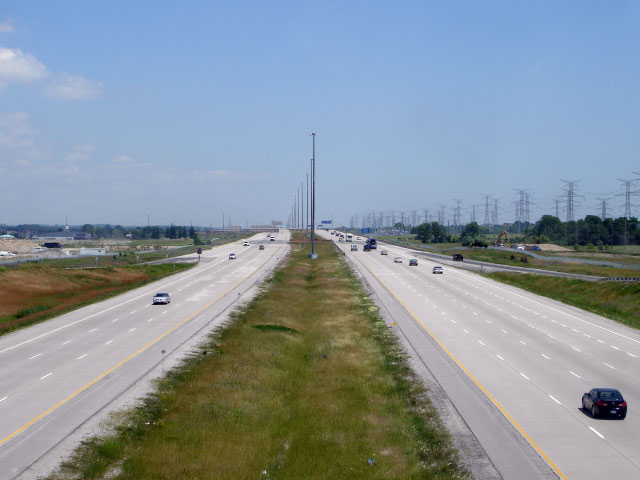
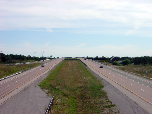
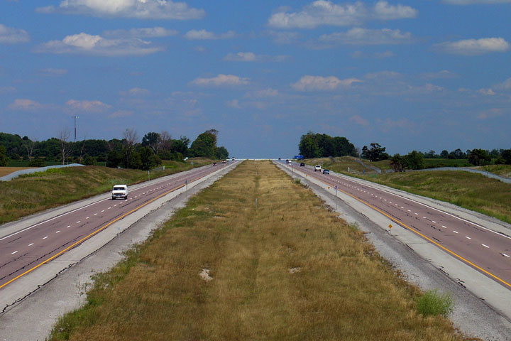
| Town of Markham Regional Municipality of York |
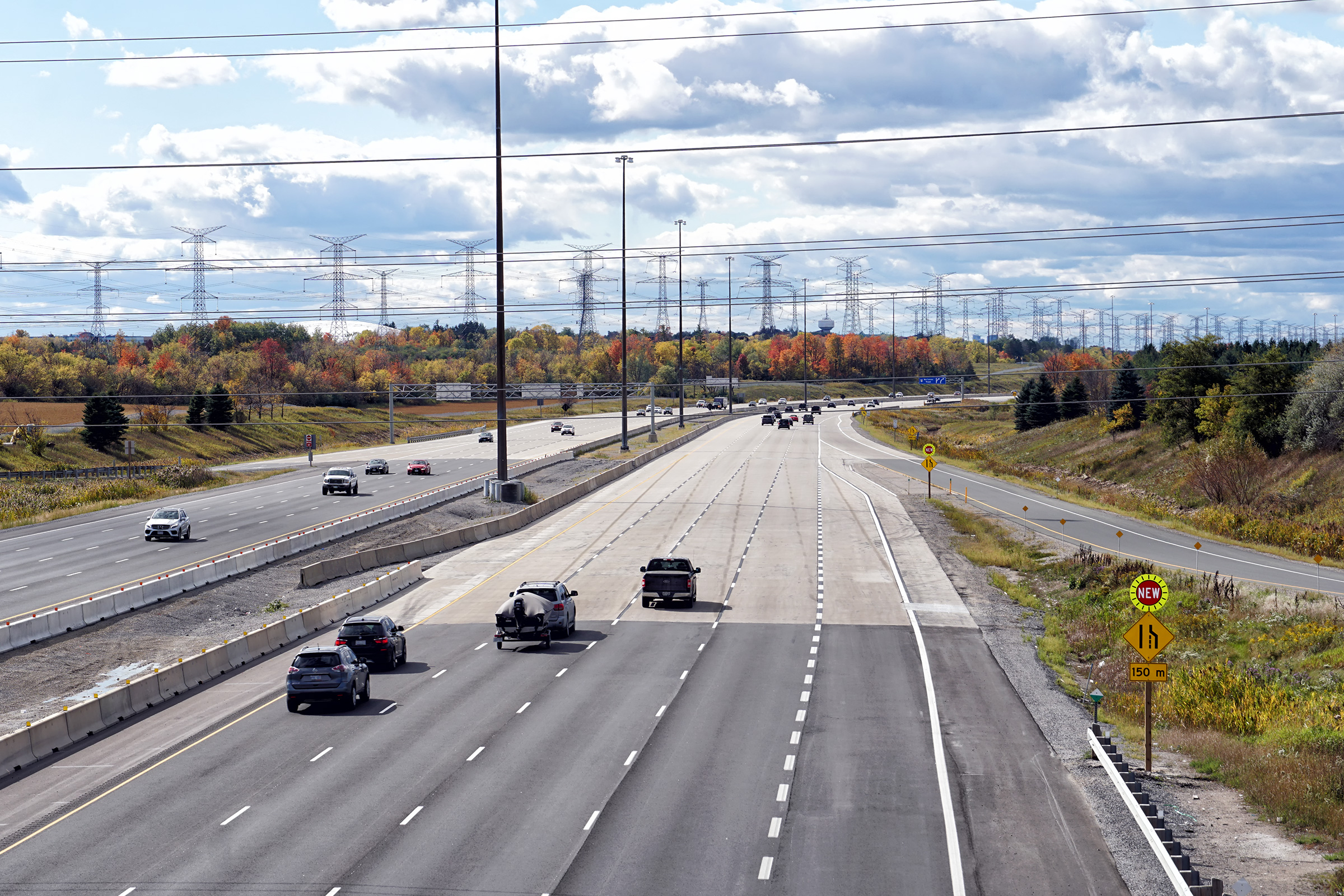
View as the eastbound ramp to McCowan Road departs from the mainline lanes.
In 2010, Highway 407 will be eight-laned east of Highway 404, so really, I
took these photos at McCowan Road to further document what the highway
looked like with its grass median in tact. In 1997, when the bulk of
the highway first opened, the carriageways were split with a grass median as
pictured here for the entire length of the road. Photo taken: October 10th, 2009. |
 Low
Res Low
ResHigh Res |
||
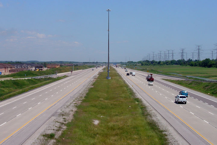
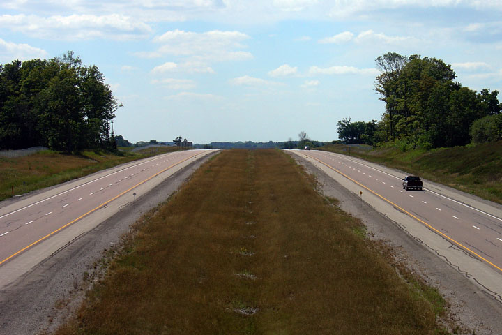
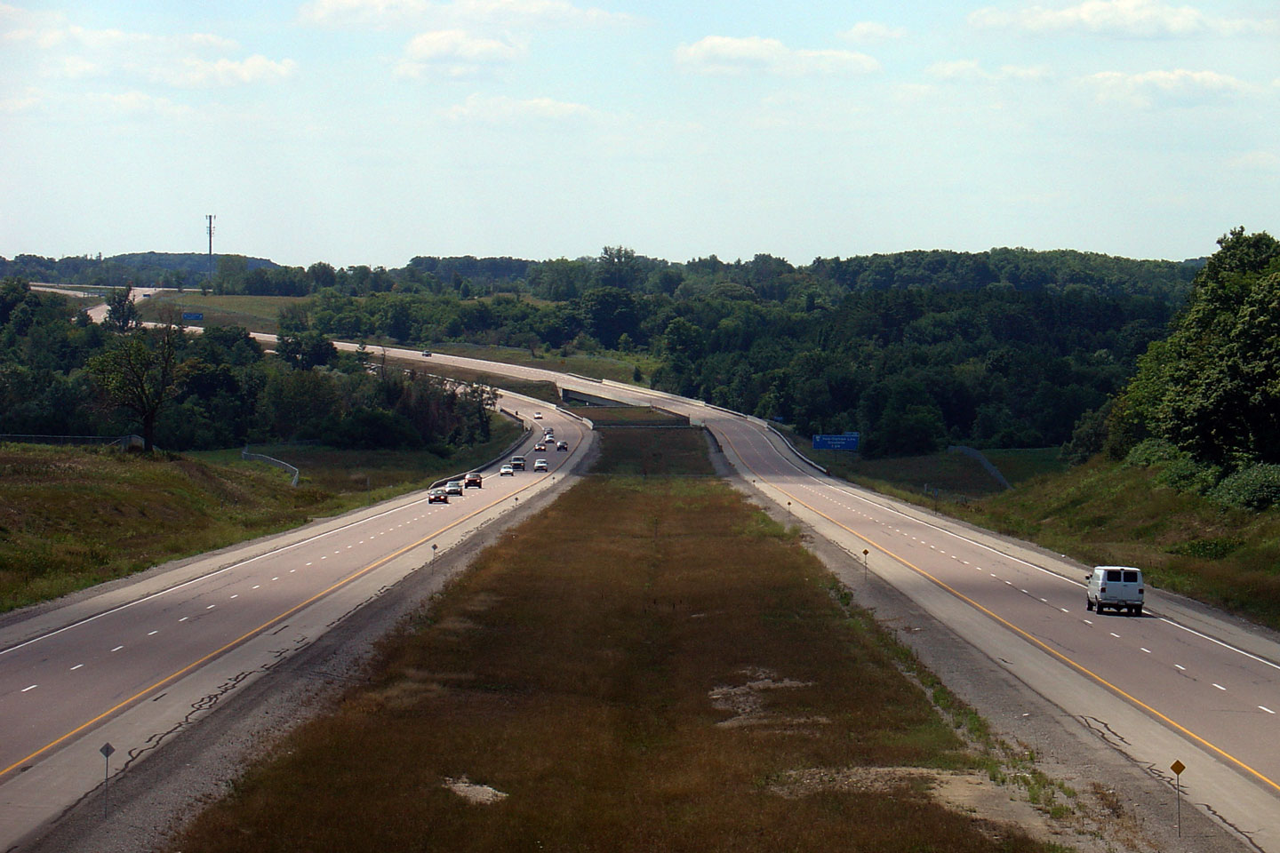
| Town of Markham Regional Municipality of York |
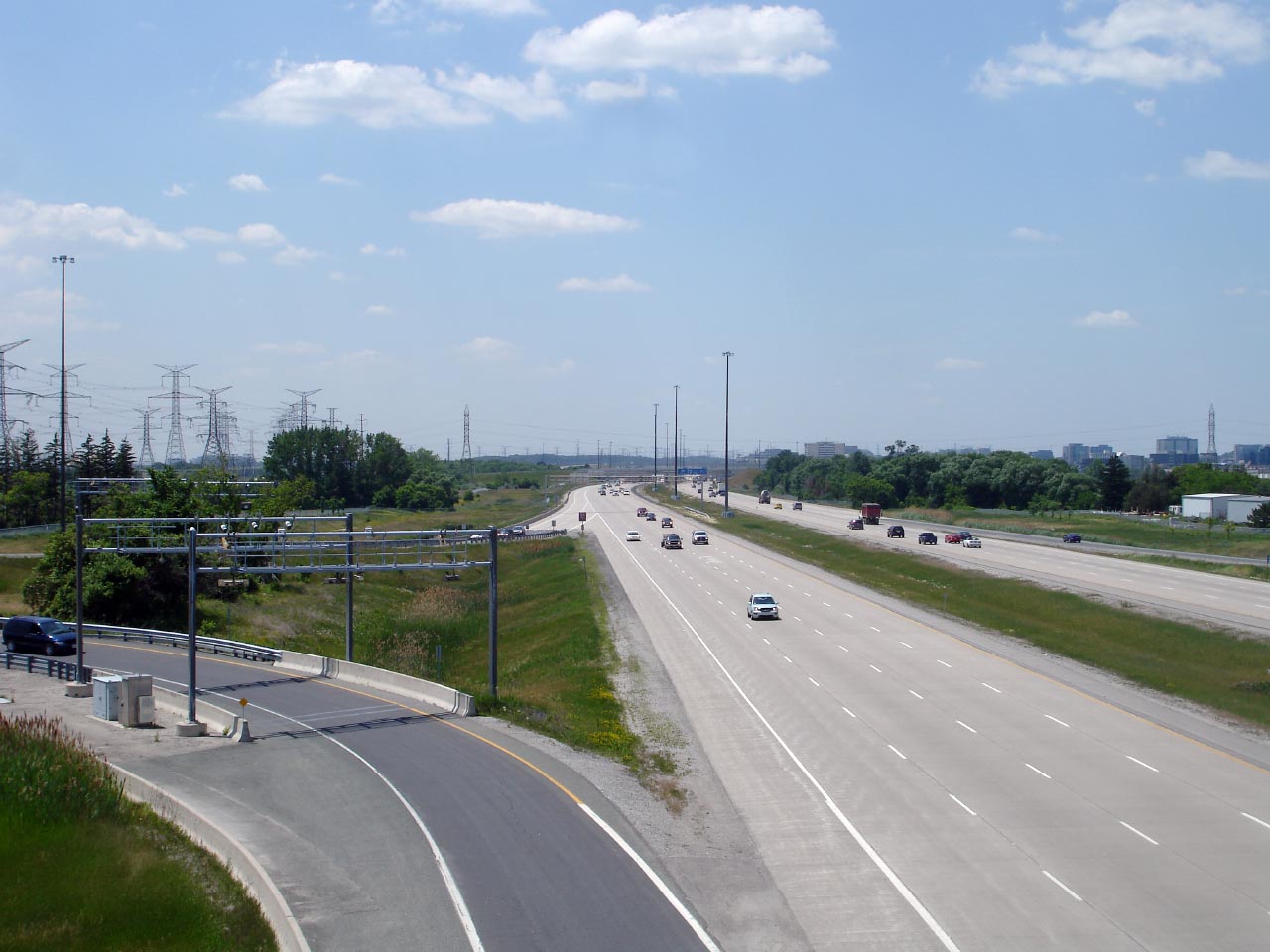
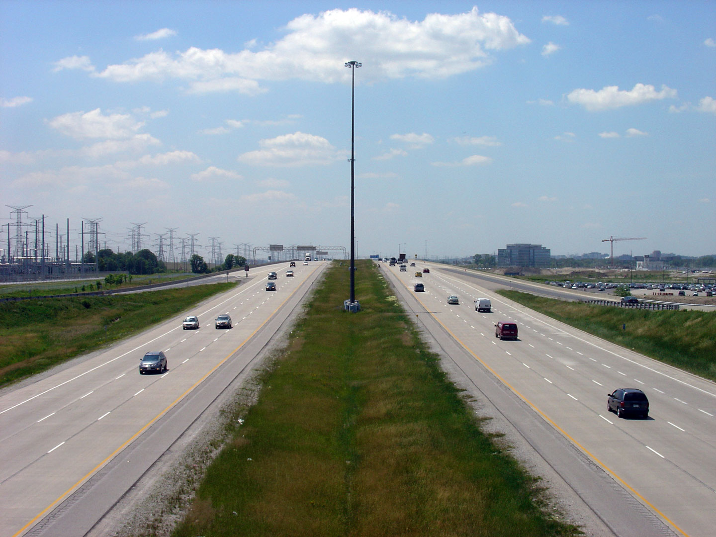
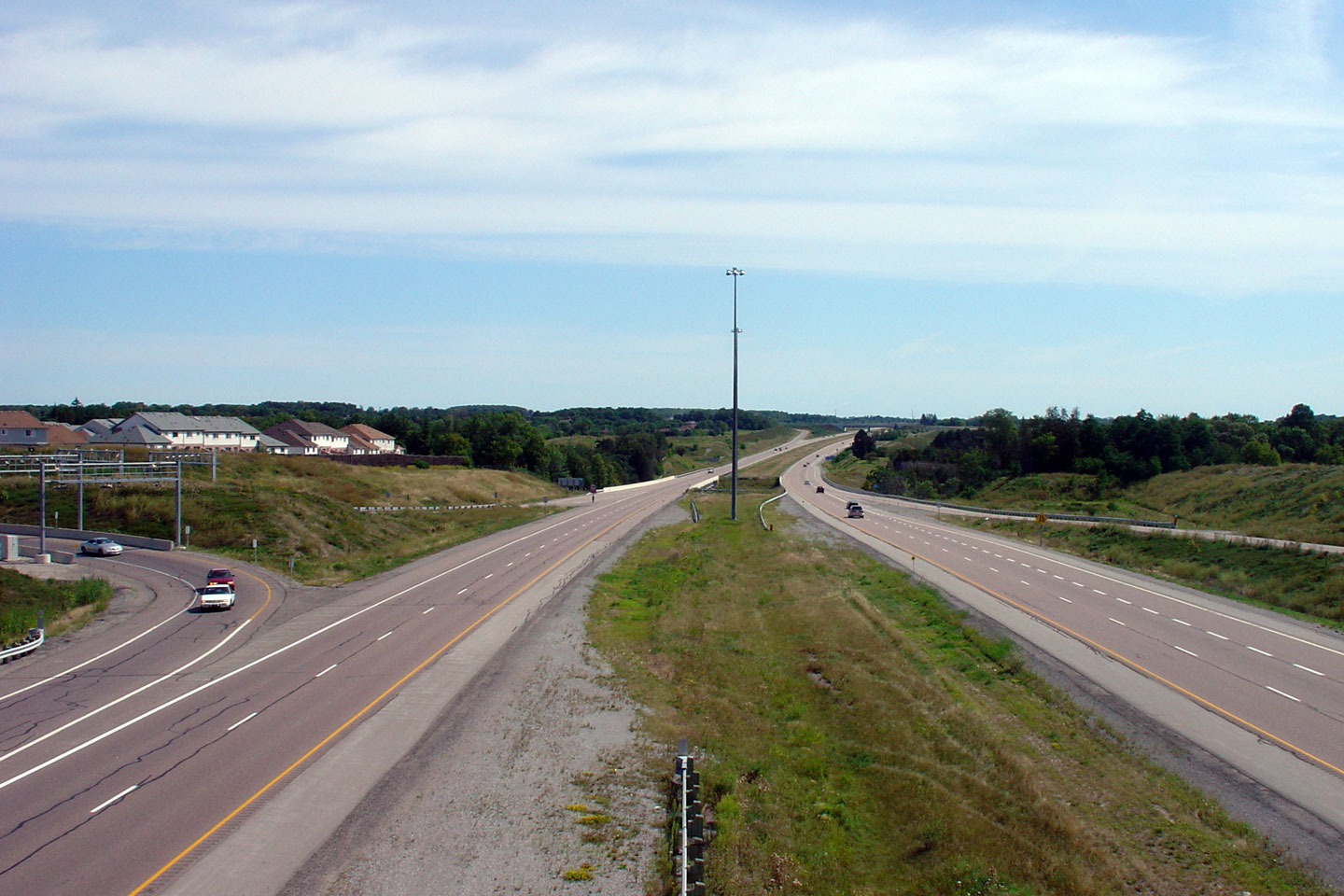
Looking westerly along Highway 407 from the McCowan Road overpass in
Markham. McCowan Road was the first temporary terminus of Highway 407
when it was first extended east of Highway 404 in 1998. McCowan Road is
located roughly at kilometre marker 90. Upper photo taken: August 12th, 2006. Lower photo taken: June 15th, 2007. |
 Low-res High-res 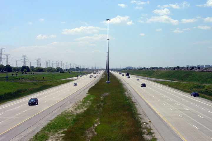 Low-res High-res |
||
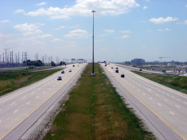
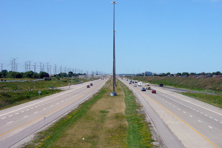
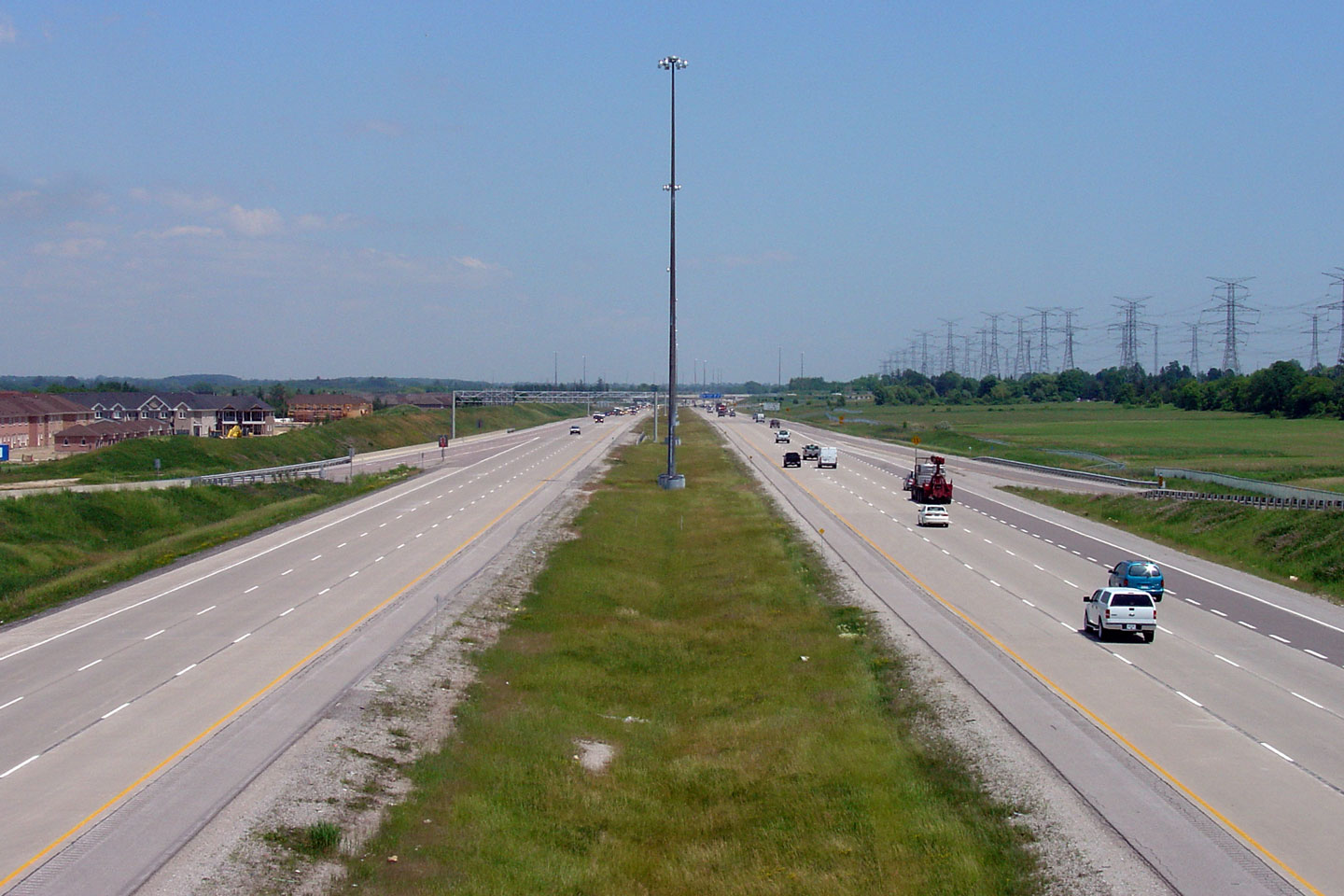
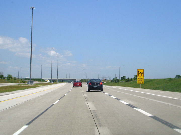
| Town of Markham Regional Municipality of York |
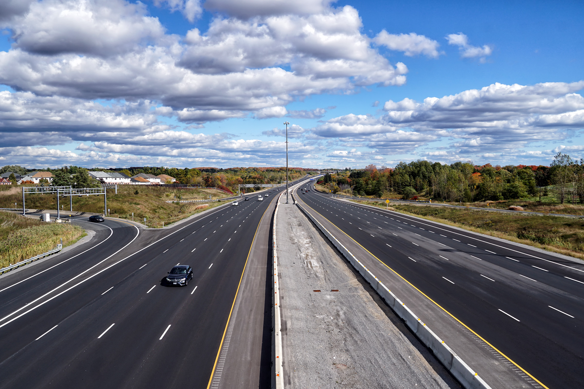
Looking east from the McCowan Road overpass. Highway 407 was widened
from 4-6 lanes between McCowan Road and Markham Road late in the fall of
2006. Upper photo taken: August 12th, 2006. Lower photo taken: June 15th, 2007. |
 Low-res High-res 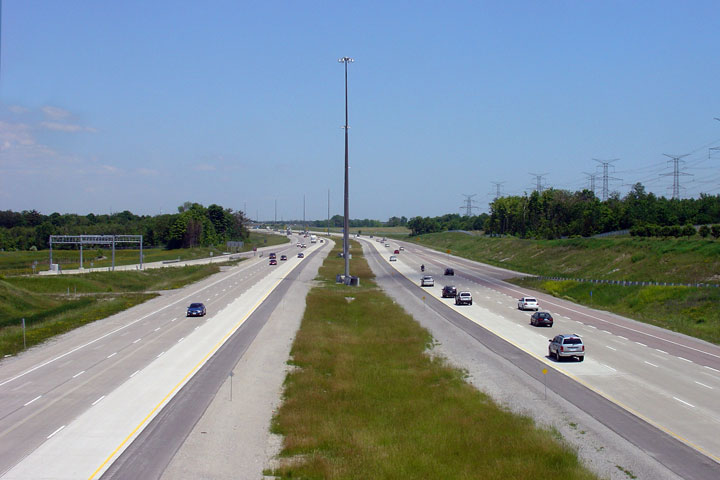 Low-res High-res |
||
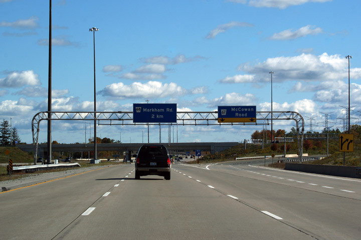
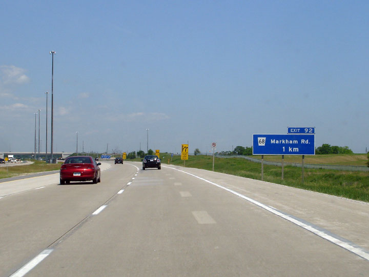
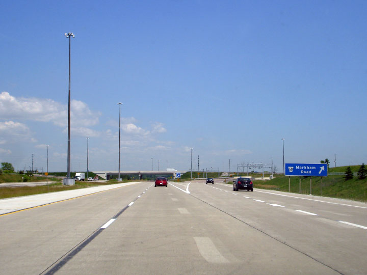
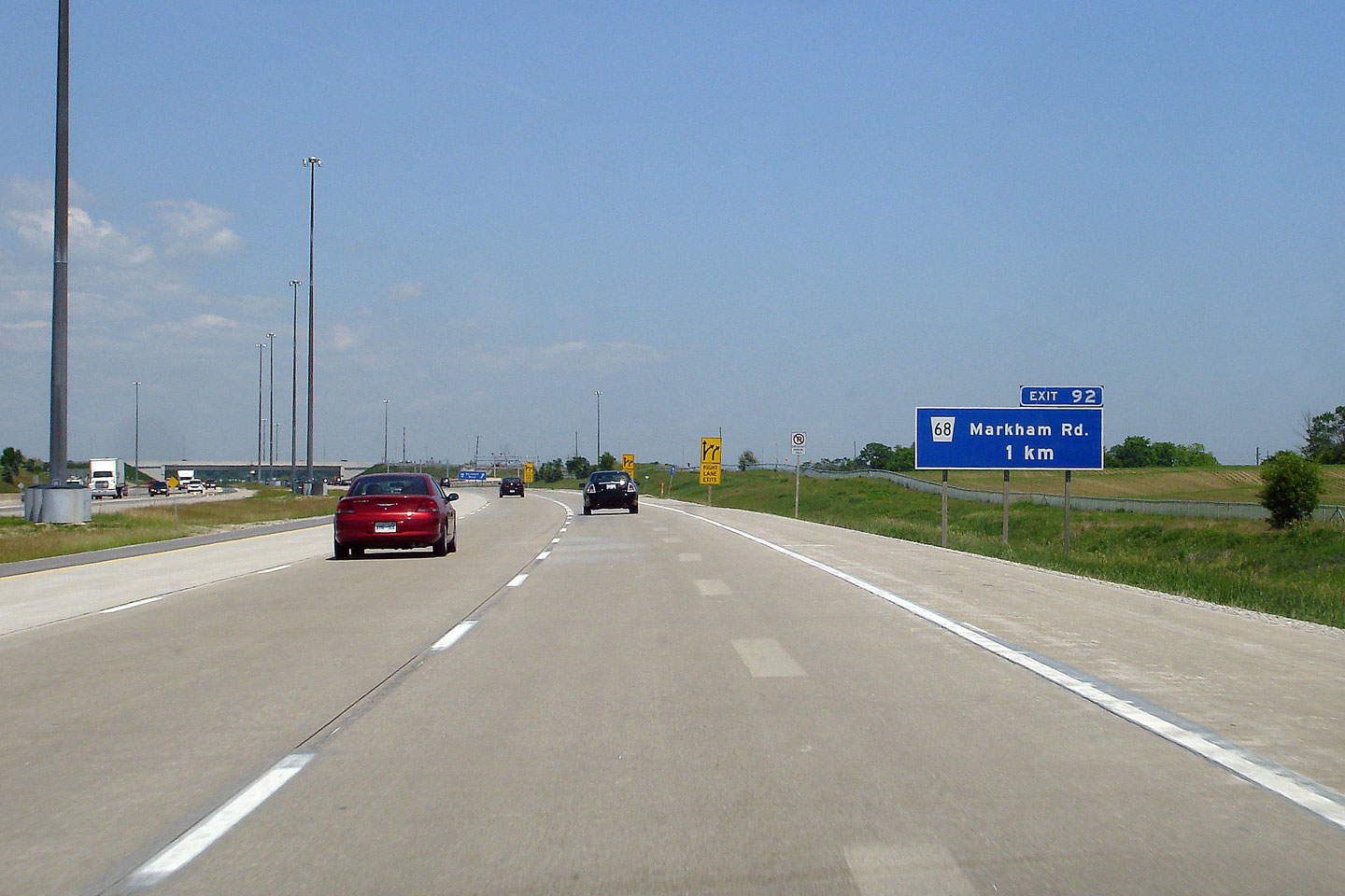
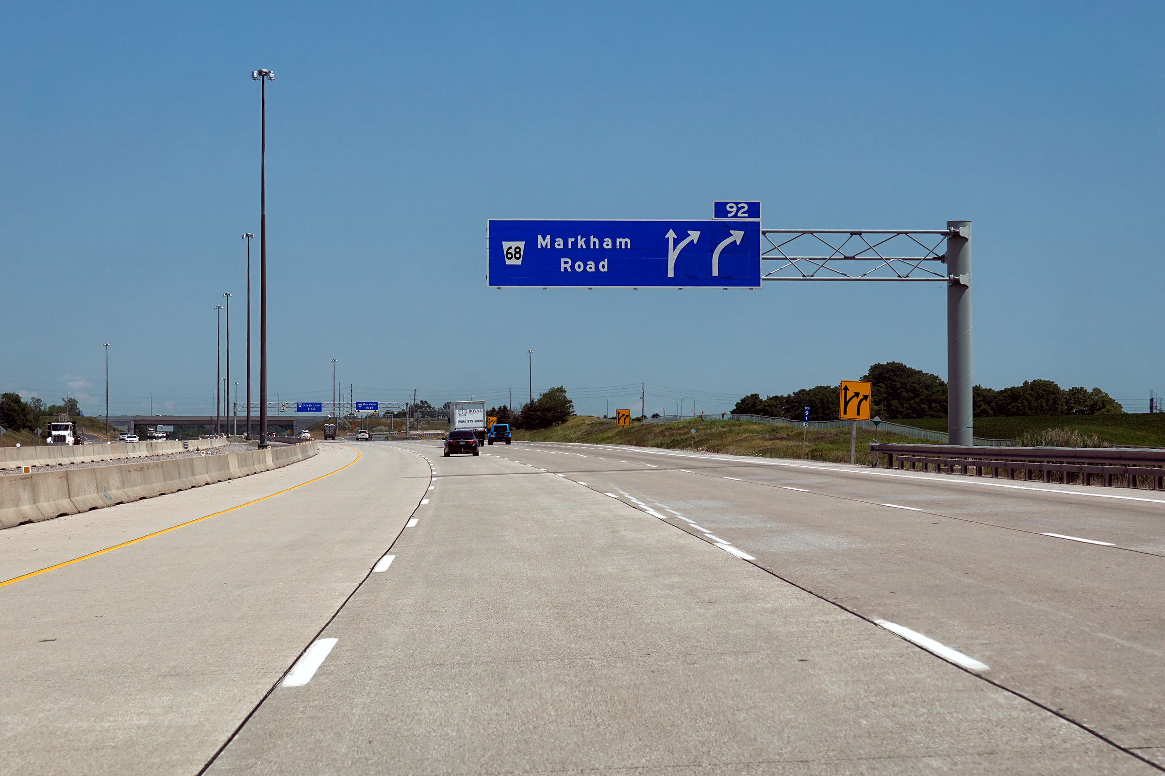
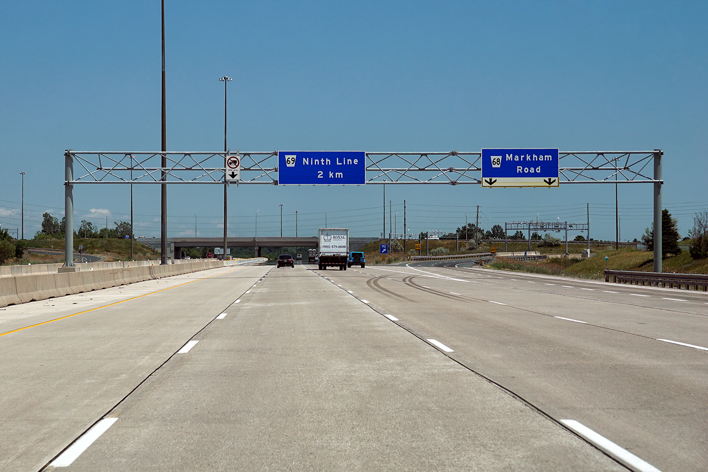
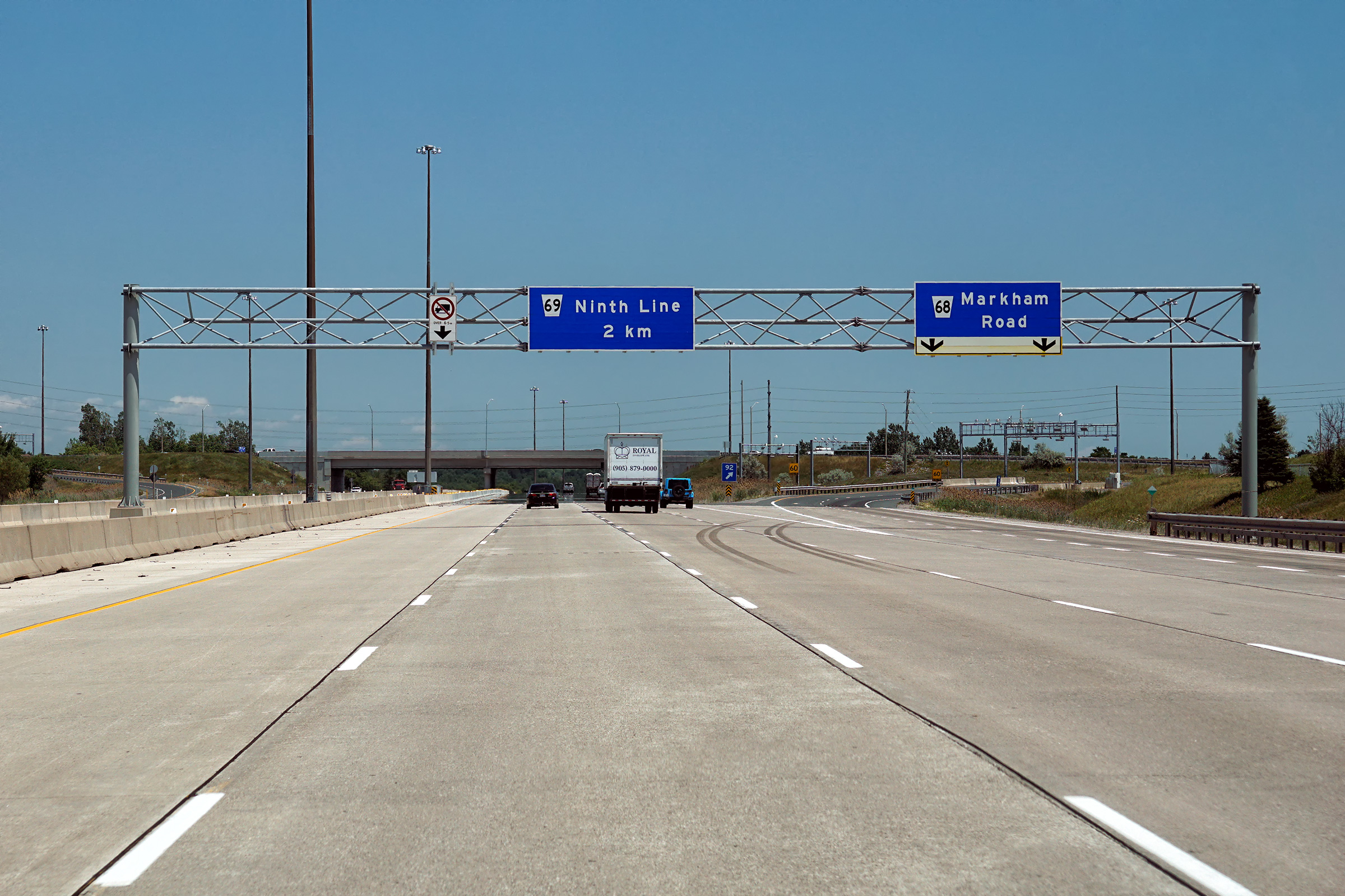
| Town of Markham Regional Municipality of York |
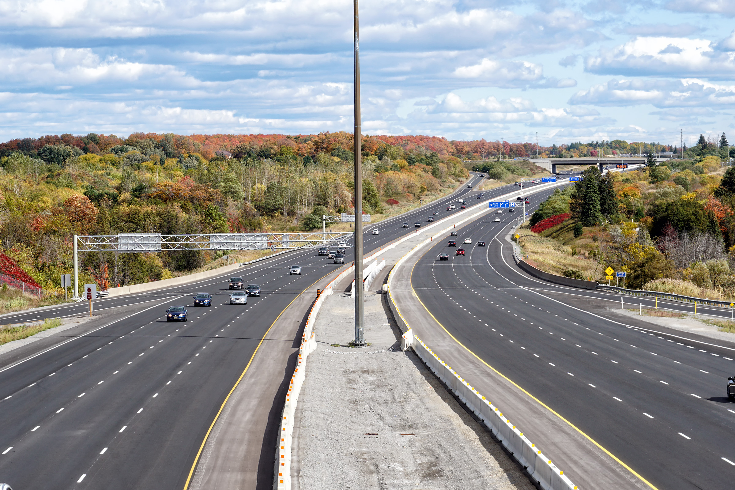
Eastbound guide signage approaching the Markham Road interchange. The
2007 photo shows ground mounted signage for the Markham Road interchange,
which seems rather unfathonable in 2020. The lower photo shows the
current overhead signage. For many years,
the 407 lost a lane at the Markham Road
interchange. Upper photo taken: June 15th, 2007. Lower photo taken: July 6th, 2020. |
 (720x480) (720x480)(1440x960) (2400x1600) |
||
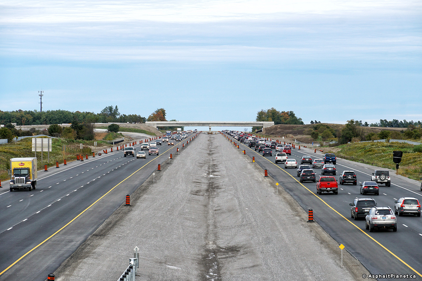
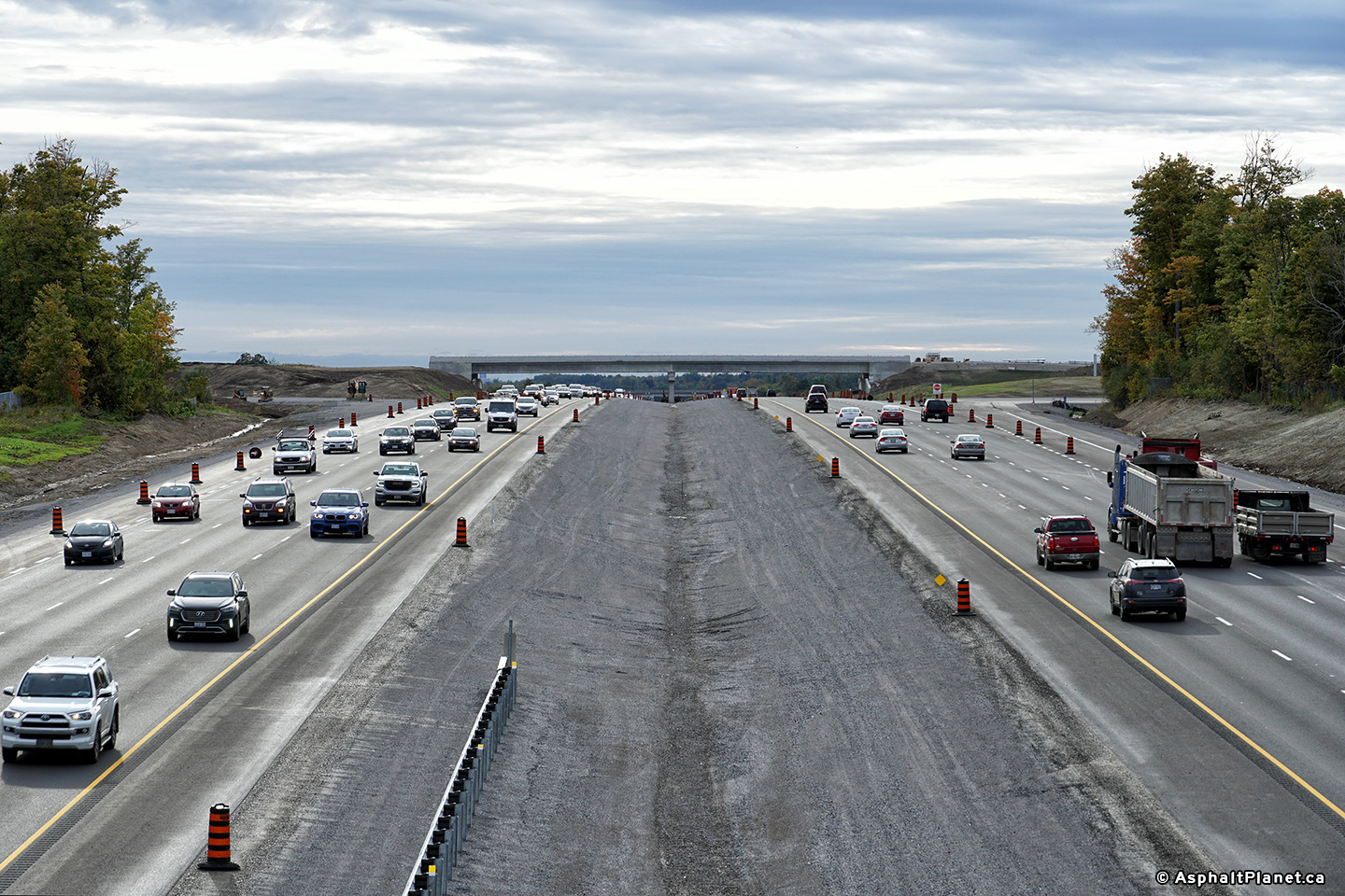
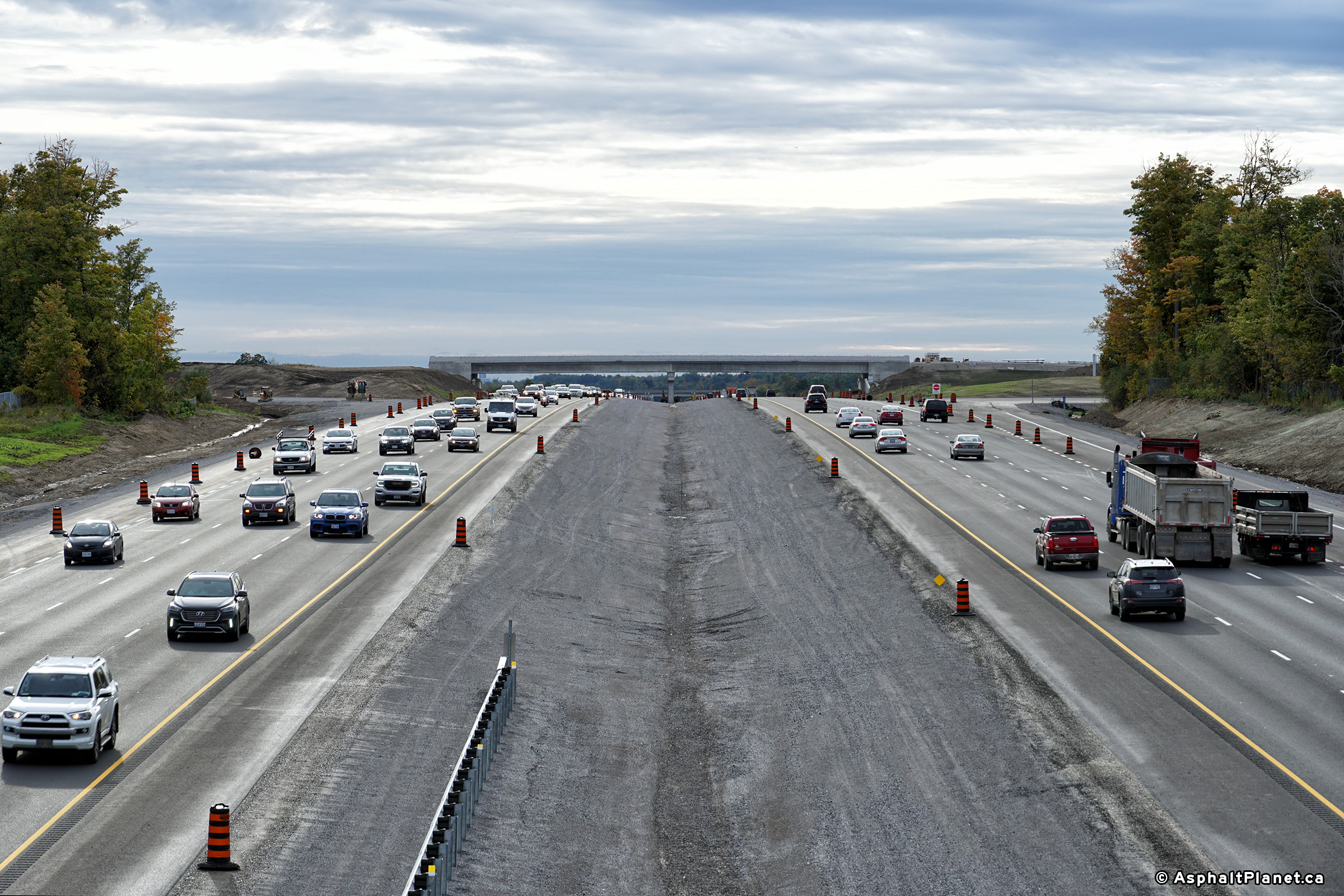
| Town of Markham Regional Municipality of York |
Driving east at the off-ramp to Markham Road. The upper photo shows the 407
narrowing to a four-lane highway east of the Markham Road interchange.
In 2019, the 407 was widened to eight lanes (four per direction) east of
Markham Road to York-Durham Line. Upper photo taken: June 15th, 2007. Lower photo taken: July 6th, 2020. |
|
||
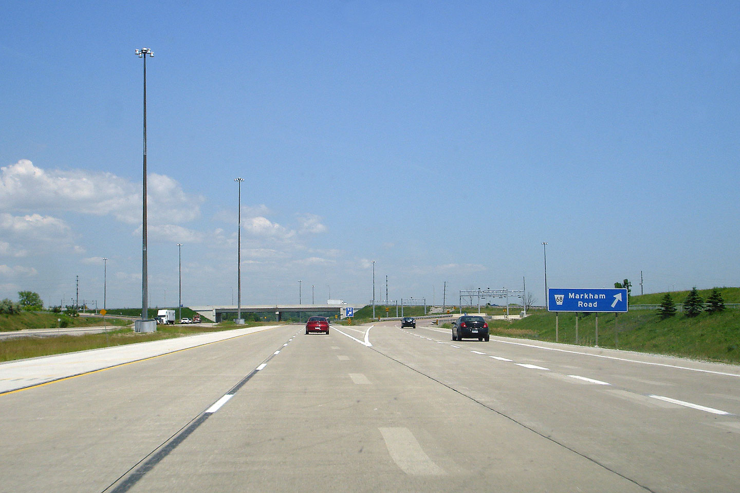
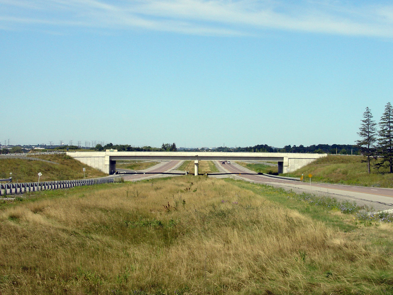
| Town of Markham Regional Municipality of York |
View looking west from the Markham Road (Highway
48) overpass. Originally, Highway 407 met Markham Road at a 'T'
junction, before the overpass and partial interchange was completed.
Markham Road marked the eastern terminus of Highway 407 before the
east-partial extension was completed in 2001. Photo taken: August 12th, 2006. |
 (720x480) (1440x960) (2400x1600)  (720x480) (1440x960) (2400x1600) |
||
| Highway 48 began its trek north from Scarborough until 1998 when the highways southern terminus was moved to Vinegar Hill. Click here for Highway 48 images. | ||||
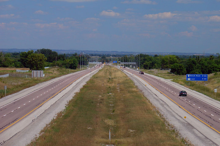
| Town of Markham Regional Municipality of York |
View looking east from Markham Road towards Pickering. Between the
Markham Road and Ninth Line overpasses Highway 407 crosses the Rouge River
valley. Markham Road is located roughly at kilometre marker 92. Photo taken: August 12th, 2006. |
 (720x480) (1440x960) (2400x1600) 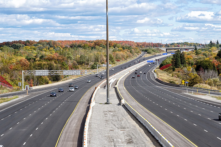 (720x480) (1440x960) (2400x1600) |
||
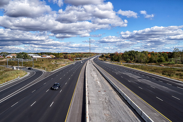
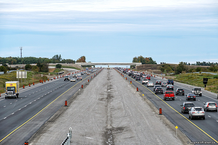
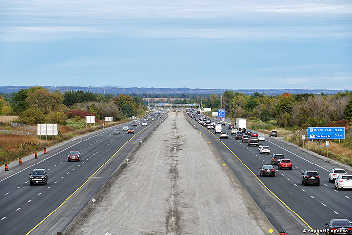
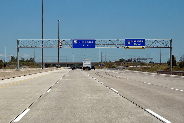
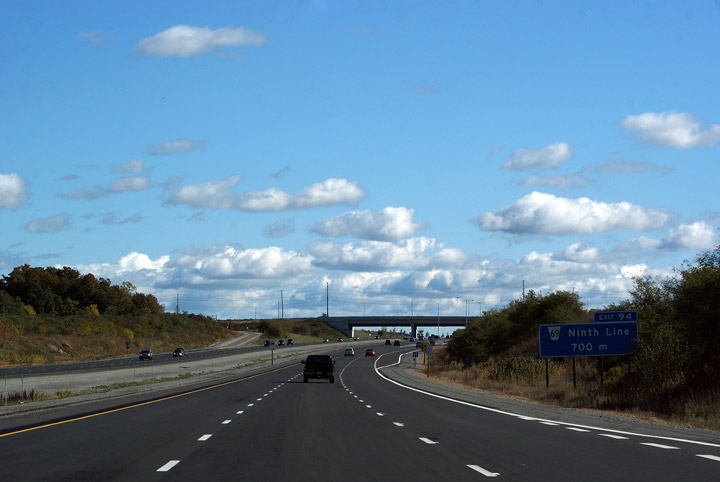
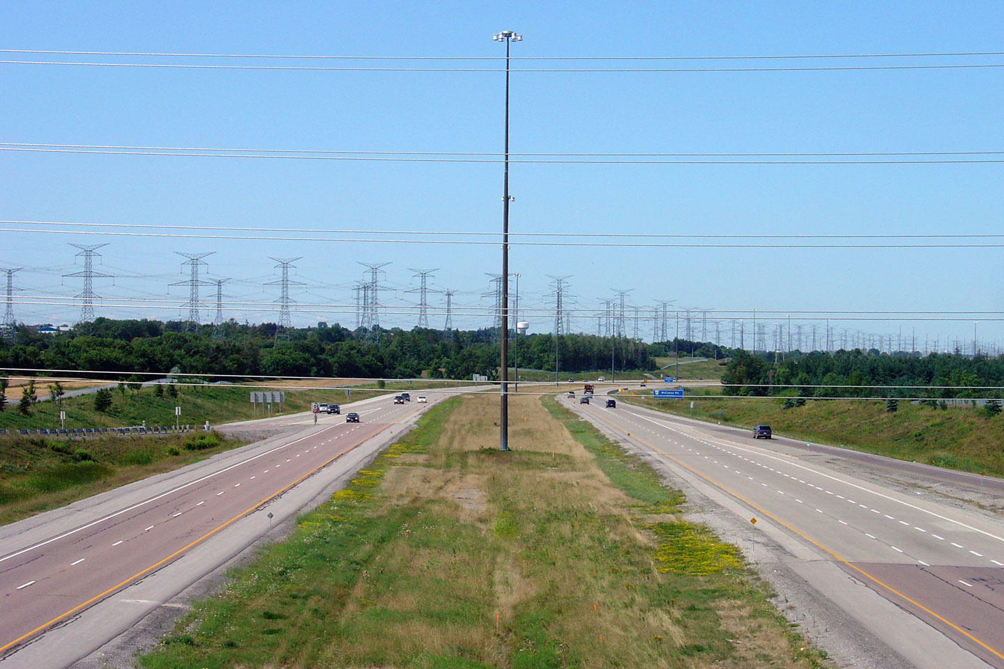
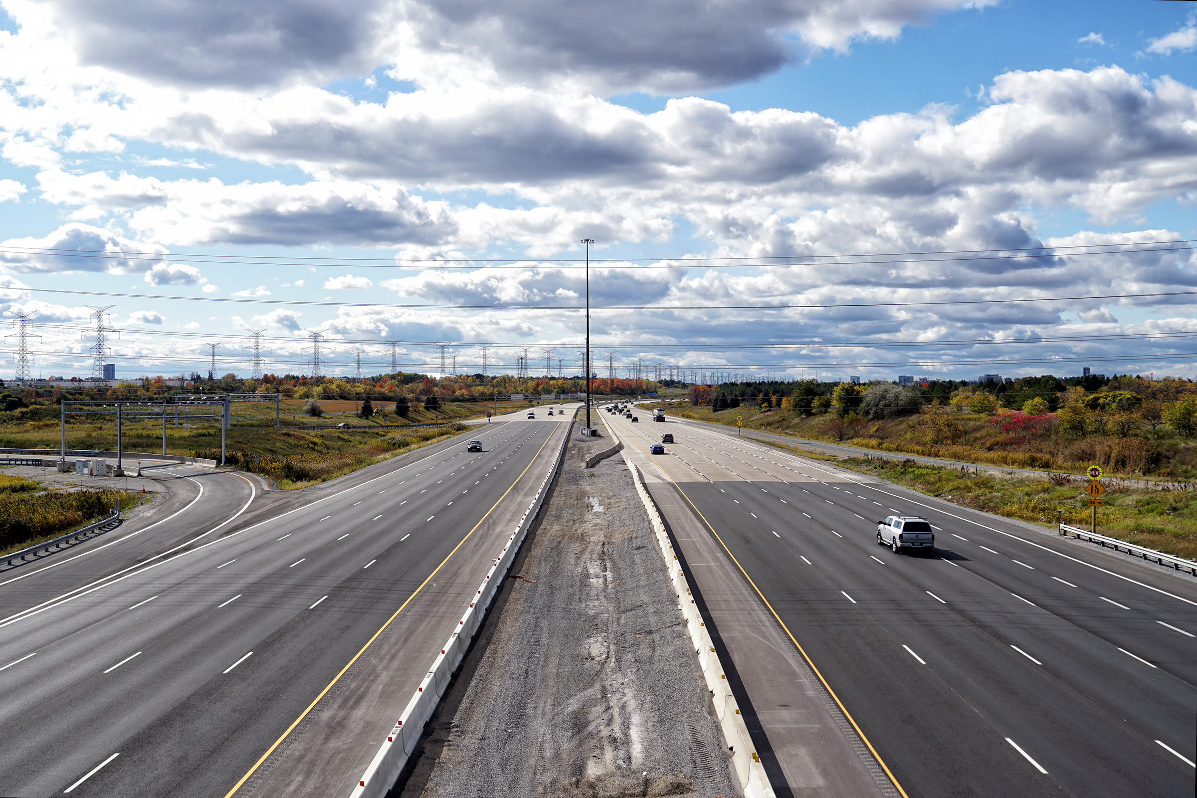
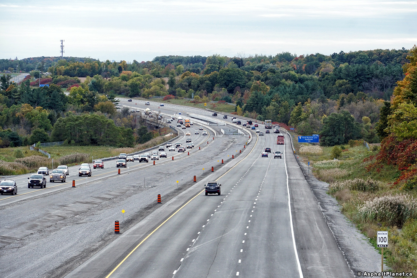
| Town of Markham Regional Municipality of York |
Eastbound advanced signage for the Ninth Line intersection. The 407
had been widened from four to six lanes in a construction project that was
completed shortly before the upper photo was taken in 2009. Upper photo taken: October 10th, 2009. Lower photo taken: July 6th, 2020. |
 (720x480) (720x480)(1440x960) (2400x1600) |
||
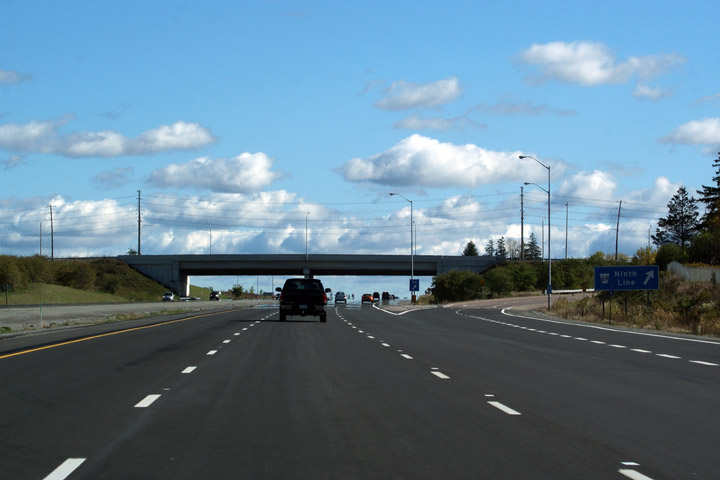
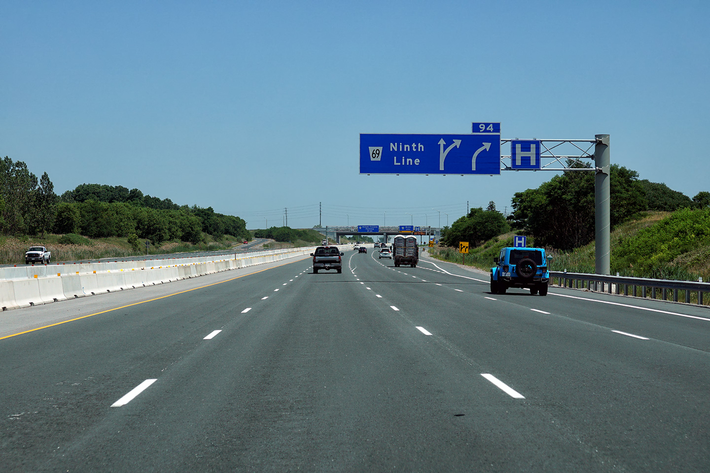
| Town of Markham Regional Municipality of York |
Guide signage for the eastbound
exit to Ninth Line. Upper photo taken: October 10th, 2009. Lower photo taken: July 6th, 2020. |
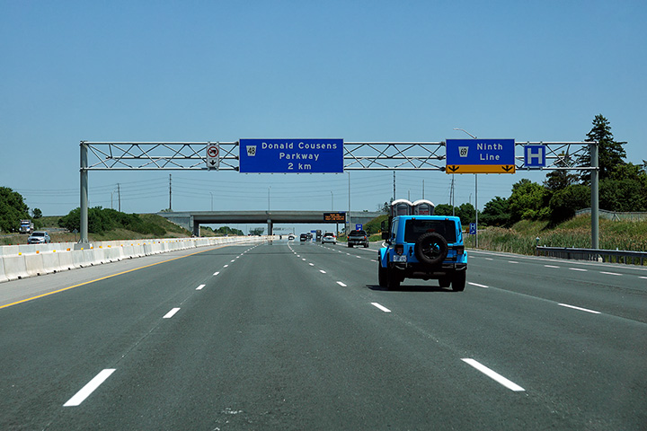 (720x480) (720x480)(1440x960) (2400x1600) |
||
| Town of Markham Regional Municipality of York |
This photo looks west through the Rouge Valley from the Ninth Line overpass. Photo taken: August 12th, 2006. |
 Low-res High-res |
||
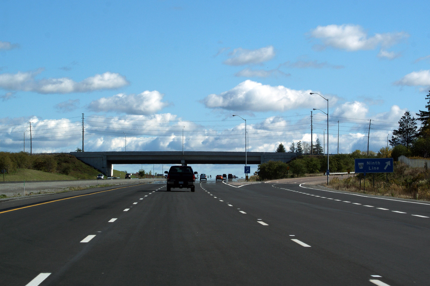
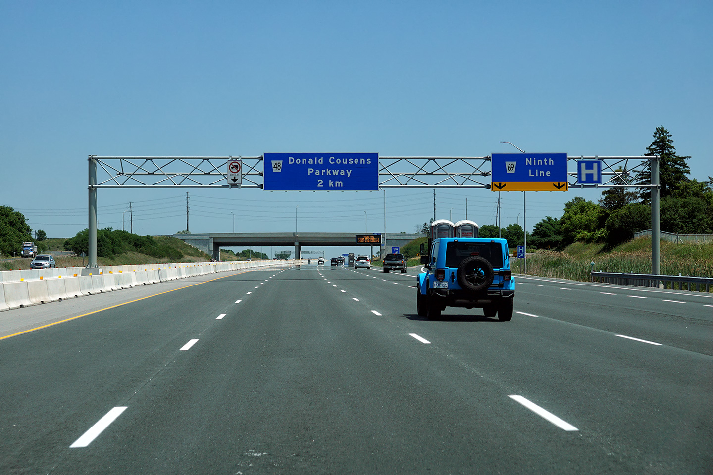
| Town of Markham Regional Municipality of York |
View looking east towards the Donald Cousens Parkway interchange from Ninth
Line. The
Parkway interchange was completed and opened to traffic in 2004. Photo taken: August 12th, 2006. |
 Low-res High-res |
||
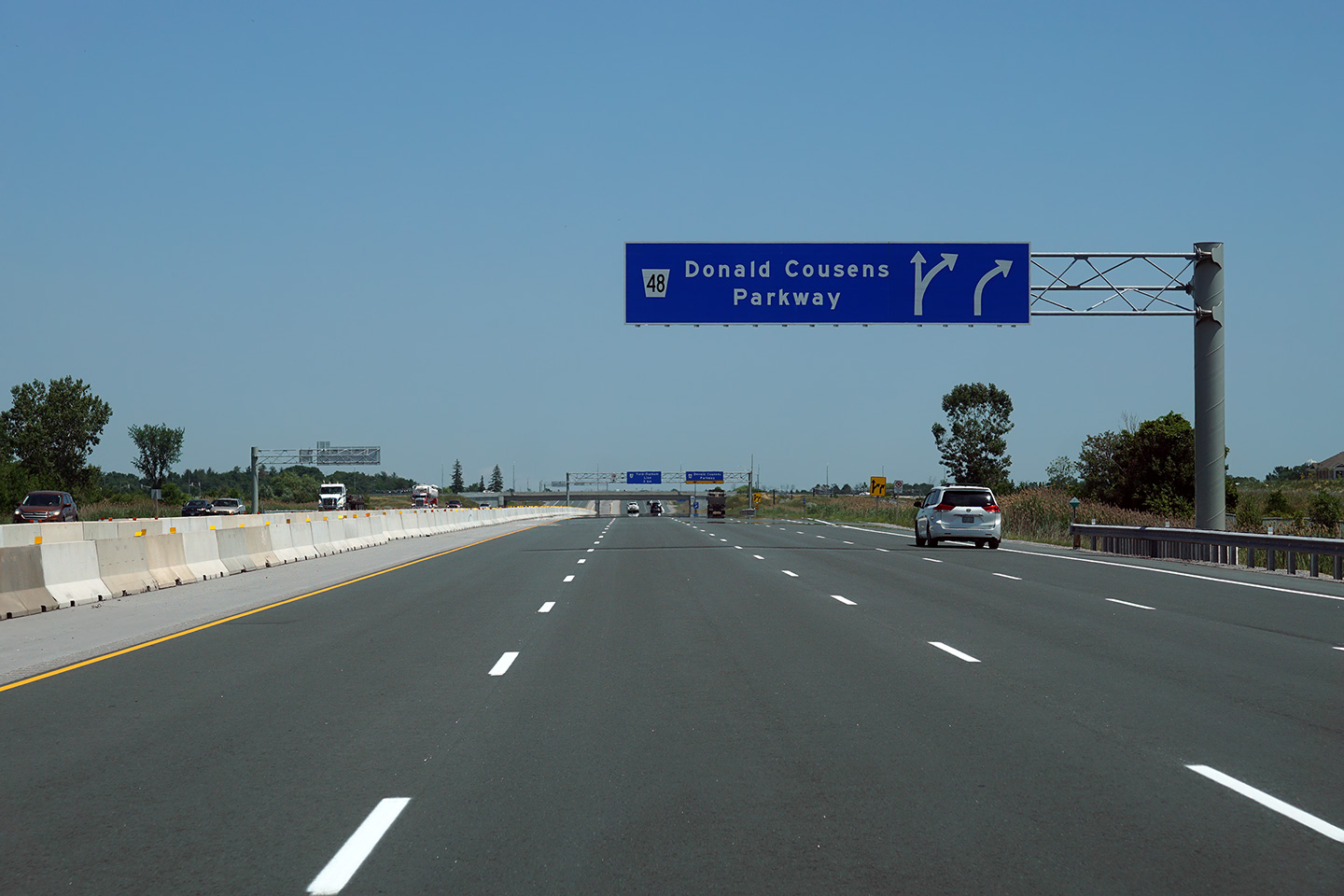
| Town of Markham Regional Municipality of York |
Eastbound signage for the off-ramp to Donald Cousins Parkway. Photo taken: July 6th, 2020. |
 (720x480) (720x480)(1440x960) (2400x1600) |
||
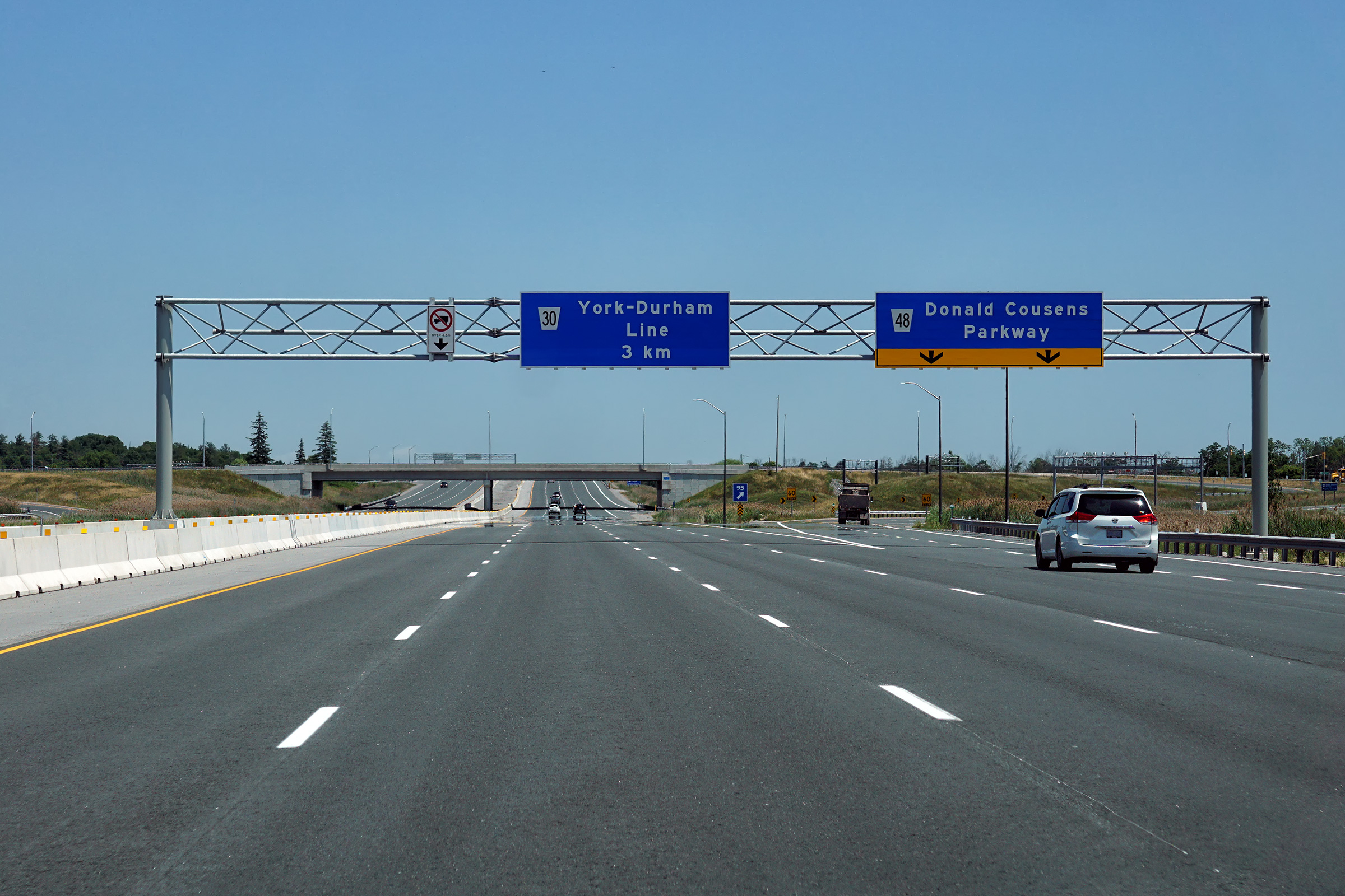
| Town of Markham Regional Municipality of York |
Signage at the eastbound off-ramp to Donald Cousins Parkway. Photo taken: July 6th, 2020. |
 (720x480) (720x480)(1440x960) (2400x1600) |
||
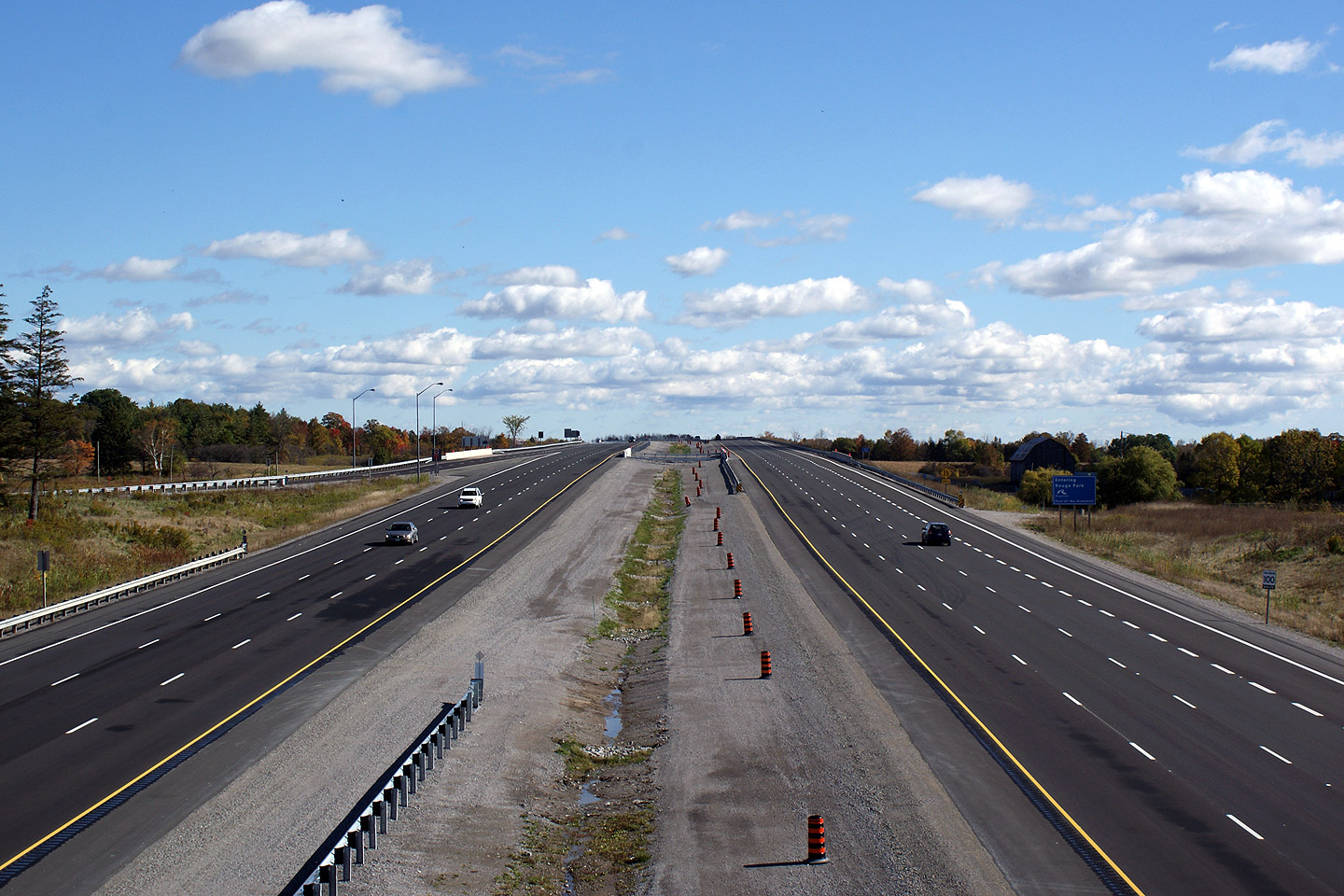
| Town of Markham Regional Municipality of York |
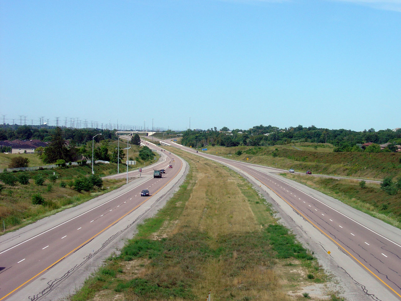
Looking west from the Donald Cousens Parkway interchange. Donald
Cousens Parkway was known as the Markham By-pass until the fall of 2007.
Donald Cousens was the mayor of Markham between 1994 and 2006. Upper photo taken: August 12th, 2006. Lower photos taken: October 10th, 2009. |
 Low-res High-res 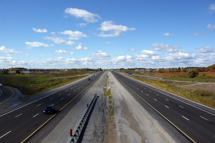 Low-res High-res 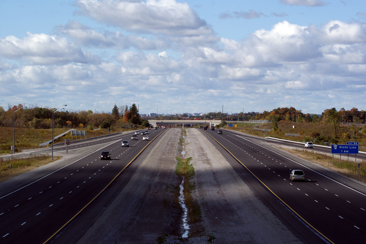 Low-res High-res |
||
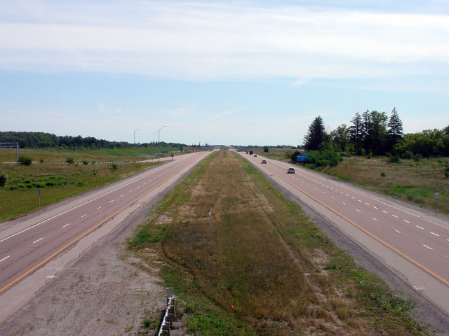
| Town of Markham Regional Municipality of York |
Two view's looking east towards the Reesor Road underpass from Donald Cousens
Parkway. Donald Cousens Parkway, (a by-pass of the Markham Village) is
numbered as York Regional Road 48. It was intended to be part of Highway
48. York Region refused to enter in to a connecting link agreement for
the maintenance of the road with the province of Ontario. Upper photo taken: August 12th, 2006. Lower photo taken: October 10th, 2009. |
 Low-res High-res  Low-res High-res |
||
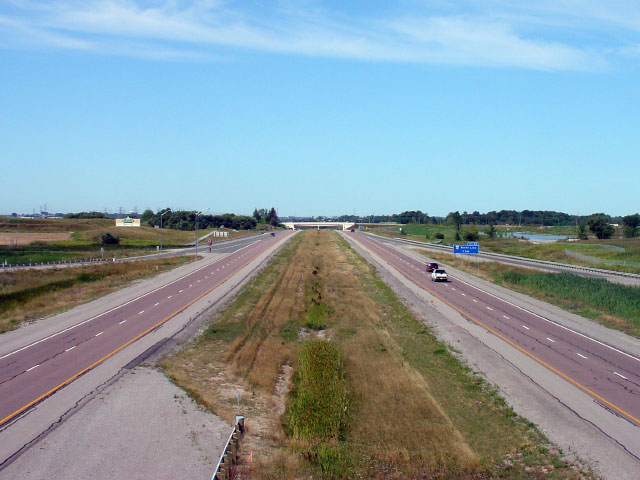
| Town of Markham Regional Municipality of York |
View looking west towards the Donald Cousens Parkway overpass from the
median of Highway 407 at the Reesor Road underpass. Reesor Road is
located roughly at kilometre marker 97. Photo taken: August 12th, 2006. |
 Low-res High-res |
||
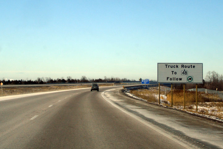
| Town of Markham Regional Municipality of York |
Westbound sign advising trucks to use the Markham By-pass to access
Highway 48. Highway 48 (Main Street in Markham) passes through the
historic Markham Village and is not suitable for trucks. Photo taken: February 24th, 2007. |
 Low
Res Low
ResHigh Res |
||
| Town of Markham Regional Municipality of York |
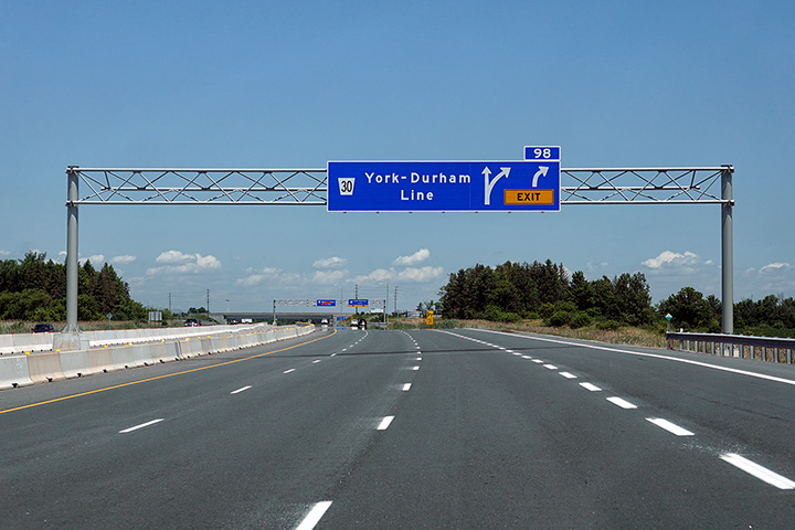
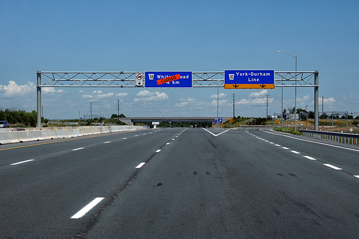
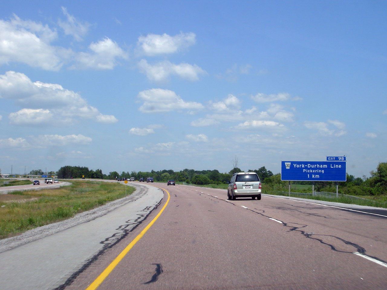
Advanced sign for the eastbound off-ramp to York/Durham Line. Upper photo taken: August 12th, 2006. Lower photo taken: July 6th, 2020. |
|
||
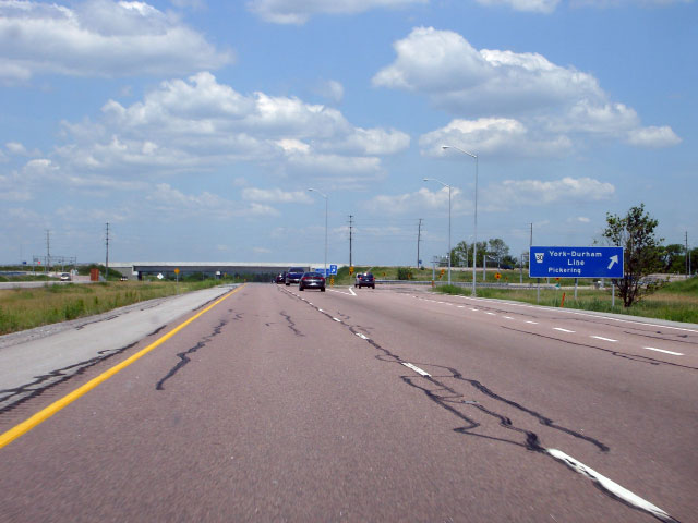
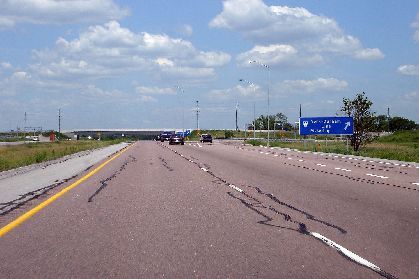
| Town of Markham Regional Municipality of York |
Signage at the eastbound off-ramp to York-Durham Line. Upper photo taken: August 12th, 2006. Lower photo taken: July 6th, 2020. |
|
||
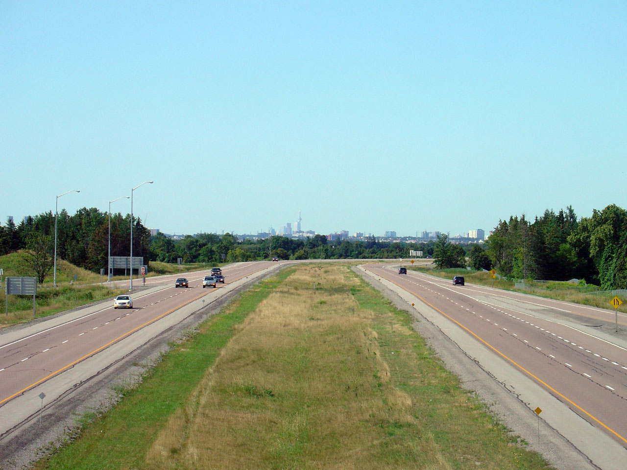
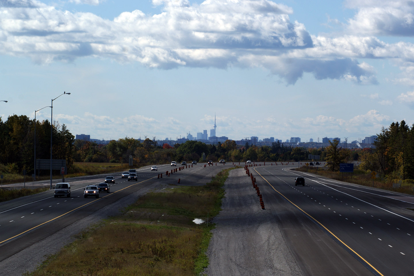
| Town of Markham Regional Municipality of York |
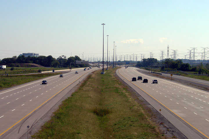
The City of Toronto skyline silhouettes the median of Highway 407.
Before and after the highway widening. Upper photo taken: August 12th, 2006. Lower photo taken: October 10th, 2009. |
 Low-res High-res  Low-res High-res |
||
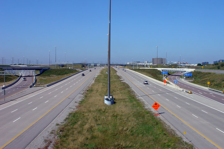
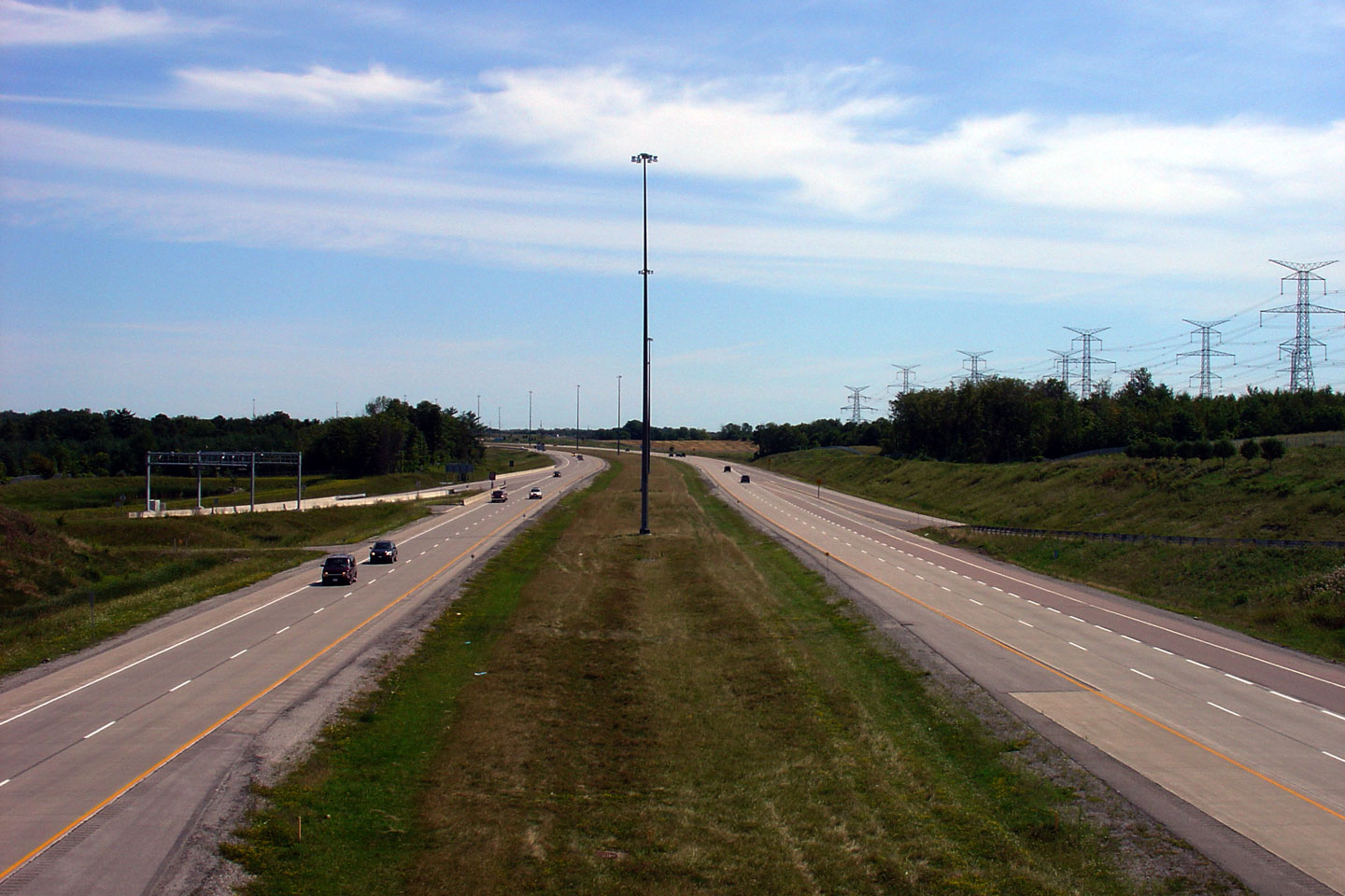
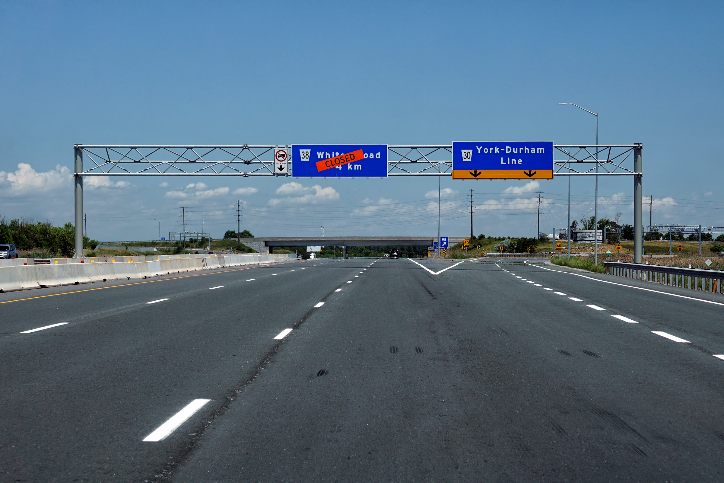
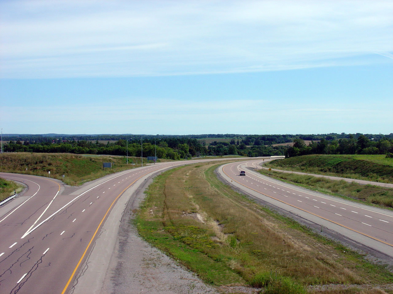
| City of Pickering Regional Municipality of Durham |
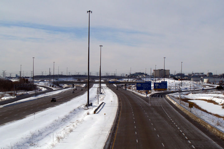
The highway traverses a long sweeping curve east of York/Durham Line as it
passes through the West Duffins Creek Valley. Summer view and fall
view. Upper photo taken: August 12th, 2006. Lower photo taken: October 10th, 2009. |
 Low-res High-res 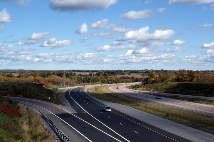 Low-res High-res |
||
| City of Pickering Regional Municipality of Durham |
View looking into the West Duffins Creek ravine from the North Road
overpass. The 407 was widened from four to six lanes through western
Durham Region during a construction project that wrapped up in September,
2018. Upper photo taken: August 15th, 2005. Lower photo taken: October 5, 2018. |
 (720x480) (1440x960) (2400x1600) |
||
| City of Pickering Regional Municipality of Durham |
Easterly view from the North Road overpass. The future Whites Road
interchange, still under construction, is visible in the lower photo. Upper photo taken: August 15th, 2005. Lower photo taken: October 5, 2018. |
 (720x480) (1440x960) (2400x1600) |
||
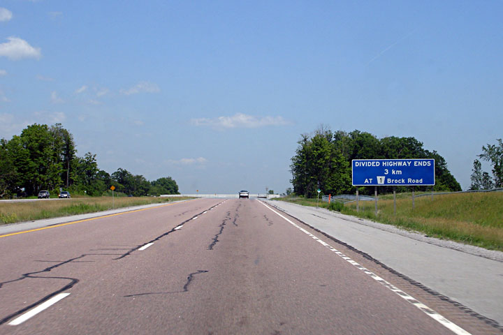
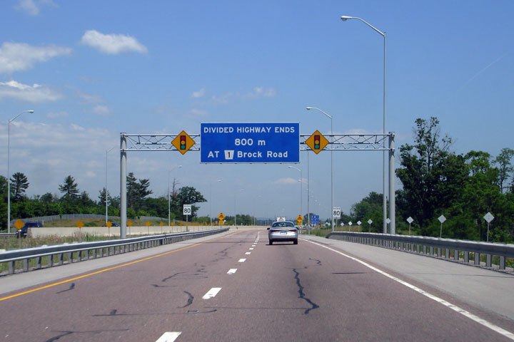
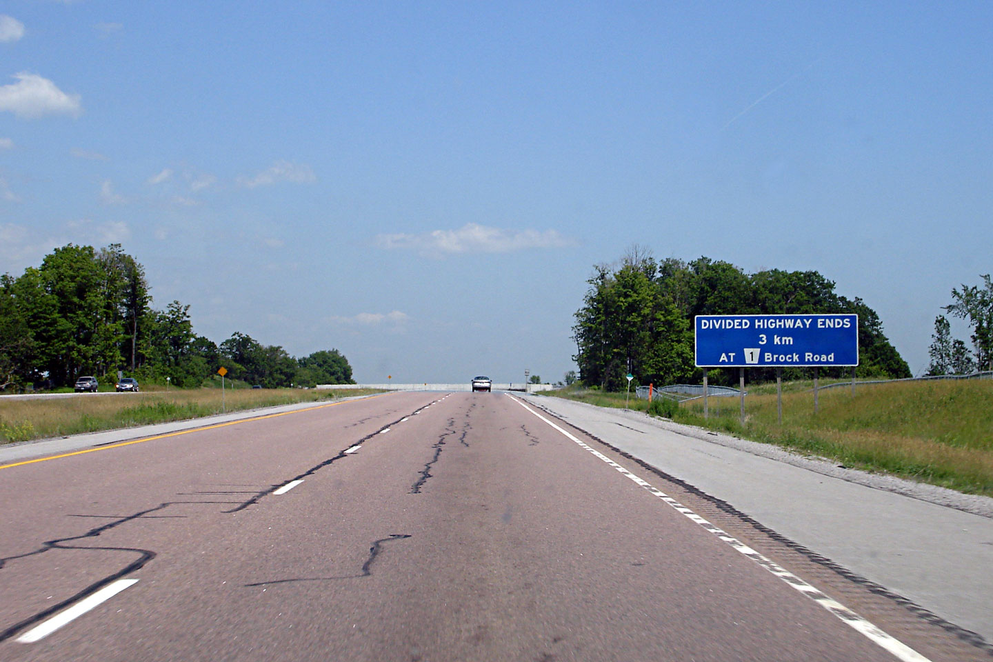
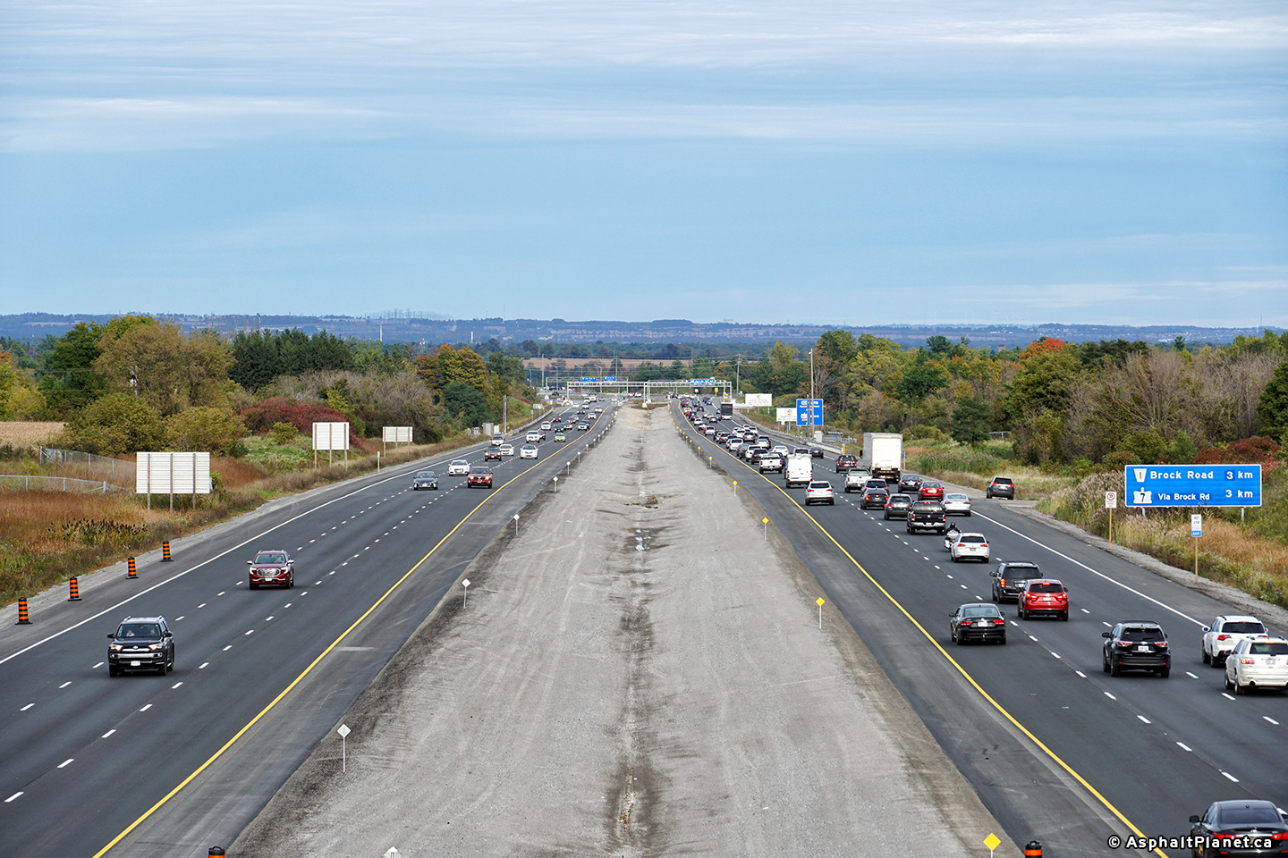
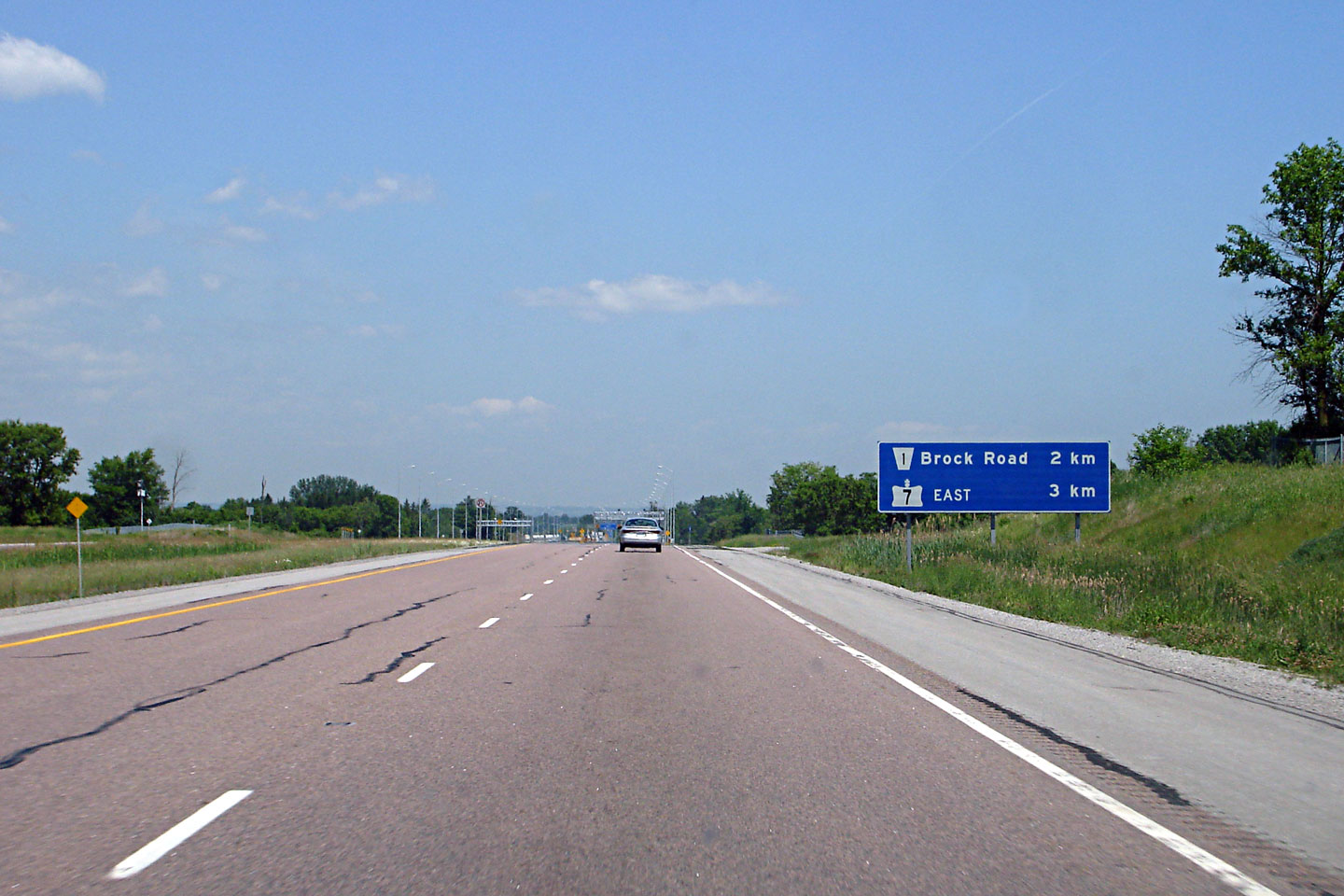
| City of Pickering Regional Municipality of Durham |
3km advanced warning sign noting the eastern end of the freeway. The
407 ends at a series of at-grade intersections where the divided highway
transitions into Highway 7, which is a conventional two-lane highway. Photo taken: June 15th, 2007. |
 Low
Res Low
ResHigh Res |
||
| City of Pickering Regional Municipality of Durham |
Two views looking western from Sideline 24. The future Whites Road
interchange can be seen in the lower photo. Upper photo taken: August 15th, 2005. Lower photo taken: October 5, 2018. |
 (720x480) (1440x960) (2400x1600) |
||
| City of Pickering Regional Municipality of Durham |
View looking easterly towards the east end of Highway 407 from the Sideline
24 overpass in Pickering. Before being extended in 2017, Highway 407 met Brock Road at an at-grade
intersection about 3km east of the Sideline 24 overpass. Upper photo taken: August 15th, 2005. |
 (720x480) (1440x960) (2400x1600) |
||
| City of Pickering Regional Municipality of Durham |
Ground mounted sign warning of the last two 'exits' from Highway 407. Photo taken: June 15th, 2007. |
 Low
Res Low
ResHigh Res |
||
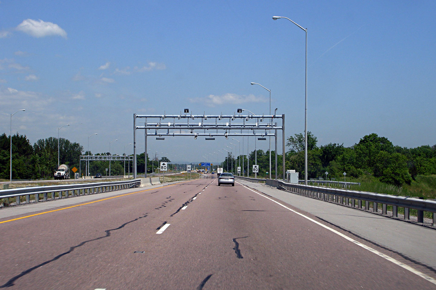
| City of Pickering Regional Municipality of Durham |
View of the eastbound overhead sensor marking the end of the toll route.
The 407 is an all electronic toll highway. Frequent highway users
lease a transponder from that is read by these gantries to signal the start
and finish of the trip. Motorists without a transponder may still use
the highway -- a photo of their license plate is taken, and a surcharge is
added to the per kilometre tolling rate. Photo taken: June 15th, 2007. |
 Low
Res Low
ResHigh Res |
||
| City of Pickering Regional Municipality of Durham |
Overhead gantry warning of the impending traffic signals at the Brock Road
intersection. This is the closest thing to a Highway 407 Ends sign. Photo taken: June 15th, 2007. |
 Low
Res Low
ResHigh Res |
||
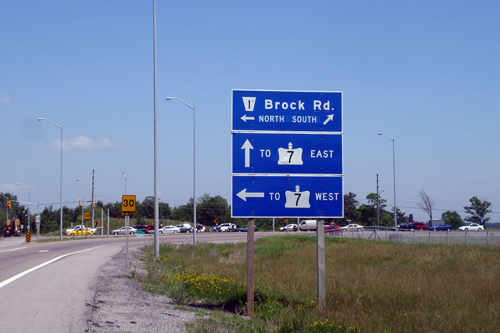
| City of Pickering Regional Municipality of Durham |
Signage for Brock Road. The contractor who makes Highway 407 signage
does a bad job with provincial crowns -- its almost a blessing that all of
the surface highways that once intersected Highway 407 no longer exist. Photo taken: June 15th, 2007. |
 |
||
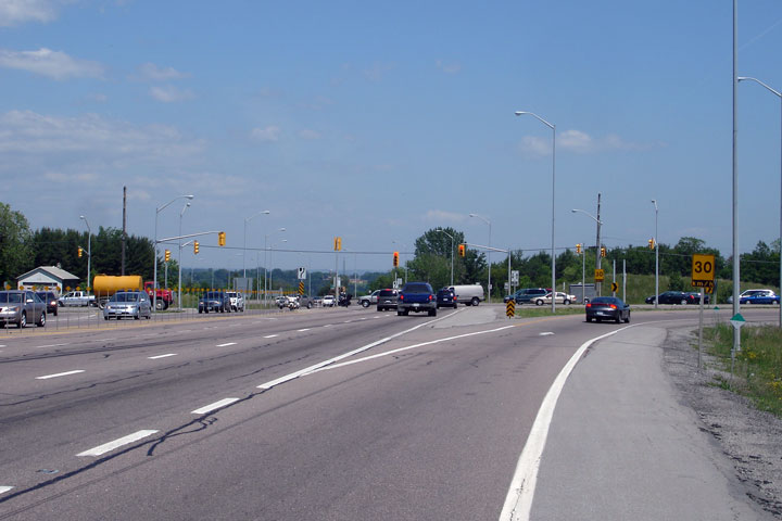
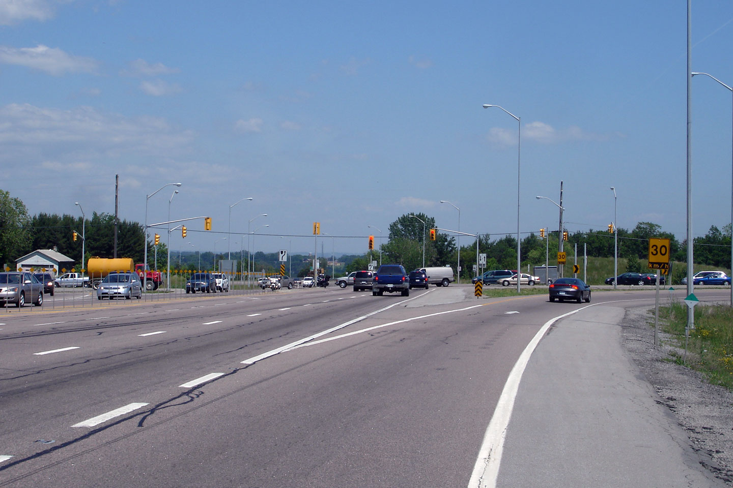
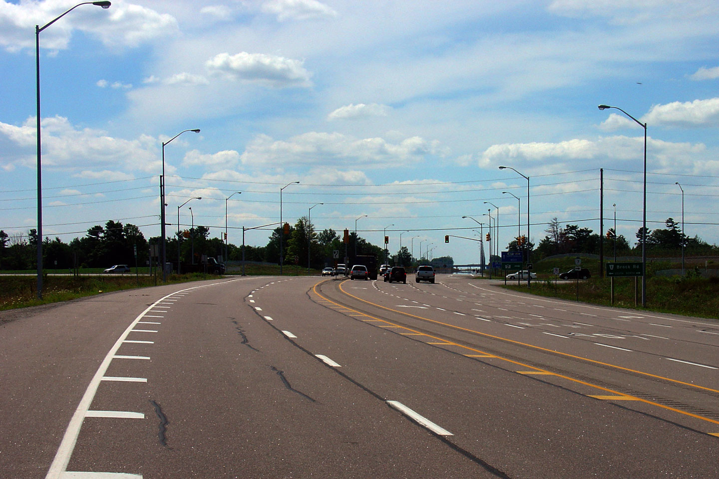
| City of Pickering Regional Municipality of Durham |
View of the Brock Road intersection looking east. Photo taken: June 15th, 2007. |
 Low-res High-res |
||
| City of Pickering Regional Municipality of Durham |
This picture shows Highway 407 looking west towards the at-grade
intersection with Brock Road. This at-grade intersection will be
replaced with a full interchange in the coming years, presumably as part of
a larger project to construct a new alignment around Brougham for Brock Road Photo taken: August 15th, 2005. |
 Low-res High-res |
||
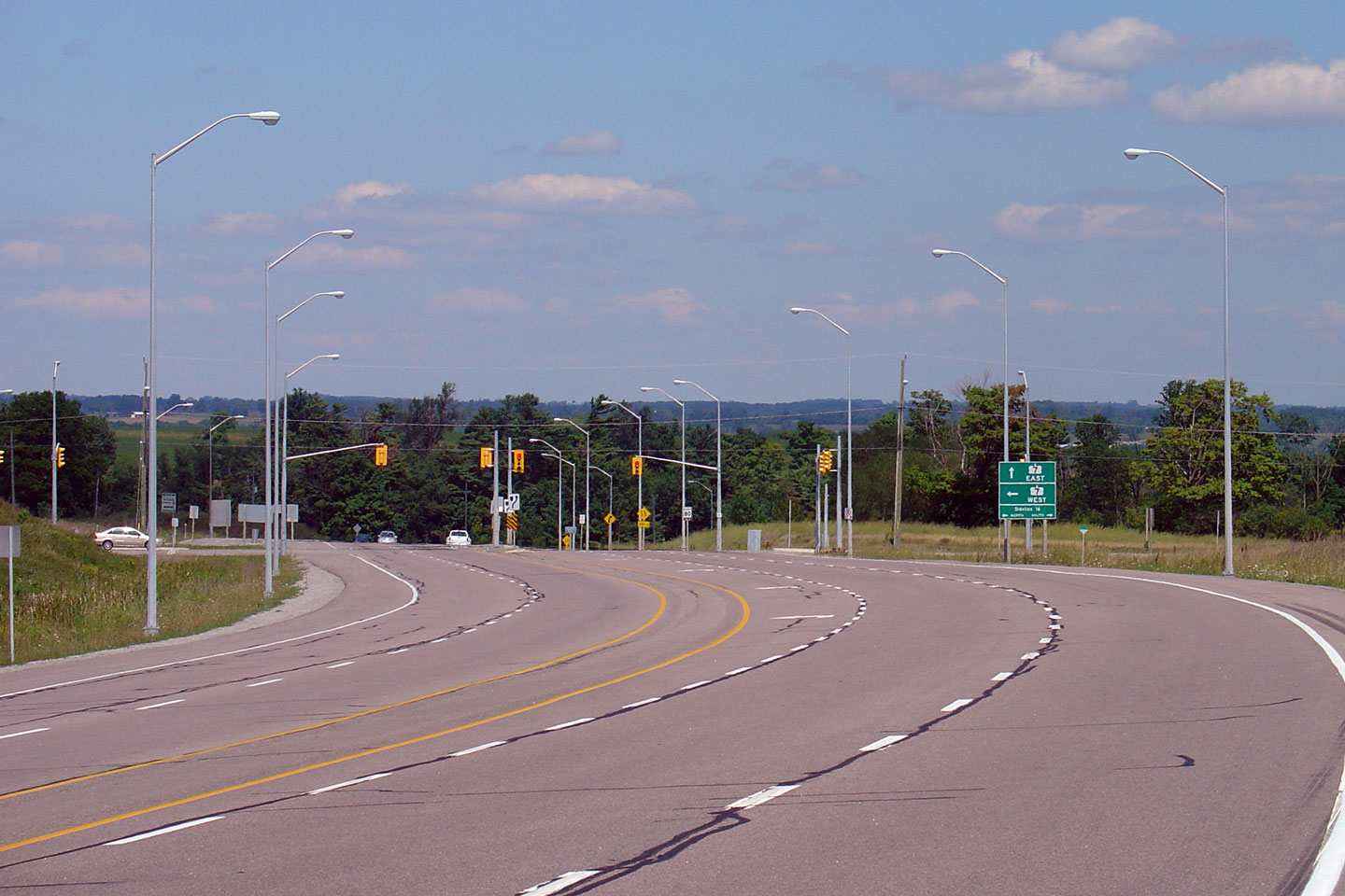
| City of Pickering Regional Municipality of Durham |
This picture showcases the eastern end of Highway 407. Highway 407
ends at an at-grade intersection with Highway 7.
In 2001 as part of the Highway 407 construction, Highway 7 was realigned to
provide a better connection with Highway 407. Presently, eastbound
Highway 407 traffic simply defaults onto eastbound Highway 7. Photo taken: August 15th, 2005. |
 Low-res High-res |
||
| Highway 407 ends at Highway 7 in Pickering. Click here to continue east along Highway 7. | ||||
<- Page 3 Images Highway 407 Images Index Page 5 Images ->
<- Highway 406 Images Back to Highway 407 Highway 409 Images ->
Copyright (c) 2004-2020 AsphaltPlanet.ca AsphaltPlanet@asphaltplanet.ca


