|
Proper Municipality Name |
Photo Description |
Photo |
|
Photos taken
from driver's perspective appear offset from centre-line Photos: |
East-
bound |
West-
bound |
|
The Trans-Canada Highway continues west through the
Ottawa Valley along
Highway 17. Click
here
for Highway 17 Images. |
Township of McNab /
Braeside
County of Renfrew |
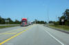
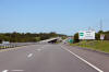
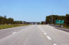
Easterly view at the current eastern terminus of Highway 17 just beyond the
Campbell Drive intersection. Highway 417 begins at this point as the
highway becomes a divided highway around Arnprior. Click
here for the same view taken in
May, 2012.
Photo taken: May 6th, 2012. |
(720x480)
(1440x960)
(2400x1600) |
Township of McNab /
Braeside
County of Renfrew |
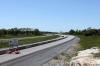
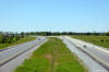
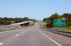
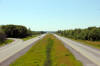
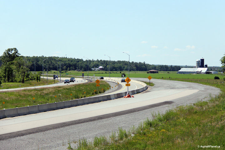
Two views looking westerly as the four-lane highway collapses into a
conventional two lane highway. The future westbound carriageway has
been graded well beyond the end of the divided highway in advance
of an additional widening contract that will see Highway 417 extended
further west from Arnprior.
Photos taken: June 19th, 2013. |
(720x480)
(1440x960)
(2400x1600)
(720x480)
(1440x960)
(2400x1600) |
Township of McNab /
Braeside
County of Renfrew |
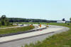
View looking easterly at the start of the four-lane highway in Arnprior
towards the Pine Grove Road overpass.
Photo taken: June 19th, 2013. |
(720x480)
(1440x960)
(2400x1600) |
Township of McNab /
Braeside
County of Renfrew |
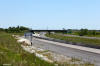
Easterly view approaching the Pine Grove Road overpass taken during highway
construction.
Photo taken: May 6th, 2012. |
 (720x480) (720x480)
(1440x960)
(2400x1600) |
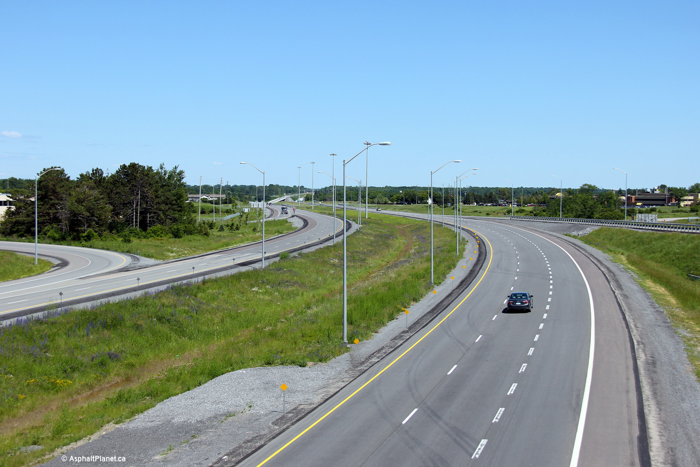
Town of Arnprior
County of Renfrew |
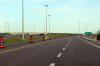
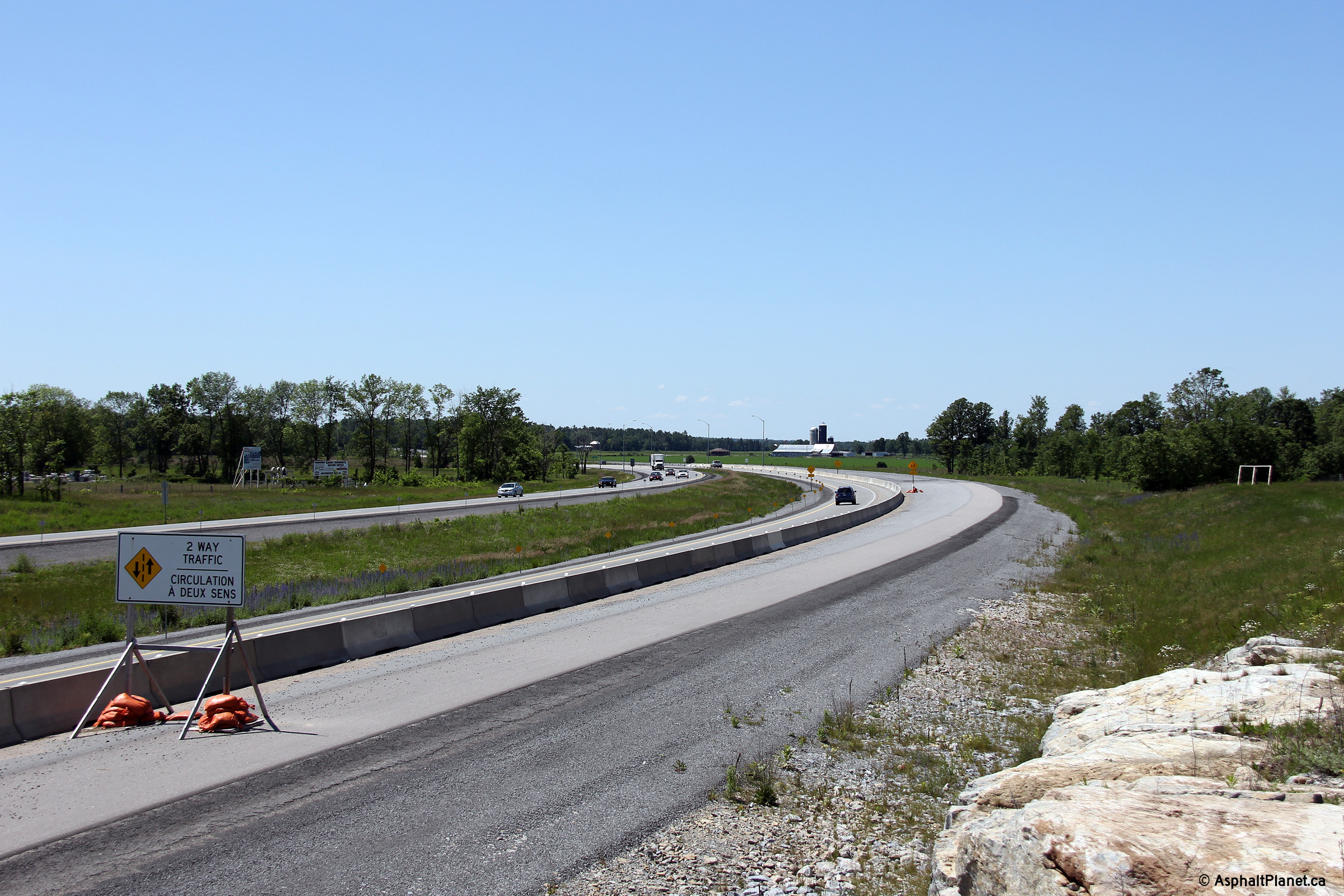
View looking westerly along Highway 417 from the Pine Grove Road overpass.
Highway 417 narrows to a two lane highway just beyond the pictured curve.
Upper photo taken: May 6th, 2012.
Lower photo taken: June 19th, 2013. |
(720x480)
(1440x960)
(2400x1600) |
Town of Arnprior
County of Renfrew |
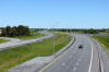
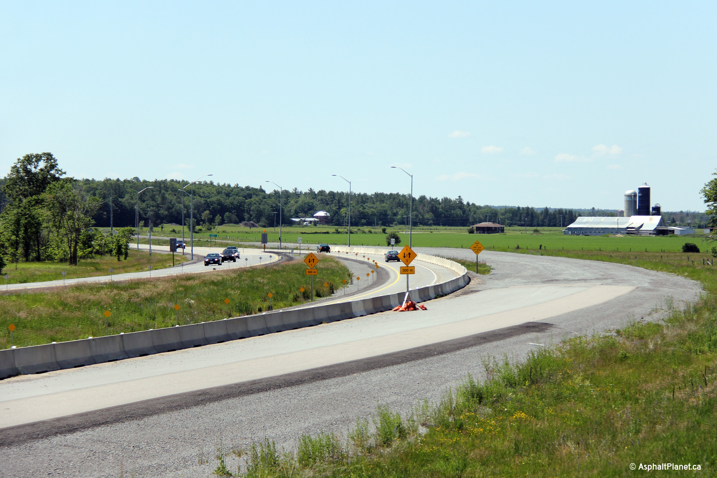
Easterly view along the freeway from the Pine Grove Road overpass.
Upper photo taken: May 6th, 2012.
Lower photo taken: June 19th, 2013. |

(720x480)
(1440x960)
(2400x1600) |
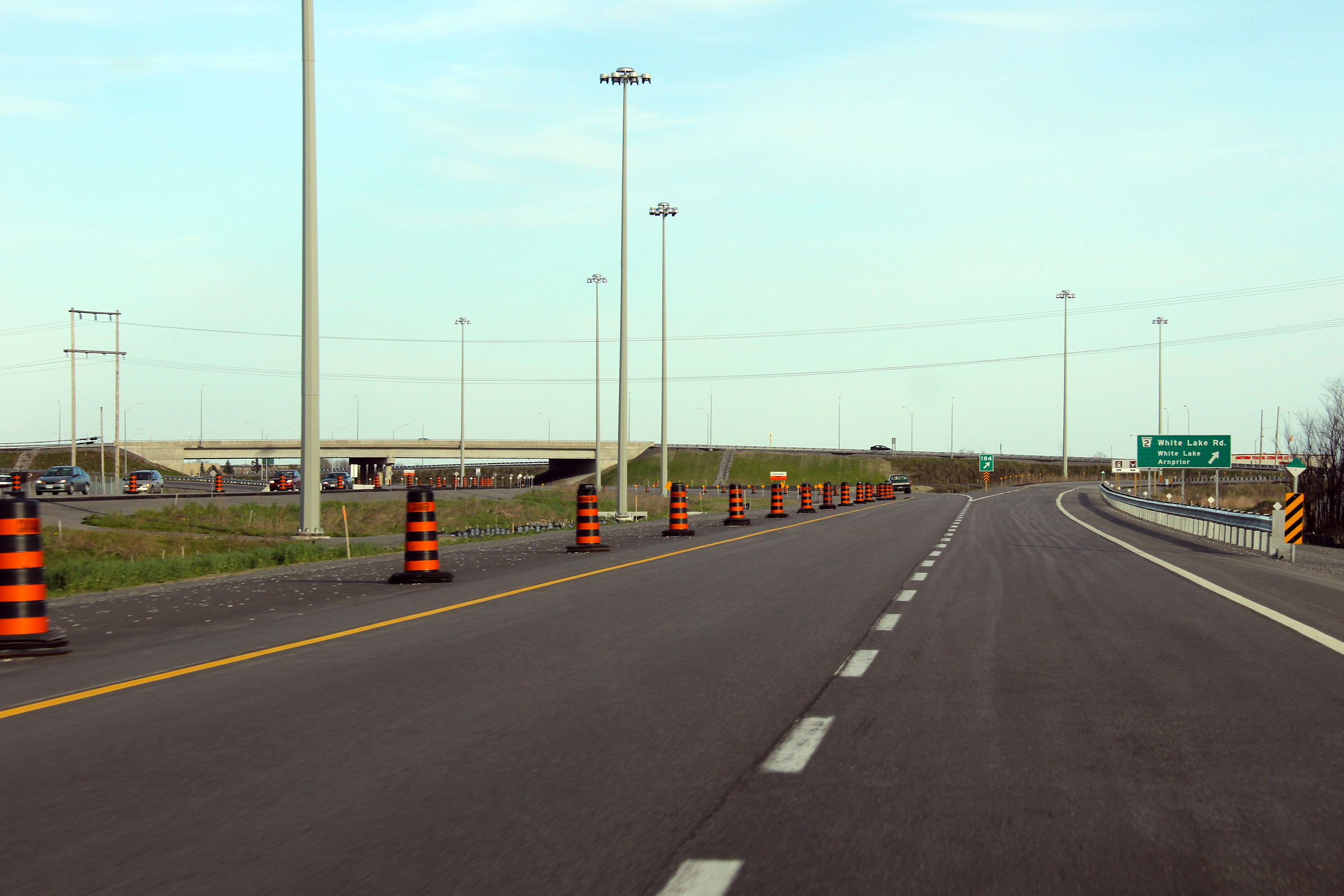
Town of Arnprior
County of Renfrew |
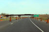
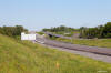
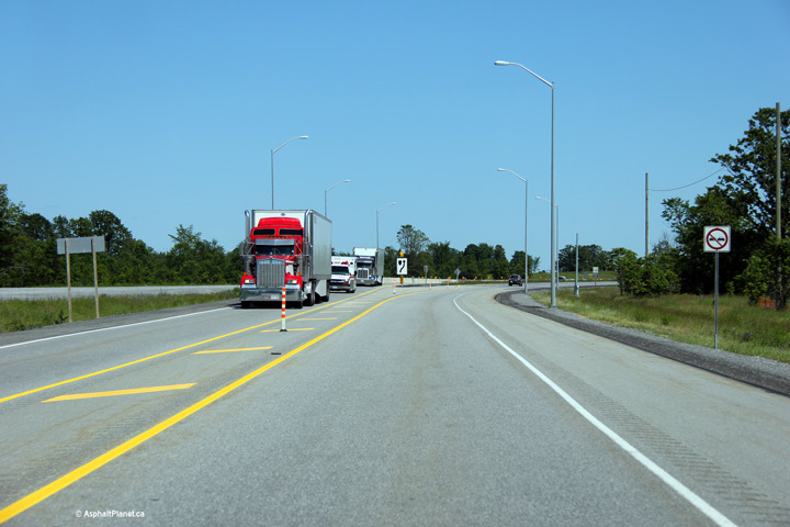
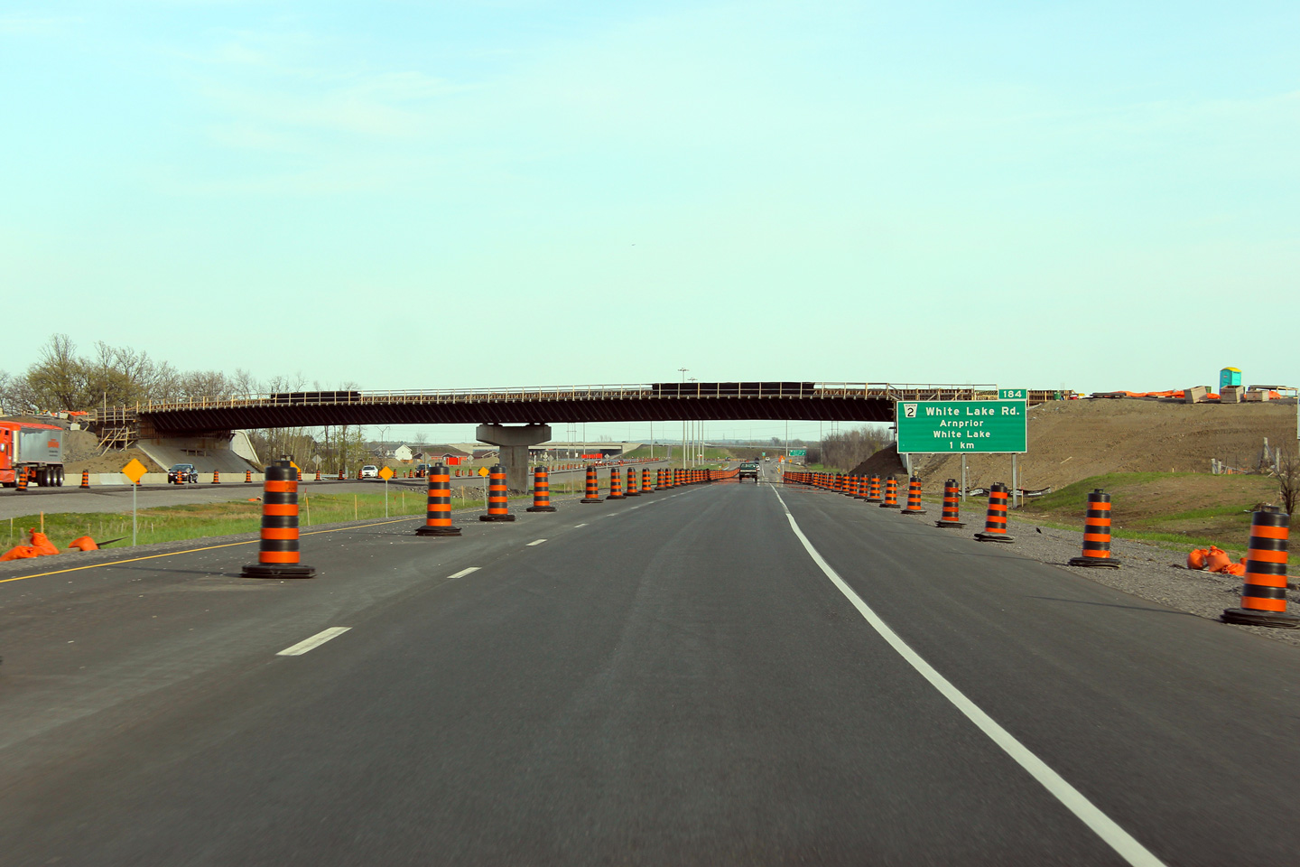
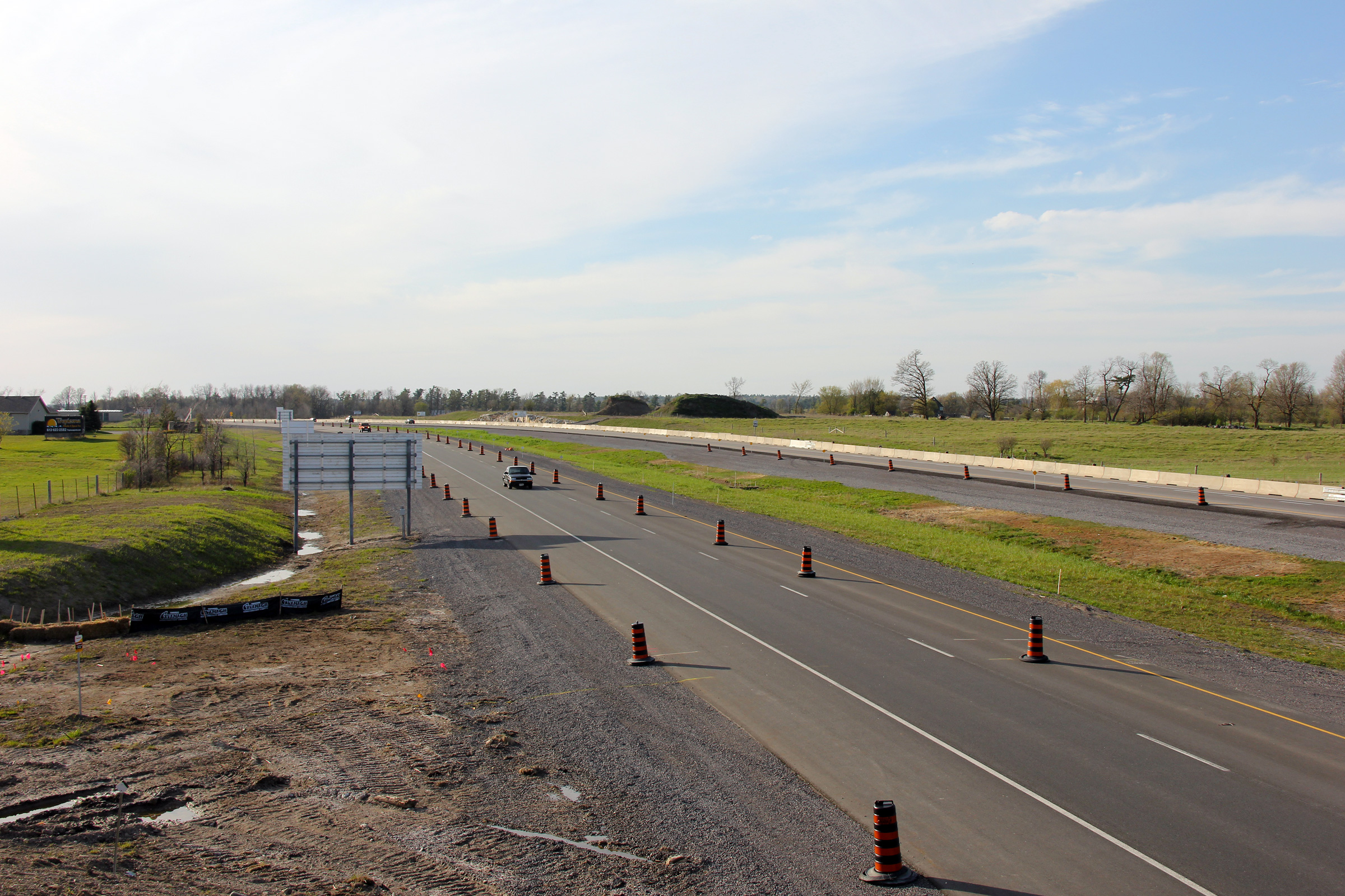
Easterly view approaching the White Lake Road interchange. Highway 417 was
still under construction when this photo was taken, and was operating
with a single lane in each direction.
Photo taken: May 6th, 2012. |
 (720x480) (720x480)
(1440x960)
(2400x1600) |
Town of Arnprior
County of Renfrew |
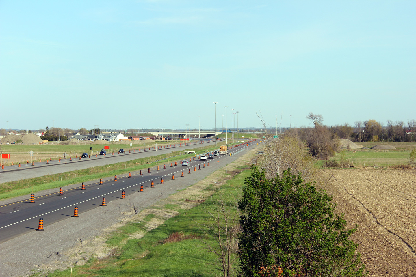
This view looks westerly from the White Lake Road overpass.
Upper photo taken: May 6th, 2012.
Lower photo taken: June 19th, 2013. |

(720x480)
(1440x960)
(2400x1600) |
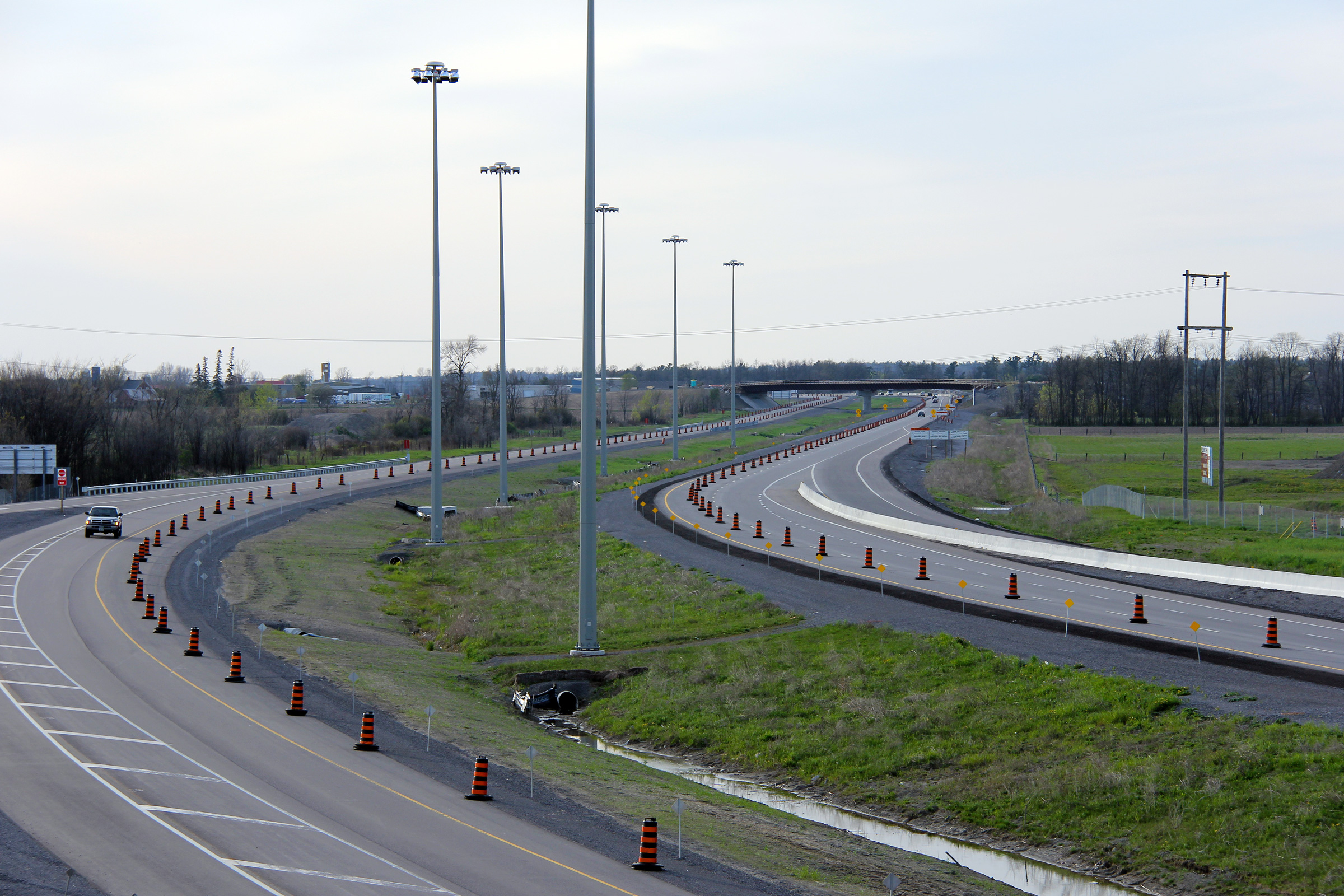
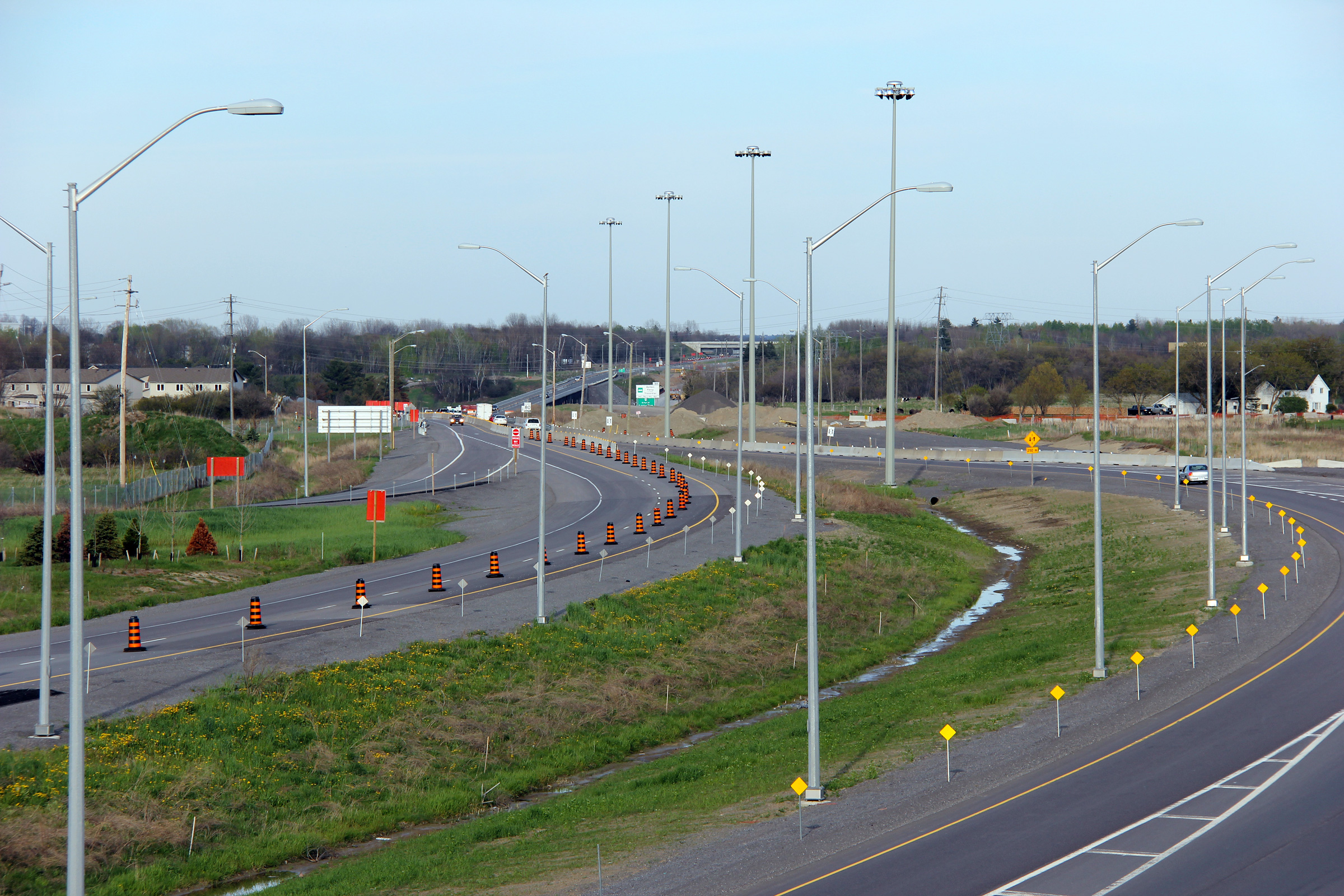
Town of Arnprior
County of Renfrew |
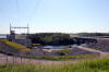
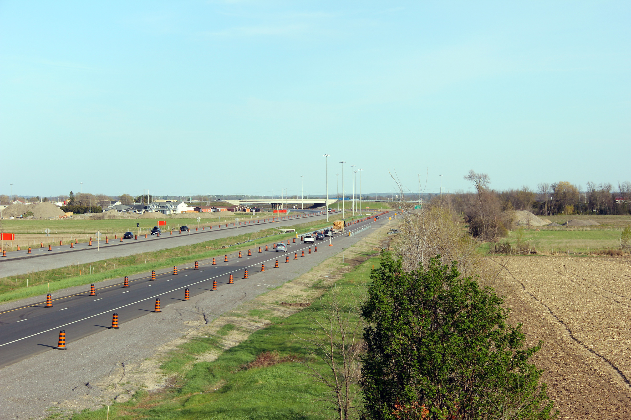
Two easterly views from the White Lake Road overpass. During
construction, when the upper photos were taken, both directions of Highway 417 crossed the Madawaska
River atop of a new high-level bridge that will serve the westbound lanes of
the freeway when highway twinning is completed. The structure that
will become the eastbound lanes, originally carried both directions of
Highway 17. Construction to twin the Arnprior by-pass was staged
differently than most other recent twinning projects. Before the
freeway opened, there were three major at-grade intersections along Highway
17 serving Arnprior. Those intersections were located at: Baskin
Drive, White Lake Road and Division Street. Because all of those
access points to Arnprior were consolidated into a single interchange, it
was imperative that the interchange be open to traffic prior the closure of
the two other intersections. The freeway is completed in the lower
photo.
Upper photos taken: May 6th, 2012.
Lower photo taken: June 19th, 2013. |
(720x480)
(1440x960)
(2400x1600) |
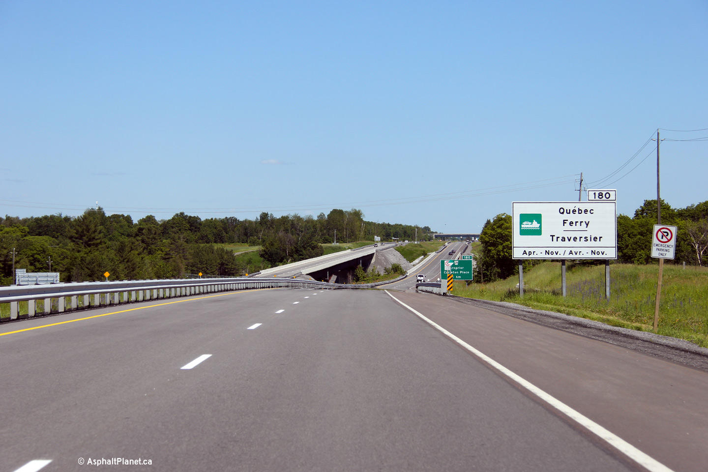
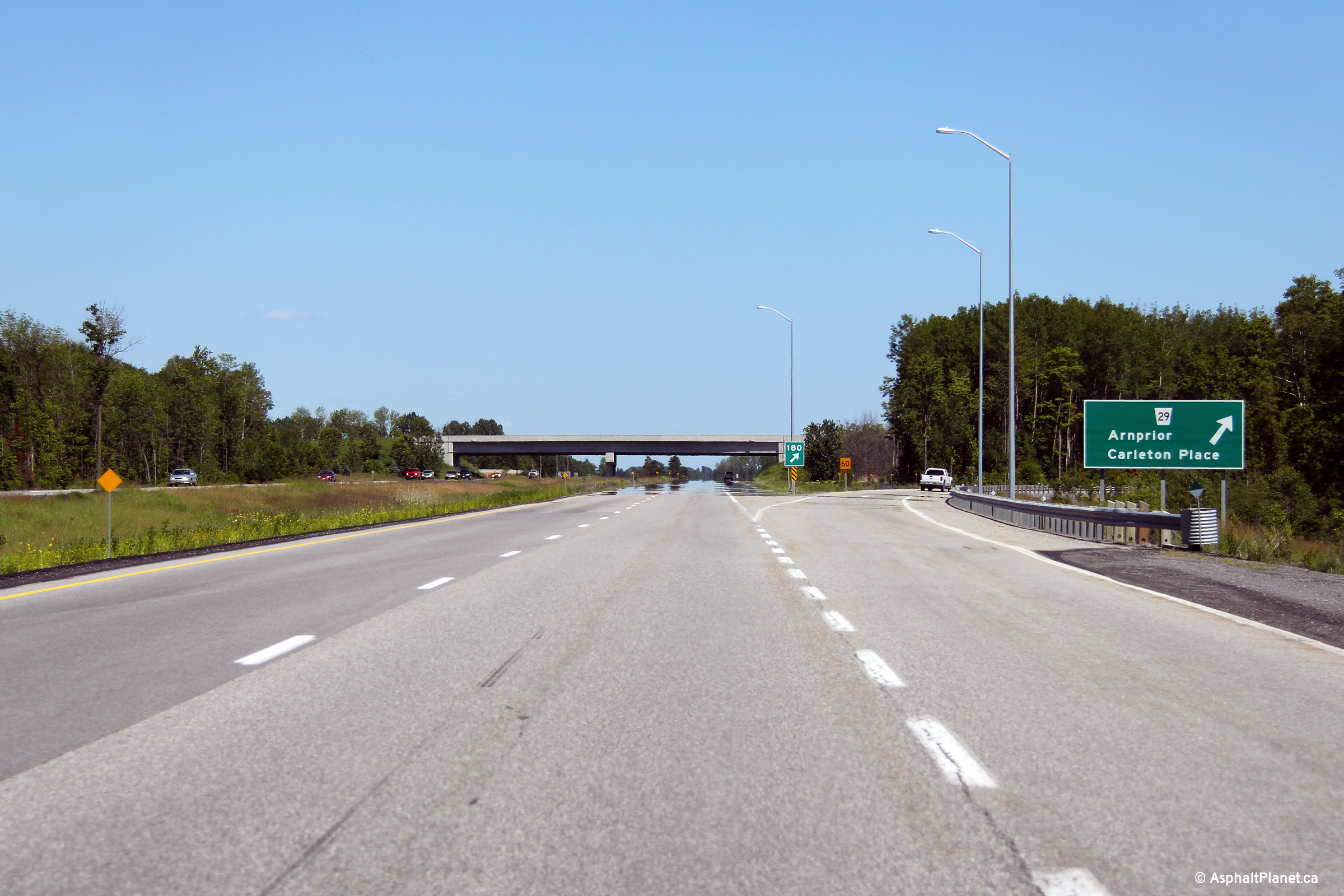
Town of Arnprior
County of Renfrew |
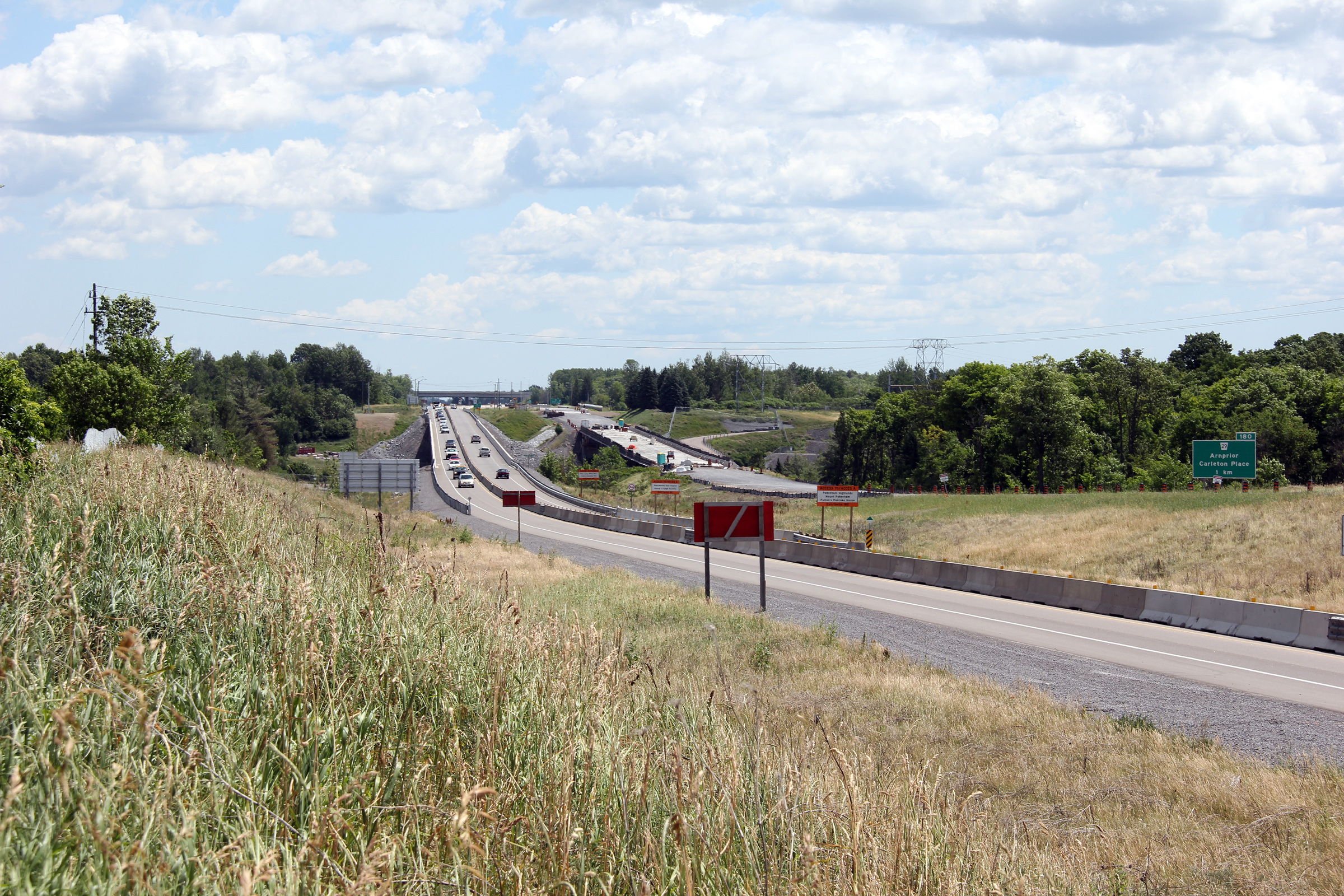
Eastbound ferry traffic to Quebec is directed to exit Highway 417 at Ottawa
Road 29.
Photo taken: June 19th, 2013. |
 (720x480) (720x480)
(1440x960)
(2400x1600) |
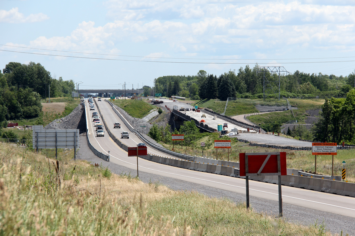
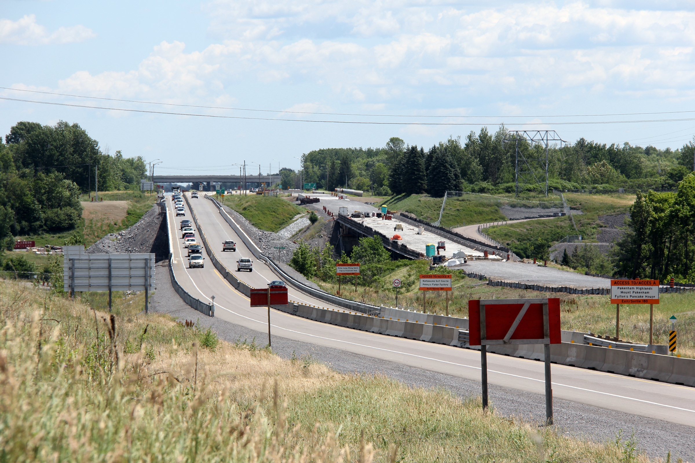
Town of Arnprior
County of Renfrew |
Advanced signage for the off-ramp to Ottawa Road 29.
Photo taken: June 19th, 2013. |
 (720x480) (720x480)
(1440x960)
(2400x1600) |
Town of Arnprior
County of Renfrew |
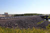
A series of views looking easterly across the twin Madawaska Bridge
structures. The upper photo shows Highway 17 while it was still a two lane
highway crossing the Madawaska River. When the 2004 photo was taken, the
417 had just been extended to the top of the pictured hill. The middle photos show the construction staging for the completion of Highway
417 around Arnprior. The future westbound structure was placed into
service during 2011. The pre-existing structure (which now carries the
eastbound lanes) was rehabilitated during 2011 and 2012. Construction
on the 417 extension through Arnprior was completed in the autumn of 2012.
Upper photo taken: October 23rd, 2004.
Middle photos taken: June 30th, 2012.
Lower photo taken: June 19th, 2013. |
(720x480)
(1440x960)
(2400x1600) |
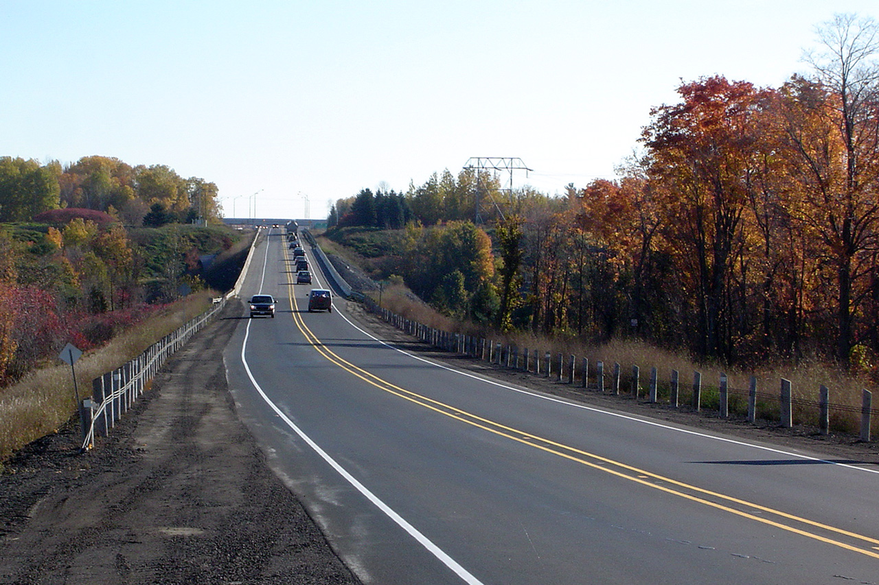
| City of
Ottawa |
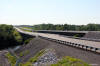
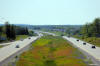
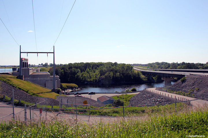
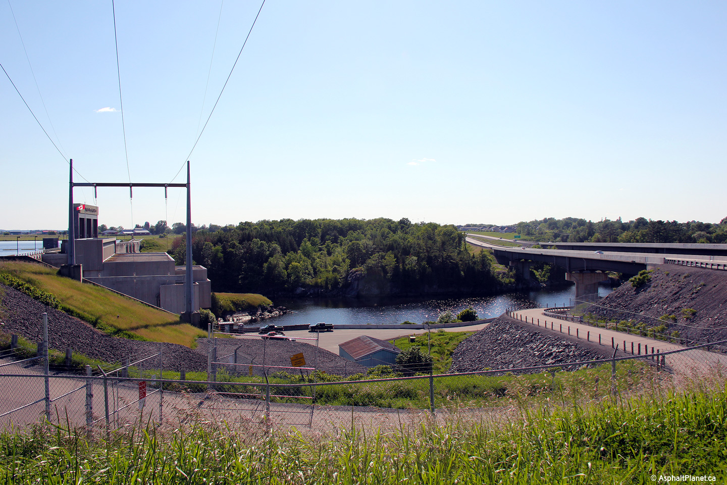
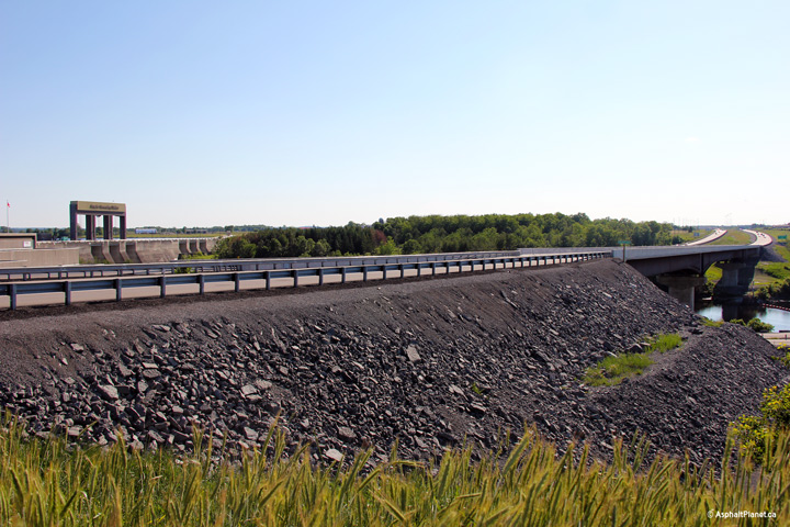
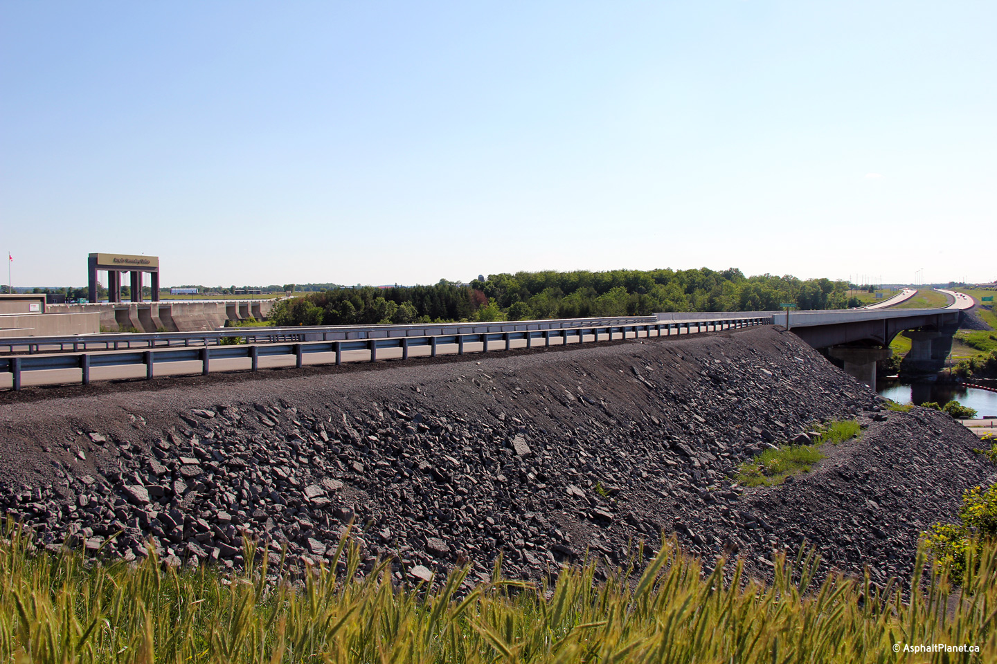
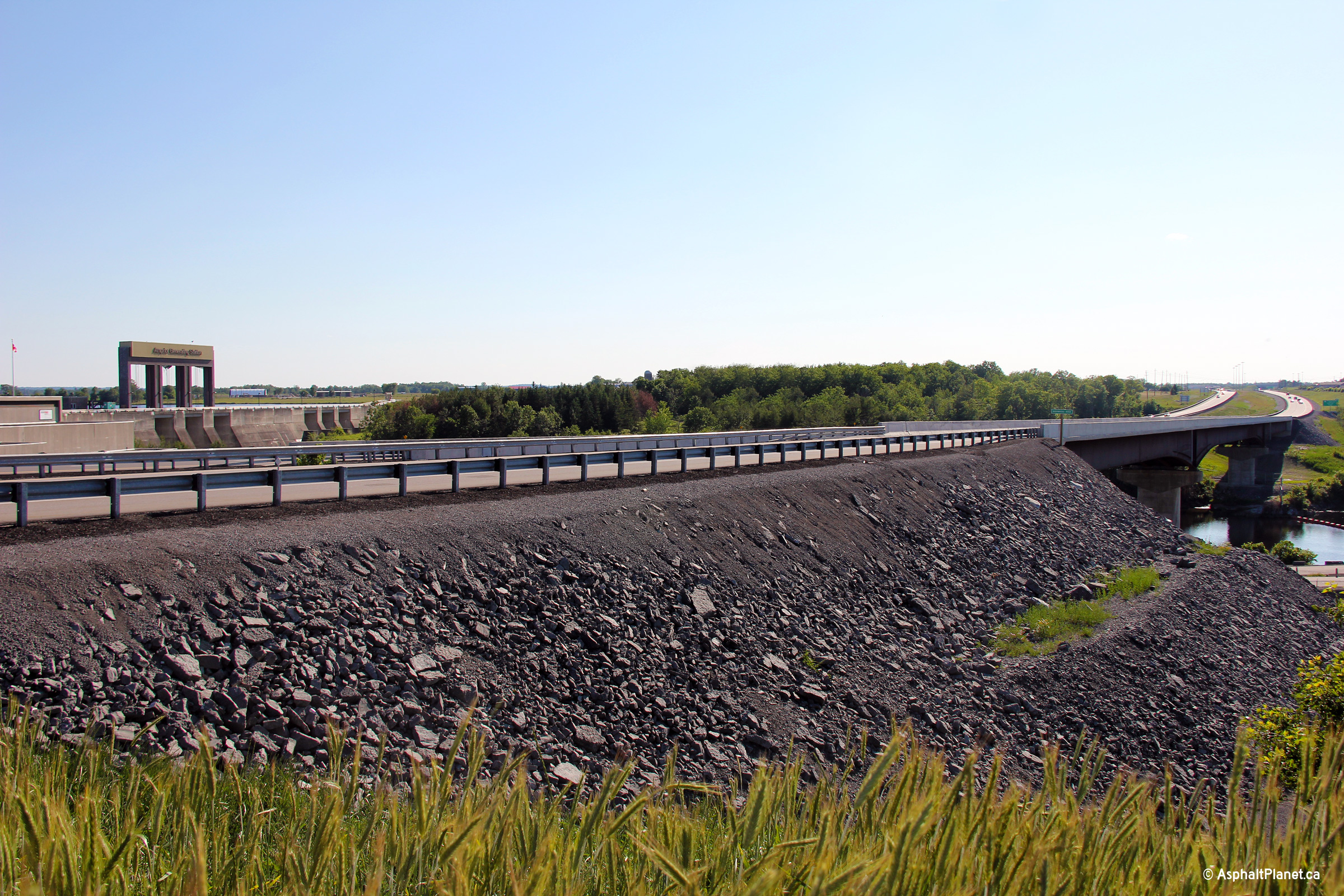
A series of three views looking easterly as Highway 417 crosses overtop of
the Madawaska River bridge. Highway 417 crosses the Madawaska River
immediately downstream of the Arnprior dam. The Arnprior dam is one of
a series of dams that control the flow of the Madawaska River and generate
hydro-electric power for the surrounding communities.
Photos taken: June 19th, 2013. |
(720x480)
(1440x960)
(2400x1600)
(720x480)
(1440x960)
(2400x1600)
(720x480)
(1440x960)
(2400x1600) |
| City of
Ottawa |
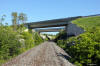
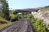
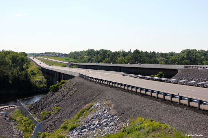
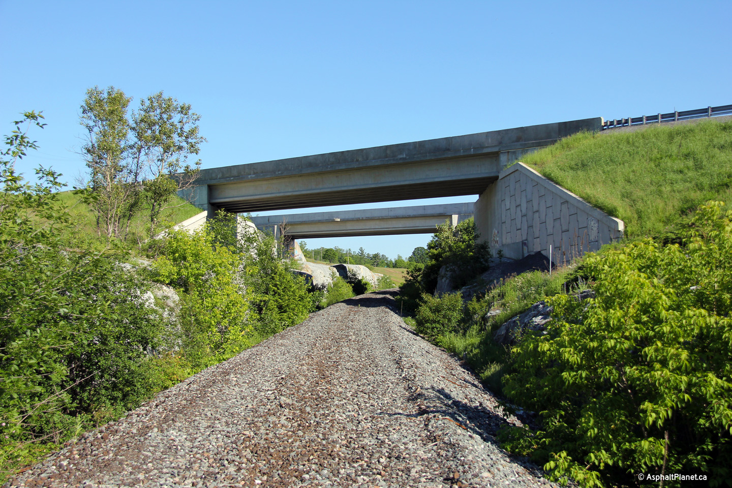
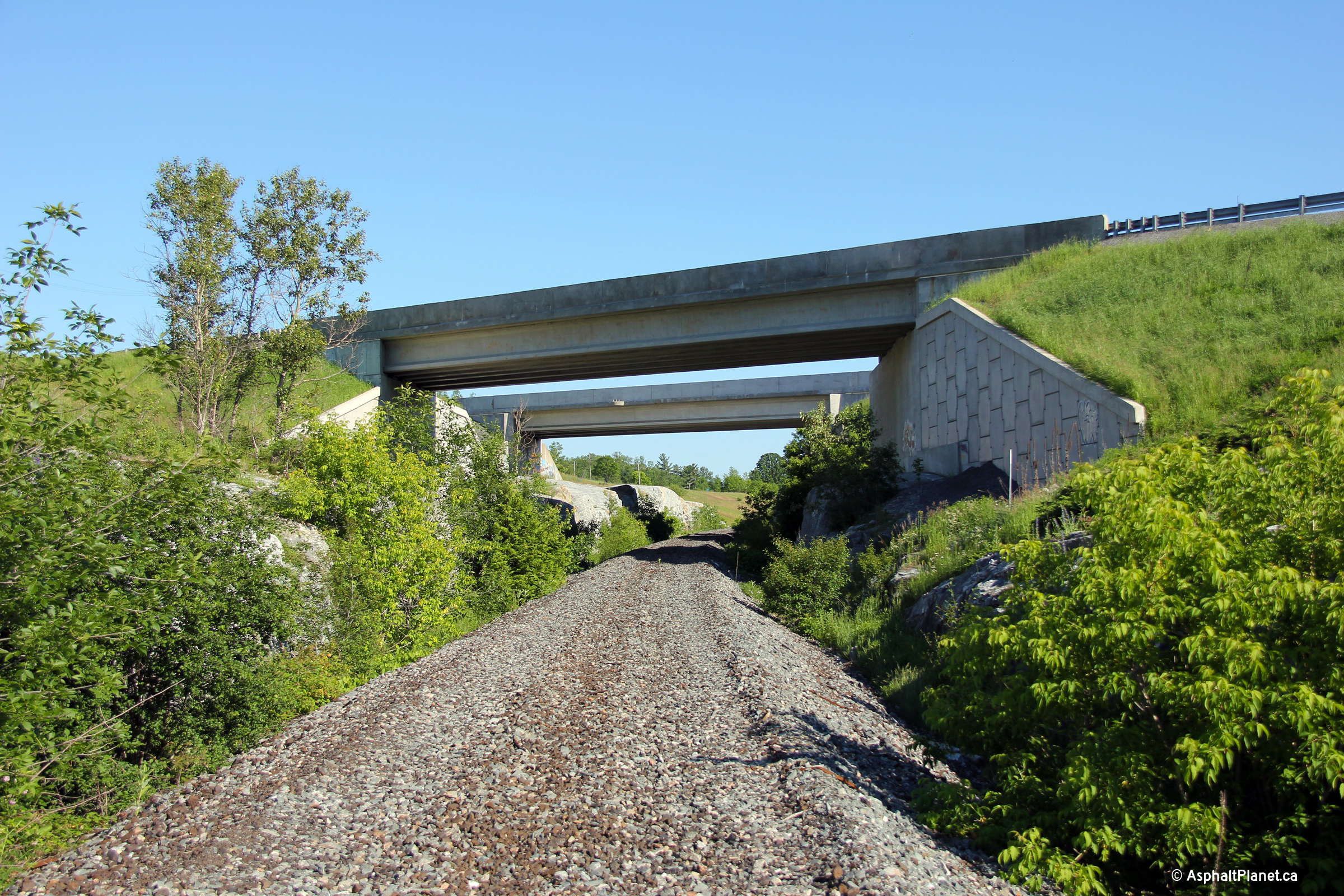
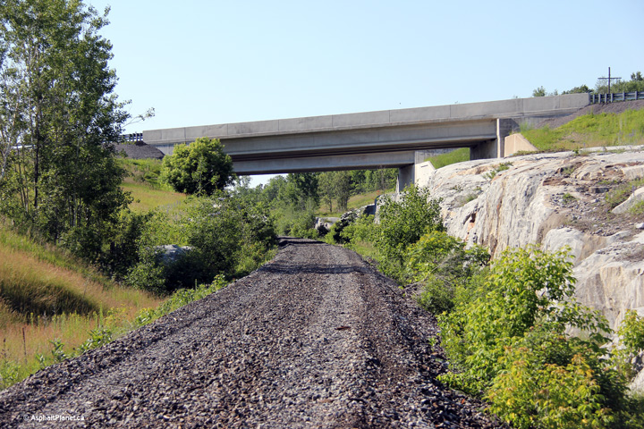
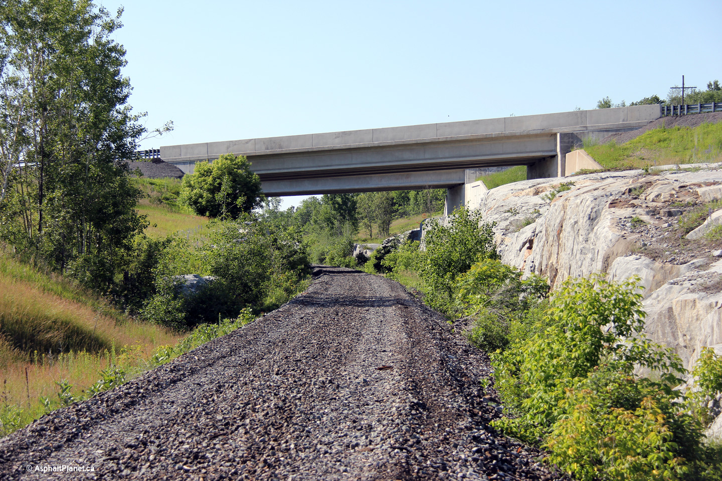
Two views of the twin Ottawa Valley Railway bridge structures that carry
Highway 417 overtop of the former railway line. The upper photo faces
to the southeast and highlights the newer westbound span while the lower
photo faces to the southwest and highlights the older eastbound span.
The Ottawa Valley Railway was abandoned during the fall of 2011. The
rail line was abandoned before construction on the grade separations between
the rail line and the new highway were even completed.
Photos taken: June 19th, 2013. |
(720x480)
(1440x960)
(2400x1600)
(720x480)
(1440x960)
(2400x1600) |
| City of
Ottawa |
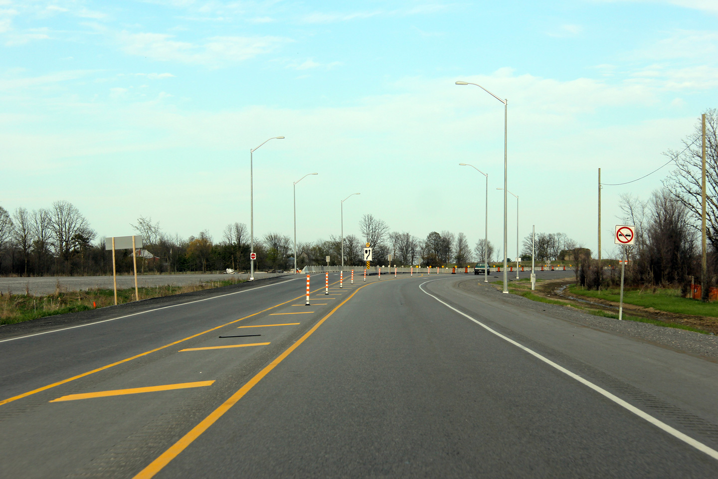
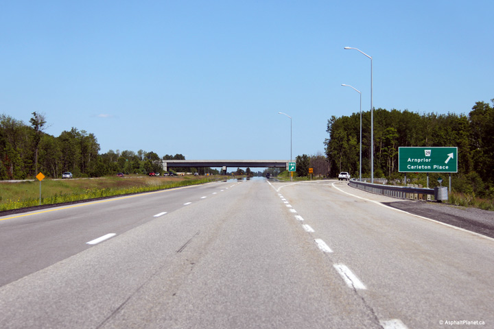
Eastbound signage for the Ottawa Road 29 (formerly Highway 15) interchange.
Photo taken: June 19th, 2013. |
 (720x480) (720x480)
(1440x960)
(2400x1600) |
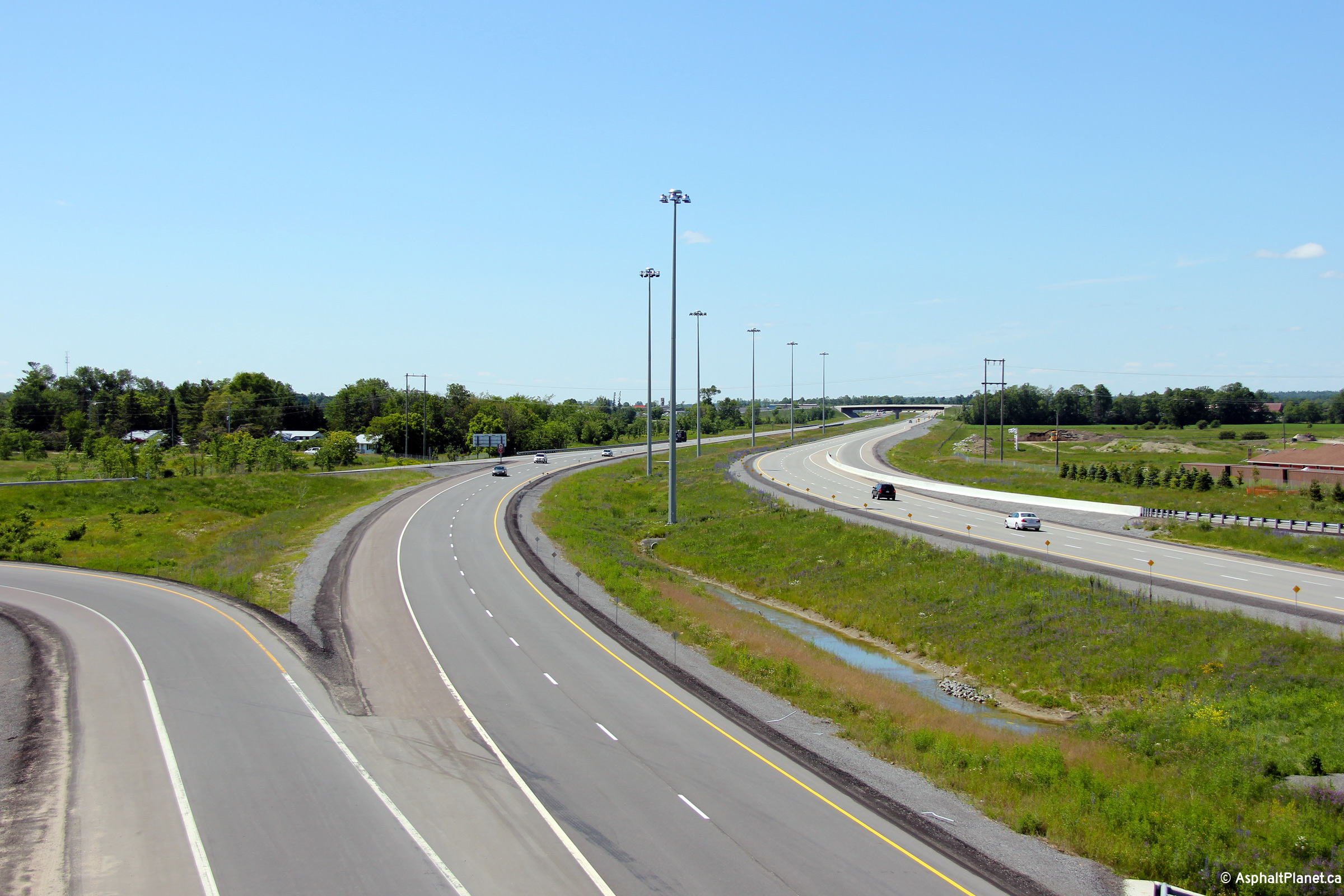
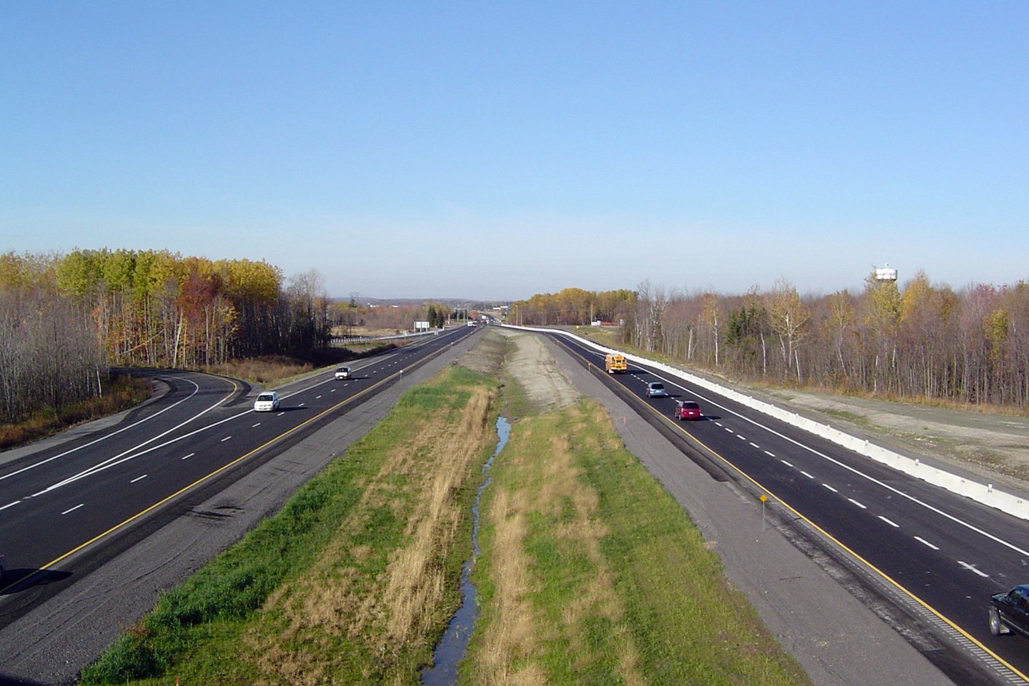
| City of Ottawa |
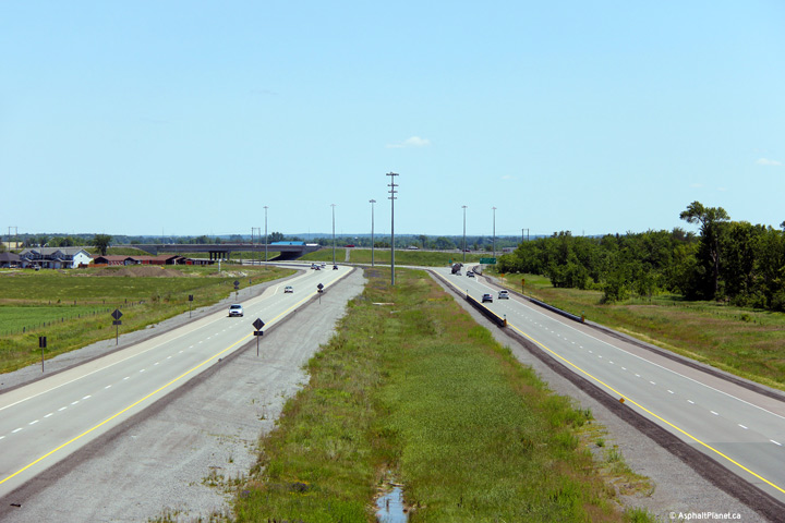
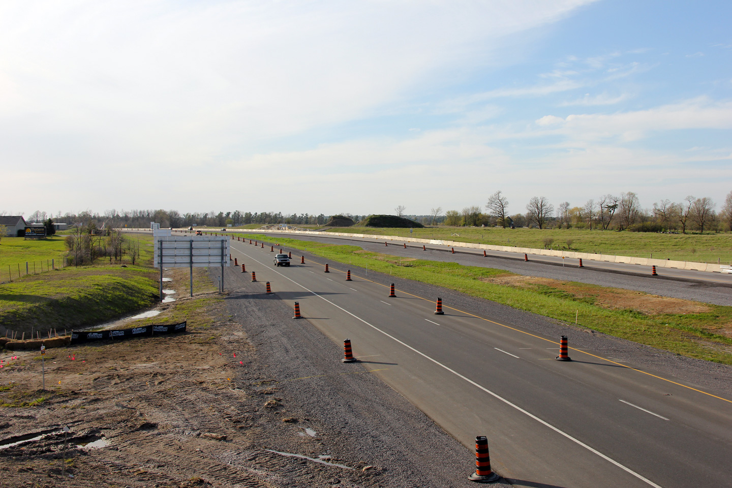
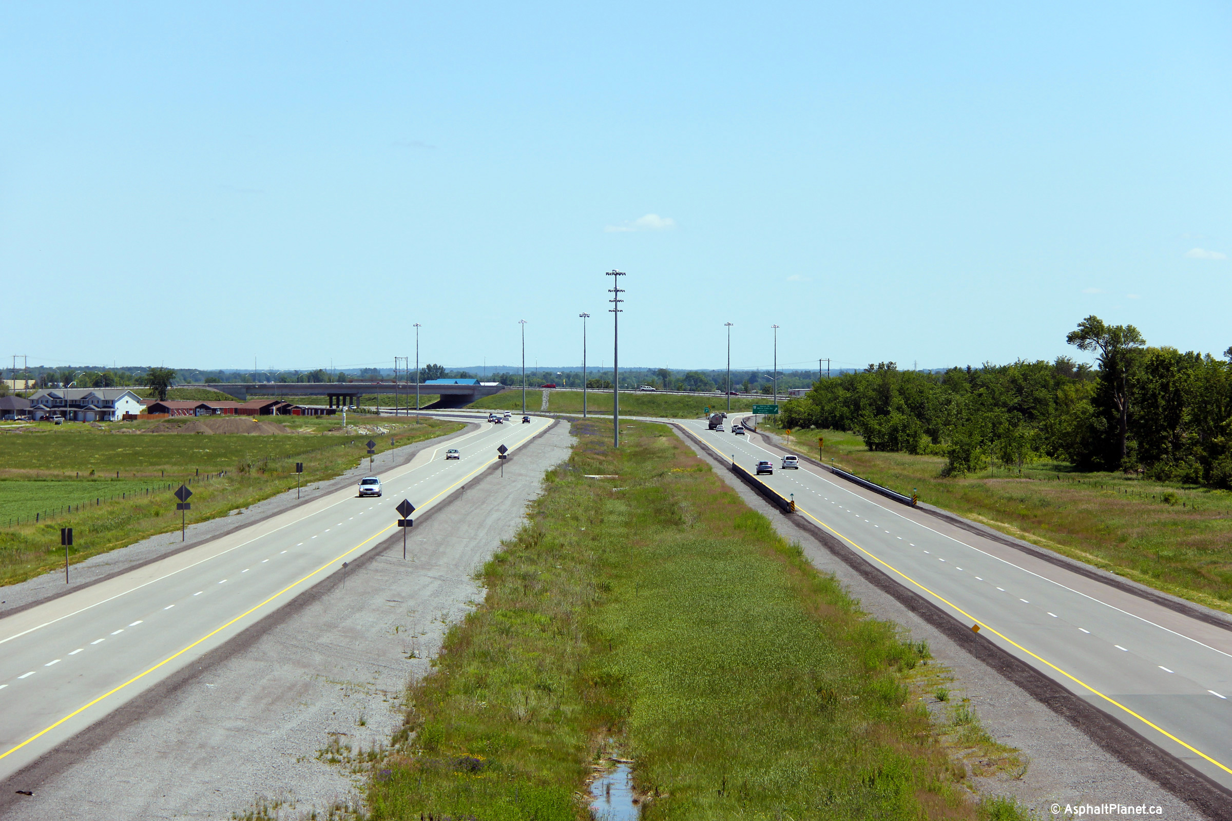
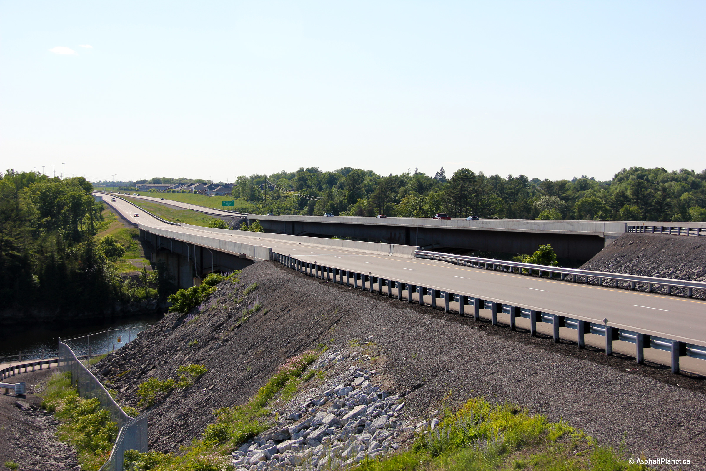
A
series of photos looking west from the Ottawa Road 29 overpass. The
2004 (upper) photos show the western end of Highway 417 just beyond this
interchange while the 2013 (lower) photos were taken once the four lane
freeway had been extended to beyond Arnprior's west limits.
Upper hoto taken: October 23rd, 2004.
Lower photos taken: June 19th,
2013. |
(720x480)
(1440x960)
(2400x1600)
(720x480)
(1440x960)
(2400x1600) |
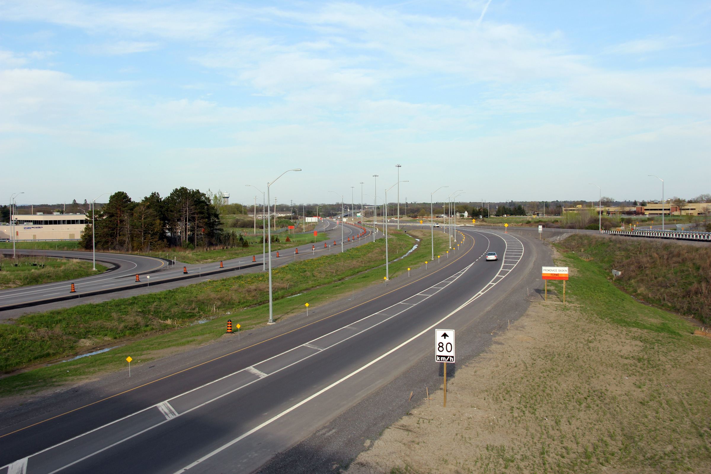
|
Ottawa Road 29 is the current
incarnation of the former Highway 15 between Carleton Place and Arnprior.
Click
here for Highway 15 images. |
|
Highway 417 images continue easterly
between Arnprior and Kanata
via Page 4F Images. |


 (720x480)


 (720x480)


 (720x480)
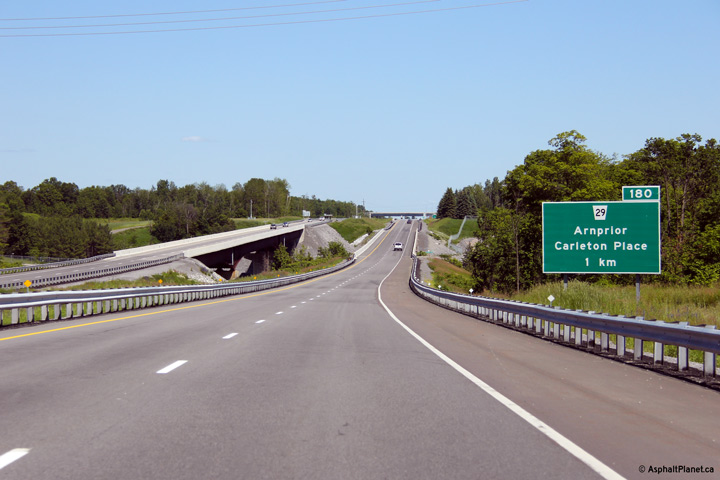 (720x480)


 (720x480)


