|
Proper Municipality Name |
Photo Description |
Photo |
|
Photos taken
from driver's perspective appear offset from centre-line Photos: |
North-
Bound |
South-
Bound |
|
Click here for Highway 69 Images between
Horseshoe Lake and
Highway 559. |
|
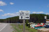
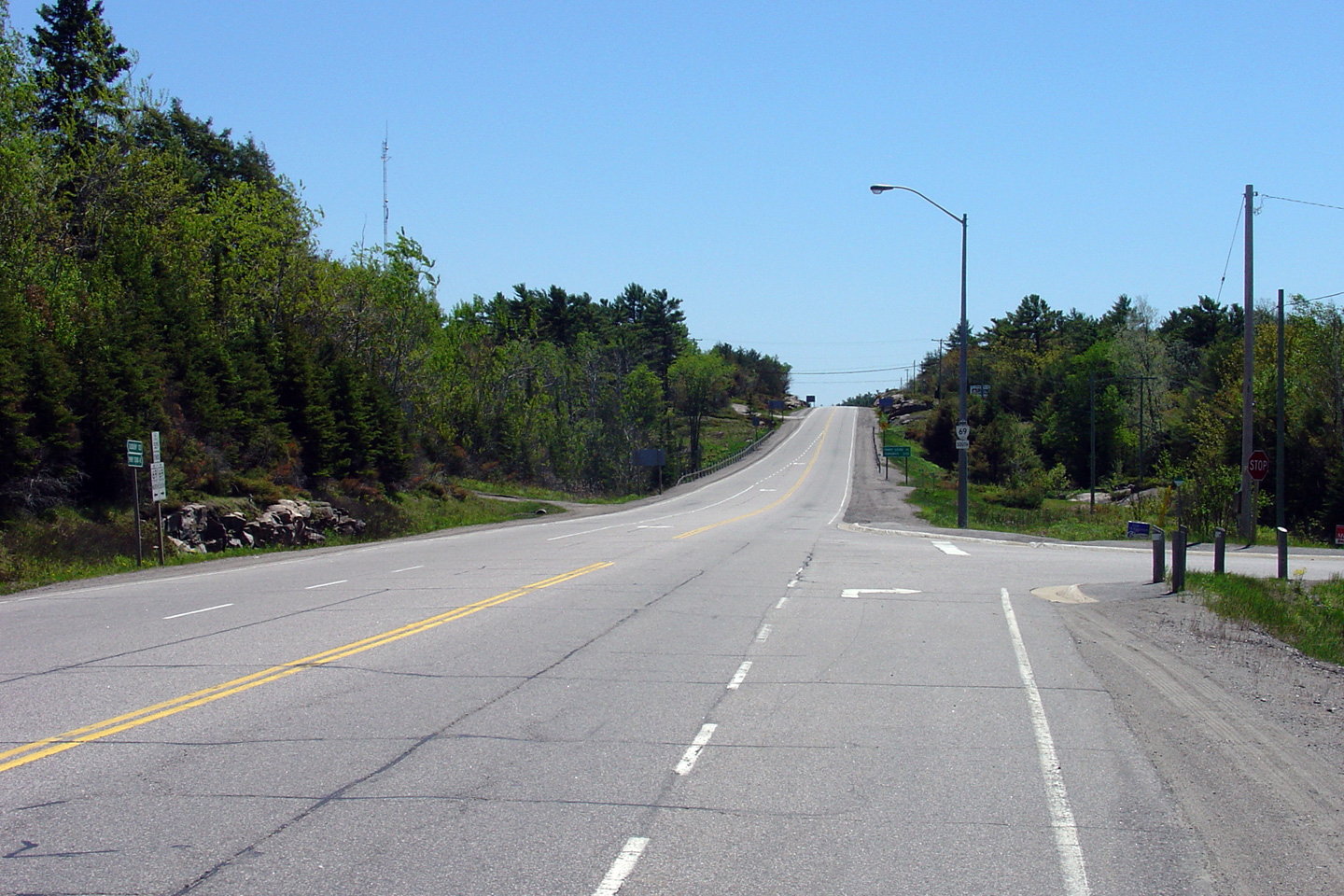
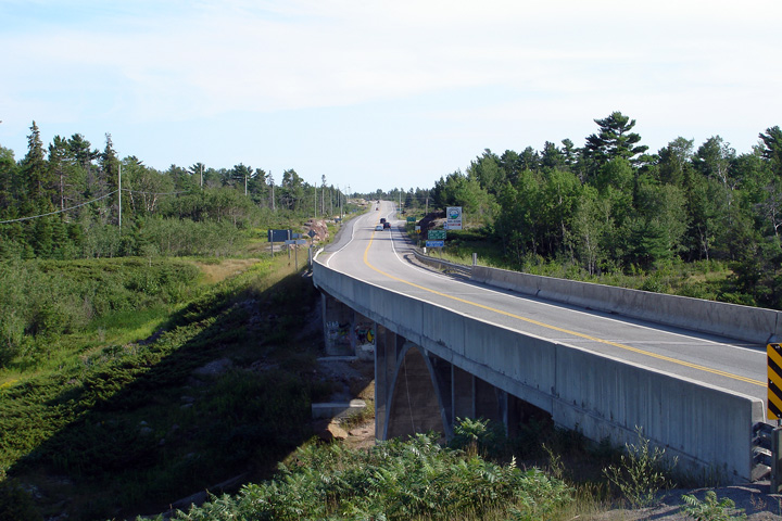
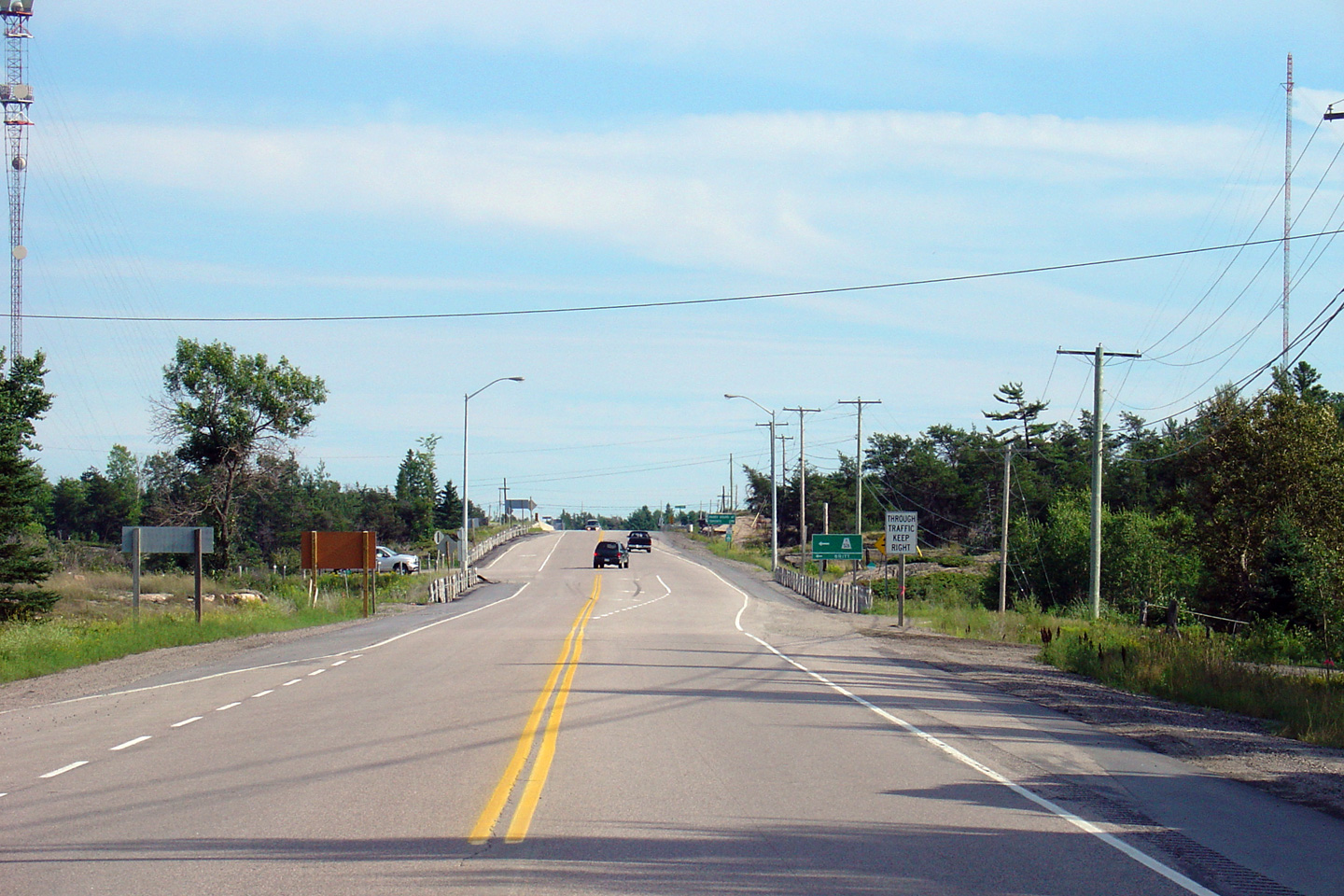
Highway 559 leads west and south
of Highway 69 towards Killbear Provincial Park and is the main access road
in Carling Township.
Click here for Highway 559
images. |
Township of
Carling
District of Parry Sound |
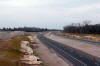
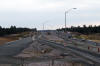
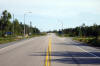
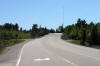
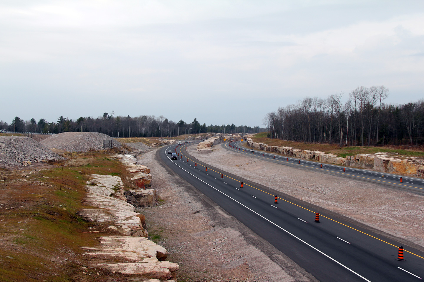
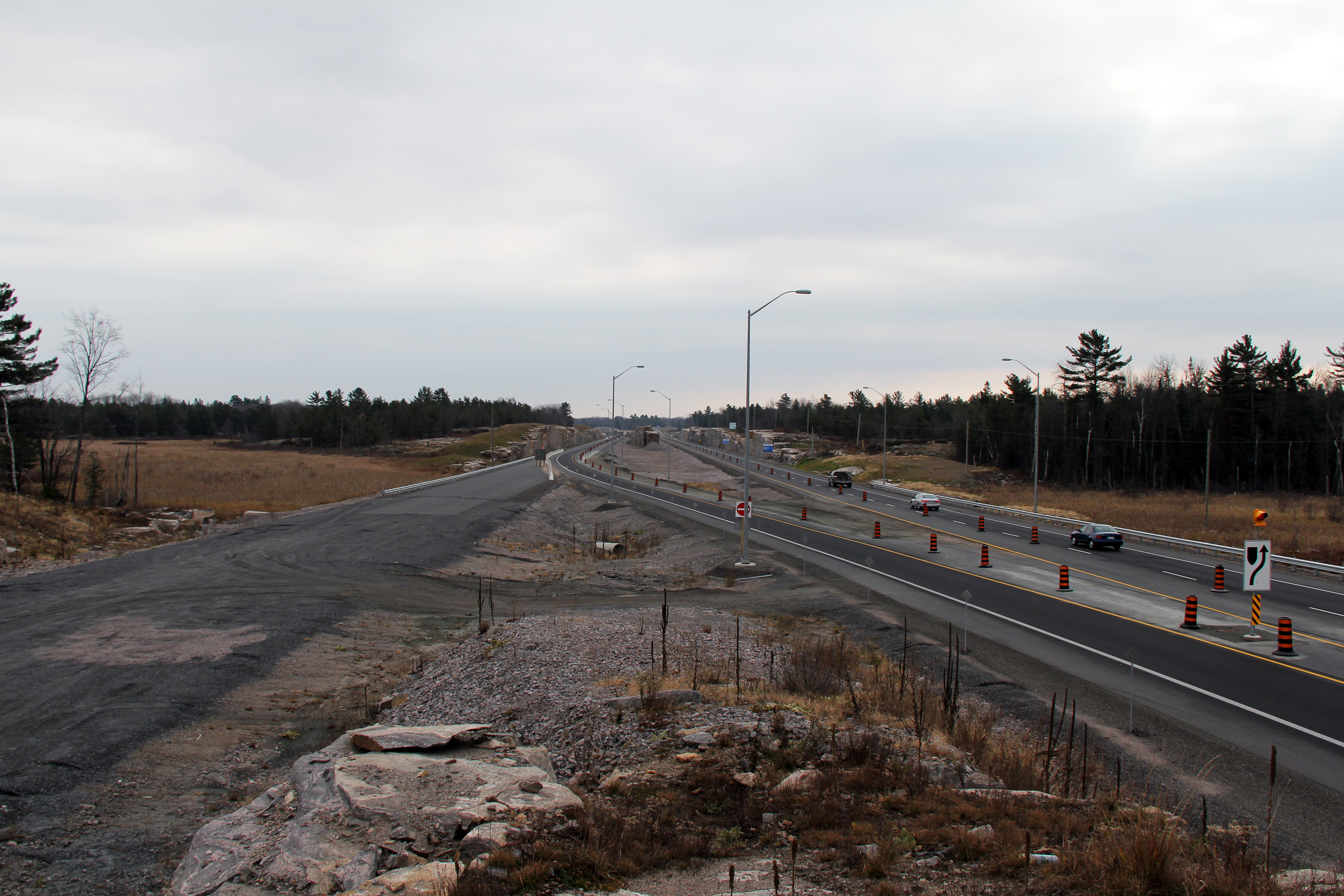
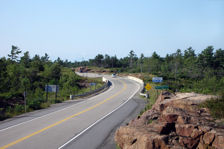
This view looks northerly along Highway 69/400 from the
Highway 559
overpass.
Photo taken: November 13th, 2010. |
(720x480)
(1440x960)
(2400x1600) |
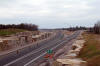
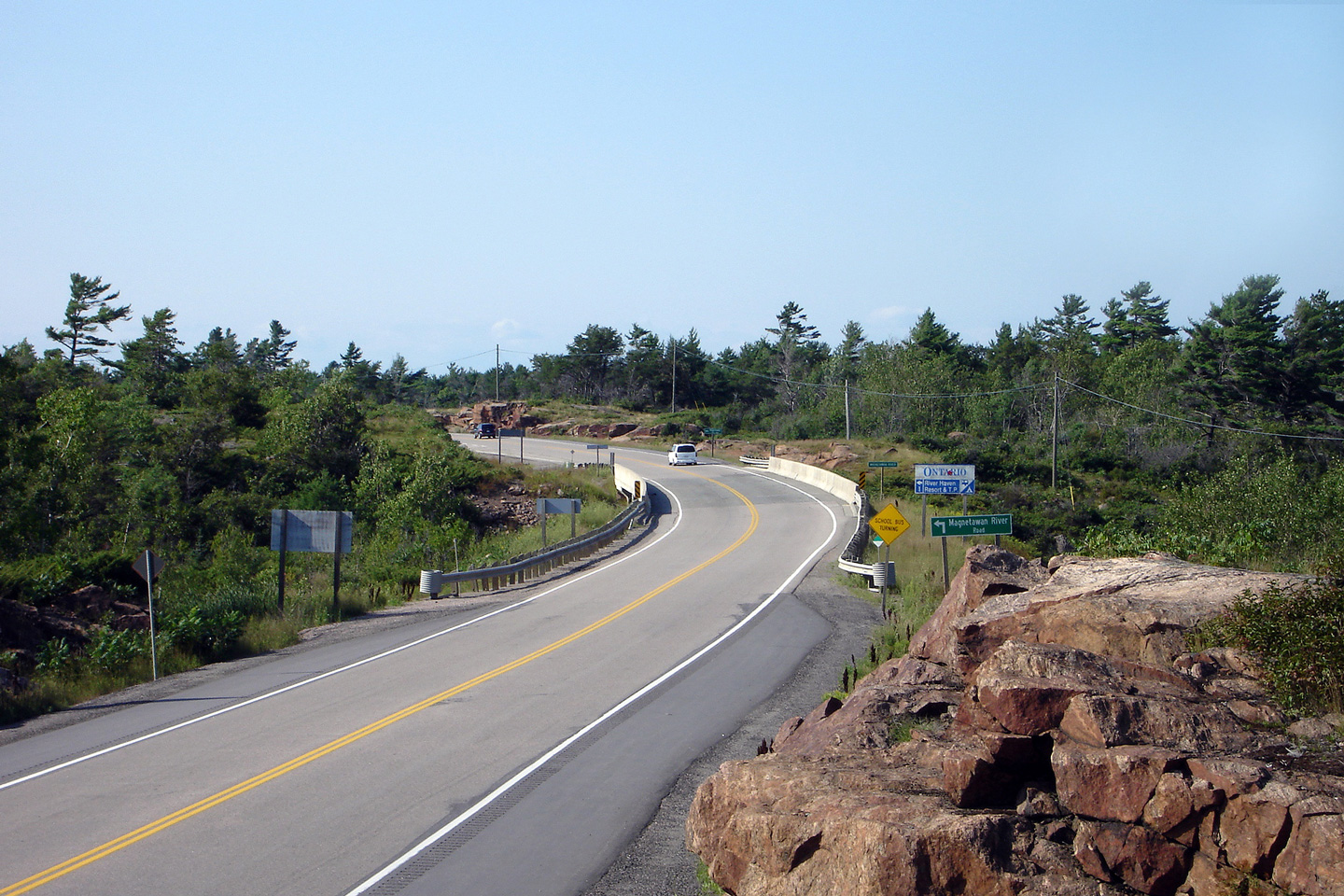
Township of
Carling
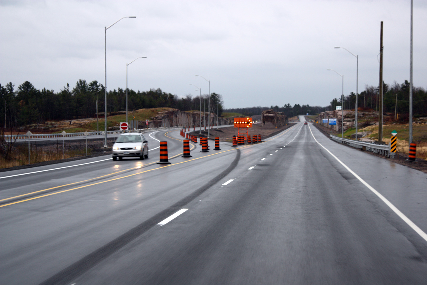
District of Parry Sound |
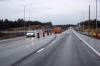
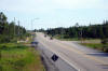
Southerly view approaching the Highway 559 interchange.
Photo taken: November 13th, 2010. |
(720x480)
(1440x960)
(2400x1600) |
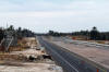
Township of
Carling
District of Parry Sound |
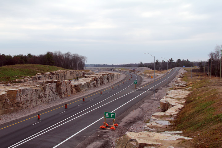
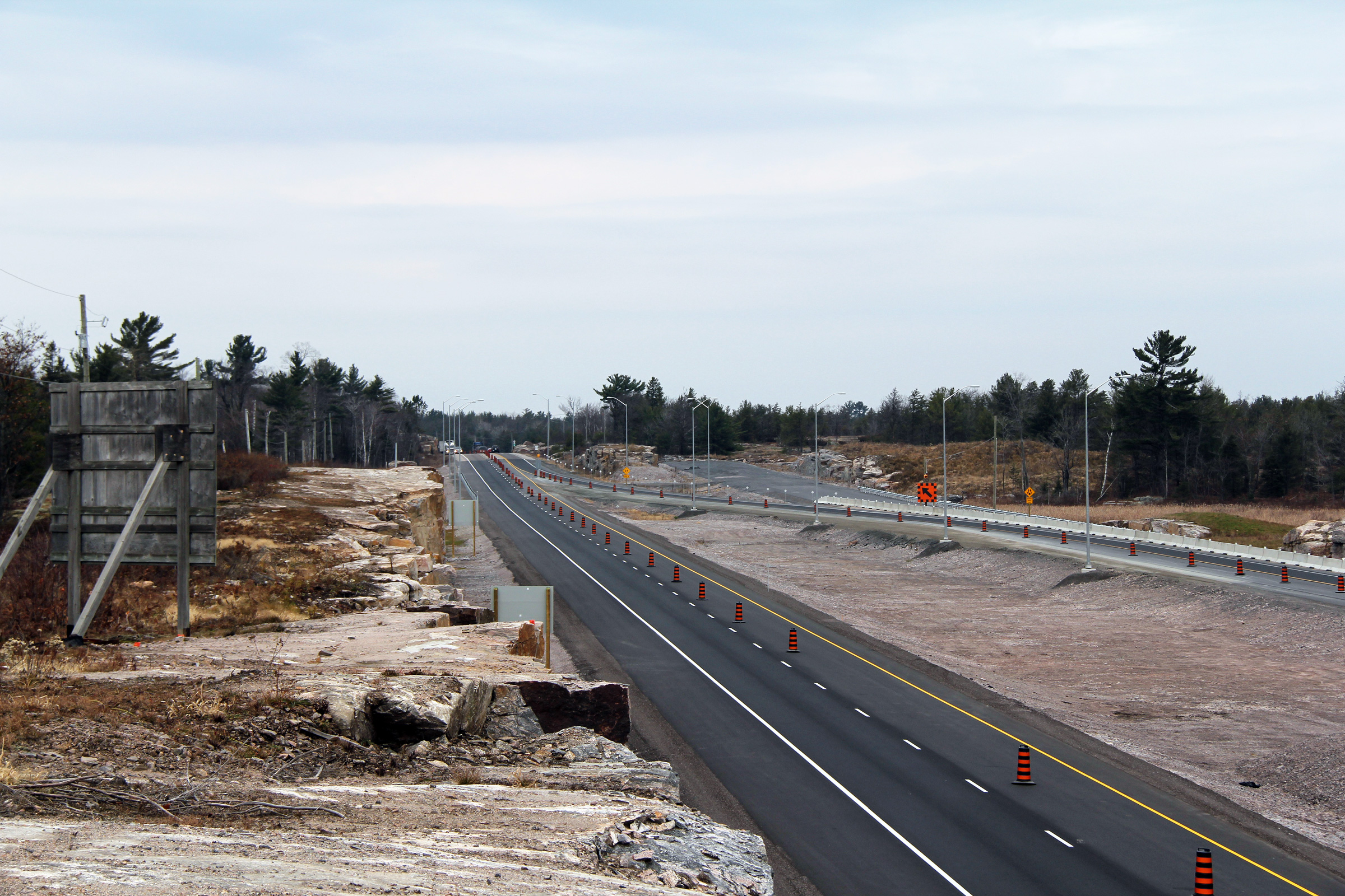
Two views, from both sides of the highway looking northerly as Highway
69/400 collapses down to just Highway 69. At the time that this photo
was taken their was no ends sign to denote the northern terminus of Highway
400, and the subsequent transition to Highway 69. Though, at the time
this photo was taken, the Highway 400 extension had just opened, and several
permanent signs were missing, so this situation could have been rectified.
Notice that aside from the short stub northbound carriageway, no trees have
been cleared as of late fall 2010 for a further extension of Highway 400.
It is unlikely that Highway 400 will reach Sudbury by 2017 as had been
previously announced by the Ontario Government.
Photos taken: November 13th, 2010. |
(720x480)
(1440x960)
(2400x1600)

(720x480)
(1440x960)
(2400x1600) |
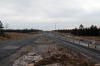
Township of
Carling
District of Parry Sound |
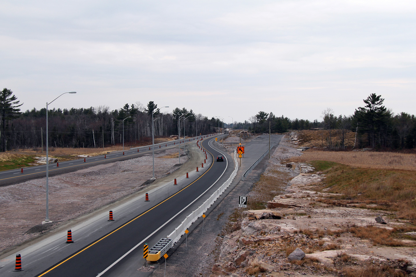
Two southbound views as the divided highway starts southerly.
Photos taken: November 13th, 2010. |
(720x480)
(1440x960)
(2400x1600)
(720x480)
(1440x960)
(2400x1600) |
Township of
Carling
District of Parry Sound |
This view looks southbound from the drivers seat along Highway 69 as the
highway widens to four lanes, and the Highway 400 designation begins.
This photo was shot almost immediately after Highway 400 opened to traffic.
Notice that when this photo was taken, the old two-lane transfer that
carried construction traffic to the northbound carriageway had yet to be
removed.
Photo courtesy: Patrick Gaudreau. Taken: October 30th, 2010. |
 (720
x 540) (720
x 540)
(1440x960) |
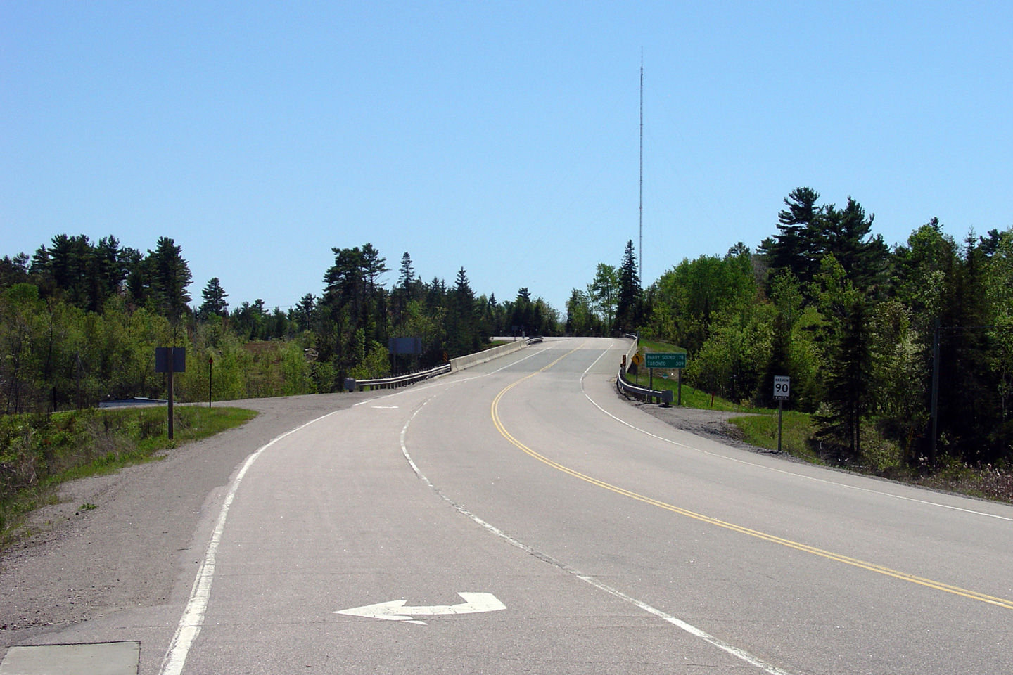
Township of
Carling
District of Parry Sound |
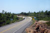
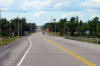
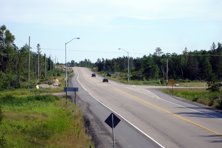
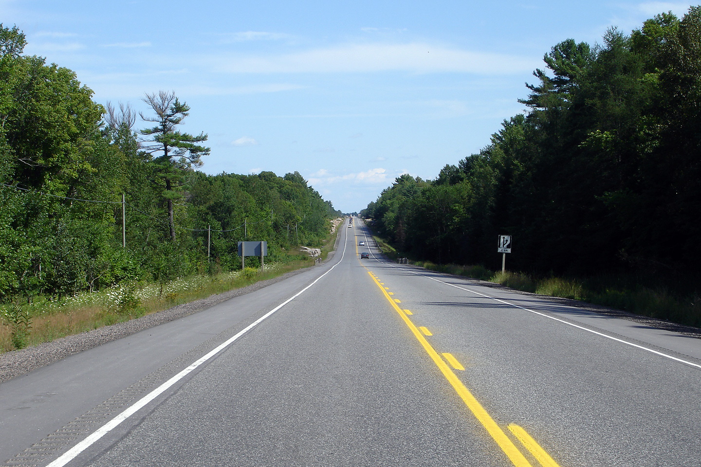
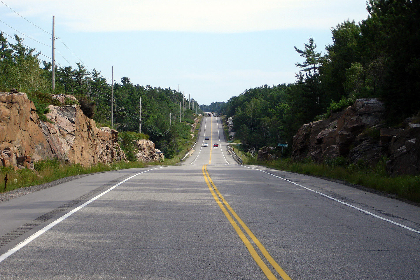
This view looks southerly about 5km north of the Highway 559 interchange
along Highway 69. The two lane stretches of Highway 69 offer a unique
perspective to a nearly bygone era of motoring. Two lane trunk highways are
almost extinct in Southern Ontario, much of Eastern Canada, and
virtually all of the United States. Before the advent of the divided
highway, all traffic had to use slower, two lane highways that progressed
through the communities they served, rather than passing around them. The
slow and steady replacement of two lane highways with modern freeways is
akin to the slow and steady replacement of railways in the early part of the
20th century with modern two-lane trunk highways.
Photo taken: August 6th, 2006. |

(720x480)
(1440x960) |
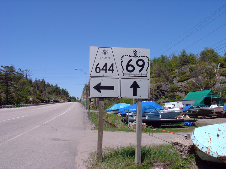
| Township of the Archipelago
District of Parry Sound |
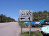
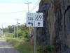
Junction assembly for Highway
69/644 facing
north. It is very unusual to see an 'oversized' secondary highway
shield.
Photo taken: May 29th, 2004. |
 |
| Township of the Archipelago
District of Parry Sound |
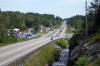
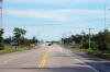
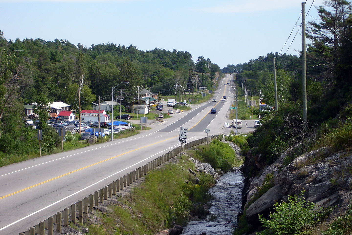
This view looks southerly along Highway 69 through Pointe au Baril at the
Highway 644 intersection. Pointe au Baril is probably the largest
community located directly along Highway 69 between Parry Sound and Sudbury.
Photo taken: August 6th, 2006. |
(720x480)
(1440x960) |
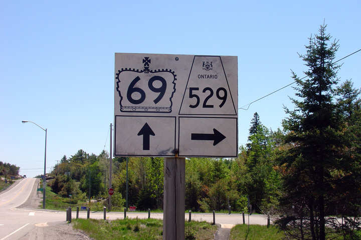
| Township of the Archipelago
District of Parry Sound |
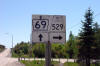
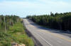
Highway 69 looking south from the southern junction of
Highway 529.
Photo taken: May 29th, 2004. |

(720x480)
(1440x960) |
|
Highway 529 is a former alignment
of Highway 69 that carries traffic on a narrow and twisting alignment between
Pointe au Baril and Britt.
Click here for Highway 529
images. |
| Township of the Archipelago
District of Parry Sound |
Southbound junction assembly at the southern
Highway 529 junction. Highway
529 is a former alignment of Highway 69 that was by-passed by a much
straighter alignment in 1961.
Photo taken: May 29th, 2004. |
 |
| Township of the Archipelago
District of Parry Sound |
Southerly view as Highway 69 crosses overtop of Naiscoot Lake. The
Naiscoot Lake structure, while very old, is constructed to very high
standards, particularly for its vintage. Observe the wide full-width
shoulders. Only the most important of highways were designed in such a
manner.
Photo taken: August 6th, 2006. |
(720x480)
(1440x960) |
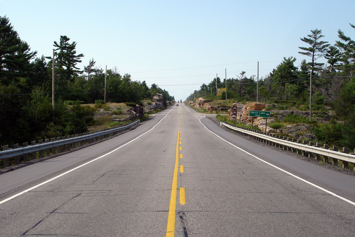
District of Parry Sound
(Geographical Township of Wallbridge) |
This view looks northerly approaching the Harris Lake Road intersection, and
picnic area of the same namesake.
Photo taken: August 6th, 2006. |

(720x480)
(1440x960) |
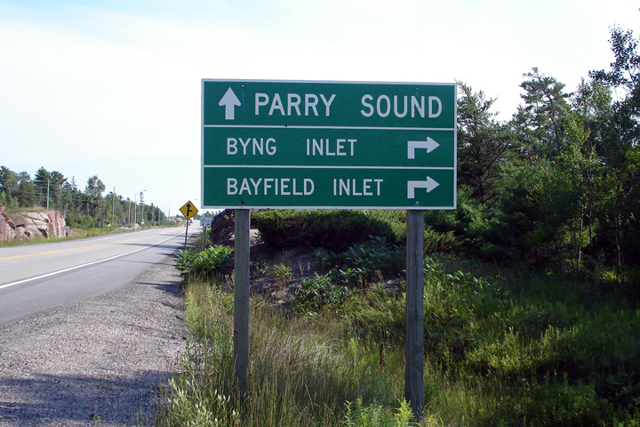
Magnetawan First Nation
District of Parry Sound |
Northbound directional signage denoting the northern Highway 529
intersection. Bying Inlet is a small community found the Magnetawan
River opposite Britt. There is no bridge directly linking Britt to
Bying Inlet.
Photo taken: August 6th, 2006. |
 (720
x 540) (720
x 540)
(1440x960) |
Magnetawan First Nation
District of Parry Sound |
Northbound view approaching the Highway 529 intersection.
Photo taken: August 6th, 2006. |

(720x480)
(1440x960) |
Magnetawan First Nation
District of Parry Sound |
Southbound direction signage along Highway 69 approaching the northern
Highway 529 junction.
Photo taken: August 6th, 2006. |
 |
Magnetawan First Nation
District of Parry Sound |
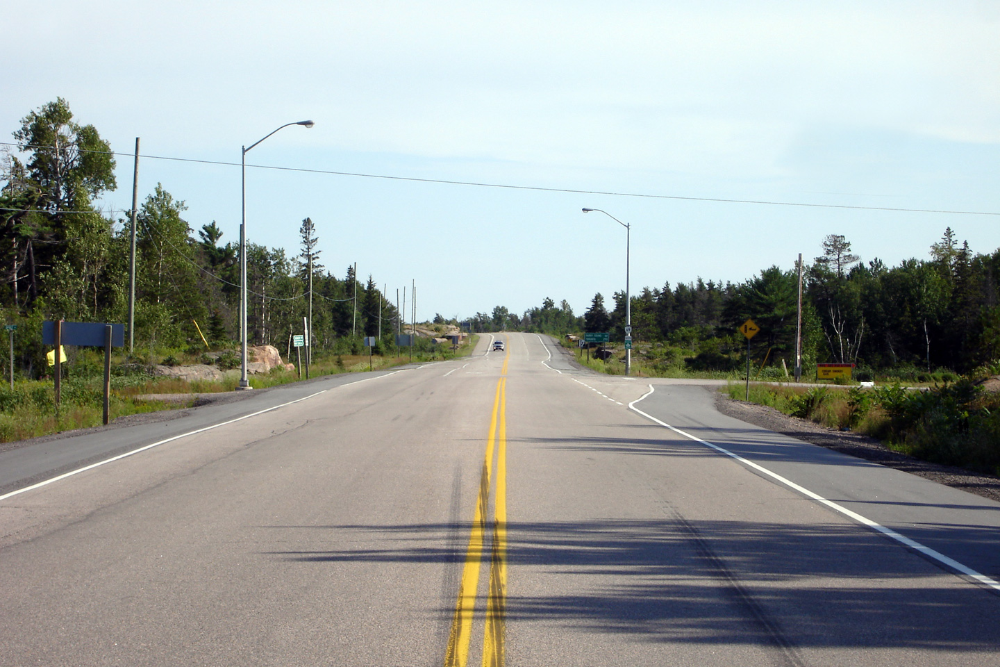
Two views looking southerly along Highway 69 approaching the northern
Highway 529 junction.
Photos taken: August 6th, 2006. |
(720x480)
(1440x960)
(720x480)
(1440x960) |
Magnetawan First Nation
District of Parry Sound |
This view looks northerly as Highway 69 crosses overtop of the Magnetawan
River Bridge.
Photo taken: August 6th, 2006. |
(720x480)
(1440x960) |
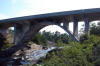
District of Parry Sound
(Geographical Township of Wallbridge) |
This view looks west at the eastern elevation of the Magnetawan River
Bridge.
Thekingshighway.ca has some additional photographs of the picturesque
Magnetawan River Bridge.
Photo taken: August 6th, 2006. |
(720x480)
(1440x960) |
District of Parry Sound
(Geographical Township of Wallbridge) |
Southerly view across the Magnetawan River Bridge along Highway 69.
This photo attempts to show both the deck and the elegant substructure of
the bridge in a single photo.
Photo taken: August 6th, 2006. |

(720x480)
(1440x960) |
District of Parry Sound
(Geographical Township of Henvey) |
View looking north along Highway 69 towards the
Highway 526
intersection. Photo taken: August 14th, 2005. |
(720x480)
(1440x960) |
|
Highway 526 is a short highway
that leads a few kilometres along the north bank of the Magnetawan River to
the community of Britt.
Click here for Highway 526
images. |
District of Parry Sound
(Geographical Township of Henvey) |
View looking south towards the
Highway 526
intersection.
Highway 526 has somewhat of an odd routing in the vicinity of Highway
69. Although the route leads only to Britt -- a small community
located to the west of Highway 69 -- the road actually departs to the east
of Highway 69 before passing under the highway via a rail overhead.
Photo taken: August 14th, 2005. |
(720x480)
(1440x960) |
District of Parry Sound
(Geographical Township of Henvey) |
Advanced junction assembly for the
Highway 526
intersection.
Photo taken: August 6th, 2005. |
 |
District of Parry Sound
(Geographical Township of Mowat) |
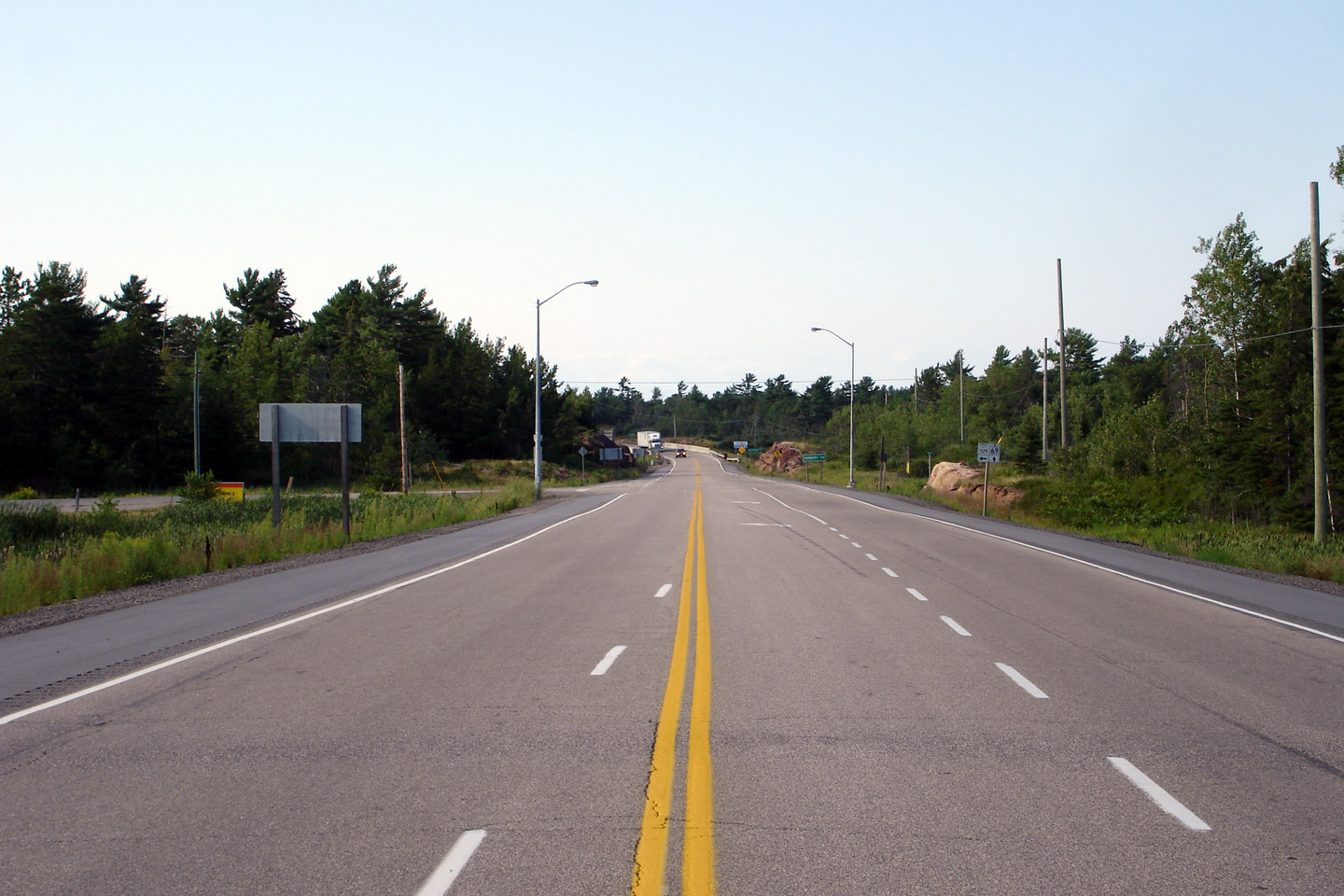
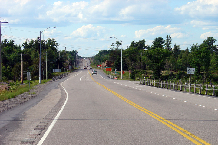
This view looks southerly along Highway 69 between Highway 526 and Highway
559. The southbound passing lane was added along this stretch of
highway in 2005 creating the four-lane highway as shown.
Photo taken: August 6th, 2006. |
(720x480)
(1440x960) |
District of Parry Sound
(Geographical Township of Mowat) |
Northbound junction assembly for the
Highway 522
junction. Highway 522
leads travelers east from Highway 69 towards Trout Creek and
Highway 11. Photo size: 40kb. |
 |
District of Parry Sound
(Geographical Township of Mowat) |
Highway 69 looking south from
Highway 522 at Cranberry. Photo taken: May 29th, 2004. |
(720x480)
(1440x960) |
|
Highway 522 leads easterly from
Cranberry, past Grundy Lake Provincial Park, bound for Trout Creek and
Highway 11.
Click here for Highway 522
images. |
|
Click here for Highway 69 -
Highway 637 and Sudbury
Images section. |


 (720
x 540)
(720
x 540)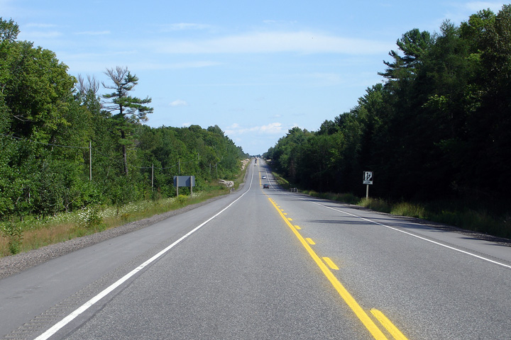


 (720
x 540)
(720
x 540)


