|
Proper Municipality Name |
Photo Description |
Photo |
|
Pictures taken
from driver's perspective appear offset from centre-line pictures: |
North-
Bound |
South-
Bound |
|
Click here for Highway 69 Images between the
Musquash River to
Horseshoe Lake. |
|
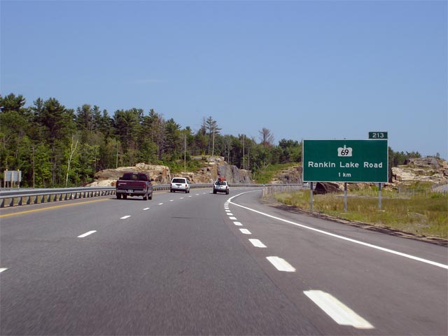
Highway 69 departs the Highway
400 alignment at Rankin Lake Road.
Click here for Highway 400-South images. |
| Township of Seguin District of
Parry Sound |
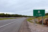
Guide signage denoting the northern Highway 69 interchange along
Highway 400. Photo taken: July 13th, 2006. |
 |
| Township of Seguin District of
Parry Sound |
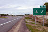
Advanced signage for the northern Highway 69 interchange. Photo taken:
July 13th, 2006. |
 |
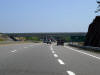
| Township of Seguin District of
Parry Sound |
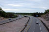
View looking southerly towards the Parry Sound truck inspection station
from Black Road.
Photo taken: August 2nd, 2008 |

Low-res
High-res |
| Township of Seguin District of
Parry Sound |
Northerly view from Black Road.
Photo taken: August 2nd, 2008 |
Low-res
High-res |
| Township of Seguin District of
Parry Sound |
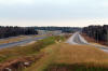
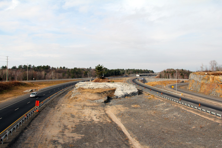
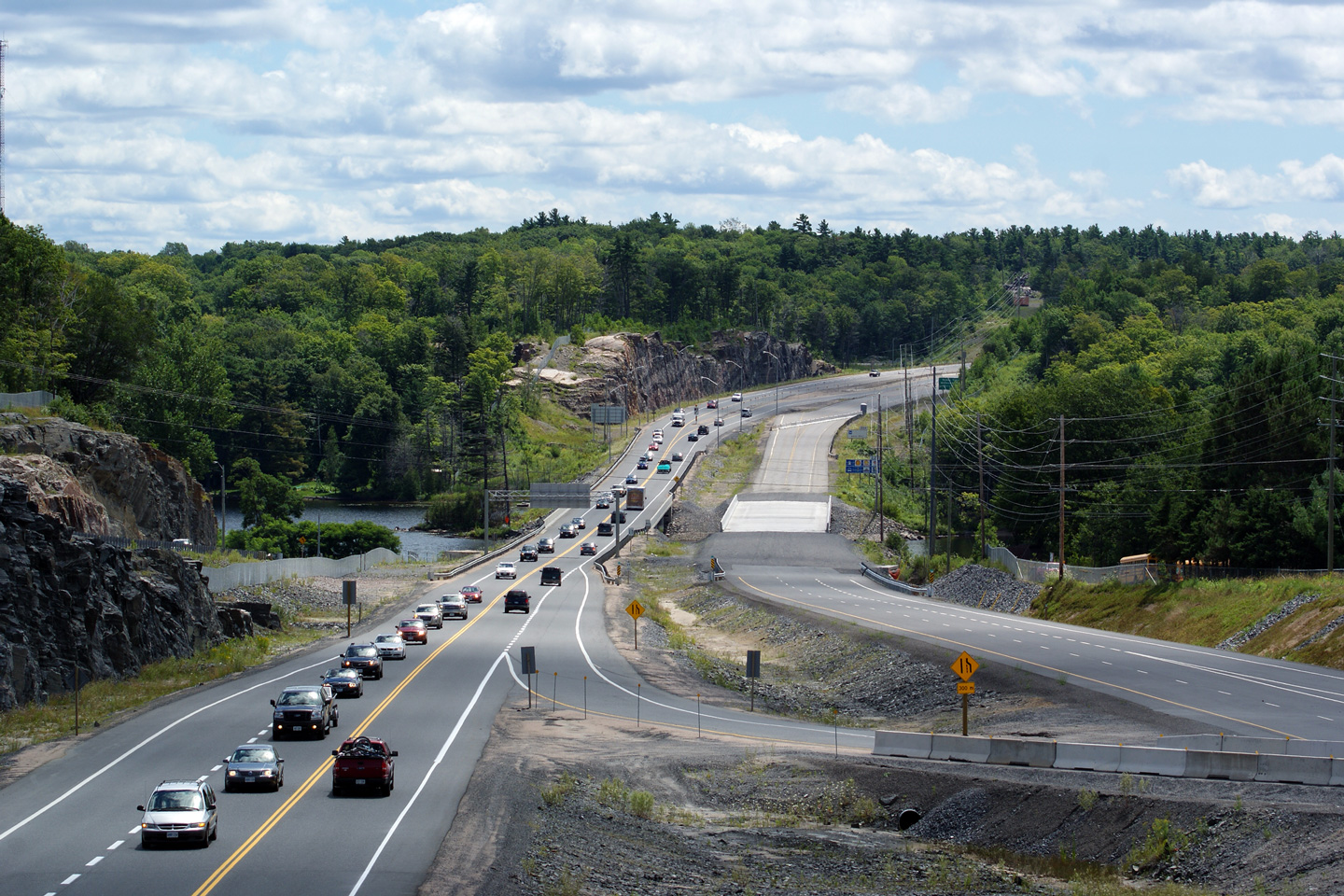
Southerly view from the Horseshoe Lake Road overpass. Horseshoe Lake Road
serves primarily as an access to the Georgian Bay Country
Welcome Centre.
Photo taken: May 29th, 2004. |
Low-res
High-res |
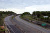
| Township of Seguin District of
Parry Sound |
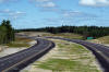
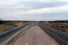
Looking north at the parclo ab-2 interchange. Photo taken: May 29th, 2004. |

Low-res
High-res |
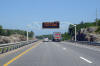
| Township of Seguin District of
Parry Sound |
Overhead COMPASS sign along the 400 just south of Oastler Park Drive. Photo
taken: July 13th, 2006. |
 Low
Res Low
Res
High Res |
| Township of Seguin District of
Parry Sound |
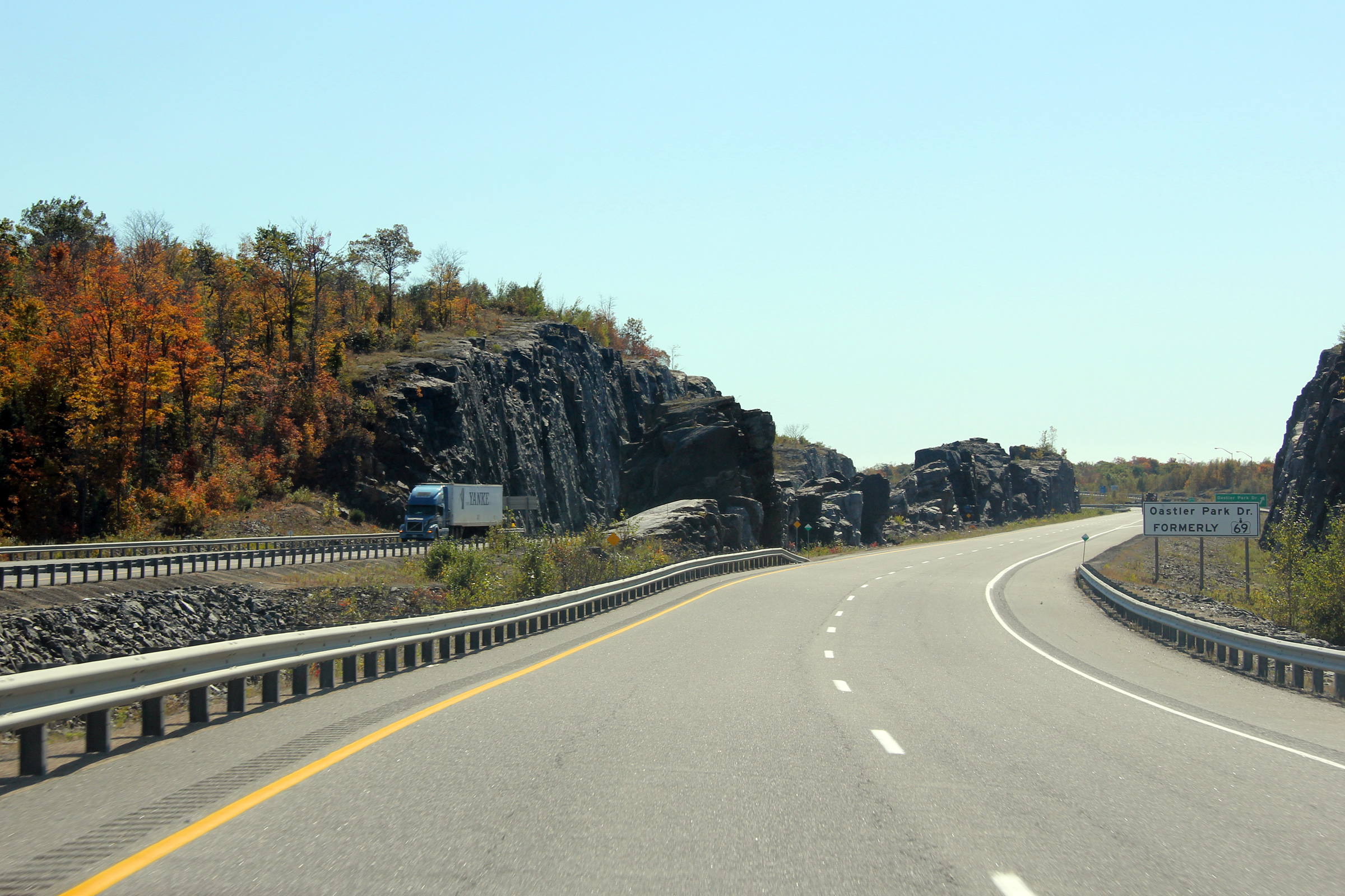
Southbound view from the Oastler Park Drive overpass. Oastler Park
Drive is
the former alignment of Highway 69 leading into Parry Sound. Photo taken:
July 13th, 2006. |

Low-res
High-res |
| Township of Seguin District of
Parry Sound |
Northerly view from Oastler Park Drive. Photo taken: July 13th, 2006. |
Low-res
High-res |
| Township of Seguin District of
Parry Sound |
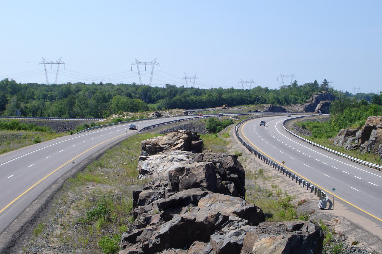
View looking northerly from a tall rock cut just to the north of the
Oastler Park Drive interchange.
Photo taken: August 2nd, 2008 |
Low-res
High-res |
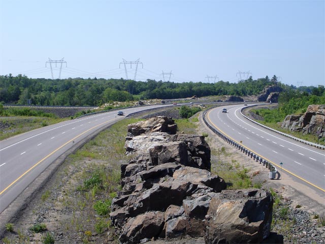
| Township of Seguin District of
Parry Sound |
View looking southerly atop the Oastler Drive Road interchange.
Photo taken: August 2nd, 2008 |
Low-res
High-res |
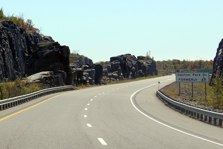
| Township of Seguin District of
Parry Sound |
White signage in advance of the Oastler Park Drive interchange to advise
drivers that Oastler Park Drive is the former alignment of Highway 69.
Photo taken: October 5th, 2011. |
 (720
x 540) (720
x 540)
(1440x960)
(2400x1600) |
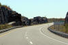
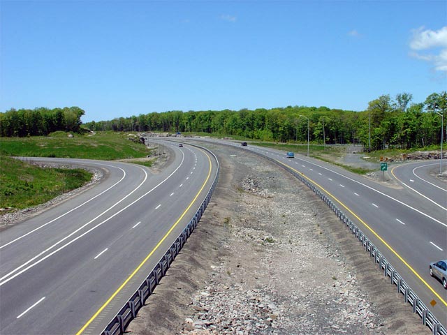
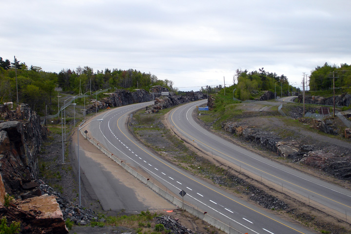
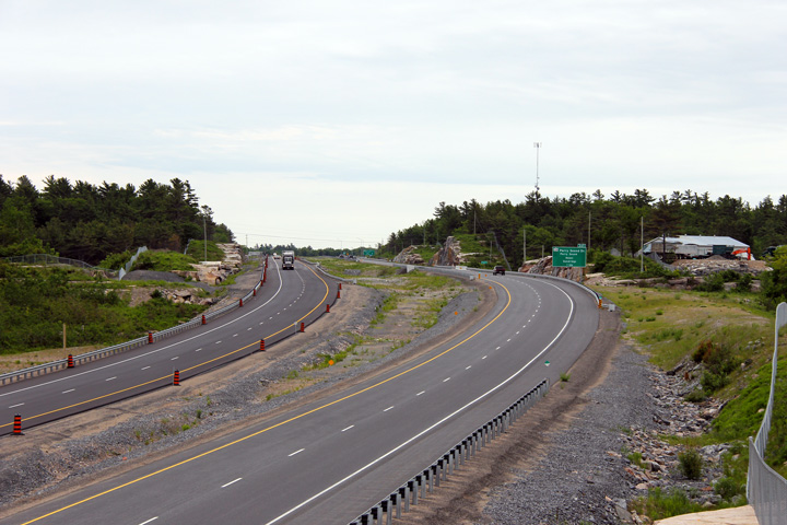
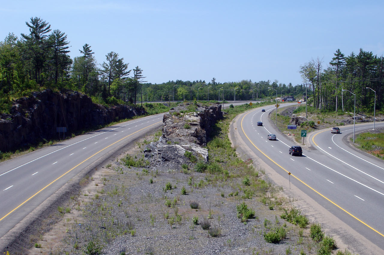
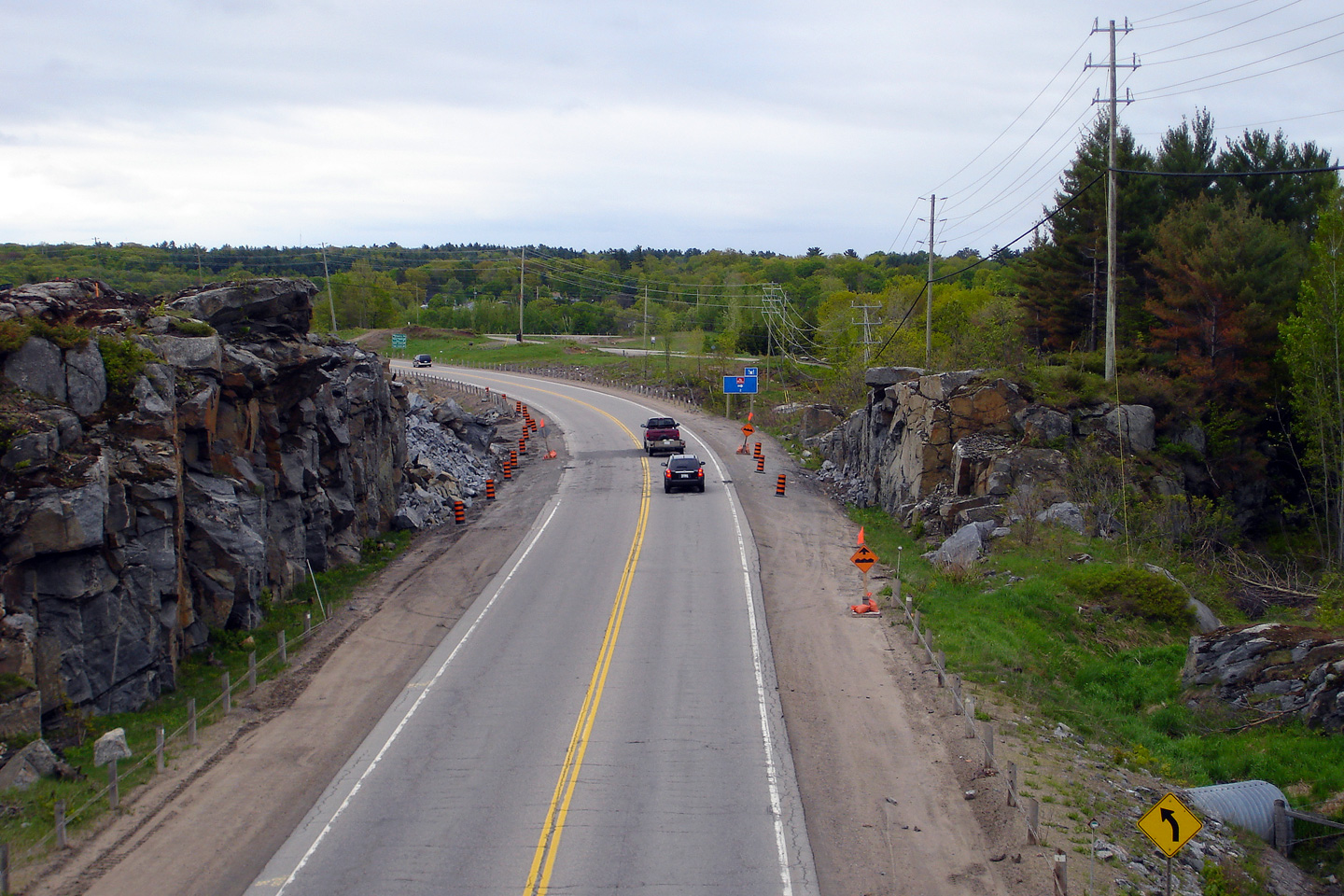
| Township of Seguin District of
Parry Sound |
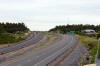
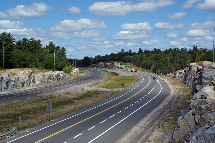
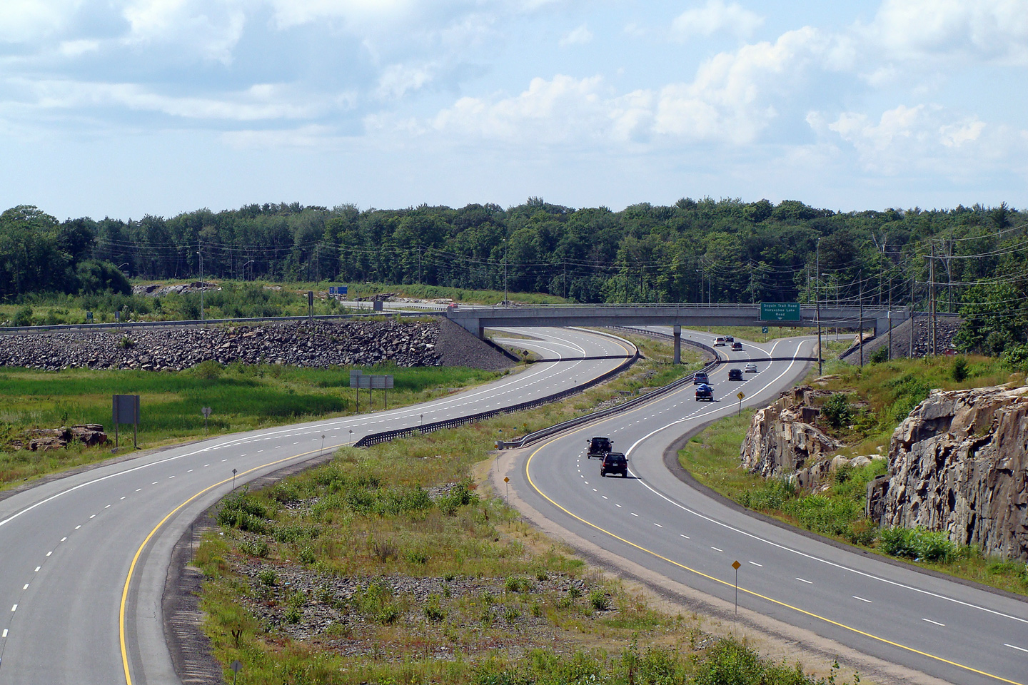
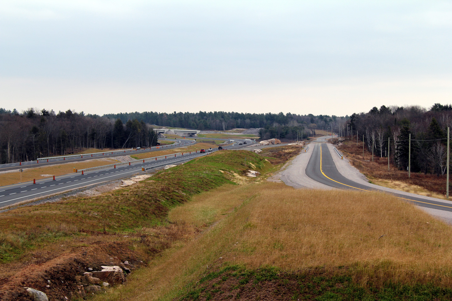
Highway 69/400 looking south from the Horseshoe Lake Road overpass near
Parry Sound. This interchange is located roughly at kilometre marker 214.
Photo taken: May 29th, 2004. |
Low-res
High-res |
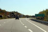
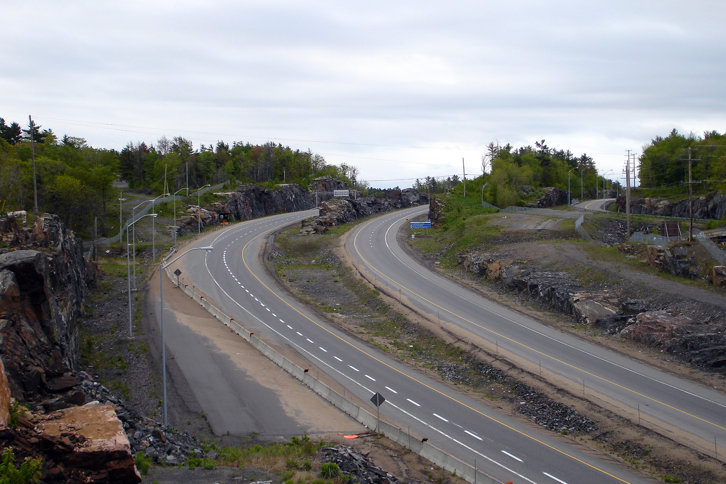
| Township of Seguin District of
Parry Sound |
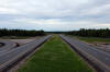
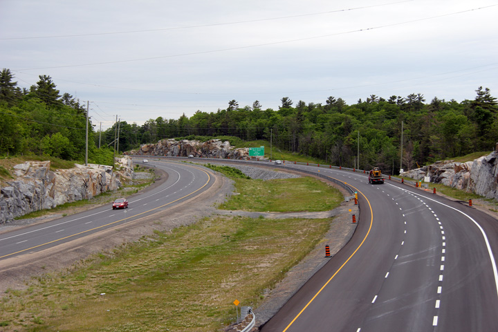
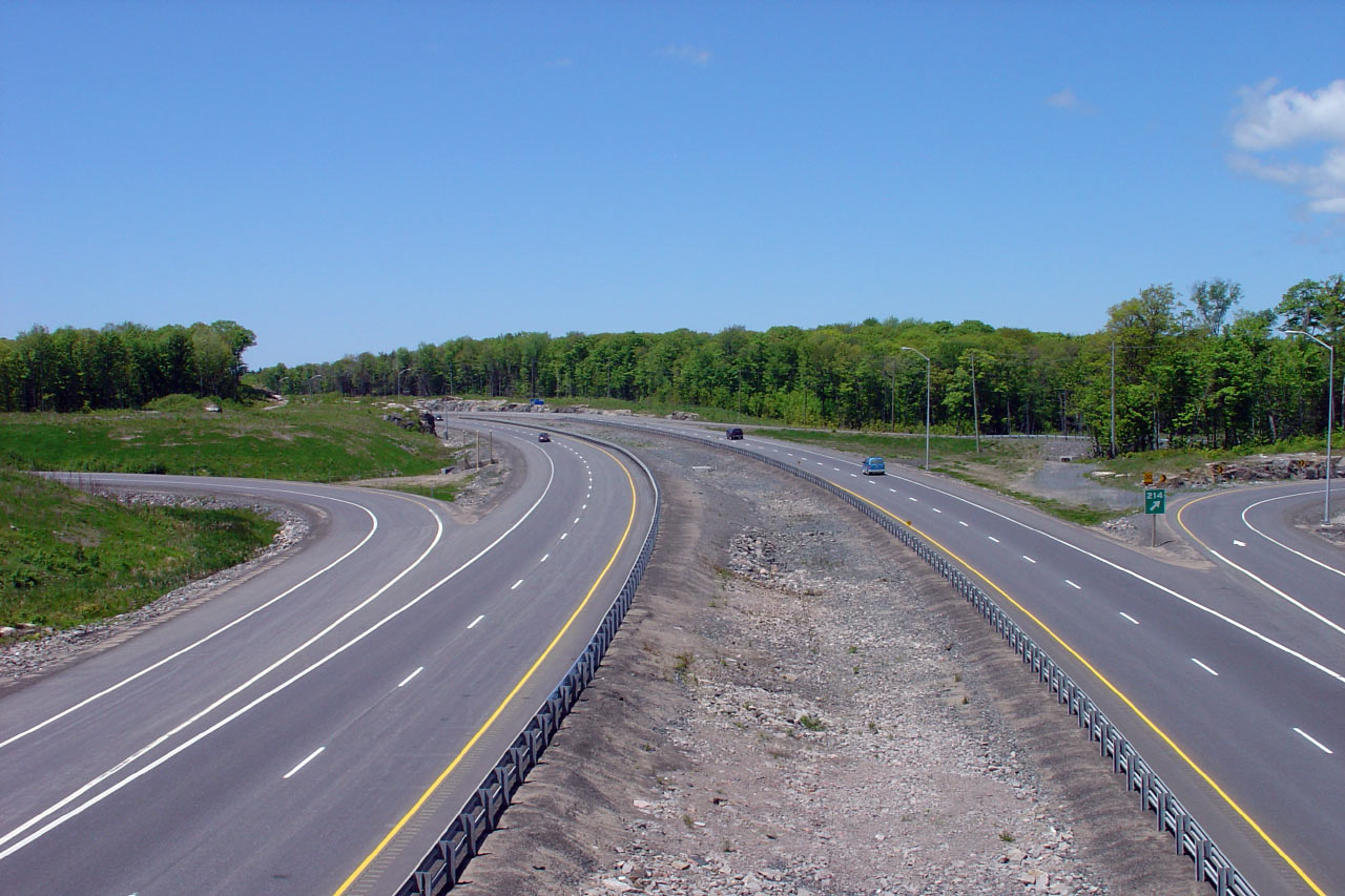
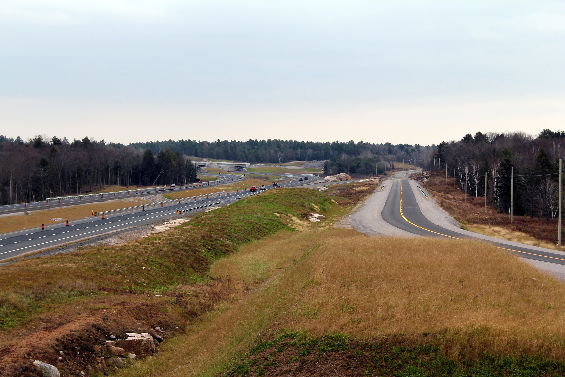
Highway 69/400 looking north from Horseshoe Lake Road. Horseshoe Lake Road
is a Parclo AB2, and is probably the lowest traveled interchange in
Ontario. The primary reason for the Horseshoe Lake Road overpass is to
provide a grade separation for a multiuse trail facility running through the
area. Horseshoe Lake Road itself, is but a minor township road.
Photo taken: May 29th, 2004. |
Low-res
High-res |
|
Between Oastler Park Drive and
Bowes Street, Highway 400 intersects Highway 518.
Click here for Highway 518 images. |
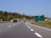
| Township of Seguin District of
Parry Sound |
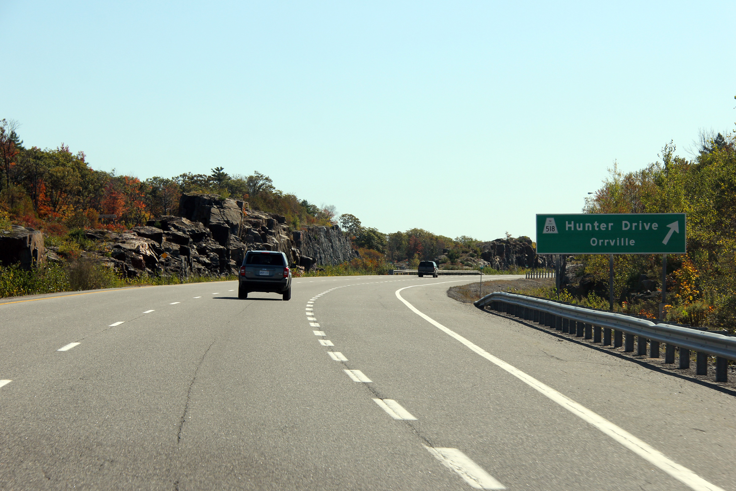
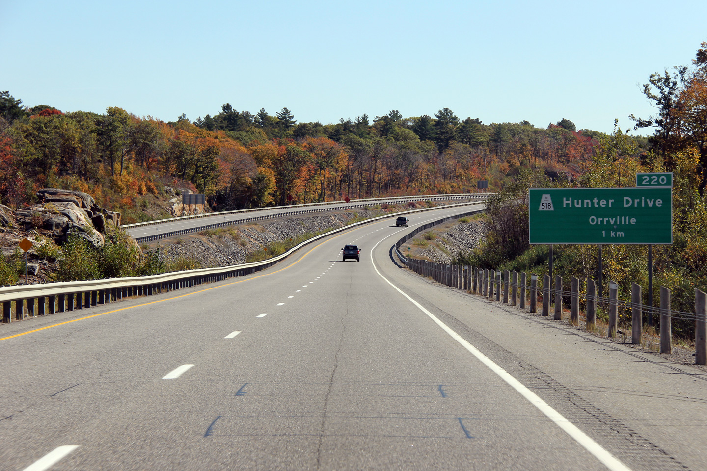
Southbound signage at the exit to
Highway 518.
Photo taken: October 5th, 2011. |
 (720
x 540) (720
x 540)
(1440x960)
(2400x1600) |
| Township of Seguin District of
Parry Sound |
Advanced signage for the southbound Highway 518 interchange.
Photo taken: October 5th, 2011. |
 (720
x 540) (720
x 540)
(1440x960)
(2400x1600) |
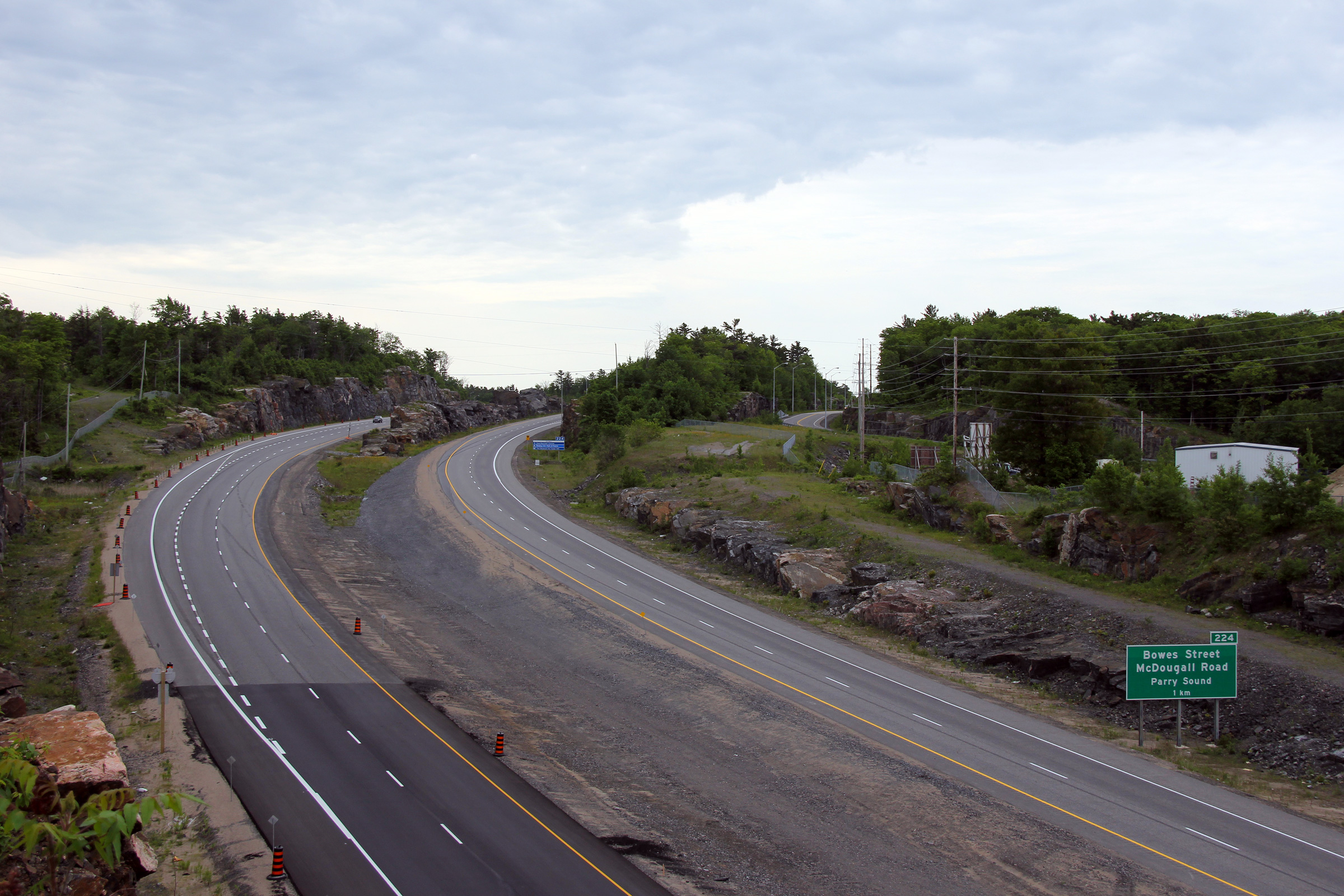
| Seguin - McDougall Boundary
District of Parry Sound |
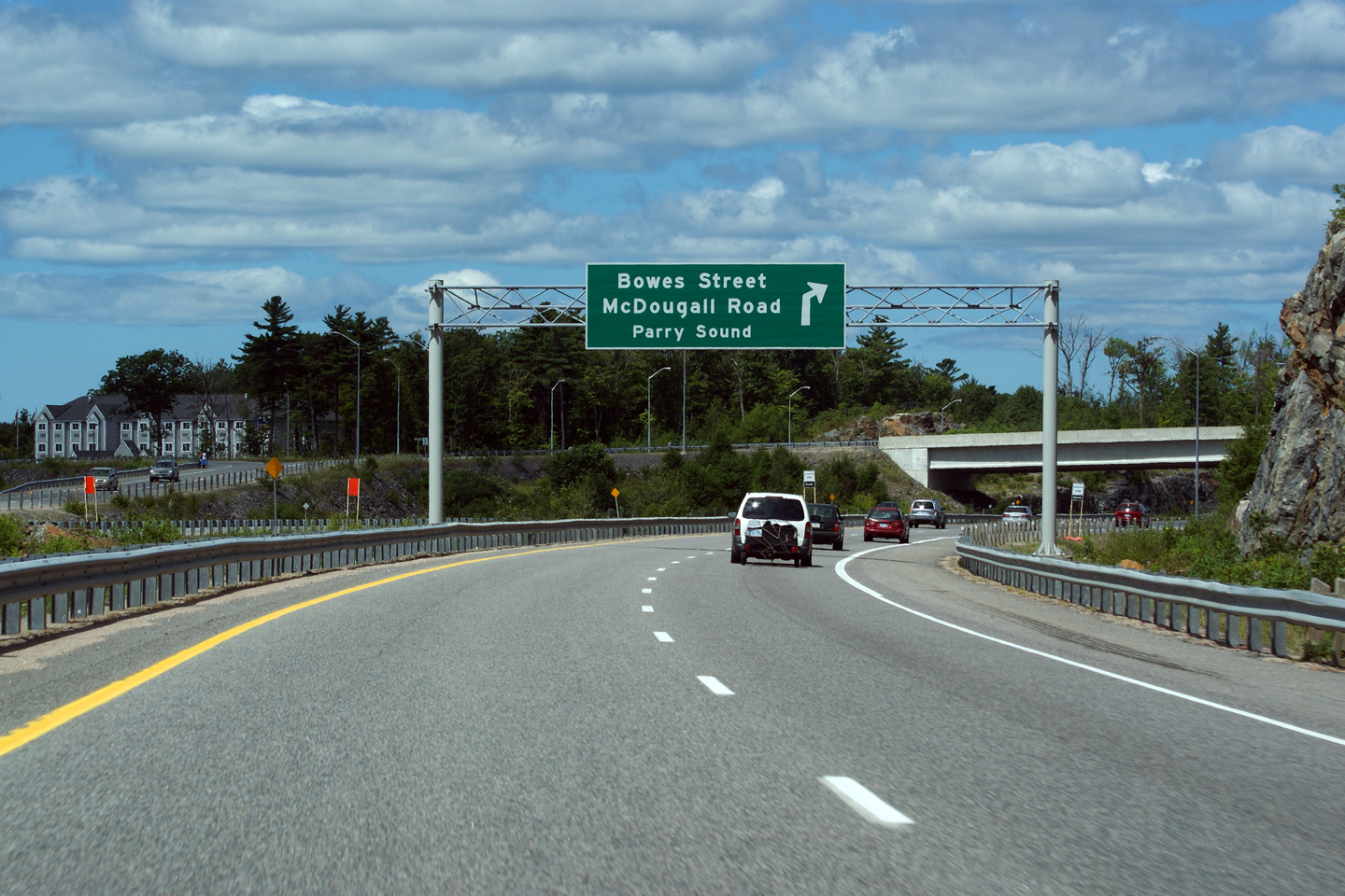
Overhead advanced warning sign for the Bowes Street & McDougal Road exit
from the northbound 400.
Photo taken: July 30th, 2010. |
 (720
x 540) (720
x 540)
(1440x960)
(2400x1600) |
| McDougall - Parry Sound Boundary
District of Parry Sound |
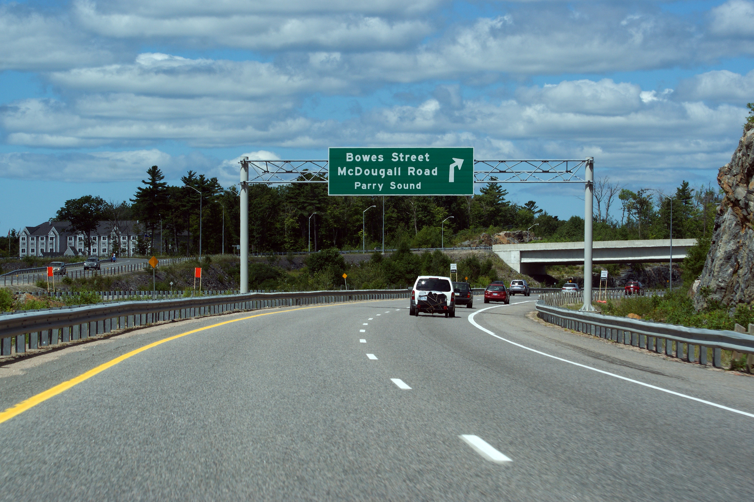
The overhead sign denoting the last exit on Highway 400. Bowes
Street is the main route into Parry Sound. Photo taken: July 30th, 2010. |

(720
x 540)
(1440x960)
(2400x1600) |
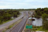
| McDougall - Parry Sound Boundary
District of Parry Sound |
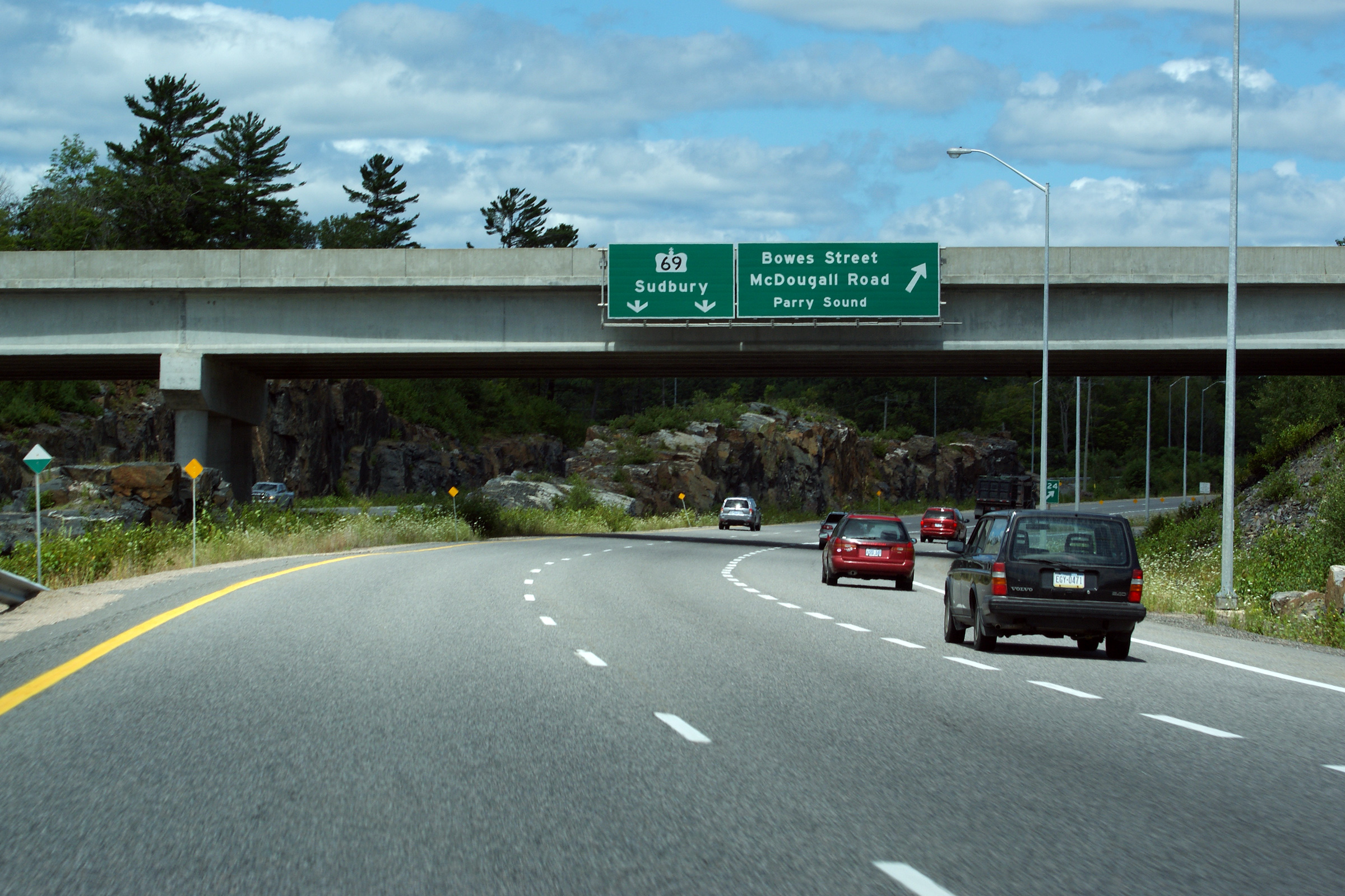
Southerly view from the Bowes Street overpass in Parry Sound. Photo taken:
May 29th, 2004. |

Low-res
High-res |
| McDougall - Parry Sound Boundary
District of Parry Sound |
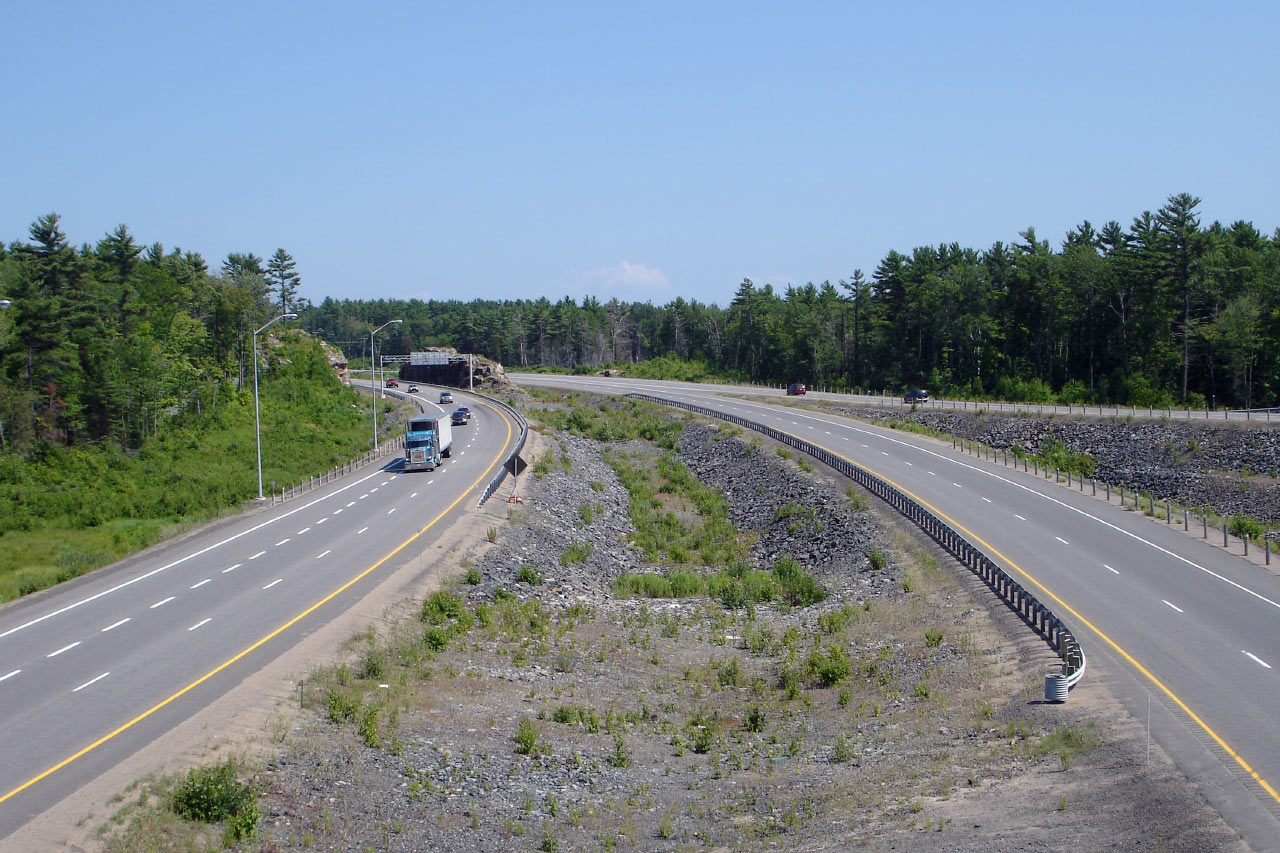
Prior to 2010,
Bowes Street was the northern most interchange along Highway 400
before it became just Highway 69. Photo taken: May 29th, 2004. |

Low-res
High-res |
| Town of Parry Sound District of
Parry Sound |
This was the ends assembly that denoted the northern terminus of Highway 400
at the former end of the divided highway on the Parry Sound By-pass.
In 2010, a new
sign was erected north of the Highway 559 interchange after the freeway was extended north
of Nobel. Photo taken: May 22nd, 2006. |
|
| Town of Parry Sound District of
Parry Sound |
Two views looking northerly towards the 2001 terminus of the first phase of
the Parry Sound By-pass. This location, just north of the Mill Lake
Narrows, marked the end of the divided highway for nine years between
November 1st, 2010 and the opening of Nobel By-pass on October 27, 2010.
The pre-2001 alignment of Highway 69 (now known as Louisa Street) can be
seen disappearing to the right of the divided highway.
Upper photo taken: May 22nd, 2006.
Lower photo taken: June 11th, 2011. |
(720x480)
(1440x960)
(2400x1600) |
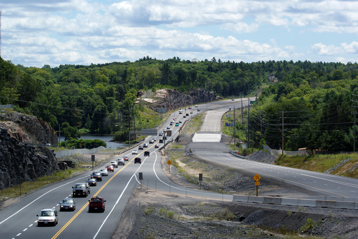
| Town of Parry Sound District of
Parry Sound |
Looking north across the Seguin River bridges. This photo set shows a
comparison of what the highway looked like during a very early stage of
highway construction as compared to the the finished four lane highway.
Upper photo taken: May 22nd, 2006.
Lower photo taken: June 11th, 2011. |
(720x480)
(1440x960)
(2400x1600) |
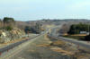
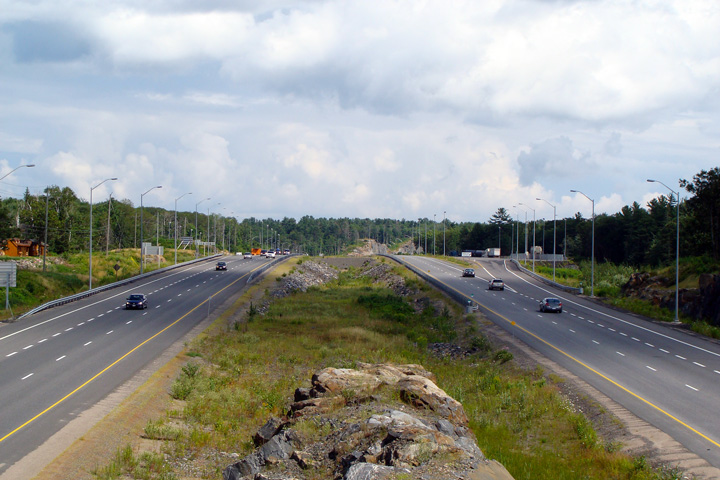
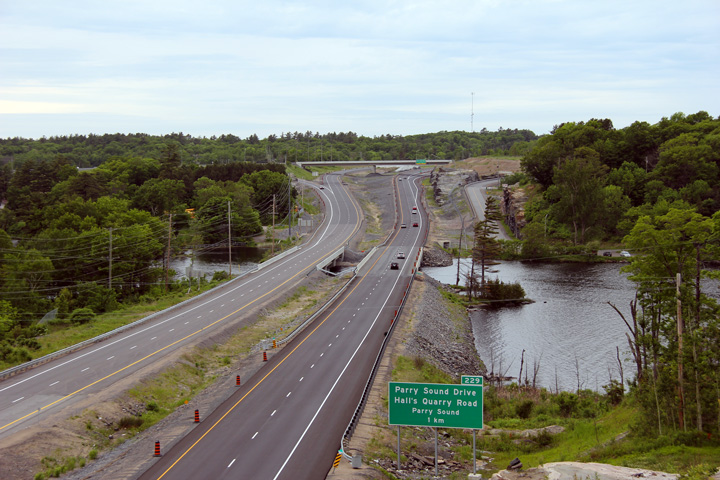
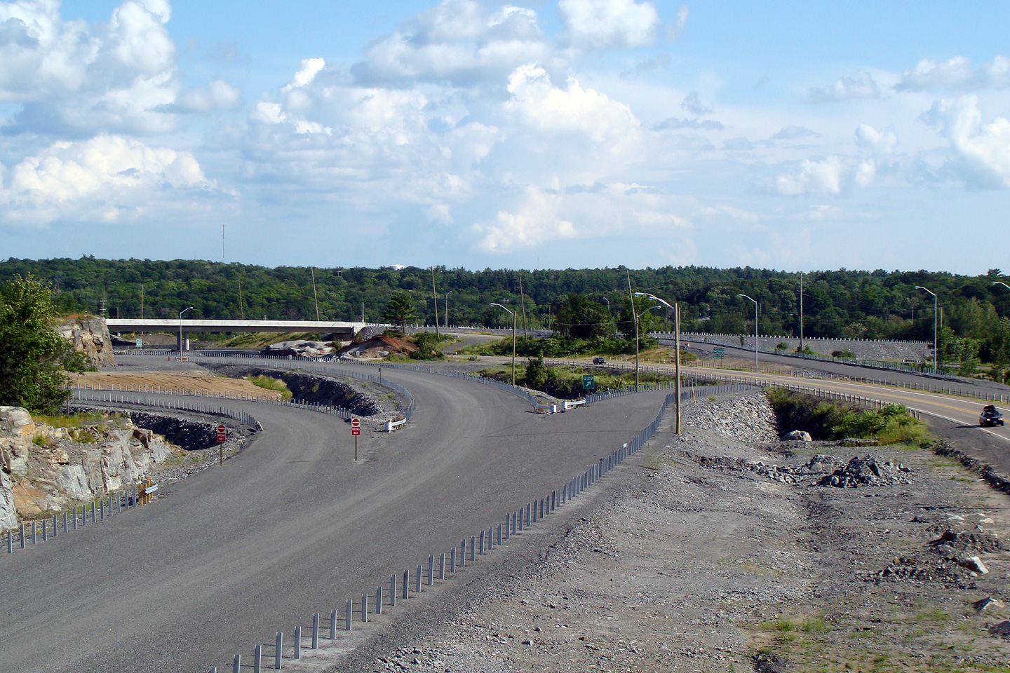
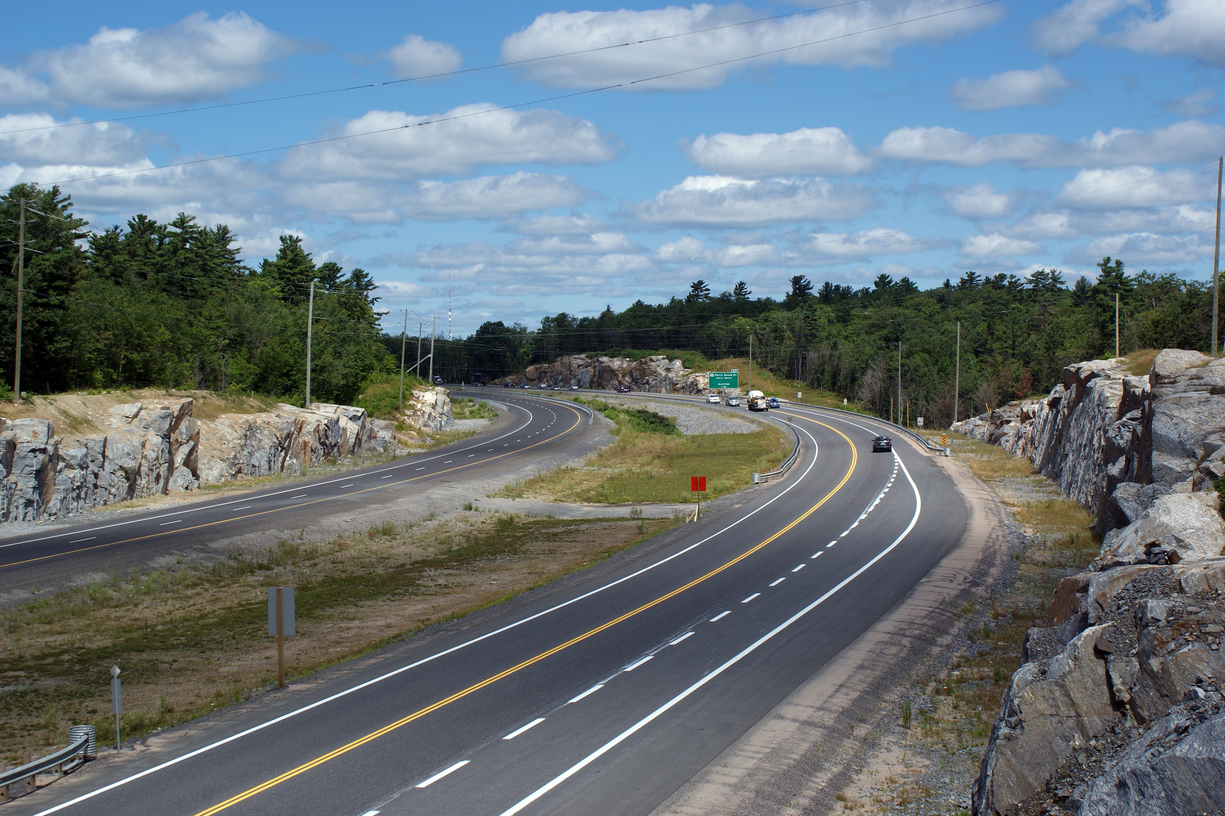
| Town of Parry Sound District of
Parry Sound |
A series of views looking northerly along Highway 400 from the Parry Sound
Drive intersection and overpass. The upper photo, taken in 2006, was taken
just after construction had commenced to twin Highway 69 between the Mill Lake
Narrows and North of Nobel. Work to accomplish this 17km freeway extension
was split into two large construction contracts. The first contract saw the
highway twinned on the existing alignment between Mill Lake and Nobel. The
second contract saw a new alignment constructed around the eastern side of
Nobel rejoining the former alignment of Highway 69 just north of Highway
559.
The divided highway between Parry Sound and Highway 559 was officially
opened to traffic on
October 27, 2010; traffic was, however, confined to a single lane in
each direction along
some sections of highway into the following construction season of 2012, while some
minor final work was completed. The lower photo taken in November of 2010
reflects some of this final construction.
Photo #1 taken: May 22nd, 2006.
Photos #2 and #3 taken: August 2nd, 2008.
Photos #3 and #4 taken: July 30th, 2010.
Photo #5 taken: November 13th, 2010. |
(720x480)
(1440x960)
(2400x1600) |
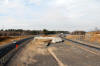
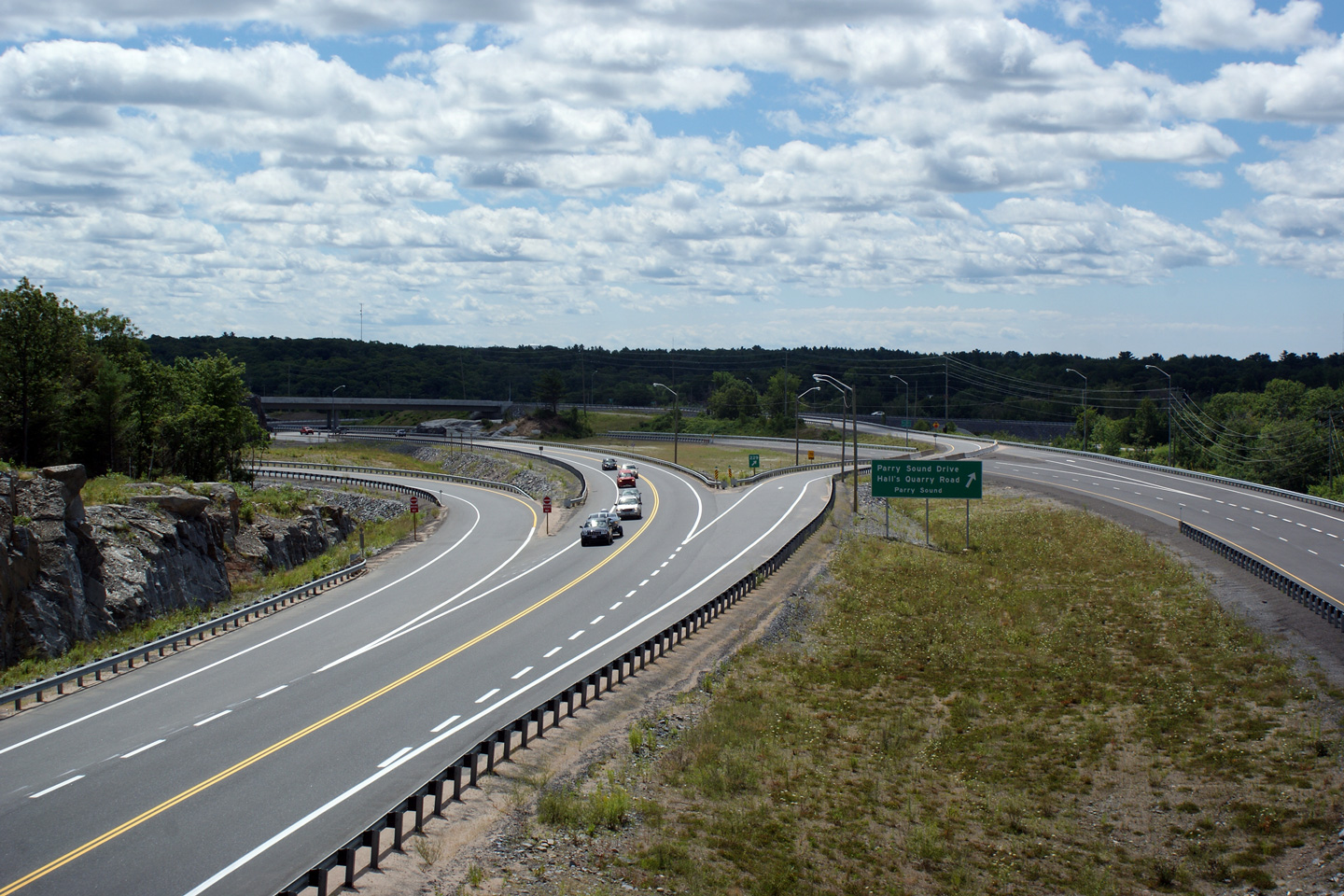
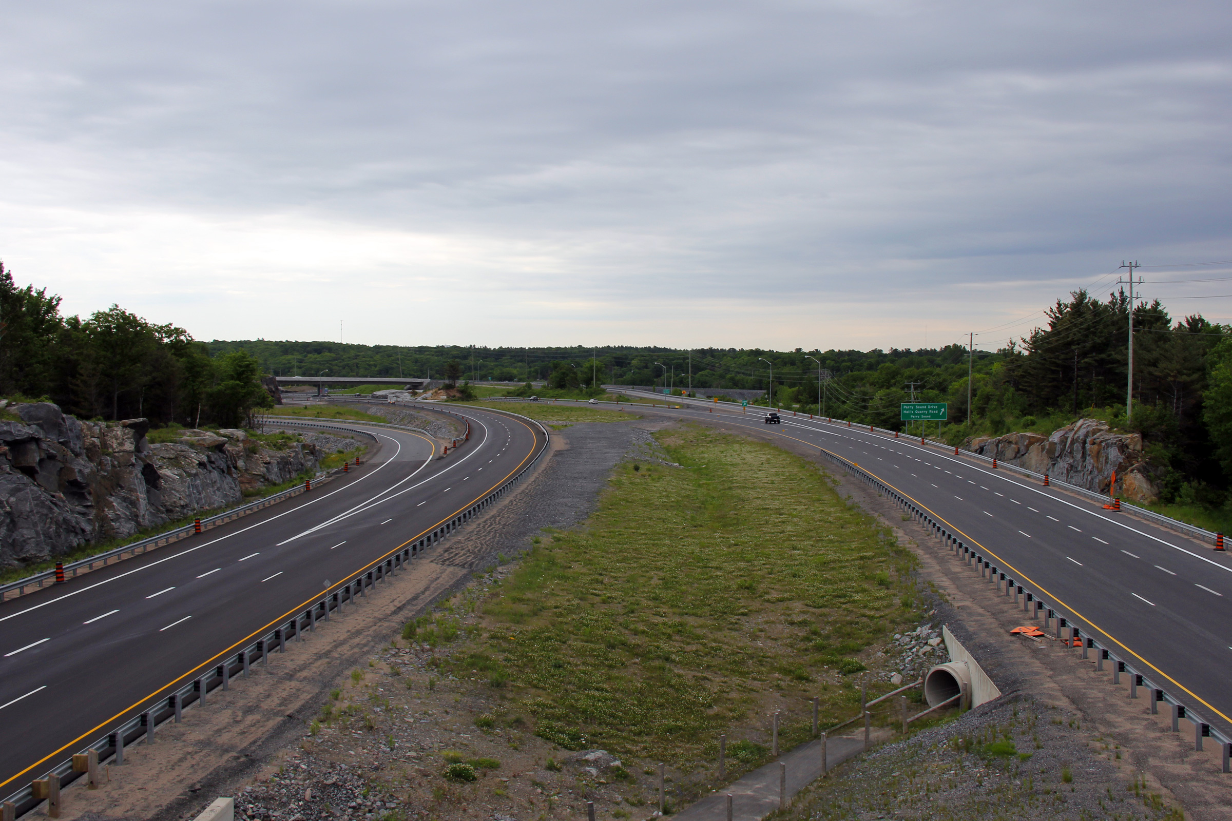
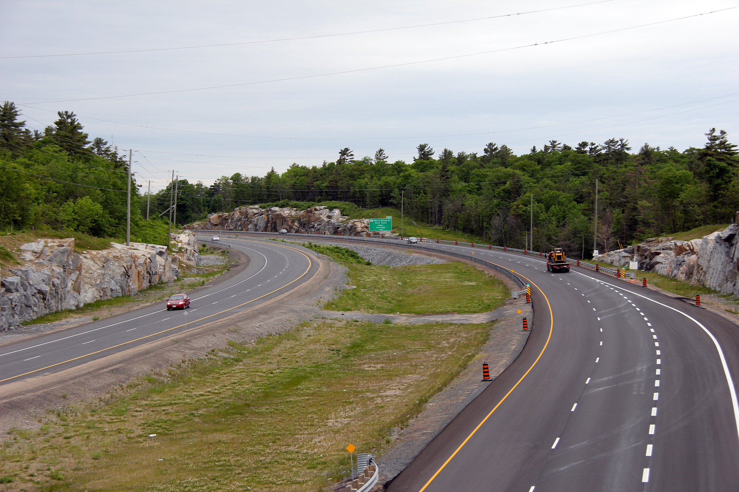
| Town of Parry Sound District of
Parry Sound |
A series of three views looking northerly from the Parry Sound Drive
overpass.
Photo #1 taken: August 2nd, 2008.
Photo #2 taken: July 30th, 2010.
Photo #3 taken: November 13th, 2010. |
(720x480)
(1440x960)
(2400x1600) |
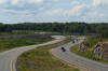
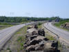
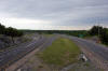
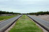
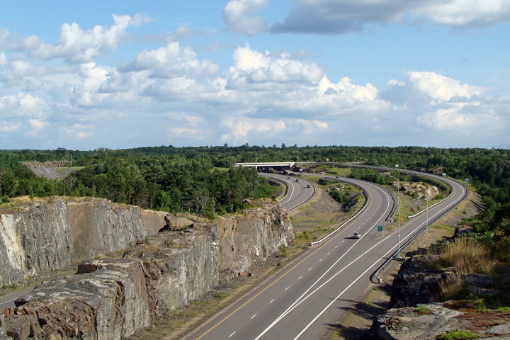
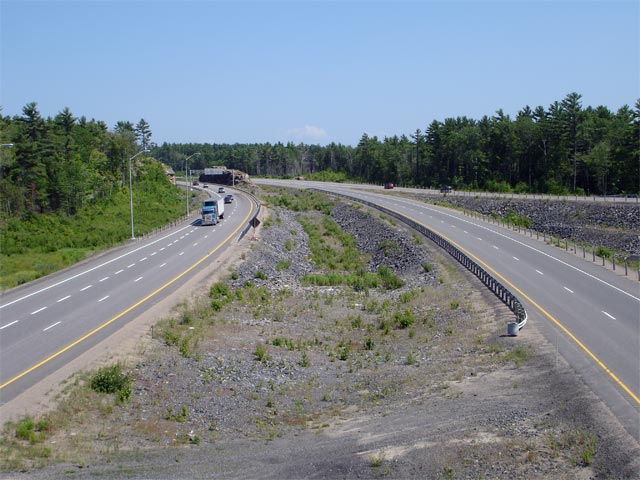
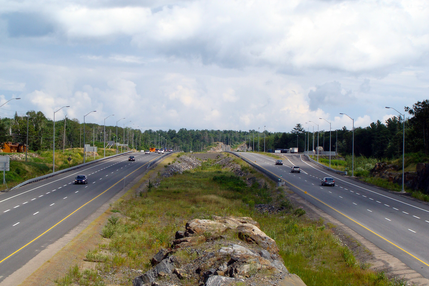
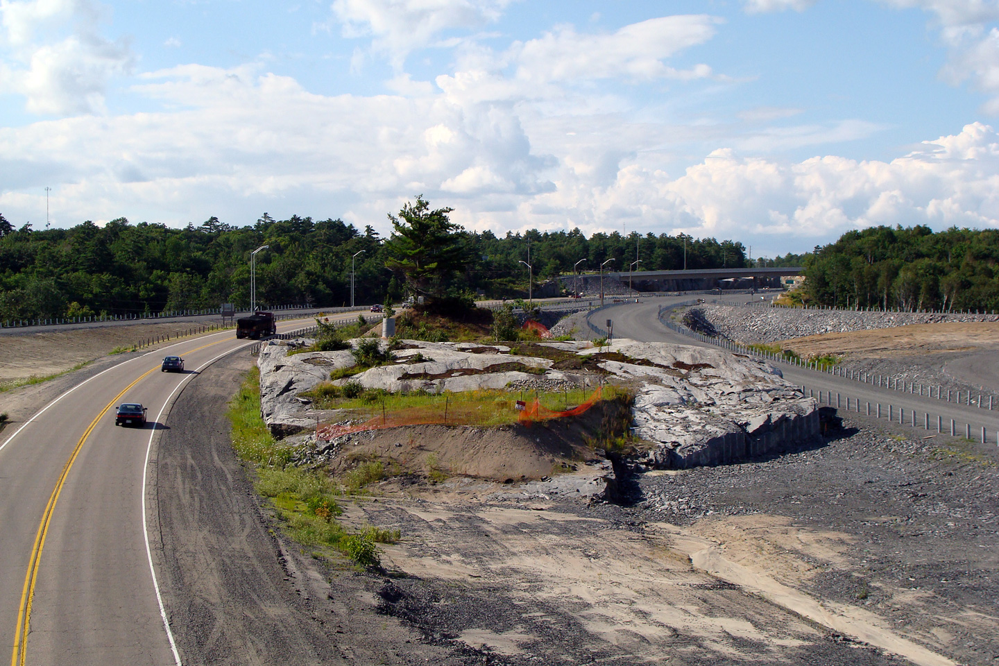
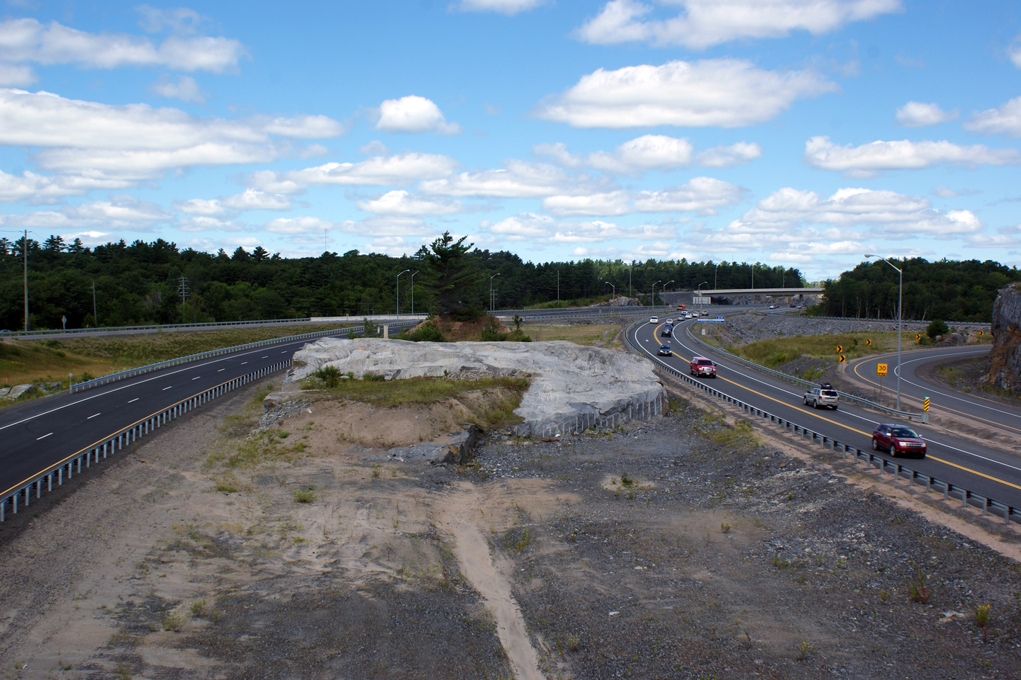
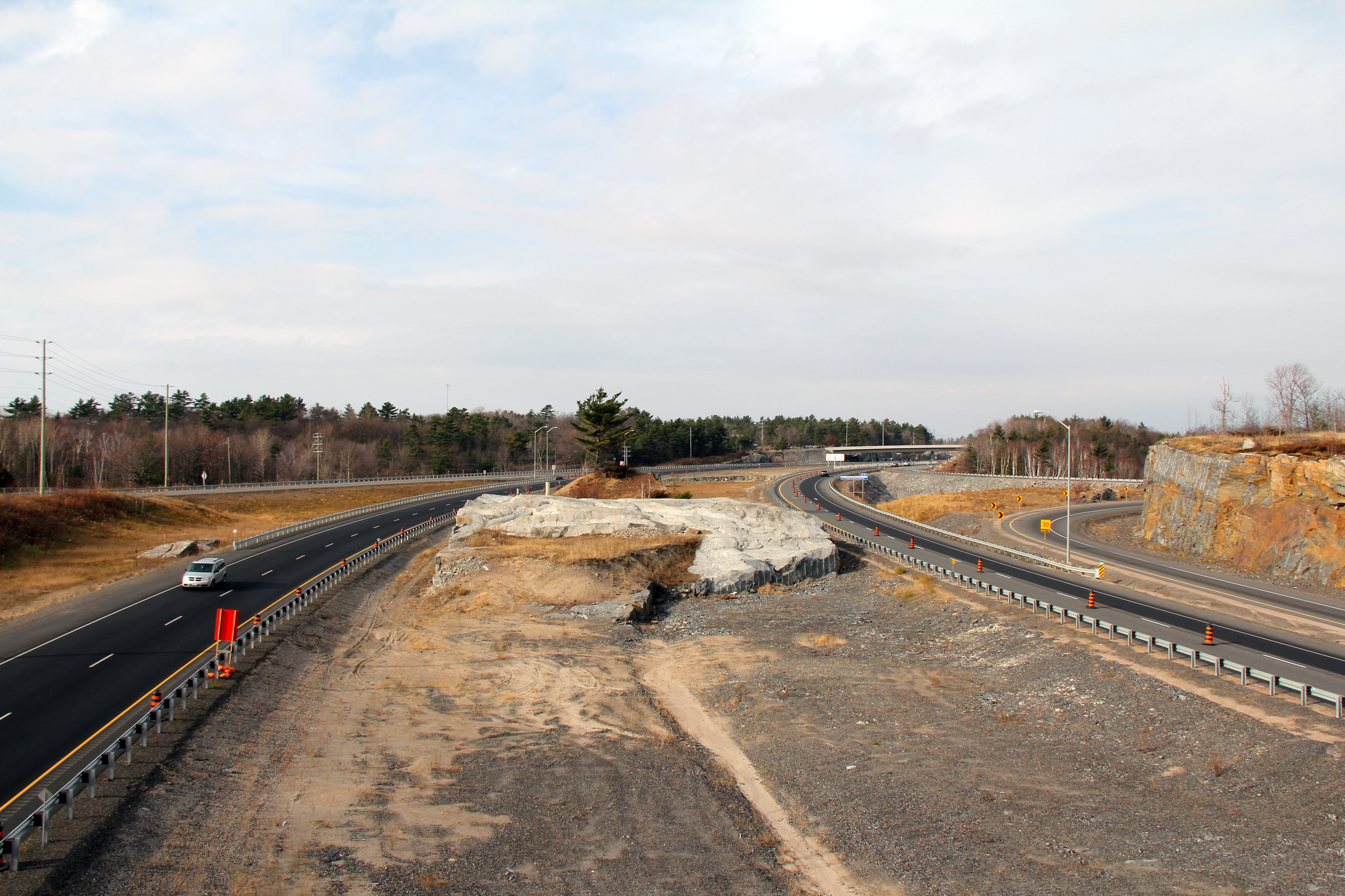
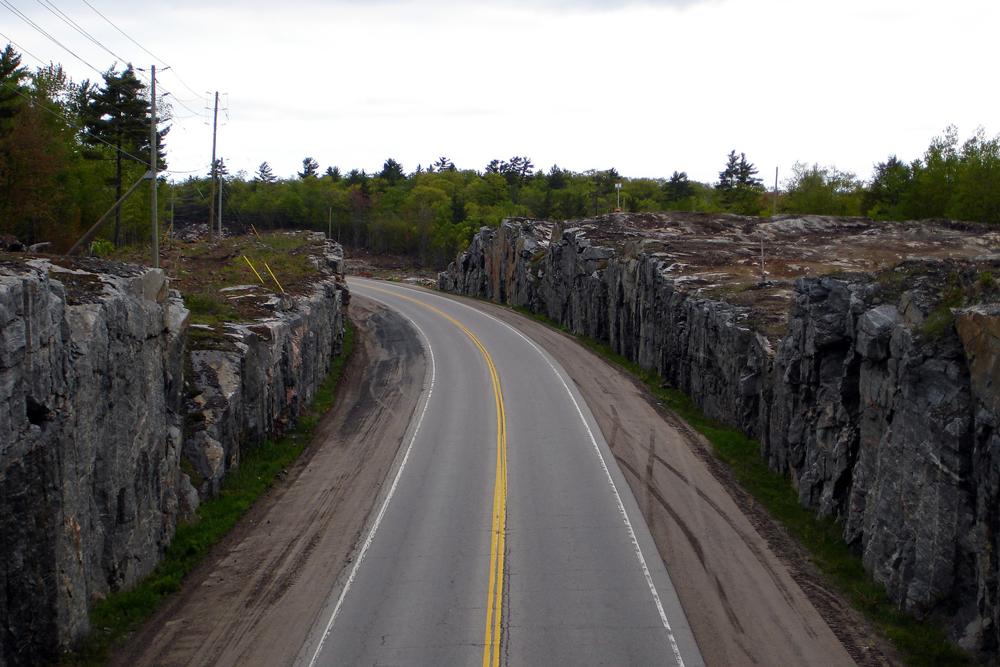
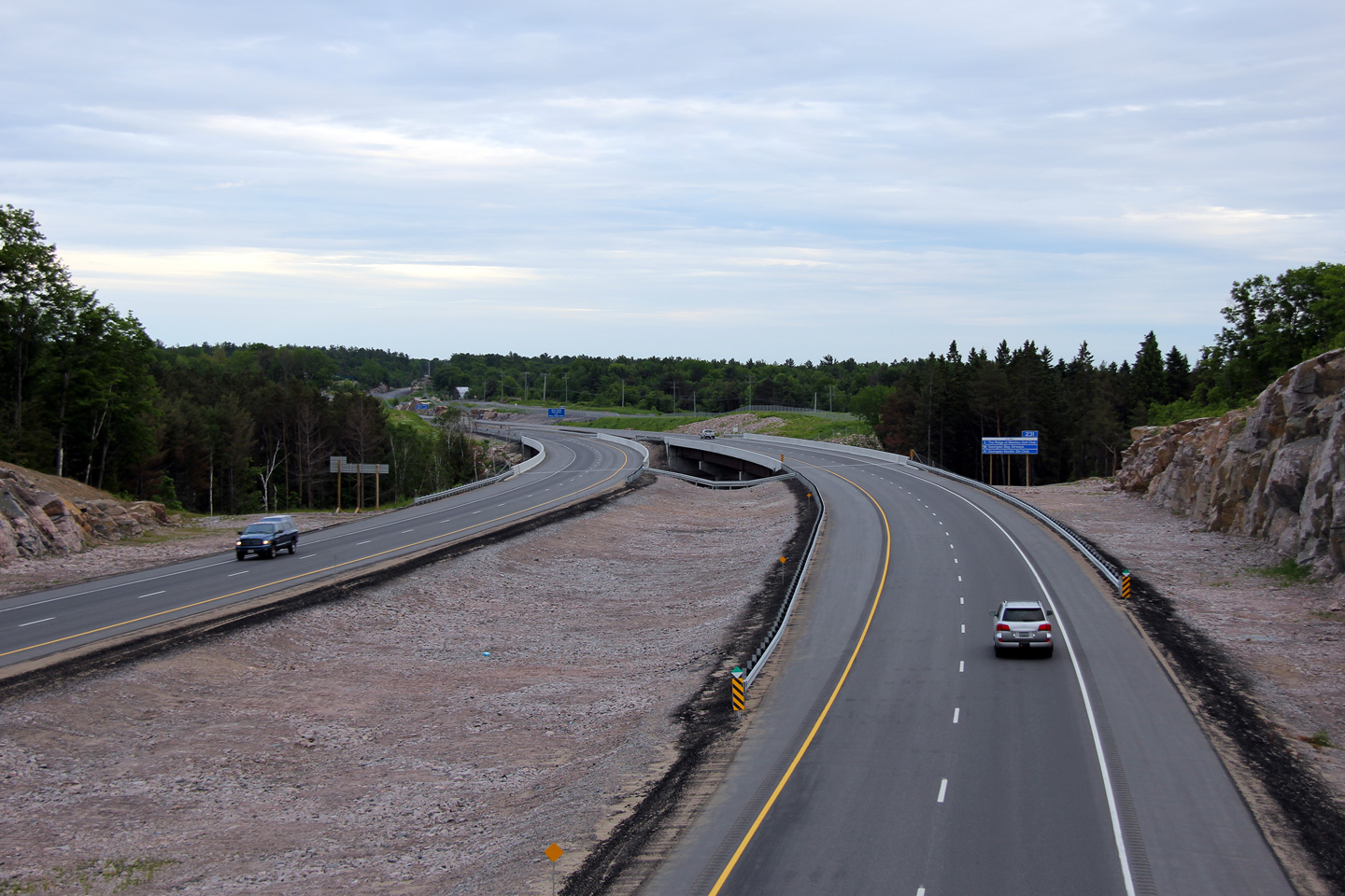
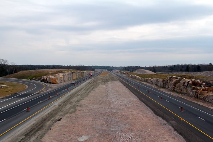
| Town of Parry Sound District of
Parry Sound |
Looking south from the North Road overpass. It is impressive, that given
the shear volume of solid rock that is often needed to be removed in order to twin
highways through the Canadian Shield, that the decision is consistently made
to build new highways with a full rural depressed median cross-section. Intuitively, it would
seem that considerable cost could be saved by narrowing the median through
large rock cuts while constructing a barrier to separate opposing traffic
flows.
Photo #1 taken: May 22nd, 2006.
Photo #2 taken: August 2nd, 2008.
Photo #3 taken: July 30th, 2010.
Photo #4 taken: June 11th, 2011. |
(720x480)
(1440x960)
(2400x1600) |
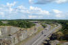
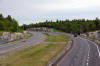
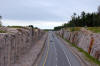
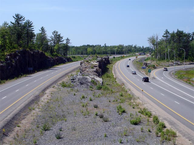
| Town of Parry Sound District of
Parry Sound |
Once again, a series of views from the North Road overpass. In the 2006 (upper)
photo, the North Road overpass was an extremely short span structure that
sat atop a high rock cut carrying the township road over Highway 69. In
2007, the short span North Road overpass was replaced by a much longer span,
pictured in both the 2010 (middle) and 2011 (lower) photos. A simply
colossal amount of rock was removed in order to twin Highway 400 through the
North Road underpass.
Upper photo taken: May 22nd, 2006.
Middle photo taken: July 30th, 2010.
Lower photo taken: June 11th, 2011. |
(720x480)
(1440x960)
(2400x1600) |
|
Highway 124 leads westerly from
Highway 400 and Parry Sound towards Highway 11 and Sundridge.
Click here for Highway 124 images. |
Municipality of McDougall
District of Parry Sound |
View looking southerly towards the Highway 124 interchange from just south
of Nobel.
Photo taken: June 11th, 2011. |
(720x480)
(1440x960)
(2400x1600) |
Municipality of McDougall
District of Parry Sound |
Northerly view once again from just south of Nobel. Highway 400's
cross-section is constrained south of Nobel where the highway passes between
Nobel Road and CP's mainline to the west and a residential subdivision to
the east. A steel guide rail was added to the median of the highway
after this photo was taken.
Photo taken: June 11th, 2011. |

(720x480)
(1440x960)
(2400x1600) |
Municipality of McDougall
District of Parry Sound |
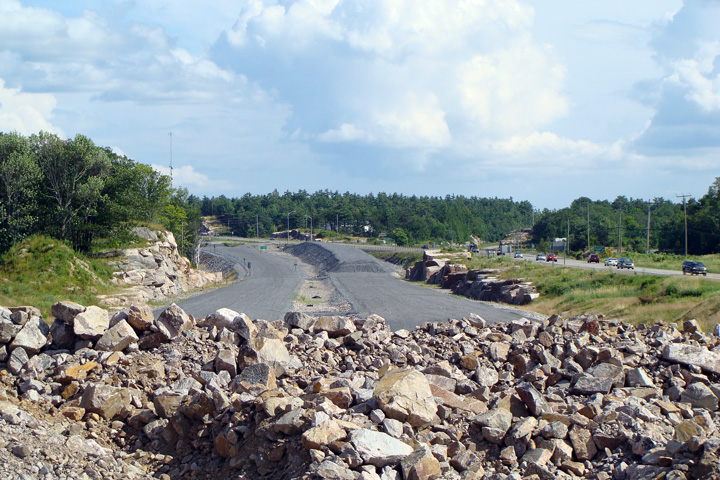
Photo of the twinned highway alignment looking southerly from Portage Lake
taken during construction.
Photo taken: August 2nd, 2008. |
|
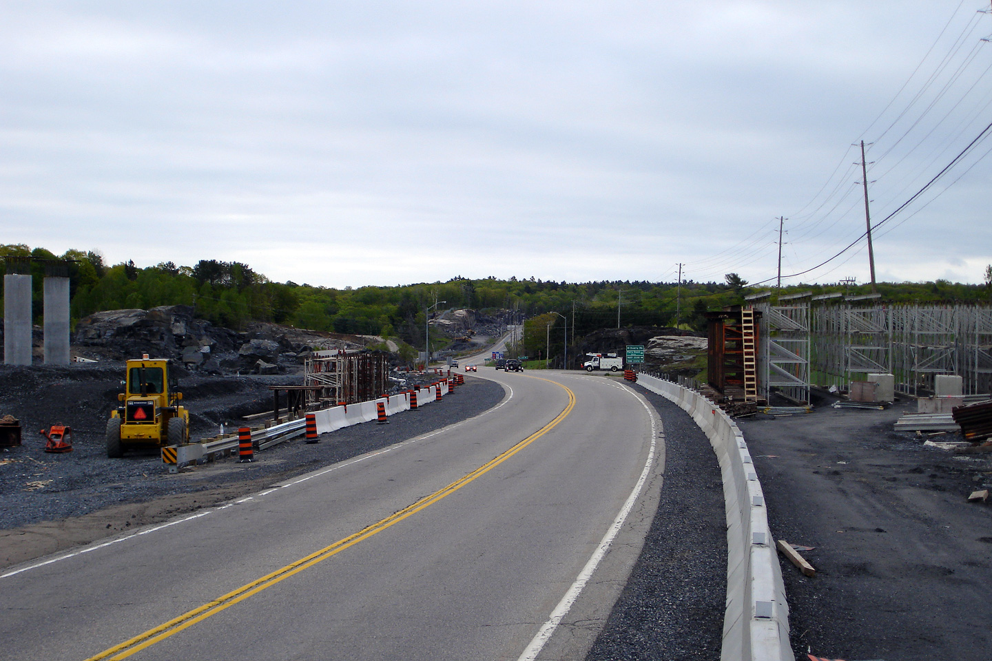
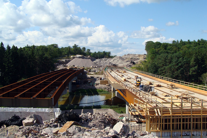
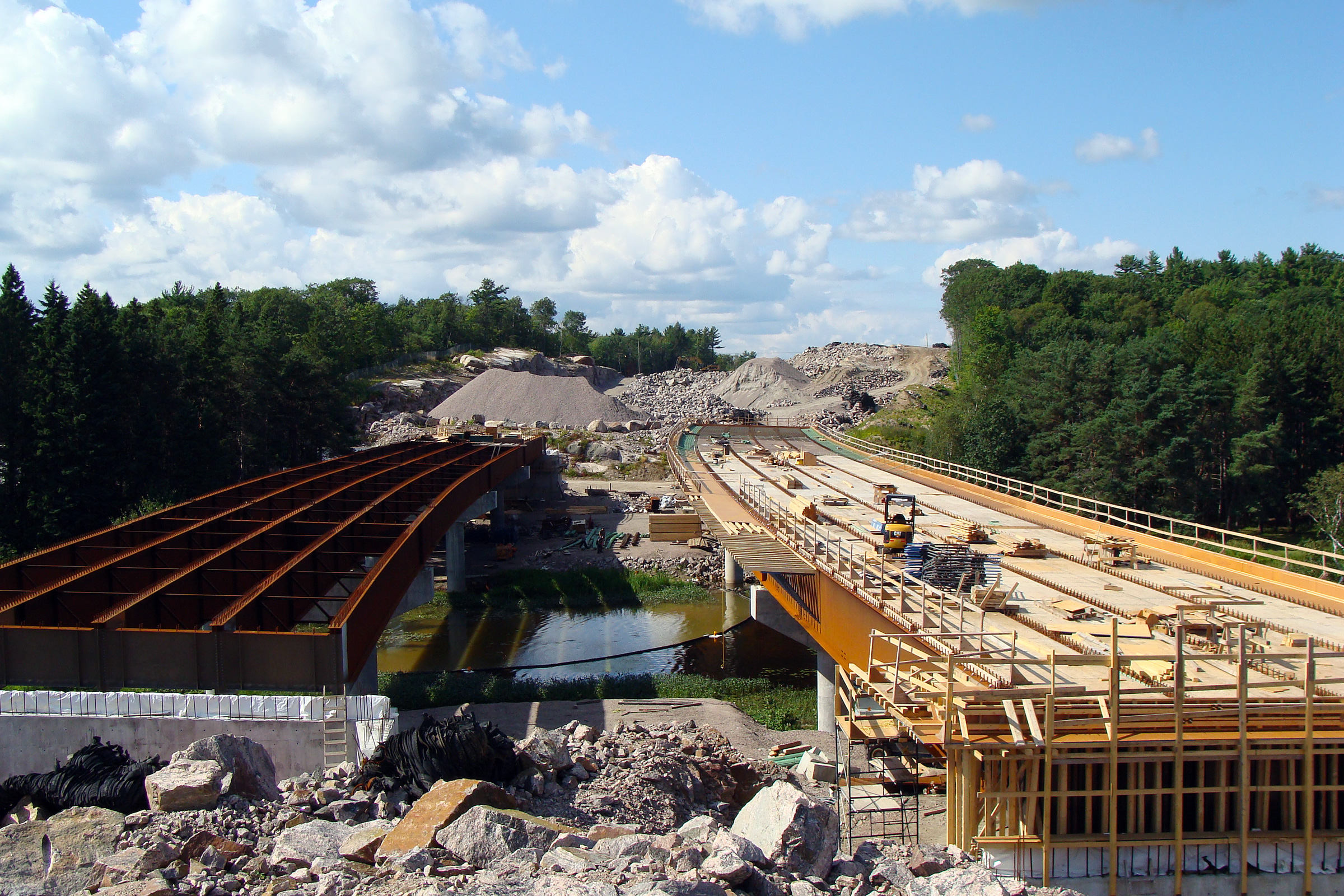
Municipality of McDougall
District of Parry Sound |
View of the steel substructures of the twin Portage Lake structures before
the deck had been constructed.
Photo taken: August 2nd, 2008. |
|
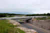
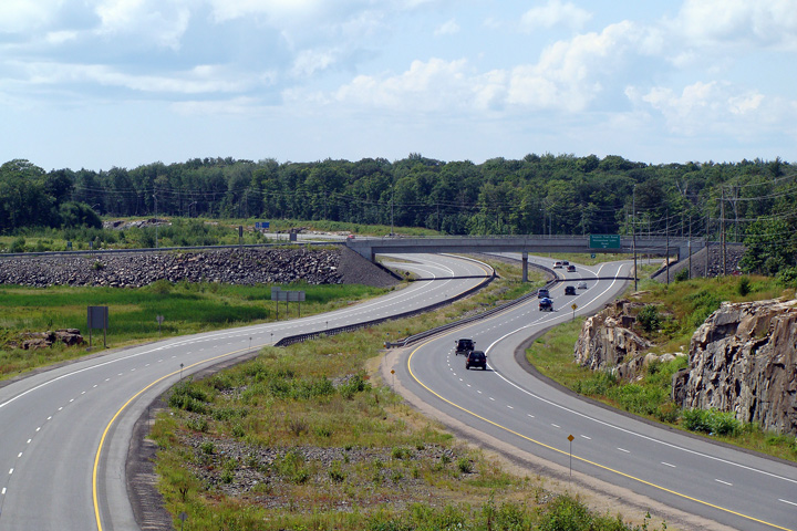
Municipality of McDougall
District of Parry Sound |
Three views from the Pineridge Road overpass towards the twin Portage Lake
bridges, and the south end of the Nobel By-pass. The upper photos were
taken several months ahead of the opening of Highway 400 between Nobel and
and Highway 559. The former (pre-2010) alignment of Highway 69 heading
into Nobel is visible due to the transport truck driving along the old
highway. The lower photo shows the
highway after it had been opened to traffic.
Photos #1 and #2 taken: July 30th, 2010.
Photo #3 taken: June 10th, 2011. |
(720x480)
(1440x960)
(2400x1600) |
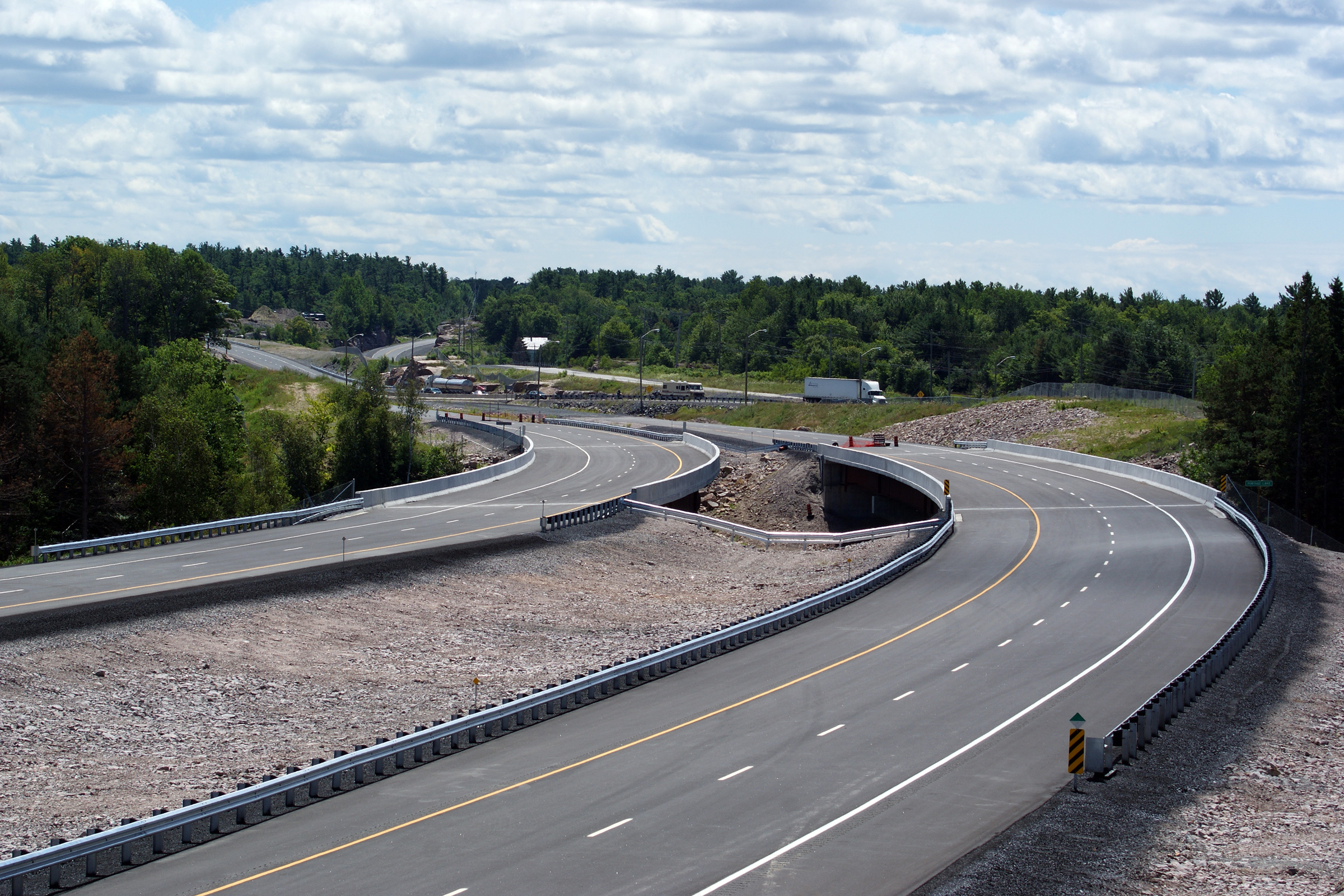
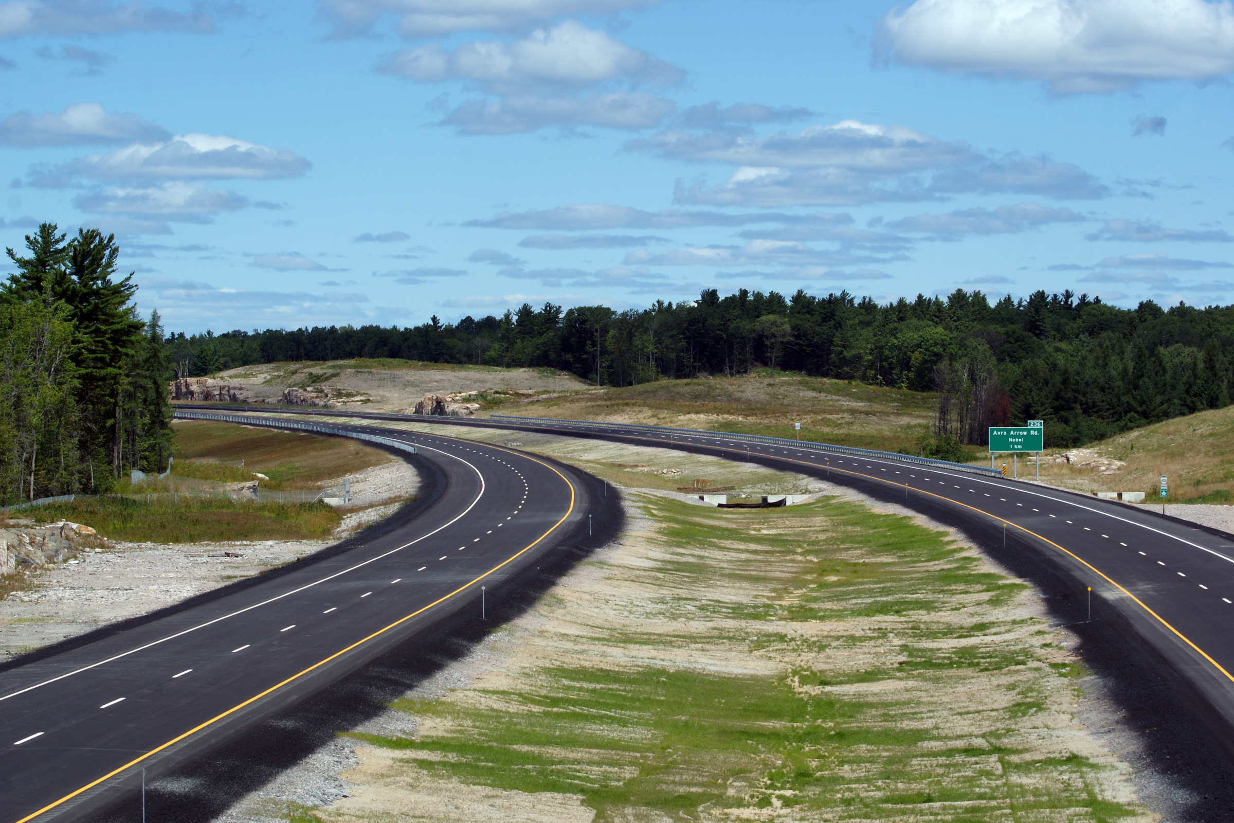
Municipality of McDougall
District of Parry Sound |
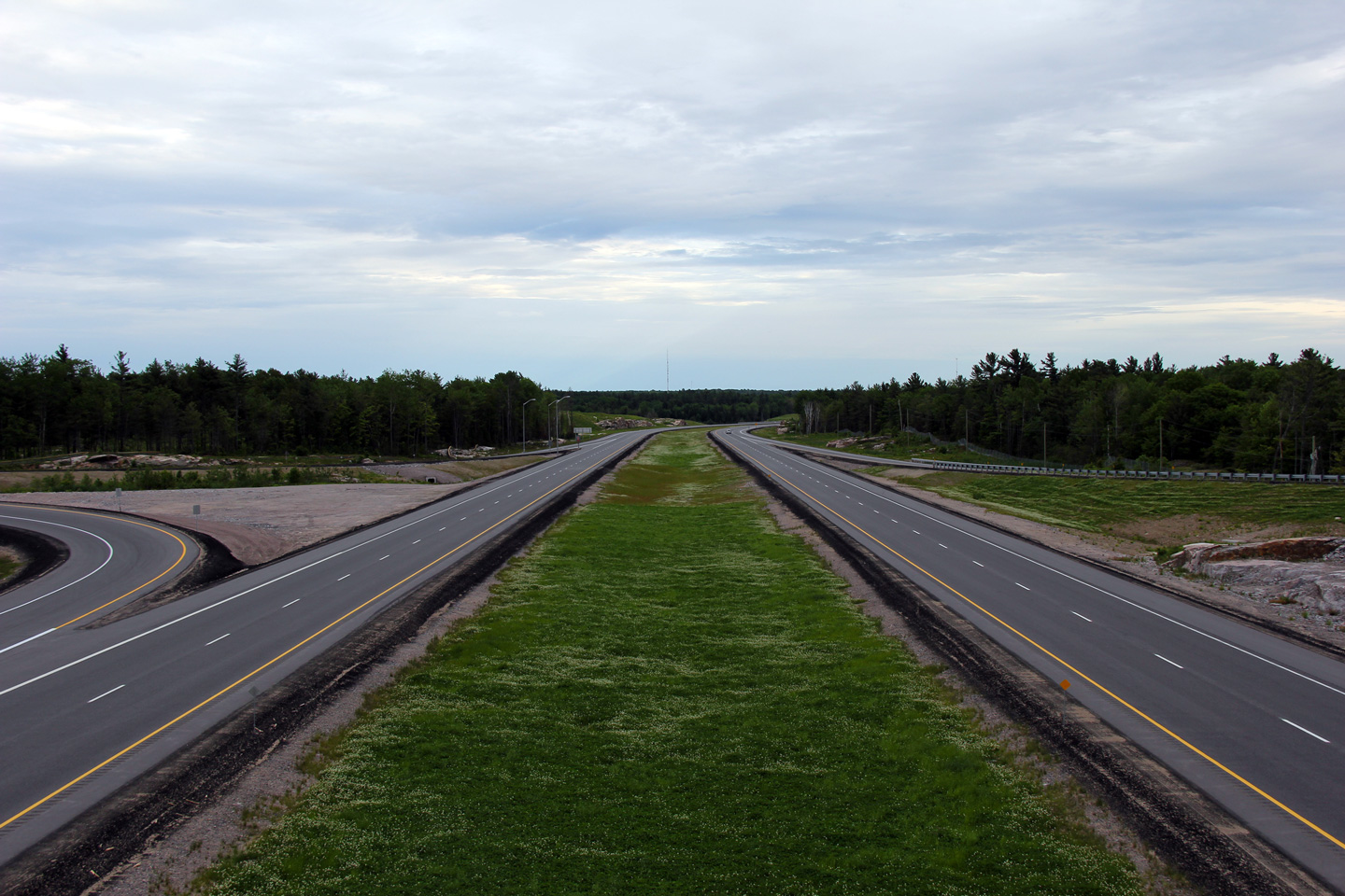
This view looks northerly from the Pineridge Drive overpass towards the Avro
Arrow Road interchange.
Photo taken: July 30th, 2011. |
(720x480)
(1440x960)
(2400x1600) |
Municipality of McDougall
District of Parry Sound |
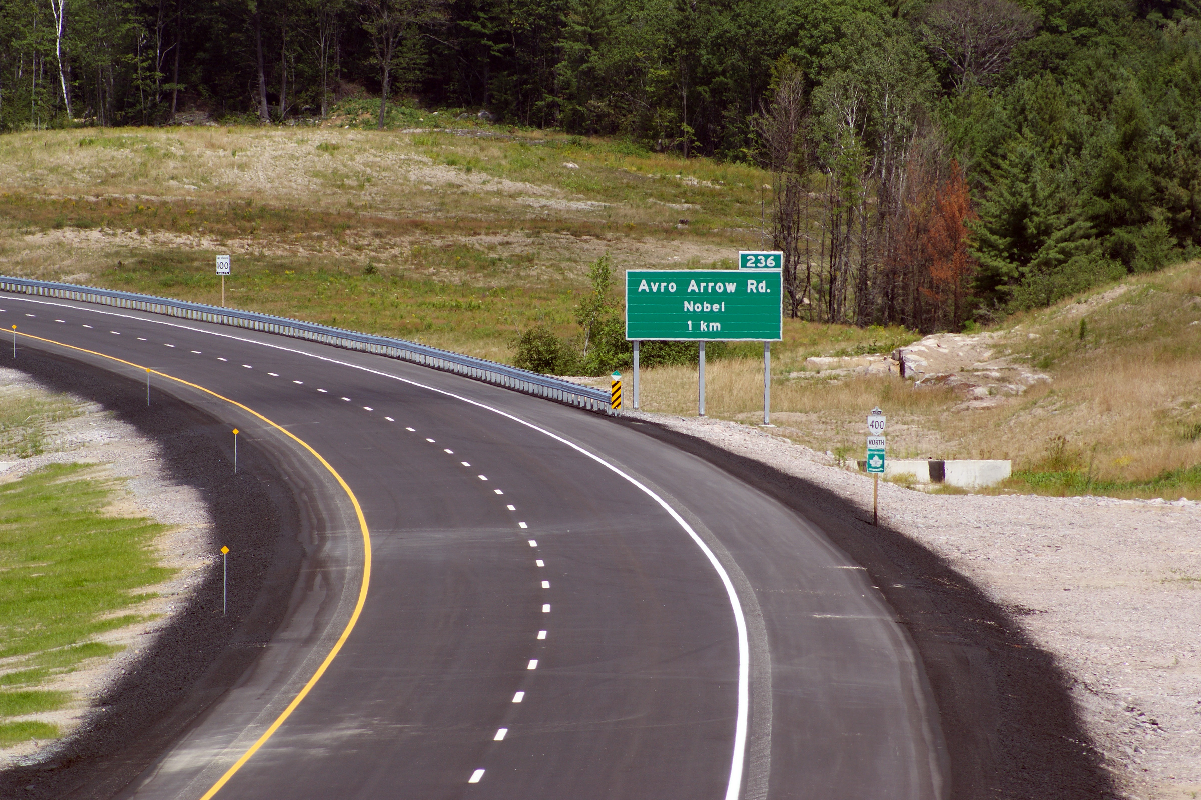
This photo highlights the northbound advanced sign for Avro Arrow Road.
Note the northbound Highway 400 reassurance marker. This photo was taken
several months prior to the opening of Highway 400 to traffic. On opening
day, all of the reassurance markers for Highway 400 had been updated to
include the Highway 69 designation as well.
Photo taken: July 30th, 2011. |
 (720
x 540) (720
x 540)
(1440x960)
(2400x1600) |
Municipality of McDougall
District of Parry Sound |
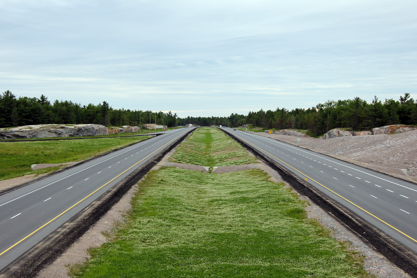
Southerly view along the 400 from the Avro Arrow Road overpass.
Photo taken: June 10th, 2011. |
(720x480)
(1440x960)
(2400x1600) |
Municipality of McDougall
District of Parry Sound |
Reverse view from the Avro Arrow Road overpass.
Photo taken: June 10th, 2011. |
(720x480)
(1440x960)
(2400x1600) |
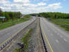
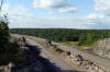
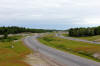
Municipality of McDougall
District of Parry Sound |
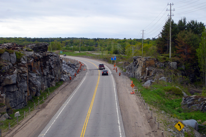
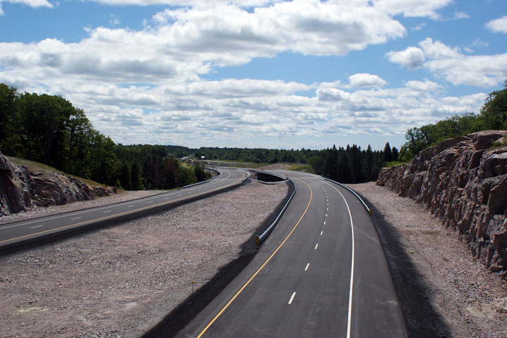
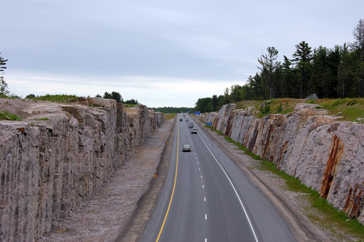
Southerly view along Highway 400 from the Marsh Lake Road overpass. As is
evident from the photo, the 400 was punched through a huge mass of rock
south of the Marsh Lake Road overpass.
Photo taken: June 11th, 2011. |
(720x480)
(1440x960)
(2400x1600) |
Municipality of
McDougall
District of Parry Sound |
Southerly view towards the Marsh Lake Road overpass. The Marsh Lake
Road crossing was split into two short spans supported by the high
outcropping of rock in the vicinity of the structure.
Photo taken: June 11th, 2011. |
(720x480)
(1440x960)
(2400x1600) |
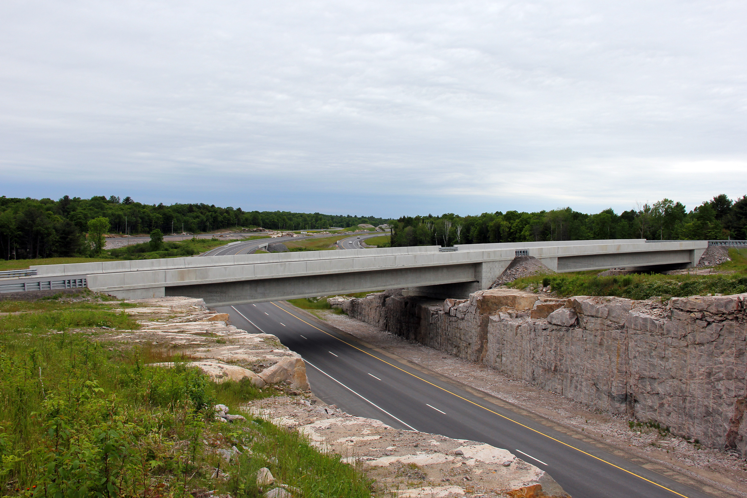
Township of Carling
District of Parry Sound |
Northerly view from the Marsh Lake Road overpass along Highway 400 looking
in the direction of the Highway 559 interchange.
Photo taken: June 11th, 2011. |
(720x480)
(1440x960)
(2400x1600) |
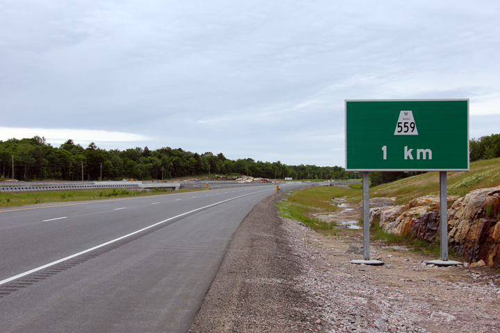
Township of Carling
District of Parry Sound |
Advanced signage for the Highway 559 interchange.
Photo taken: June 11th, 2011. |
 (720
x 540) (720
x 540)
(1440x960)
(2400x1600) |
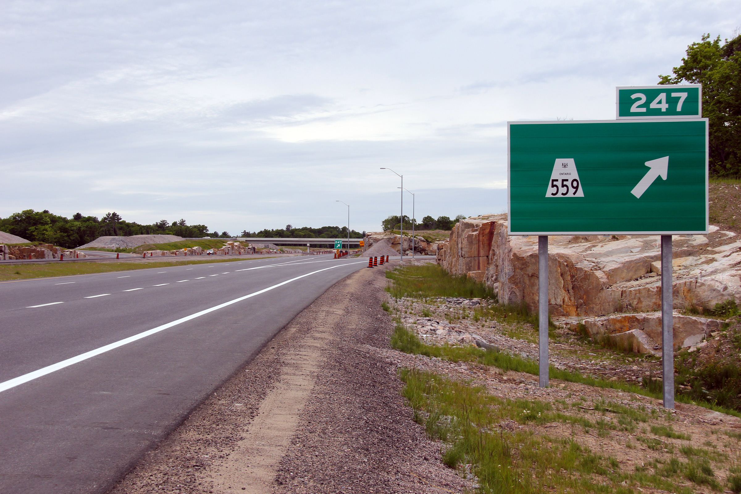
Township of Carling
District of Parry Sound |
Signage at the exit to Highway 559. There are two errors on this signage,
the first is that the wrong exit number had been applied to Highway 559. It is
supposed to be exit 241 (and has since been likewise numbered). Further,
the exit tab should not have been applied to the turn-off sign, but should
have been affixed to the preceding advanced signage.
Photo taken: June 11th, 2011. |
 (720
x 540) (720
x 540)
(1440x960)
(2400x1600) |
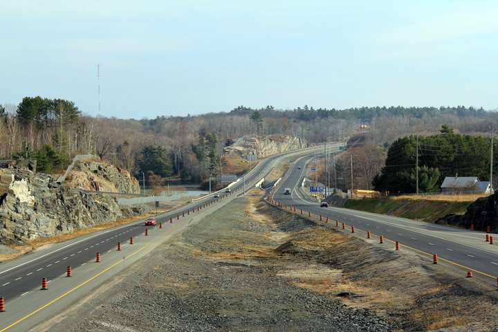
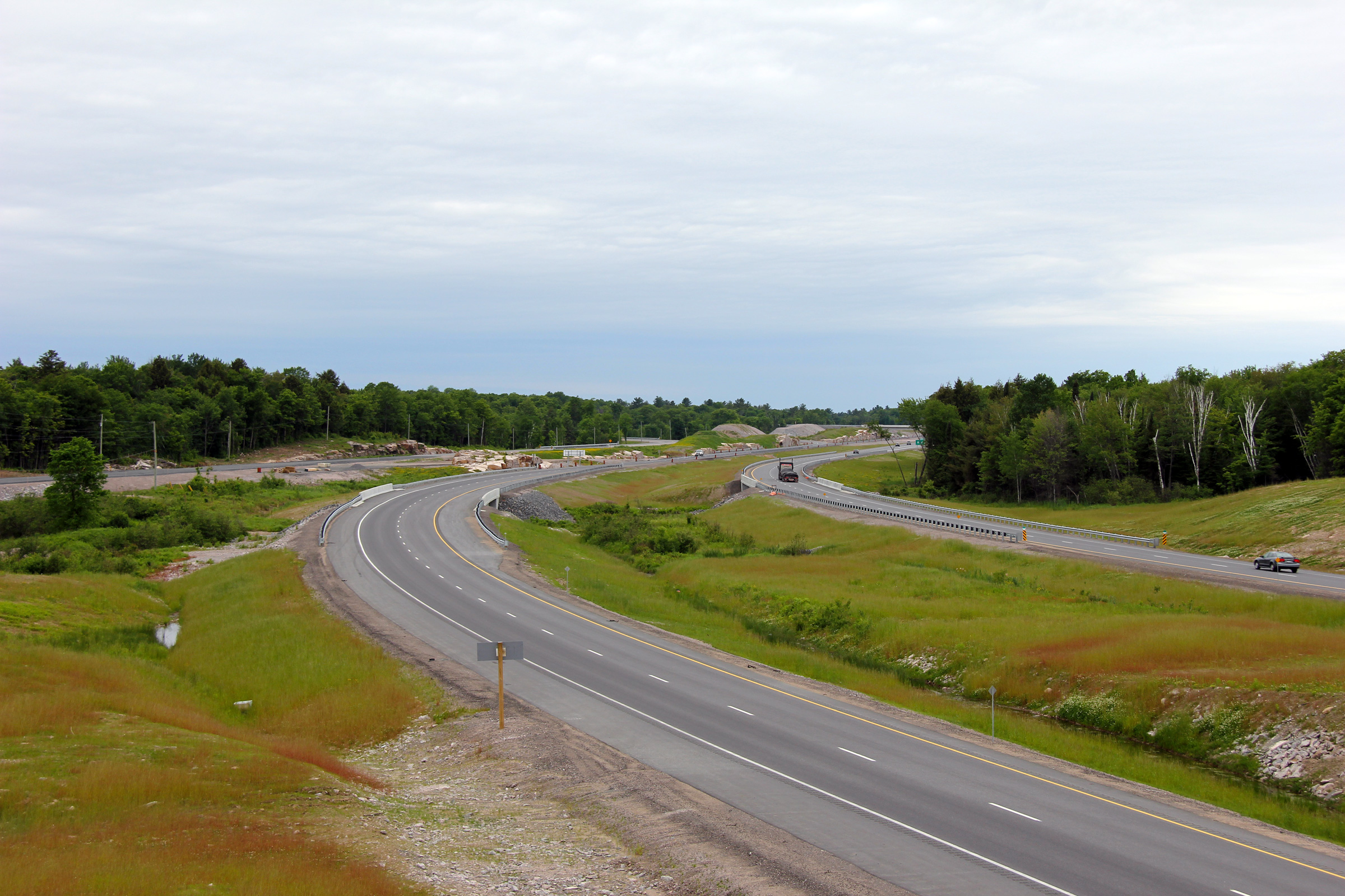
Township of Carling
District of Parry Sound |
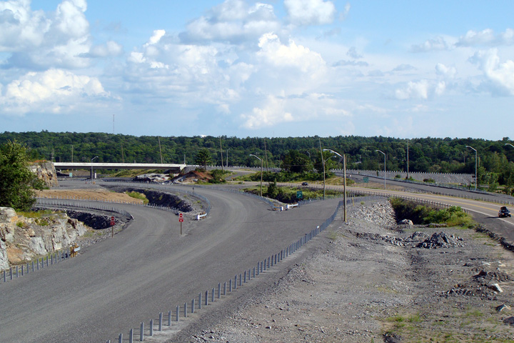
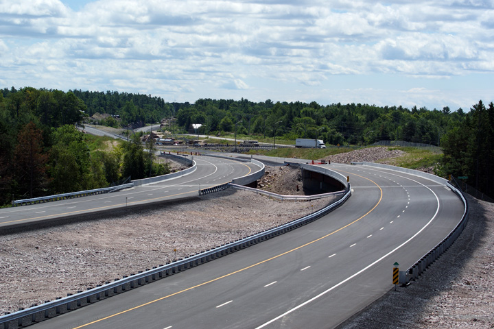
This view looks southerly at the northern beginning of the Nobel By-pass.
From this point northerly, Highway 400 was simply twinned along Highway 69's
existing alignment. To the south, Highway 400 was constructed to the east
of Nobel. Nobel Road (the two-lane highway at the right side of the photo)
more or less follows Highway 69's former alignment through Nobel.
Photo taken: November 13th, 2010. |
(720x480)
(1440x960)
(2400x1600) |
Township of Carling
District of Parry Sound |
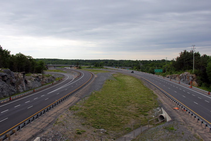
Southerly view along Highway 400 from the
Highway 559 overpass. The former
temporary alignment of the two-lane construction diversion through the
Highway 559 interchange is still very evident.
Photo taken: November 13th, 2010. |
(720x480)
(1440x960)
(2400x1600) |
|
Highway 559 leads west and south
of Highway 69 towards Killbear Provincial Park and is the main access road
in Carling Township.
Click here for Highway 559 images. |
|
Click here for Highway 69 Images between
Highway 559 and Highway
637. |

 Low
Res
Low
Res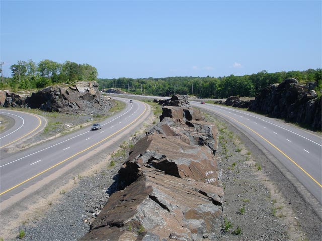

 (720
x 540)
(720
x 540)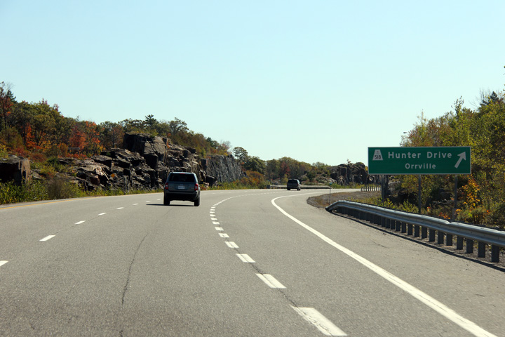 (720
x 540)
(720
x 540) (720
x 540)
(720
x 540) (720
x 540)
(720
x 540)


 (720
x 540)
(720
x 540)


 (720
x 540)
(720
x 540)
 (720
x 540)
(720
x 540)
