|
Proper Municipality Name |
Photo Description |
Photo |
|
Pictures taken
from driver's perspective appear offset from centre-line pictures: |
North-Bound |
South-Bound |
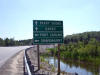
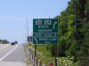
| Township of Georgian Bay
District Municipality of Muskoka |
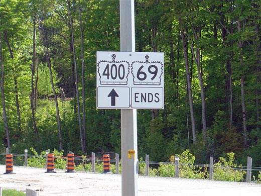
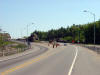
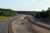
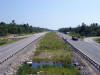
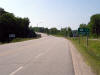
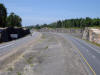
Sign denoting the southern terminus of Highway 69. This sign is
located just south of the Musquash River bridge at the transition from 2- to
4-lanes. Click here
for Highway 400 Images. Picture size: 65kb. |
 |
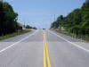
| Township of Georgian Bay
District Municipality of Muskoka |
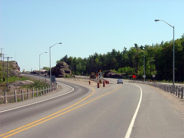
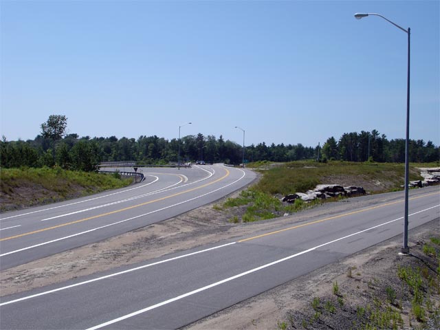
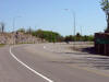
This picture shows Highway the southern terminus of Highway 69.
Highway 69 ends as the divided Highway begins just south of the Musquash
River Bridge. Before being freewayalized, the Highway 69 designation
continued southerly to Highway 12. As Highway 69 becomes freewayalized, it is being re-designated as Highway 400.
Picture taken: June 1st, 2005. Size: 50kb. |
 |
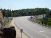
| Township of Georgian Bay
District Municipality of Muskoka |
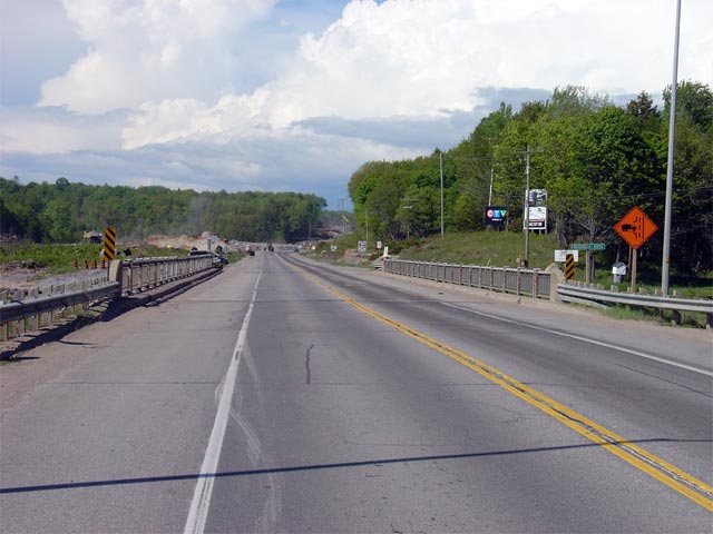
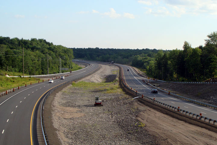
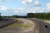
Highway 69/400 looking north across the Musquash River Bridge. North
of the Musquash River, Highway 69/400 passes through roughly 5km of the Wahta Mohawk Territory. Ongoing land use negotiations had delayed
twinning of Highway 69/400 until Summer 2004. This dispute resulted in
a 9km gap in freeway between Parry Sound and Barrie. Freewayalization
is now underway with expected completion in the summer or fall of 2008.
Picture taken: June 1st, 2005. Size: 50kb. |
 |
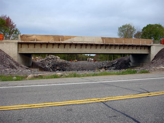
| Township of Georgian Bay
District Municipality of Muskoka |
Looking west from the existing Musquash River Bridge along Highway 69/400
towards the twin structures that will carry the divided highway across the
Musquash River. Picture taken: May 22nd, 2006. Size: 45kb. |
 |
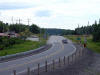
| Township of Georgian Bay
District Municipality of Muskoka |
Looking south towards the Musquash River bridge along Highway 69/400.
The divided highway is being constructed on a new alignment from the future
Cranberry Marsh Interchange to the Musquash River Bridge. Presumably,
the existing highway will be converted into a service road.
Picture taken: May 22nd, 2006. Size: 60kb. |
 |
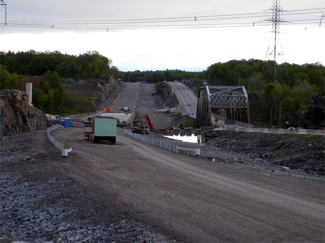
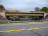
| Township of Georgian Bay
District Municipality of Muskoka |
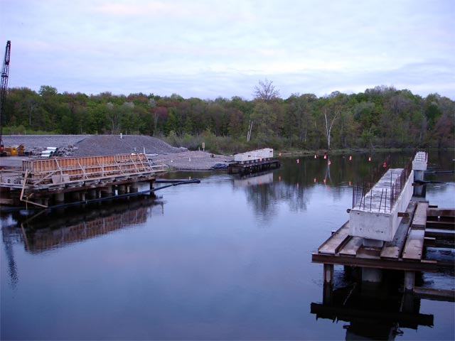
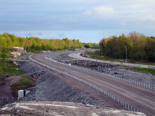
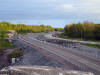
Looking northerly from just north of the Musquash River towards the future
Cranberry Marsh overpass. The central pier and western abutment of the
Cranberry Marsh Access Road have been completed and are visible in the
photo.
Picture taken: May 22nd, 2006. Size: 50kb. |
 |
| Township of Georgian Bay
District Municipality of Muskoka |
View from road level along the current Highway 69/400
alignment from just north of the Cranberry Marsh Road. As evident from
the photo, the newly constructed southbound carriageway navigates the
pictured curve much more gradually then the current highway does.
Presumably the existing carriageway will be realigned to match the
southbound carriageway before completion.
Picture taken: May 22nd, 2006. Size: 35kb. |
 |
| Township of Georgian Bay
District Municipality of Muskoka |
Looking north along Highway 69/400 from just
north of the previous picture. This photo again shows the geometric
improvements the divided highway will have over the existing two-lane
highway. Picture taken: May 22nd, 2006. Size: 64kb. |
 |
| Township of Georgian Bay
District Municipality of Muskoka |
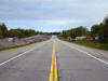
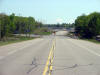
Looking north along the existing Highway 69/400
towards the Twelve Mile Lake Road junction. Picture taken: May 22nd, 2006.
Size: 50kb. |
 |
| Township of Georgian Bay
District Municipality of Muskoka |
The eastern facade of the nearly completed southbound Twelve Mile Lake Road
underpass. The Twelve Mile Lake interchange will be located roughly
200m south of the current at-grade intersection. The future western
on- and off-ramps are of a diamond configuration.
Picture taken: May 22nd, 2006. Size: 65kb. |
 |
| Township of Georgian Bay
District Municipality of Muskoka |
View of the current Twelve Mile Lake Road junction looking southbound.
Twelve Mile Lake Road meets Highway 69/400
in a rather inopportune location, at the crest of a hill at the end of a
curve. Picture taken: May 22nd, 2006. Size: 40kb. |
 |
| Township of Georgian Bay
District Municipality of Muskoka |
Looking north towards the Moon River bridge. The existing
truss-structure will likely be replaced due to its rather poor condition.
The Moon River bridge is located just north of Twelve Mile Lake Road.
Picture taken: May 22nd, 2006. Size: 55kb. |
 |
| Township of Georgian Bay
District Municipality of Muskoka |
Looking south towards the Moon River bridge. The newly constructed
Moon River bridge crosses the valley on a much improved alignment compared
to the existing structure. Picture taken: May 22nd, 2006. Size:
55kb. |
 |
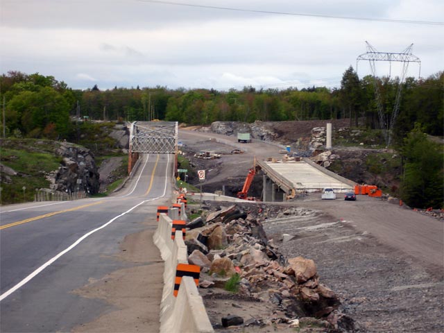
| Township of Georgian Bay
District Municipality of Muskoka |
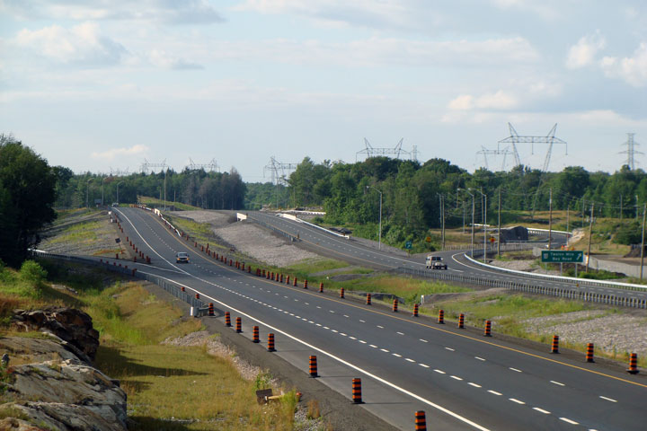
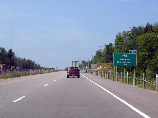
View of the beginning of the divided highway at the northern end of the
Wahta Gap. About 1km north of where the divided highway resumes
Highway 69 splits from Highway 400 heading
towards MacTier and Foot's Bay.
Picture taken: May 22nd, 2006. Size: 45kb. |
 |
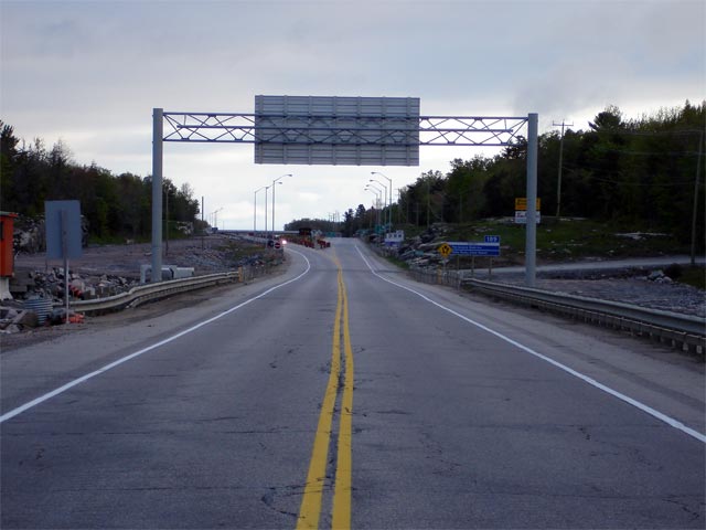
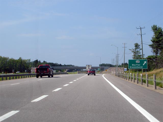
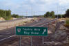
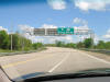
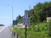
| Township of Georgian Bay
District Municipality of Muskoka |
Advanced guide signage informing northbound traffic of the Highway 69 split
located just to the north of the Wahta Gap. Picture taken: July 13th,
2006. Size: 40kb. |
 |
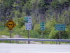
| Township of Georgian Bay
District Municipality of Muskoka |
Signage at the interchange for the Highway 69 split.
Click here for Highway 400
images. Picture taken: July 13th, 2006. Size: 35kb. |
 |
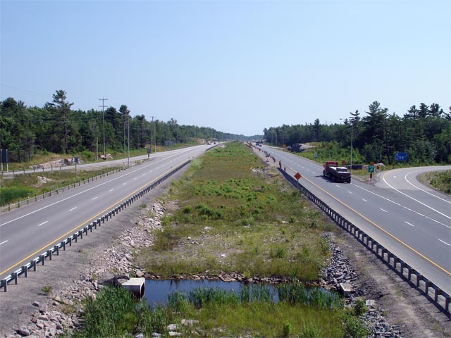
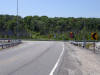
| Township of Georgian Bay
District Municipality of Muskoka |
Looking south from the southern Highway 69 overpass towards Highway 69/400.
The divided highway narrows for the Wahta Gap just south of this overpass.
Picture taken: July 13th, 2006. Size: 60kb. |
 |
| Township of Georgian Bay
District Municipality of Muskoka |
Highway 69 looking south towards the southern trumpet interchange with
Highway 400.
Picture taken: June 1st, 2005. Size: 45kb. |
 |
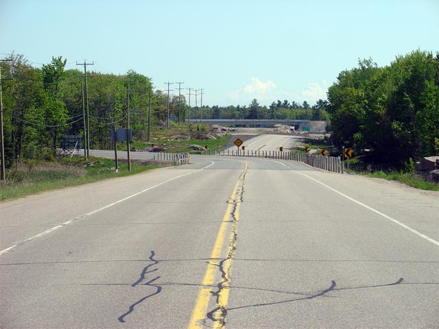
| Township of Georgian Bay
District Municipality of Muskoka |
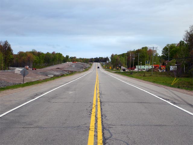
Highway 69 looking south from just south of Tower Road. This picture
shows a recently (2003) realigned section of highway that was bypassed for
the new trumpet interchange with Highway 400. This interchange is located just south of
this picture.
Picture taken: June 1st, 2005. Size: 55 kb. |
 |
| Township of Georgian Bay
District Municipality of Muskoka |
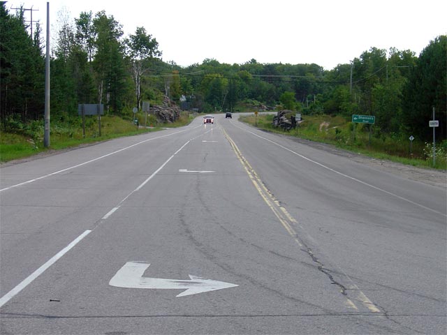
Looking south along Highway 69 from the junction of Muskoka Road 11.
Before the District Municipality of Muskoka was set up in the early 1970s,
Muskoka Road 11 was part of Secondary
Highway 612. Picture taken: August
7th, 2004. Size: 50kb. |
 |
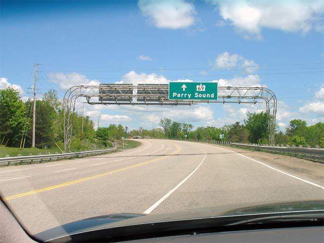
| Township of Muskoka Lakes
District Municipality of Muskoka |
Highway 69 driving north from
just north of the Highway 169 junction. Before the
400 opened in Fall 2003, this section of
Highway 69 was much more important. This is still evident by the use
of overhead signage. This overhead sign has unfortunately since been
removed.
Picture taken: May 29th, 2004.
Size: 45kb |
 |
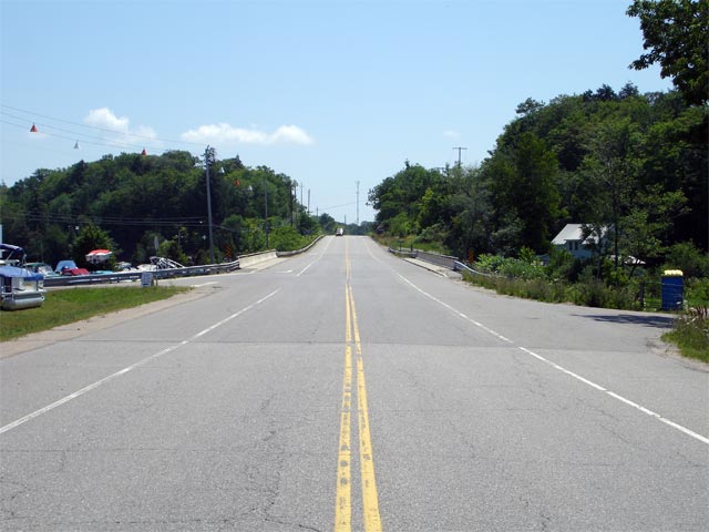
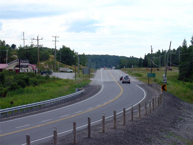
| Township of Seguin District of
Parry Sound |
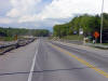
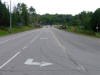
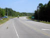
Looking south along Highway 69 from Silver Lake towards Gordon Bay.
Picture taken: July 13th, 2006. Size: 50kb. |
 |
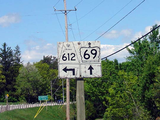
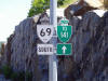
| Township of Seguin District of
Parry Sound |
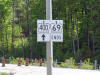
Sign denoting the junction of
Highways 69 and 612. This picture was taken looking northwards on
Highway 69. Click here for Highway 612 images (Coming Soon!).
Picture size: 50kb
|
 |
| Township of Seguin District of
Parry Sound |
Looking north along Highway 69 from the
Highway 612 intersection.
Interestingly, Highway 612 (as well as its southern continuation as Muskoka
Road 11) was the original alignment of Highway 69 through MacTier. Picture
taken: May 29th, 2004. Size: 70kb. |
 |
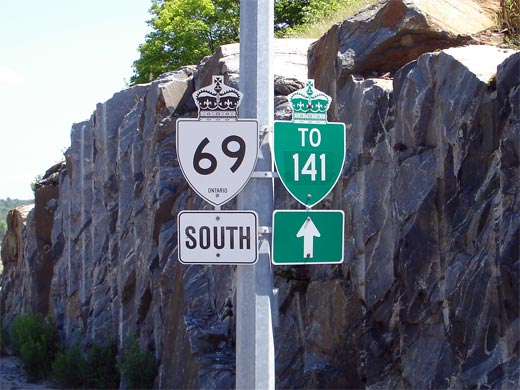
| Township of Seguin District of
Parry Sound |
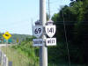
Advanced junction assembly for the southern
Highway 141 junction. Picture size: 50kb. |
 |
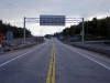
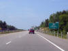
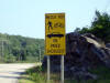
| Township of Seguin District of
Parry Sound |
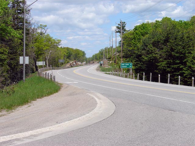
Looking northerly along Highway 69 towards the southern
Highway 141 junction.
Highway 69 was realigned to a 'T' junction with
Highway 141 to provide free-flow movements for
Highway 141 traffic. As such,
northbound traffic must turn right at the stop sign to continue along
Highway 69.
Picture taken: July 13th, 2006. Size: 65kb. |
 |
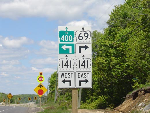
| Township of Seguin District of
Parry Sound |
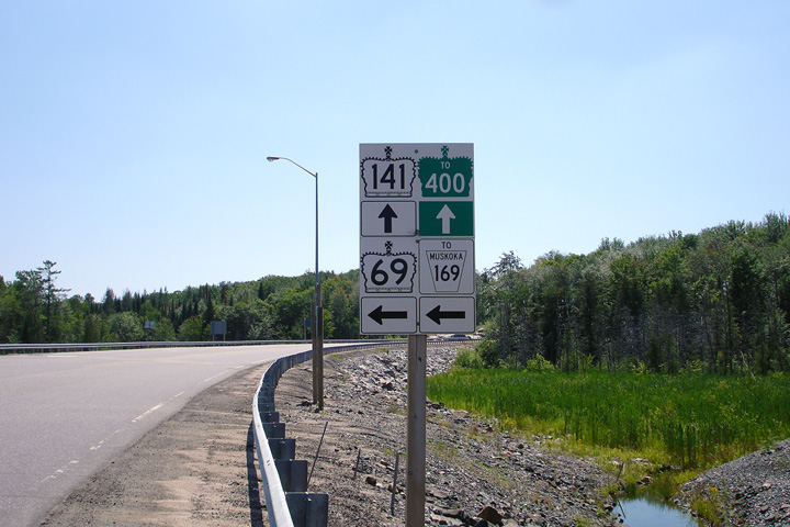
Signage at the southern Highway 141
junction. At this junction, Highway 400 is located approximately 1km
west of Highway 69 via Highway 141.
Click here for Highway 141 images (Coming Soon). Picture size: 100kb. |
 |
| Township of Seguin District of
Parry Sound |
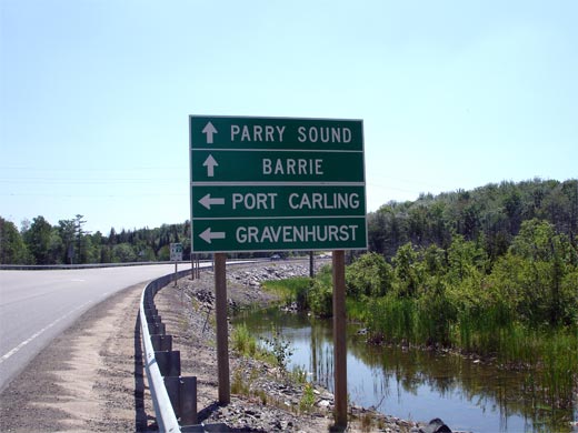
Southbound junction assembly for the southern Highway 69/141
junction. Notice the signage directing traffic to Muskoka Road 169
(former Highway 169). A considerable amount of signage directing
traffic to Highway 169 has been erected at this junction and along Highway
69.
Picture size: 35kb. |
 |
| Township of Seguin District of
Parry Sound |
Green directional signage approaching the southern Highway 69/141 junction.
Picture size: 40kb. |
 |
| Township of Seguin District of
Parry Sound |
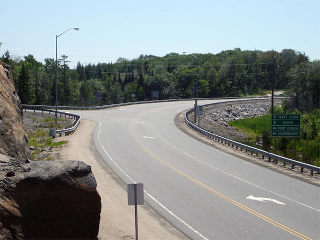
Looking south along Highway 69/141 towards the
southern 69/141 junction.
Highway 69 was realigned in this area as part of the Highway 400
construction during 2003. A left turn is now required to continue
southbound along Highway 69.
Picture taken: July 13th, 2006. Size: 55kb. |
 |
| Township of Seguin District of
Parry Sound |
View of Highway 69/141 looking north from
just northof the southern Highway 141
junction. Notice that the Highway 69 diversion constructed in the
vicinity of Highway 141 was not constructed
with fully paved shoulders unlike other sections of Highway 69 .
Picture taken: August 7th, 2004. Size: 50kb. |
 |
| Township of Seguin District of
Parry Sound |
Signage reminding drivers of possible obstacles that could be encountered on
the paved shoulders. The shoulders along Highway 69 were originally
paved so that slow drivers could pull off onto the shoulder to allow faster
vehicles to pass; though this courtesy has become quite rare in modern
years.
Picture size: 40kb. |
 |
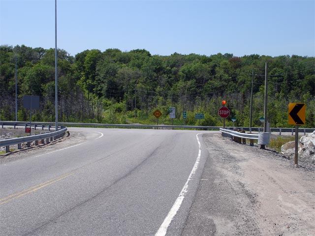
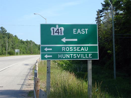
| Township of Seguin District of
Parry Sound |
Looking north along Highway 69/141 towards
the northern Highway 141 junction.
Picture taken: July 13th, 2006. Size: 50kb. |
 |
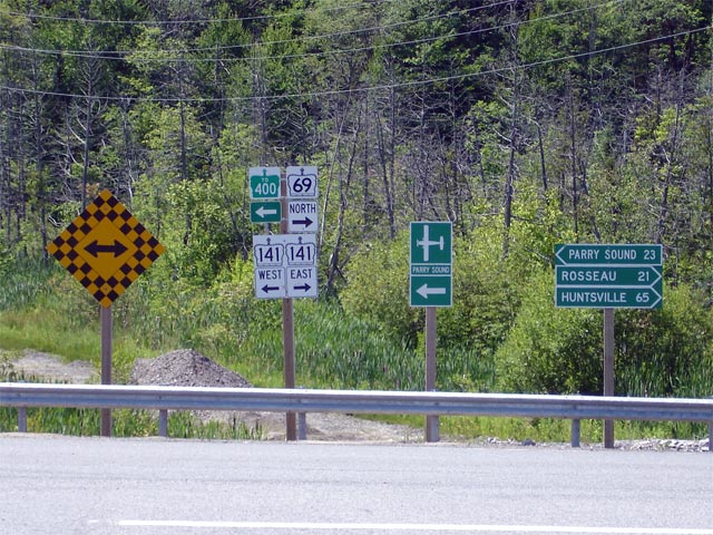
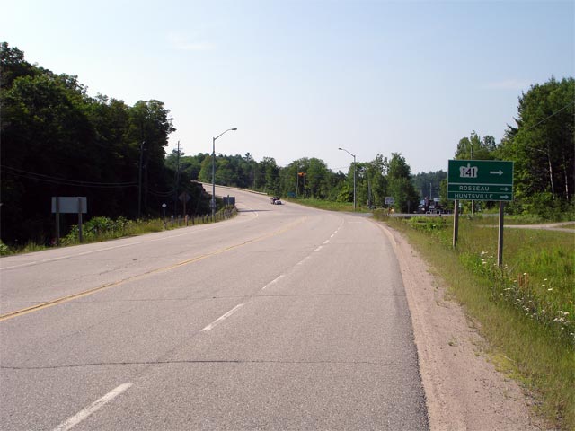
| Township of Seguin District of
Parry Sound |
Junction assembly for the northern Highway 69/141
junction. As evident from the signage,
Highway 141 departs towards to the right towards Huntsville and Rosseau
at this junction. Click here for Highway 141 images. (Coming
Soon!)
Picture size: 50kb. |
 |
| Township of Seguin District of
Parry Sound |
Signage for Highway 69/141 just south of
the northern Highway 141 junction.
Picture size: 45kb. |
 |
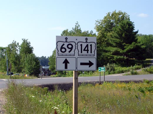
| Township of Seguin District of
Parry Sound |
Green signage for the northern Highway 141
junction located on southbound Highway 69.
Highway 141 continues straight ahead at
this junction in addition to heading to the left, following Highway 69 for
roughly 3km before ending at Highway 400.
Click here for Highway 141 images. (Coming Soon!)
Picture size: 40kb. |
 |
| Township of Seguin District of
Parry Sound |
View of Highway 69 looking south towards the northern
Highway 141 junction. Picture taken: July
13th, 2006. Size: 50kb. |
 |
| Township of Seguin District of
Parry Sound |
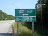
Green signage denoting the northern Highway 400 interchange along Highway
69. Picture size: 45kb. |
 |
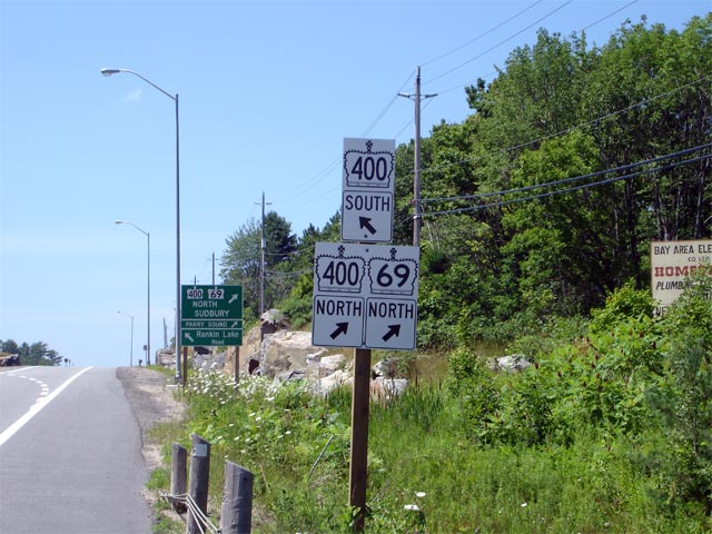
| Township of Seguin District of
Parry Sound |
Looking northerly towards the northern Highway 400 interchange. Before
the 400 diversion was constructed, Highway 69 continued straight ahead
towards Parry Sound along what has now become the northbound ramp to the new
highway.
Picture taken: July 13th, 2006. Size: 50kb. |
 |
| Township of Seguin District of
Parry Sound |
Junction assembly for the upcoming interchange.
Click here for Highway 400
images. Picture size: 75kb. |
 |
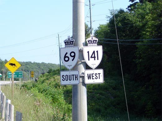
| Township of Seguin District of
Parry Sound |
Highway 69 shield cosigned with a Highway 141 trailblazer.
Surprisingly when the 400 diversion opened in 2003,
Highway 141 was routed to
the 4-lane highway via the newly constructed Airport Road interchange, and
not the seemingly more logical connection via Highway 69.
Picture size: 50kb. |
 |
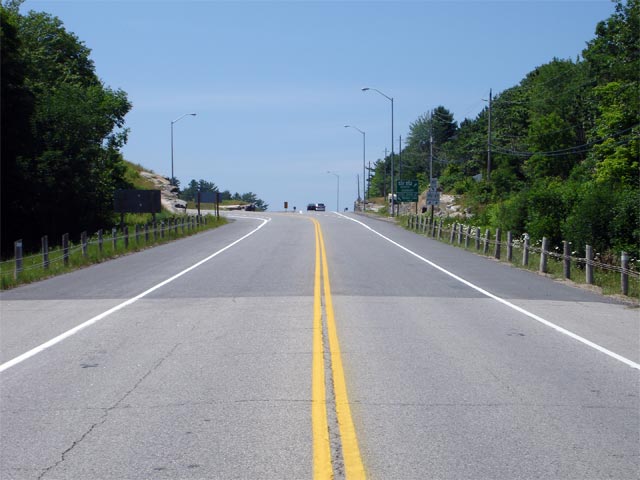
| Township of Seguin District of
Parry Sound |
View looking northwest towards the northern Highway 69/400 interchange.
Highway 69 meets Highway 400 at a non-standard interchange that with a parclo-b on the west side and a diamond configuration on the east side.
Picture taken: July 13th, 2006. Size: 50kb. |
 |
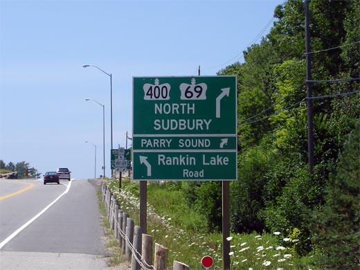
| Township of Seguin District of
Parry Sound |
Looking north along Highway 69/400 from the Highway 69/Rankin Lake Road
overpass. Before 2003, this point marked the southern end of the Parry
Sound By-pass. Picture taken: July 13th, 2006. Size: 55kb. |
 |
|
Click here for Highway 69 Images between
Horseshoe
Lake and Highway 559 |