|
Proper Municipality Name |
Photo Description |
Photo |
|
Pictures taken
from driver's perspective appear offset from centre-line pictures: |
North-
Bound |
South-
Bound |
|
Highway 169 ends at Highway 12 between Orillia and
Beaverton.
Click here for Highway 12 images. |
| Township of Ramara County of
Simcoe |
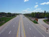
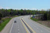
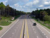
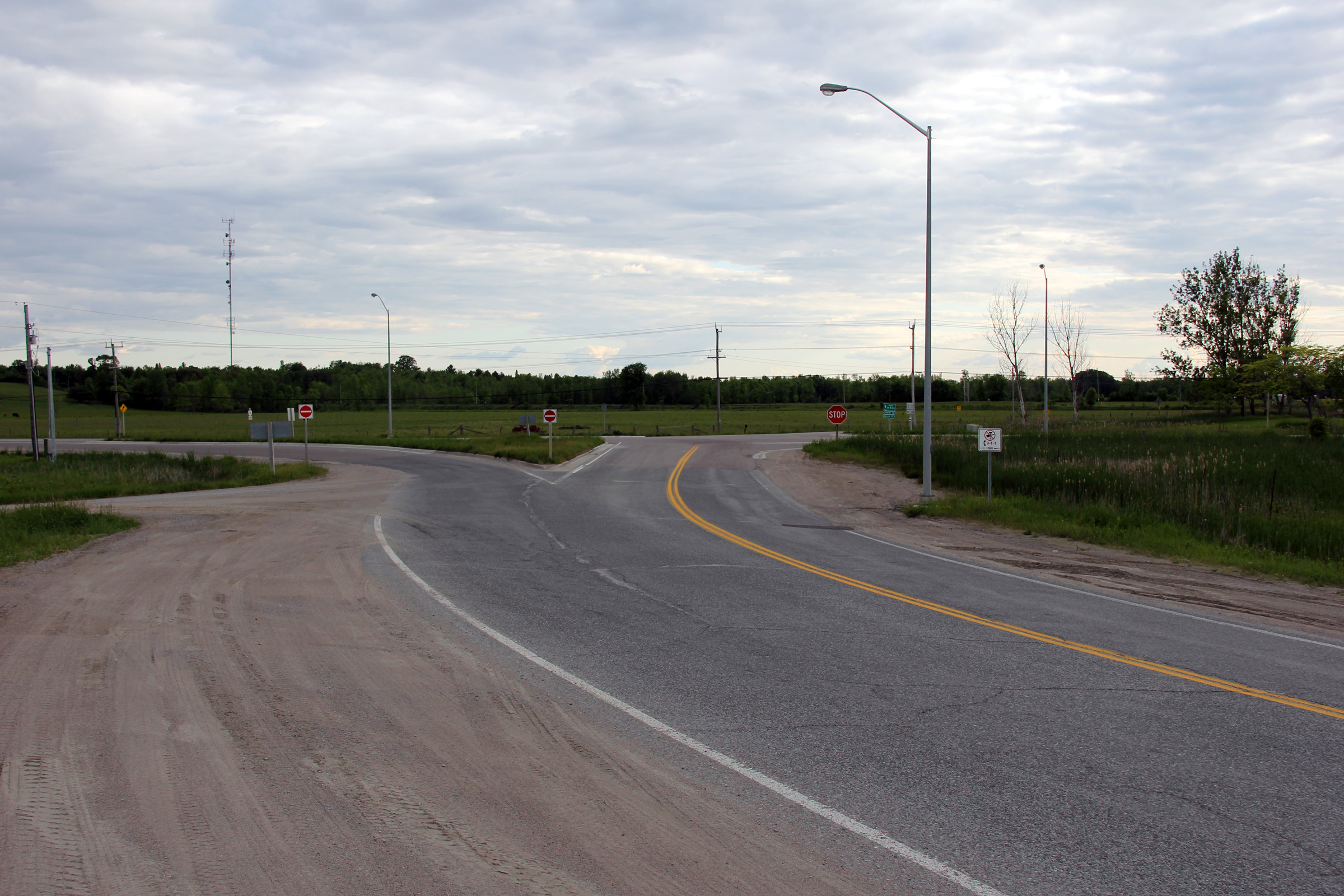
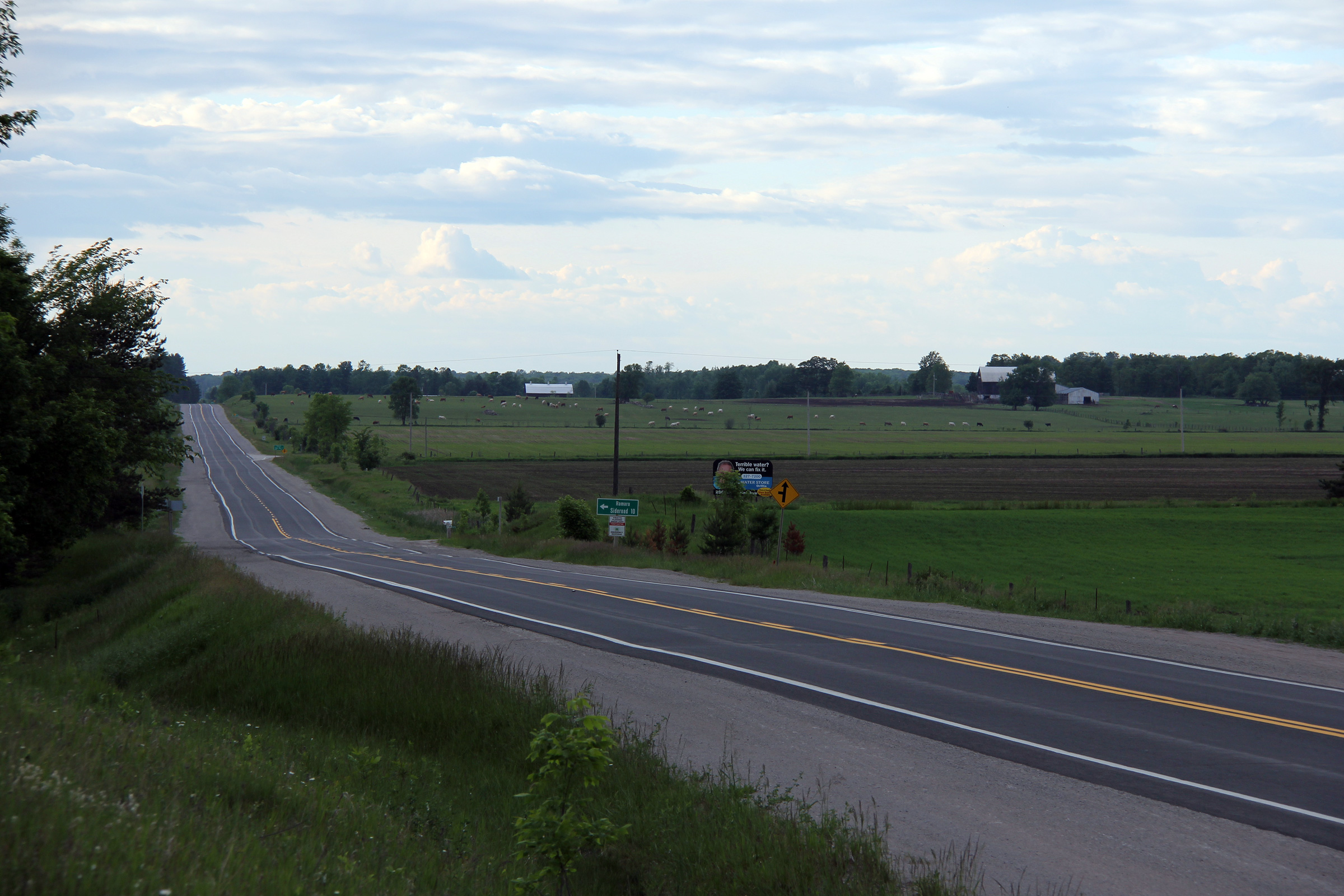
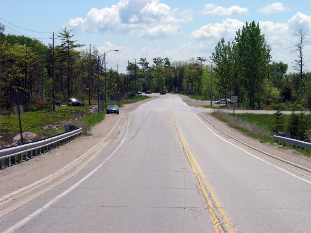
View looking southerly at the southern terminus
of Highway 169 at the Highway 12 junction.
Photo taken: June 5th, 2012. |
(720x480)
(1440x960)
(2400x1600) |
| Township of Ramara County of
Simcoe |
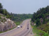
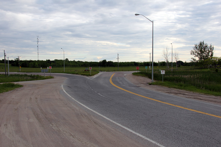
Southerly view as Highway 169 rounds a sharp curve just before the end of
the highway at Highway 12.
Photo taken: June 5th, 2012. |
(720x480)
(1440x960)
(2400x1600) |
| Township of Ramara County of
Simcoe |
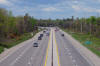
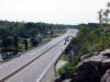
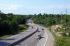
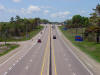
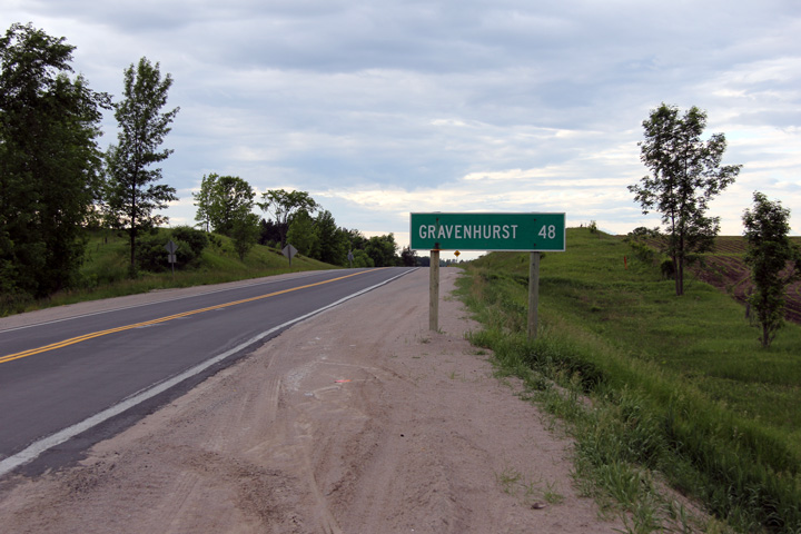
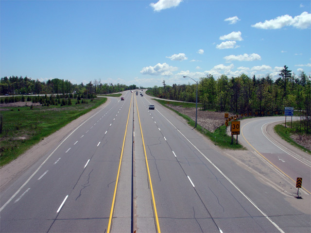
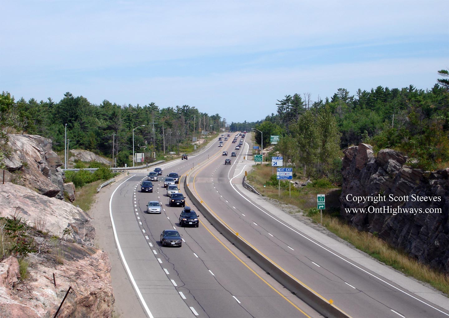
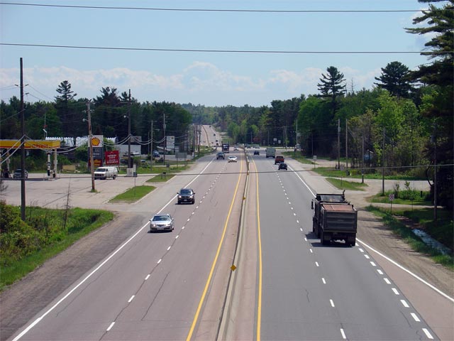
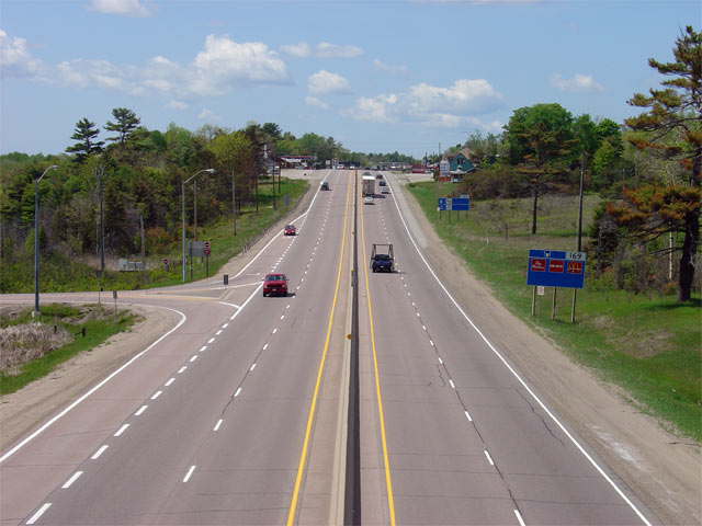
Distance signage for Gravenhurst just north of Highway 12. There are
not any notable settlements along Highway 169 through Simcoe County.
Highway 169 serves traffic as a high-speed link for motorists between Durham
Region and Muskoka District.
Photo taken: June 5th, 2012. |
 (720x480) (720x480)
(1440x960) |
| Township of Ramara County of
Simcoe |
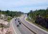
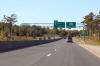
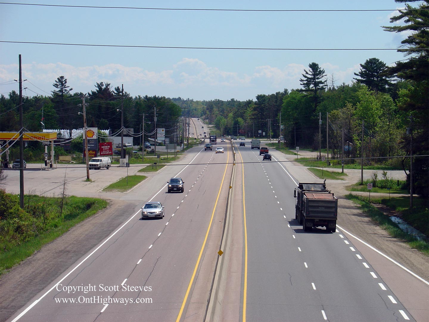
Ends assembly in advance of the Highway 12 junction.
Photo taken: June 5th, 2012. |
 (720x480) (720x480)
(1440x960) |
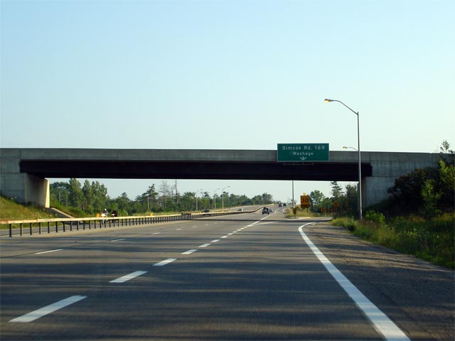
| Township of Ramara County of
Simcoe |
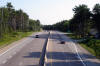
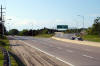
Northerly view along Highway 169 from just north of the Highway 12
intersection. A large late afternoon storm cloud had blown in from
Lake Simcoe when this photo was taken; casting the pastoral countryside of
northern Simcoe County in shadow.
Photo taken: June 5th, 2012. |

(720x480)
(1440x960)
(2400x1600) |
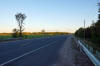
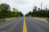
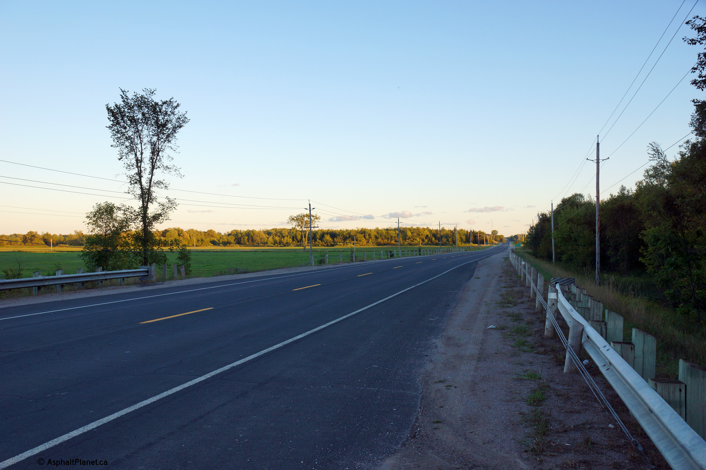
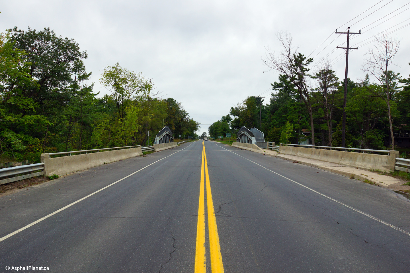
| Township of Ramara County of
Simcoe |
Southerly view along Highway 169 from just south
of the Black River Bridge
Photo taken: September 3rd, 2013. |
(720x480)
(1440x960)
(2400x1600) |
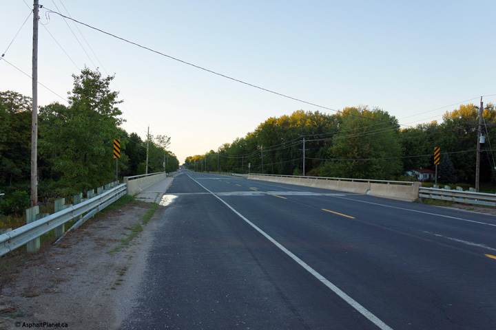
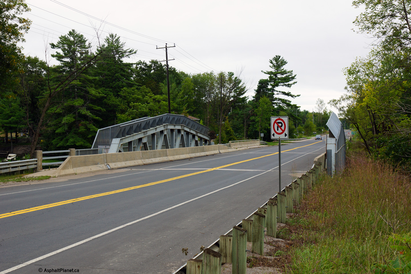
| Township of Ramara County of
Simcoe |
Northerly view across the Black River Bridge.
Photo taken: September 3rd, 2013. |
(720x480)
(1440x960)
(2400x1600) |
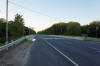
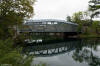
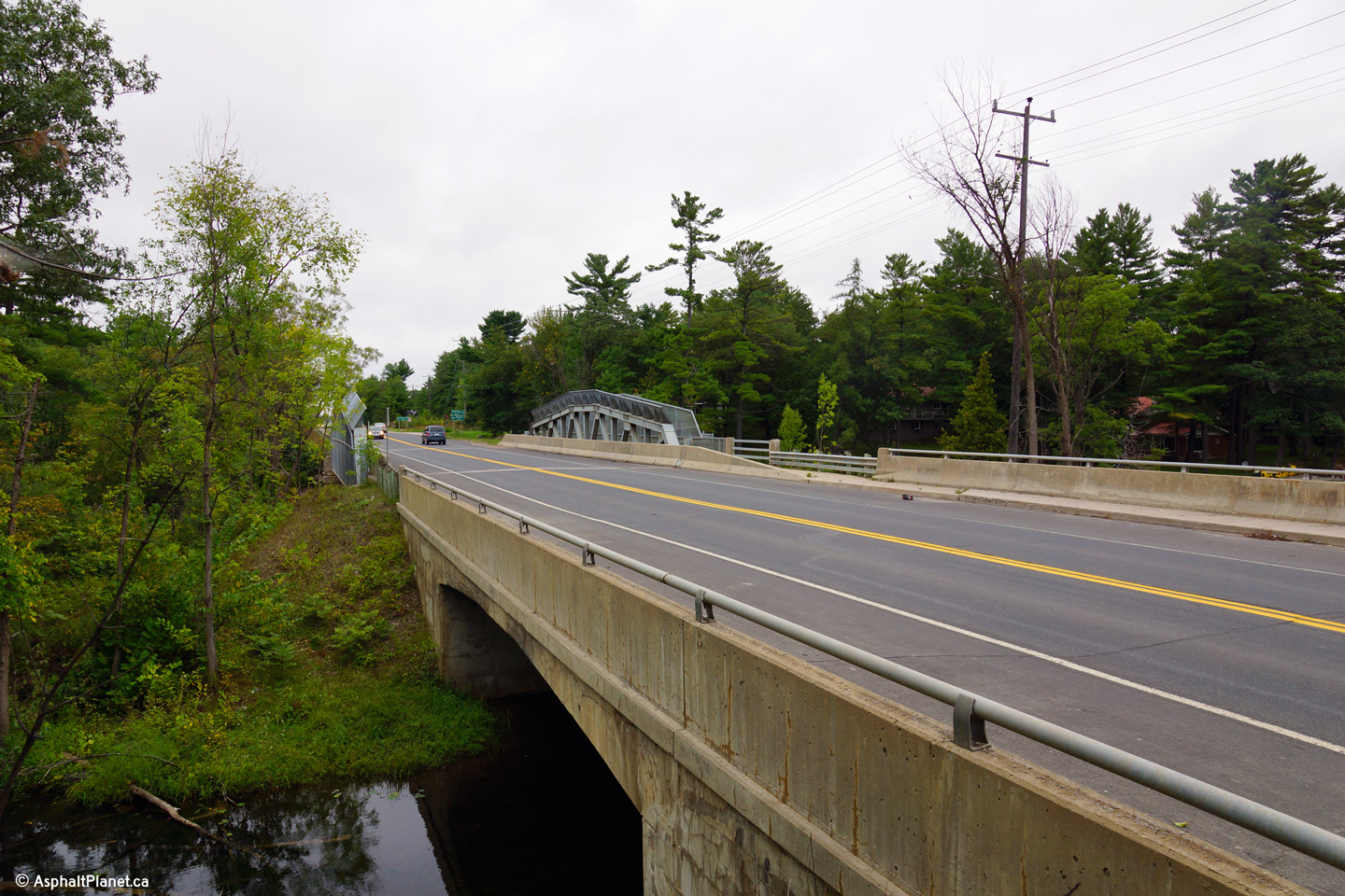
| Township of Ramara County of
Simcoe |
The Black River Bridge is typical of 1950s era
steel bridges with the exception of the concrete railings which were added
during a rehabilitation project completed in 1989.
Photo taken: September 3rd, 2013. |
(720x480)
(1440x960)
(2400x1600) |
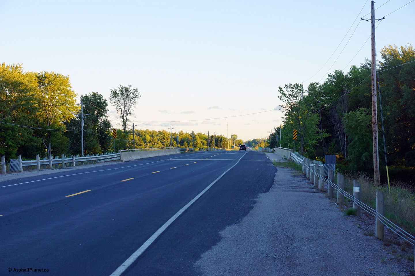
| Township of Ramara County of
Simcoe |
Southerly view across the Black River Bridge.
Photo taken: September 3rd, 2013. |
(720x480)
(1440x960)
(2400x1600) |
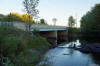
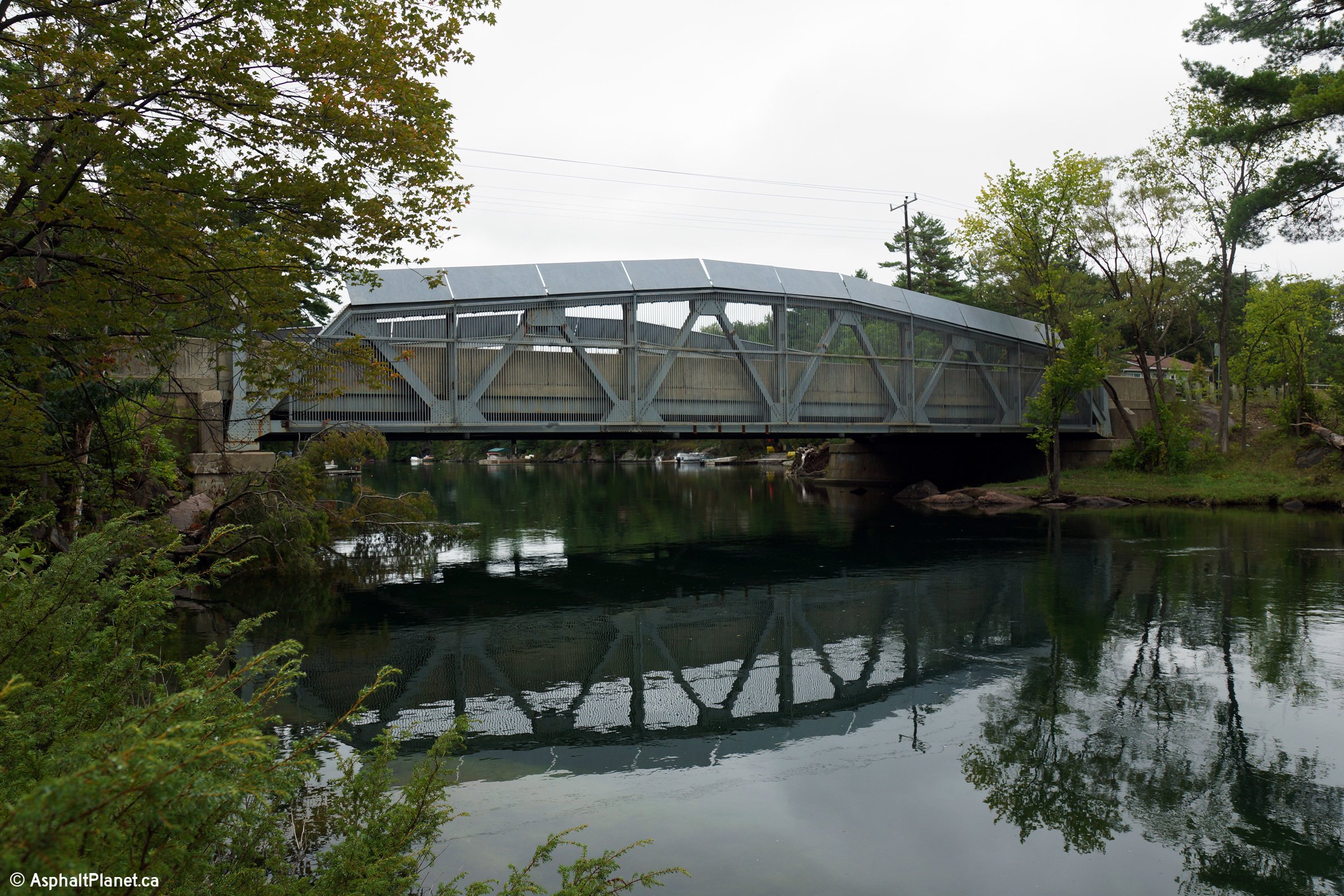
| Township of Ramara County of
Simcoe |
Two views northerly as Highway 169 passes
overtop of the Severn River south of Washago. The Trent-Severn Waterway
does not follow this arm of the Severn River, instead following a dredged
channel that by-passes a winding part of the river.
Photos taken: September 3rd, 2013. |
(720x480)
(1440x960)
(2400x1600)

(720x480)
(1440x960)
(2400x1600) |
| Township of Ramara County of
Simcoe |
Side view of the Servern River truss bridge.
A steel cage has been installed along this bridge, presumably to discourage
people from diving or fishing from the highway bridge.
Photo taken: September 3rd, 2013. |
(720x480)
(1440x960)
(2400x1600) |
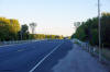
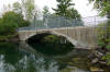
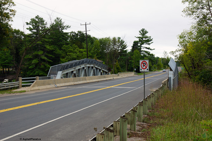
| Township of Ramara County of
Simcoe |
Before the truss bridge was constructed, traffic
used this single lane concrete barrel arch bridge which stands immediately
adjacent to the existing truss bridge.
Photo taken: September 3rd, 2013. |
(720x480)
(1440x960)
(2400x1600) |
| Township of Ramara County of
Simcoe |
Southerly view across the Severn River truss
bridge.
Photo taken: September 3rd, 2013. |

(720x480)
(1440x960)
(2400x1600) |
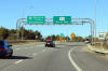
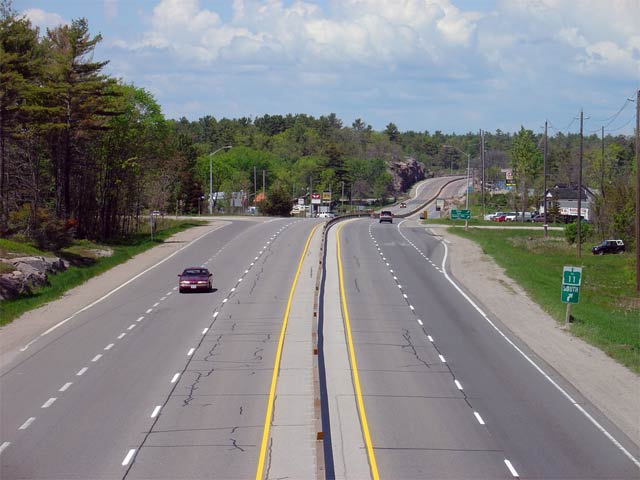
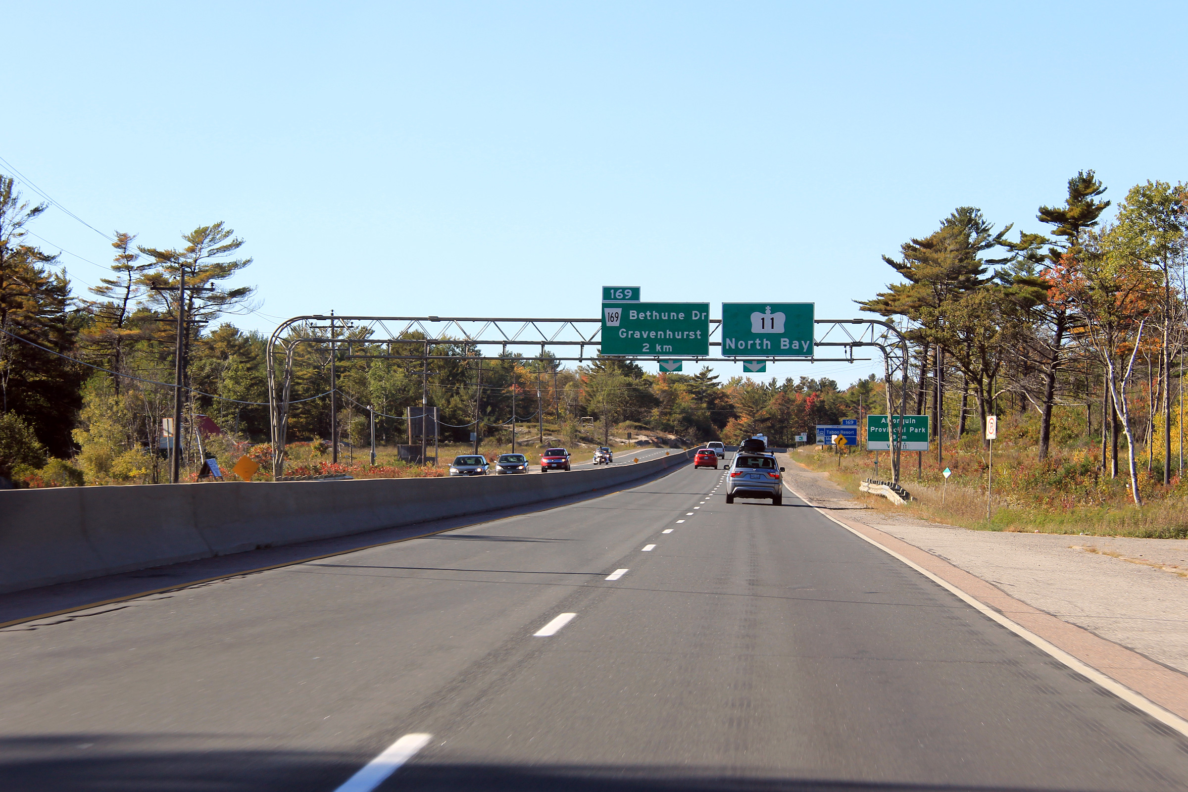
| Township of Severn County of
Simcoe |
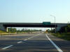
View looking southerly along Highway 169 from
just south of the Highway 11 overpass. The intersection in this photo
links Highway 169 to the east side of the Highway 11 RIRO expressway.
Picture taken: June 1st, 2005. Size: 120kb. |
 |
| Township of Severn County of
Simcoe |
View looking southerly from the Highway 169 overpass along
Highway 11.
The southern Highway 11/169 ramp is a bit of a mix between a trumpet
interchange and a typical RIRO interchange. Notice the guidance
measures directing traffic around the loop ramp on the right hand side of
the photo.
Picture taken: June 1st, 2005. Low Res: 90kb. |
Low-Res
High-Res |
|
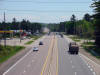
South of Highway 169, Highway 11
continues to Orillia and now terminates at Highway 400.
Click here for Highway 11-South images. |
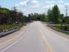
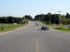
| Township of Severn County of
Simcoe |
View looking northerly along Highway
11/169 from
the southern Highway 169 overpass. The Washago By-pass was completed
in 1955 as a controlled access highway. Because the Washago By-pass is
a controlled access highway, it lacks private driveways and this short
section of highway can be
considered a full freeway.
Picture taken: June 1st, 2005. |
(720x480)
(1440x960) |
| Township of Severn County of
Simcoe |
View driving south along
Highway 11 approaching
the Highway 169 overpass near Washago. Picture taken: July 13th, 2006.
Size: 35kb. |
 |
| Township of Severn County of
Simcoe |
Advanced signage for the Highway 169
interchange. Notice that the signage used on
Highway 11 is not the
typical aluminum extruded signage that would normally be present on
freeways. Signage along the RIRO portions of
Highway 11 is very
similar to what would normally adorn a conventional 2-lane highway.
Picture taken: July 13th, 2006. Size: 40kb. |
 |
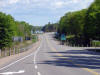
| Township of Severn County of
Simcoe |
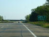
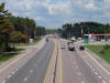
Looking south from the Coopers Falls Road
overpass. The Washago By-pass starts at Coopers Falls Road and
by-passes roughly 4km of Highway 11s former routing through Downtown Washago.
Picture taken: June 1st, 2005. |
(720x480)
(1440x960) |
| Township of Severn County of
Simcoe |
Highway 11 looking north from the Coopers Falls Road overpass located about
17km south of Gravenhurst. This picture highlights Highway
11/169crossing
the Severn River Bridge. The route via Severn Bridge was at one point the only route
between Toronto and the Muskoka Region. Later, Highway 103 (now
69/400) was constructed
to the west.
Picture taken: June 1st, 2005. Low Res: 50kb. High Res: 245kb. |

Low Res
High Res |
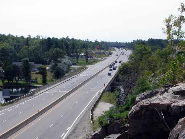
| Town of Gravenhurst District
Municipality of Muskoka |
View looking southerly across the Severn River
bridge along Highway 11/169. Late in
2006 construction started to rehabilitate the Severn River bridge. The
structure was completed in two phases in 1966, when
Highway 11 was first 4-laned.
Picture taken: August 26th, 2006. Low Res: 60kb. High Res:
270kb. |
Low Res
High Res |
| Town of Gravenhurst District
Municipality of Muskoka |
View looking northerly from just north of the
Severn River bridge. Highway 11 ended
at the Severn River bridge until 1937 when the DHO (predecessor to the MTO)
merged with the Department of Mines, who, prior to that had had jurisdiction
over trunk roads in Northern Ontario. The Highway 11
designation was extended northerly almost 900km to just west of Hearst at
that time.
Picture taken: August 26th, 2006. Low Res: 55kb. High Res:
230kb. |
Low Res
High Res |
| Town of Gravenhurst District
Municipality of Muskoka |
View looking southerly from the Sparrow Lake
Road 'D' overpass. Picture taken: June 30th, 2006. |
(720x480)
(1440x960) |
| Town of Gravenhurst District
Municipality of Muskoka |
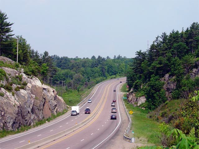
Looking northerly through a scenic reversing
curve along Highway 11/169 from the
Sparrow Lake Road 'D' overpass. North of the Severn River Highway
11/169 quickly makes the transition from the Great Lakes Lowlands to the
Canadian Shield.
Picture taken: June 30th, 2006. |
(720x480)
(1440x960) |
| Town of Gravenhurst District
Municipality of Muskoka |
View looking southerly from the South Kahshe
Lake Road overpass. Picture taken: June 1st, 2005. Low Res: 55kb.
High Res: 235kb. |
Low Res
High Res |
| Town of Gravenhurst District
Municipality of Muskoka |
Looking northerly along Highway
11/169 from the South Kahshe Lake Road
overpass. Picture taken: June 1st, 2005. Size: 55kb. |
 |
| Town of Gravenhurst District
Municipality of Muskoka |
View looking northerly along Highway 11/169
across Beaver Creek just south of Luigi Road. Picture taken: June 1st,
2005. Size: 70kb. |
 |
| Town of Gravenhurst District
Municipality of Muskoka |
Looking south along Highway
11/169 from the Sedore Road overpass. Picture
taken: June 1st, 2005. Size: 65kb. |
 |
| Town of Gravenhurst District
Municipality of Muskoka |
Looking north towards Gravenhurst from the Sedore Road overpass. The
Sedore Road overpass is located roughly 4km south of Gravenhurst. Picture
taken: June 1st, 2005. Size: 65kb. |
 |
| Town of Gravenhurst District
Municipality of Muskoka |
Advanced signage for the upcoming northern split
of Highway 169 from Highway 11. Picture
taken: October 1st, 2011. |
 (720x480) (720x480)
(1440x960)
(2400x1600) |
| Town of Gravenhurst District
Municipality of Muskoka |
Diagramical signage approaching the northern
Highway 11/169 interchange. Notice
that the speed limit drops to 80km/h just before the interchange. This
speed limit drops due to the rather sharp right-hand curve just beyond the
off-ramp. At Highway 169, Highway 11 curves easterly as it swings
around Gull Lake on the Gravenhurst By-pass.
Picture taken: October 1st, 2011. |
 (720x480) (720x480)
(1440x960)
(2400x1600) |
| Town of Gravenhurst District
Municipality of Muskoka |
View looking northerly along Highway 11/169
at the northern interchange between the two highways. Notice the
diagramical sign is placed at the beginning of the ramp in this photo rather
then in advance of the interchange. The diagramical sign was erected
late in June of 2006 at the start of the off-ramp but was quickly moved to
the existing gantry downstream of the interchange.
Picture taken: June 30th, 2006. |
(720x480)
(1440x960) |
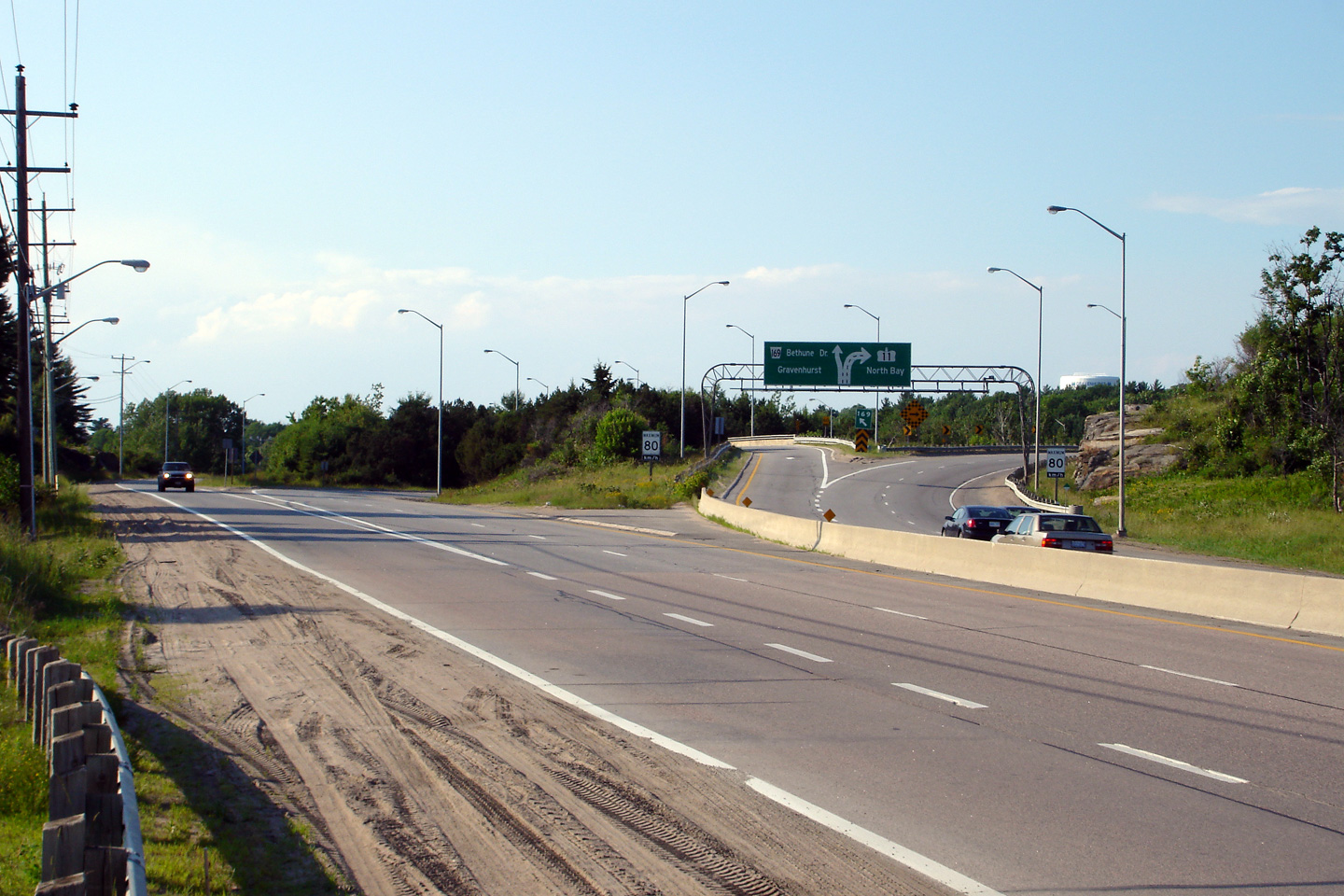
| Town of Gravenhurst District
Municipality of Muskoka |
Overhead signage at the
Highway 169 exit from Highway 11 in Gravenhurst. North of Gravenhurst, Highway 11 has been extensively
realigned and is now a mixed at-grade expressway and full freeway northerly
to Emsdale.
Picture taken: October 1st, 2011. |
 (720x480) (720x480)
(1440x960)
(2400x1600) |
|
North of Highway 169, Highway 11
progresses north past North Bay to Rainy River.
Click here for Highway 11-North images. |
| Town of Gravenhurst District
Municipality of Muskoka |
View looking southerly along Highway 169
approaching the Highway 11 interchange in
Gravenhurst. Southbound traffic along Highway 169 can only access
southbound Highway 11. To access
Highway 11 northbound, traffic must follow
Bethune Drive, which is itself an old alignment of
Highway 11.
Picture taken: June 30th, 2006. Size: 45kb. |
 |
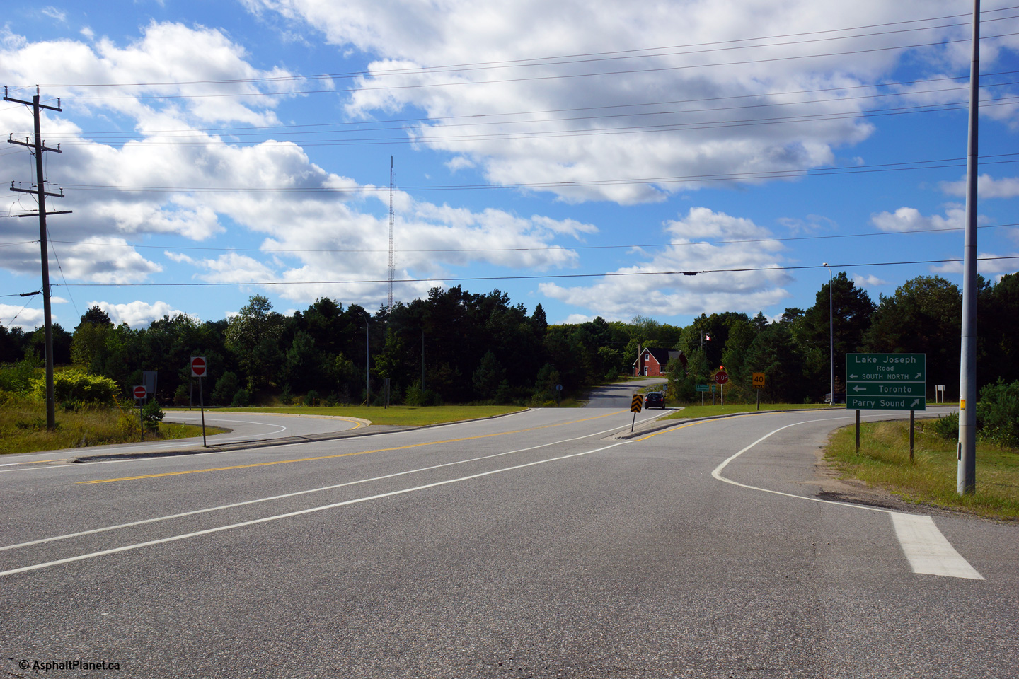
| Township of Muskoka Lakes
District Municipality of Muskoka |
View looking southerly towards the
Highway 118
junction at Glen Orchard. Notice Butterfly Lake in the distance to the
southeast side of the junction. Picture taken: June 1st, 2005. Low
Res: 65kb. High Res: 300kb. |
Low Res
High Res |
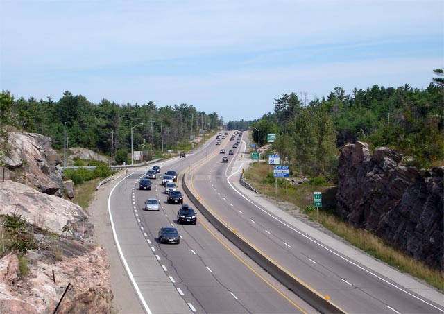
| Township of Muskoka Lakes
District Municipality of Muskoka |
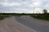
View looking northerly along Highway 169 towards
the Highway 69 junction at Foot's Bay.
Upper photo taken: June 1st, 2005.
Lower photo taken: September 3rd, 2013. |

(720x480)
(1440x960)
(2400x1600) |
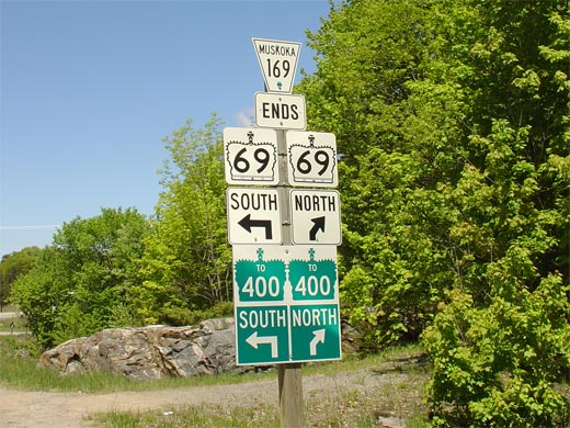
| Township of Muskoka Lakes
District Municipality of Muskoka |
Junction assembly at the north end of Highway
169. Highway 169 was downloaded to the District of Muskoka in 1998.
Notice that northbound traffic bound to Highway 400 is directed northerly
along Highway 69 to the Highway 141
interchange.
Picture taken: 70kb. |
 |
|
During the summer of 2012,
Highway 69 between MacTier and Parry Sound was re-designated as Lake Joseph
Road.
Click here for Lake Joseph Road images. |

 (720x480)
 (720x480)
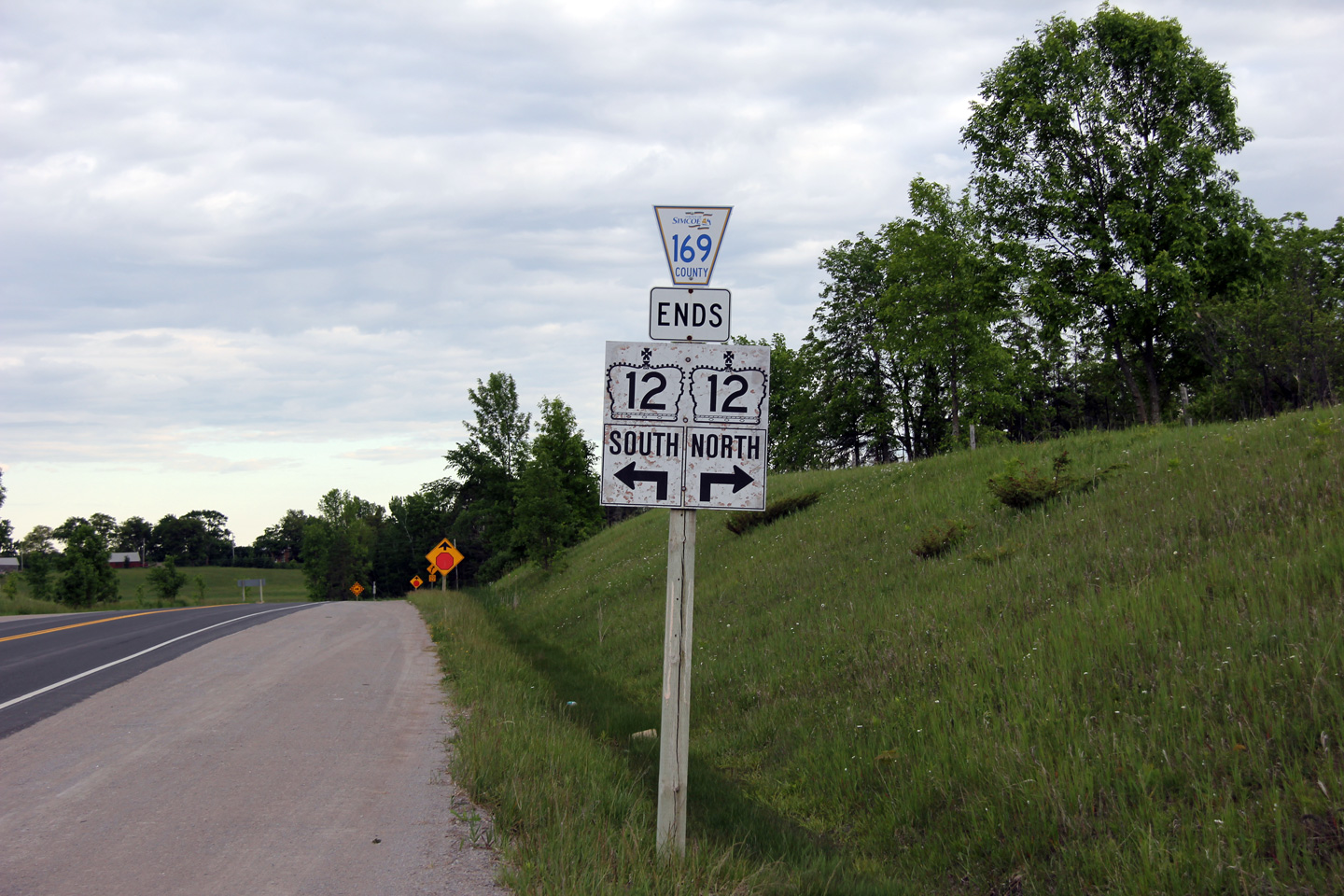


 (720x480)
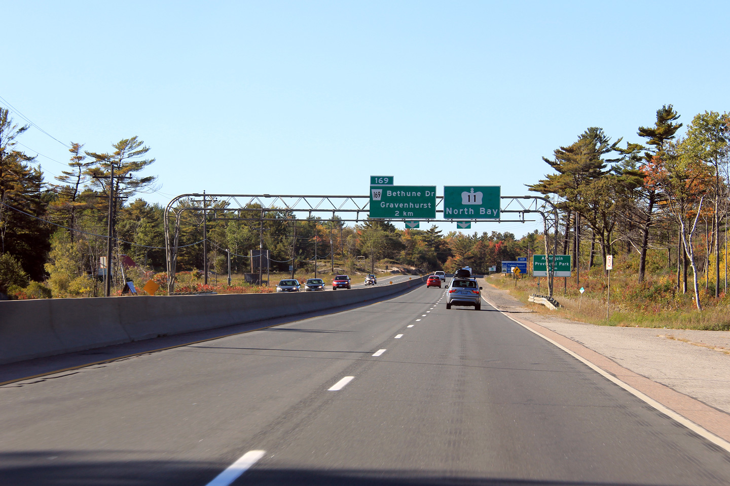
 (720x480)
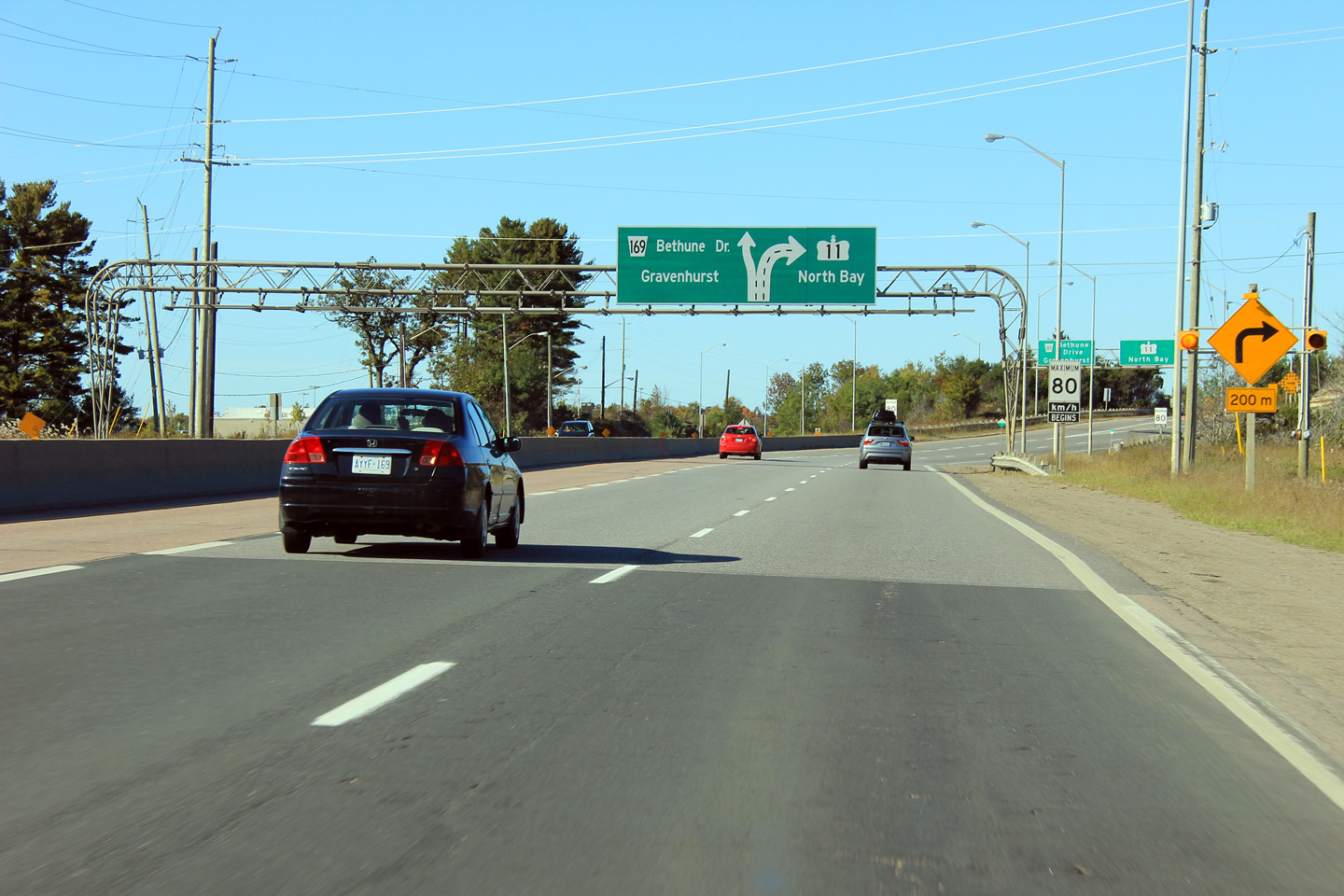

 (720x480)
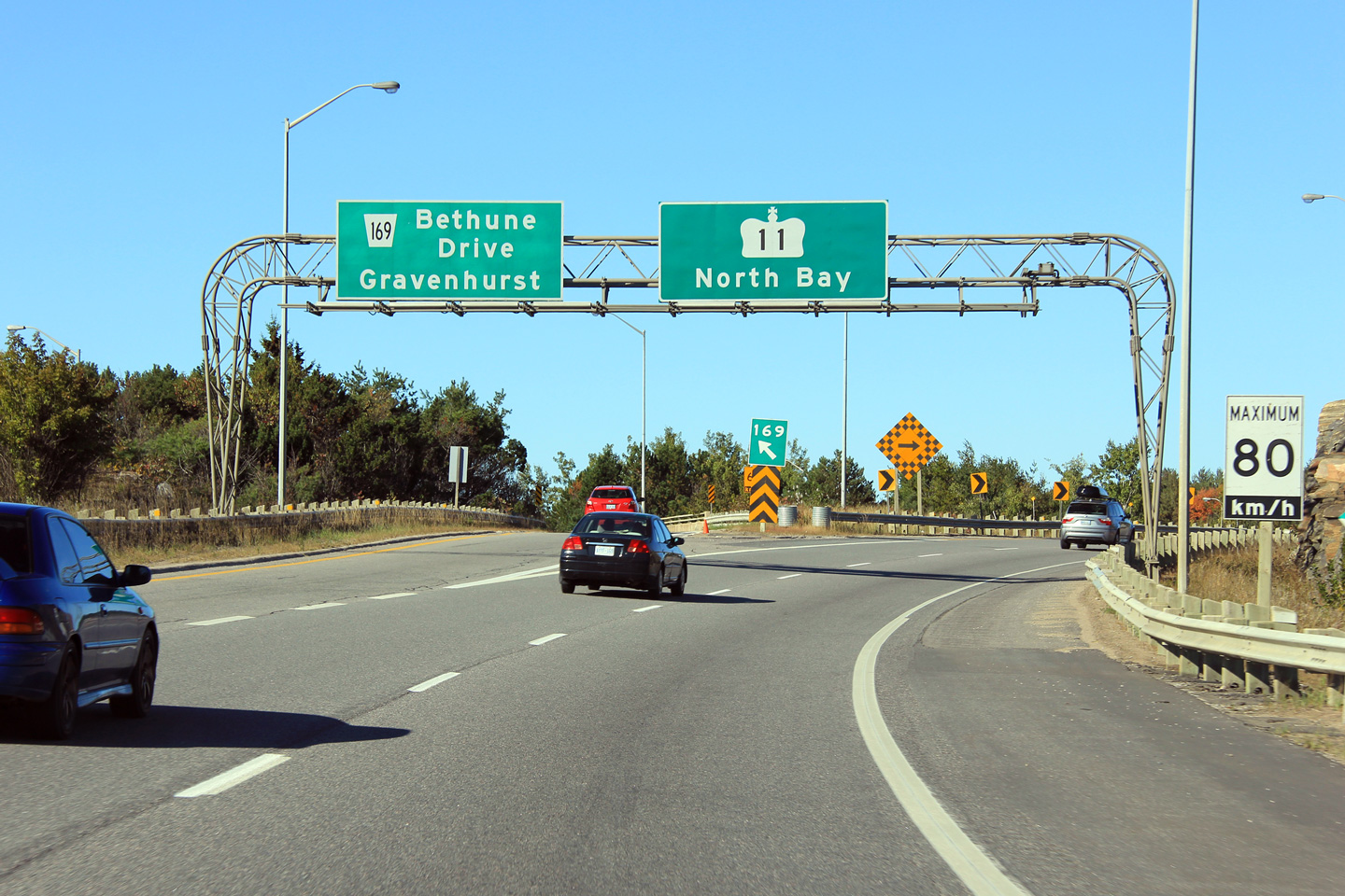


