|
Proper Municipality Name |
Photo Description |
Photo |
|
Photos taken
from driver's perspective appear offset from centre-line Photos: |
East-
bound |
West-
bound |
|
Continued from
Brantford to Hamilton Images |
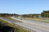
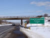
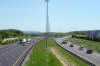
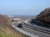
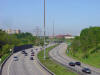
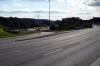
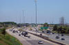
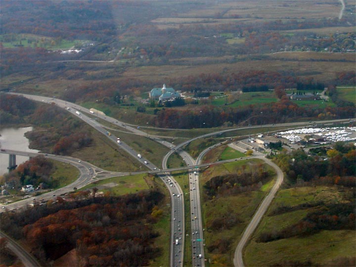
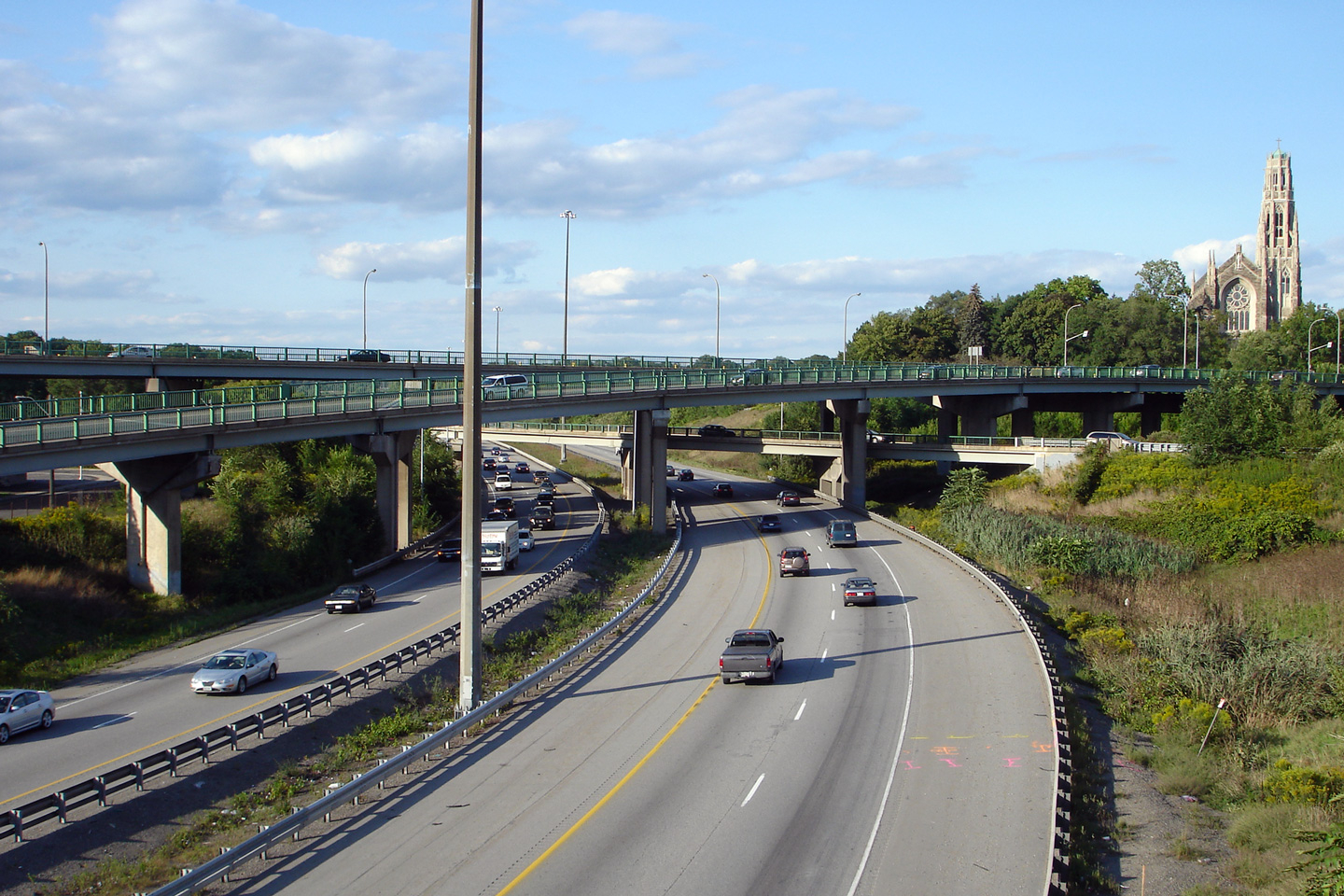
| City of Hamilton |
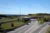
View looking easterly from the Wilson Street (Highway 2) overpass in Ancaster.
Photo taken: October 7th, 2011. |

(720x480)
(1440x960)
(2400x1600) |
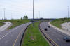
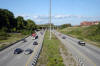
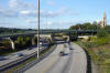
| City of Hamilton |
Two views looking west towards the Wilson Street interchange from the Hamilton Road
overpass.
Photos taken: October 7th, 2011. |
(720x480)
(1440x960)
(2400x1600)

(720x480)
(1440x960)
(2400x1600) |
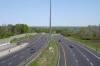
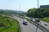
| City of Hamilton |
View looking east from Hamilton Road.
Photo taken: October 7th, 2011. |
(720x480)
(1440x960)
(2400x1600) |
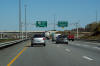
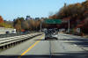
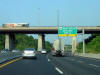
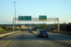
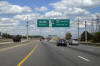
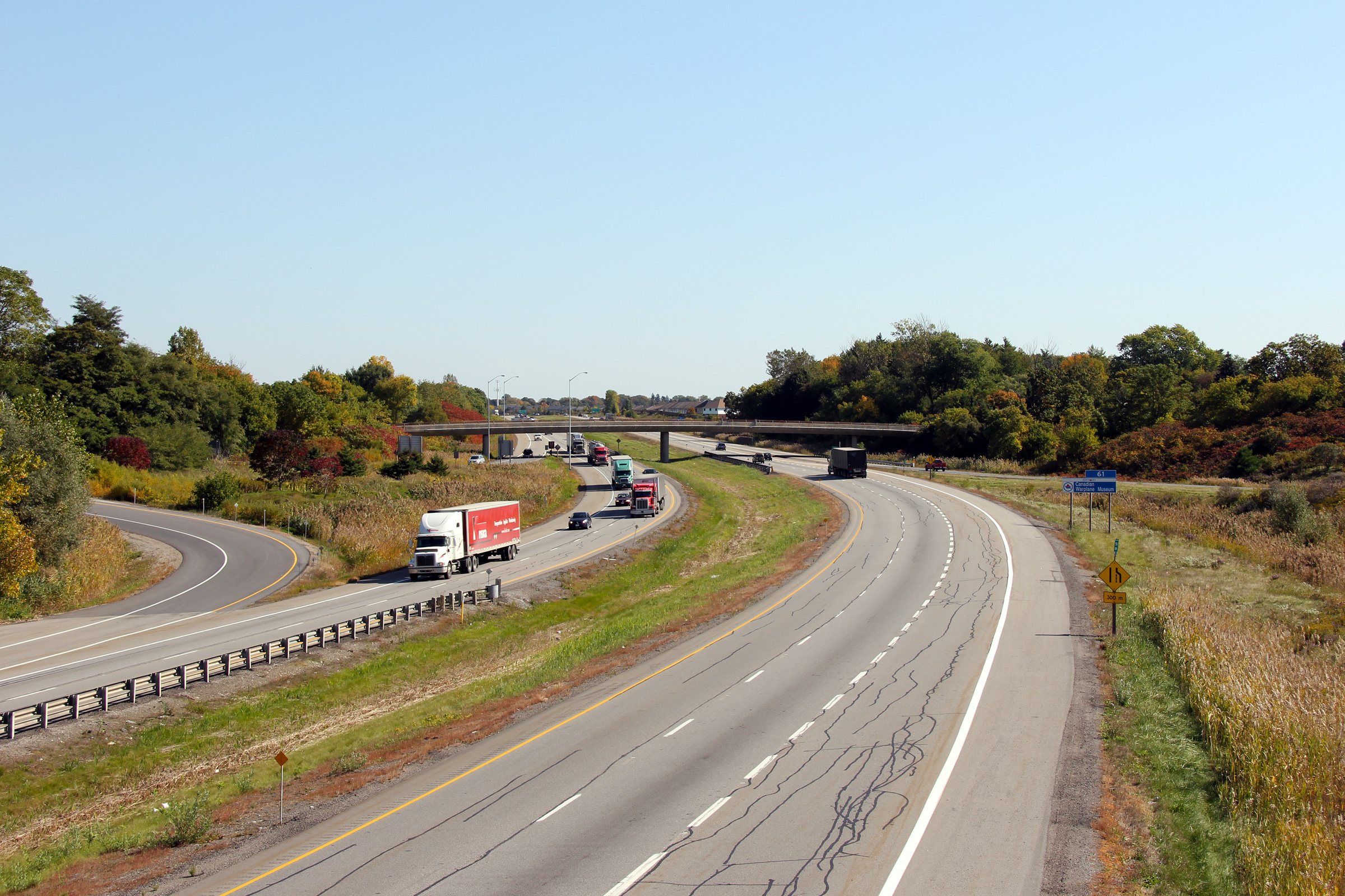
| City of Hamilton |
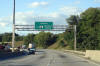
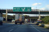
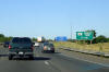
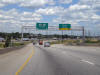
Eastbound advanced signage for Highway 6 South. To split hairs, this
sign should have an exit tab on it.
Photo taken: October 16th, 2010. |
 (720x480) (720x480)
(1440x960)
(2400x1600) |
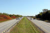
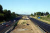
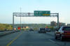
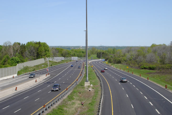
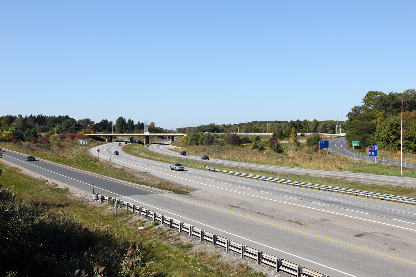
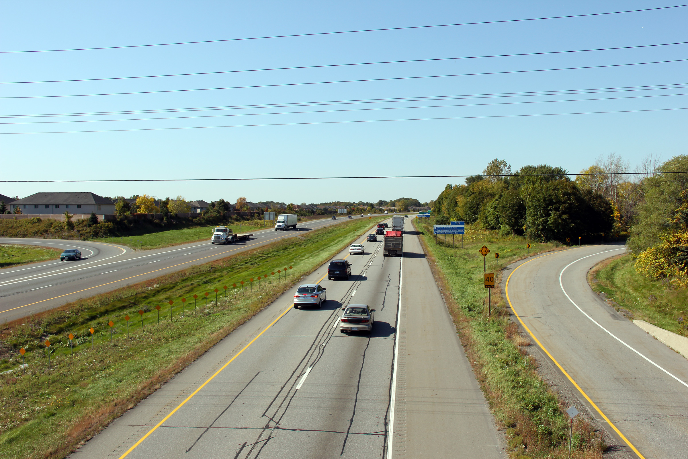
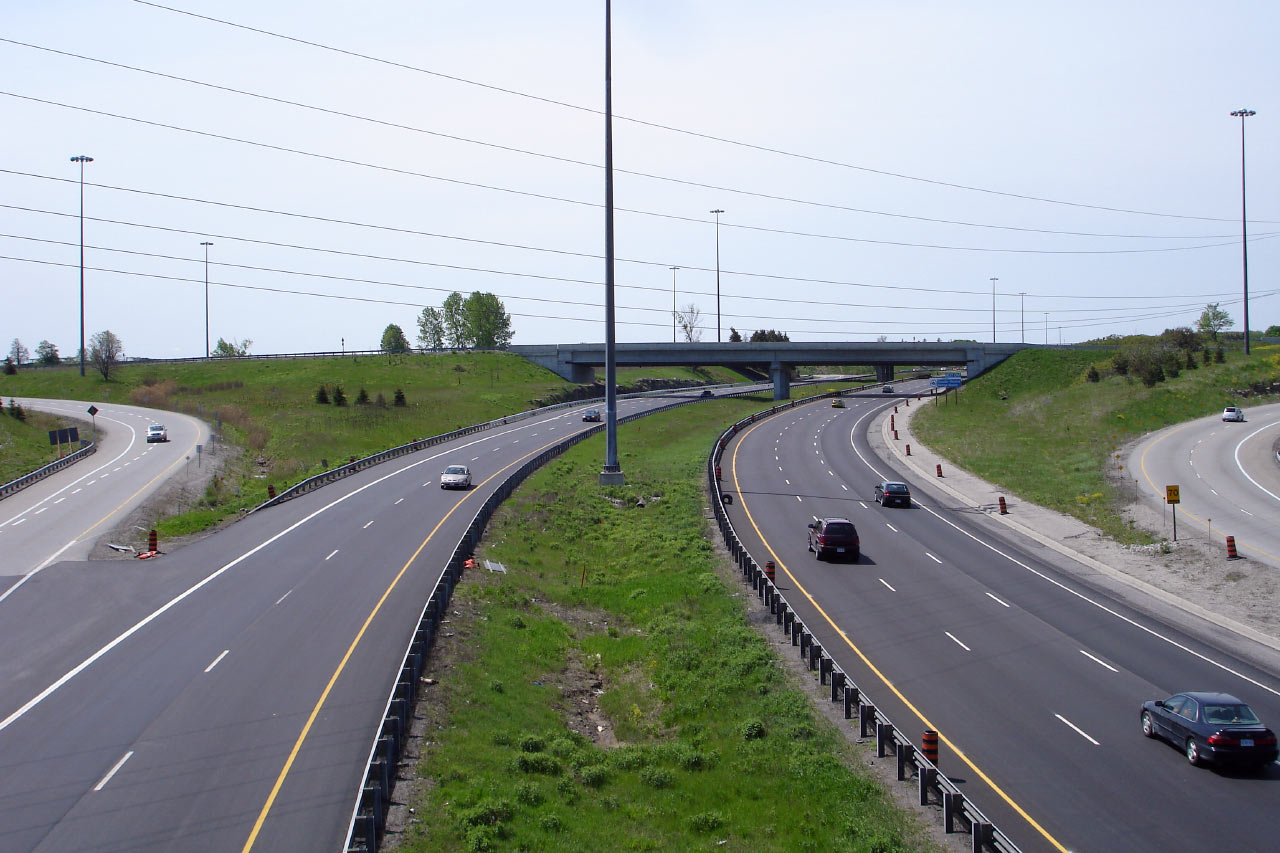
| City of Hamilton |
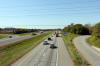
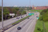
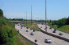
View looking easterly along Highway 403 approaching the Fiddler's Green Road
overpass. Note the etched in electrical lines that appear between the
passing and driving lanes. This is a remnant from in pavement LED
lights which were tried on Highway 403 through Ancaster in 2006-2007.
Photo taken: October 16th, 2010. |
 (720x480) (720x480)
(1440x960)
(2400x1600) |
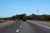
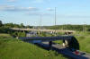
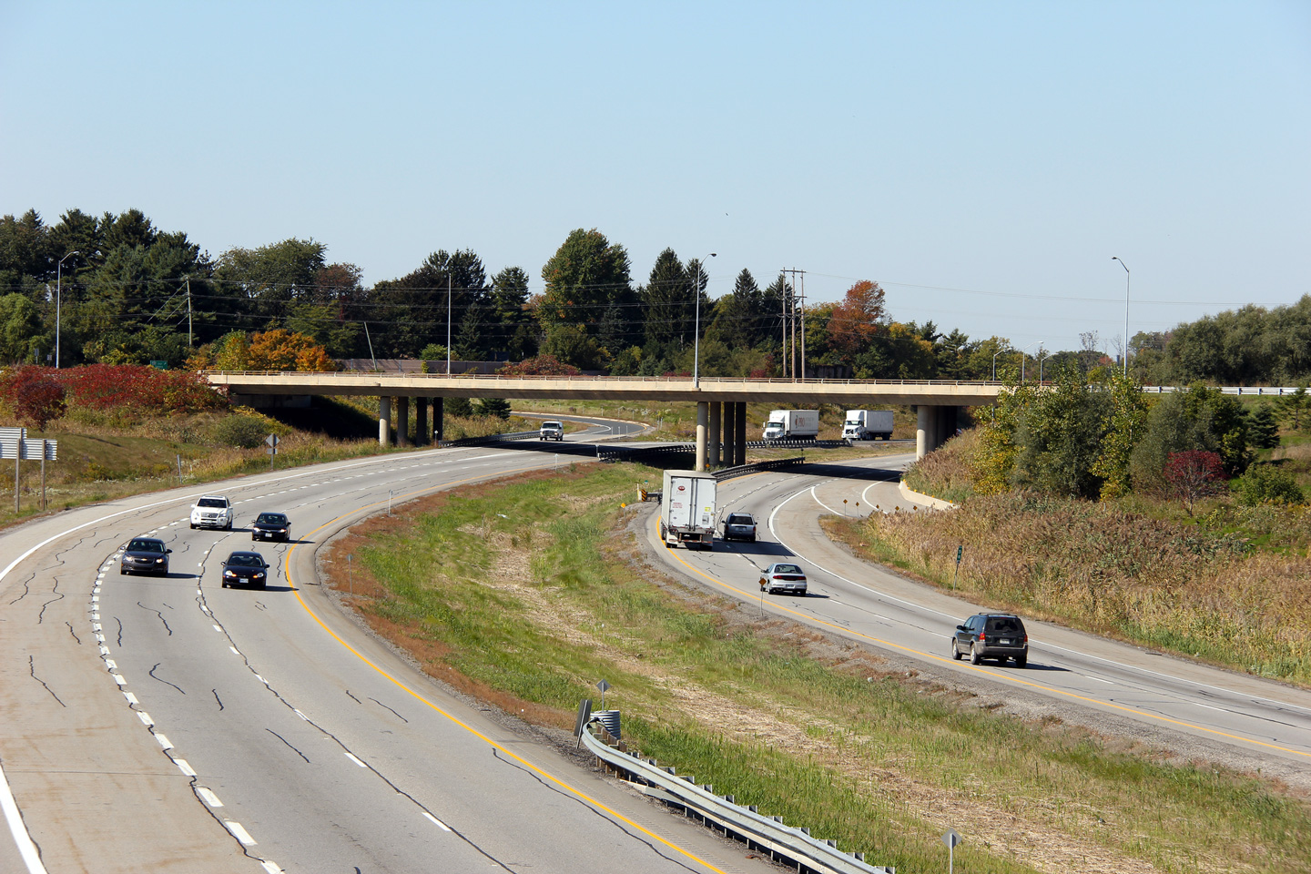
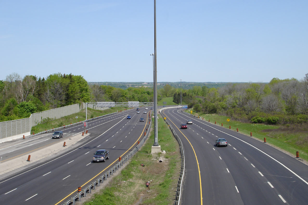
| City of Hamilton |
Westerly view from Fiddler's Green Road. The 403 was resurfaced during
the Summer of 2007 through Ancaster.
Photo taken: October 7th, 2011. |
(720x480)
(1440x960)
(2400x1600) |
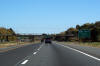
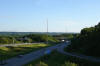
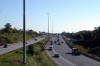
| City of Hamilton |
Looking east from Fiddler's Green Road.
Photo taken: October 7th, 2011. |
(720x480)
(1440x960)
(2400x1600) |
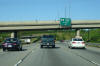
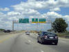
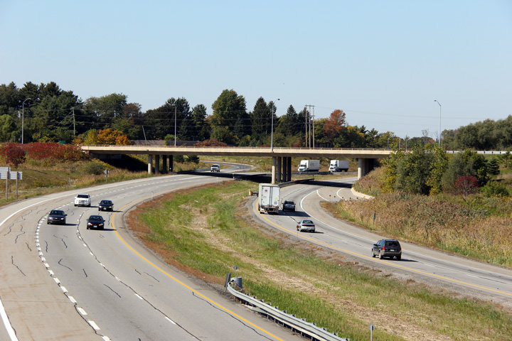
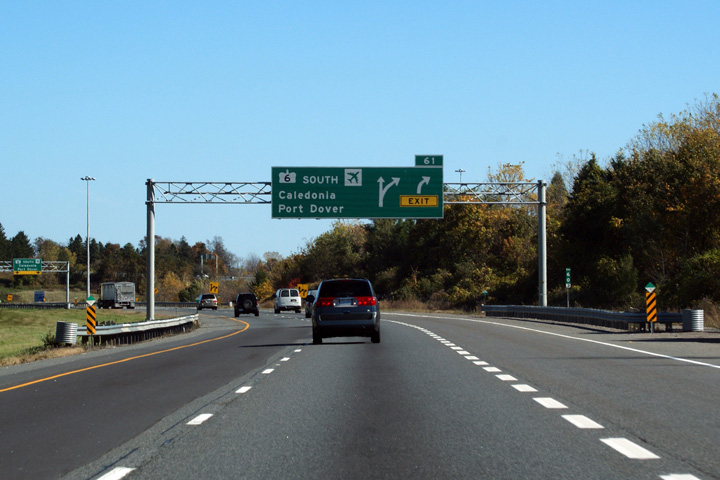
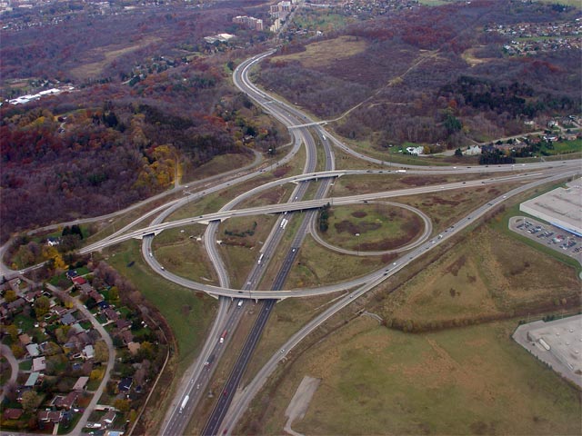
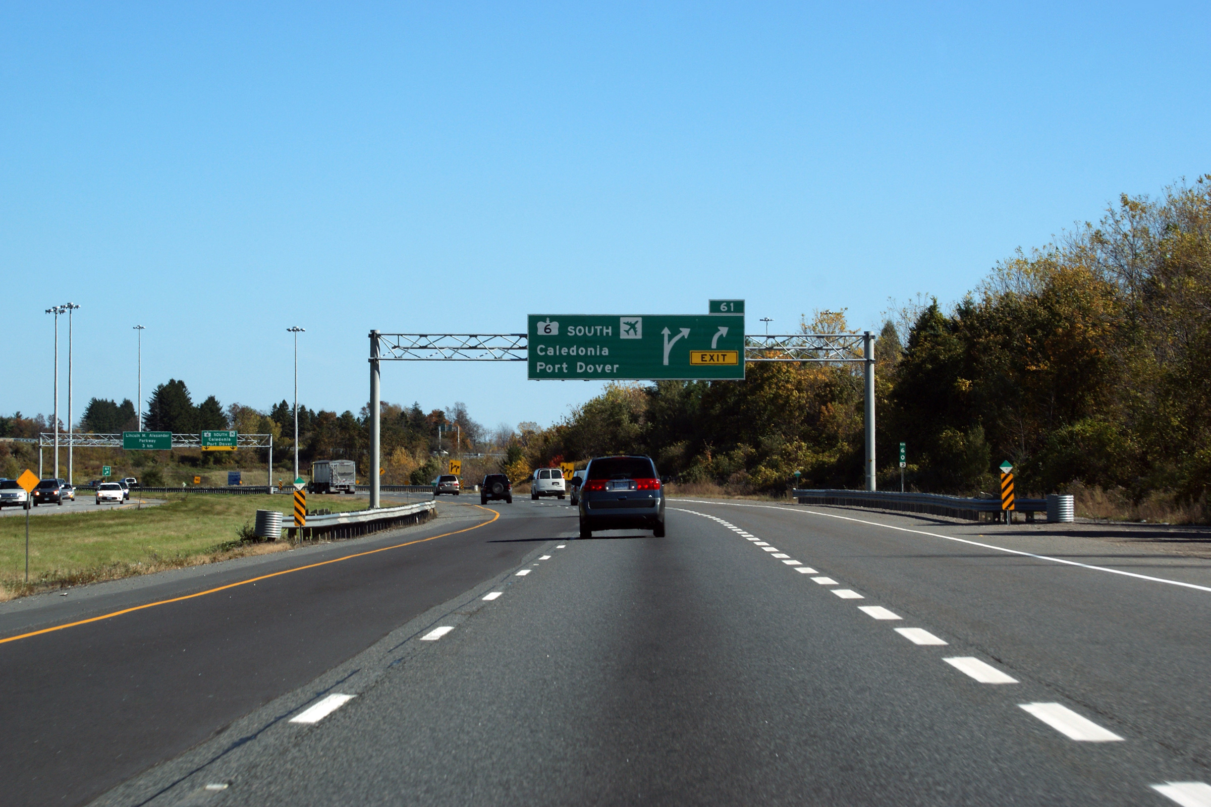
| City of Hamilton |
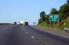
Eastbound advanced signage for the new Highway 6 interchange in Ancaster.
Photo taken: October 16th, 2010. |
 (720x480) (720x480)
(1440x960)
(2400x1600) |
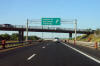
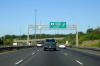
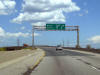
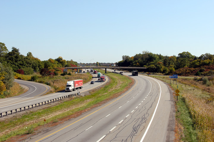
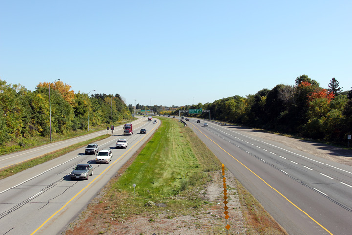
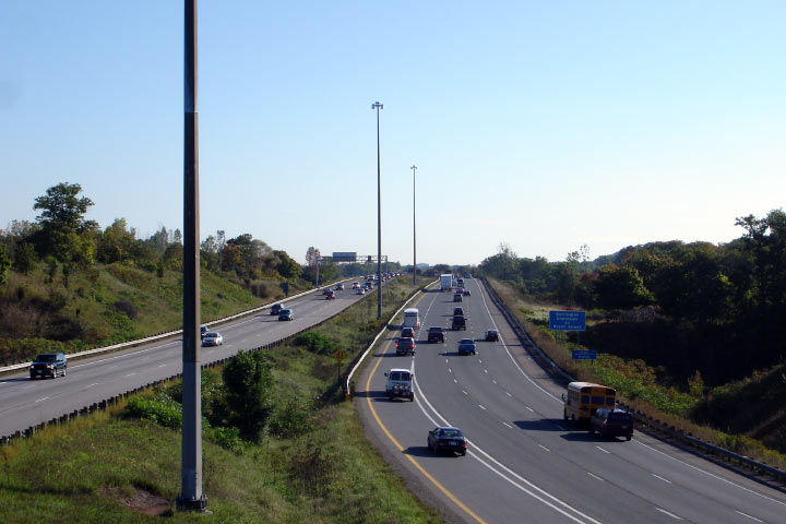
| City of Hamilton |
Signage at the exit for Highway 6-South. Highway 6 was routed to this
location in November 2004. The new Highway 6 by-passes all of urban
Hamilton and greatly improves access to Hamilton's International Airport.
Photo taken: October 16th, 2010. |
 (720x480) (720x480)
(1440x960)
(2400x1600) |
|
South of Highway 403, Highway 6
leads to Hamilton's Airport, Caledonia and Port Dover.
Click here for Highway 6 images. |
| City of Hamilton |
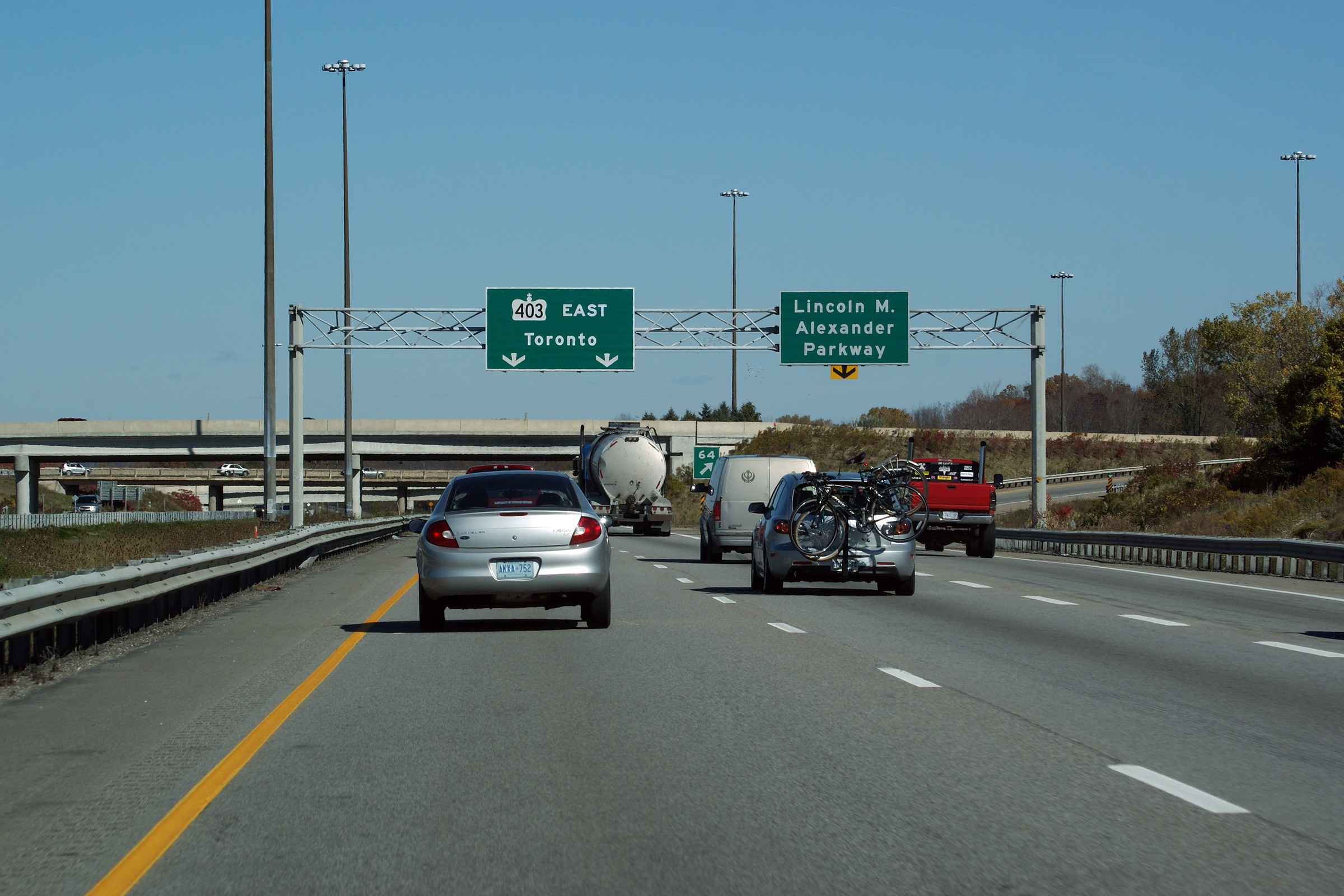
Overhead signage for the ramp to Highway 6-South from the westbound 403.
Notice the use of an exit tab on the pull-through signage for Fiddler's
Green Road. Ontario's Ministry of Transportation does not typically
sign exit numbers atop pull-through signs.
Photo taken: August 3rd, 2009. |
 Low
Res Low
Res
High Res |
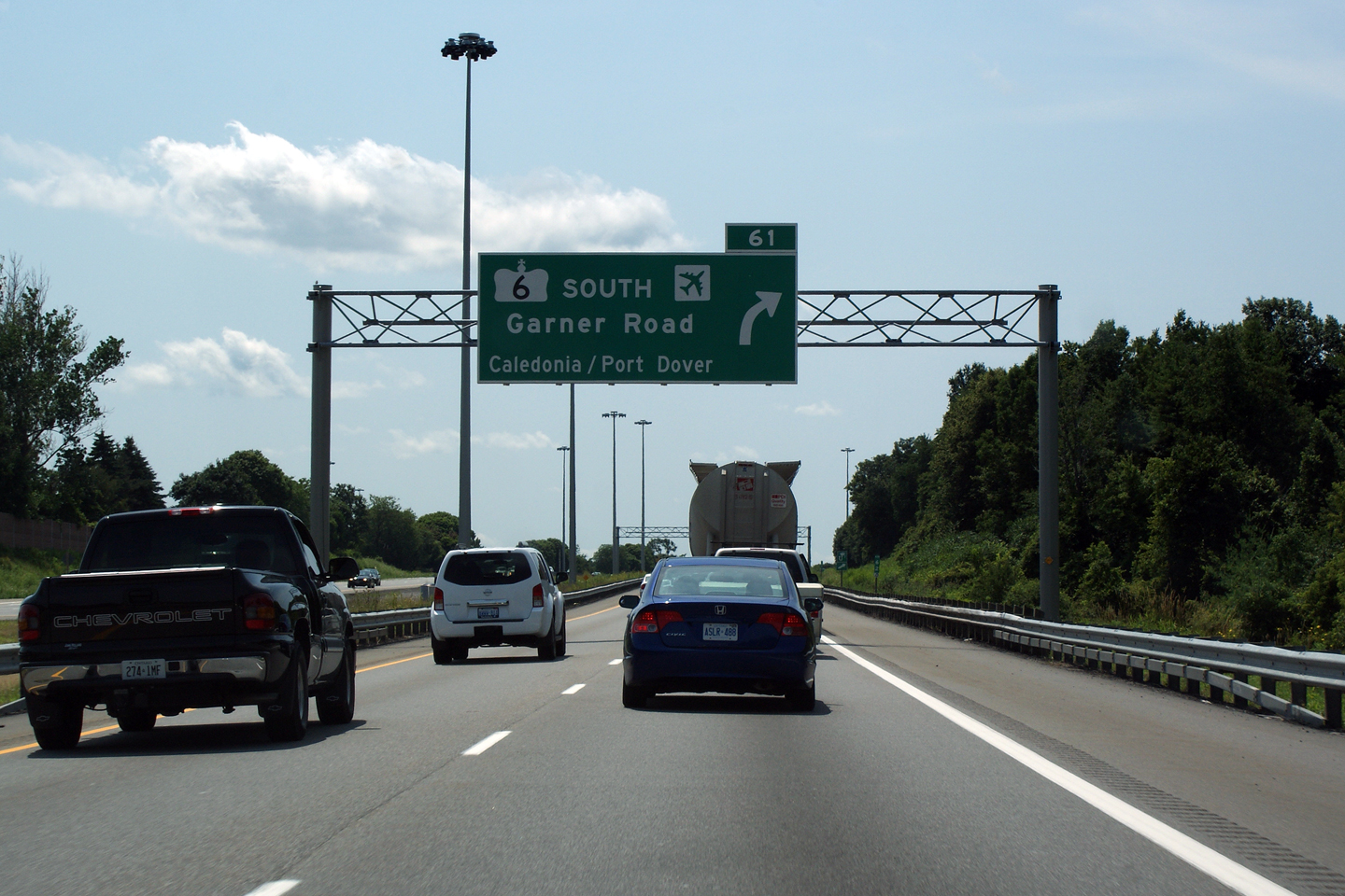
| City of Hamilton |
Advanced signage for Highway 6-South. Note the odd way in which
Caledonia and Port Dover are signed here -- when the new Highway 6-South
first opened to traffic only Hamilton International Airport was signed as a
destination.
Photo taken: August 3rd, 2009. |
 Low
Res Low
Res
High Res |
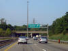
| City of Hamilton |
Advanced signage for the Linc. The exit tab adorning this sign was one
of the first to be signed along the 403 through Hamilton. Photo taken:
March 9th, 2005. Low-res: 50kb. |
 |
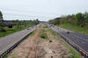
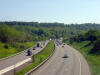
| City of Hamilton |
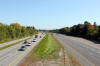
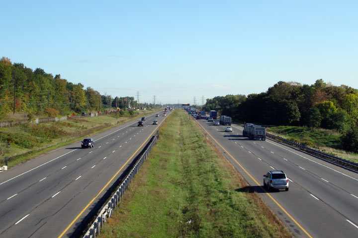
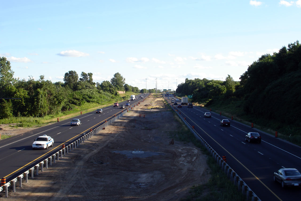
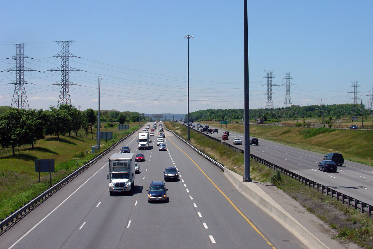
View looking west from the Southcote Drive overpass. Note the ongoing
median work pictured for the installation of high mast lighting. The
lighting became operational during September 2007.
Photo taken: July 11th, 2007. Low-res: 55kb. High-res: 160kb. |

Low-res
High-res |
| City of Hamilton |
Easterly view from the Southcote Drive overpass.
Photo taken: July 11th, 2007. Low-res: 75kb. High-res: 200kb. |
Low-res
High-res |
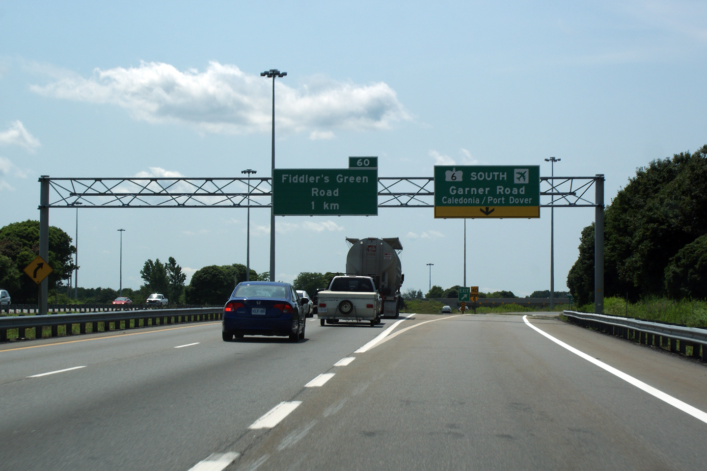
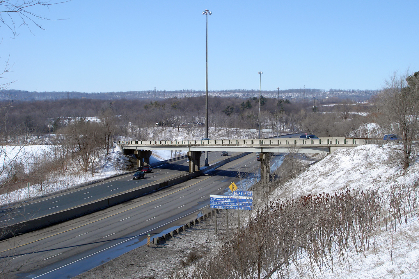
| City of Hamilton |
Overhead sign situated in front of the Golf Links Road overpass. This
sign was newly erected in the Summer of 2007. Photo taken: August 4th, 2005.
Low-res: 55kb. |
 |
| City of Hamilton |
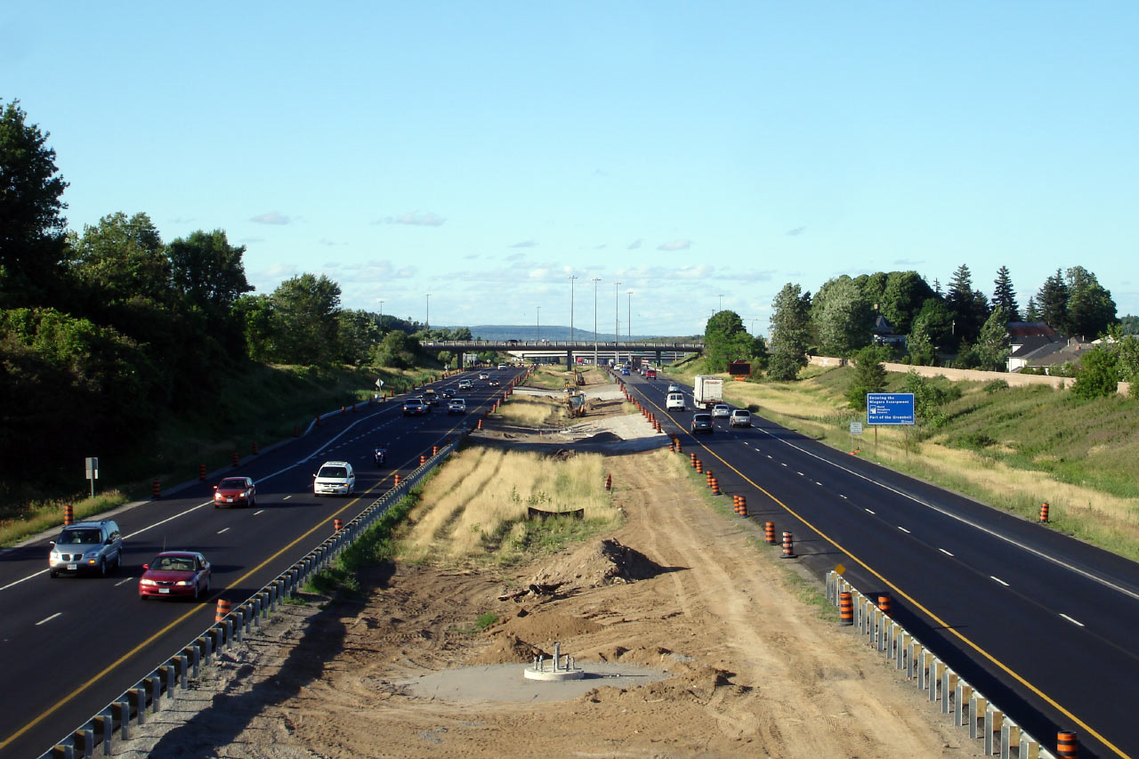
Westerly view from Golf Links Road in Ancaster. Once again, note the
median construction in advance of high-mast lighting installation. Photo taken: May 21st, 2007. Low-res:
80kb.
High-res: 235kb. |
Low-res
High-res |
| City of Hamilton |
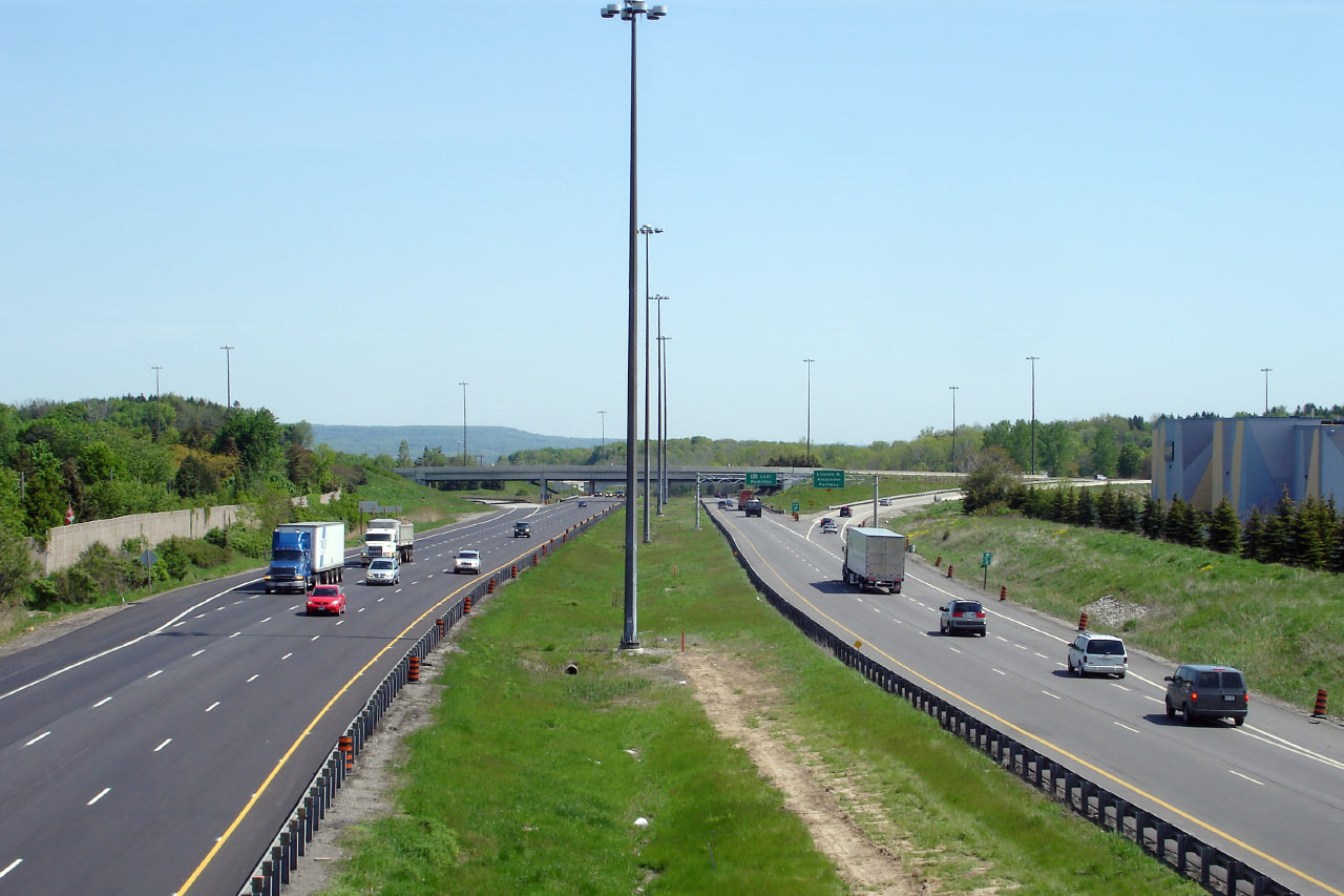
Easterly view from Golf Links Road towards the Linc interchange. Photo taken: May 21st, 2007. Low-res: 60kb.
High-res: 165kb. |
Low-res
High-res |
| City of Hamilton |
Eastbound signage at the ramp to the Linc from the eastbound 403. Only
the Linc is accessible from the eastbound lanes of the 403 - there is no
direct access from the eastbound 403 to Rosseaux Street. Photo taken:
October 16th, 2010. |
 (720x480) (720x480)
(1440x960)
(2400x1600) |
|
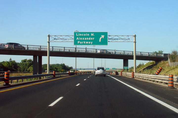
The Lincoln M. Alexander Parkway
is a short municipal expressway running along the Hamilton Mountain.
Click here for Lincoln Alexander Parkway images. |
| City of Hamilton |
Looking westerly from the Bruce Trail Pedestrian overpass towards the
interchange between the Linc and Highway 403. This interchange is
particularly interesting due to geometric constraints as it is situated
right at the top of the Hamilton Mountain.
Photo taken: May 21st, 2007. Low-res: 65kb. High-res: 180kb. |
Low-res
High-res |
| City of Hamilton |
View looking easterly towards Highway 403's mountain access from the Bruce
Trail Pedestrian overpass. Photo taken: May 21st, 2007. Low-res: 60kb.
High-res: 175kb. |
Low-res
High-res |
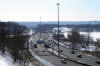
| City of Hamilton |
View looking easterly towards the start of the Mountain Access on Highway
403. Notice the newly constructed concrete barrier along the outside
of the curve along the eastbound carriageway. Concrete barriers were
constructed along several curves along the 403 through Hamilton in the Fall
of 2006.
Photo taken: November 15th, 2006. Low-res: 50kb. |
 |
| City of Hamilton |
Looking easterly along Highway 403 as the highway descends the Hamilton
Mountain. Photo taken: November 15th, 2006. Low Res: 50kb.
High Res: 235kb. |

(720x480)
(1440x960)
(2400x1600) |
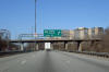
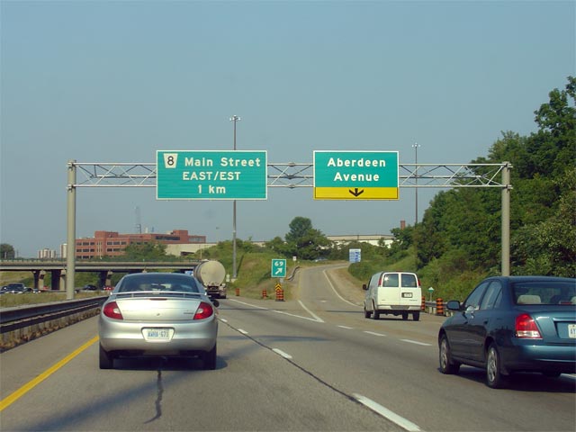
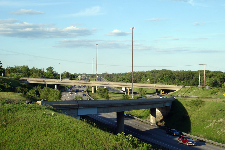
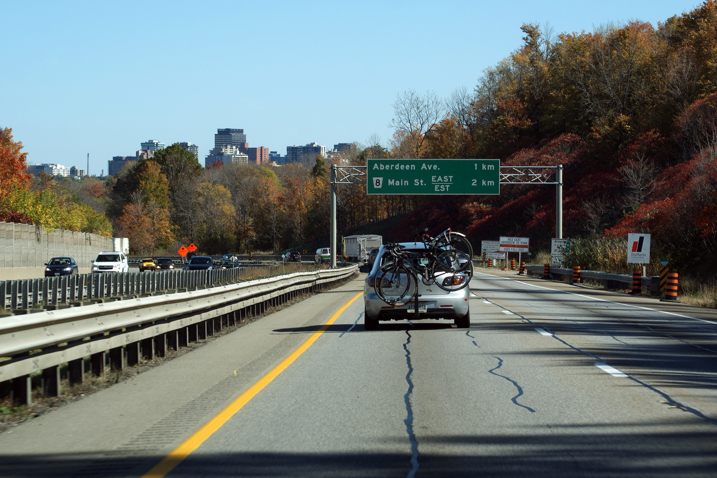
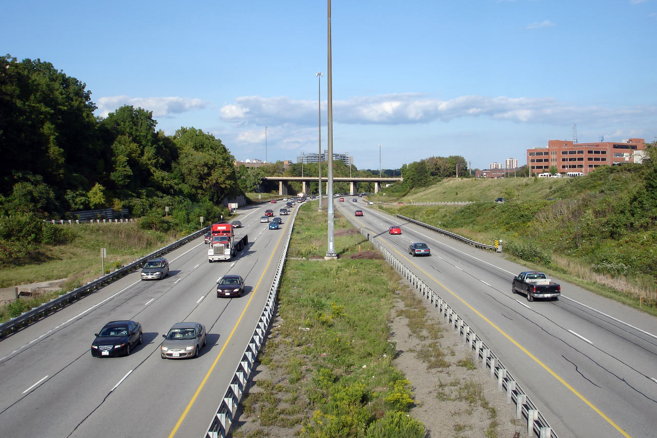
| City of Hamilton |
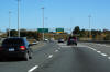
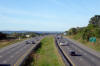
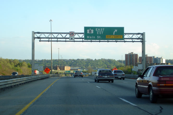
View looking easterly at the newly erected advanced signage for the Aberdeen
Avenue and Highway 8 interchanges in Hamilton. This is somewhat of a
unique sign for an Ontario freeway. Typically multiple exits are not
signed on stand-alone signage.
Photo taken: October 16th, 2010. |
 (720x480) (720x480)
(1440x960)
(2400x1600) |
| City of Hamilton |
View looking east along the 403 as the highway rounds the long curve at the
east end of the Hamilton Mountain. Photo taken: May
29th, 2007. Low-res: 100kb. High-res: 295kb. |

Low-res
High-res |
| City of Hamilton |
New partial overhead gantry in advance of the Aberdeen Avenue interchange.
Partial overhead signage is becoming more and more common along Ontario's
freeways. Note the lack of exit number (exit #69) on this sign.
Photo taken: August 1st, 2007. Low-res: 50kb. High-res: 170kb. |
Low
Res
High Res |
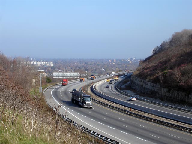
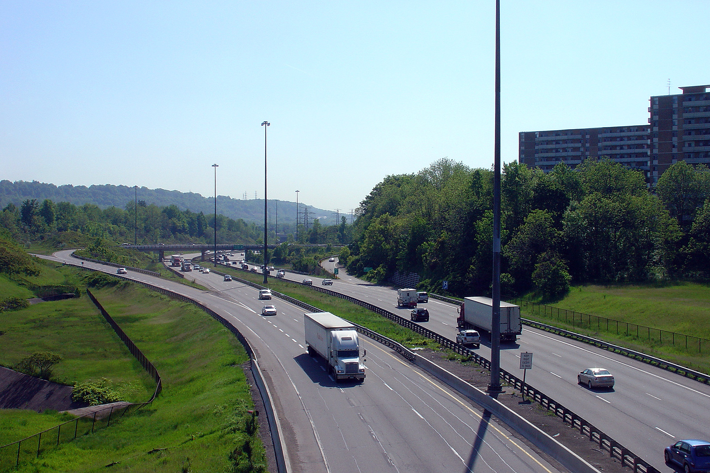
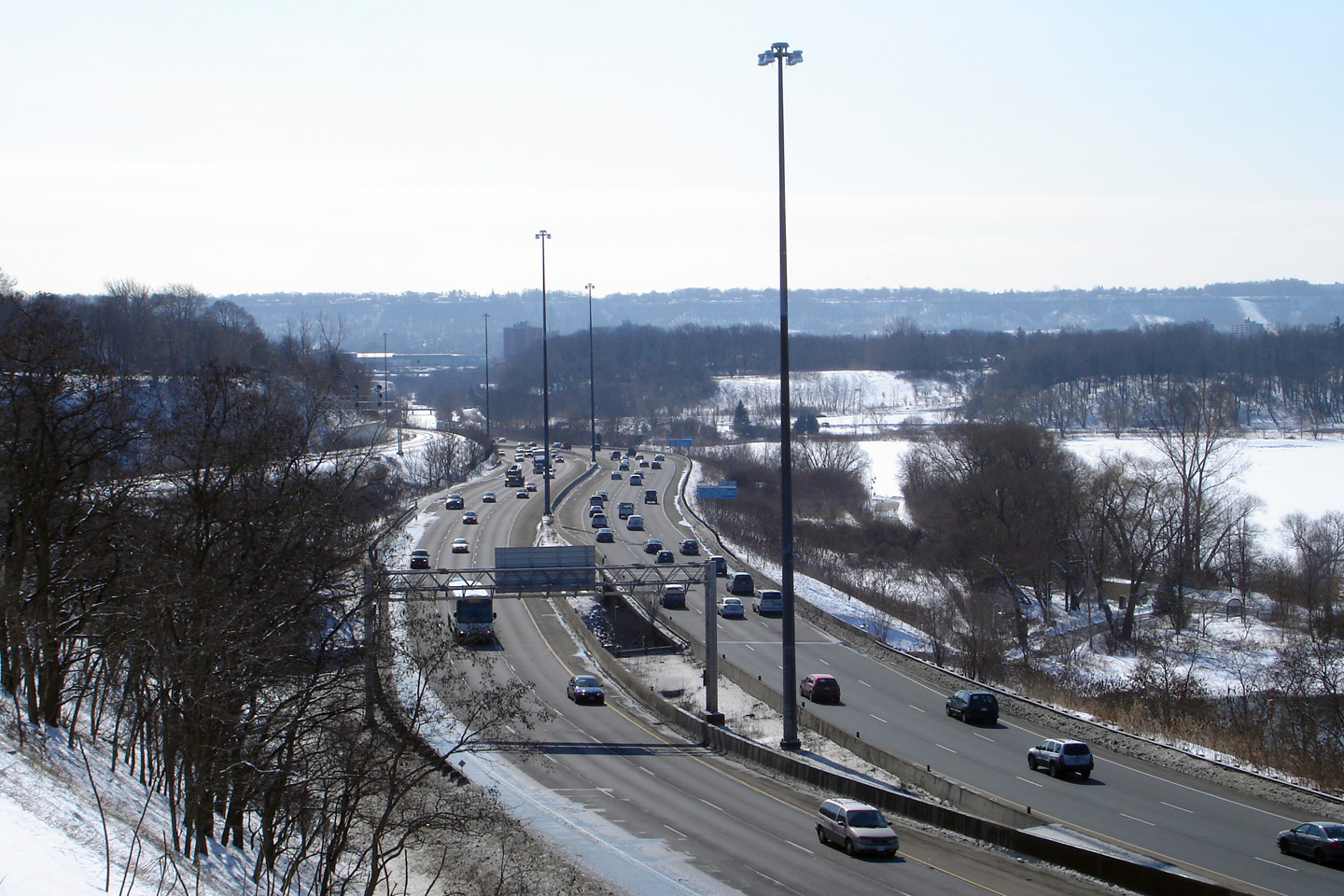
| City of Hamilton |
View looking westerly from the CP Rail marshalling yard overhead. The
Hamilton Mountain looms over the highway here, as just beyond this curve
Highway 403 begins its long 5km ascent up the hill. Photo taken: May
29th, 2007. Low-res: 55kb. High-res: 205kb. |
Low-res
High-res |
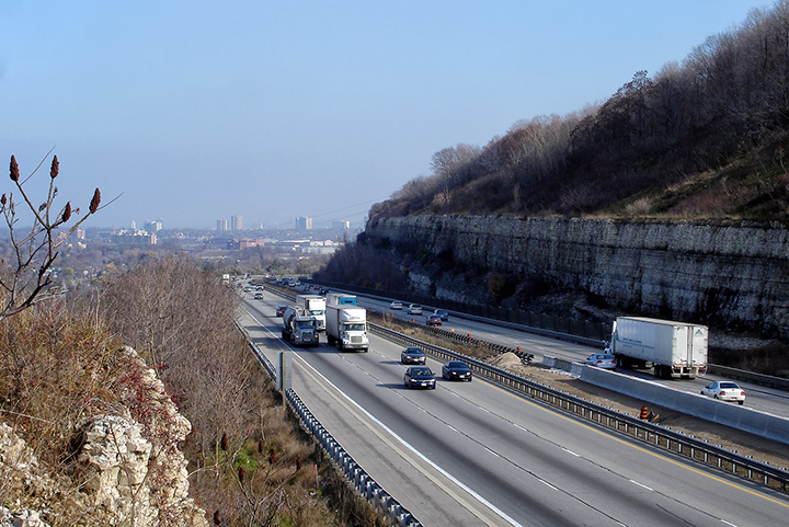
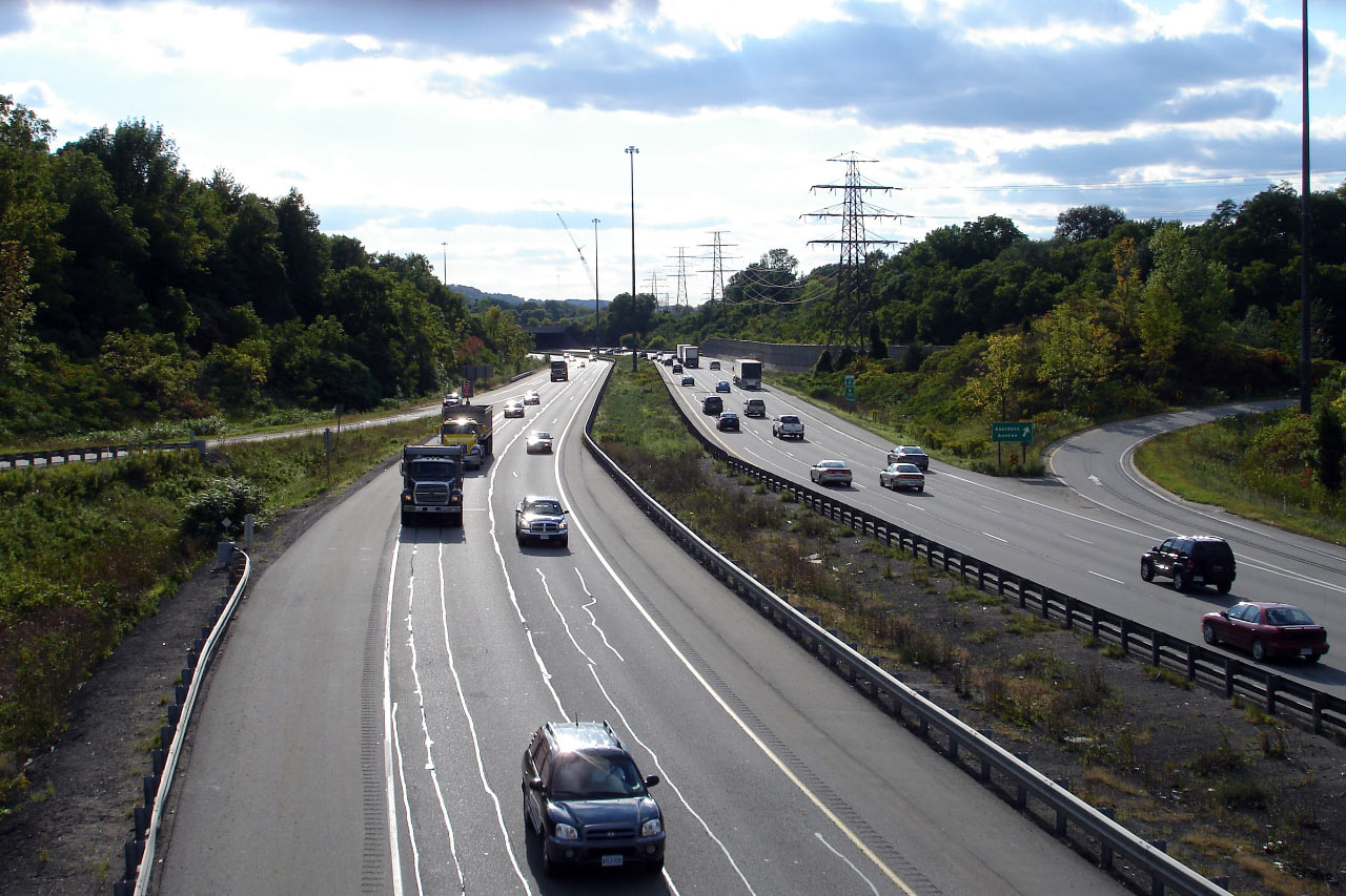
| City of Hamilton |
View looking east towards the Aberdeen Avenue interchange from the CPR
overhead. Notice these photos were taken before overhead signs were
added through Downtown Hamilton. Photo taken: May 29th, 2007.
Low-res: 50kb. High-res: 180kb. |
Low-res
High-res |
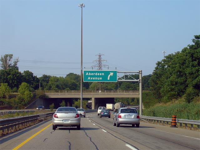
| City of Hamilton |
Overhead signage at the ramp to Aberdeen Avenue. Aberdeen ends at the
403 at a trumpet interchange. Photo taken: August 1st, 2007.
Low-res: 45kb. High-res: 140kb. |

Low
Res
High Res |
| City of Hamilton |
Looking westerly into the afternoon sun along Highway 403 from the Aberdeen
Avenue overpass in Hamilton. Just west of Aberdeen Avenue, Highway 403
begins its long trek up the escarpment. Photo taken: September 21st,
2006. Low-res: 65kb. High-res: 240kb. |

Low-res
High-res |
| City of Hamilton |
Looking east from the Aberdeen Avenue overpass. Photo taken: September 21st,
2006. Low-res: 65kb. High-res: 240kb. |
Low-res
High-res |
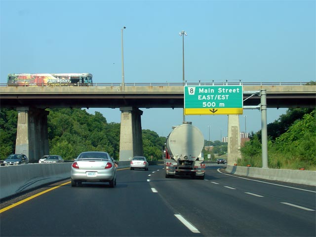
| City of Hamilton |
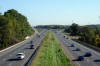
View looking easterly through the high-level Longwoods Road overpass and
another newly erected partial gantry for Main Street. Note once again
the lack of an exit tab posted on this advanced signage. Photo taken:
August 1st, 2007. Low-res: 40kb. High-res: 140kb. |
Low
Res
High Res |
| City of Hamilton |
Looking westerly from Longwoods Road. Photo taken: May 29th, 2007.
Low-res: 70kb. High-res: 195kb. |
Low-res
High-res |
| City of Hamilton |
Easterly view from Longwoods Road. Note the old advanced signage for
Highway 8. This sign was removed during the Summer of 2007.
Photo taken: May 29th, 2007.
Low-res: 85kb. High-res: 245kb. |
Low-res
High-res |
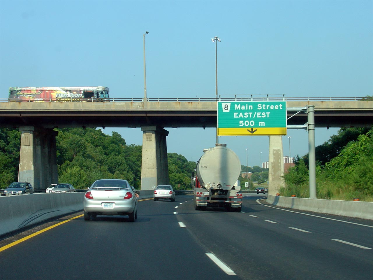
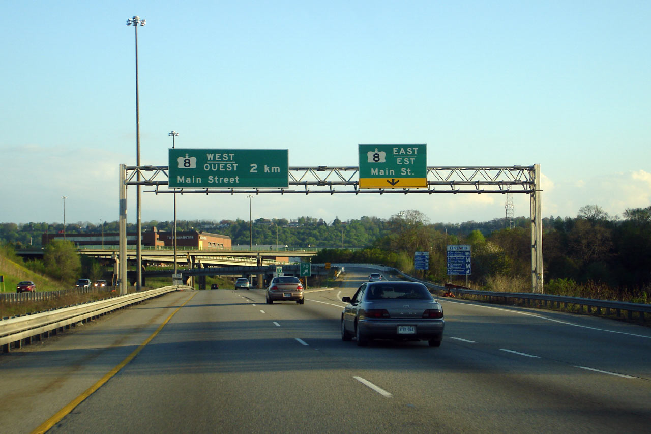
| City of Hamilton |
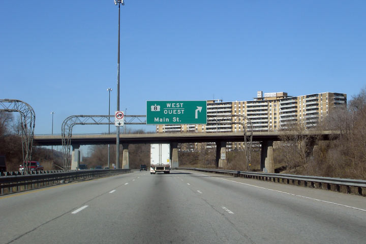
Overhead signage for the westbound ramp to Main Street West leading to
Dundas. This sign was updated in August to now show Main Street as
Hamilton Road 8. Photo taken: April 29th, 2007. Low-res: 55kb. |
 |
| City of Hamilton |
The upper sign images is a photo of the fifth and final new eastbound sign
through Hamilton. The lower sign images a photo of the former t-gantry
sign for Main Street. Upper photo taken: August 1st, 2007. Low-res: 40kb.
High-res: 135kb. Lower photo taken: April 29th, 2007. Low-res: 55kb. |
 Low
Res Low
Res
High Res
 |
| City of Hamilton |
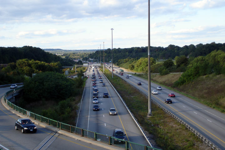
View looking westerly along Highway 403 from the Main Street overpass.
Through Downtown Hamilton, Highway 403 runs through the narrow Chedoke
Valley. Photo taken: September 21st, 2006. Low-res: 50kb.
High-res: 225kb. |
Low-res
High-res |
|
Highway 8 is Hamilton's major
east-west arterial.
Click here for Highway 8 images. |
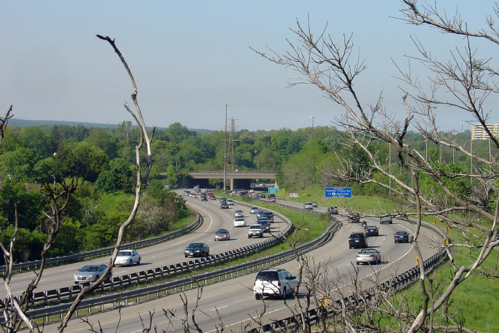
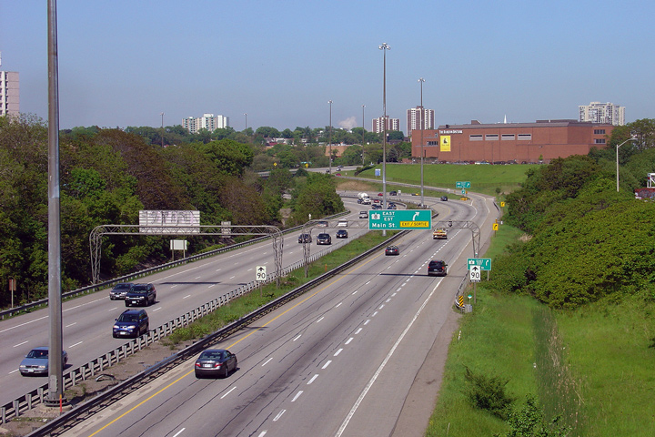
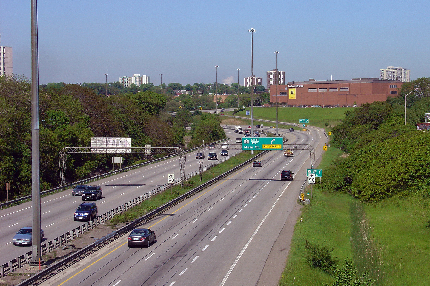
| City of Hamilton |
View looking easterly from the Main Street overpass. The three-level
interchange between Highway 2/8 and Highway 403 was completed in 1965.
It was only the fourth 3-level interchange to be completed in Ontario.
Photo taken: September 21st, 2006. Low Res: 60kb. High Res:
270kb. |
Low-res
High-res |
| City of Hamilton |
Looking east from the King Street overpass. The
high-speed directional ramp between the westbound freeway and King Street is visible
heading underneath the Main Street overpass. Photo taken: September 21st, 2006.
Low-res: 65kb. High-res: 185kb. |

Low-res
High-res |
| City of Hamilton |
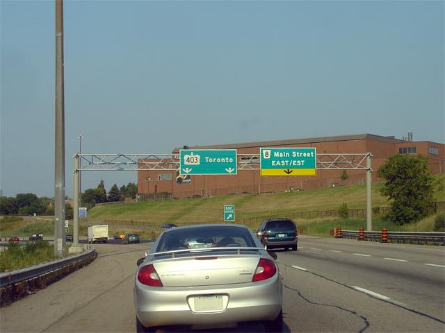
Overhead signage for the ramp to Main Street from the westbound 403. Photo
taken: April 29th, 2007. Low-res: 55kb. High-res: 150kb. |
Low
Res
High Res |
| City of Hamilton |
Overhead advanced sign for Main Street. Photo taken: April 29th, 2007.
Low-res: 50kb. |
 |
| City of Hamilton |
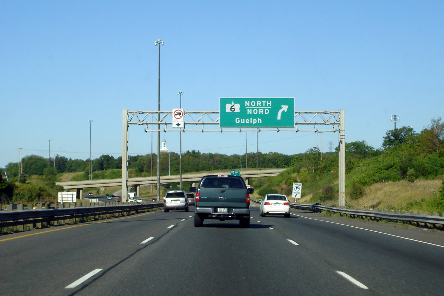
Unique signage in advance of Highway 6 North. Photo taken: September 21st,
2006. Low-res: 85kb. |
 |
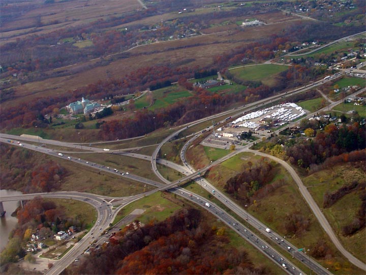
| City of Hamilton |
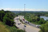
Two view looking westerly along Highway 403 across the Desjardins Canal.
The eastbound carriageway utilizes the original Loongwoods Road structure
over the canal. This structure was completed in the early 1930s to
carry Highway 2 traffic. Upper photo taken: February 28th, 2007. Low Res: 60kb. High Res:
280kb.
Lower photo taken: June 29th, 2007. Low-res: 90kb. High-res:
265kb. |
Low-res
High-res
Low-res
High-res |
| City of Hamilton |
Looking easterly along Highway 403 towards the York Road interchange.
Before Highway 6 was rerouted away from Downtown, this interchange carried
Highway 6 traffic between Highway 403 and Downtown.
Photo taken: February 28th, 2007. Low Res: 65kb. High Res:
315kb. |
Low-res
High-res |
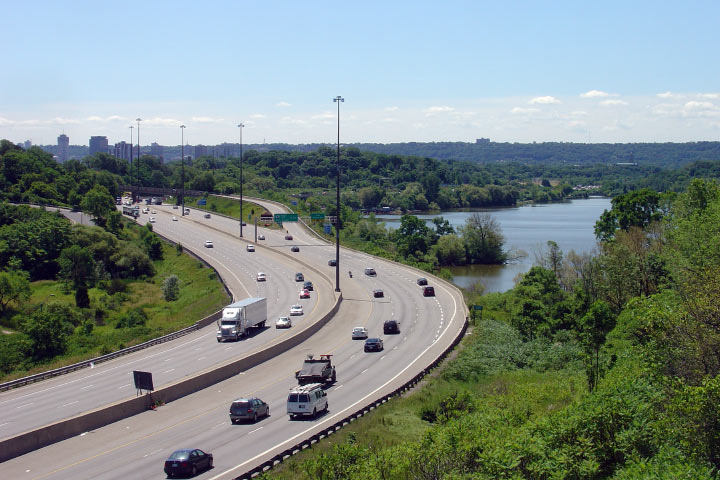
| City of Hamilton |
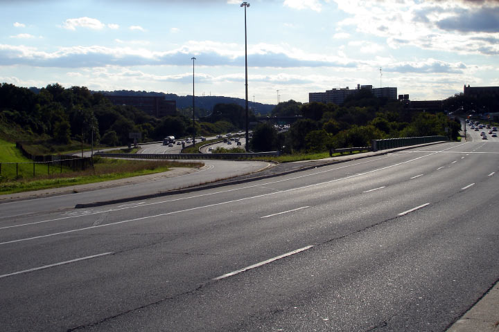
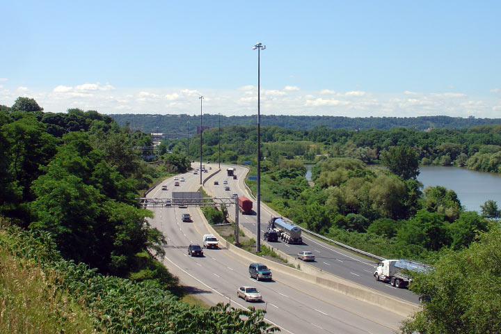
This scenic view looks west along the 403 from the CN overpass towards
Cootes Paradise. Photo taken: June 29th, 2007. Low-res: 90kb. High-res: 245kb. |

Low-res
High-res |
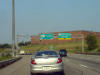
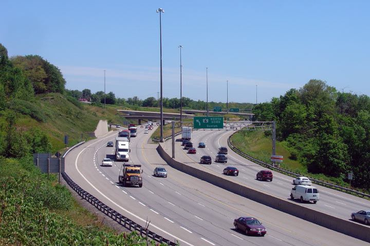
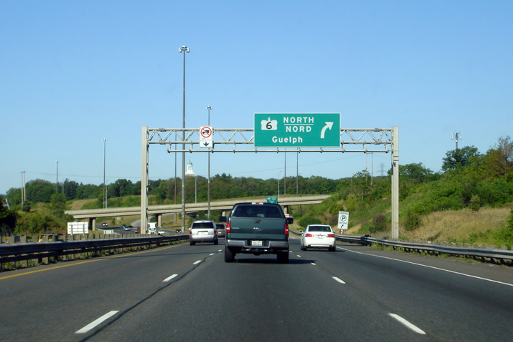
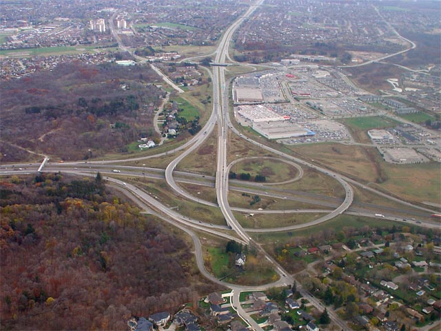
| City of Hamilton |
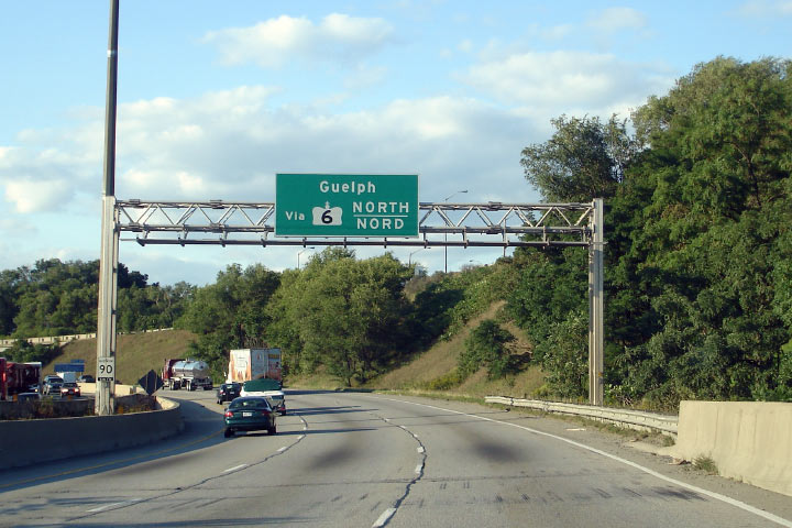
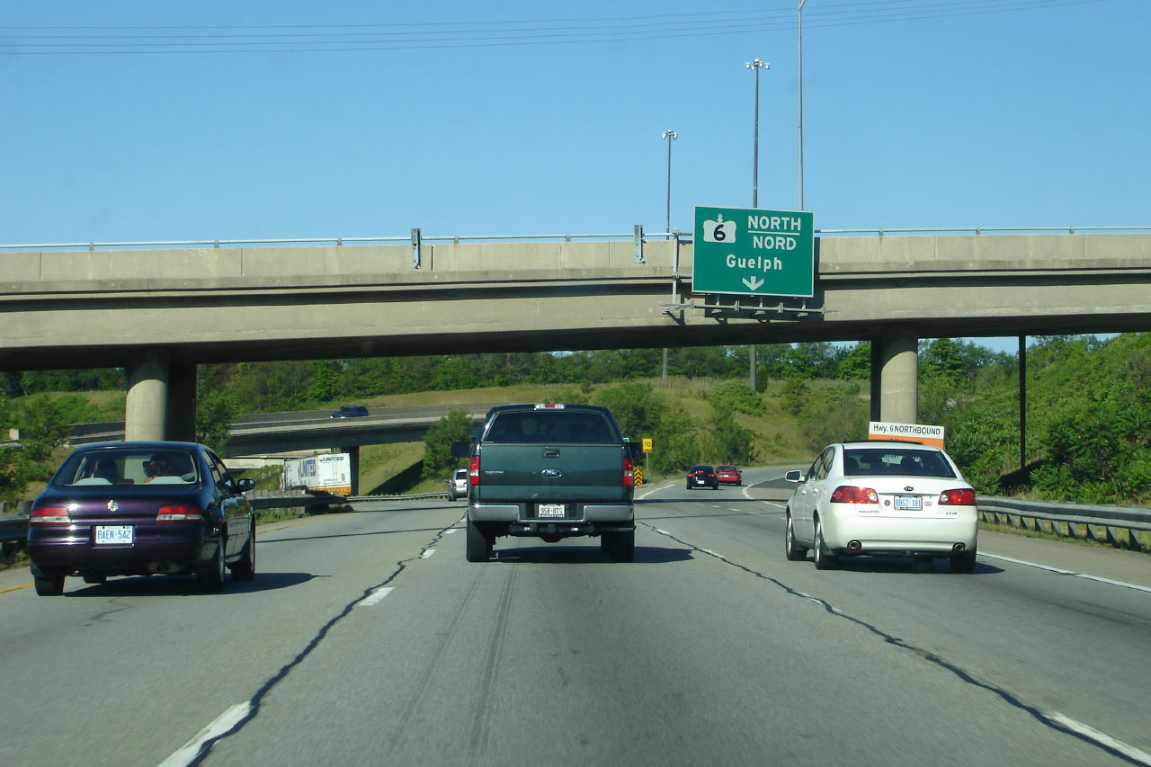
Eastbound diagram sign for Highway 6 to Guelph. Photo taken: September 21st,
2006. Low-res: 70kb. |
 |
| City of Hamilton |
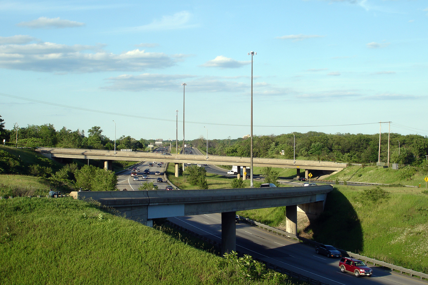
Two views looking east towards the Highway 6-North interchange. I took
a lot of photos of this directional t interchange. Upper photo taken: June 29th, 2007. Low-res:
75kb. High-res: 225kb. Lower photo taken: June 29th, 2007. Low-res:
70kb. High-res: 205kb. |

Low-res
High-res
Low-res
High-res |
| City of Hamilton |
Westerly view taken right at the 6/403 interchange. Photo taken: June 6th,
2007. Low-res: 45kb. High-res: 120kb. |
Low-res
High-res |
|
North of the 403, Highway 6
heads to Guelph and eventually Espanola.
Click here for Highway 6 images. |
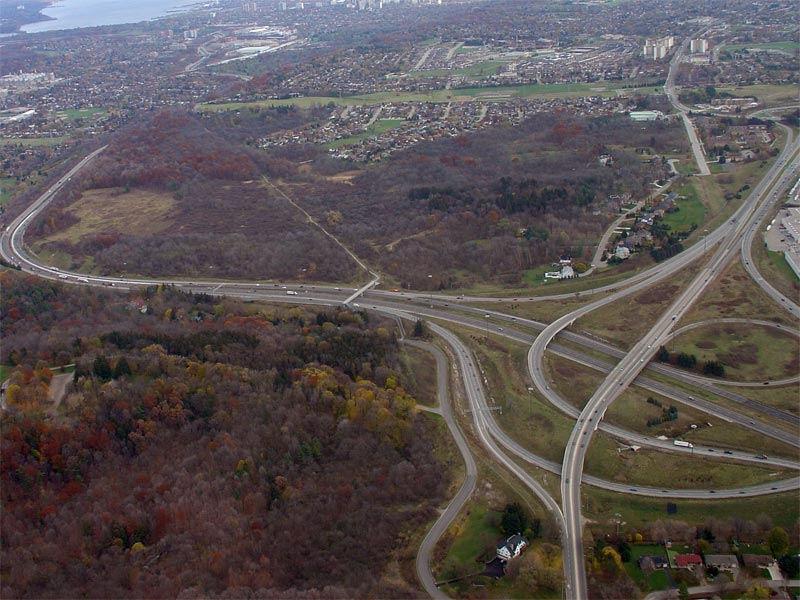
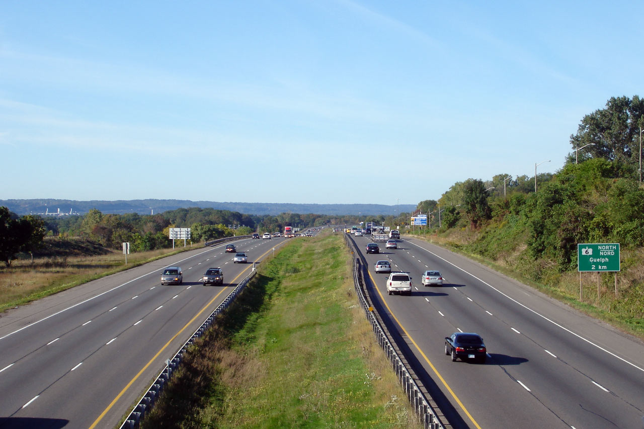
| City of Hamilton |
Looking east along the 403 from Highway 6-North. Photo taken: June 6th,
2007. Low-res: 75kb. High-res: 215kb. |
Low-res
High-res |
| City of Burlington Regional
Municipality of Halton |
The Highway 6 interchange as viewed from the Plains Road overpass. The
original Burlington 403/QEW interchange was very similar to this
interchange.
Photo taken: September 25th, 2006. Low-res: 60kb. High-res:
185kb. |
Low-res
High-res |
| City of Burlington Regional
Municipality of Halton |
This view looks east from Plains Road.
Photo taken: September 25th, 2006. Low-res: 60kb. High-res:
165kb. |
Low-res
High-res |
| City of Burlington Regional
Municipality of Halton |
Final overhead signage for the ramp to Highway 6-North. Note the lack
of exit taper -- this type of ramp design was common during the 1960s, when
this interchange was constructed. Photo taken: July 12th, 2007.
Low-res: 55kb. High-res: 155kb. |
 Low
Res Low
Res
High Res |
| City of Burlington Regional
Municipality of Halton |
Overhead advanced signage for Highway 6-North. Photo taken: July 12th,
2007. Low-res: 55kb. |
 Low
Res Low
Res
High Res |
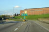
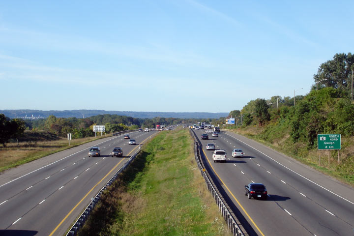
| City of Burlington Regional
Municipality of Halton |
The Highway 6-South exit is found in Ancaster, 13km from the Highway 6-North
interchange. Photo taken: July 12th, 2007. Low-res: 45kb. |
 |
| City of Burlington Regional
Municipality of Halton |
Advanced signage is not commonly placed at the 2km interval in Ontario.
Photo taken: July 21st, 2007. Low-res: 50kb. |
 |
| City of Burlington Regional
Municipality of Halton |
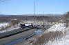
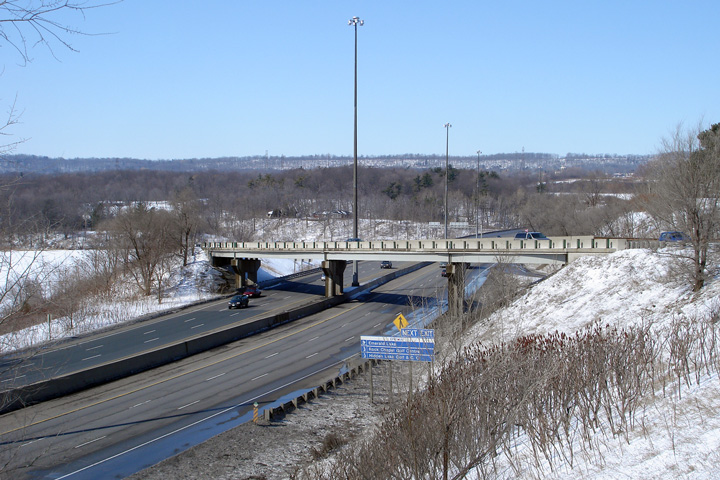
View looking west from the Lemonville Road overpass. Note the
different carriageway elevations.
Photo taken: September 25th, 2006. Low-res: 60kb. High-res:
180kb. |
Low-res
High-res |
| City of Burlington Regional
Municipality of Halton |
Easterly view towards Waterdown Road from Lemonville Road.
Photo taken: September 25th, 2006. Low-res: 70kb. High-res:
200kb. |
Low-res
High-res |
| City of Burlington Regional
Municipality of Halton |
Looking west from the Waterdown Road overpass.
Photo taken: September 25th, 2006. Low-res: 65kb. High-res:
190kb. |

Low-res
High-res |
| City of Burlington Regional
Municipality of Halton |
Easterly view from Waterdown Road.
Photo taken: September 25th, 2006. Low-res: 65kb. High-res:
200kb. |

Low-res
High-res |
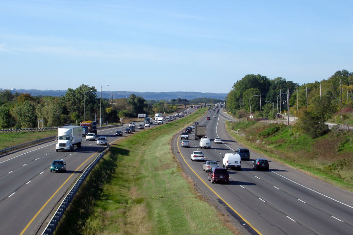
| City of Burlington Regional
Municipality of Halton |
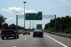
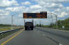
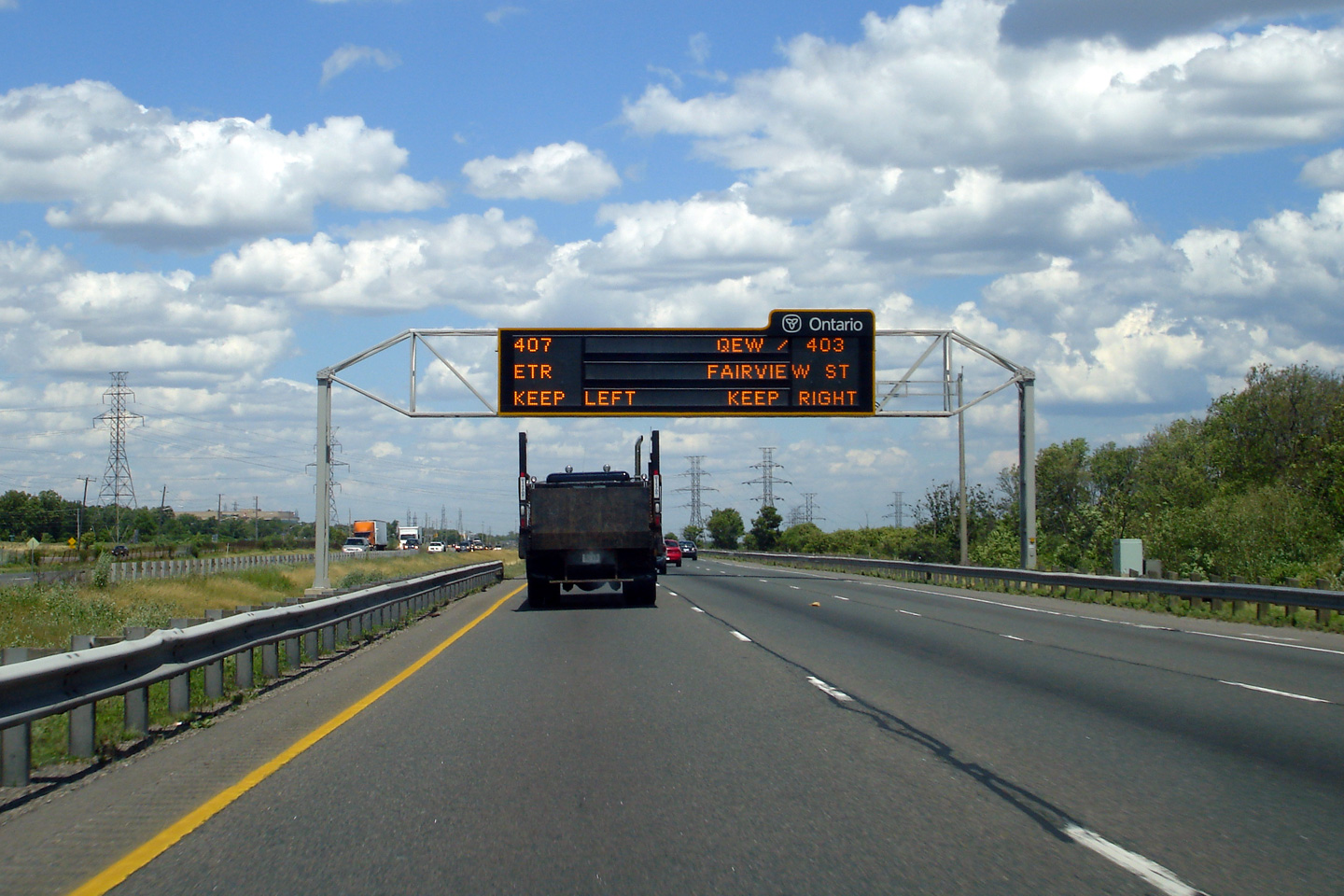
Changeable message sign approaching the Freeman interchange along the 403.
Typically this sign informs travelers of the chronic congestion that plagues
the QEW through Burlington and Oakville. Photo taken: July 12th, 2007.
Low-res: 65kb. |
 Low
Res Low
Res
High Res |
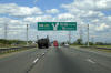
| City of Burlington Regional
Municipality of Halton |
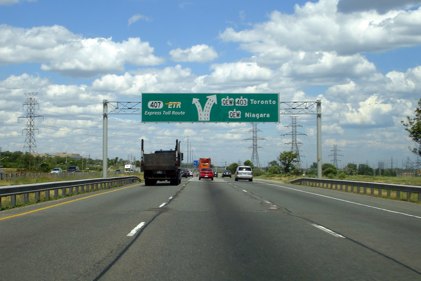
Diagram sign in advance of the interchange. Photo taken: July 12th, 2007.
Low-res: 60kb. |
 Low
Res Low
Res
High Res |
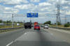
| City of Burlington Regional
Municipality of Halton |
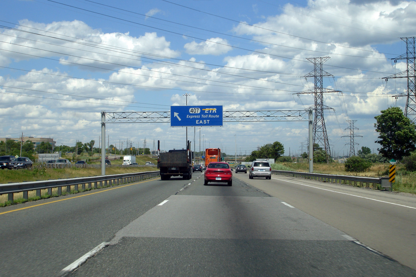
Highway 407 departs from the left side of Highway 403. Photo taken: July
12th, 2007. Low-res: 70kb. |
 Low
Res Low
Res
High Res |
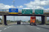
| City of Burlington Regional
Municipality of Halton |
Crooked overhead signs affixed to the King Road overpass. Photo taken:
July 12th, 2007. Low-res: 65kb. |
 Low
Res Low
Res
High Res |
| City of Burlington Regional
Municipality of Halton |
This view looks west from the King Road overpass. Photo taken: June 29th, 2007. Low-res: 65kb. High-res: 245kb. |

Low-res
High-res |
| City of Burlington Regional
Municipality of Halton |
View looking west towards the Freeman interchange from King Road. Photo taken: June 29th, 2007. Low-res: 65kb. High-res: 245kb. |
Low-res
High-res |
|
Highway
407 begins its trek easterly from the Freeman interchange.
Click here for Highway 407 images. |
| City of Burlington Regional
Municipality of Halton |
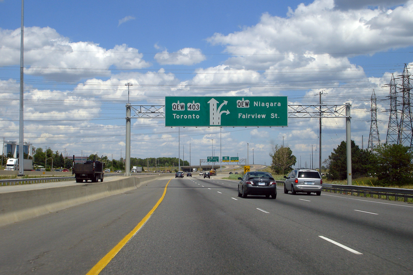
The second eastbound diagram sign approaching the QEW in Burlington.
The left two lanes continue easterly towards Toronto. Photo taken: July
12th, 2007. Low-res: 65kb. |
 Low
Res Low
Res
High Res |
| City of Burlington Regional
Municipality of Halton |
Looking east from the North Service Road once again towards the Freeman
interchange. Photo taken: June 29th, 2007. Low-res: 65kb. High-res:
190kb. |

Low-res
High-res |
| City of Burlington Regional
Municipality of Halton |
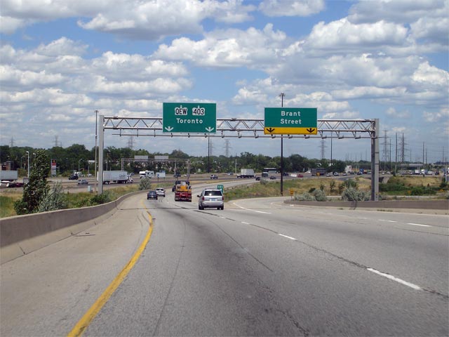
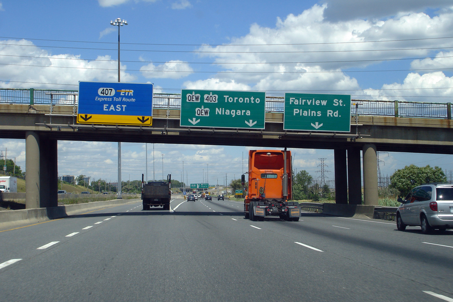
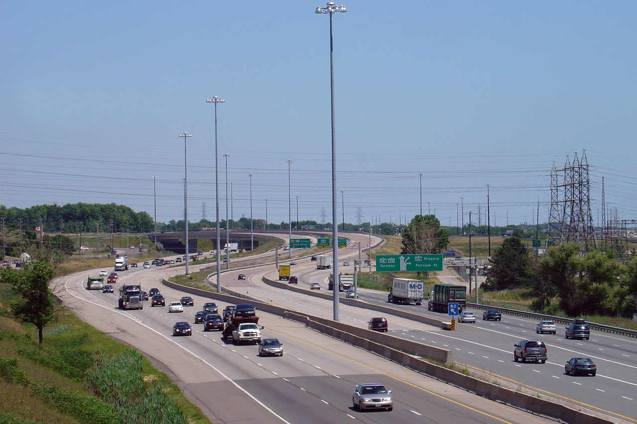
Overhead guide signs at the eastbound QEW/403 interchange. Because of
the large footprint of the Freeman interchange, it encompasses two other
smaller more local interchanges, hence the references to both Fairview and
Brant Streets on the overhead signage.
Photo taken: July 12th, 2007. Low-res: 50kb. |
 |
|
The Queen Elizabeth Way extends
from Fort Erie to Toronto.
Click
here for QEW images. |
| City of Burlington Regional
Municipality of Halton |
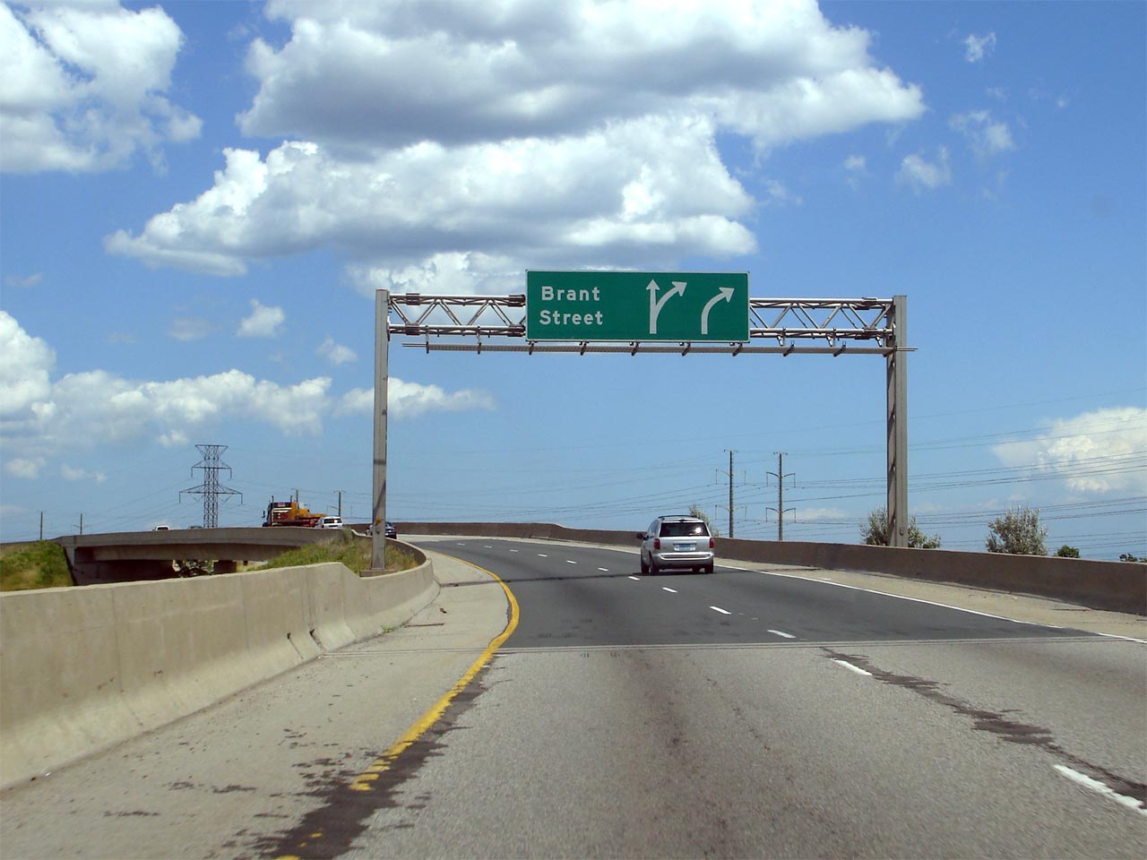
The eastbound advanced sign for the Brant Street exit is located along the
high-speed flyover ramp onto the Toronto-bound QEW. The Brant Street
interchange was completed in 1992/93 as part of the Freeman interchange
reconstruction.
Photo taken: July 12th, 2007. Low-res: 40kb. High-res: 125kb. |
Low
Res
High Res |
| City of Burlington Regional
Municipality of Halton |
Drivers perspective looking eastbound at the signage and off-ramp for the
Brant Street interchange. Note (especially visible in the
high-resolution image) the exit number for Brant Street is 101. 101
corresponds with the QEW's mileage from Fort Erie even though
Brant Street is only accessible from the 403. Brant Street is roughly
82km from the 403's western terminus in Woodstock.
Photo taken: July 12th, 2007. Low-res: 50kb. High-res: 175kb. |
Low
Res
High Res |
|
Click here for
Burlington to Oakville Images |


 (720x480)
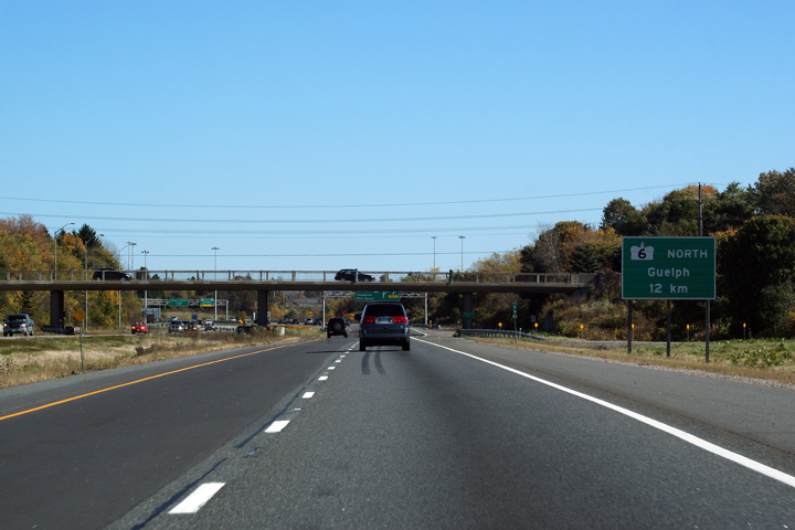 (720x480)
 (720x480)
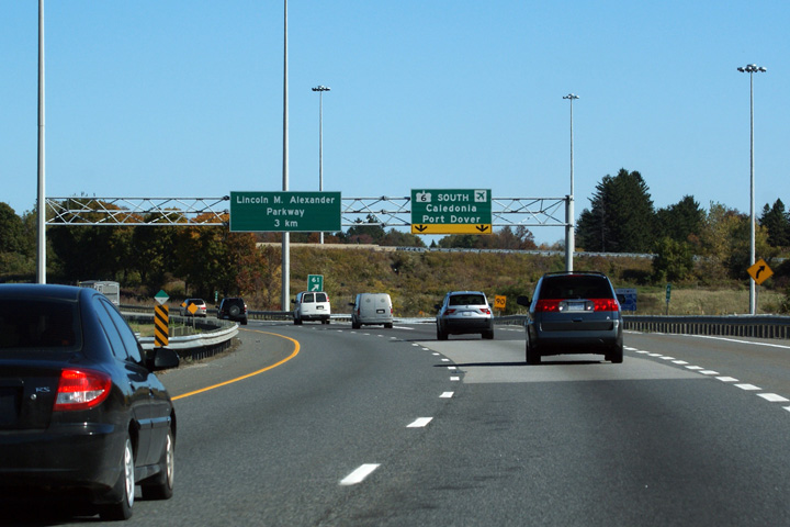 (720x480)
 Low
Res
Low
Res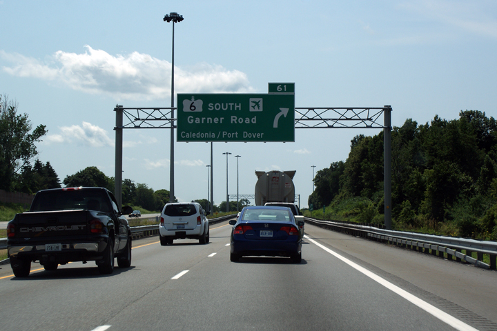 Low
Res
Low
Res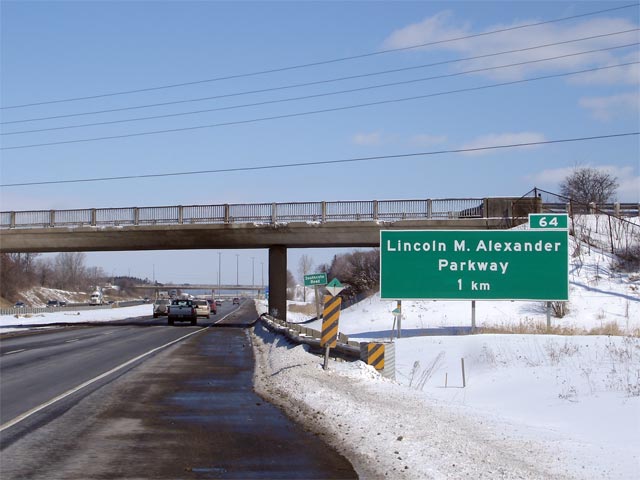


 (720x480)


 Low
Res
Low
Res


 Low
Res
Low
Res Low
Res
Low
Res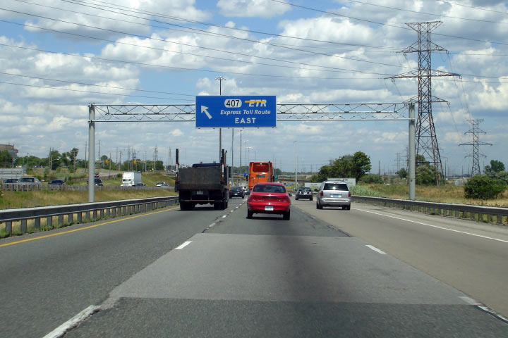 Low
Res
Low
Res Low
Res
Low
Res

 Low
Res
Low
Res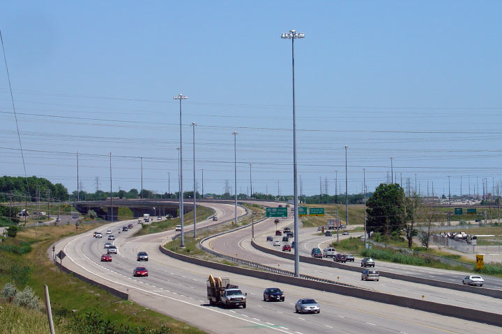

