AsphaltPlanet.ca > OntHighways > QEW > Images > Page 3
Queen Elizabeth Way - Images
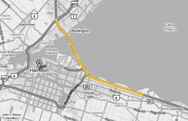
<- Page 2 Page 3 - Stoney Creek to Burlington Page 4 ->
Photos shown in this table are arranged from South (Fort Erie) to North (Toronto):
| Proper Municipality Name | Photo Description | Photo | ||
|
Photos taken from driver's perspective appear offset from centre-line Photos: |
Toronto- Bound |
Fort Erie- Bound |
||
| Continued from St Catharines to Hamilton Images | ||||
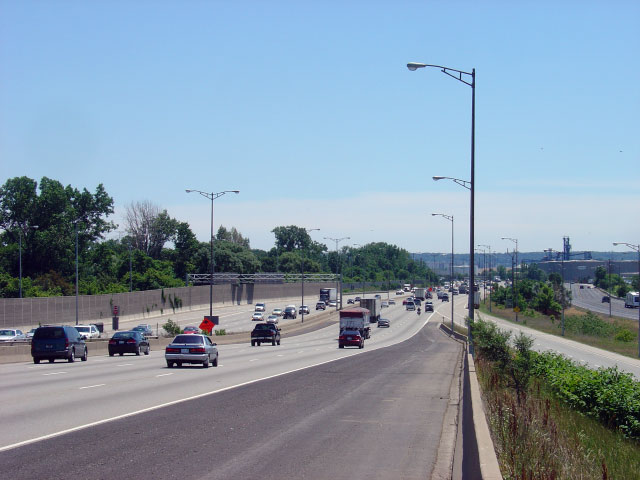
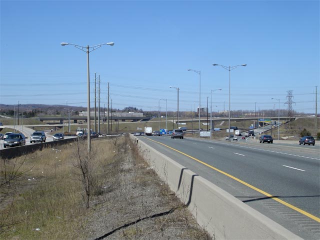
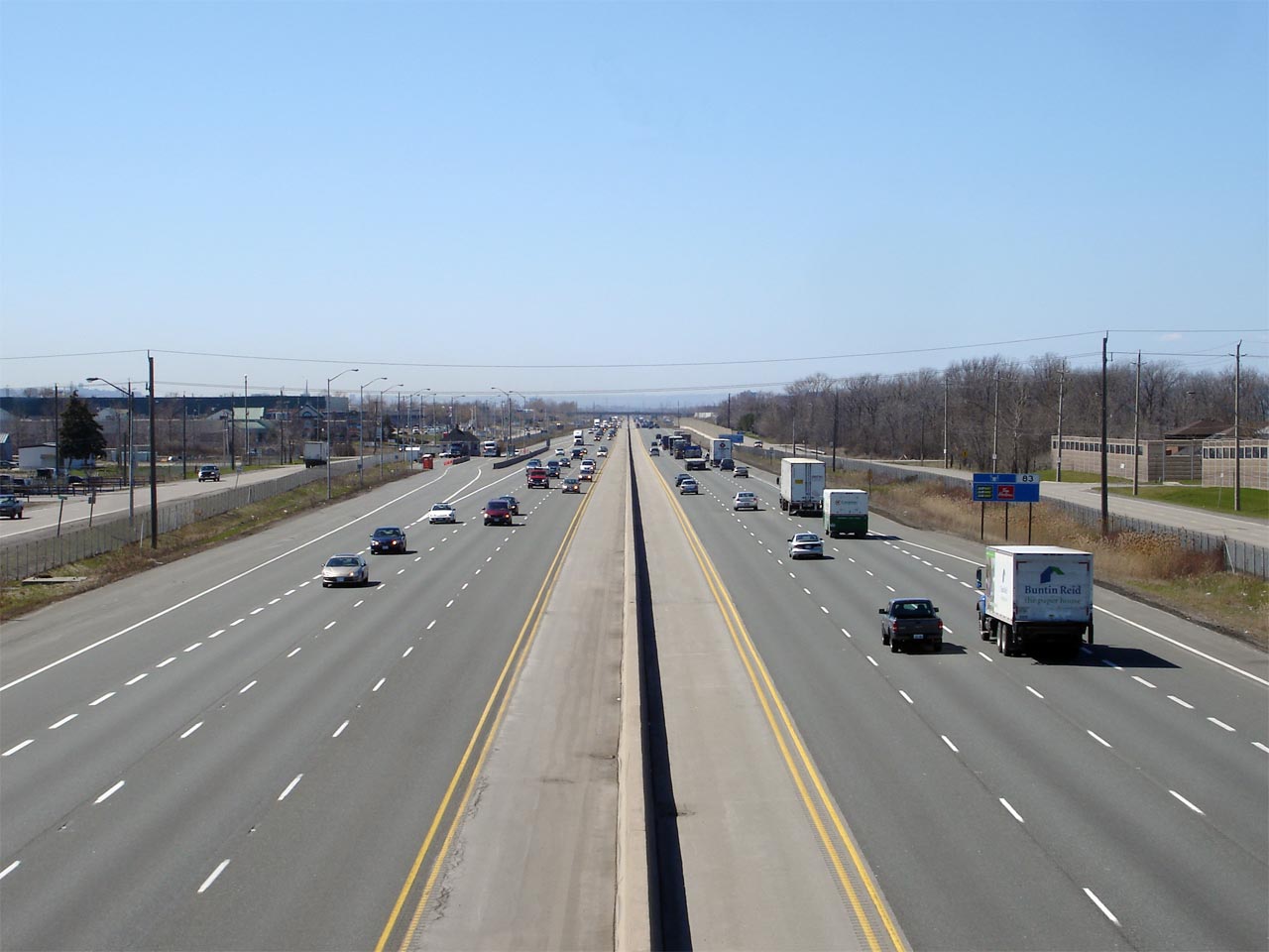
| City of Hamilton |
Looking towards Hamilton and Toronto from the Fifty Road overpass.
Fifty Road is located roughly at kilometer marker 78.
Click here to jump to the opposing view from
the Fifty Road overpass found on Images Page 2. Photo taken: May 8th, 2005. |
 (720x480) (1440x960) |
||
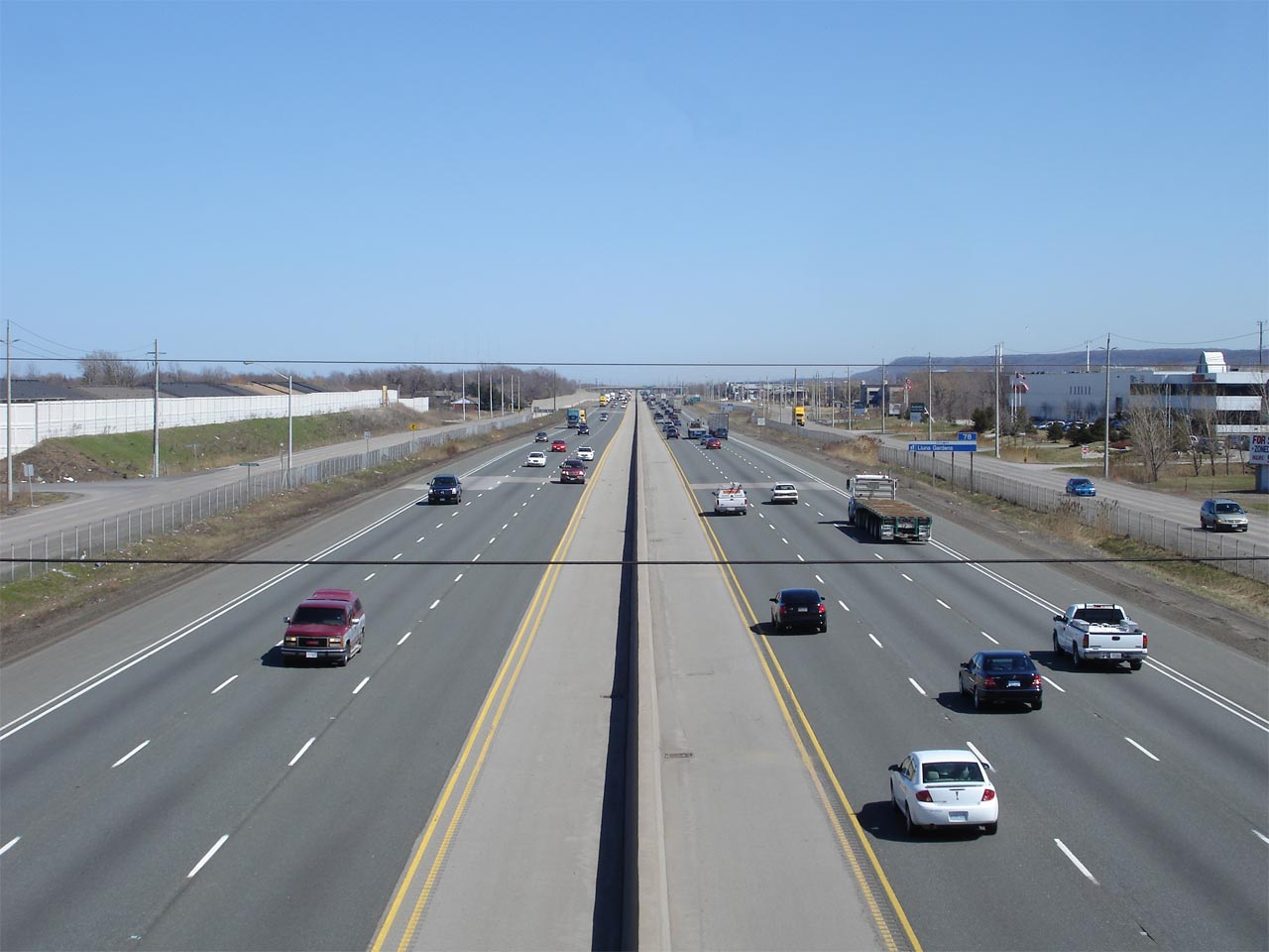
| City of Hamilton |
Looking Niagara-bound (east) along the QEW from the Winona Road overpass.
Given the QEW's modern 6-lane cross section, it is hard to fathom that until
the late 1960s the QEW featured many at-grade intersections.
Specifically, Winona Road was not grade-separated until 1969. Photo taken: April 19th, 2007. |
 (720x480) (1440x960) |
||
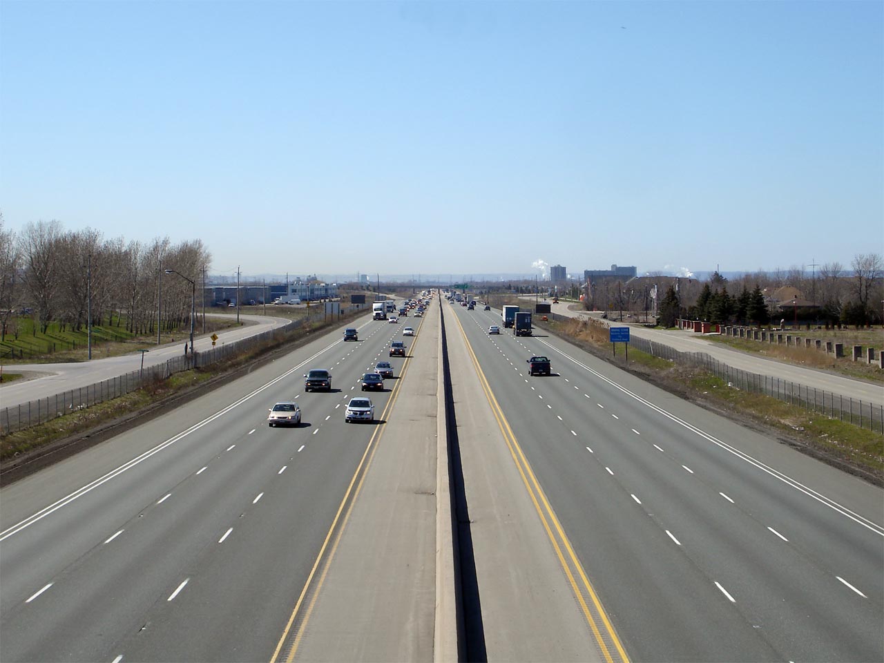
| City of Hamilton |
Looking westerly (Toronto-bound) along the QEW from the Winona Road
overpass. A truck inspection station is pictured on the south side of
the highway. Photo taken: April 19th, 2007. |
 (720x480) (1440x960) |
||
| City of Hamilton |
Niagara-bound view of the QEW from the Glover Road overpass. Glover
Road is located at roughly kilometre marker 81. Photo taken: April 19th, 2007. |
 (720x480) (1440x960) |
||
| City of Hamilton |
Opposing view of the QEW from the Glover Road overpass. Photo taken: April 19th, 2007. |
 (720x480) (1440x960) |
||
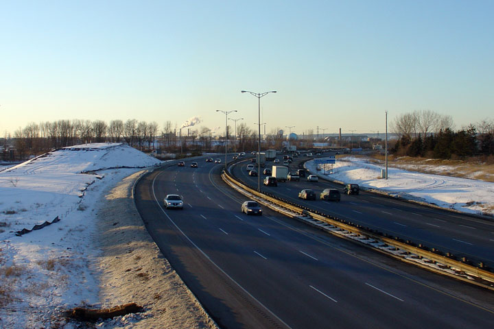
| City of Hamilton |
View looking Niagara Bound along the QEW from the Millen Bridge. Generally,
the land between St. Catharines and Hamilton would best be described as
rural countryside, with only a few small communities dotting the landscape,
however the land immediately surrounding the QEW is always
quite suburban. Photo taken: September 25th, 2006. |
 (720x480) (1440x960) |
||
| City of Hamilton |
View looking to the west in towards Hamilton from Millen Road bridge. Photo taken: September 25th, 2006. |
 (720x480) (1440x960) |
||
| City of Hamilton |
Old style changeable message sign (CMS) still referencing the now long defunct
Highway 20. Photo taken: November 23rd, 2007. |
 (720x480) (720x480)(1440x960) |
||
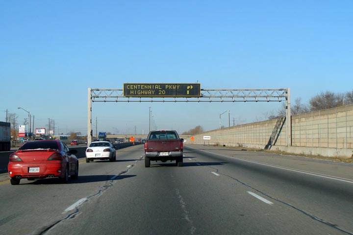
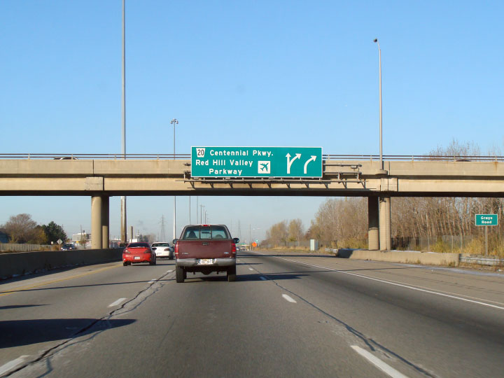
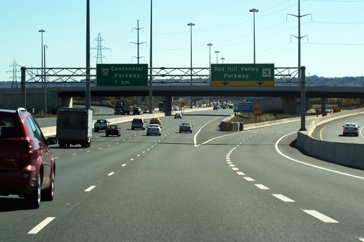
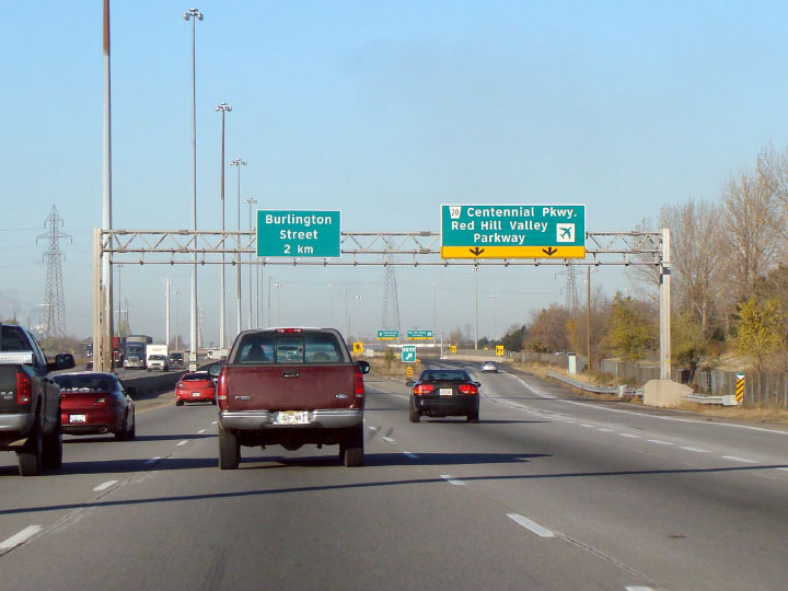
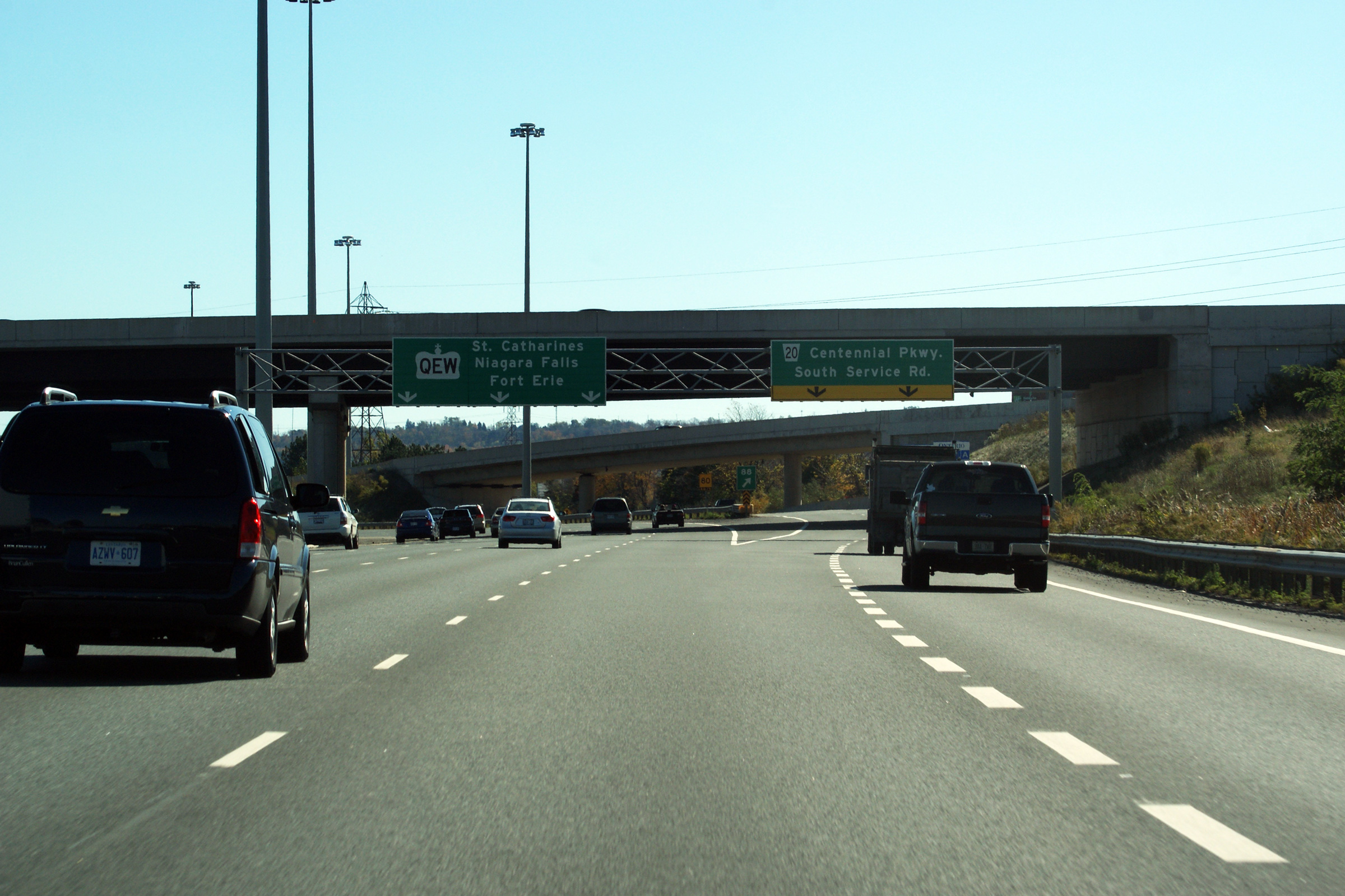
| City of Hamilton |
Overhead advanced signage mounted to the Grays Road overpass in advance of
the Centennial and Red Hill Valley Parkways. One of the problems with Ontario's municipal expressway network
is that travelers are not informed of the status of a given route by its
signage nor its designation. The lower sign refers to two parkways, the numbered route is
a conventional city street, while the other route is a freeway and part of
Hamilton's beltway. This hierarchy between freeway and arterial street
is not reflected on the pictured signage at all. Upper photo taken: September 25th, 2006. Lower photo taken: November 23rd, 2007. |
 (720x480) (720x480)(1440x960) |
||
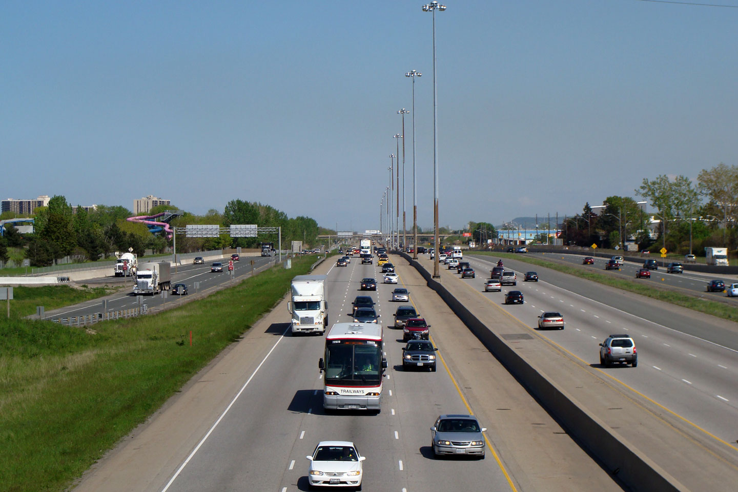
| City of Hamilton |
View looking easterly towards St. Catharines from the Grays Road overpass in
Stoney Creek. Grays Road marks is the eastern end of the QEW's
continuous freeway lighting. As of 2011, the QEW is continuously lit
from this overpass in Hamilton to Eastern Oakville, a distance of over 35km. Photo taken: September 25th, 2006. |
 (720x480) (1440x960) |
||
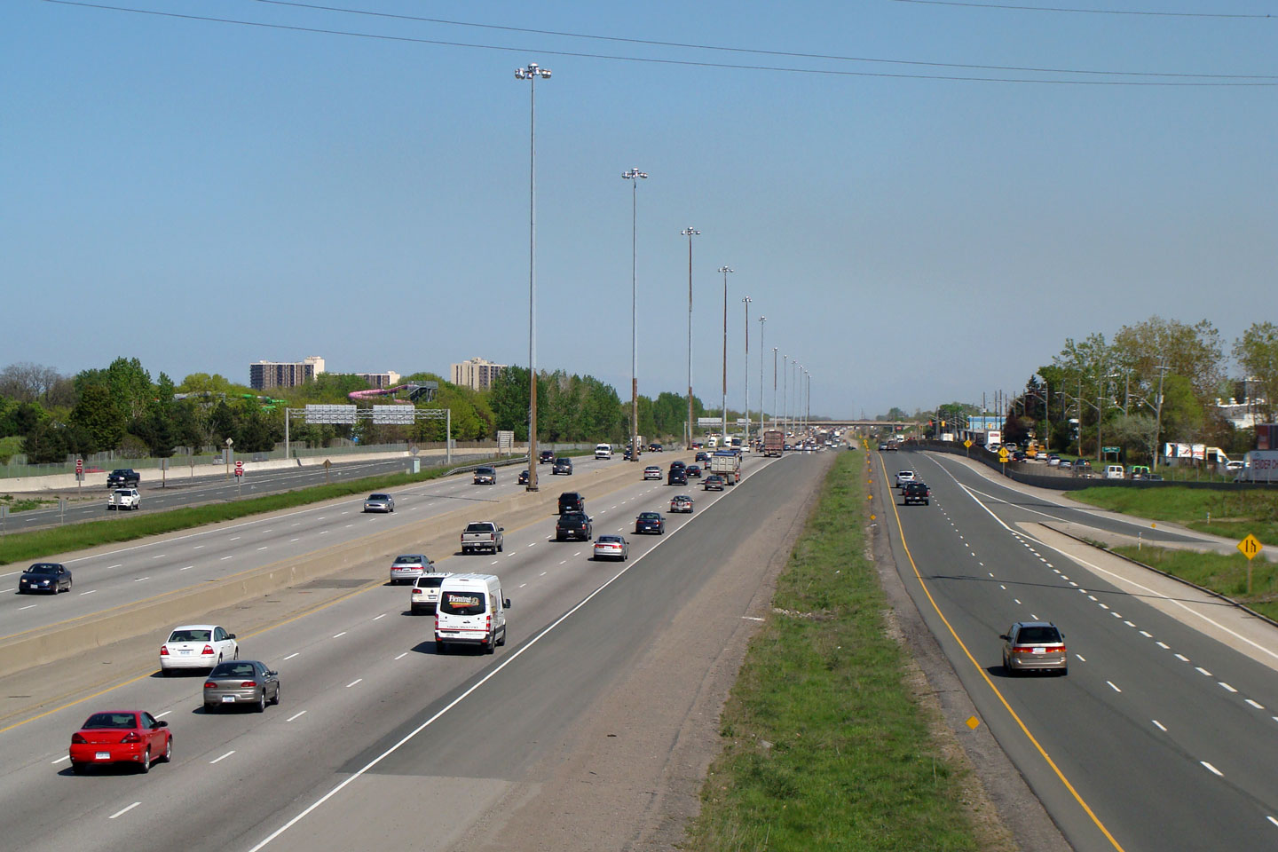
| City of Hamilton |
Westerly view of a high-mast light standard and a small section of freeway.
Really, this photo isn't very interesting, it is included out of 'complete-ness'. Photo taken: September 25th, 2006. |
 (720x480) (1440x960) |
||
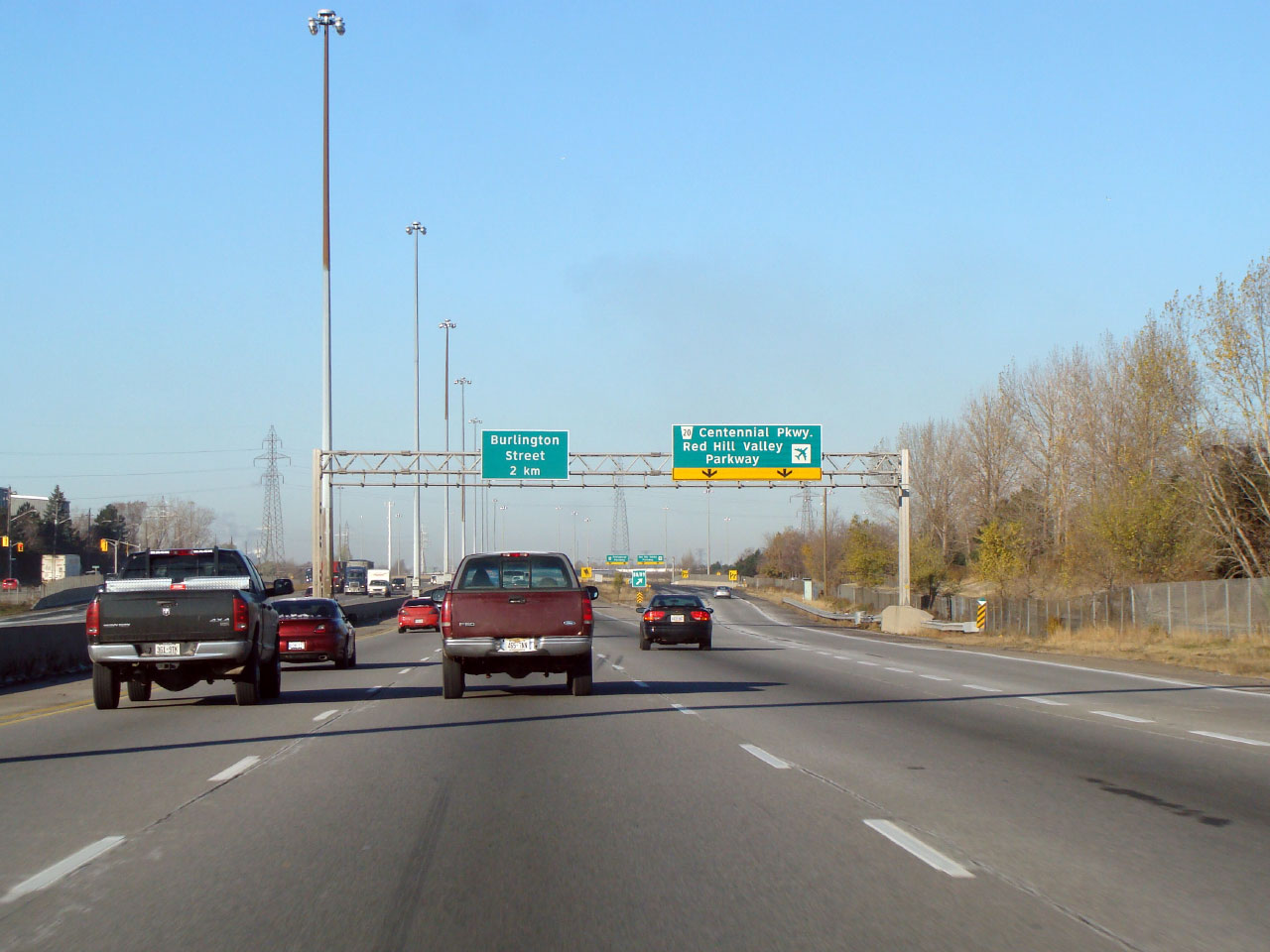
| City of Hamilton |
Two incarnations of signage. The first is for Highway 20, back when
Highway 20 still existed Hamilton. The second and lower photo shows clearview
signage for the Centennial Parkway and Red Hill Valley Parkway interchange.
This was one of the first installations of signs with clearview font on a
provincial highway in Ontario. Upper photo taken: September 25th, 2006. Lower photo taken: November 23rd, 2007. |
|
||
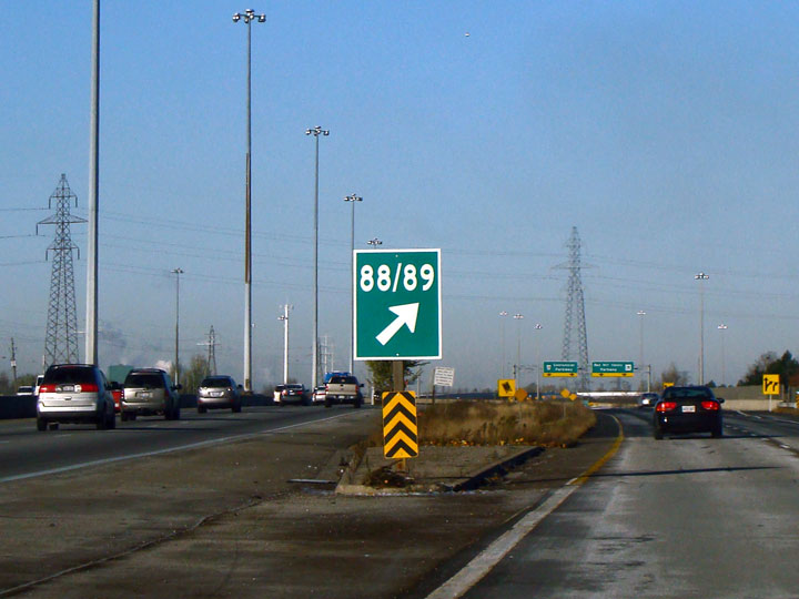
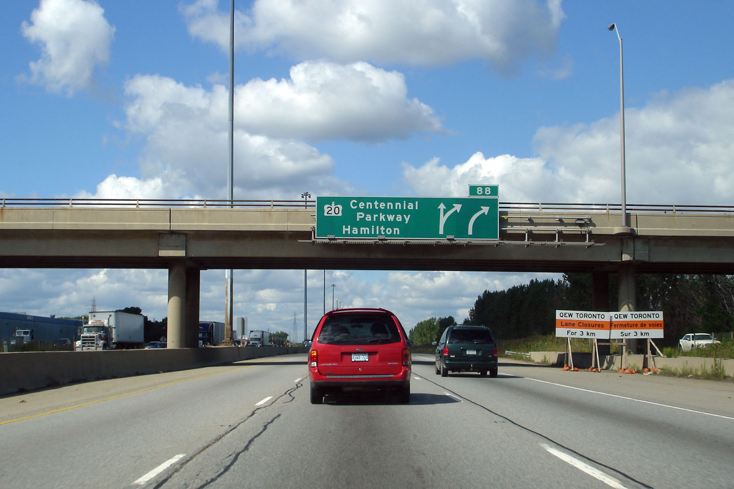
| City of Hamilton |
Unique gore signage for the Toronto-bound ramp to Centennial Parkway and the
Red Hill Valley Parkway. Centennial Parkway is exit 88 and the Red
Hill Valley Parkway is exit 89. Photo taken: November 23rd, 2007. |
 |
||
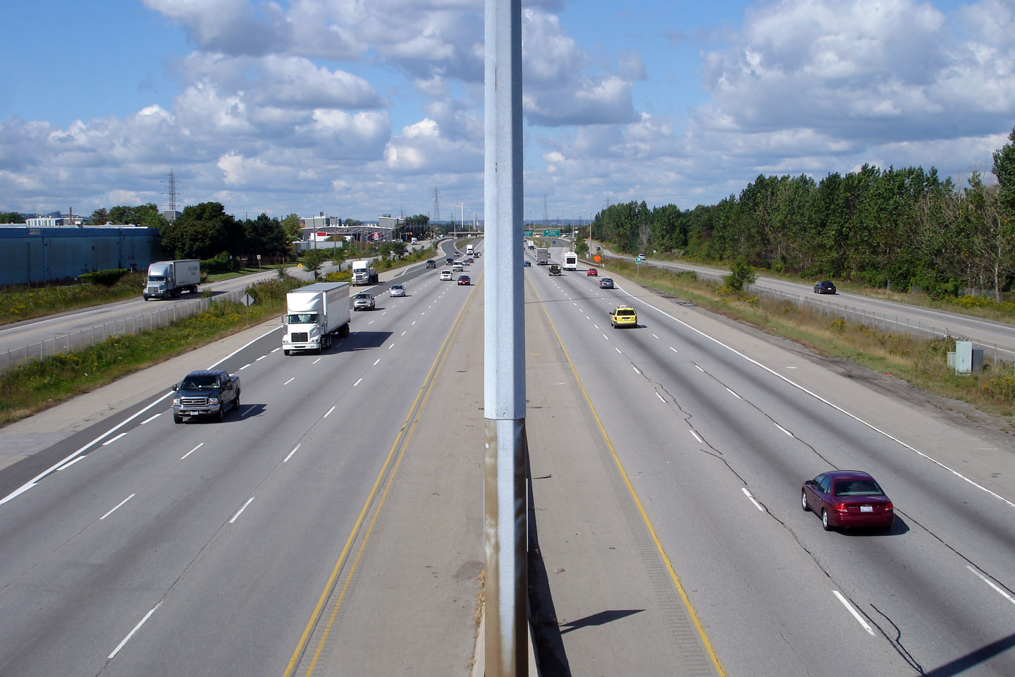
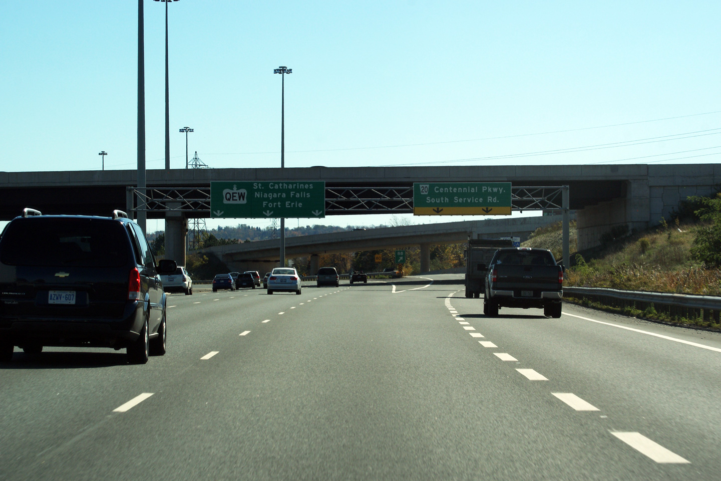
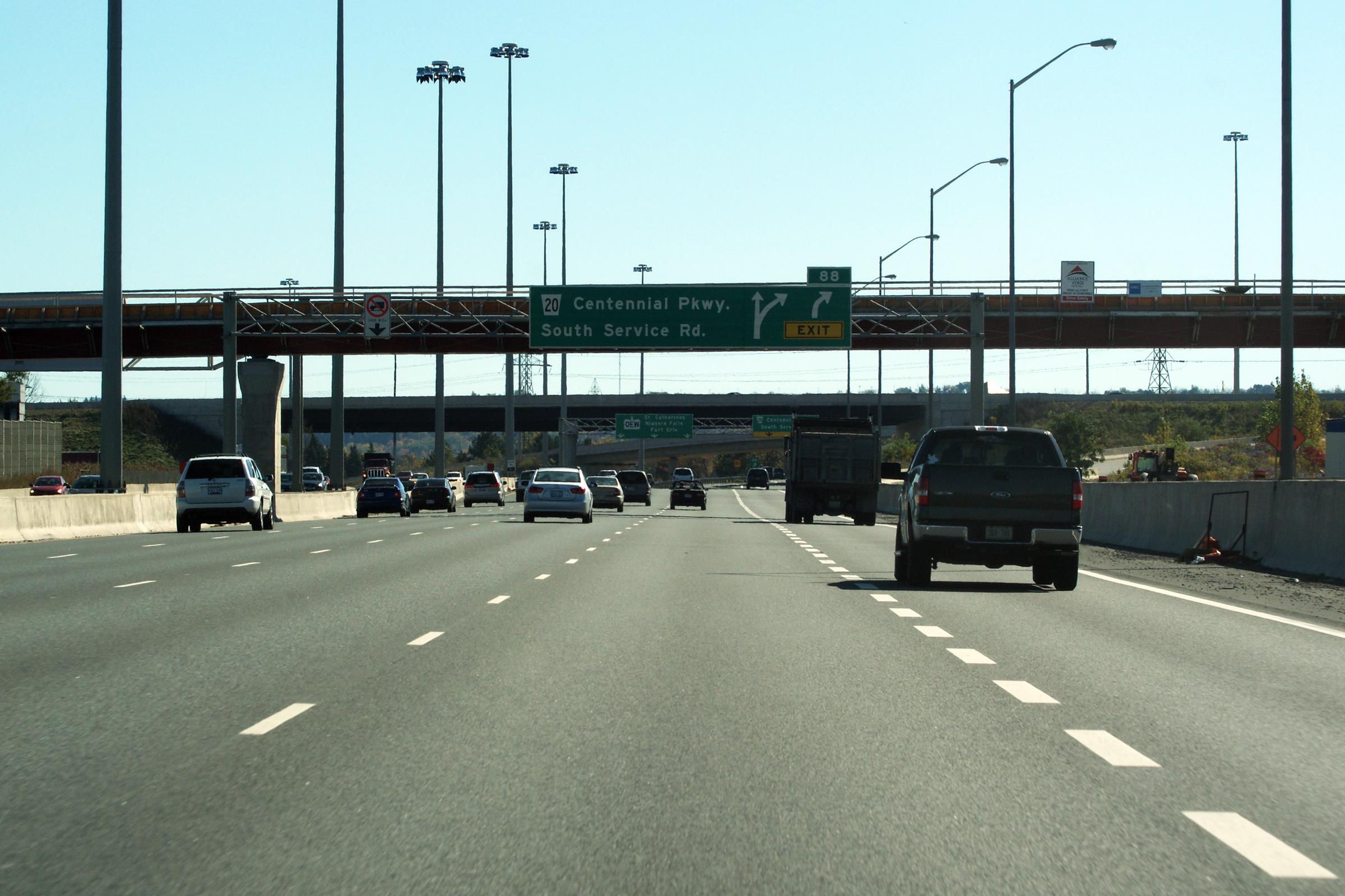
| City of Hamilton |
This photo showcases the QEW looking Fort Erie-bound (east) from the Centennial Parkway (Highway 20) overpass in Hamilton. The Highway 20 overpass is located roughly at kilometre marker 88. Note the scale of the freeway within the Highway 20 and Red Hill Valley Parkway interchange. It is often overlooked that two of Hamilton's three municipal expressways intersect the Queen Elizabeth Way within one kilomtre of one-another.
Photos taken: May 2008 |
 (720x480) (1440x960) 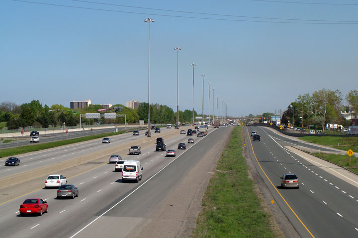 (720x480) (1440x960) |
||
| The former Highway 20 lead southeast of Hamilton into Niagara Region. Click here for Highway 20 images. | ||||
| City of Hamilton |
Two views looking westerly from the Centennial Parkway overpass. The upper photo shows the QEW before the completion of the Red Hill Valley Parkway. Advanced grading for the new Red Hill Valley structures had been completed, though work had not yet begun to widen the Queen Elizabeth Way to eight lanes through the Red Hill interchange. Observe the steel beam central median complete with truss lighting. The lower photo was taken several months after the completion of the Red Hill Valley Parkway, though some work was still underway at the neighbouring Burlington Street interchange.
Upper photo taken: February 23rd, 2005.
Lower photo taken: May 2008. |
 (720x480) (1440x960) |
||
| City of Hamilton |
This view looks towards Toronto from the Red Hill Valley Parkway.
Note all the construction activity -- during the 2008 construction
season a collector lane was added between Burlington Street and the
Red Hill Valley Parkway. Photo taken: November 23rd, 2007. |
|
||
| The Red Hill Valley Parkway is a freeway running from the QEW southerly to the Linc along the former Stoney Creek Hamilton boundary. Click here for Red Hill Valley Parkway images | ||||
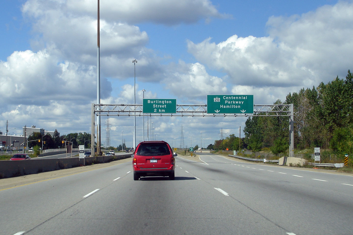
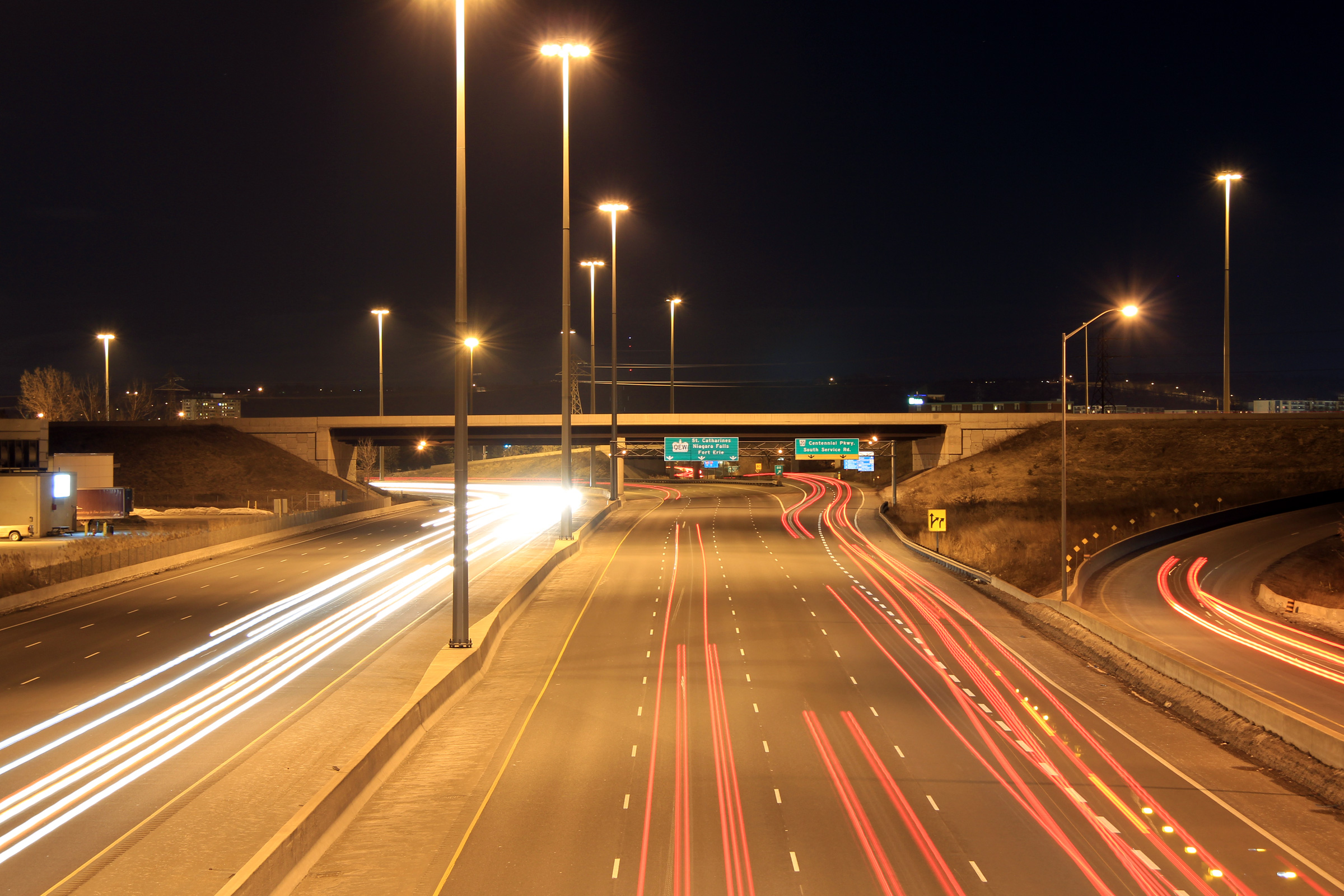
| City of Hamilton |
Green
signage for the ramp to Centennial Parkway from the Niagara-bound QEW.
The Niagara-bound QEW narrows to three lanes just beyond the Centennial
Parkway exit. The overhead signage does not reflect this, as it
should. The QEW was widened to eight lanes between Centennial
Parkway and Beach Boulevard in the Summer of 2009. Photo taken: October 16th, 2010. |
 (720
x 540) (720
x 540)(1440x960) (2400x1600) |
||
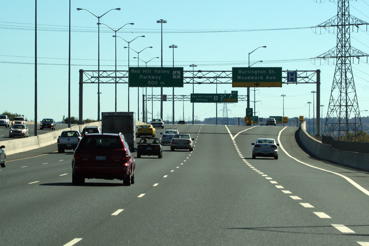
| City of Hamilton |
View looking Niagara bound along the Queen Elizabeth Way from Hamilton's new
pedestrian bridge towards the Red Hill Valley and Centennial Parkway
interchanges. Photo taken: February 19th, 2011. |
 |
||
| City of Hamilton |
Reverse view along the Queen Elizabeth Way looking towards the Burlington
Street interchange. Photo taken: February 19th, 2011. |
 |
||
| City of Hamilton |
Advanced signage for the Niagara-bound ramp to Centennial Parkway. A
new pedestrian bridge linking Hamilton to its waterfront was under
construction at the time this photo was taken. Photo taken: October 16th, 2010. |
 (720
x 540) (720
x 540)(1440x960) (2400x1600) |
||
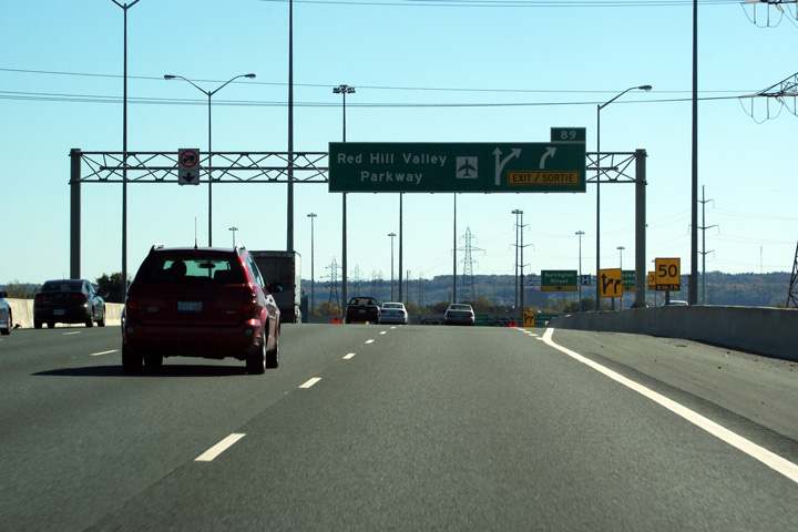
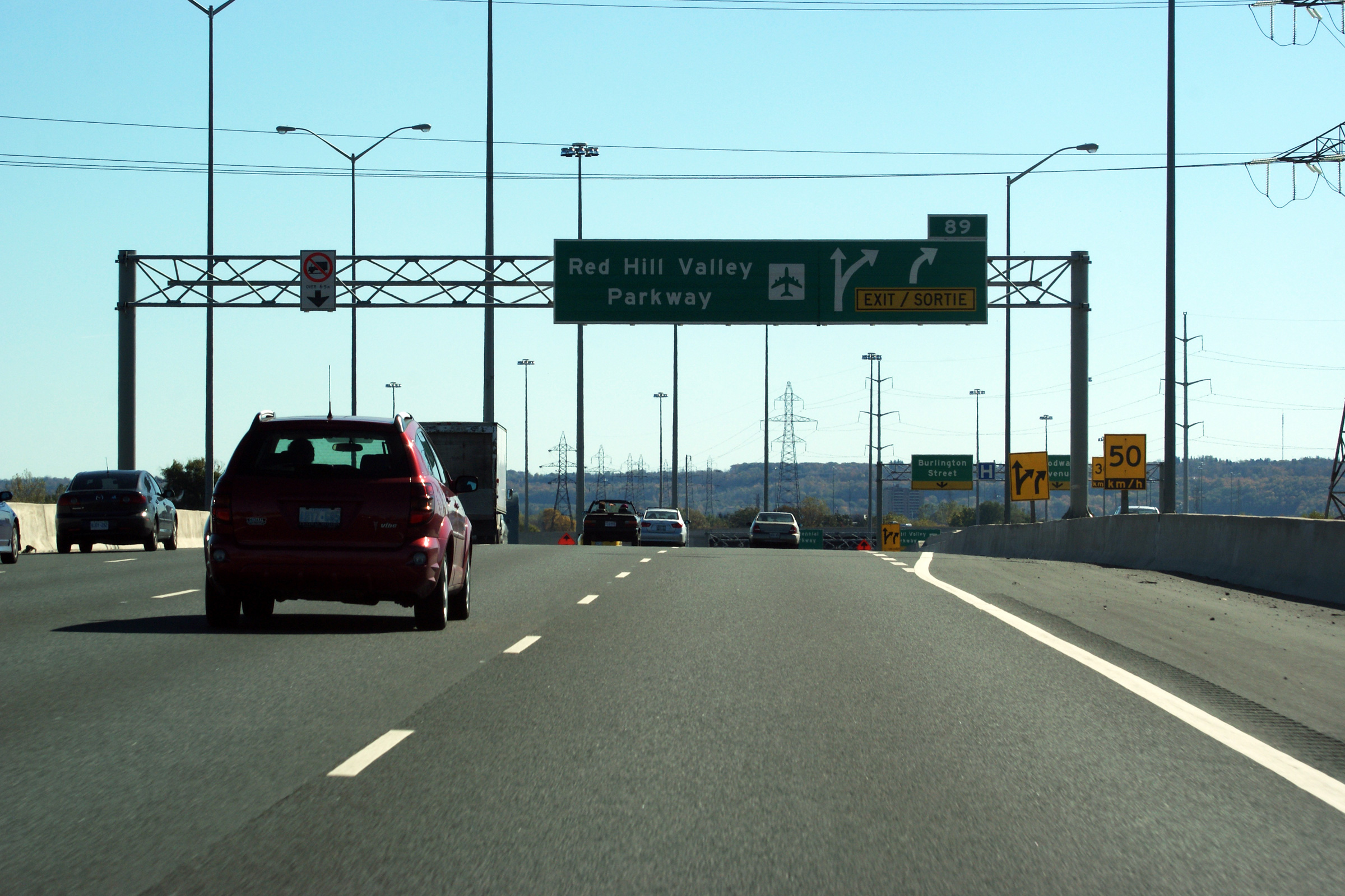
| City of Hamilton |
Signage
for the Niagara-bound exit to the Red Hill Valley Parkway. The exit
for the Red Hill departs the QEW just before the on-ramps from Burlington Street join
the freeway; this setup creates a unique collector-express like highway for a
short distance. Photo taken: October 16th, 2010. |
 (720
x 540) (720
x 540)(1440x960) (2400x1600) |
||
| City of Hamilton |
Overhead advanced signage for the Niagara-bound Red Hill Valley Parkway
interchange. Photo taken: October 16th, 2010. |
 (720
x 540) (720
x 540)(1440x960) (2400x1600) |
||
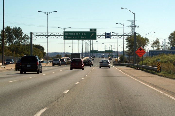
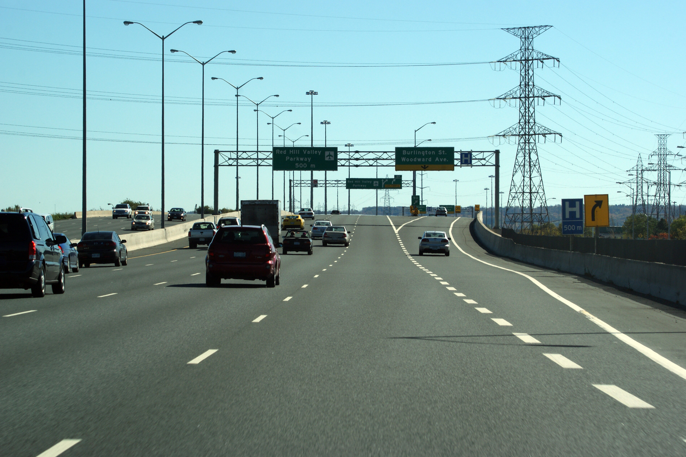
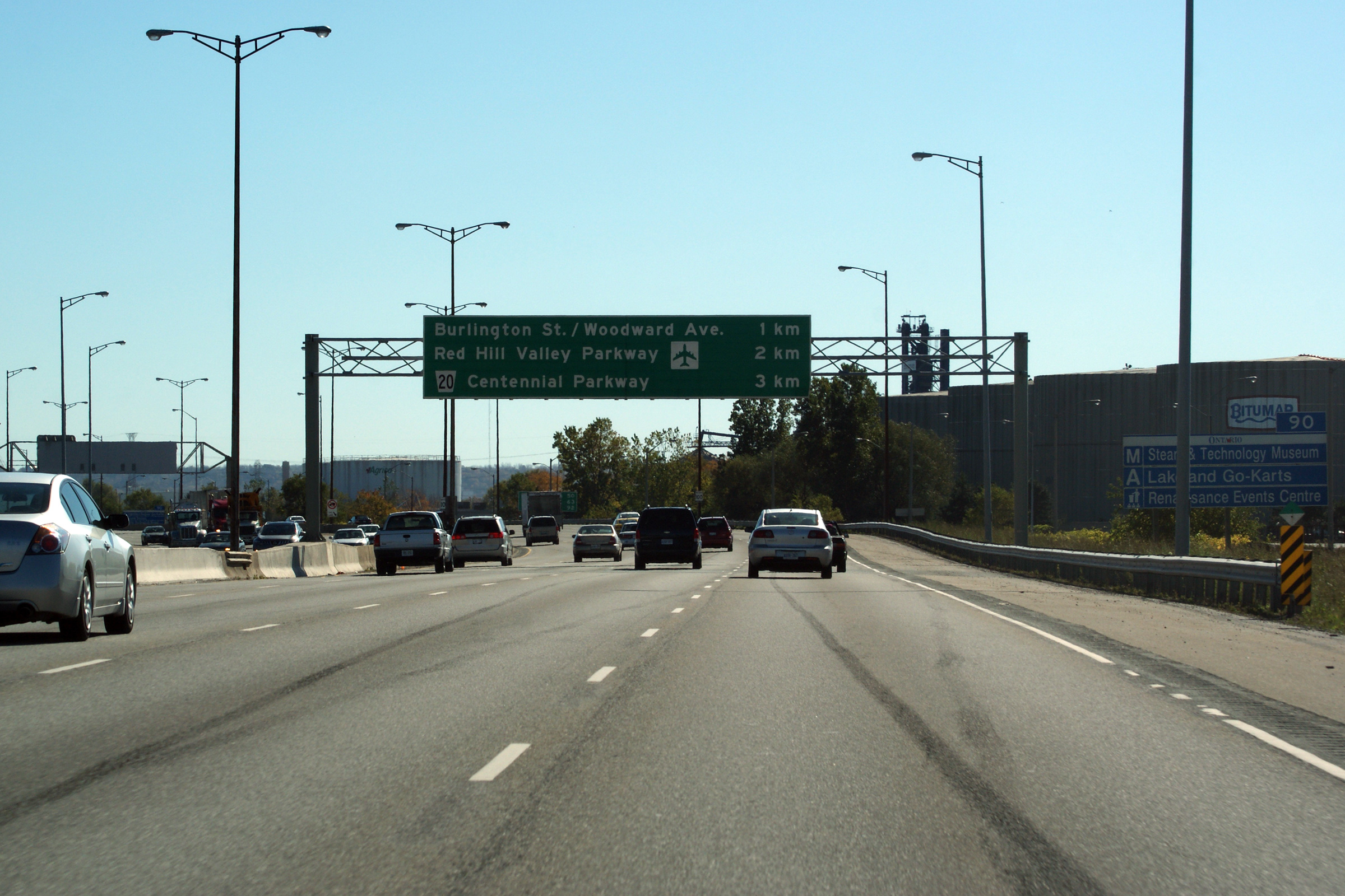
| City of Hamilton |
Niagara-bound view as the ramp to Burlington Street and Woodward Avenue
departs from the Queen Elizabeth Way. Photo taken: October 16th, 2010. |
 (720
x 540) (720
x 540)(1440x960) (2400x1600) |
||
| City of Hamilton |
View looking towards the Burlington Skyway from the Beach Boulevard
underpass. At the time of this photo, the Beach Boulevard underpass was being widened for
an extra lane in each direction as part of the Burlington Street interchange
reconstruction. Photo taken: June 29th, 2007. |
|
||
| City of Hamilton |
Advanced signage for the ramp to Burlington Street and Woodward Avenue. Photo taken: October 16th, 2010. |
 (720
x 540) (720
x 540)(1440x960) (2400x1600) |
||
| City of Hamilton |
Sign denoting
Hamilton's
exits from the QEW. Does it make sense that the only route that isn't
a freeway leading away from the QEW is the route that has a numbered highway designation?
Sometimes designations in Ontario
don't make a lot of sense. Photo taken: October 16th, 2010. |
 (720
x 540) (720
x 540)(1440x960) (2400x1600) |
||
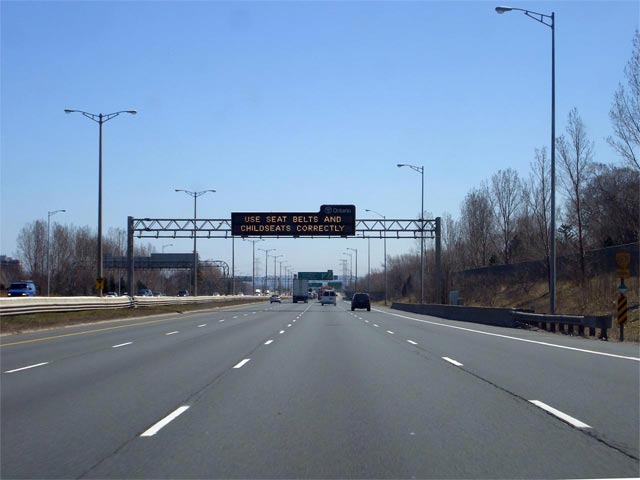
| City of Hamilton |
Ground mounted clearview advanced signage well in advance of the Freeman
interchange in Burlington. For those unaware, 'Clearview' is a new
font for highway signs that has become common in many North American
jurisdictions, including those that surround Ontario.
Clearview font is touted for its increased readability versus the
current highway font. As of early 2011, the MTO has yet to fully
implement Clearview font on Ontario's highways. Photo taken: October 16th, 2010. |
 (720
x 540) (720
x 540)(1440x960) (2400x1600) |
||
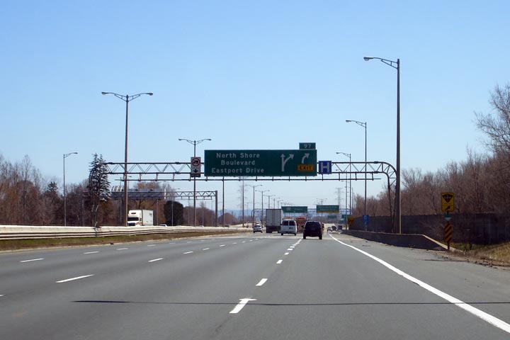
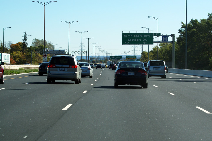
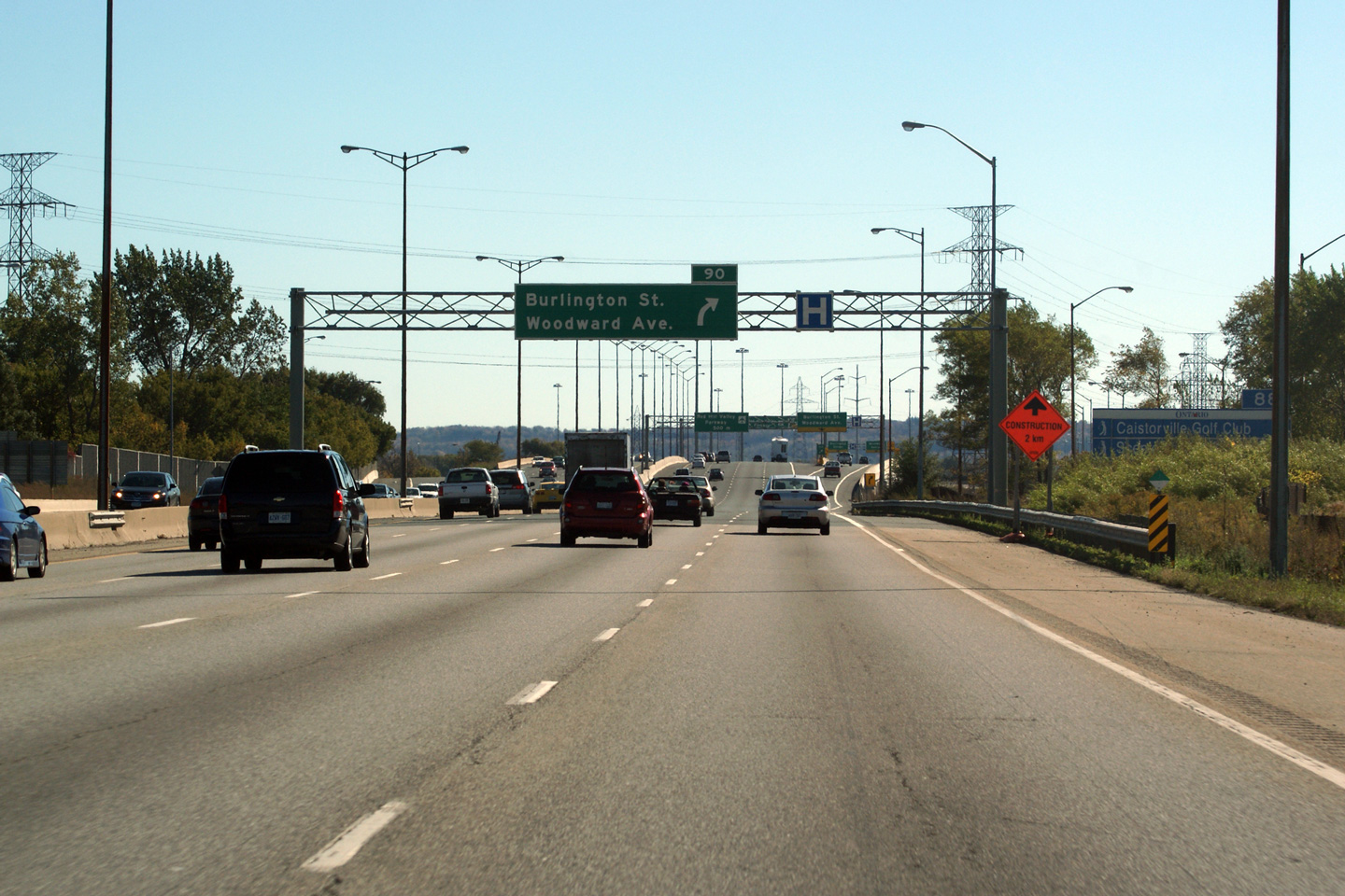
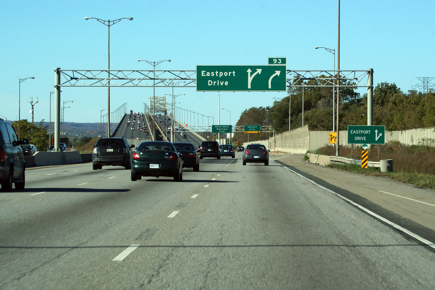
| City of Hamilton |
Overhead advanced signage for the ramp to Eastport Drive. Photo taken: October 16th, 2010. |
 (720x480) (720x480)(1440x960) |
||
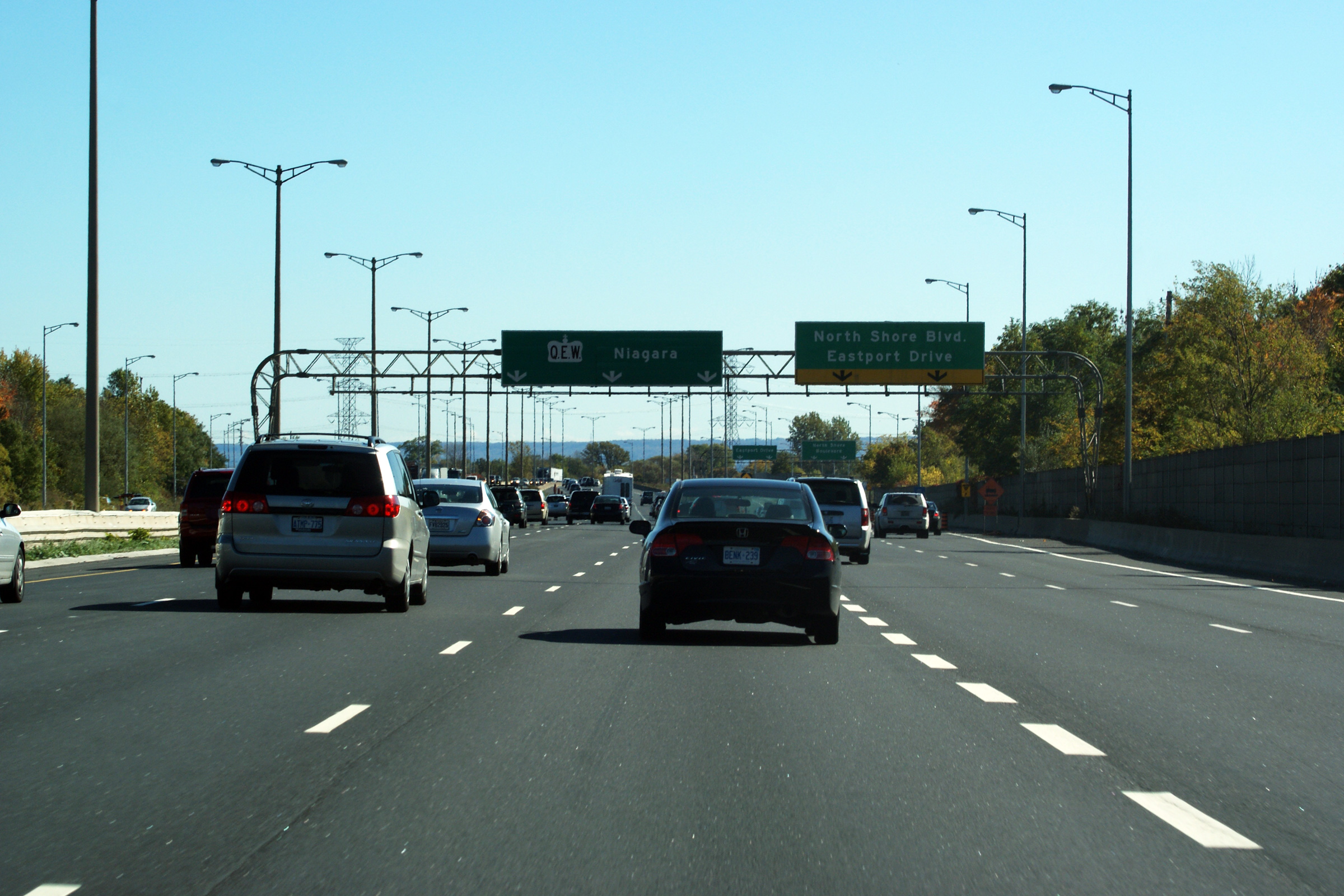
| City of Hamilton |
Green signage at the Toronto-bound ramp to Eastport Drive at the south end
of the Burlington Skyway. Eastport Drive serves as an alternate route
to the Skyway that is used in the event of a Skyway closure. Photo taken: November 15th, 2006. |
|||
| City of Hamilton |
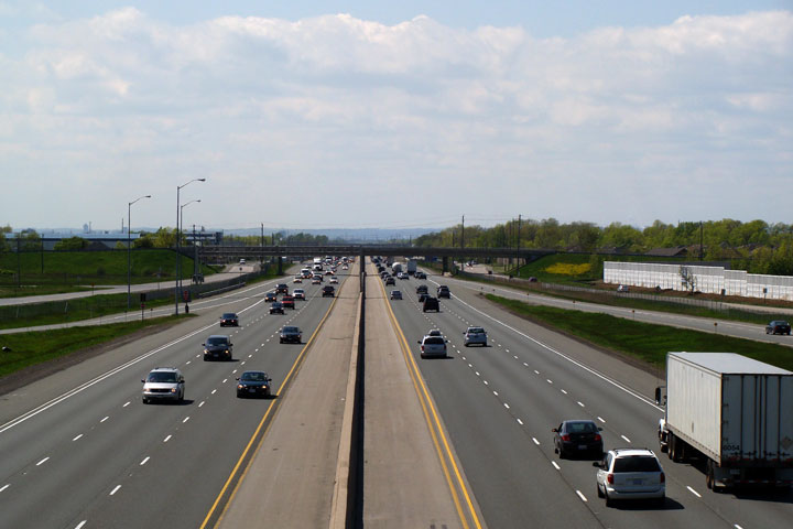
Niagara-bound view of the QEW from the foot of the Burlington Skyway.
The QEW has an eight lane cross-section between the Skyway and Centennial
Parkway. Photo taken: June 29th, 2007. |
 (720x480) (1440x960) |
||
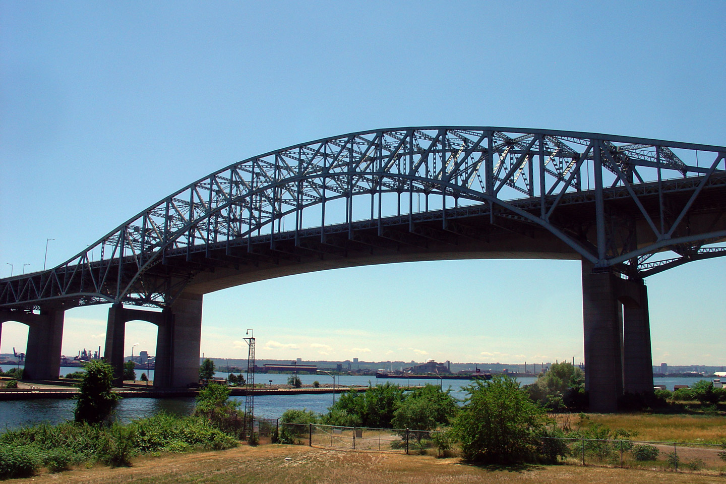
| City of Hamilton |
Two
views of the Skyway Bridge from Eastport Drive. This elegant truss span was
completed in 1959, while the modern concrete structure was opened in 1987.
When first completed, the Skyway bridge was the largest undertaking in
Ontario Highway history. The structure was originally tolled, and was one of
two toll bridges along the QEW. Tolls were lifted in 1973. Upper photo taken: June 29th, 2007. Lower photo taken: February 2nd, 2009. |
 (720x480) (1440x960) 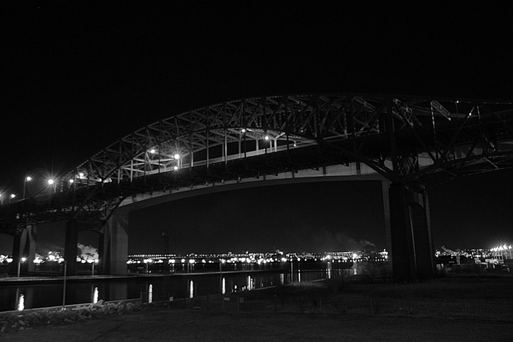 (720x480) (1440x960) |
||
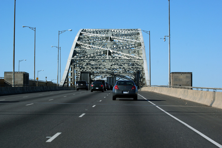
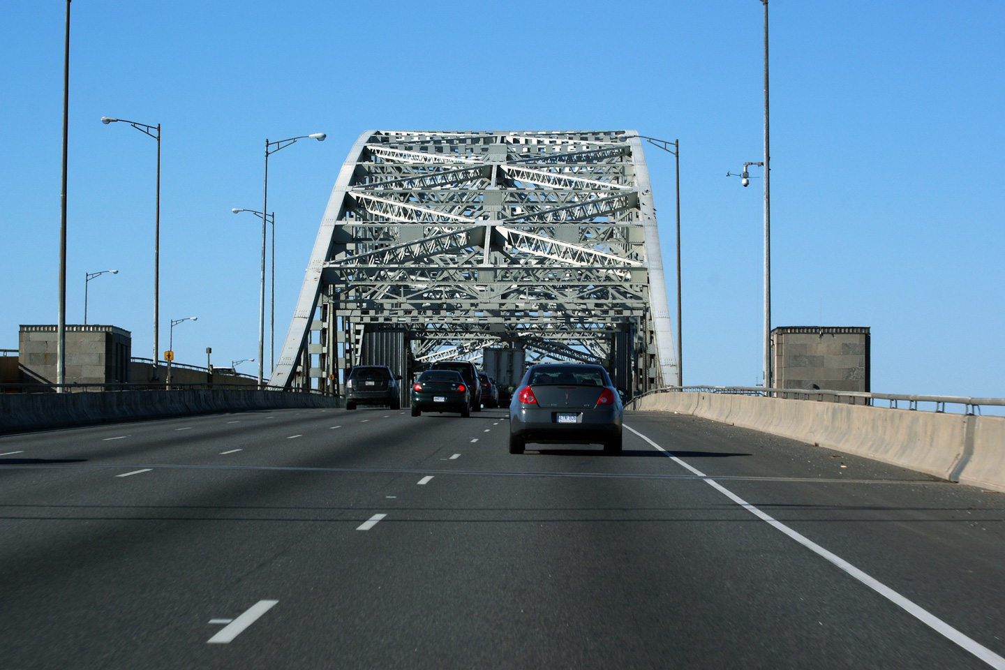
| City of Hamilton |
The
Toronto-bound lanes of the Burlington Skyway are decorated by an elaborate
overhead (structural) truss. Photo taken: October 16th, 2010. |
 (720
x 540) (720
x 540)(1440x960) (2400x1600) |
||
| City of Burlington Regional Municipality of Halton |
New
triangular truss overhead sign for North Shore Boulevard. Photo taken: October 16th, 2010. |
 (720
x 540) (720
x 540)(1440x960) (2400x1600) |
||
| City of Burlington Regional Municipality of Halton |
It
really is a shame seeing Ontario's distinct rounded truss gantries being
replaced by these bland generic triangular truss overheads. This new
triangular truss denotes the North Shore Boulevard interchange. Photo taken: October 16th, 2010. |
 (720
x 540) (720
x 540)(1440x960) (2400x1600) |
||
| City of Burlington Regional Municipality of Halton |
View looking across the Burlington Bay James N. Allen Skyway from North
Shore Boulevard. The
Burlington Skyway is without a doubt the most impressive freeway structure
on an Ontario freeway. Photo taken: February 28th, 2007.. |
 (720x480) (1440x960) |
||
| Highway 2 leads east and west of the QEW through Hamilton and Oakville. Click here for Highway 2 images | ||||
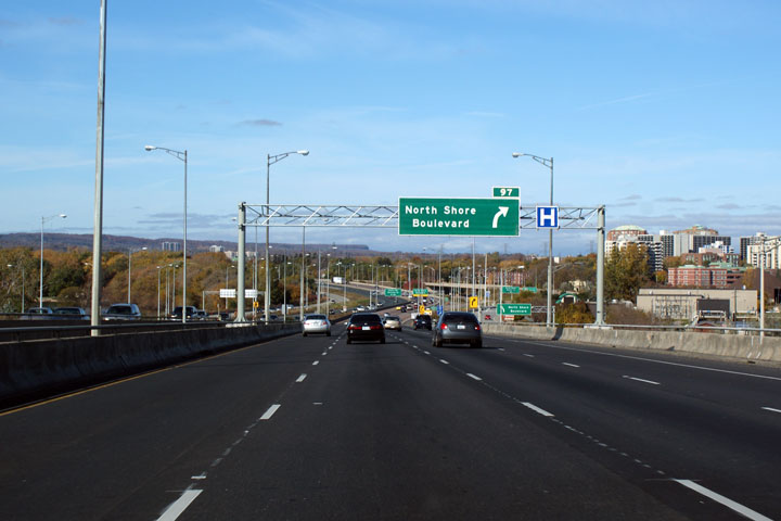
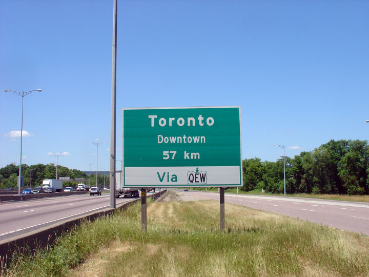
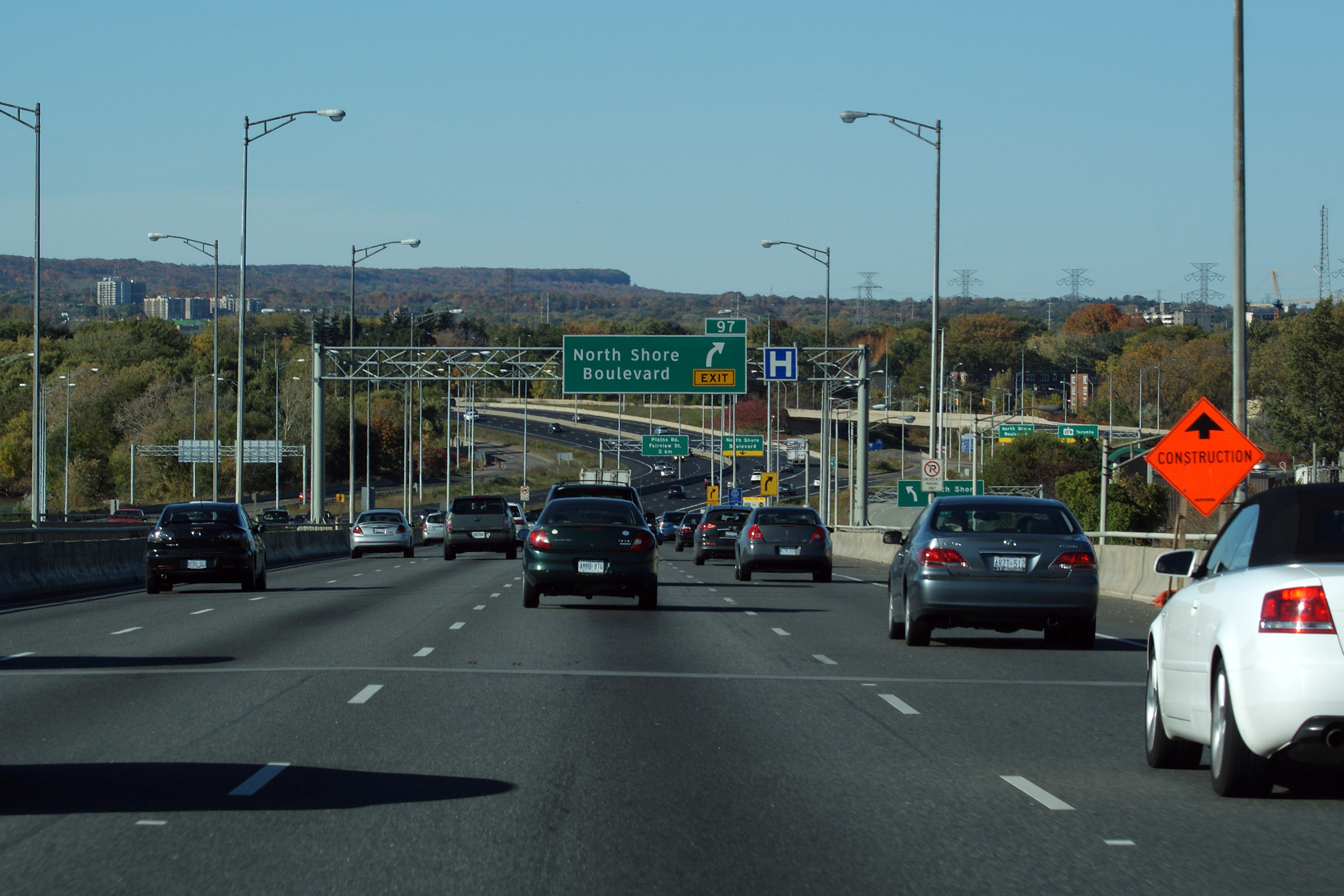
| City of Burlington Regional Municipality of Halton |
Green distance sign just north of the North Shore Boulevard interchange.
Destination specific distance signs appeared on Central Region's Freeway's
shortly after the SAR's induced tourism decline of 2003. Photo taken: June 29th, 2007. |
 |
||
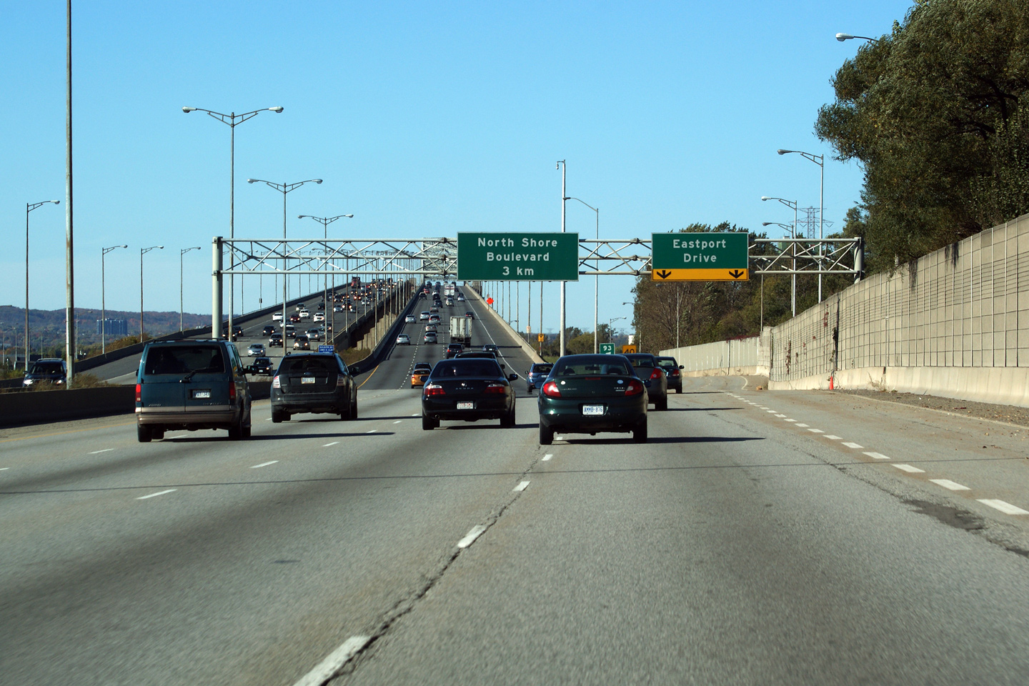
| City of Burlington Regional Municipality of Halton |
View looking Niagara-bound approaching the North Shore Boulevard (Highway
2) and Eastport Drive (Highway 7189) interchange. Photo taken: October 16th, 2010. |
|||
| City of Burlington Regional Municipality of Halton |
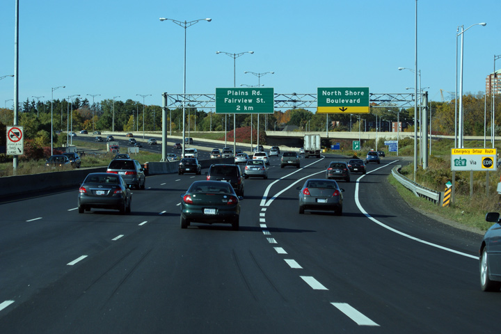
Two views of the overhead signage in advance of the North Shore Boulevard and Eastport Drive
interchange. The two right-most lane along the QEW departs the highway at
this interchange. This pictured signage was updated as part of a
construction project that saw an extra Niagara-bound lane added between
Highway 407 and North Shore Boulevard. Upper photo taken: April 19th, 2007. Lower photo taken: October 16th, 2010. |
|
||
| City of Burlington Regional Municipality of Halton |
This photo is of a former
COMPASS sign in advance of the North Shore Boulevard interchange and the
Burlington Skyway. The Burlington COMPASS CMS system debuted in 1986
on the QEW in response to congestion at peak times along the Skyway bridge.
This LED board has been retrofitted from its original flip-disk design.
This COMPASS sign was removed and not replaced during a 2010 construction
project that saw the Niagara-bound carriageway widened to five lanes. Photo taken: April 19th, 2007. |
|
||
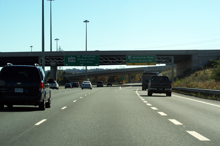
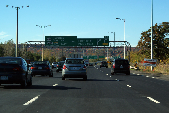
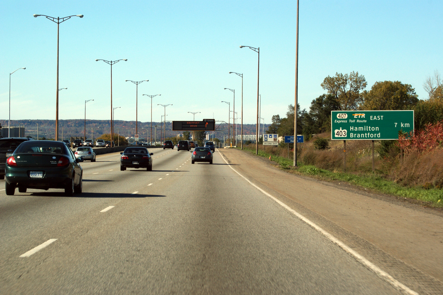
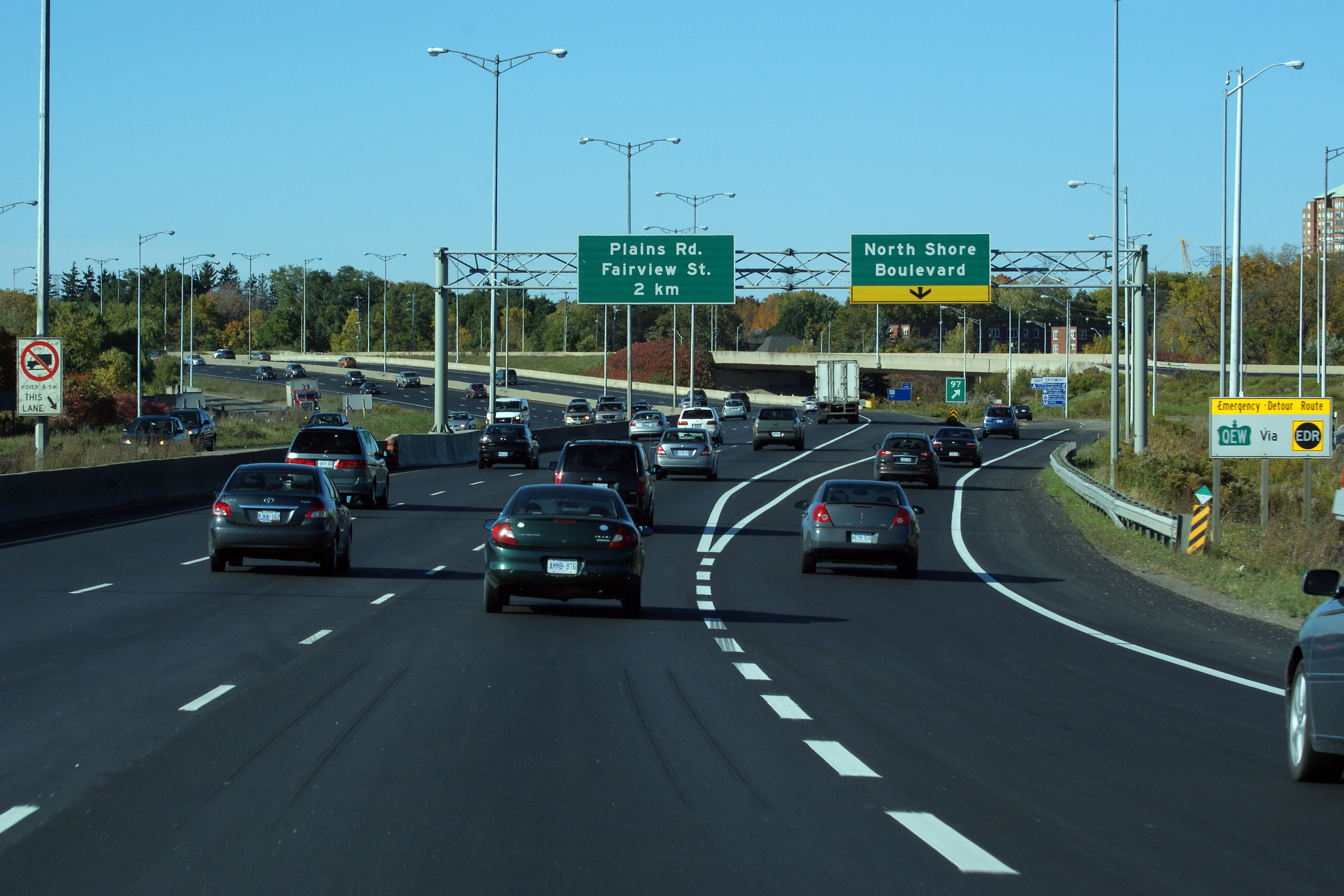
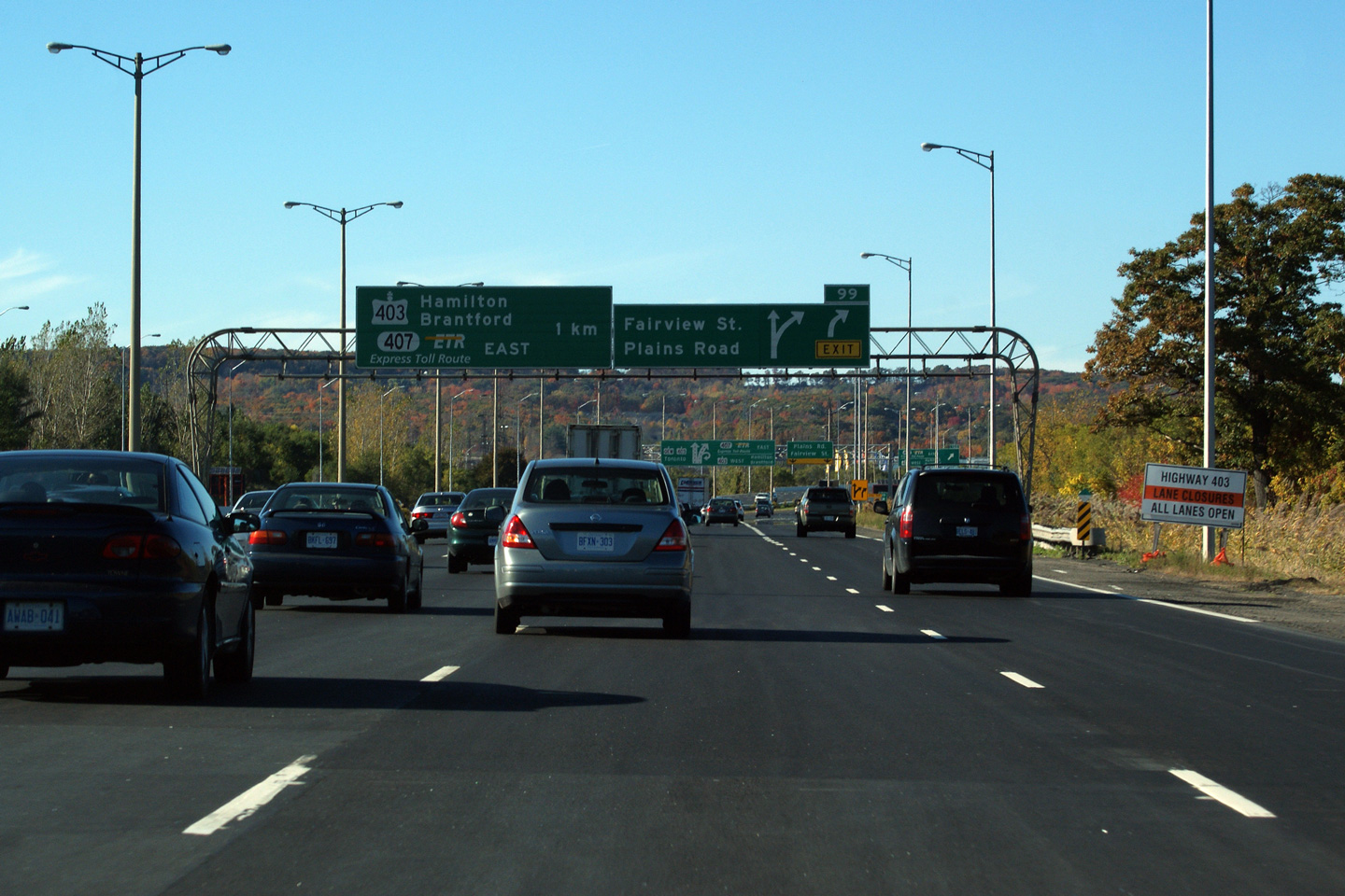
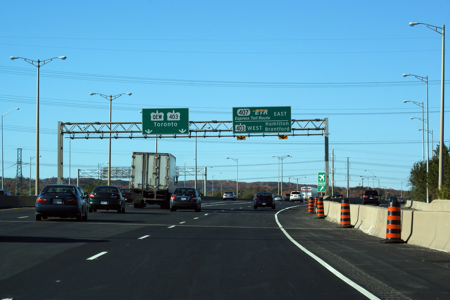
| City of Burlington Regional Municipality of Halton |
Advanced signage for both the Plains Road / Fairview Street interchange, and
the Highway 403/407 interchange. Note the misshapen Highway 403 shield
on the left-most advanced sign. Photo taken: October 16th, 2010. |
 (720
x 540) (720
x 540)(1440x960) (2400x1600) |
||
| City of Burlington Regional Municipality of Halton |
This
overhead diagram sign was first erected in the Fall of 2008. It is one of
Ontario's more complex overhead's -- reminiscent of the sign approaching
Highway 7 on Highway 8 in Kitchener. In April of 2010, the diagram
sign was updated with clearview font, as pictured. Clearview font is
being tried as a replacement to Highway Gothic in Ontario. Photo taken: October 16th, 2010. |
 (720
x 540) (720
x 540)(1440x960) (2400x1600) |
||
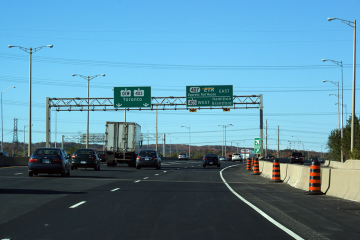
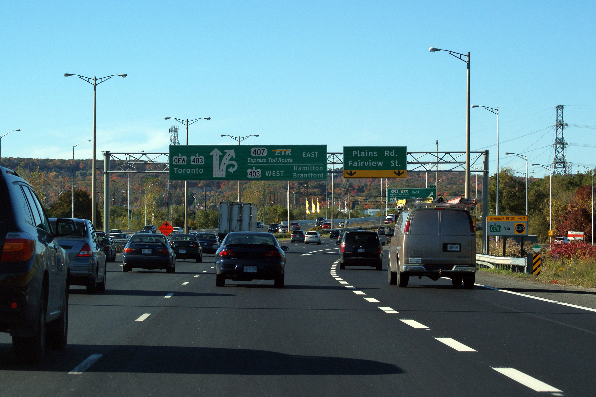
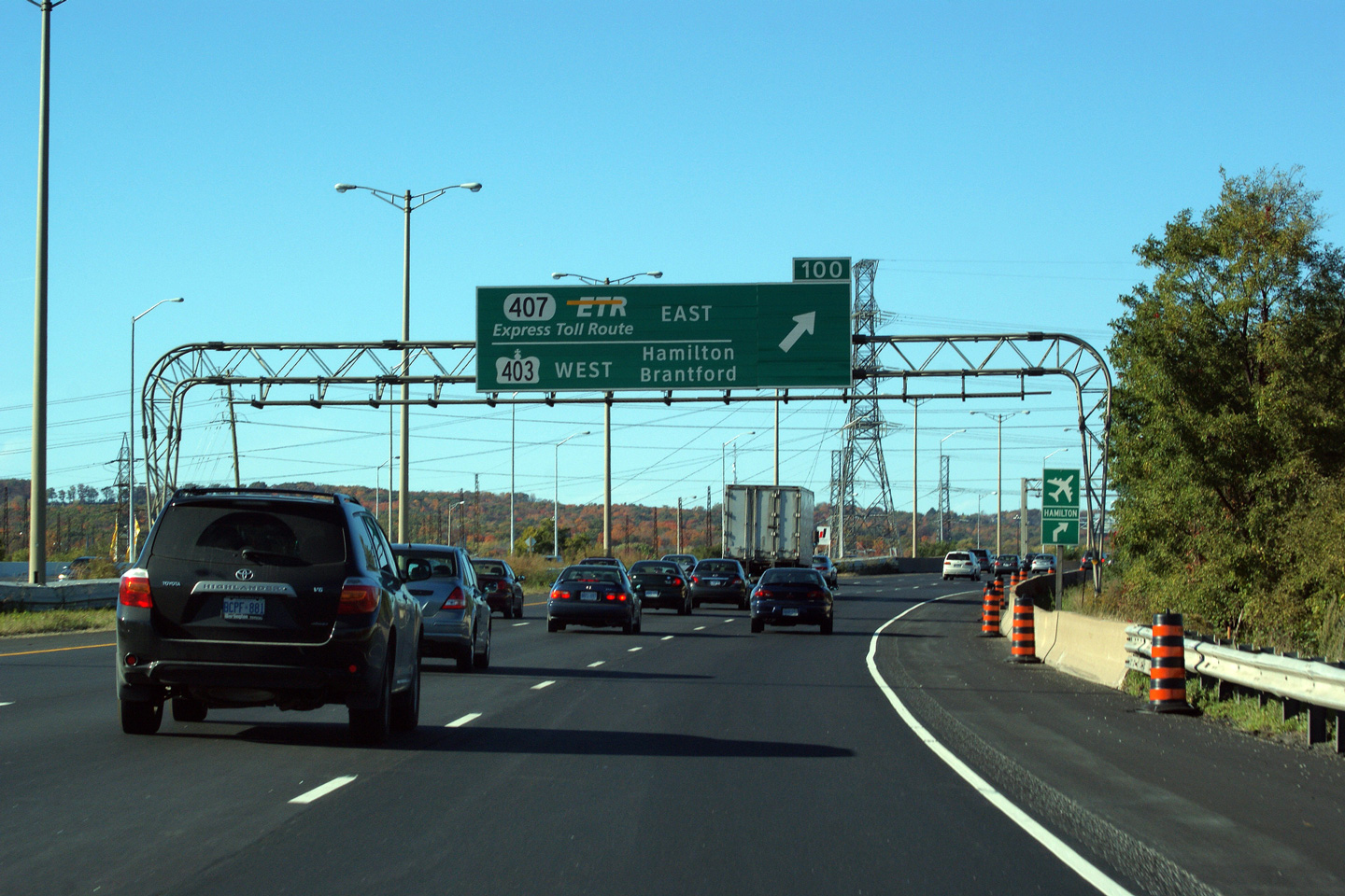
| City of Burlington Regional Municipality of Halton |
Overhead
sign in advance of the ramp to Highway 403 West and Highway 407 East.
Oddly, MTO chose this advanced arrow design on a new sign. Note the exit
tab on the clearview signage -- Clearview numerals have quite exaggerated
serifs compared to their highway gothic counterparts. Photo taken: October 16th, 2010. |
 (720
x 540) (720
x 540)(1440x960) (2400x1600) |
||
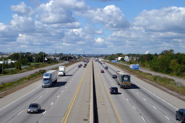
| City of Burlington Regional Municipality of Halton |
The
QEW is four-lanes through the Freeman interchange. This is the only
section of highway between St. Catharines and Toronto to be four-lanes.
This photograph is taken as the ramp to Highway 403-West and Highway 407
diverges from the Toronto-bound Queen Elizabeth Way. Photo taken: October 16th, 2010. |
 (720
x 540) (720
x 540)(1440x960) (2400x1600) |
||
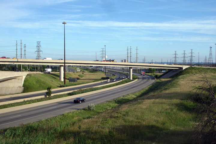
| City of Burlington Regional Municipality of Halton |
Looking Toronto-bound towards the Freeman (Highway
403/407)
Interchange from the median of the QEW. The current (and pictured)
incarnation of the Freeman
Interchange was completed in stages between 1990 and 2001, and replaced a
rather substandard directional tee interchange that had been completed in
the early 1960s. The Freeman
Interchange is the largest interchange along the QEW between Niagara Falls
and Toronto. Photo taken: April 19th, 2007. |
 (720x480) (1440x960) |
||
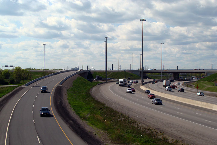
| City of Burlington Regional Municipality of Halton |
View
looking towards Niagara from the top of the Freeman interchange. This
is the only four-lane section of the QEW between Toronto and St. Catharines. Photo taken: June 2007. |
 (720x480) (1440x960) |
||
| In Burlington, Highway 403 leads west of the QEW towards Hamilton and Brantford, Highway 407 is an express toll route. Click here for Highway 403 images, and here for Highway 407 ETR images. | ||||
| Continues on Burlington to Oakville Images | ||||
Page 3 - Aerials
Photos shown in this table are arranged from West to East:
| Proper Municipality Name | Photo Description | Photo |
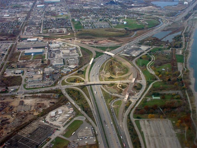
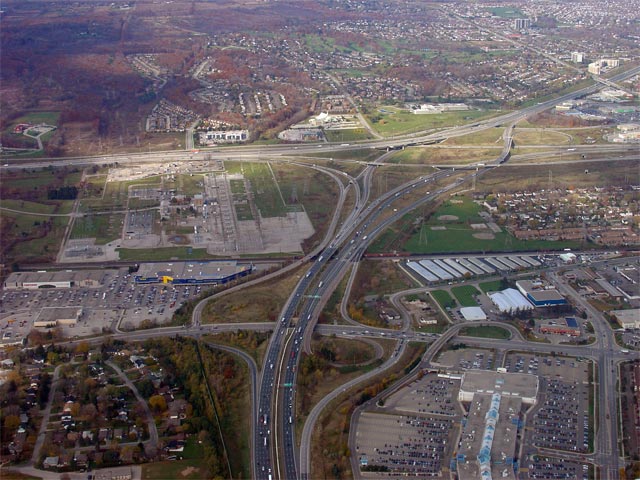
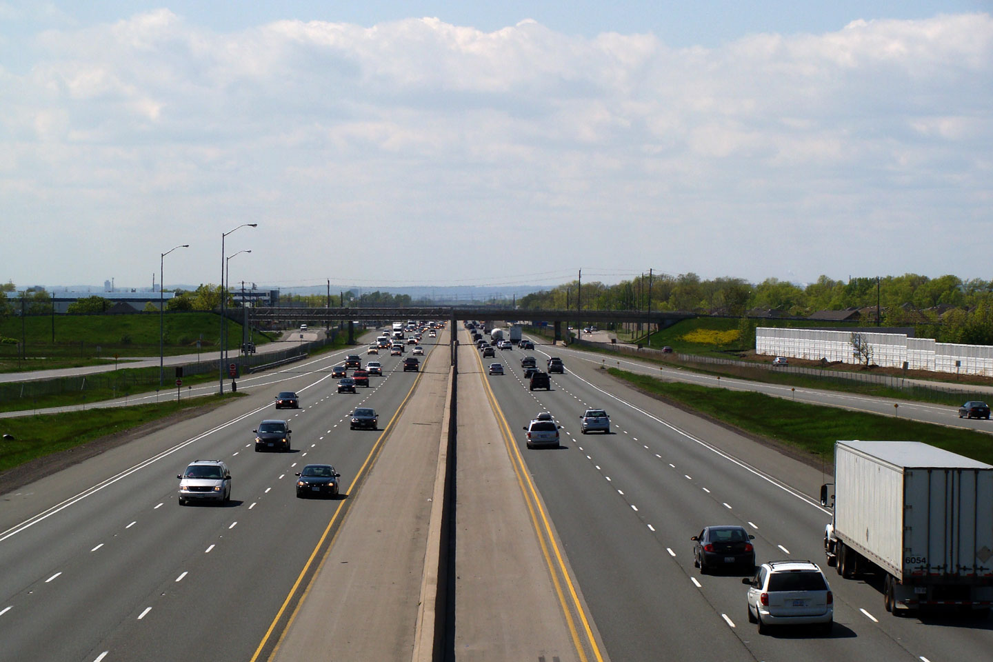
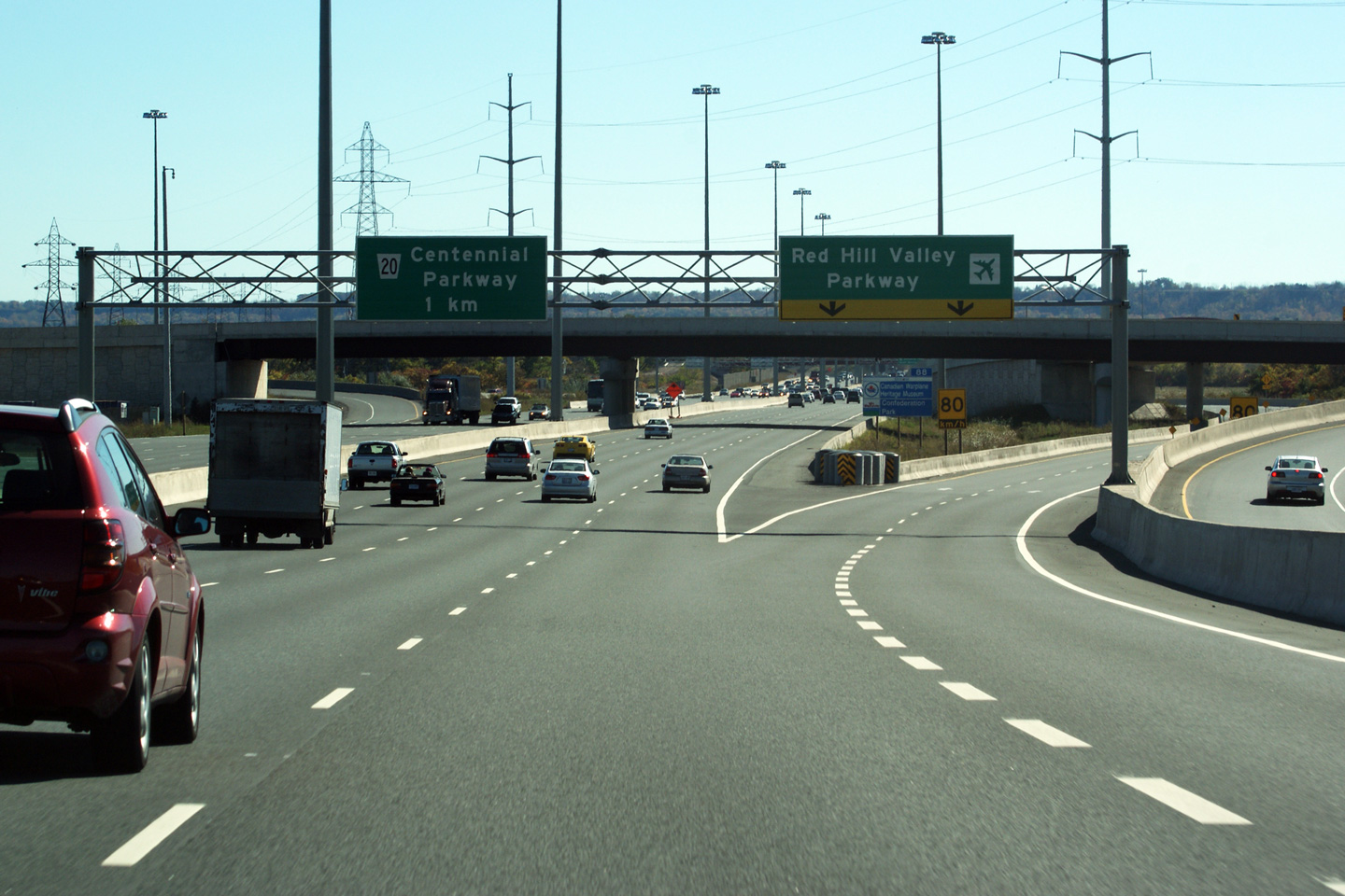
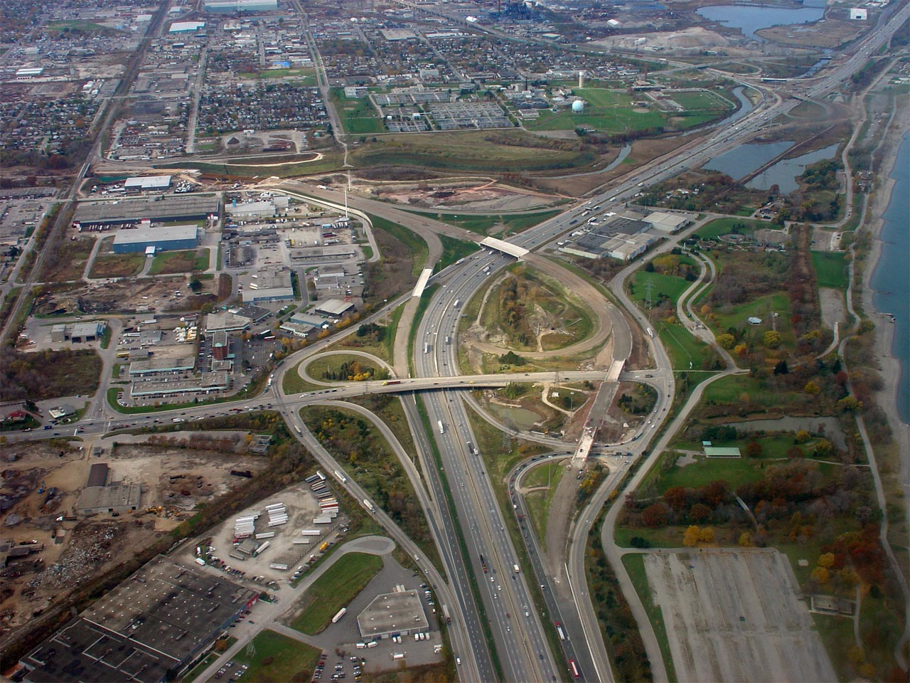
| City of Hamilton |
Aerial view of the QEW/Highway 20 interchange. Notice the advanced grading for the Red Hill Valley
Parkway just to the west of the Highway 20 interchange. The new
expressway opened in November of 2007. Photo taken: November 3rd, 2006. |
 (720x480) (1440x960) |
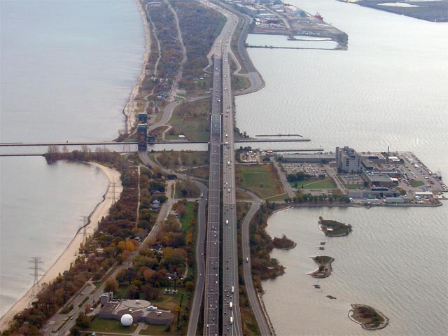
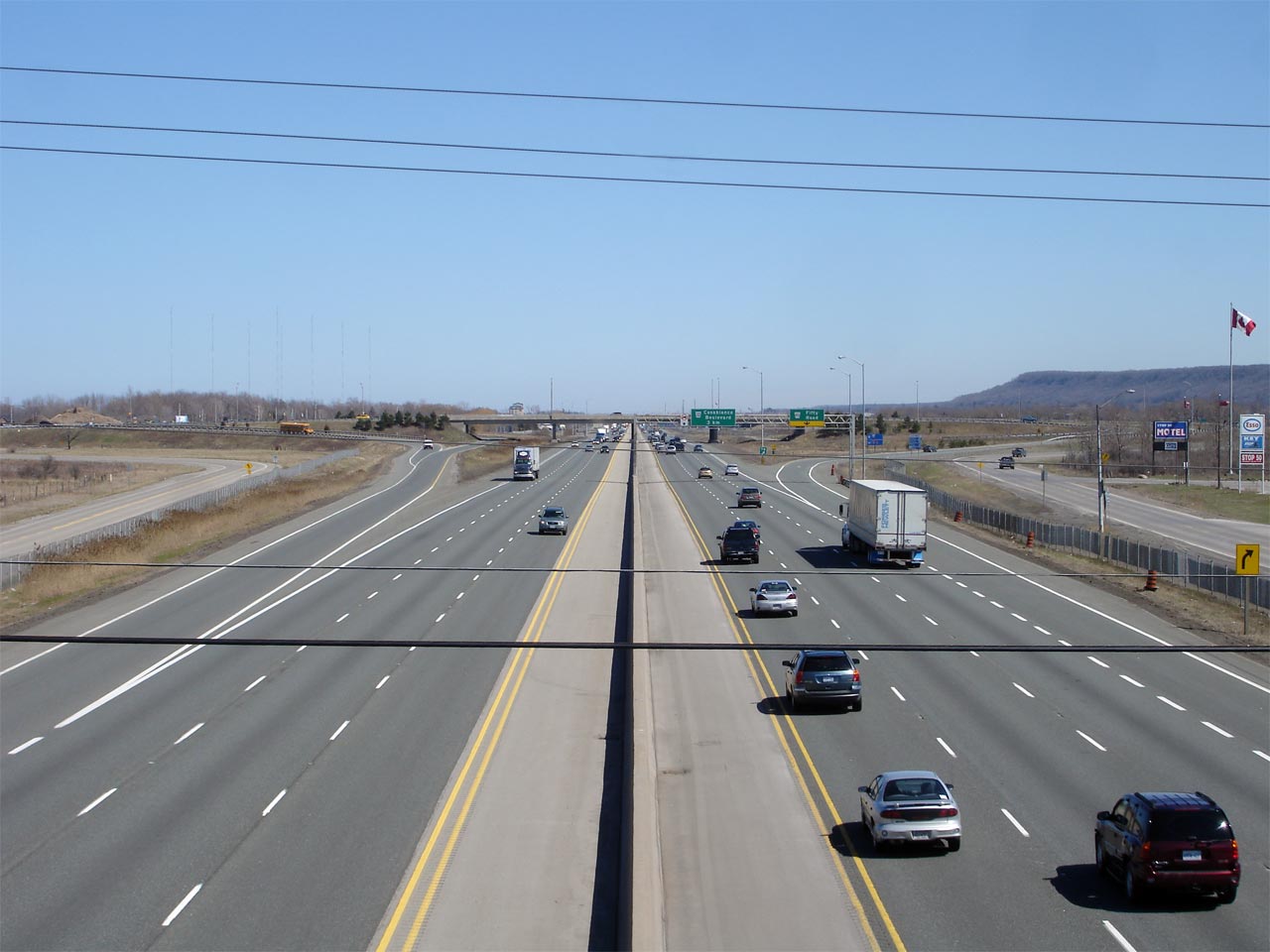
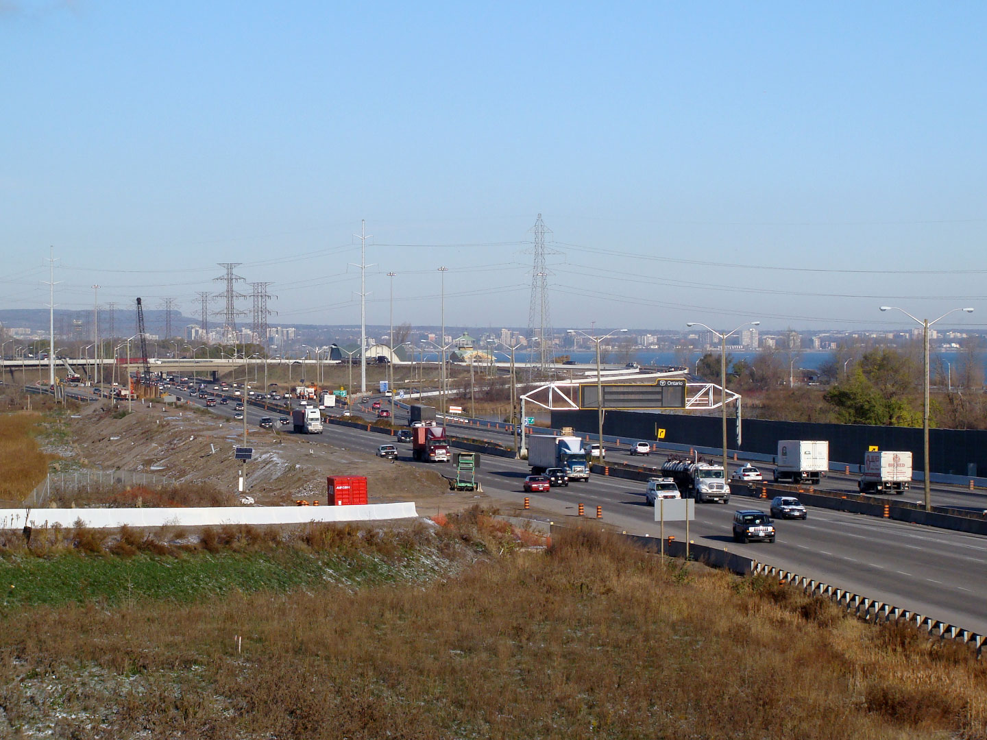
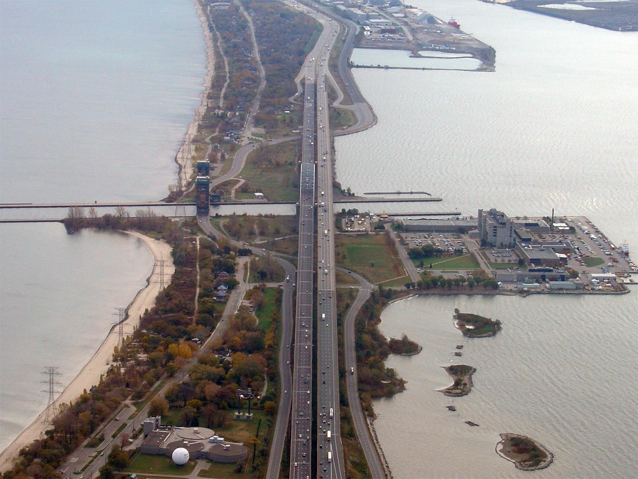
| City of Burlington Regional Municipality of Halton |
A centre-line view of the QEW from 2500ft. This view highlights the
twin Burlington Bay Skyway bridges that cross Hamilton's Harbour. Photo taken: November 3rd, 2006. |
 (720x480) (1440x960) |
| City of Burlington Regional Municipality of Halton |
View looking northerly towards the QEW at the Fairview Street and Freeman
interchanges. Note the abandoned loop ramp from Fairview Street to the
Fort Erie-bound QEW. This ramp was abandoned when
Highway 407 was connected to the QEW in
2001 -- and was subsequently reinstated in 2010. Photo taken: November: 3rd, 2006. |
 (720x480) (1440x960) |
<- Page 2 Images Queen Elizabeth Way Images Index Page 4 Images ->
<- Highway 811 Images Back to Queen Elizabeth Way Highway 2 Images ->
Copyright (c) 2004-2010, Scott Steeves (Webmaster) scott@asphaltplanet.ca


