|
Proper Municipality Name |
Photo Description |
Photo |
|
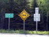
Pictures taken
from driver's perspective appear offset from centre-line pictures: |
North-
Bound |
South-
Bound |
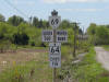
| Municipality of French River
District of Sudbury |
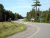
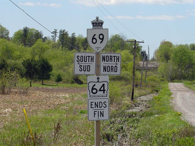
The junction assembly located at
the south (and west) end of Highway 64 at Highway 69. This certainly
has to be one of the ugliest (and most non-standard) junction assembly that
can be found on an Ontario highway.
Click here for Highway 69 images.
Picture size: 75kb |
 |
| Municipality of French River
District of Sudbury |
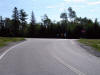
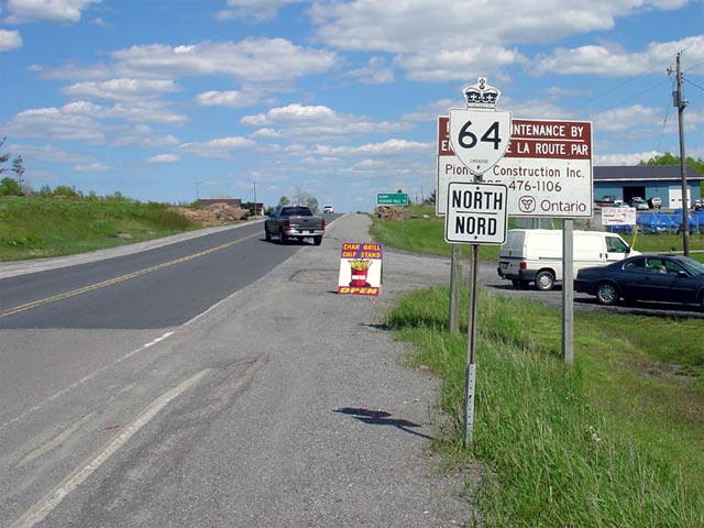
First shield located north (east) of Highway 69. Highway 64's routing
is somewhat odd, in that it travels nearly as far east-west as it does
north-south. Highway 64 is predominantly an east-west route near
Highway 69.
Picture size: 65kb. |
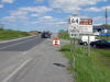 |
| Municipality of French River
District of Sudbury |
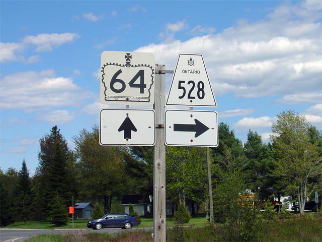
The signage assembly for Highway 64 and the Highway 528 junction. This
picture is taken looking north along Highway 64. Click here for
Highway 528 images (Coming Soon!). Picture size: 35kb |
 |
| Municipality of French River
District of Sudbury |
The junction assembly for Highway
64 at Highway 535 looking north. Highway 64 is laden with non-standard
junction assemblies. 'Teardrop' shields are not supposed to be used on
the same assembly with a secondary highway.
Picture size: 35kb |
 |
|
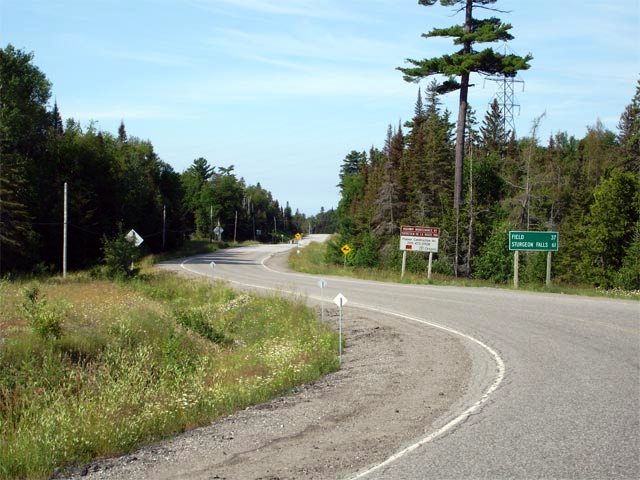
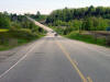
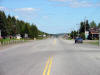
Municipality of French River District of Sudbury |
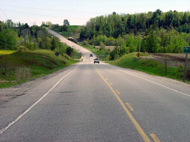
Highway 64 looking north (east) through Noelville. Highway 64 passes
through a series of small communities from Highway 69 northerly to Highway
17. Noelville is the largest of these communities, and is full
service. Picture taken: May 29th, 2004. Size: 70kb. |
 |
|
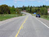
Municipality of French River District of Sudbury |
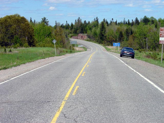
Highway 64 looking south from
just north of Bear Lake Road. This picture is not really a fair
depiction of the terrain that 64 passes through. South of Verner most
of 64's routing follows fairly flat farm land. This
picture does, however, give an accurate portrayal of Highway 64's standards
and general appearance.
Picture taken: May 29th, 2004.
Size: 50kb. |
 |
|
Municipality of French River District of Sudbury |
Highway 64 looking north from the Sudbury - Nipissing Boundary Line.
This boundary line is located about 44 km northeast of
Highway 69. Picture
taken: May 29th, 2004. Size: 75kb. |
 |
|
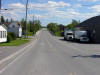
Municipality of West Nipissing District of Nipissing |
Highway 64 looking south from just south of Highway 17 in Verner.
Highway 64 has been recently rehabilitated, and has a similar appearance
from Verner southerly to Lavigne. Picture taken: May 29th, 2004.
Size: 55kb. |
 |
|
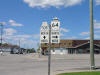
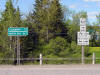
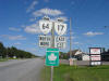
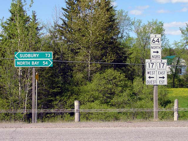
Municipality of West Nipissing District of Nipissing |
This picture shows the signage at
Verner where Highway 64 turns to run concurrent with Highway 17.
Highway 64 runs concurrent with Highway 17 for about 15 kilometres easterly
to Sturgeon Falls. There, 64 once again turns north, heading towards
Field and Martin River.
Click here for Highway 17
images.
Picture size: 85kb |
 |
|
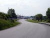
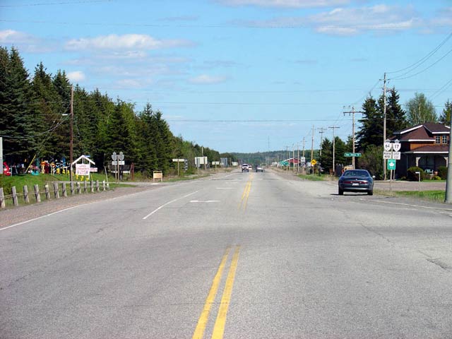
Municipality of West Nipissing District of Nipissing |
Highway 17/64 looking east from the western Highway
17/64 junction looking
east towards Sturgeon Falls. This is a fairly typical looking section
of Highway 17/64 between Verner and Sturgeon Falls. Picture taken: May 29th, 2004. Size: 50kb. |
 |
|
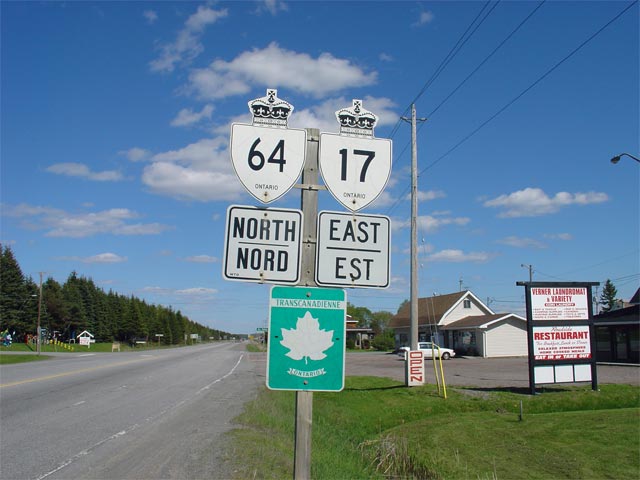
Municipality of West Nipissing District of Nipissing |
First cosign assembly eastbound on Highway 17/64 just east of Verner.
Oddly all assemblies on this co-designation are signed with the Highway 64
shield before the Highway 17 shield. This is inconsistent with normal
signage practices in Ontario.
Picture size: 50kb. |
 |
|
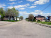
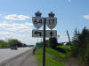
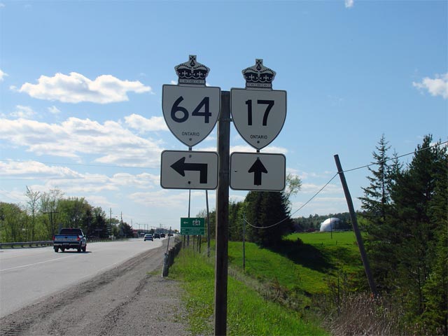
Municipality of West Nipissing District of Nipissing |
Signage denoting the western
split of Highway 17/64 at Verner. This picture was taken westbound on
Highway 17. Straight ahead, Highway 17 leads towards Sudbury. A
left turn at this junction leads travelers southbound towards Lavigne and
Noelville. Click here
for Highway 17 images.
Picture size: 50kb. |
 |
|
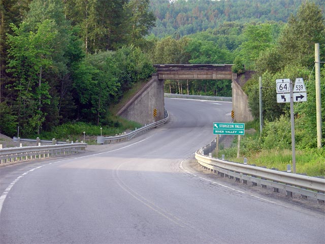
Municipality of West Nipissing District of Nipissing |
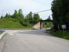
Looking southerly from just south of the
Highway 539
junction in Field. South of
Highway 539,
Highway 64 heads southerly before highway abruptly turns westerly to cross
the Sturgeon River. Directly across the Sturgeon River, Highway 64
meets Highway 575
where the route again turns southerly.
Picture taken: July 1st, 2006. Size: 45kb. |
 |
|
Municipality of West Nipissing District of Nipissing |
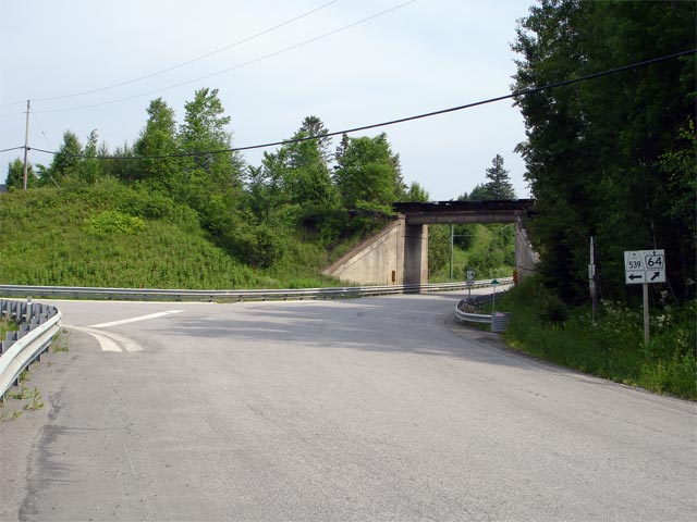
Looking northerly along Highway 64 towards the
Highway 539
junction and the Field overhead. The intersection grading would
suggest that when this intersection was initially constructed it favoured
through movements between Highway 64 and
539, and that
through-traffic on Highway 64 would have had to turn to continue along the route.
Picture taken: July 1st, 2006. Size: 55kb. |
 |
|
Municipality of West Nipissing District of Nipissing |
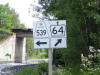
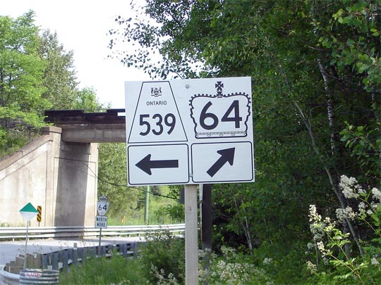
Signage denoting the
Highway 539
junction for vehicles traveling northbound along Highway 64. Click
here for Highway 539 images (Coming Soon!). Picture size: 65kb. |
 |
|
Municipality of West Nipissing District of Nipissing |
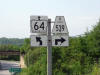
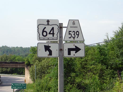
Junction signage approaching the
Highway 539
junction. Click here for Highway 539 image. (Coming Soon!).
Picture size: 45kb. |
 |
|
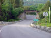
Municipality of West Nipissing District of Nipissing |
View looking southerly along Highway 64 towards Field, and the Field
overhead. The Field overhead was completed in 1937, and no longer
carries a rail line.
Click
here for high resolution photo (370kb). Picture taken: July 4th, 2005.
Size: |
 |
|
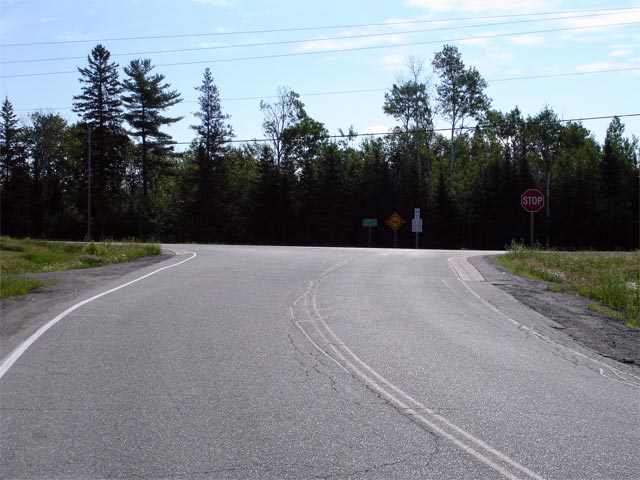
Town of Tamagami District of Nipissing |
View looking southerly along Highway 64 from the
Highway 11 junction at Martin River. Picture taken: July 1st, 2006.
Size: 70kb. |
 |
|
Town of Tamagami District of Nipissing |
Looking northerly at the northern end of Highway 64 at the
Highway 11 junction. Picture taken: July 1st, 2006. Size: 60kb. |
 |
|
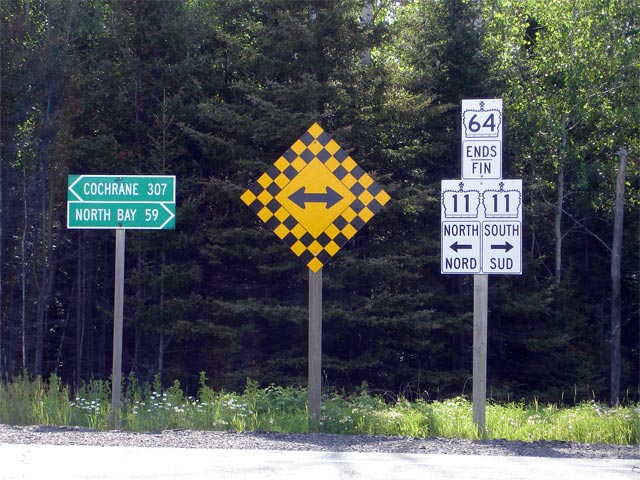
Town of Tamagami District of Nipissing |
Junction assembly at the northern end of Highway 64 at
Highway 11.
Click here for Highway 11
images. Picture size: 85kb. |
 |


