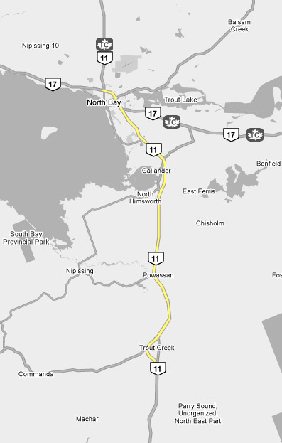
AsphaltPlanet.ca > OntHighways >
Highway 11 > Images
> Page 2F
King's Highway 11 - Images
<- Page 2E Page 2F - Trout Creek to North Bay Page 3A->
Photos shown in this table are arranged from South to North:
| Proper Municipality Name | Photo Description | Photo | |
|
Photos taken from driver's perspective appear offset from centre-line Photos: |
North- bound |
South- bound |
|
| Continued from Burk's Falls to Trout Creek Images | |||
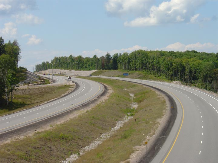
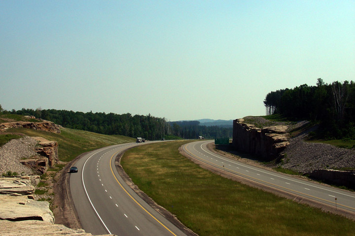
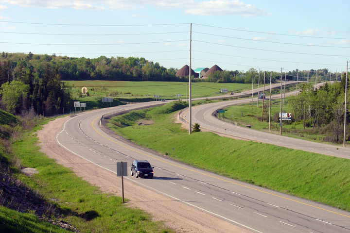
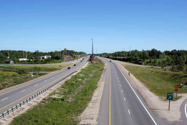
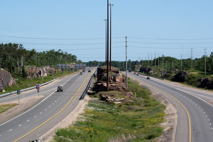
| Municipality of Powassan District of Parry Sound |
Looking north from the southern
Highway 522 overpass. The Trout Creek
Bypass curves around the west side of the small community of Trout Creek.
The southern Highway 522 overpass is located at roughly kilometre marker
301. Photo taken: August 14th, 2005. |
 |
|
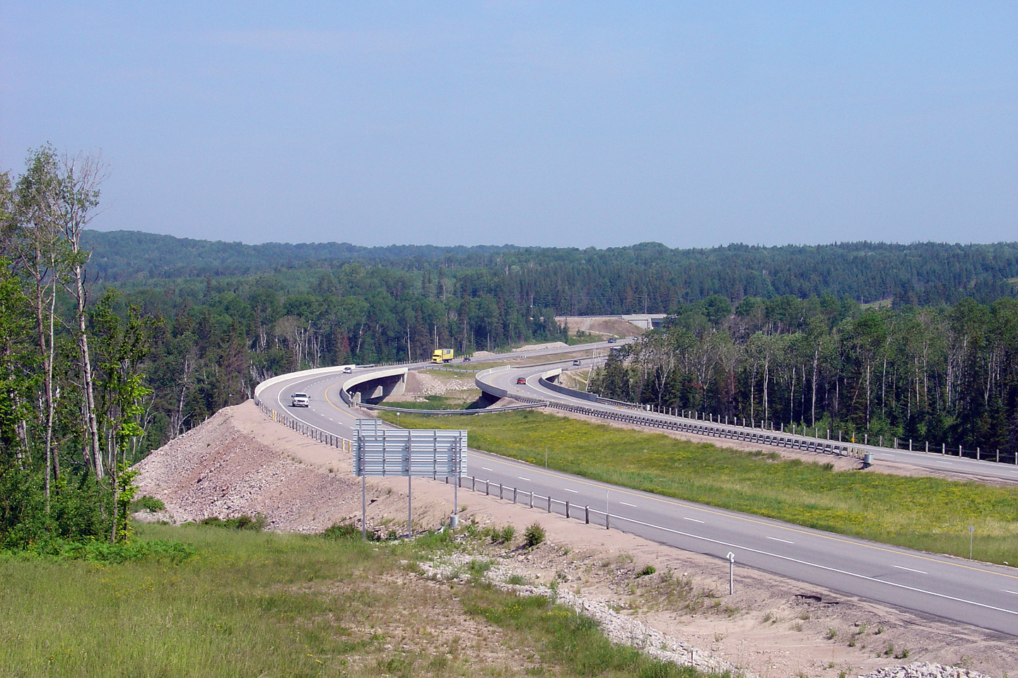
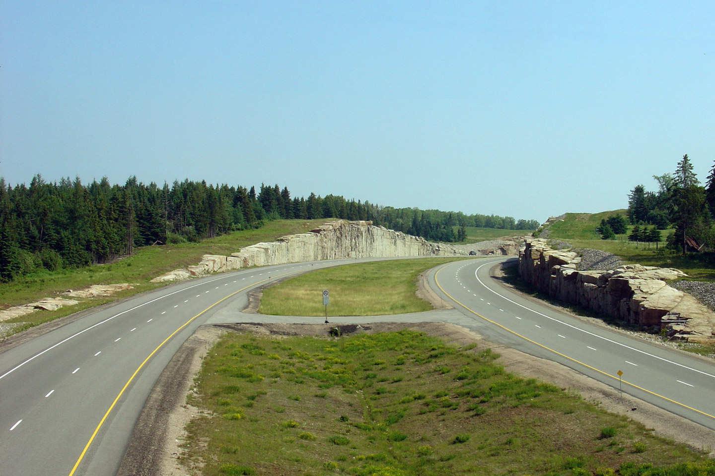
| Municipality of Powassan District of Parry Sound |
View looking northerly along the Trout Creek By-pass approaching the Trout
Creek structures, and
Highway 522. Photo taken: June 18th, 2006. |
 |
|
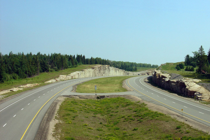
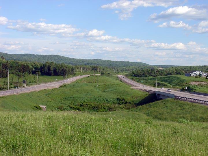
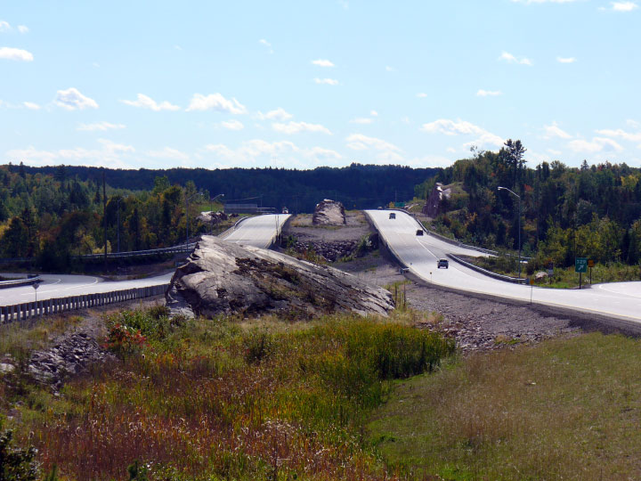
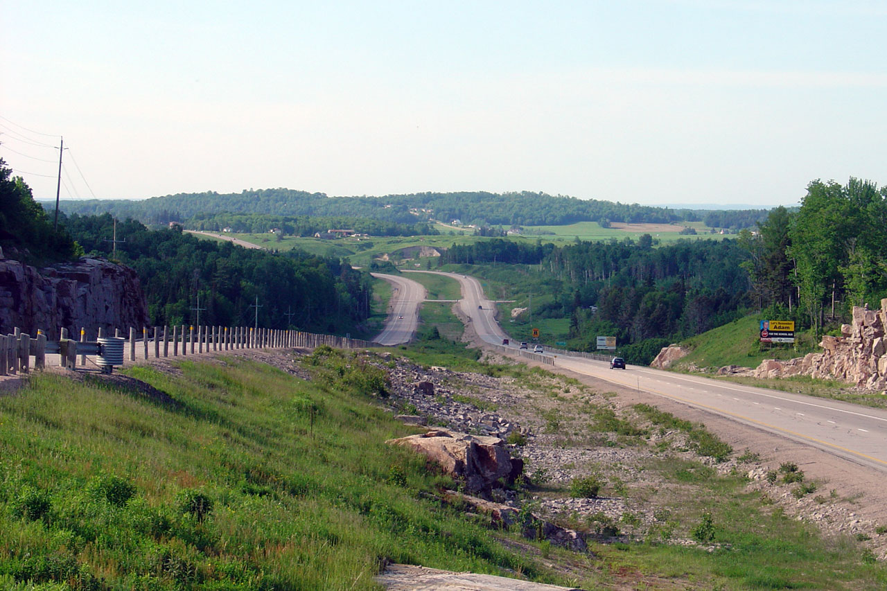
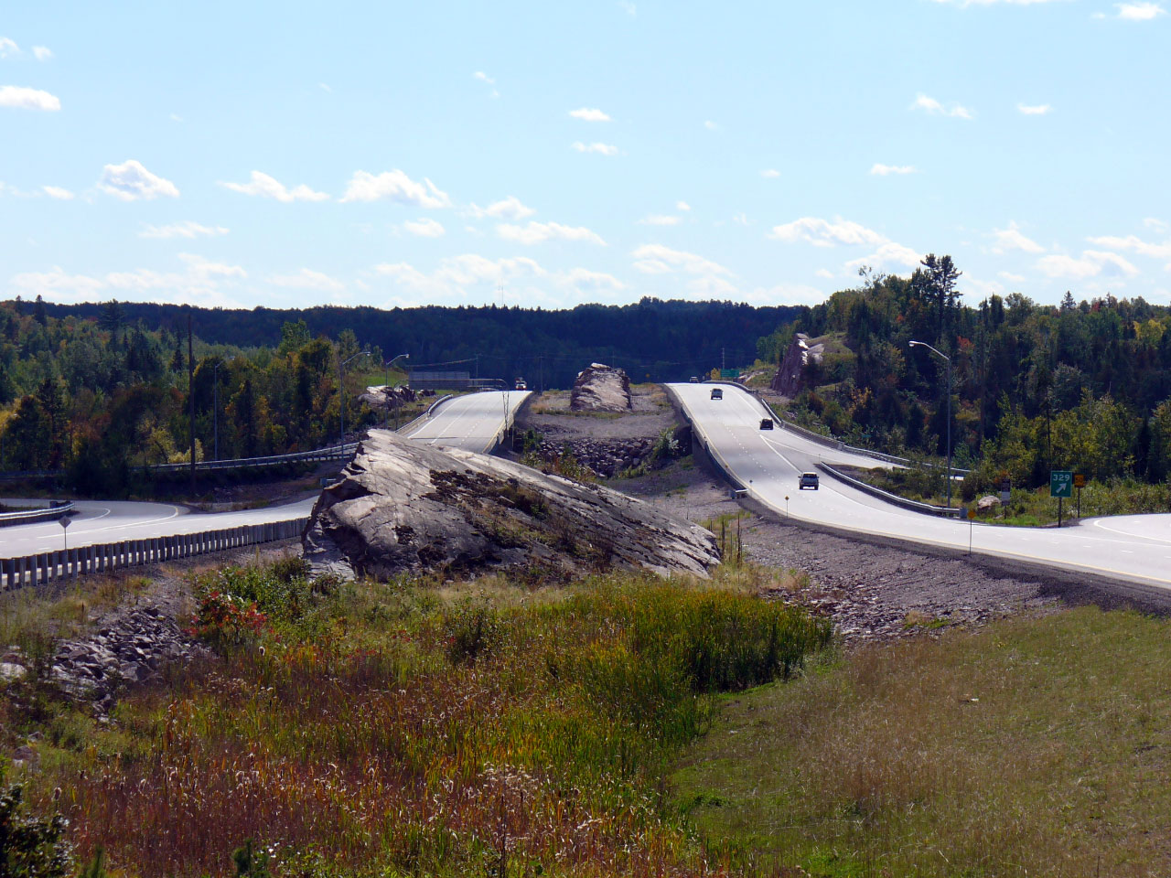
| Municipality of Powassan District of Parry Sound |
Looking southerly towards the massive twin Trout Creek bridges from the
northern Highway 522 overpass. Compare these massive structures over
Trout Creek with the much smaller (and less impressive) structure on old Highway 11 (now
Highway 522)
here and
here Photo taken: August 14th, 2005. |
 |
|
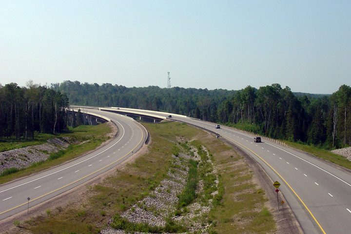
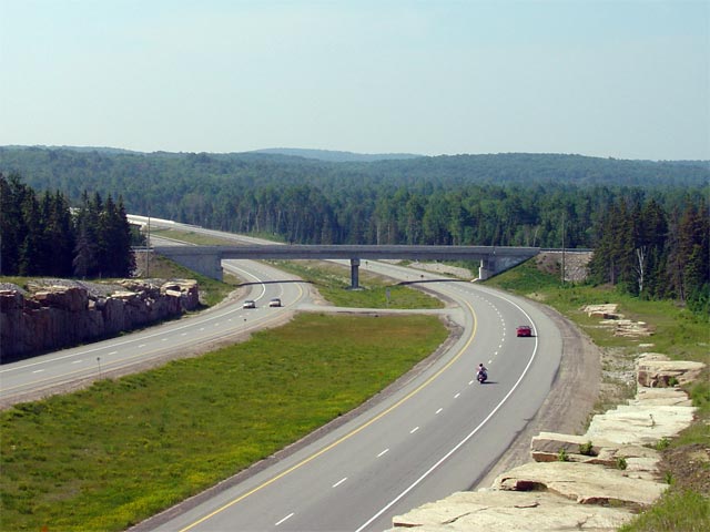
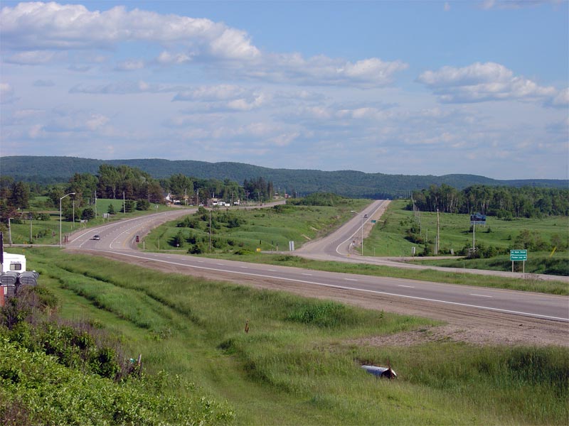
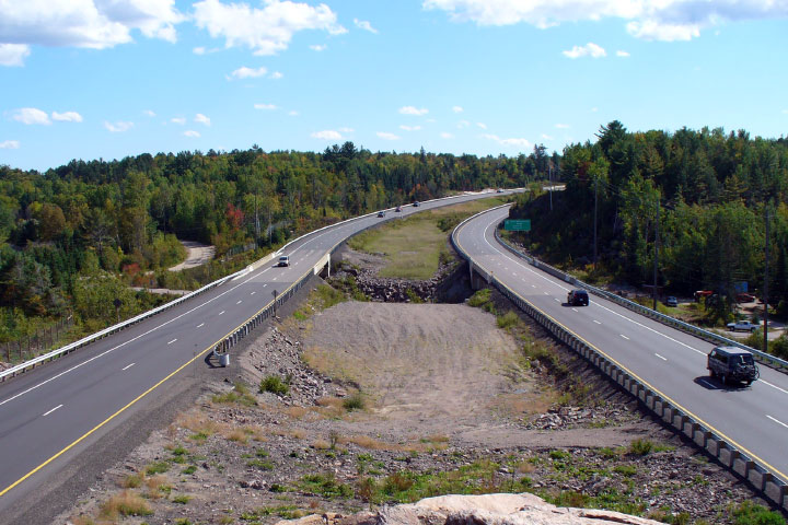
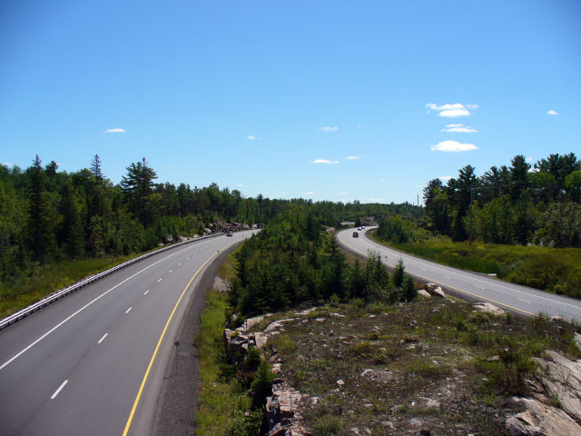
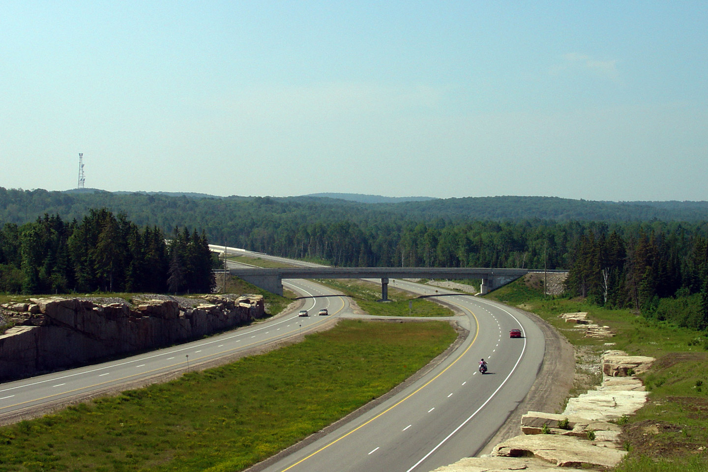
| Municipality of Powassan District of Parry Sound |
Looking north from the second
Highway 522 overpass. This
Photo
highlights some of the rugged terrain that the Highway 11 passes through
while bypassing Trout Creek. The northern
Highway 522 overpass is
located at roughly kilometre marker 304. Photo taken: June 18th, 2006. |
 |
|
| Municipality of Powassan District of Parry Sound |
View looking southerly along the Trout Creek by-pass towards
Highway 522
overpass. Photo taken: June 18th, 2006. |
 |
|
| Municipality of Powassan District of Parry Sound |
View looking northerly along Highway 11 towards the Highway 522B
interchange. The MTO chose to construct the Trout Creek By-pass on the
western side of Trout Creek to avoid crossing or realigning the CN railway
line that runs just east of Highway 11's former alignment through Trout
Creek. Photo taken: June 18th, 2006. |
 |
|
| Municipality of Powassan District of Parry Sound |
Looking south from the Highway 522B overpass. Highway 522B is located
roughly at kilometre marker 306. Photo taken: August 14th, 2005. |
 |
|
| Highway 522B is the north leg of Highway 11's former alignment into Trout Creek. Click here for Highway 522B images. | |||
| Municipality of Powassan District of Parry Sound |
Looking north from the Highway 522B overpass at the north end of the Trout
Creek Bypass. Before October 2002, the divided highway ended just to
the north of the Highway 522B interchange, and Highway 11 passed through
Trout Creek as a conventional two-lane highway. Photo taken: August 14th, 2005. |
 |
|
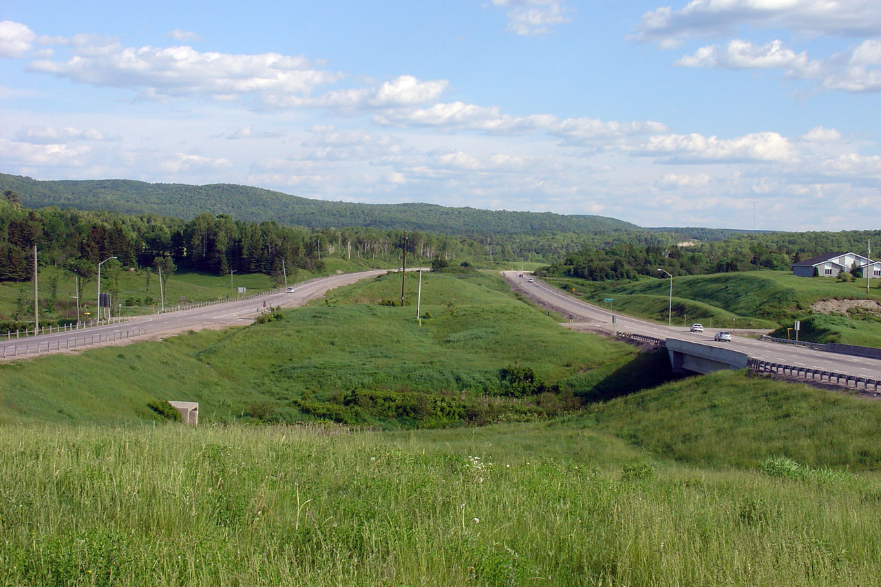
| Municipality of Powassan District of Parry Sound |
Looking northerly along Highway 11 towards the Proudfoot Road intersection,
which can be seen at the bottom of this long hill. Photo taken: June 4th, 2006. |
 |
|
| Municipality of Powassan District of Parry Sound |
Looking southerly from the median of Highway 11 towards the English/Loxton
Line at-grade intersection. Notice the extra-wide central median that
has been constructed through the southern portion of Powassan. Photo taken: June 4th, 2006. |
 |
|
| Municipality of Powassan District of Parry Sound |
Looking southerly towards the southern end of the Powassan By-pass at the
southern junction of Main Street. Just south of Powassan there are
several property accesses along the northbound lanes. I would
speculate that the MTO plans to eventually construct a new northbound
carriageway in the median of Highway 11 converting the existing NB lanes
into a service road. Photo taken: June 4th, 2006. |
 |
|
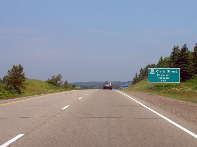
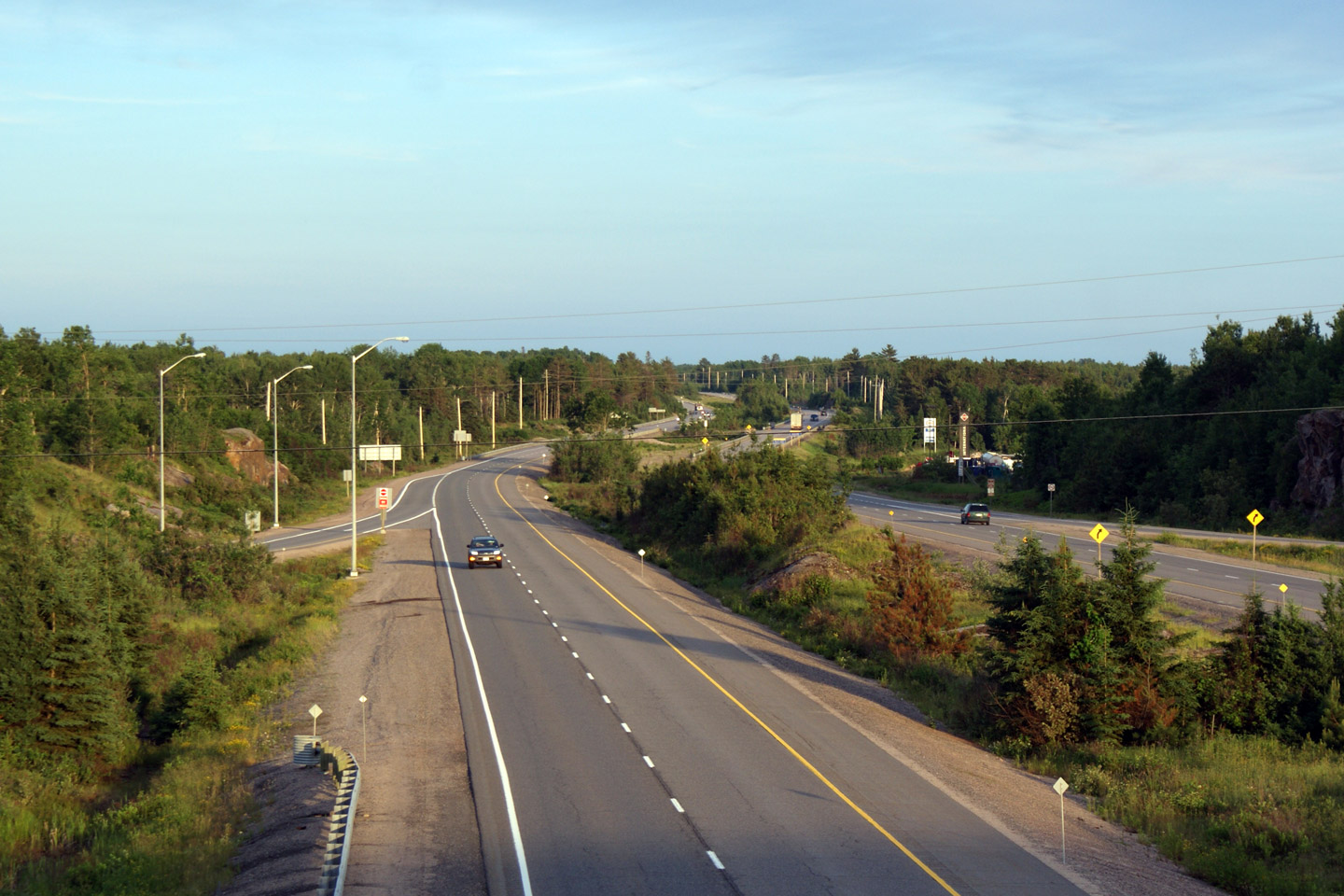
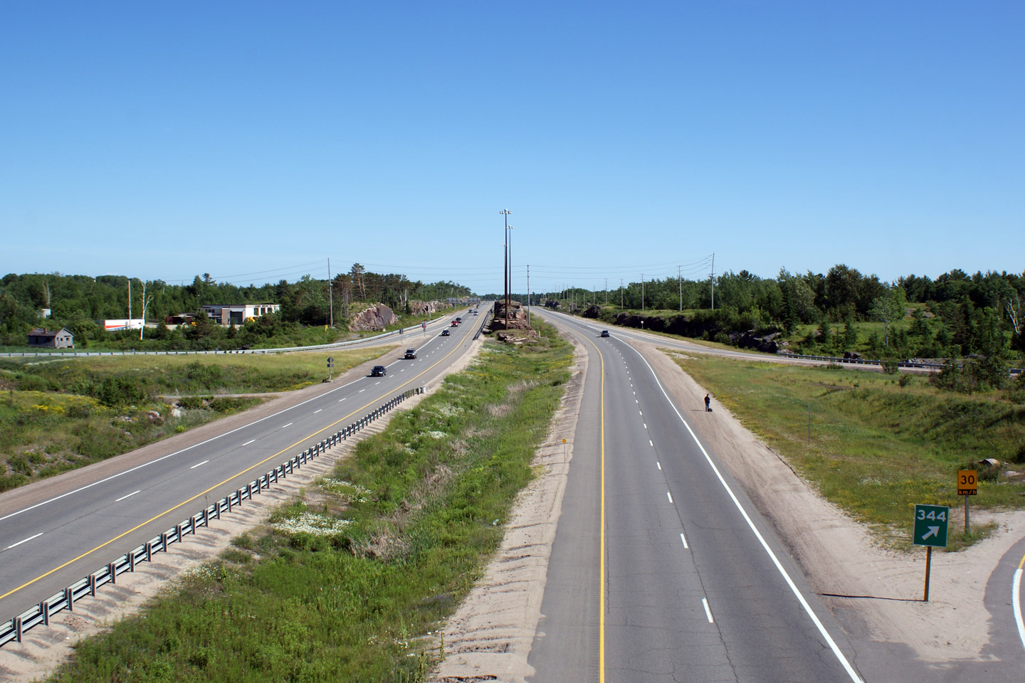
| Municipality of Powassan District of Parry Sound |
Signage approaching the Highway 534 junction near Powassan. The
interchange at Highway 534 is the only grade separated interchange along Highway 11 between
Trout Creek and Callander. Photo taken: June 18th, 2006. |
 |
|
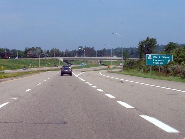
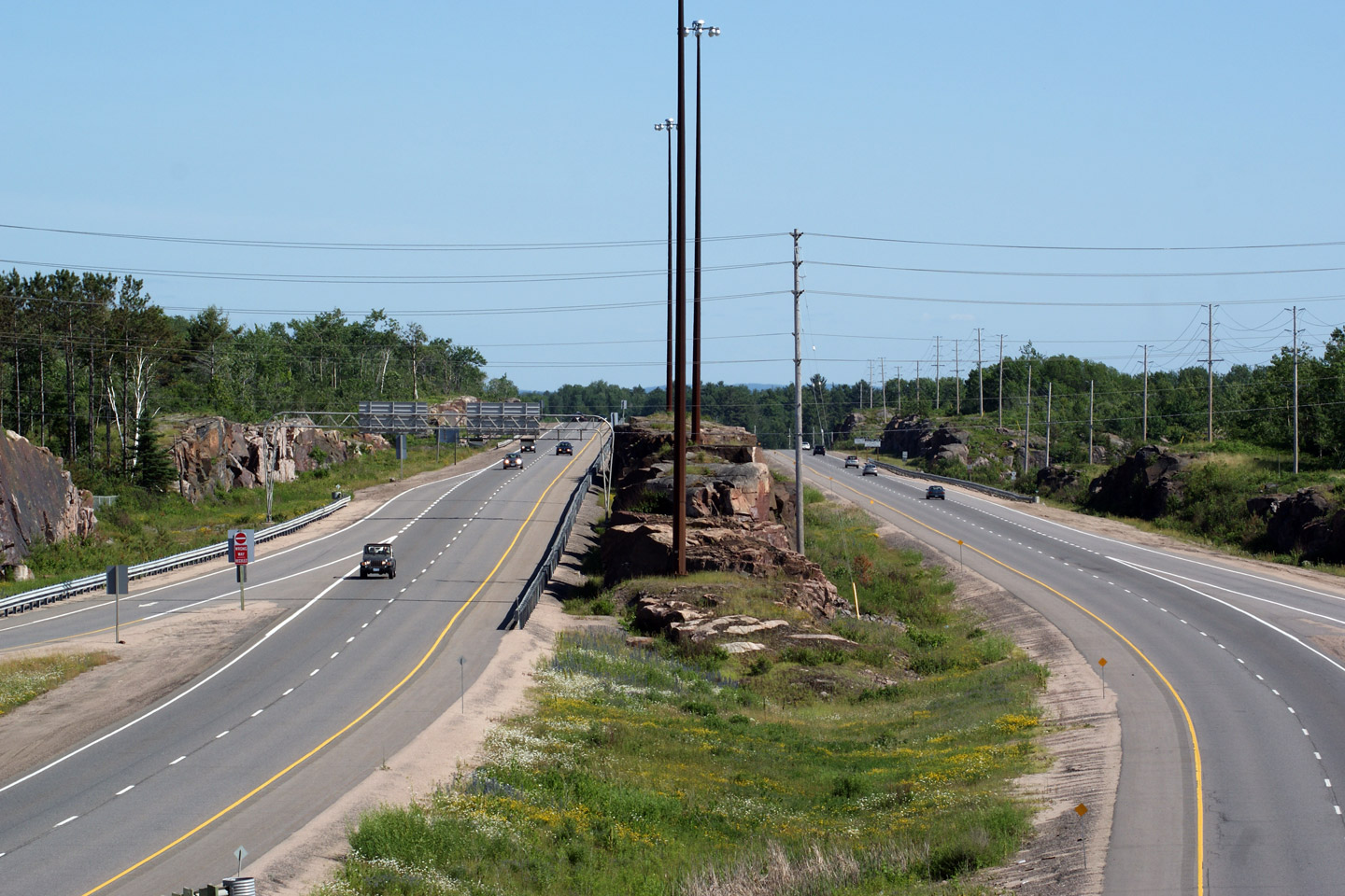
| Municipality of Powassan District of Parry Sound |
View looking northerly towards the
Highway 534
interchange.
Highway 534 meets Highway 11 at partial-cloverleaf interchange with all
ramps on the south side of the structure. Photo taken: June 18th, 2006. |
 |
|
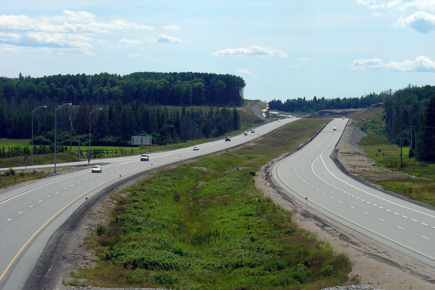
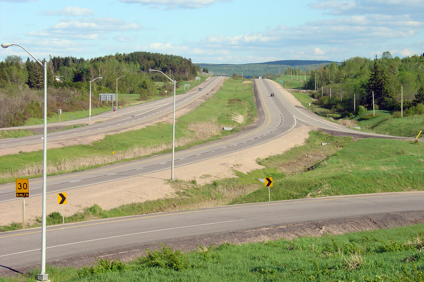
| Municipality of Powassan District of Parry Sound |
Highway 11 looking south from
Highway 534 at Powassan. Highway 534 is
located roughly at kilometre marker 316, and Powassan is located about 30km
south of North Bay. Photo taken: May 29th, 2004. |
 |
|
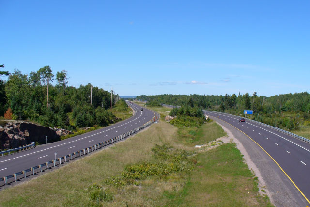
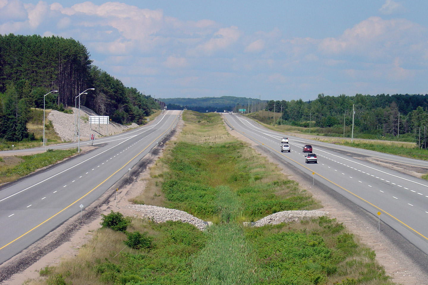
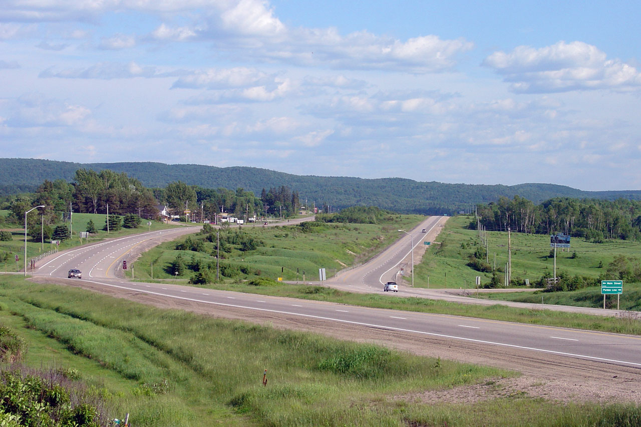
| Municipality of Powassan District of Parry Sound |
Highway 11 looking north from the
Highway 534 overpass. Originally,
Highway 11 ran directly through the heart of Powassan (running a few hundred
metres east of the current alignment). The Powassan By-pass was
constructed during the 1970s originally as a two-lane road. The
by-pass was twinned and freewayalized in the mid-1990s. Photo taken: May 29th, 2004. |
 |
|
|
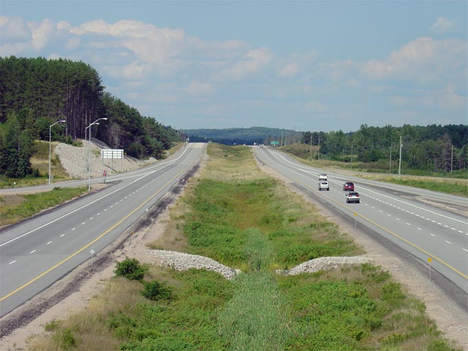
Municipality of Powassan District of Parry Sound |
Looking south through the McCharles/Lindquist Line at-grade intersection.
This intersection is located just to the north of Powassan, at roughly
kilometre marker 319. Photo taken: June 4th, 2006. |
 |
|
|
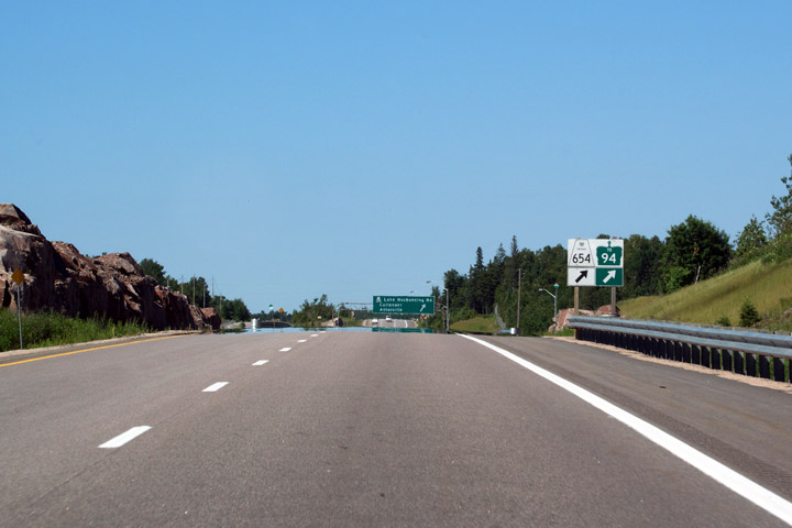
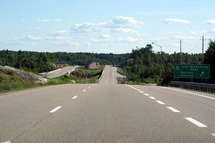
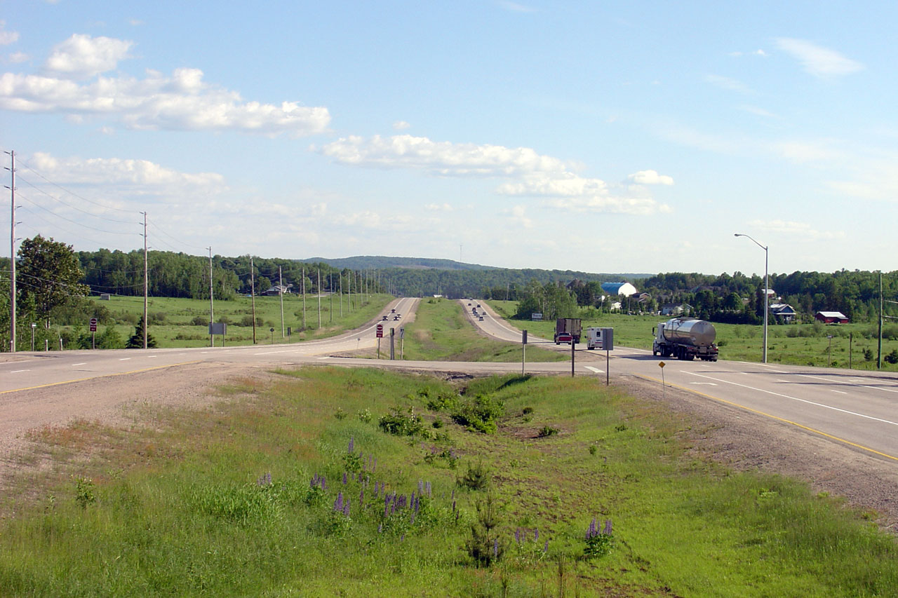
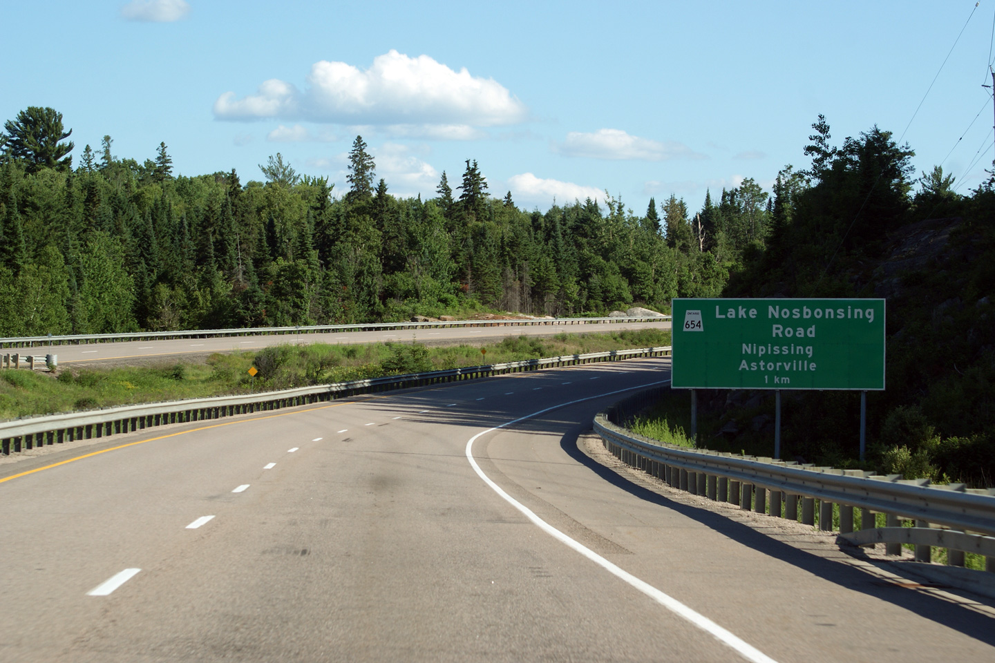
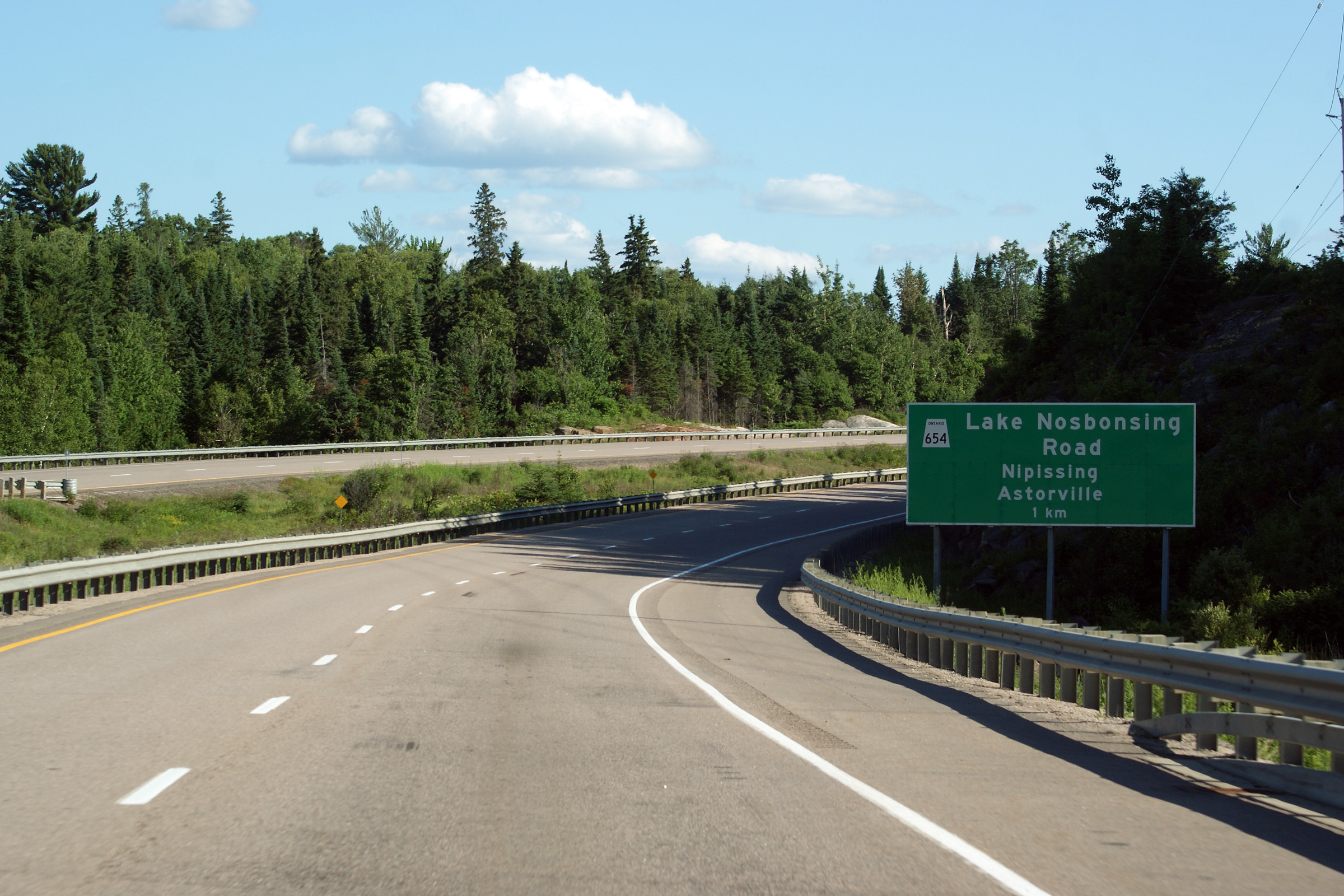
Township of North Himsworth District of Parry Sound |
Advanced signage for the Highway 654. Notice the odd shield used for
Highway 654 -- Ontario is written in the shield however the sign omits the
Ontario coat of arms. Photo taken: June 27th, 2009. |
 |
|
|
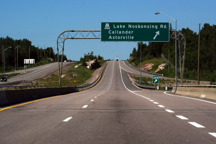
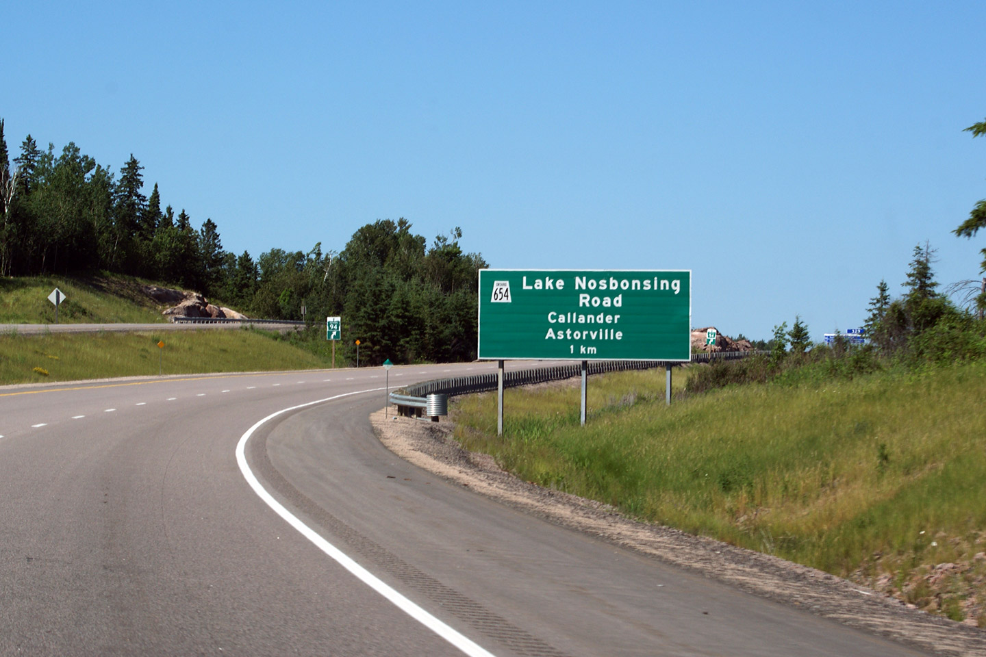
Township of North Himsworth District of Parry Sound |
Highway 94 is not directly accessible from Highway 654, rather traffic bound
for Highway 94 is directed to exit at Highway 654, to follow the secondary
highway for a short distance to Highway 94. Highway 94 is one of two
King's Highway's to end at a secondary highway. Photo taken: June 27th, 2009. |
 (720x480) (720x480)(1440x960) |
|
|
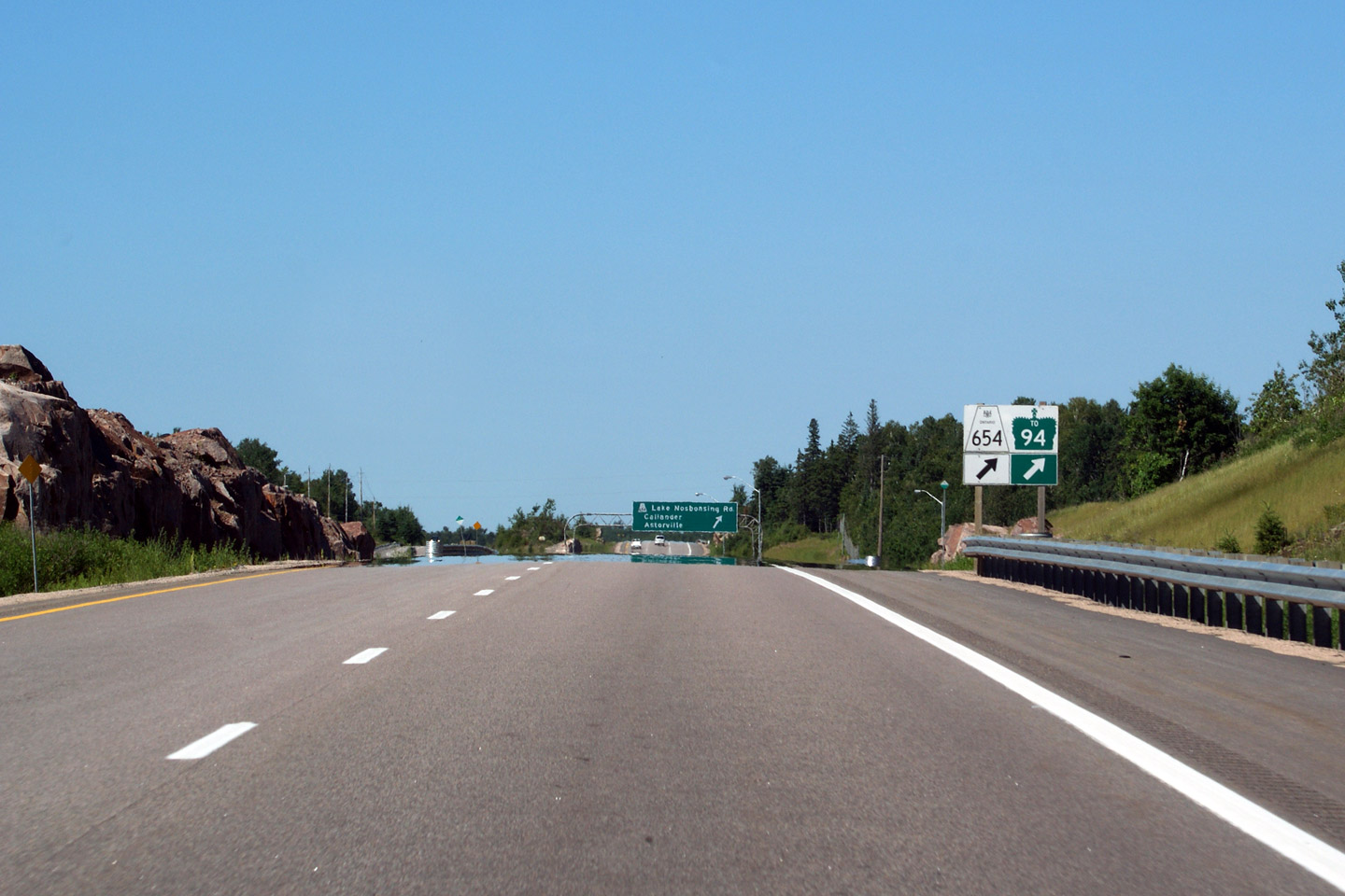
Township of North Himsworth District of Parry Sound |
Overhead sign northbound at the Highway 654 exit. This overhead sign
dates back to 1982 when the Highway 11 freeway was extended south of
Callander. Photo taken: June 27th, 2009. |
 (720x480) (720x480)(1440x960) |
|
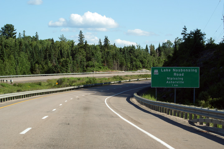
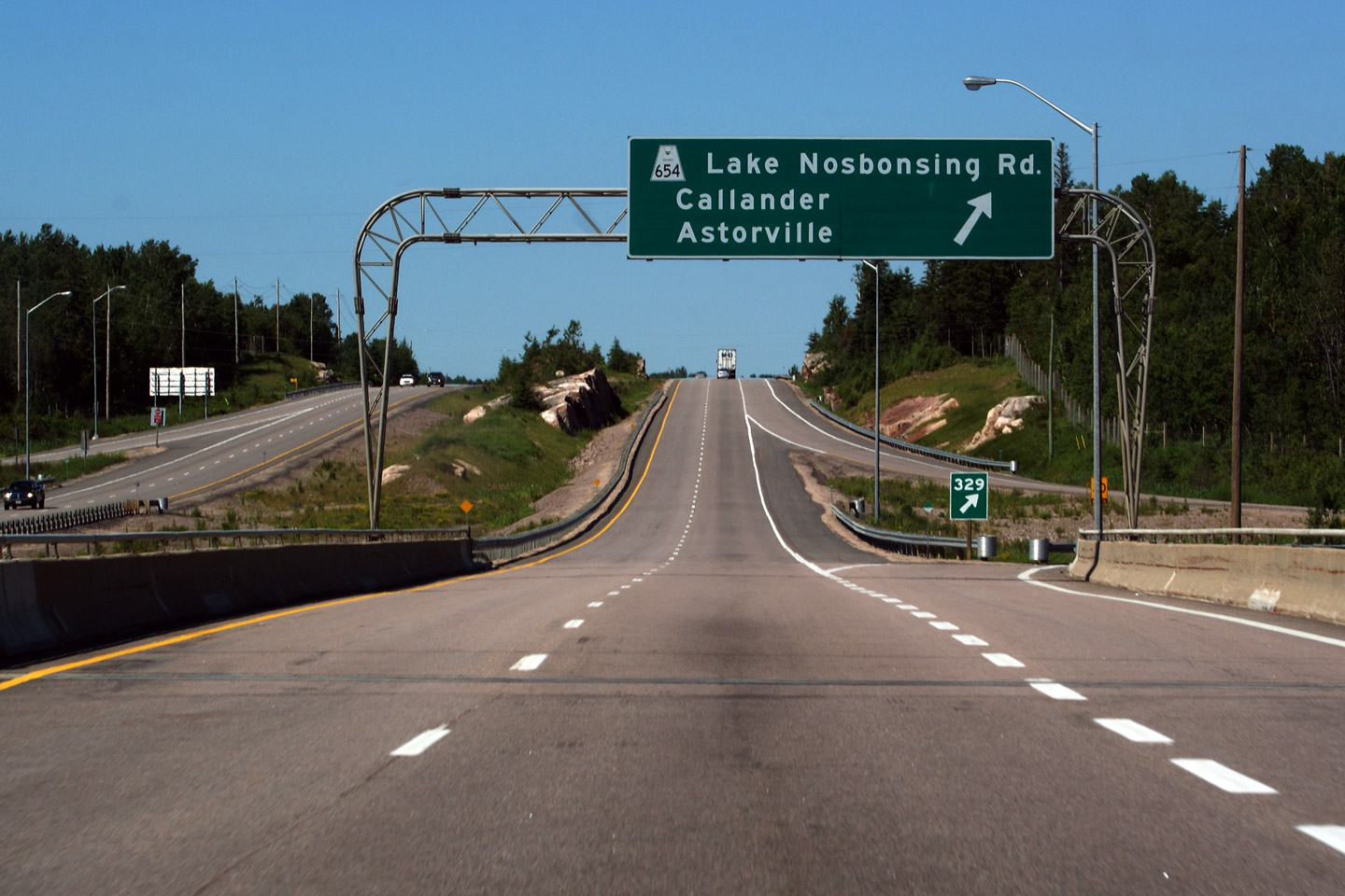
| Highway 654 leads west of Highway 11 to Highway 534 at Nipissing. Click here for Highway 654 images. | |||
|
Municipality of Callander District of Parry Sound |
A Unique view of Highway 11 looking south from the median towards the
Highway 654 interchange. Photo Courtesy: Patrick Gaudreau. Taken: September 22nd, 2007. |
 |
|
|
Municipality of Callander District of Parry Sound |
Southbound signage at the off-ramp to Highway 654. Photo taken: June 23rd, 2012. |
 (720x480) (720x480)(1440x960) (2400x1600) |
|
|
Municipality of Callander District of Parry Sound |
Advanced signage for the southbound off-ramp to Highway 654. Photo taken: June 23rd, 2012. |
 (720x480) (720x480)(1440x960) (2400x1600) |
|
|
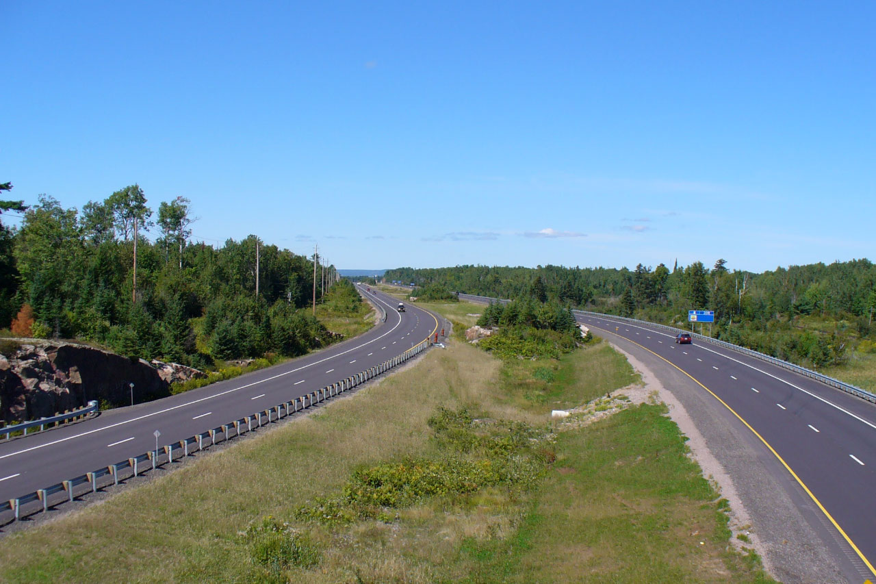
Municipality of Callander District of Parry Sound |
Another median view of Highway 11, this time looking south from roughly 1km
north of the Highway 654 interchange. Highway 11 was extensively
reconstructed between Highway 654 and North Bay during the Summer of 2006. Photo Courtesy: Patrick Gaudreau. Taken: September 22nd, 2007. |
 |
|
|
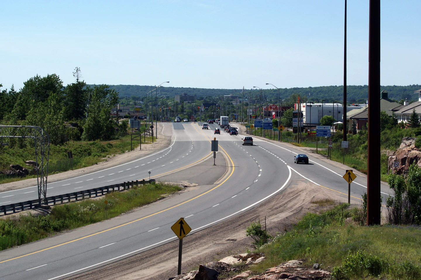
Township of East Ferris District of Nipissing |
View looking south from the Highway 94 overpass towards Highway 11.
This is the only place where an active King's Highway crosses another King's
Highway without connecting directly to it Photo Courtesy: Patrick Gaudreau. Taken: September 22nd, 2007. |
 |
|
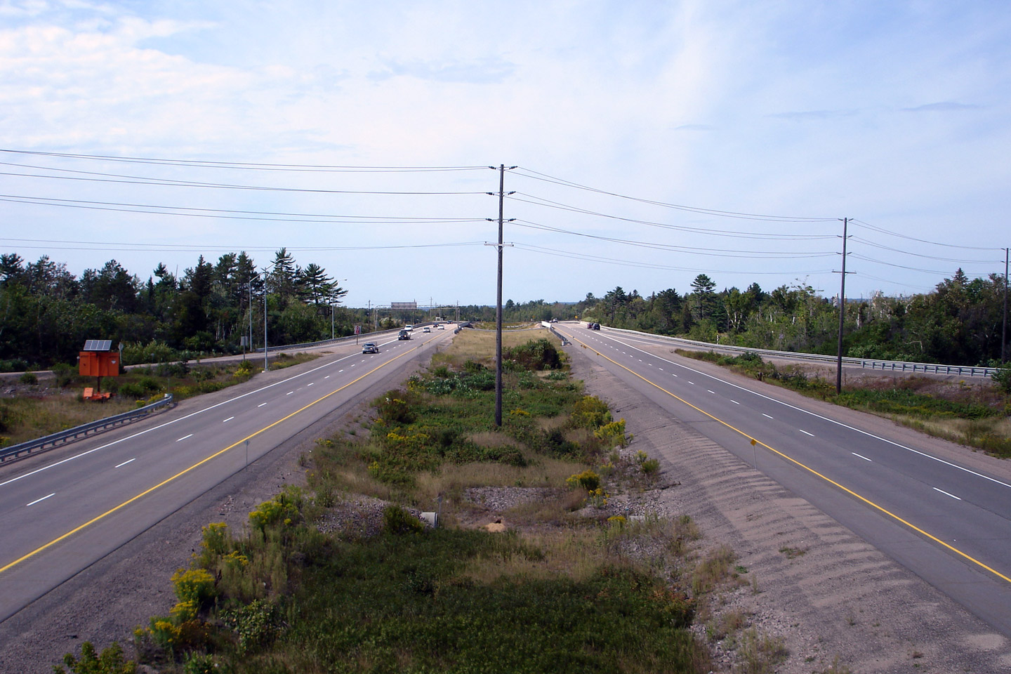
|
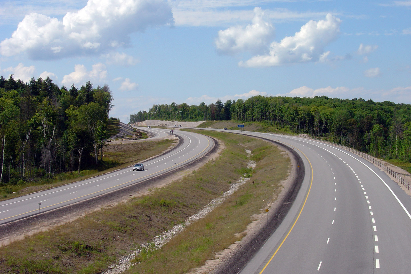
Township of East Ferris District of Nipissing |
Looking north towards North Bay on a very recently reconstructed divided
highway. Photo Courtesy: Patrick Gaudreau. Taken: September 22nd, 2007. |
 |
|
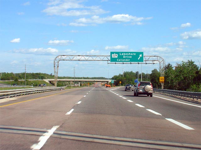
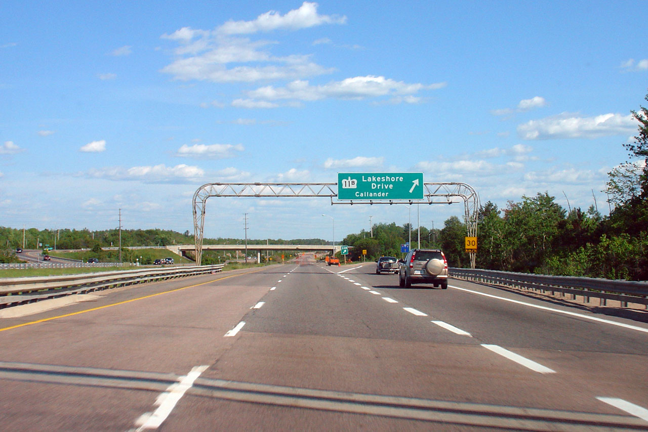
| City of North Bay |
Guide signage in advance of the Highway 11B interchange at the south end of
North Bay. Photo taken: August 26th, 2006. |
 |
|
| City of North Bay |
View looking southerly along Highway 11 from the Highway 11B overpass in the
south of North Bay. Photo taken: June 27th, 2009. |
 |
|
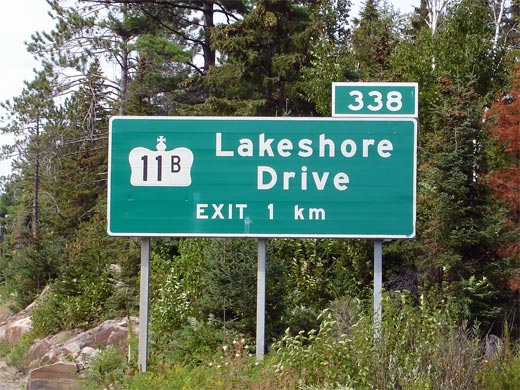
| Lakeshore Drive carried the Highway 11B designation until 1997, and is Highway 11's former alignment through North Bay. Click here for Highway 11B images (Coming Soon!) | |||
| City of North Bay |
Looking north from the Highway 11B overpass just to the south of North Bay. Photo taken: August 26th, 2006. (720x480): 50kb. |
 |
|
| City of North Bay |
Overhead sign over Highway 11's southbound lanes, denoting the Highway 11B
interchange. Photo taken: June 4th, 2006. |
 |
|
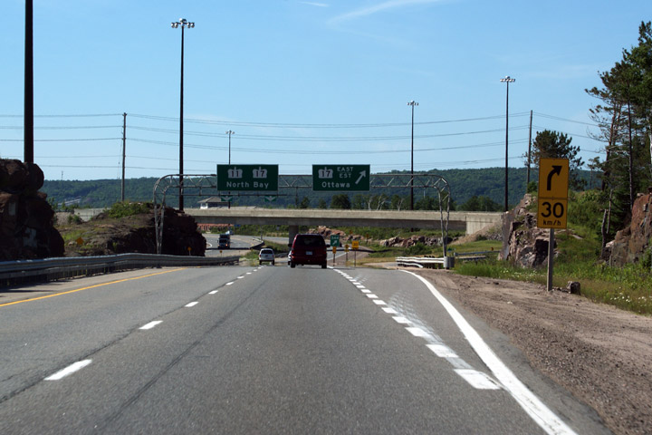
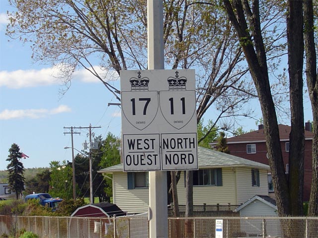
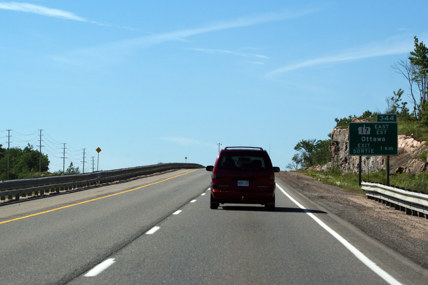
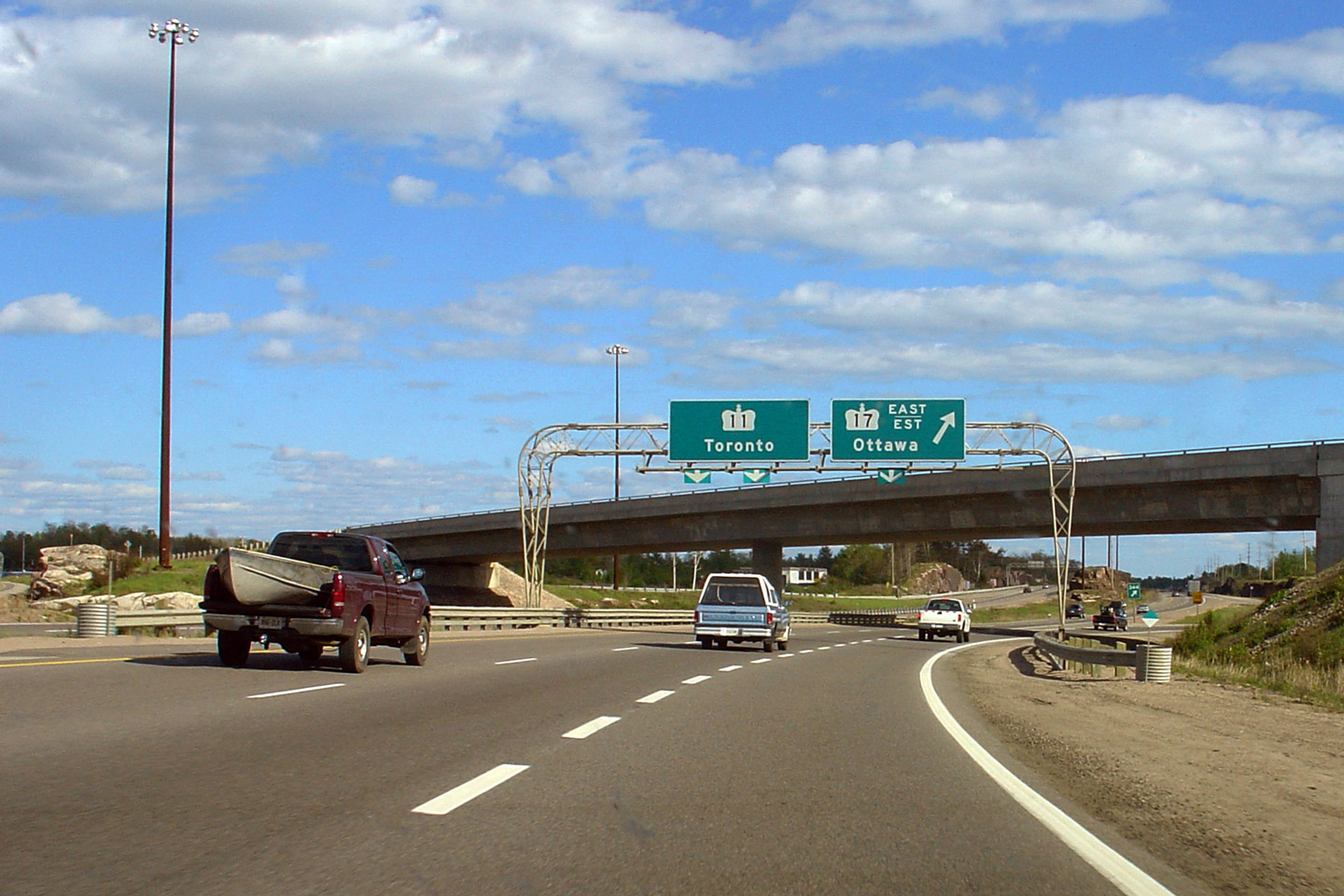
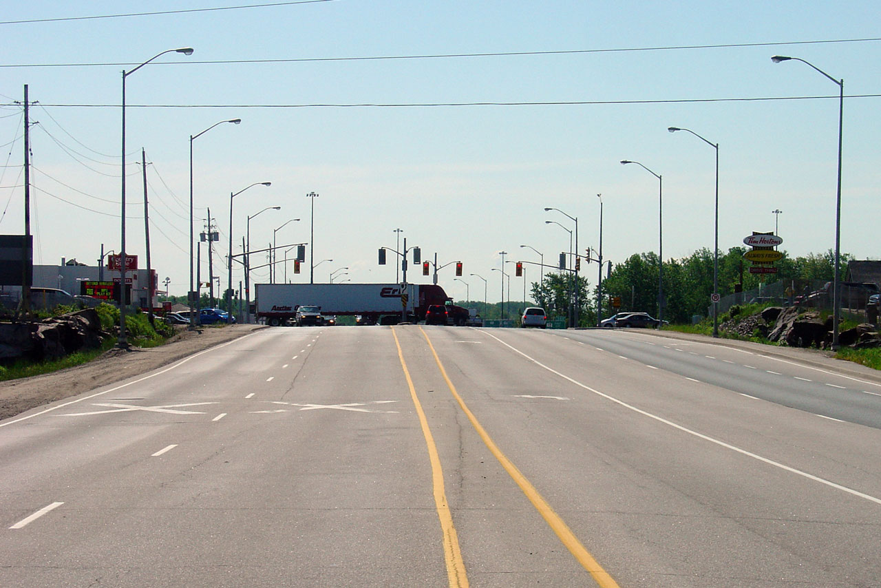
| City of North Bay |
Northbound signage in advance of the Highway 17 interchange. Notice the use
of EXIT/SORTIE before the distance. This is very atypical of Ontario
signage. Photo taken: June 27th, 2009. |
 |
|
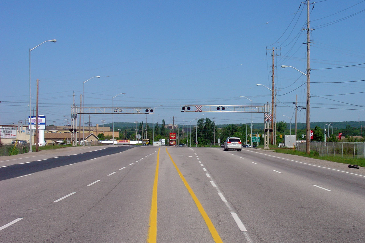
| City of North Bay |
Overhead gantry for the Highway 17-East interchange. North and West of the
this interchange, Highway 11 and 17 follow the undivided at-grade North Bay
by-pass through the north of the City. Photo taken: June 27th, 2009. |
 (720x480) (720x480)(1440x960) |
|
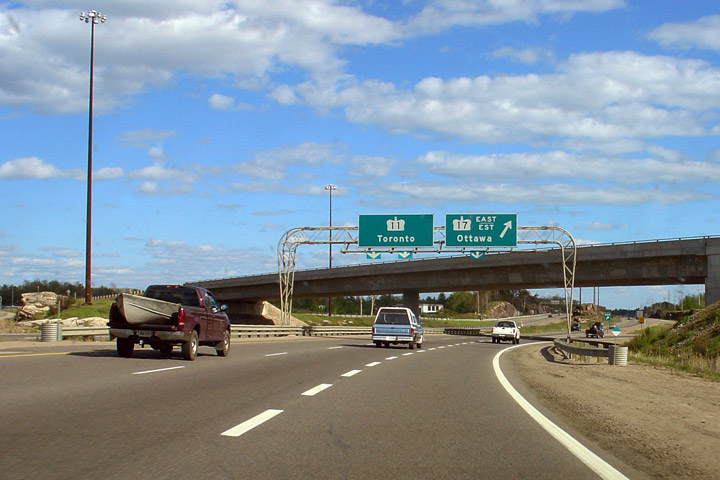
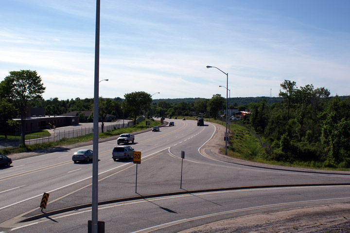
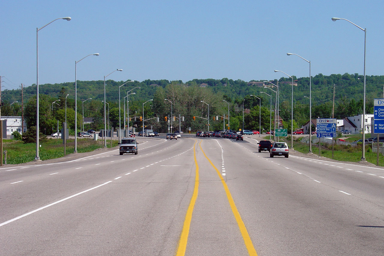
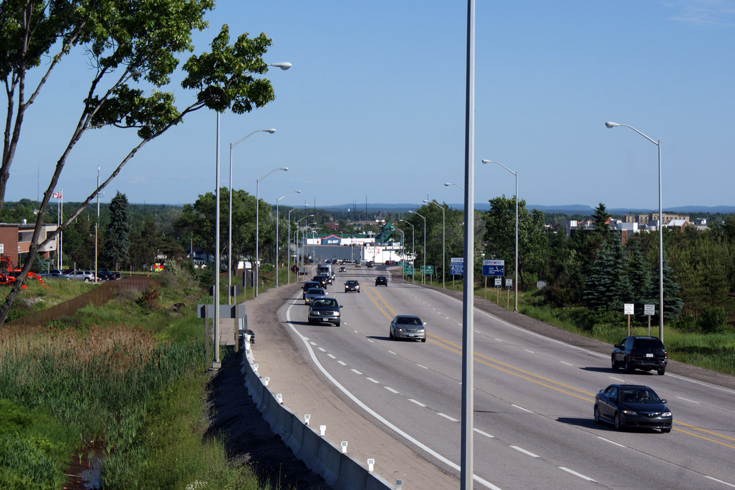
| City of North Bay |
Two views looking southerly from the Highway 17 overpass along Highway 11.
It takes almost 3 and a half hours to drive Highway 11 from North Bay to
Toronto. Photos taken: June 27th, 2009. |
 |
|
| East of Highway 11, Highway 17 leads through the Upper Ottawa River Valley. Click here for Highway 17 images. | |||
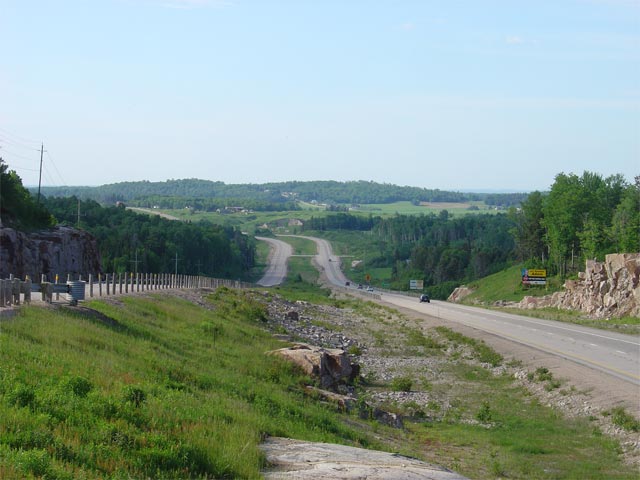
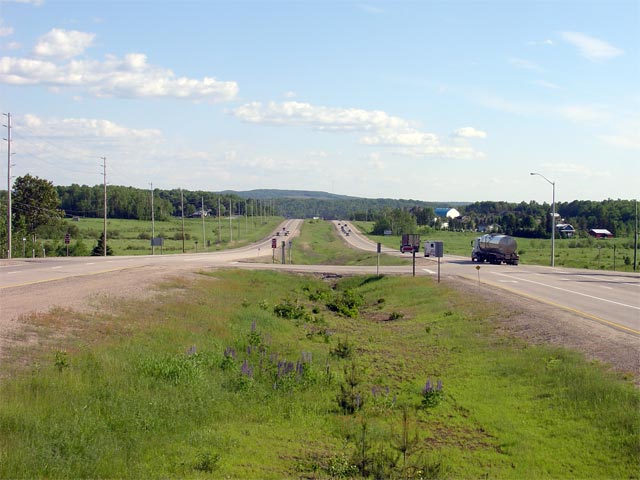
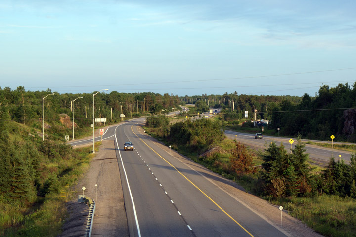
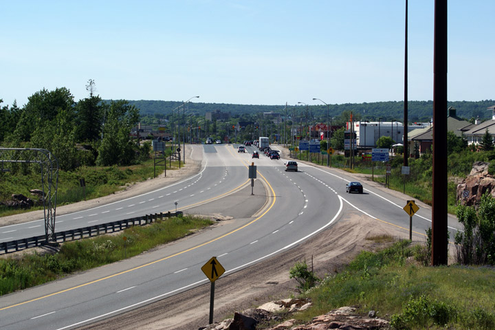
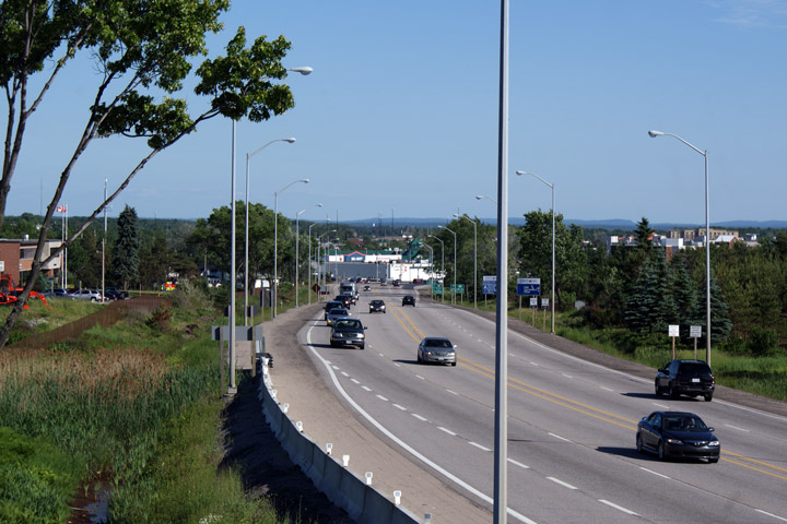
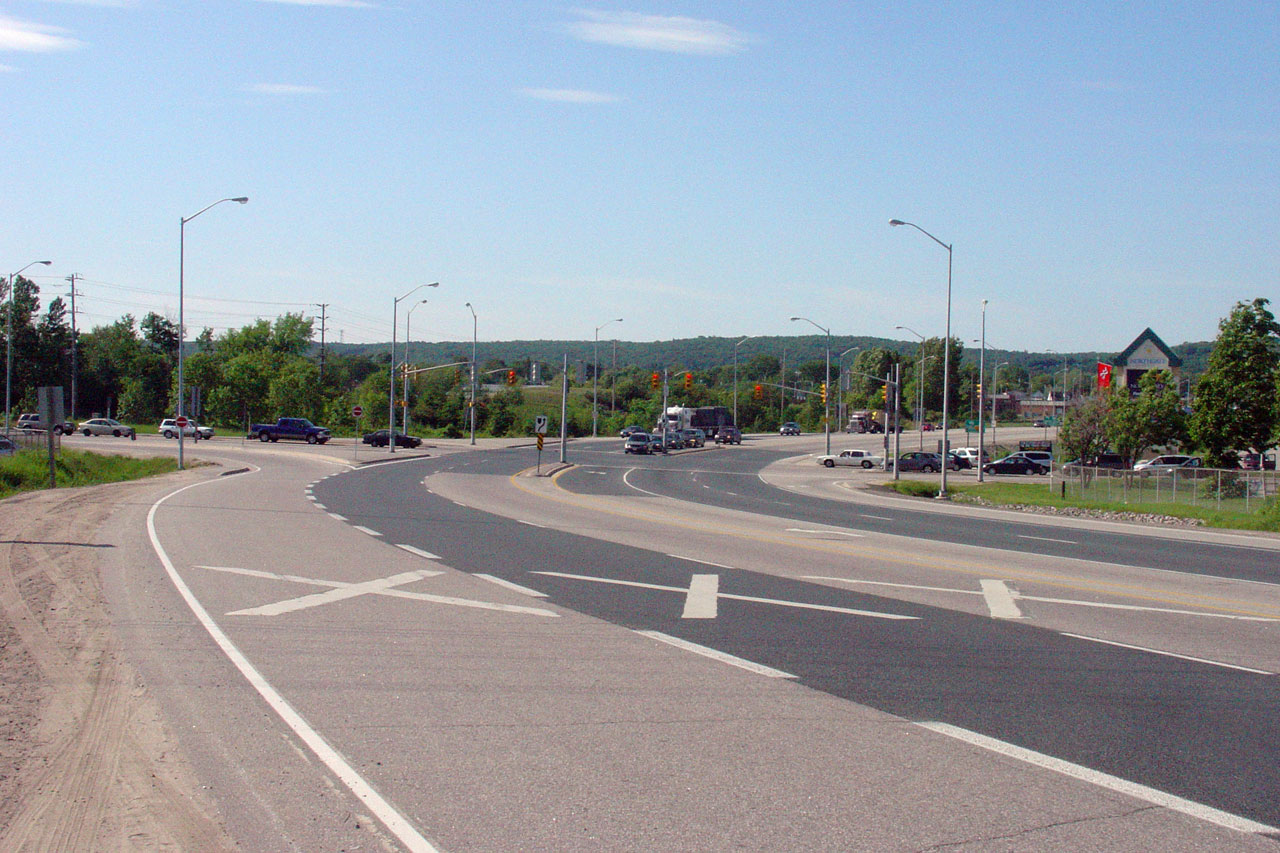
| City of North Bay |
View looking northerly from the Highway 17 overpass at the southern portion
of the North Bay by-pass. The North Bay by-pass was built as a four
lane road long before the Highway 11 freeway to Callander was completed;
this of course explains why Highway 11/17 wasn't constructed as a full freeway. Photo taken: June 27th, 2009. |
 |
|
| City of North Bay |
Highway 11/17 driving south and eastbound approaching the Highway 11/17
trumpet interchange. Photo taken: May 29th, 2004. |
 |
|
| City of North Bay |
View looking south along Highway 11/17
towards the Seymore Street intersection. Seymore Street is the
southern-most signalized intersection located on the North Bay By-pass.
Seymore Street is located roughly 700m north of the
Highway 17 interchange. Photo taken: June 4th, 2006. |
 |
|
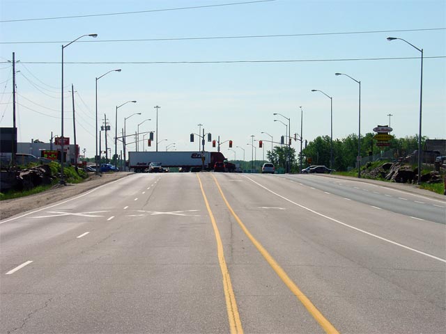
| City of North Bay |
View looking northerly along Highway 11/17
from the same vantage point as the previous photo. Between Seymore and
Fisher Street's, Highway 11/17
crosses the Ontario Northland Railway at-grade. Between the Highway 17
interchange and Fisher Street, the North Bay by-pass follows the orginal
routing of Highway 17 into the City. Photo taken: June 4th, 2006. |
 |
|
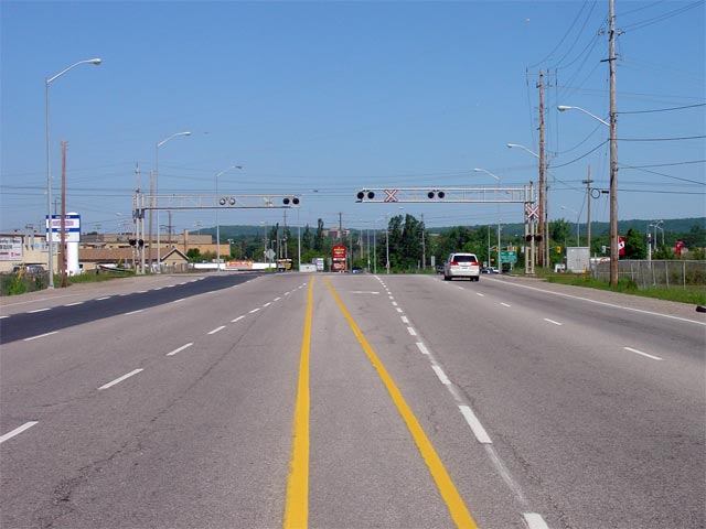
| City of North Bay |
Advanced signage for the Highway 17B intersection along the North Bay
By-pass. Signs indicating 'B' routes in North Bay were finally removed
from area highways in late 2007. Photo taken: June 4th, 2006 |
 |
|
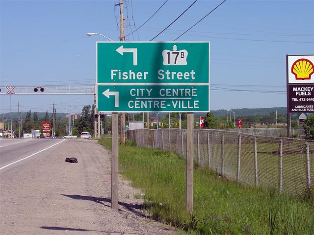
| City of North Bay |
View looking northwesterly along the North Bay By-pass towards the Highway
17B intersection. Photo taken: June 4th, 2006. |
 |
|
| Fisher Street is Highway 17's former route through North Bay. Click here for Highway 17B images (Coming Soon) | |||
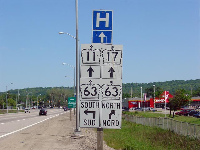
| City of North Bay |
Advanced signage for the Highway 63 junction. Though
Highway 63 is
indicated leading both directions from the North Bay By-pass, this is
technically incorrect, as Highway 63 was
downloaded south of the North Bay By-pass in 1998. Photo taken: June 4th, 2006. |
 |
|
| City of North Bay |
Looking northwesterly along the North Bay By-pass towards the
Highway 63
junction. Photo taken: June 4th, 2006. |
 |
|
| Highway 63 is the main route between North Bay and the Temiscamingue Region of Quebec. Click here for Highway 63 images. | |||
| City of North Bay |
View looking southerly along Highway 11/17 from the new pedestrian overpass
constructed during the Summer of 2009 in the vicinity of the Frost Street
RIRO intersection. Northgate Mall is visible in the distance of this
photo. Photo taken: June 27th, 2009. |
 |
|
| City of North Bay |
View looking northerly along the North Bay by-pass from the Frost Street
pedestrian overpass. Photo taken: June 27th, 2009. |
 |
|
| City of North Bay |
An unusual way to sign a multiplex! 'Uniboard' signage has become
increasingly more popular throughout Ontario, particularly in the North Bay
area. This sign showcases an 11/17 shield assembly located
north and westbound just north of Highway 63 along the North Bay Bypass. Photo (720x480): 90kb. |
|
|
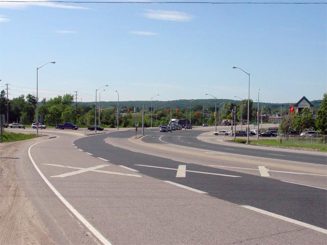
| City of North Bay |
The junction assembly for the western North Bay split of Highways
17 and
11.
Highway 17 continues west of Highway 11 on the North Bay By-pass until
narrowing to a conventional two-lane highway a few kilometres westerly. Highway 11 heads north towards New Liskard
and Cochrane also mostly as a conventional two-lane highway. Photo (720x480): 50kb. |
 |
|
| West of Highway 11, Highway 17 continues to Sudbury, through Sault Ste. Marie, eventually meeting Highway 11 once again in Nipigon. Click here for Highway 17 images. | |||
| Continue north on Highway 11 via North Bay to Cochrane Images | |||
<- Page 2E Images Highway 11 Images Index Page 3A Images ->
<- Highway 10 Images Back to Highway 11 Highway 11A Images ->
Copyright (c) 2004-2014, AsphaltPlanet.ca scott@asphaltplanet.ca