|
Proper Municipality Name |
Photo Description |
Photo |
|
Pictures taken
from driver's perspective appear offset from centre-line pictures: |
East-
bound |
West-
bound |
|
Pictures continue westward from
Page 3G Images |
|
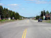
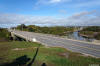
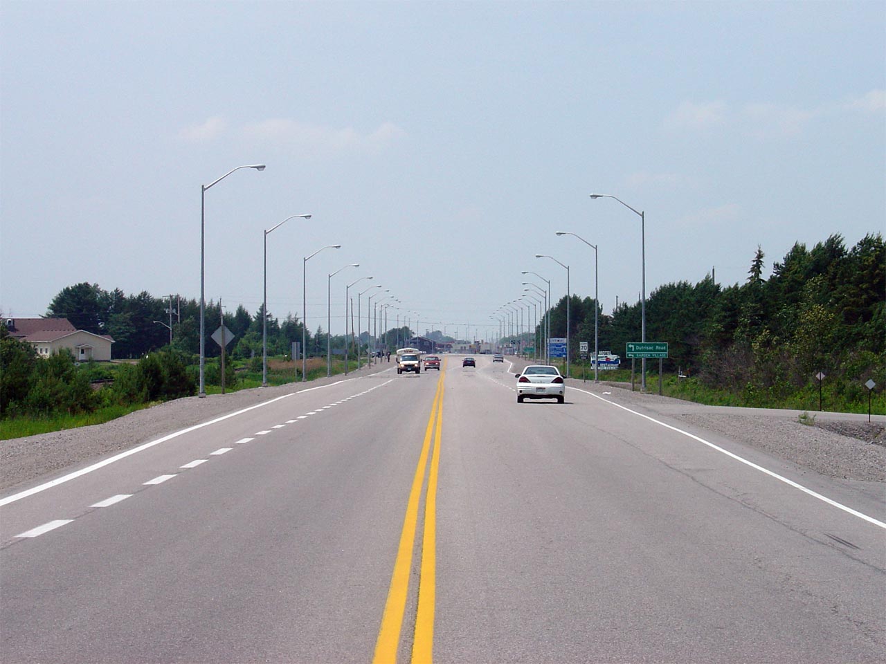
Municipality of West Nipissing District of Nipissing |
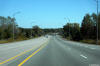
Highway 17/64 looking east from
the western Highway 17/64 junction. For a great deal of the route
between Sudbury and North Bay, Highway 17 passes through very flat terrain.
Picture taken: May 29th, 2004.
Size: 50kb. |
 |
|
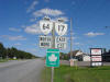
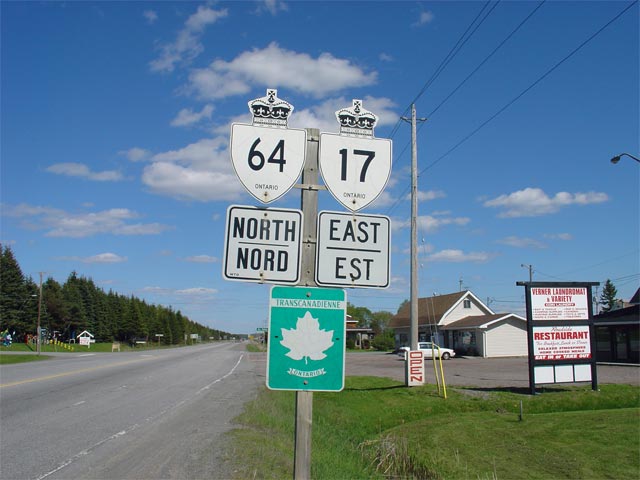
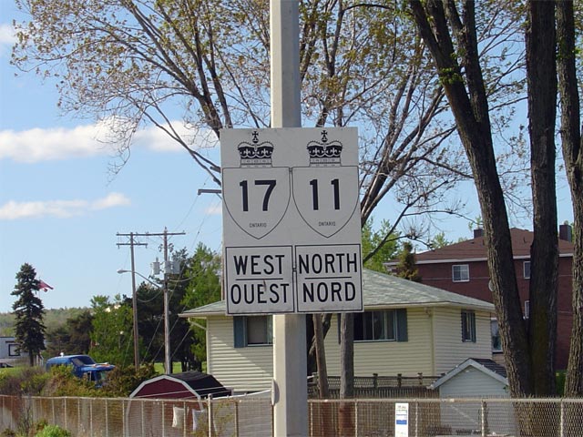
Municipality of West Nipissing District of Nipissing |
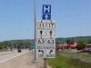
First cosign assembly eastbound on Highway 17/64 just east of Verner.
Oddly all assemblies on this co-designation are signed with the Highway 64
shield before the Highway 17 shield. This is inconsistent with normal
signage practices in Ontario.
Picture size: 50kb. |
 |
|
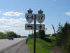
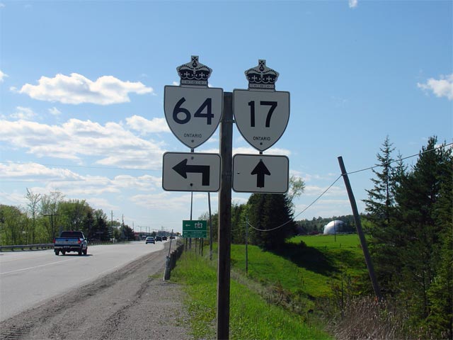
Municipality of West Nipissing District of Nipissing |
Signage denoting the western
split of Highway 17/64 at Verner. This picture was taken westbound on
Highway 17. Straight ahead, Highway 17 leads towards Sudbury. A
left turn at this junction leads travelers southbound towards Lavigne and
Noelville.
Picture size: 50kb. |
 |
|
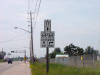
Municipality of West Nipissing District of Nipissing |
Easterly view at the eastern Highway 64 junction in Sturgeon Falls.
Photo taken: September 21st, 2015. |

(720x480)
(1440x960)
(2400x1600) |
|
Highway 64 extends north and
south from Highway 17.
Click here for Highway 64 images. |
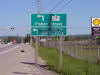
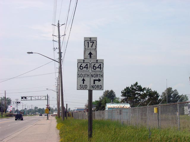
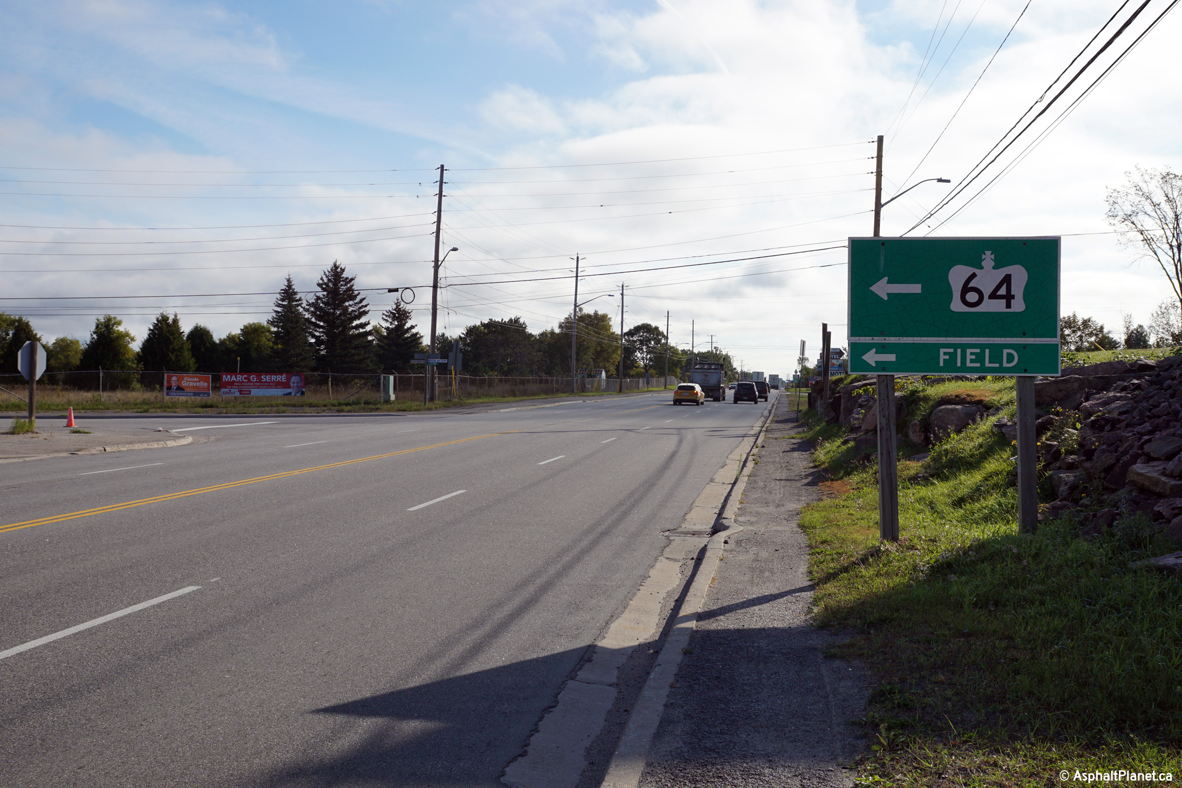
| Municipality of West Nipissing District of Nipissing |
Westbound junction assembly for Highway 64-North.
North of Sturgeon Falls, Highway 64 jogs through Sturgeon Falls, leading
through Field before terminating at Highway 11. Picture taken: June 18th,
2006. Size: 60kb. |
 |
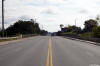
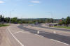
| Municipality of West Nipissing District of Nipissing |
View looking westerly approaching the Highway 64 at the western edge of
Sturgeon Falls.
Photo taken: September 21st, 2015. |
(720x480)
(1440x960)
(2400x1600) |
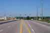
| Municipality of West Nipissing District of Nipissing |
View looking easterly as Highway 17 crosses over the Sturgeon River bridge
in Sturgeon Falls.
Photo taken: September 21st, 2015. |
(720x480)
(1440x960)
(2400x1600) |
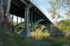
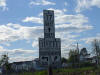
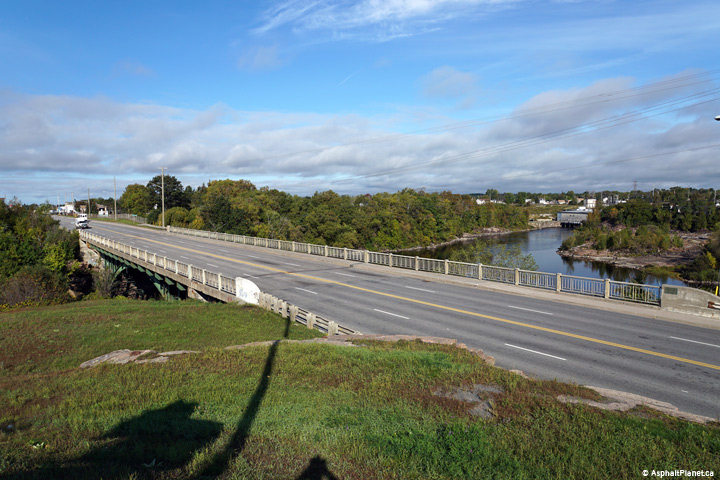
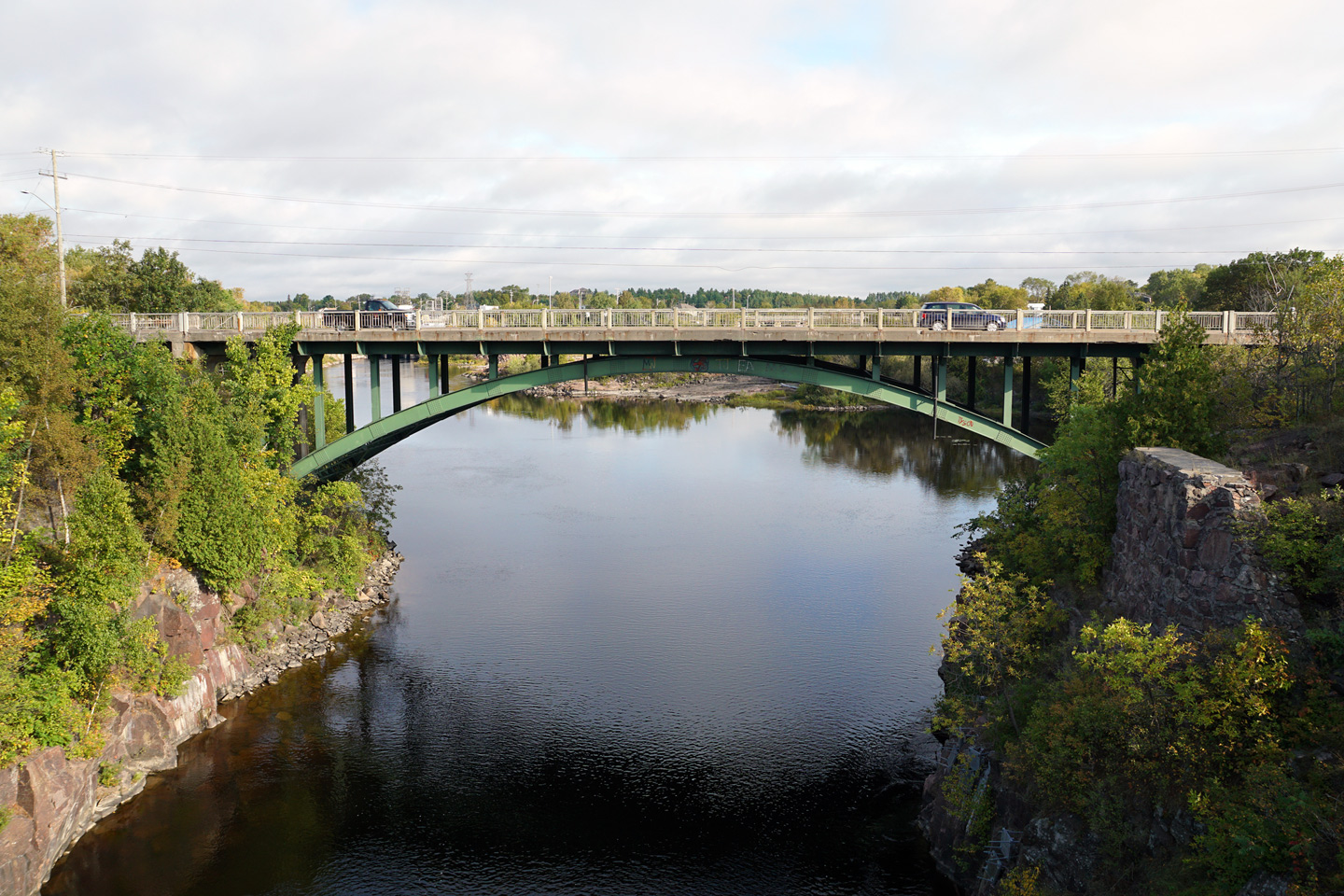
| Municipality of West Nipissing District of Nipissing |
View looking northerly towards the picturesque steel arch structure that
carries Highway 17 overtop of the Sturgeon River.
Photo taken: September 21st, 2015. |
(720x480)
(1440x960)
(2400x1600) |
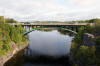
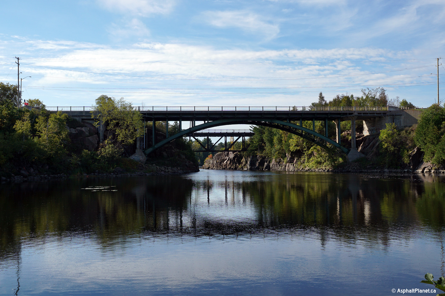
| Municipality of West Nipissing District of Nipissing |
Views both to the south and southeasterly towards the Sturgeon River Bridge.
There are surprisingly few steel arch bridges such as this elsewhere on the
provincial highway network.
Photos taken: September 21st, 2015. |

(720x480)
(1440x960)
(2400x1600)
(720x480)
(1440x960)
(2400x1600) |
| Municipality of West Nipissing District of Nipissing |
View looking easterly towards the Sturgeon River bridge from a small
parkette that overlooks the picturesque structure.
Photo taken: September 21st, 2015. |
(720x480)
(1440x960)
(2400x1600) |
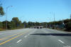
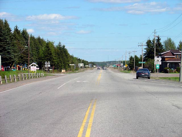
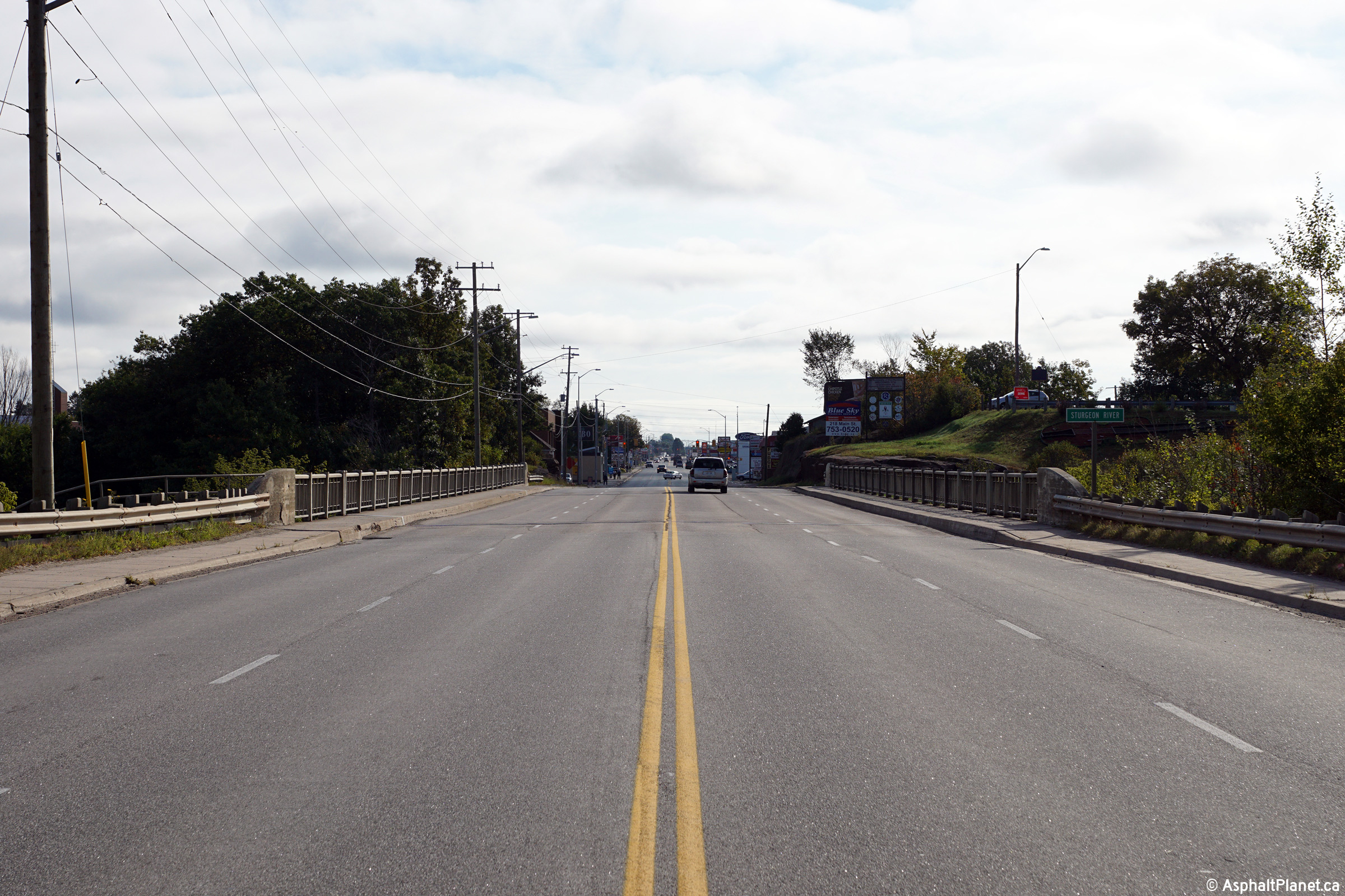
| Municipality of West Nipissing District of Nipissing |
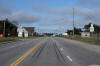
Looking westerly towards Sturgeon Falls along Highway 17 from the eastern
edge of the community. Sturgeon Falls is the largest community between
Sudbury and North Bay and is one of the largest communities not to be
by-passed along Highway 17's route.
Picture taken: June 18th, 2006. |
(720x480)
(1440x960) |
|
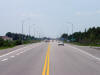
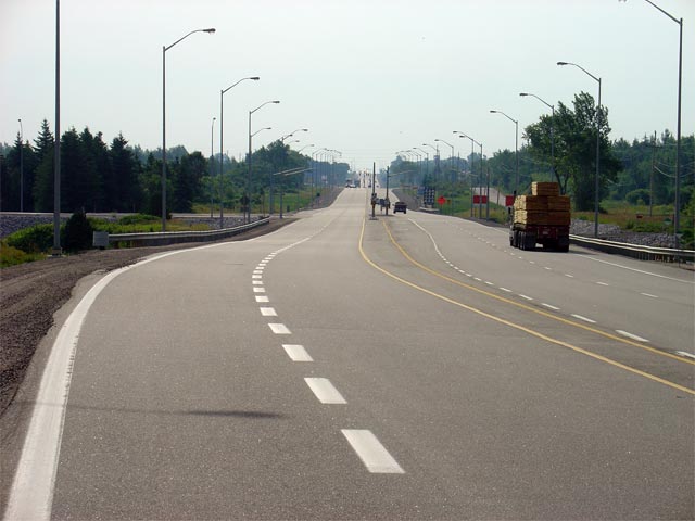
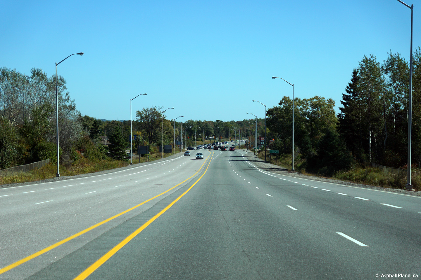
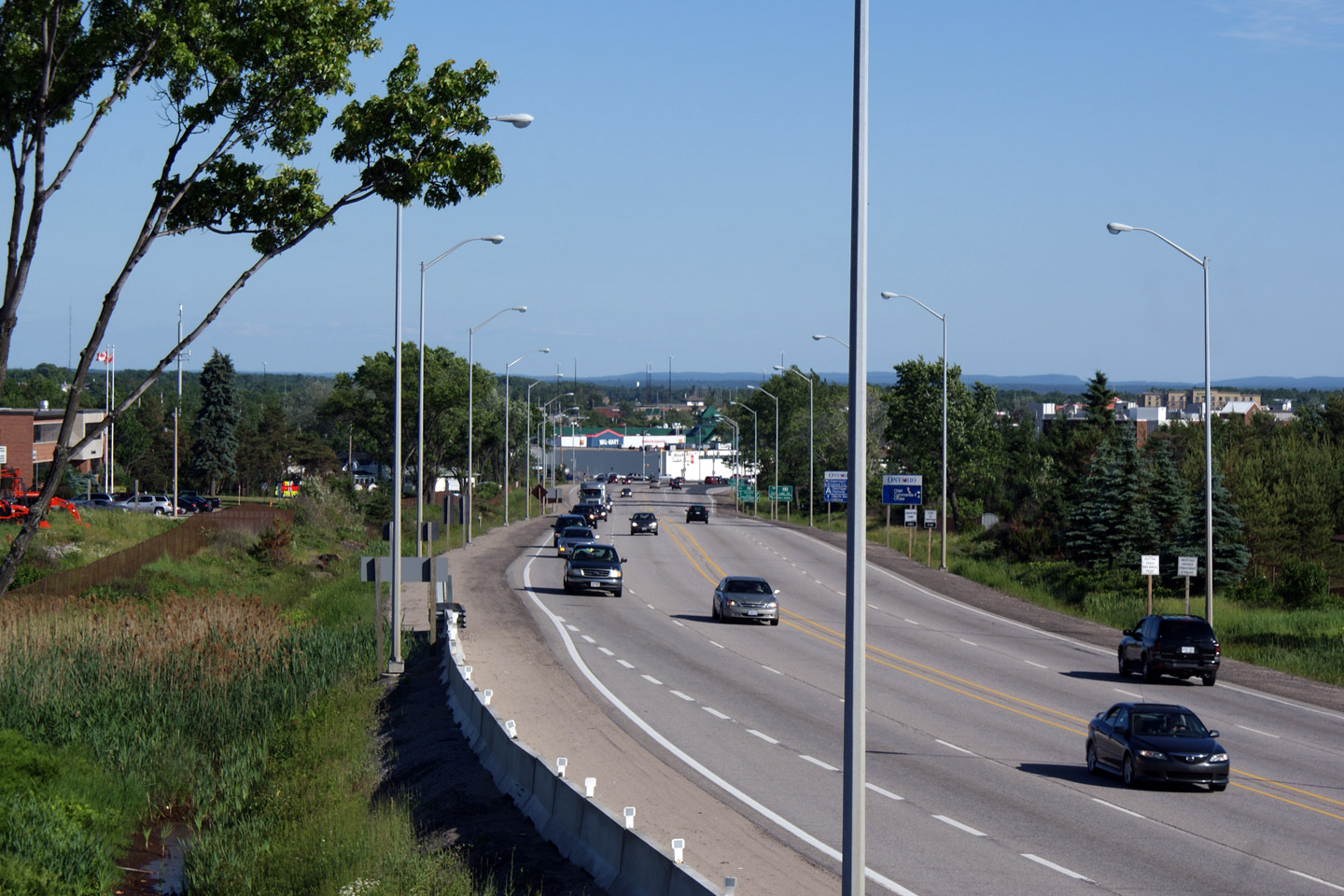
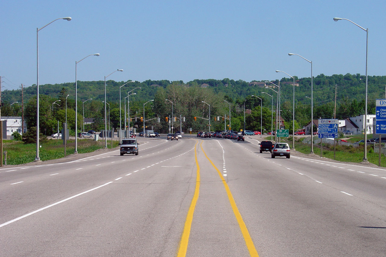
District of Nipissing |
Highway 17 looking east from just
west of the western Highway 17B junction in North Bay. When first
constructed in the 1930s, Highway 17 would have curved right and followed
what is now Highway 17B into North Bay. The North Bay Bypass was built
in the 1950s as a two lane route bypassing congested downtown North Bay.
The North Bay Bypass is currently a 4-lane undivided, at-grade urban
expressway.
Picture taken: May 29th, 2004.. |
_east_small.jpg) |
|
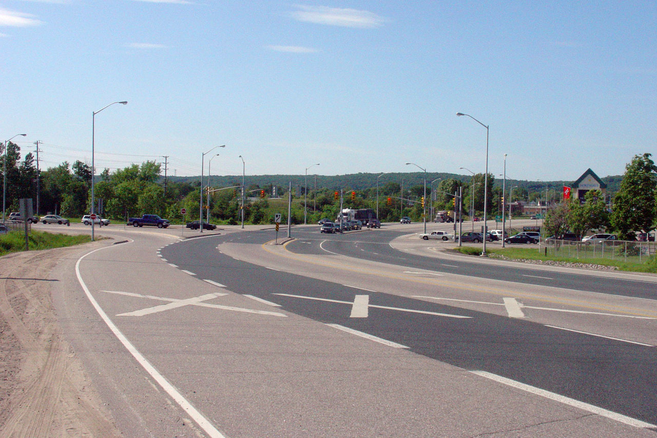
City of North Bay |
View looking easterly along the North Bay By-pass roughly halfway between
Lakeshore Road and Gormanville Road. Notice the roughed in
intersection at the future site of the North Bay Hospital. It is from this intersection southeasterly that
the North By-pass has a 4.5 lane cross-section.
Picture taken: July 4th, 2005. |
(720x480)
(1440x960) |
|
Highway 11 departs northerly from
the North Bay By-pass at Algonquin Avenue.
Click here for Highway 11-North Images. |
|
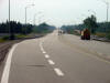
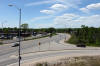
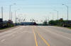
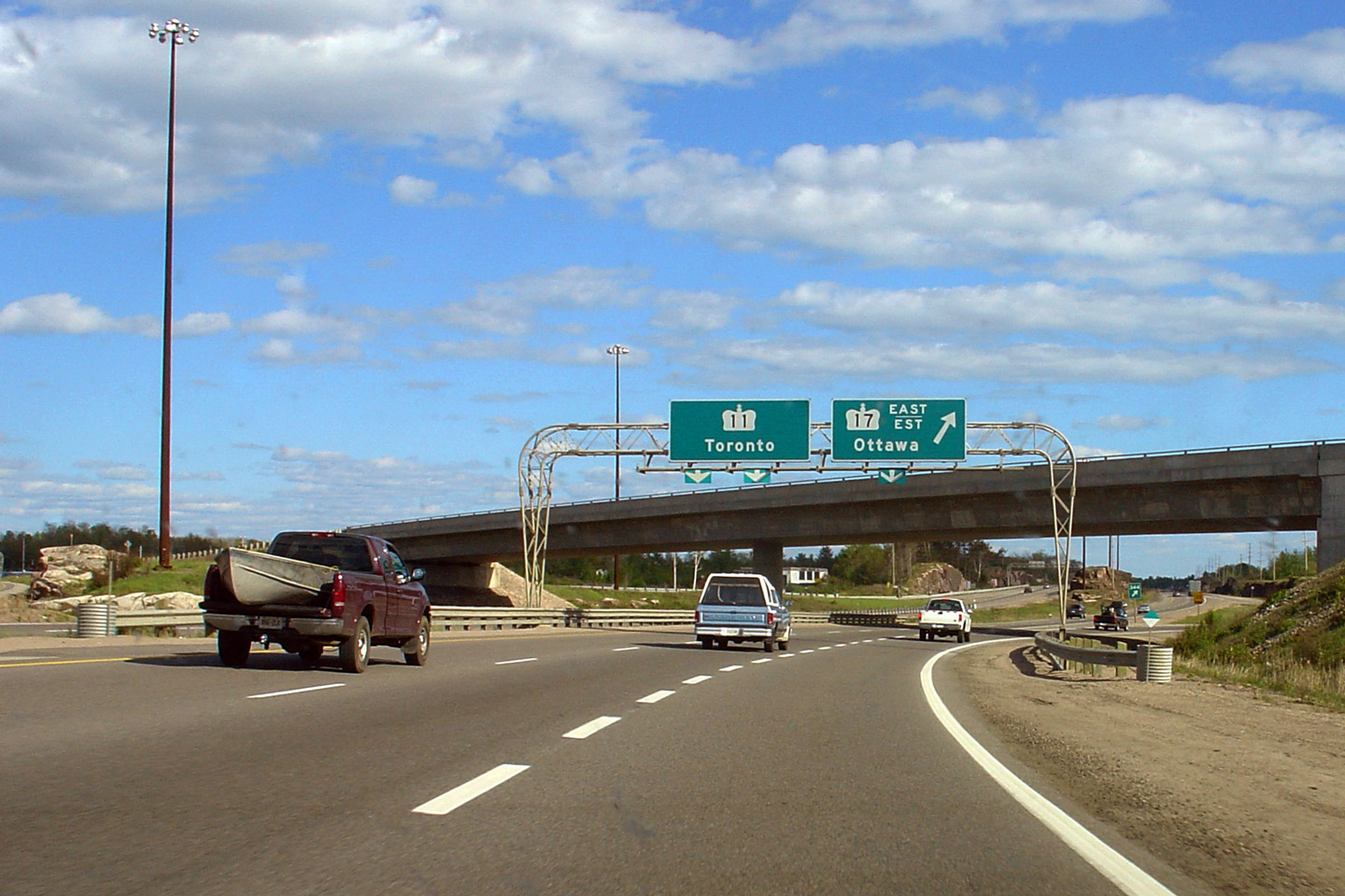
City of North Bay |
The junction assembly for the western North Bay split of Highways 17 and
11.
Highway 17 continues west of Highway 11 on the North Bay Bypass until
narrowing to a conventional two-lane highway a few kilometres westerly.
Highway 11 heads north towards New Liskard
and Cochrane also mostly as a conventional two-lane highway.
Picture size: 50kb. |
 |
|
City of North Bay |
Easterly view along Highway 11/17 from just east of the Highway 11 North
intersection.
Photo taken: September 27th, 2015. |
(720x480)
(1440x960)
(2400x1600) |
|
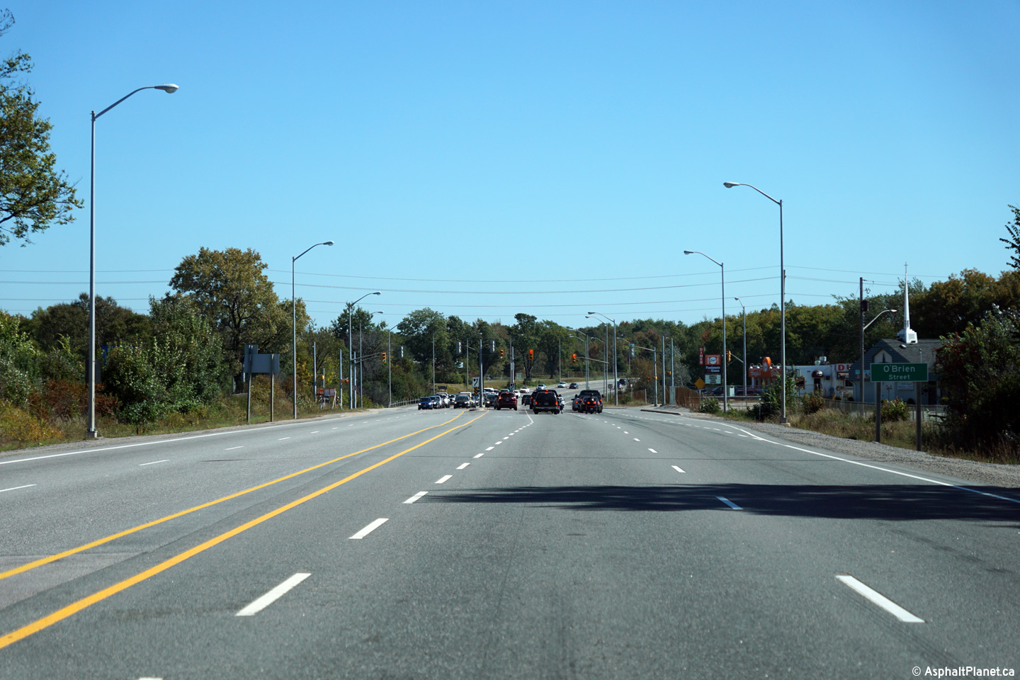
City of North Bay |
View looking easterly along Highway 11/17 approaching the O'Brien Road
intersection.
Photo taken: September 27th, 2015. |
(720x480)
(1440x960)
(2400x1600) |
|
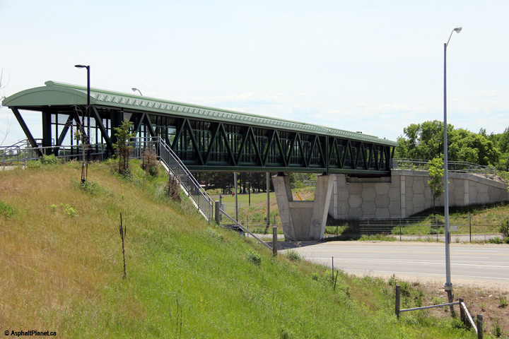
City of North Bay |
View looking southwesterly towards the Frost Street pedestrian overpass.
Photo taken: June 6th, 2014. |

(720x480)
(1440x960)
(2400x1600) |
|
City of North Bay |
View looking northerly along the North Bay by-pass from the Frost Street
pedestrian overpass.
Click here for an
additional view from this vantage point taken in June, 2009.
Photo taken: June 6th, 2014. |
(720x480)
(1440x960)
(2400x1600) |
|
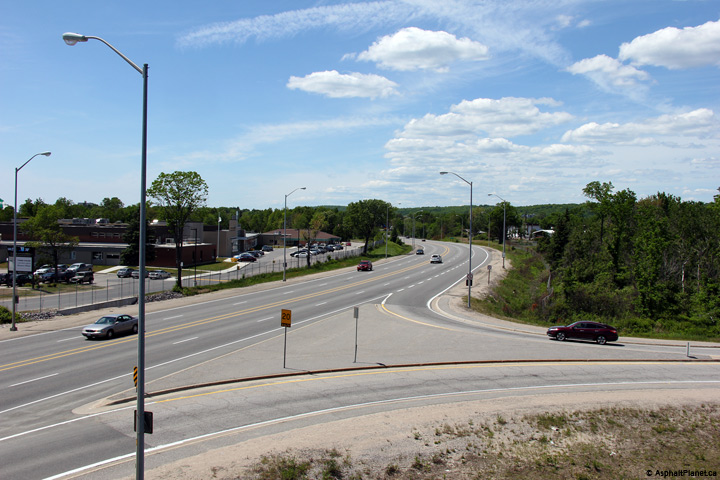
City of North Bay |
View looking southerly along Highway 11/17 from the new pedestrian overpass
constructed during the Summer of 2009 in the vicinity of the Frost Street
RIRO intersection. Northgate Mall is visible in the distance of this
photo. Click here
for an additional view from this vantage point taken in June, 2009.
Photo taken: June 6th, 2014. |

(720x480)
(1440x960)
(2400x1600) |
|
Highway 63 leads from Downtown
North Bay northeasterly to Quebec Highway 101.
Click here for Highway 63
Images. |
|
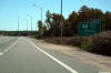
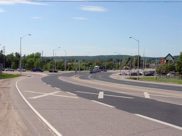
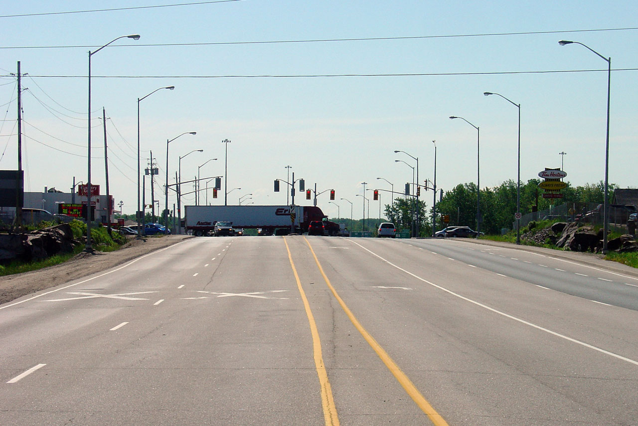
City of North Bay |
Looking northwesterly along the North Bay By-pass towards the
Highway 63
junction. Photo taken: June 4th, 2006. |
(720x480)
(1440x960) |
|
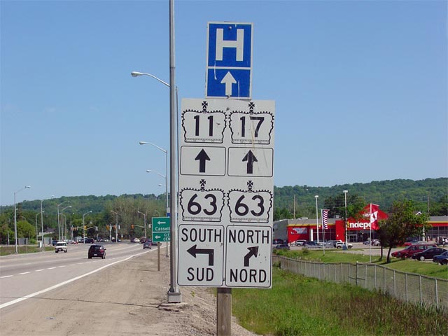
City of North Bay |
Advanced signage for the Highway 63 junction. Though
Highway 63 is
indicated leading both directions from the North Bay By-pass, this is
technically incorrect, as Highway 63 was downloaded south of the North Bay
By-pass in 1998.
Picture size: 50kb. |
 |
|
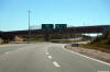
City of North Bay |
View looking northwesterly along the North Bay By-pass towards the Highway
17B intersection. Photo taken: June 4th, 2006. |
(720x480)
(1440x960) |
|
City of North Bay |
Advanced signage for the Highway 17B intersection along the North Bay
By-pass. Interestingly, despite the fact that North Bay's 'B' routes are no
longer indicated on maps of the area, all of the junctions are still fully
signed along the North Bay By-pass.
Picture size: 65kb. |
 |
|
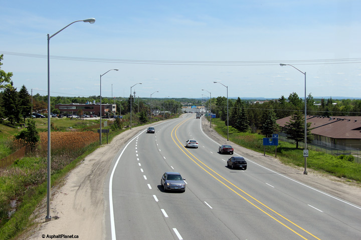
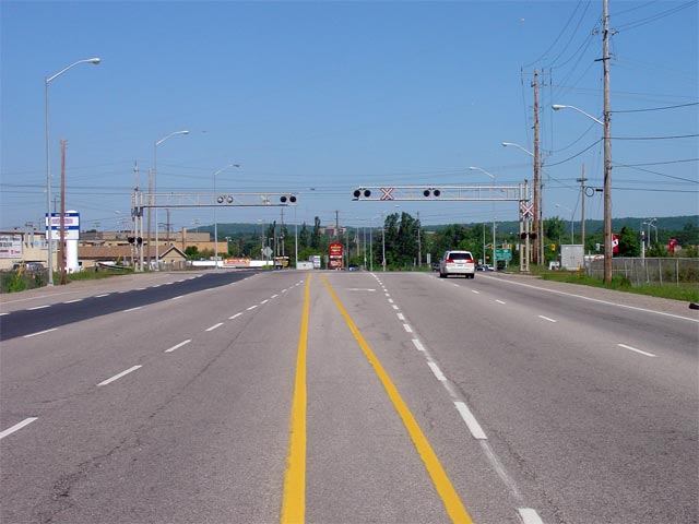
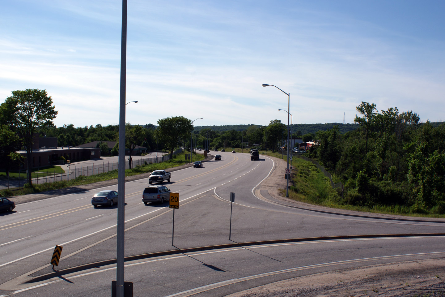
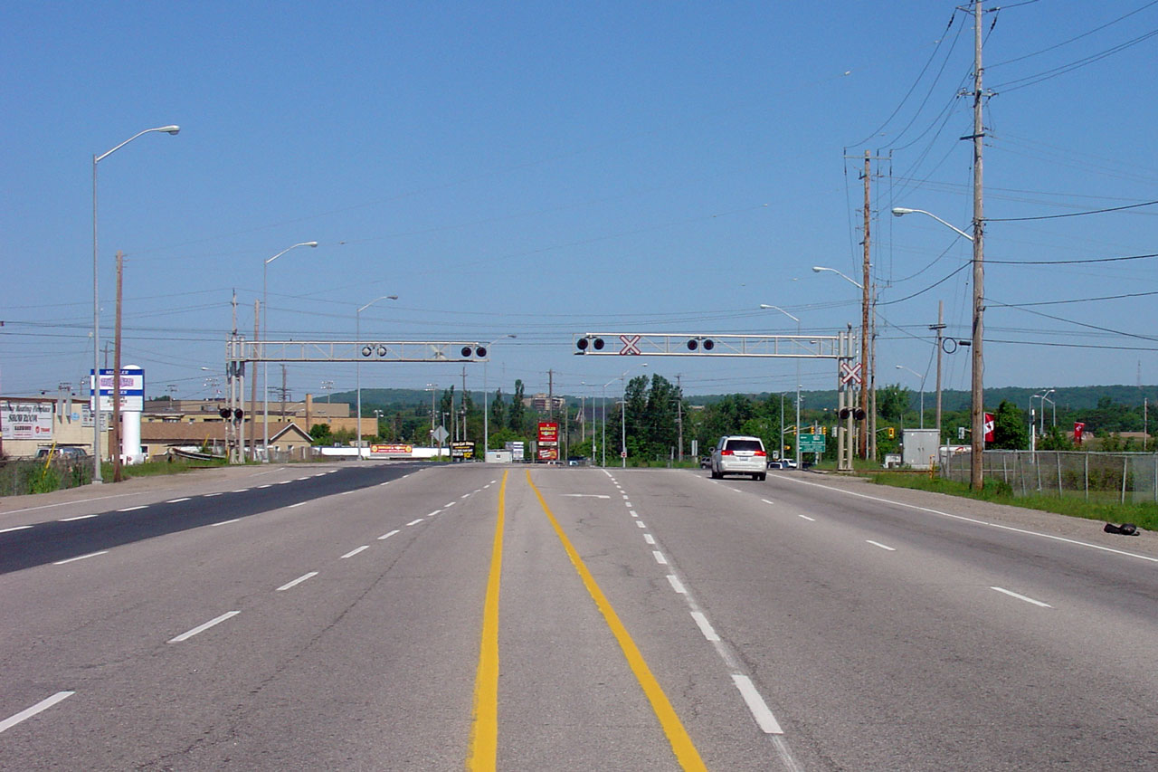
City of North Bay |
View looking northerly along Highway 11/17 from the same vantage point as
the previous photo. Between Seymore and Fisher Street's, Highway 11/17
crosses the Ontario Northland Railway at-grade. Picture taken: June 4th,
2006. Size: 50kb. |
(720x480)
(1440x960) |
|
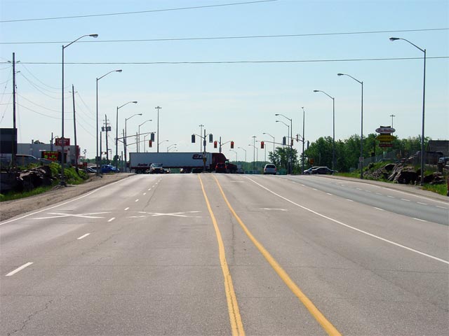
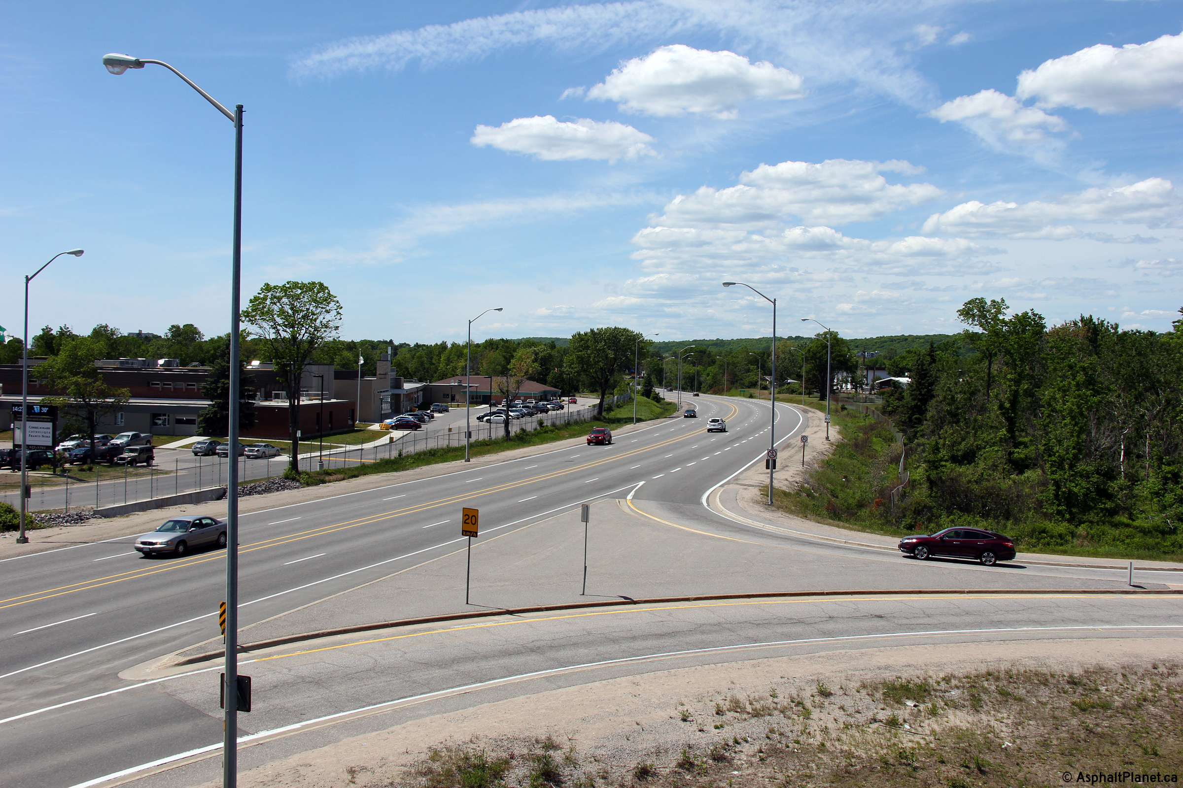
City of North Bay |
View looking south along Highway 11/17
towards the Seymore Street intersection. Seymore Street is the
southern-most signalized intersection located on the North Bay By-pass.
Seymore Street is located roughly 700m north of the Highway 17 interchange.
Picture taken: June 4th, 2006. Size: 45kb. |
(720x480)
(1440x960) |
|
City of North Bay |
An unusual way to sign a multiplex! 'Uniboard' signage has become
increasingly more popular throughout Ontario, particularly in the North Bay
area. This sign showcases an 11/17 shield assembly located
north and westbound just north of Highway 63 along the North Bay Bypass.
Picture size: 90kb. |
 |
|
City of North Bay |
Eastbound advanced signage for the Highway 17 interchange at the
southeastern edge of North Bay.
Photo taken: September 27th, 2015. |
 (720x480) (720x480)
(1440x960)
(2400x1600) |
|
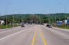
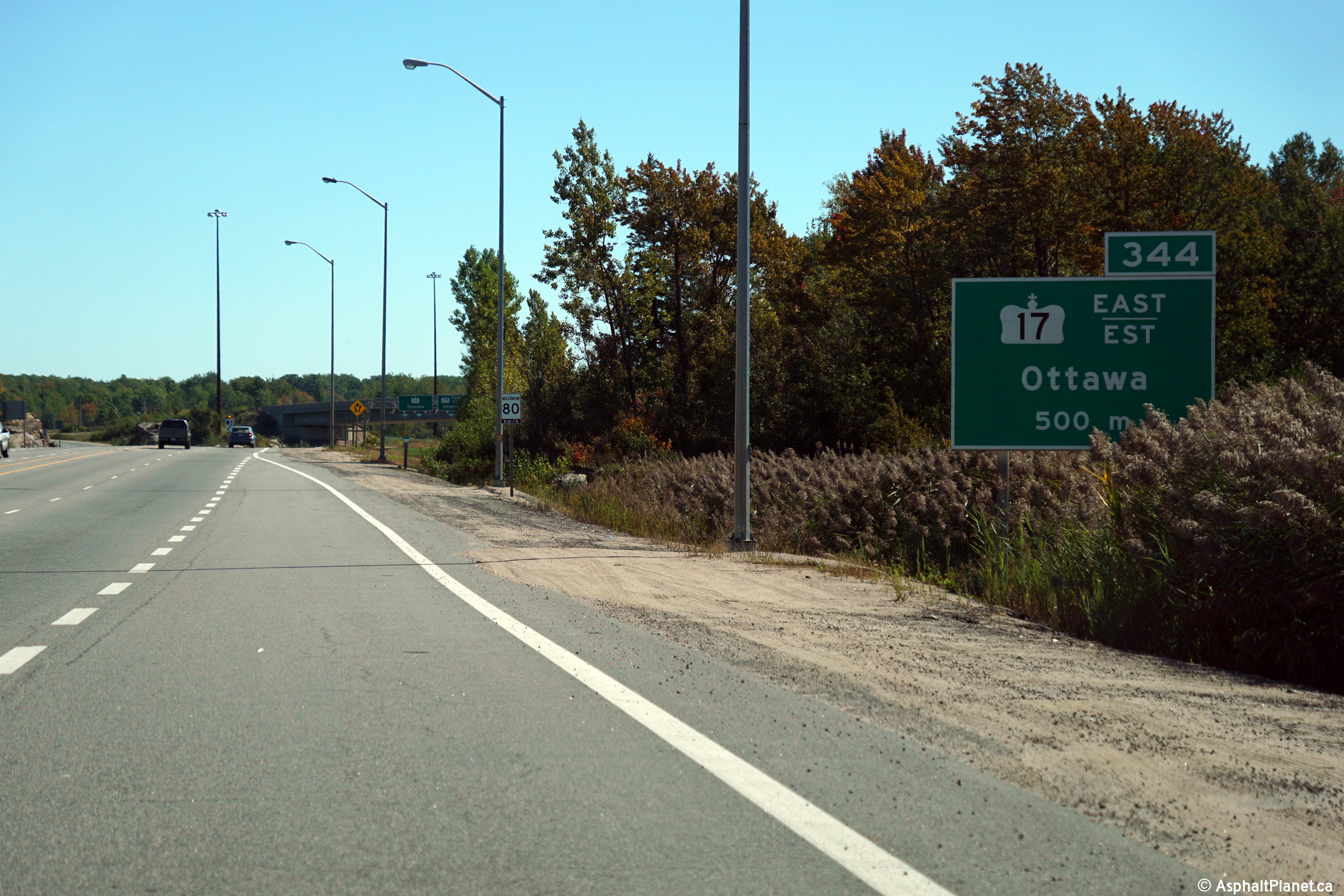
City of North Bay |
Highway 11/17 driving south and eastbound approaching the Highway
11/17 trumpet interchange. Highway 17 continues east of North Bay
as a two-lane highway.
Click here for an
earlier photo of this signage, taken in May, 2004. Click here to
continue easterly along Highway 17.
Photo taken: September 27th, 2015. |
 (720x480) (720x480)
(1440x960)
(2400x1600) |
|
Highway 11 continues south to
Toronto along the freeway.
Click here for Highway 11-South Images. |
|
Click here for North Bay to Mattawa Images. |


_east.jpg)


 (720x480)
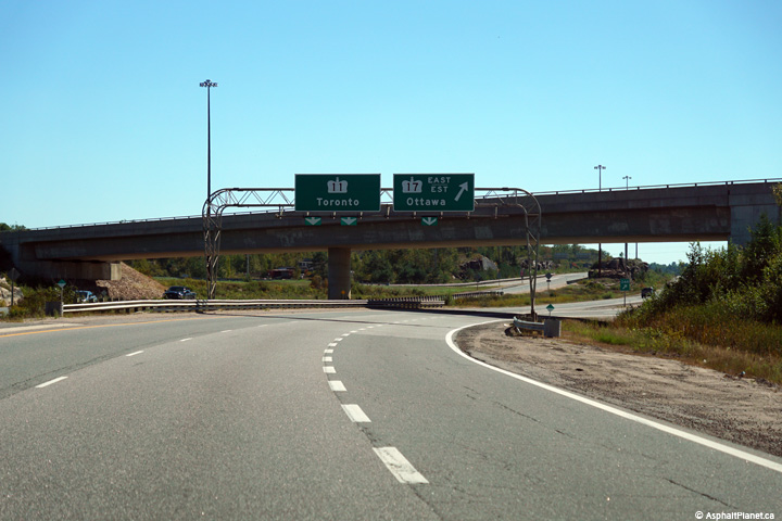