|
Proper Municipality Name |
Photo Description |
Photo |
|
Pictures taken
from driver's perspective appear offset from centre-line pictures: |
North-
Bound |
South-
Bound |
|
Highway 28 ends at Highway 7 west
of Peterborough. Highway 7 heads across the lower part of Ontario.
Click
here for Highway 7 images. |
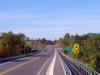
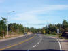
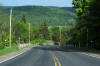
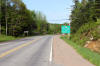
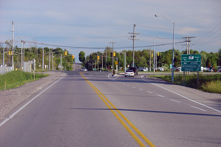
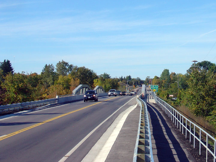
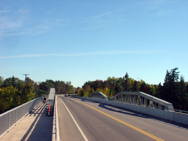
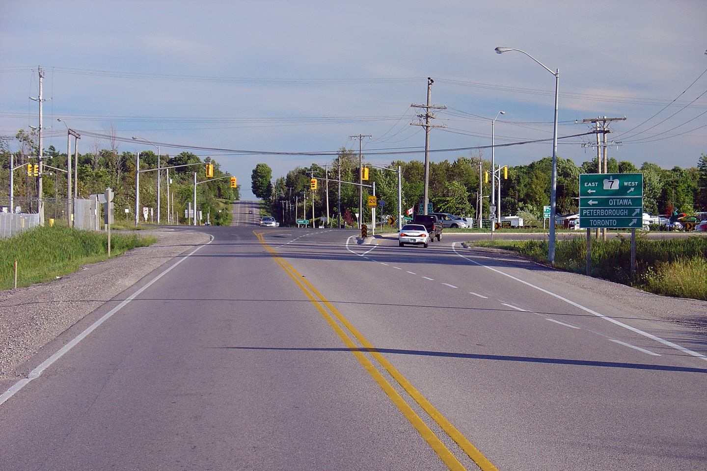
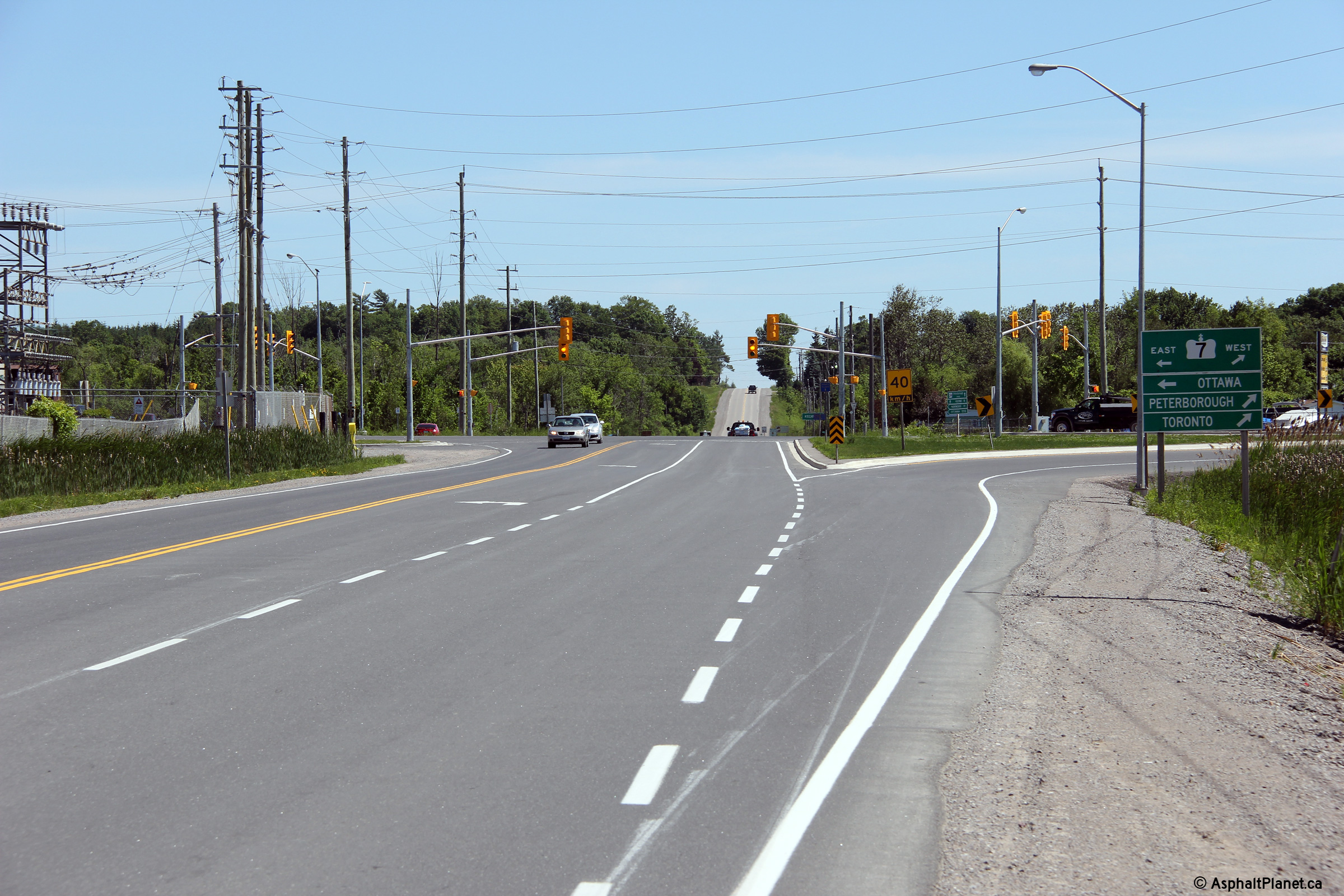
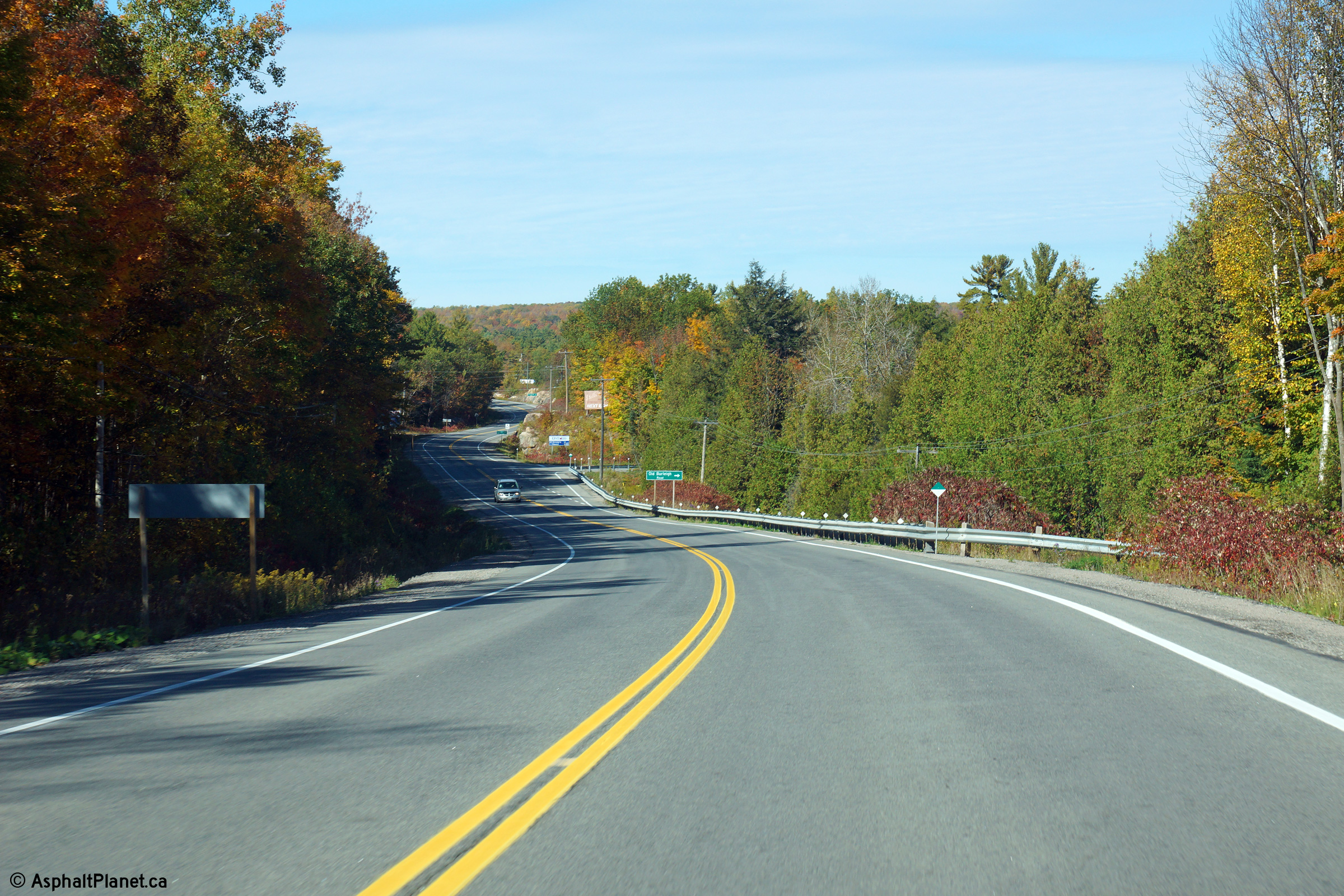
| Township of Asphodel - Norwood
County of Peterborough |
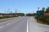
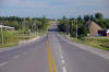
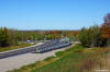
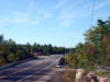
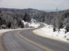
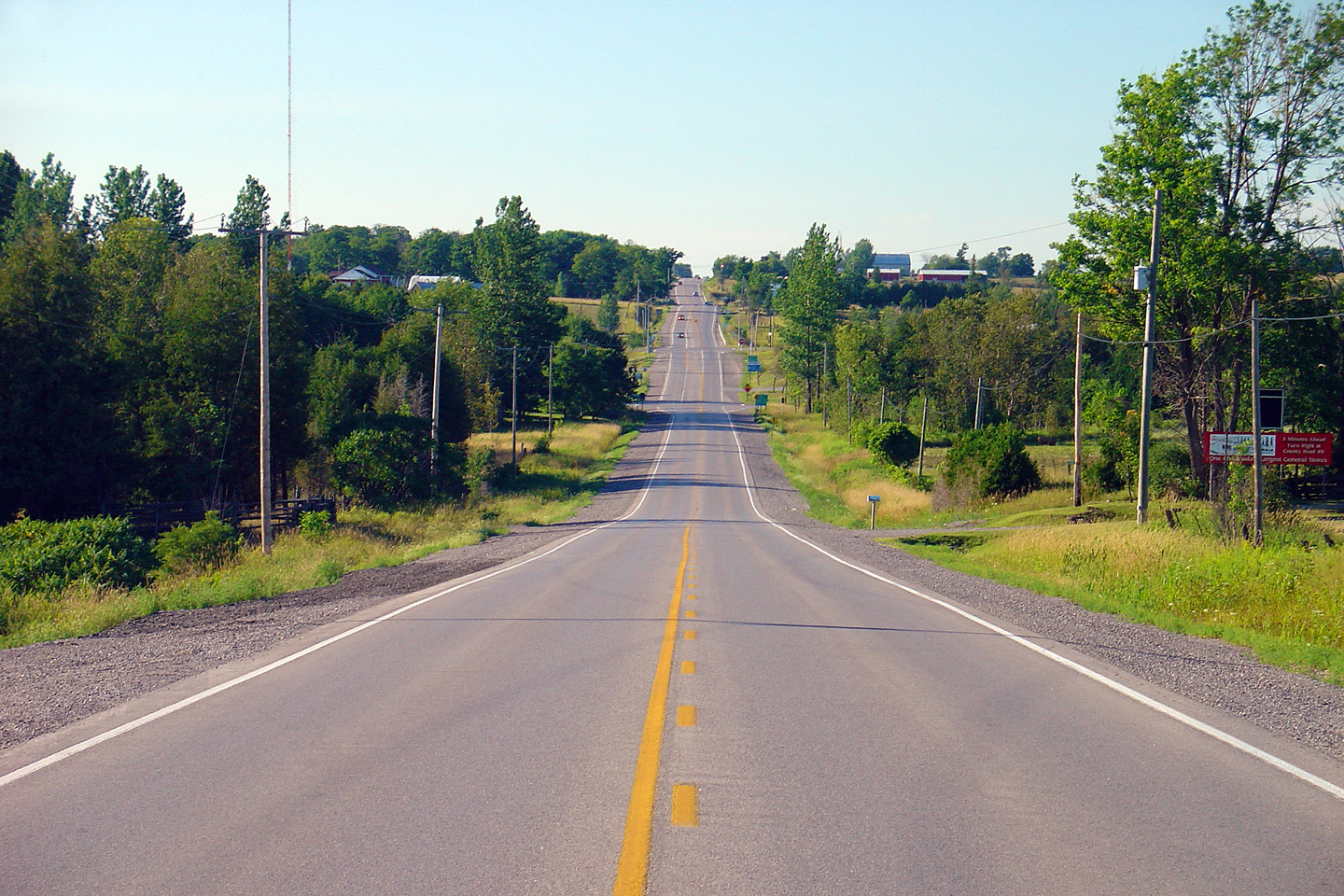
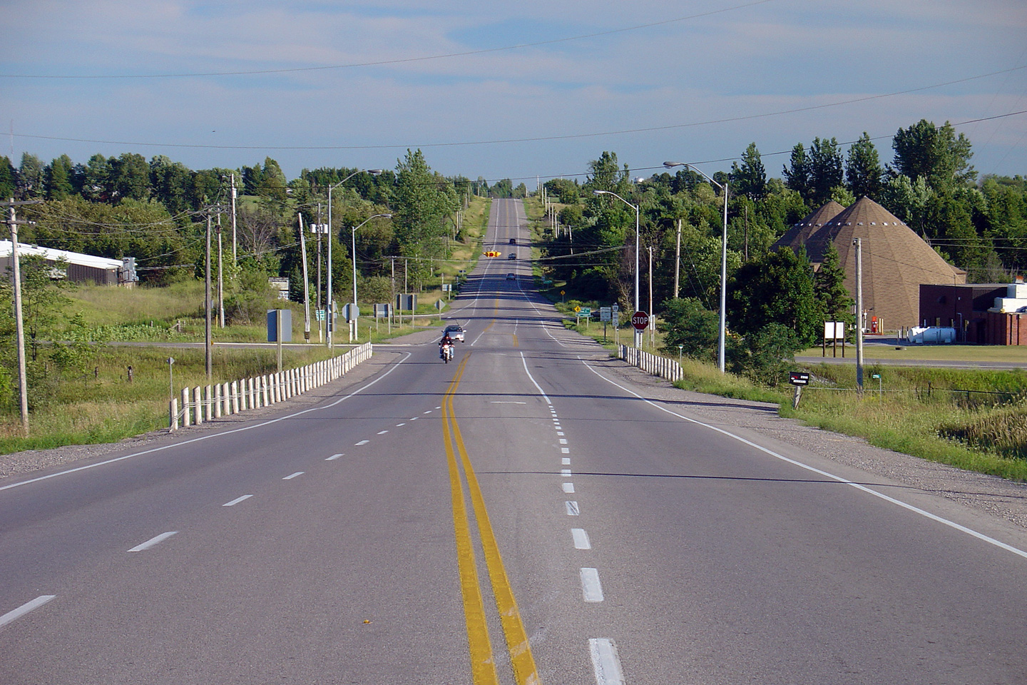
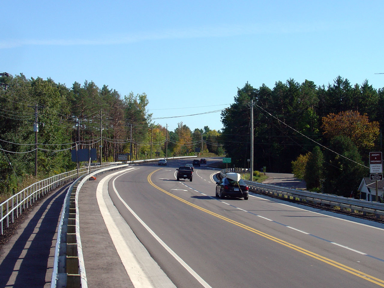
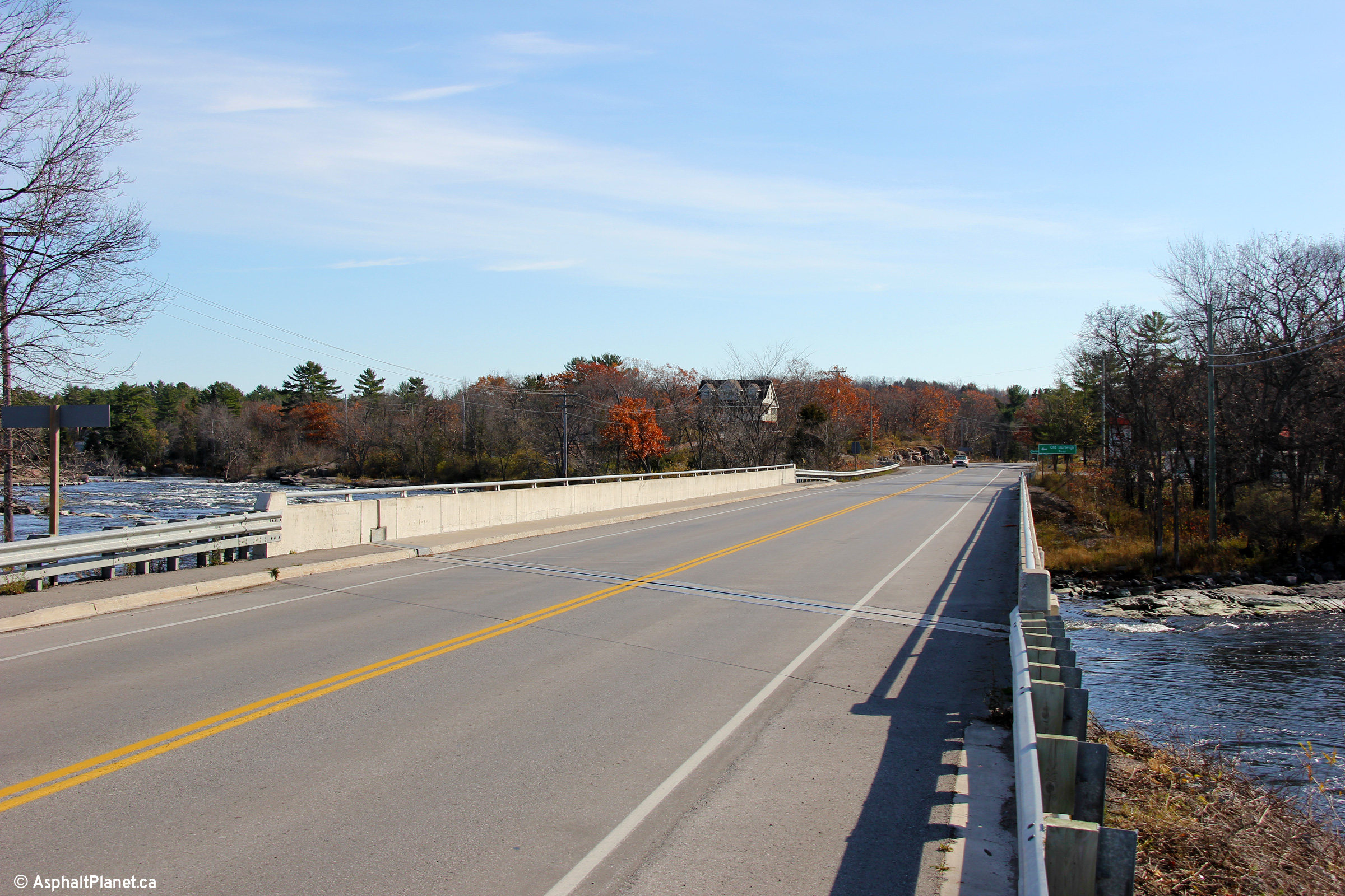
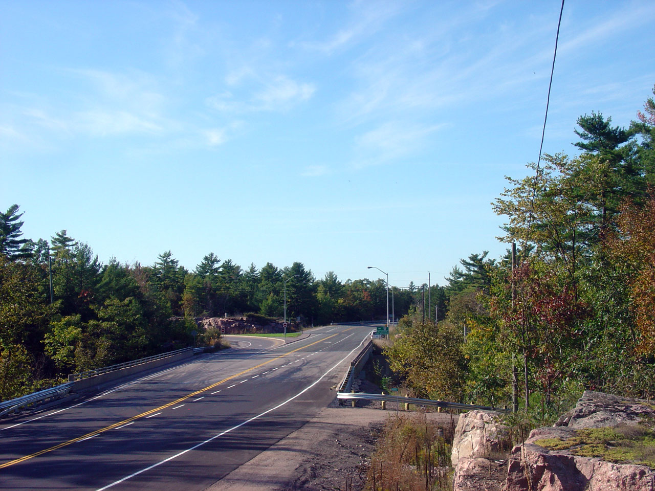
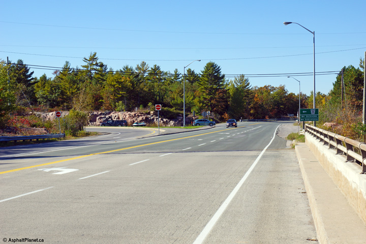
Looking south along Highway 28 towards its current southern terminus at
Highway 7. Highway 28 meets
Highway 7 about 7km east of
Highway 115
in Peterborough. Several geometric improvements to this intersection
were made during a construction contract that saw Highway 7 widened to five
lanes easterly from Peterborough to this junction in 2011. Upper photo
taken: August 6th, 2005. Lower photo taken: June 14th, 2012. |

(720x480)
(1440x960)
(2400x1600)
(720x480)
(1440x960)
(2400x1600) |
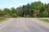
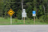
| Township of Asphodel - Norwood
County of Peterborough |
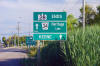
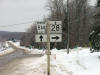
This sign assembly denotes the southern terminus of Highway 28 at the
Highway 7 and Peterborough Road 34 junction
located east of the City of Peterborough.
Before Summer 2003, this stretch of Highway 28 was part of
Highway 134.
Highway 134 was renumbered to 28 to improve the logic of the areas route
numbering.
Photo taken: August 6th, 2005. |
 (720x480) (720x480)
(1440x960) |
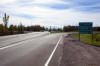
| Ashodel - Norwood / Douro - Dummer
Boundary County of Peterborough |
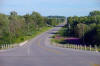
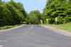
Looking south along Highway 28 from the Division Street intersection.
Division Street is located about 3km north of Highway 7.
Between Highway 7 and Division Street,
Highway 28 crosses the Havelock Subdivision of the CPR at an at-grade
crossing.
Photo taken: August 6th, 2005. |
(720x480)
(1440x960) |
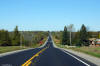
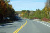
| Township of Douro - Dummer
County of Peterborough |
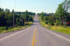
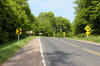
Looking north along Highway 28 towards the Five
Corners junction. Photo taken: August 6th, 2005. |
(720x480)
(1440x960) |
| Township of Douro - Dummer
County of Peterborough |
Looking south towards the intersection with
Peterborough Road 4 at Five Corners. The intersection with
Peterborough Road 4 is controlled by a four-way stop. This four-way
stop causes a great deal of congestion during peak summer times, and should
be replaced by traffic signals. A northbound passing lane starts just
north of Peterborough Road 4.
Photo taken: August 6th, 2005. |
(720x480)
(1440x960) |
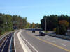
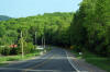
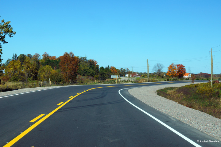
| Township of Douro - Dummer
County of Peterborough |
View looking northerly from north of Centre Road
as the highway descends into the Sawers Creek Valley.
Photo taken: October 3rd, 2013. |
(720x480)
(1440x960)
(2400x1600) |
| Township of Douro - Dummer
County of Peterborough |
This view looks northerly just north of the
Peterborough Road 33 intersection.
Photo taken: October 3rd, 2013. |
(720x480)
(1440x960)
(2400x1600) |
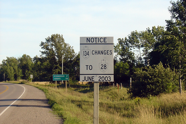
| Township of Douro - Dummer
County of Peterborough |
Former signage explaining that the redesignation
of Highway 134 to Highway 28 would be effective as of June 2003. This
sign has long since been removed.
Photo taken: August 6th, 2005. |
|
| Township of Douro - Dummer
County of Peterborough |
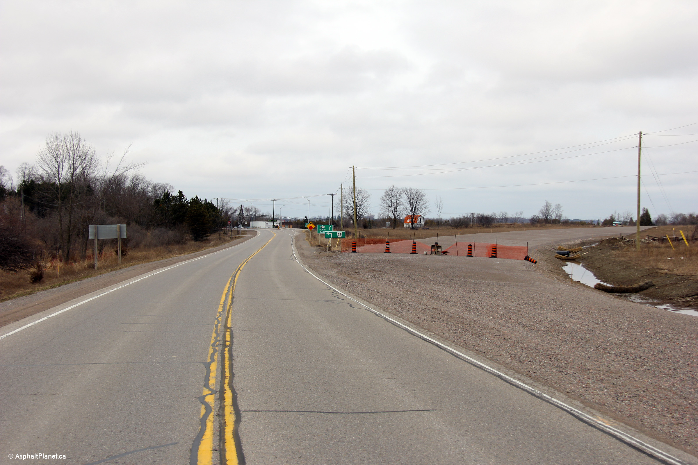
A series of three views towards then then
current and now former Peterborough Road 29 junction. Before 2003,
Highway 134 ended at this junction, becoming Highway 28 northerly. In
2003, Highway 134 was renumbered to Highway 28, improving the highway
numbering through Peterborough County. In 2012, construction started
on a new curve diversion that would eliminate the turn that was required for
through movements along Highway 28 -- this configuration is highlighted in
the middle photo. The lower photo shows the completed curve diversion
with the pavement on the former alignment having been pulverized and
removed.
Upper photo taken: August 6th, 2005.
Middle photo taken: April 9th, 2012.
Lower photo taken: October 3rd, 2013. |

(720x480)
(1440x960)
(2400x1600)
|
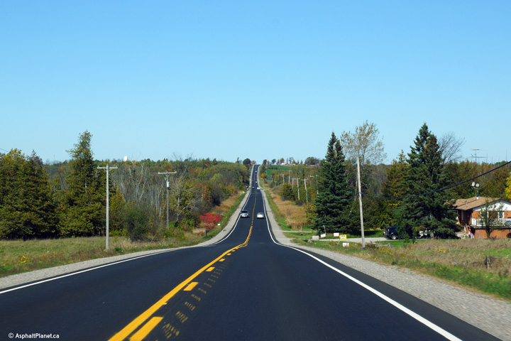
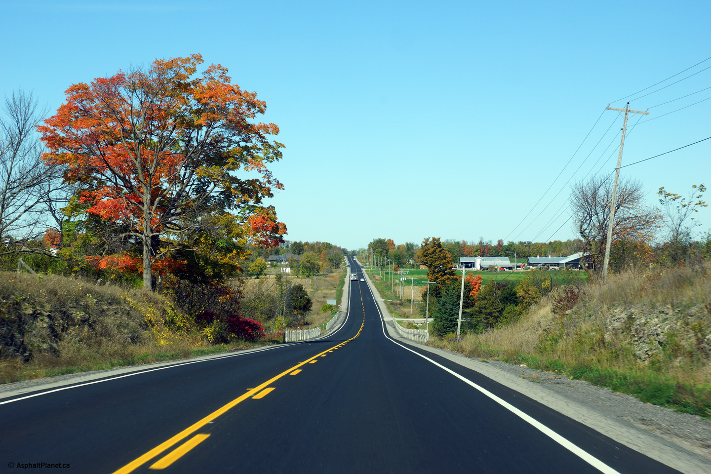
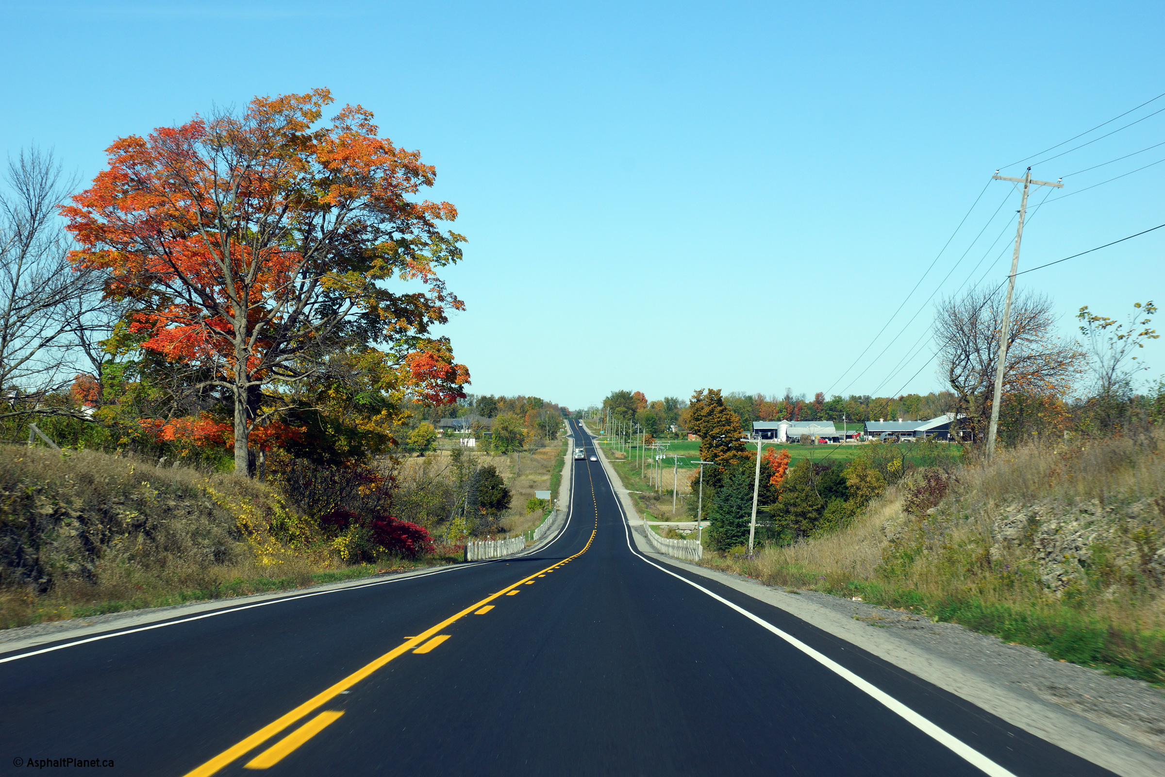
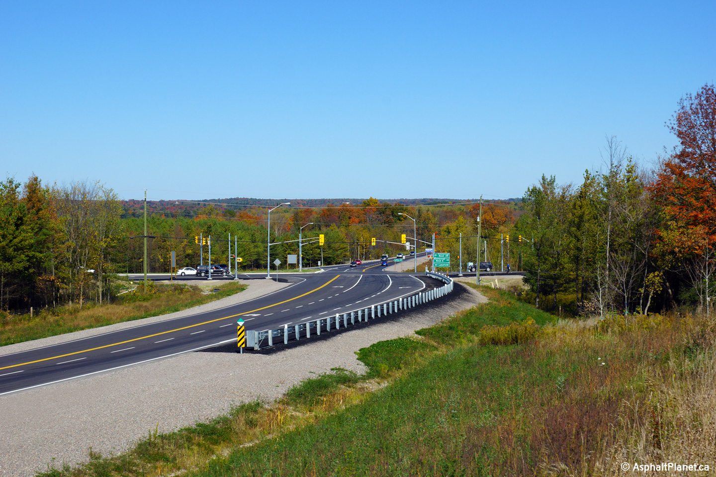
| Township of Douro - Dummer County
of Peterborough |
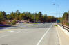
Southerly view along the recently completed
(2013) alignment of Highway 28 from just south of the Peterborough Road 6/29
intersection.
Photo taken: October 3rd, 2013. |
(720x480)
(1440x960)
(2400x1600) |
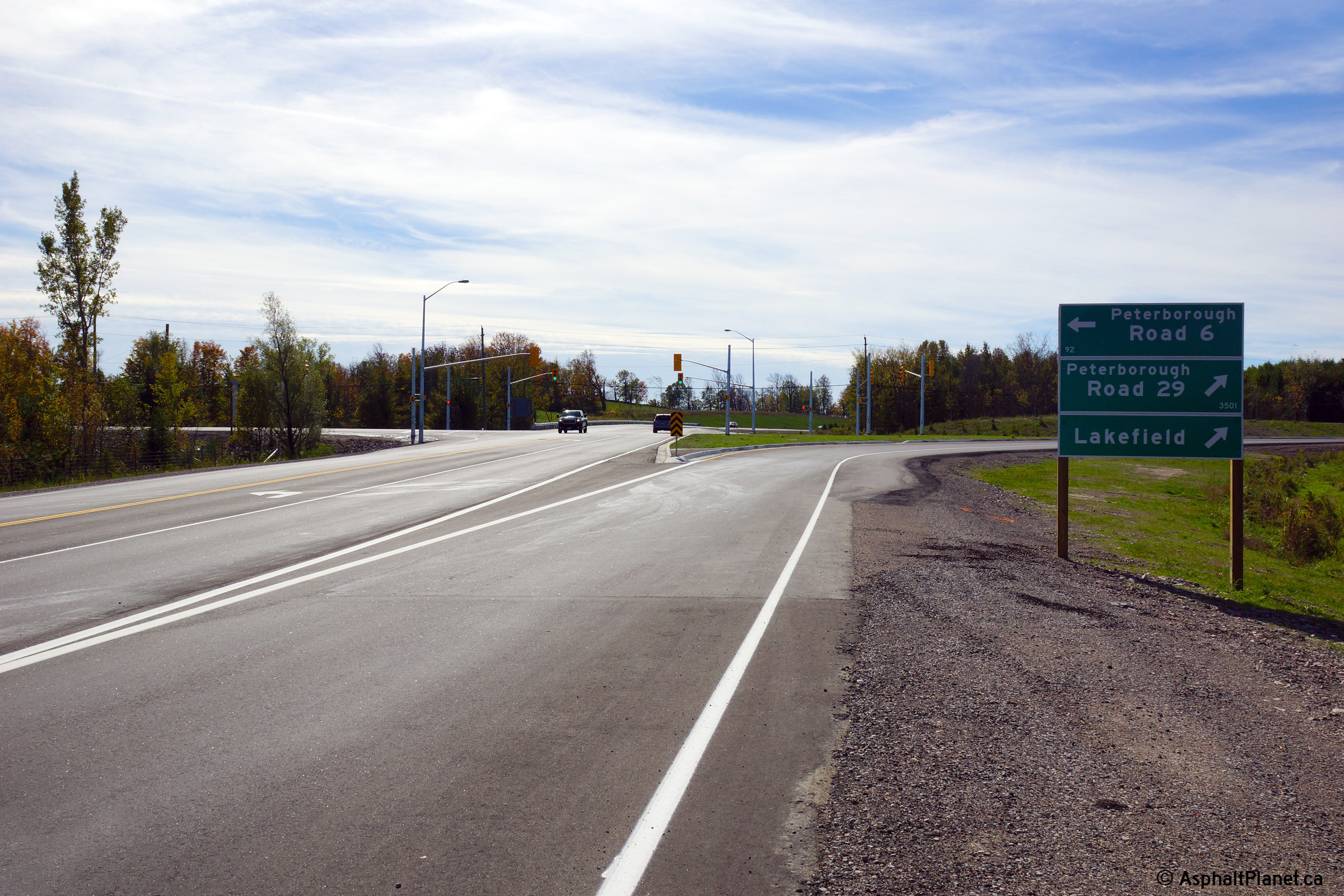
| Township of Douro - Dummer County
of Peterborough |
Northerly view through the signalized
Peterborough Road 6/29 intersection.
Photo taken: October 3rd, 2013. |
(720x480)
(1440x960)
(2400x1600) |
| Township of Douro - Dummer County
of Peterborough |
View looking southerly towards the Peterborough
Road 6/29 intersection. A channelized right turn was constructed to
facilitate the former through movement between Highway 28 and Peterborough
Road 29.
Photo taken: October 3rd, 2013. |
(720x480)
(1440x960)
(2400x1600) |
| Township of Douro - Dummer County
of Peterborough |
This view looks northerly towards Young's Point
from just north of the Peterborough Road 29 intersection.
Photo taken: October 3rd, 2013. |

(720x480)
(1440x960)
(2400x1600) |
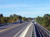
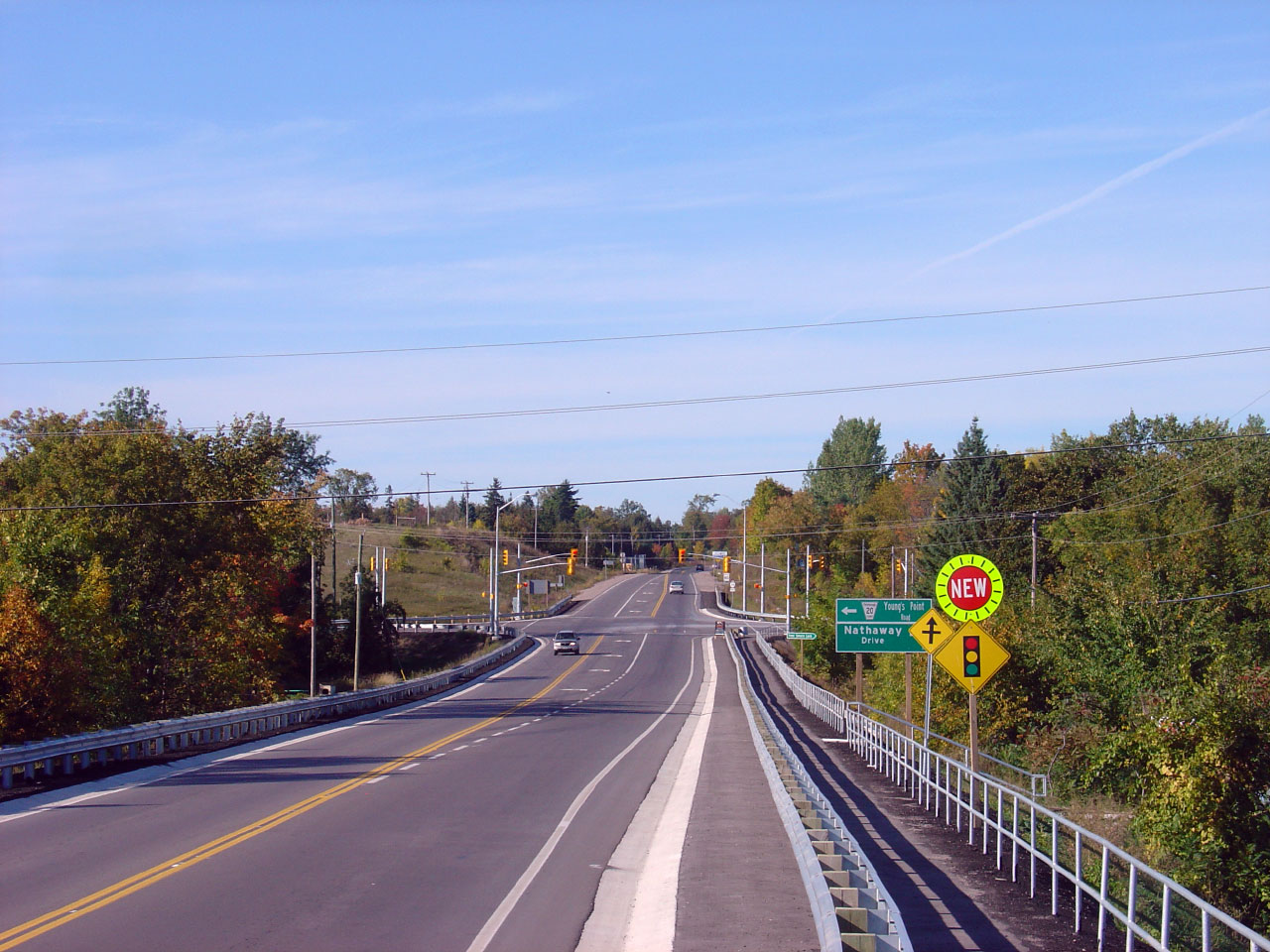
| Township of Douro - Dummer County
of Peterborough |
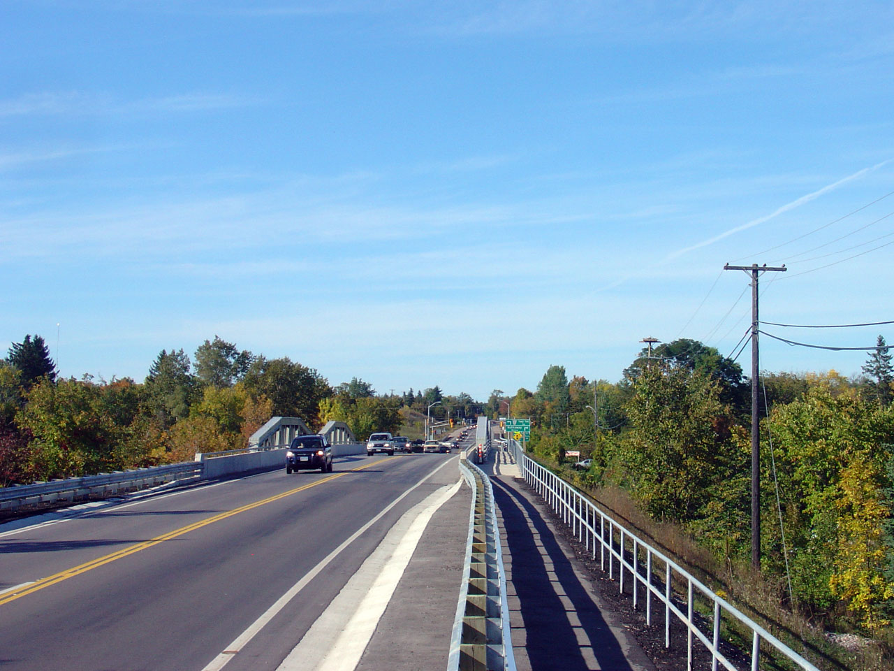
View looking south along Highway 28 from just
south of the Young's Point Bridge.
Photo taken: September 23rd, 2007.. |
(720x480)
(1440x960)
|
| Township of Douro - Dummer County
of Peterborough |
View looking north across the Young's Point
Bridge. Note the conga line of traffic heading southbound across the
bridge. Primary highways in Eastern Ontario have not seen the same
attention as Central Ontario, like Highway 11 and 69.
Photo taken: September 23rd, 2007.. |
(720x480)
(1440x960)
|
| Township of Smith Ennismore-Lakefield
County of Peterborough |
The recently rehabilitated Highway 28 Young's
Point Bridge structure. This bridge was rehabilitated and repainted
between 2004 and 2007.
Photo taken: September 23rd, 2007. |

(720x480)
(1440x960)
|
| Township of Smith Ennismore-Lakefield
County of Peterborough |
Looking north from the Young's Point Bridge
towards the Young's Point Road intersection. Traffic signals were
added at this site as part of the Young's Point Bridge construction project.
Photo taken: September 23rd, 2007. |
(720x480)
(1440x960)
|
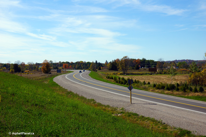
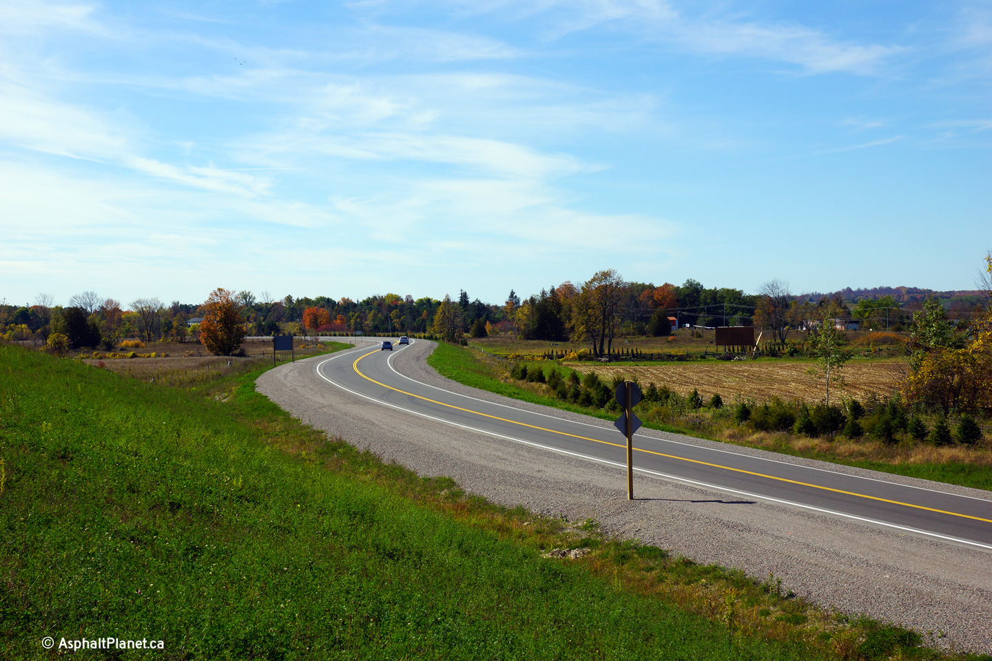
| Township of Douro-Dummer County
of Peterborough |
A Series of reversing curves along Highway 28
south of Young's Point. Click here
for a similar image, taken in December, 2004.
Photo taken: October 3rd, 2013. |
(720x480)
(1440x960)
(2400x1600)
|
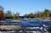
| Township of Smith Ennismore-Lakefield
County of Peterborough |
Northerly view across the bridge over the south
branch of Burleigh Falls.
To the left of the highway is Lower Buckhorn Lake, while to the right of the
highway is Stony Lake.
Photo taken: October 3rd, 2013 |

(720x480)
(1440x960)
(2400x1600) |
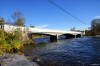
| Township of Smith Ennismore-Lakefield
County of Peterborough |
Scenic view looking westerly towards the Highway
28 bridge as the water from Lower Buckhorn Lake begins to cascade over the
upper rapids before Burleigh Falls.
Photo taken: October 3rd, 2013. |
(720x480)
(1440x960)
(2400x1600) |
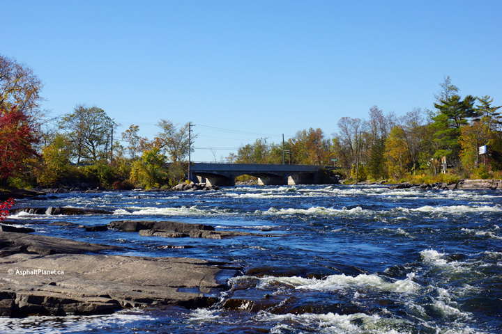
| Township of Smith Ennismore-Lakefield
County of Peterborough |
The Burleigh Falls bridge is a three span
concrete rigid frame arch bridge. These bridges were a common design
for several years during the mid-1950s.
Photo taken: October 3rd, 2013. |
(720x480)
(1440x960)
(2400x1600) |
| Township of Smith Ennismore-Lakefield
County of Peterborough |
Southerly view across the Burleigh Falls Bridge.
Photo taken: November 5th, 2011. |

(720x480)
(1440x960)
(2400x1600) |
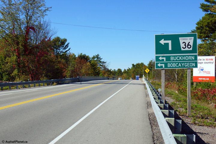
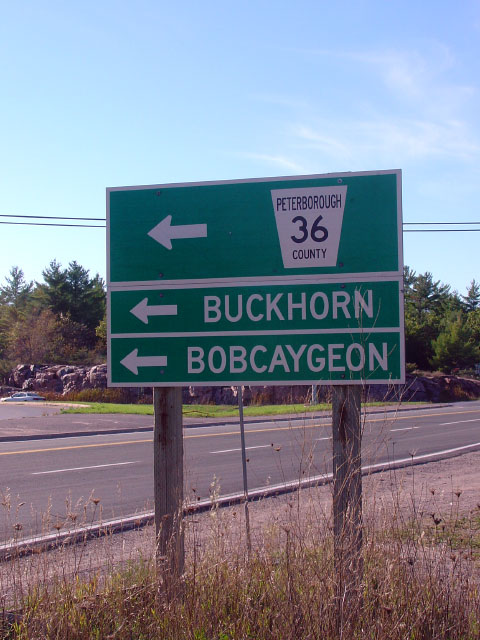
| Township of Smith Ennismore-Lakefield
County of Peterborough |
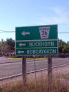
The northbound advanced signage for Highway 36
is situated just south of the bridge that carries Highway 28 over the
Trent-Severn Waterway.
Photo taken: October 3rd, 2013. |

(720x480)
(1440x960)
(2400x1600) |
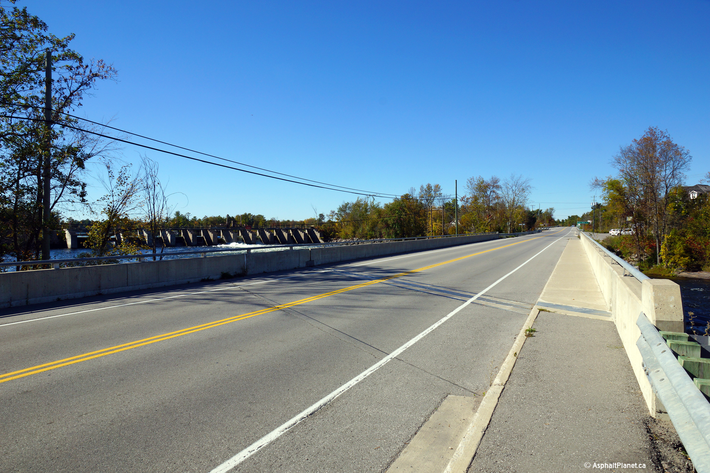
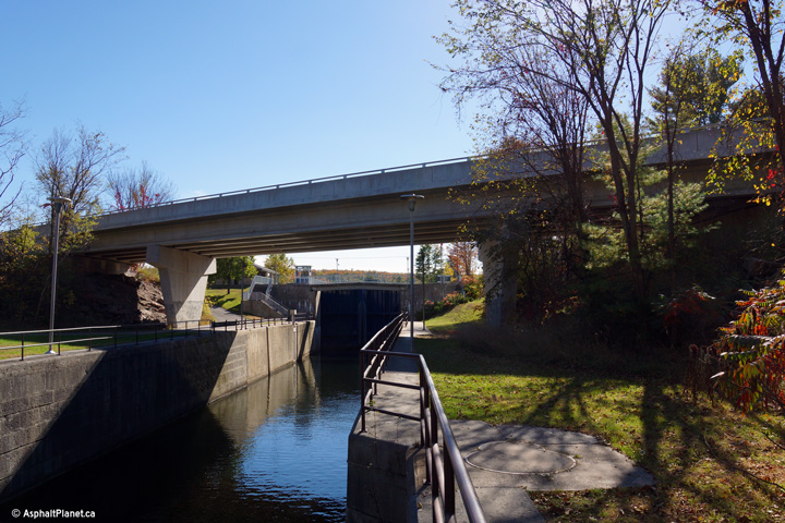
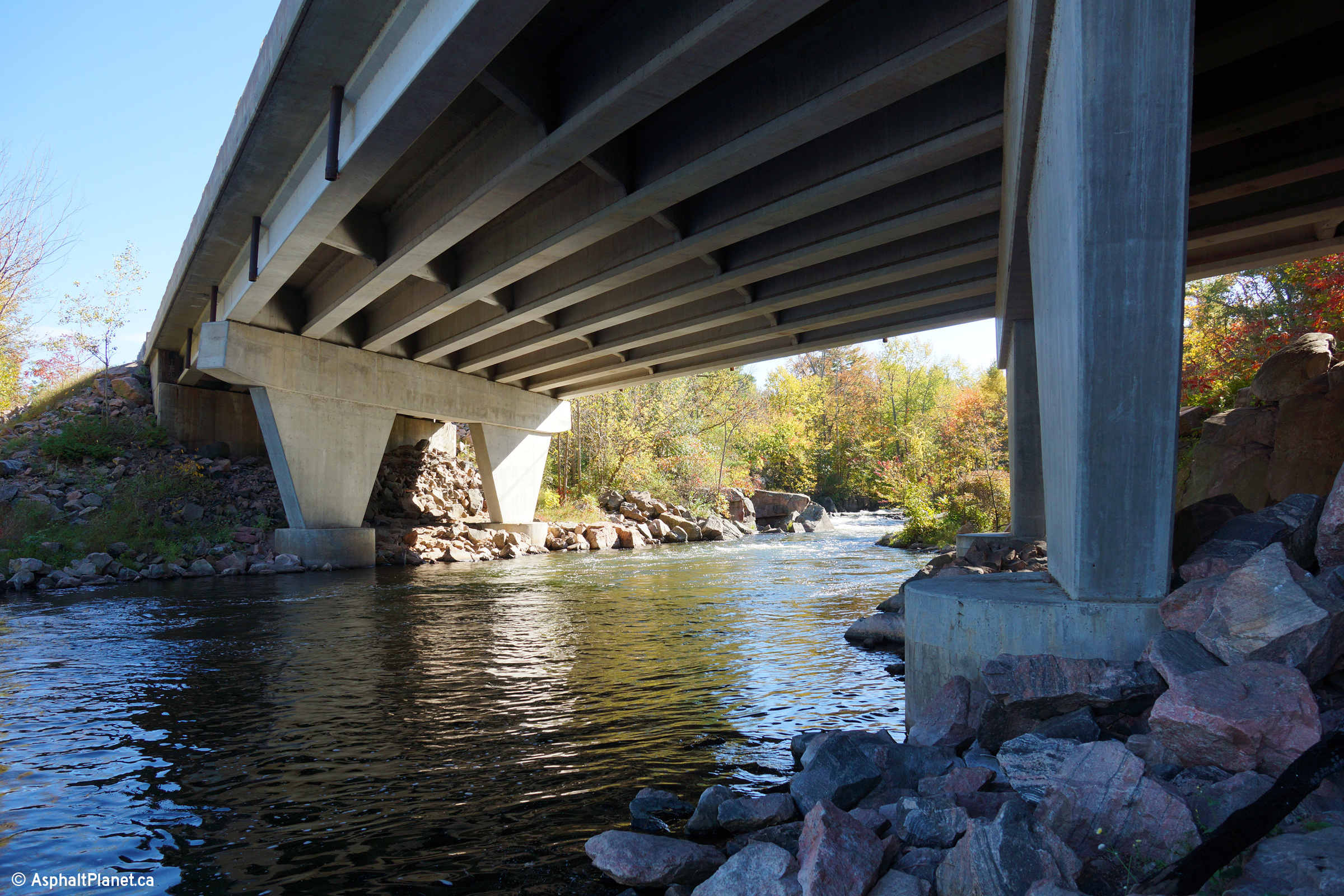
| Township of Smith Ennismore-Lakefield
County of Peterborough |
View beneath the Trent-Severn Waterway bridge.
Highway 28 crosses the waterway directly overtop of Burleigh Falls Lock #29.
The bridges that carry Highway 28 overtop of both the Trent-Severn Waterway
and Burleigh Falls North Branch were constructed approximately 2 decades
later than the Burleigh Falls South Branch bridge. Aside from the
alignment of the small parking lot for the lock, no evidence remains of the
former swing bridge that once carried Highway 28 across the canal.
Photo taken: October 3rd, 2013. |

(720x480)
(1440x960)
(2400x1600) |
| Township of Smith Ennismore-Lakefield
County of Peterborough |
View looking northerly at Highway 28 as it nears
the Highway 36 junction.
Photo taken: September 23rd, 2007. |
(720x480)
(1440x960)
|
| Township of Smith Ennismore-Lakefield
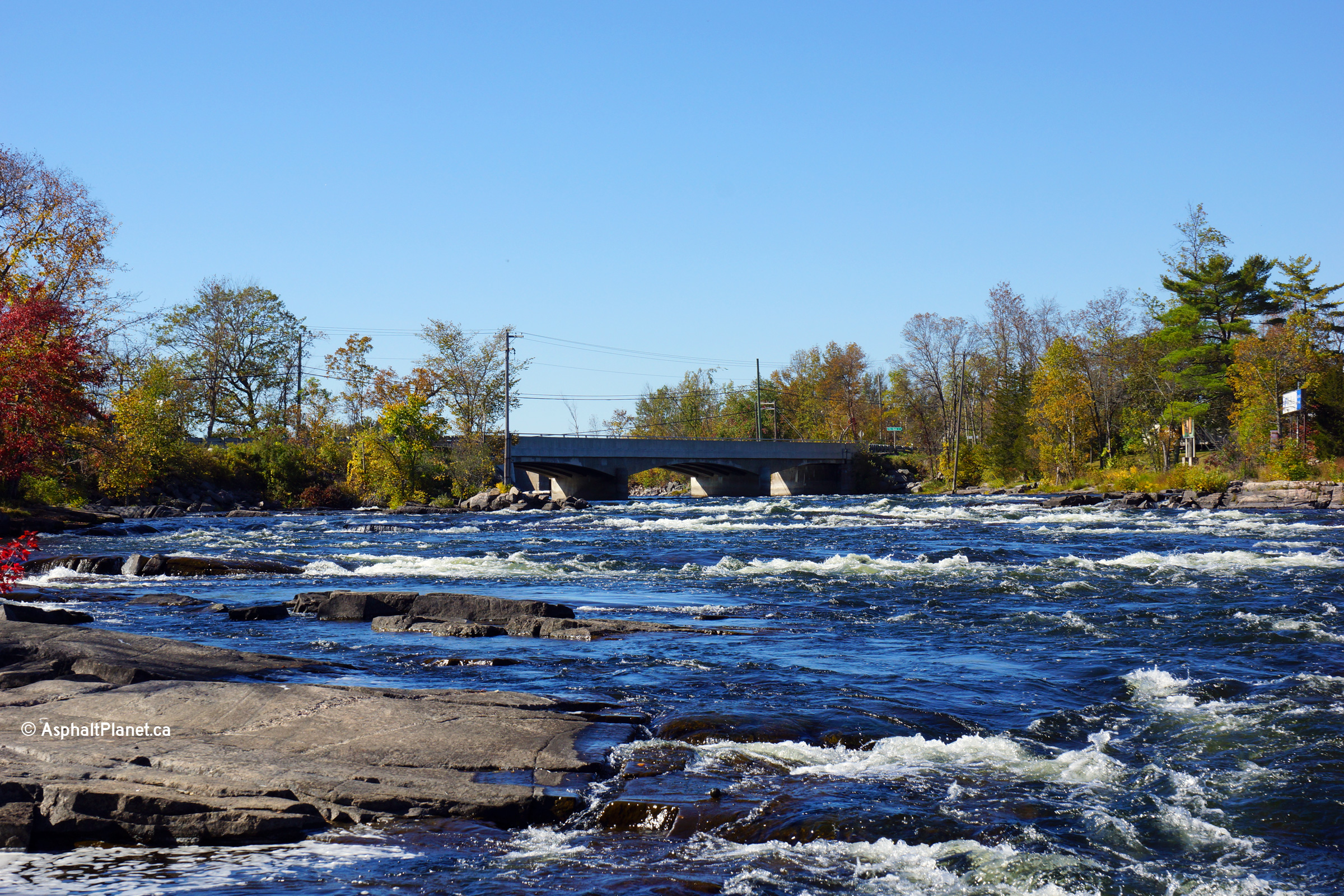
County of Peterborough |
Northerly view from mid-span of the Burleigh
Falls North Branch bridge towards the Highway 36 intersection. The
Burleigh Falls North Branch has a concrete wearing surface, very atypical of
most structures in Ontario.
Photo taken: October 3rd, 2013. |
(720x480)
(1440x960)
(2400x1600) |
| Township of North Kawartha
County of Peterborough |
View beneath the Burleigh Falls North
Branch bridge along Highway 28. The original alignment of Highway 28 lies
about 75m upstream of this bridge. The former highway bridge was demolished
following the completion of this structure.
Photo taken: October 3rd, 2013. |

(720x480)
(1440x960)
(2400x1600) |
| Township of North Kawartha
County of Peterborough |
Southerly view towards the Burleigh Falls North
Branch bridge from just south of the Highway 36 junction. The Burleigh
Falls North Bridge has a four lane cross-section because of its close
proximity to the Highway 36 intersection.
Photo taken: October 3rd, 2013. |

(720x480)
(1440x960)
(2400x1600) |
| Township of North Kawartha
County of Peterborough |
Green signage for what was Highway 36.
Photo taken: September 23rd, 2007. |
 |
|
Highway 36 heads to the west of
Burleigh Falls towards Lindsay.
Click
here for Highway 36 images. |
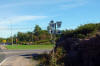
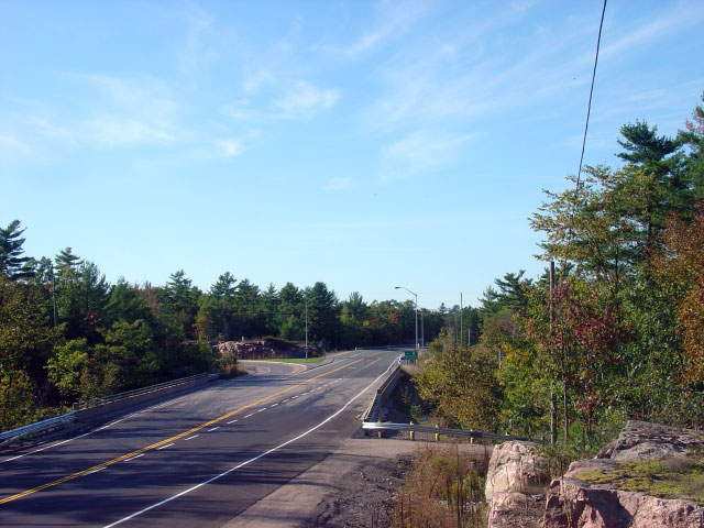
| Township of North Kawartha
County of Peterborough |
Junction assembly that once denoted the Highway
36 junction. Highway 36 was handed over to the counties of
Peterborough and Kawartha Lakes on January 1st, 1998. Photo taken:
September 23rd, 2007. |
 (720x480) (720x480)
(1440x960) |
| Township of North Kawartha
County of Peterborough |
View looking southerly towards Highway 36.
Photo taken: September 23rd, 2007. |
(720x480)
(1440x960)
|
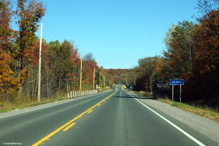
| Township of North Kawartha
County of Peterborough |
Northbound view as Highway 28 passes through the
community of Big Cedar. There isn't much to Big Cedar, in fact, the
speed limit isn't even reduced below 80km/h through town.
Photo taken: October 3rd, 2013. |

(720x480)
(1440x960)
(2400x1600) |
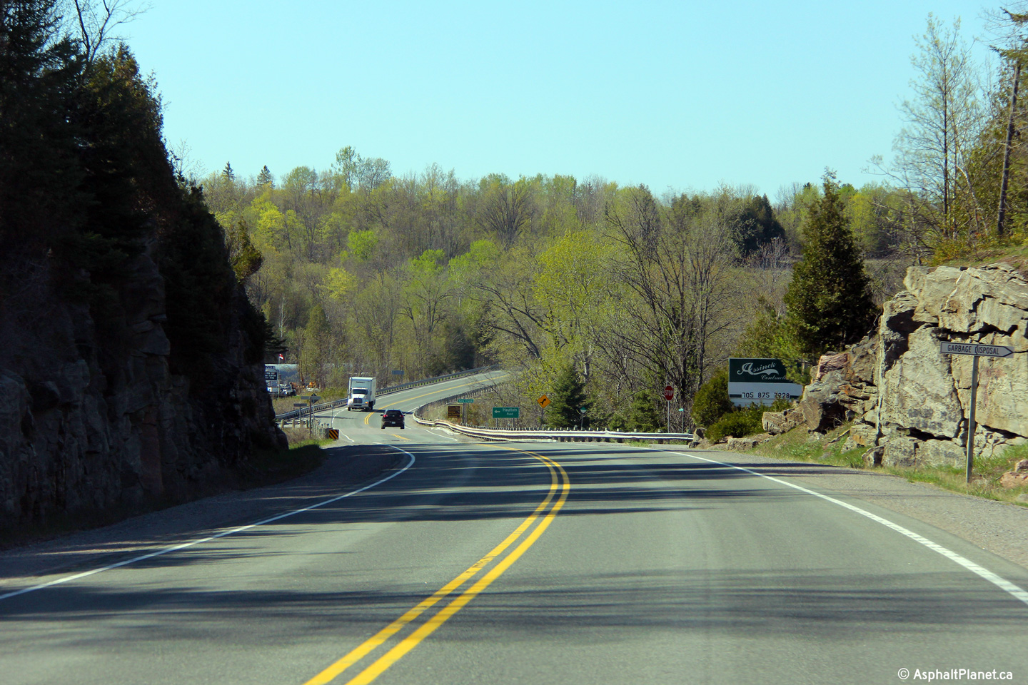
| Township of North Kawartha
County of Peterborough |
Northerly view as Highway 28 climbs a large hill
immediately north of Big Cedar. This is the only northbound passing
lane along Highway 28 between Lakefield and Bancroft.
Photo taken: May 7th, 2013. |

(720x480)
(1440x960)
(2400x1600) |
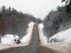
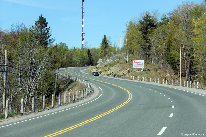
| Township of North Kawartha
County of Peterborough |
View as Highway 28 descends into the Eels Creek
Valley at Haultain.
Photo taken: May 7th, 2013. |

(720x480)
(1440x960)
(2400x1600) |
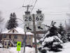
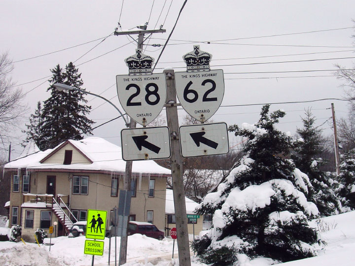
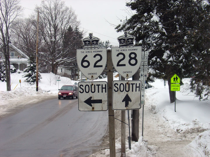
| Town of Bancroft County of
Hastings |
Signage assembly for Highway's 28 and 62 in
Bancroft. Technically speaking, Highway 62 should be shown with a
green trailblazer as this sign is not actually located on Highway 28/62.
Photo taken: December 30th, 2004. |
 |
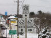
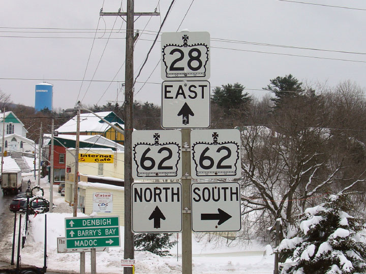
| Town of Bancroft County of
Hastings |
Eastbound junction assembly for Highway's 62 and
28 in Bancroft. Highway 62 is cosigned with Highway 28 for a short
distance where the highways cross the York River.
Photo taken: December 30th, 2004. |
 |
|
Highway 62 is one of Eastern
Ontario's longest and most notable highways -- stretching from Bloomfield
northeasterly to Pembroke.
Click
here for Highway 62 images. |
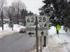
| Town of Bancroft County of
Hastings |
Opposing junction signage at the western Highway
28/62 intersection.
Photo taken: December 30th, 2004. |
 |
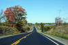
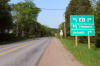
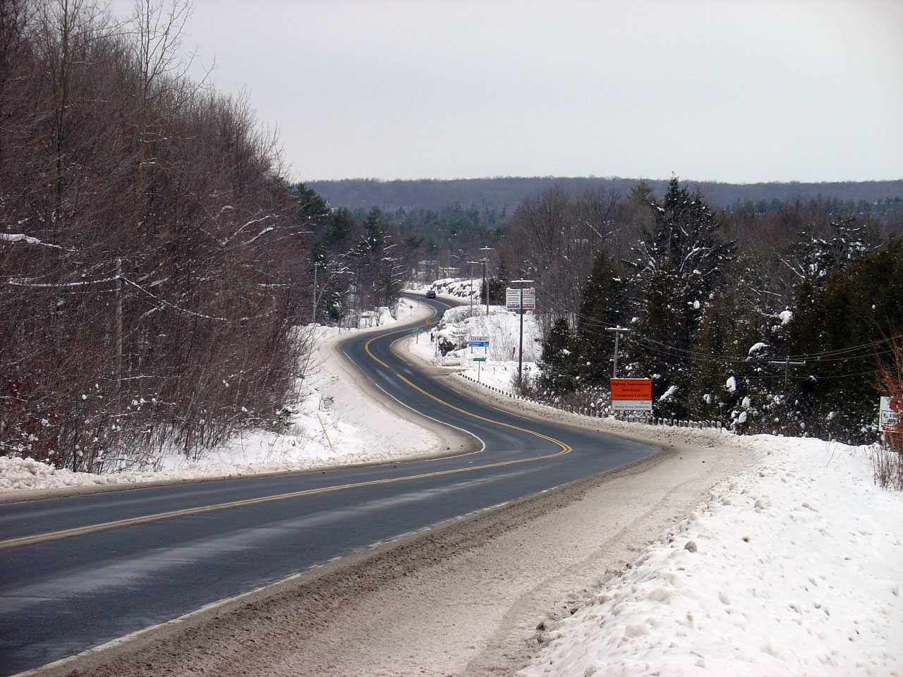
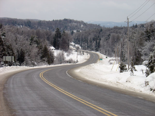
| Township of Carlow/Mayo County
of Hastings |
East of Bancroft now, this winter scene shows
Highway 28 as it nears the Bruce Road intersection. East of Bancroft,
Highway 28 is lightly traveled.
Photo taken: December 30th, 2004. |
(720x480)
(1440x960)
|
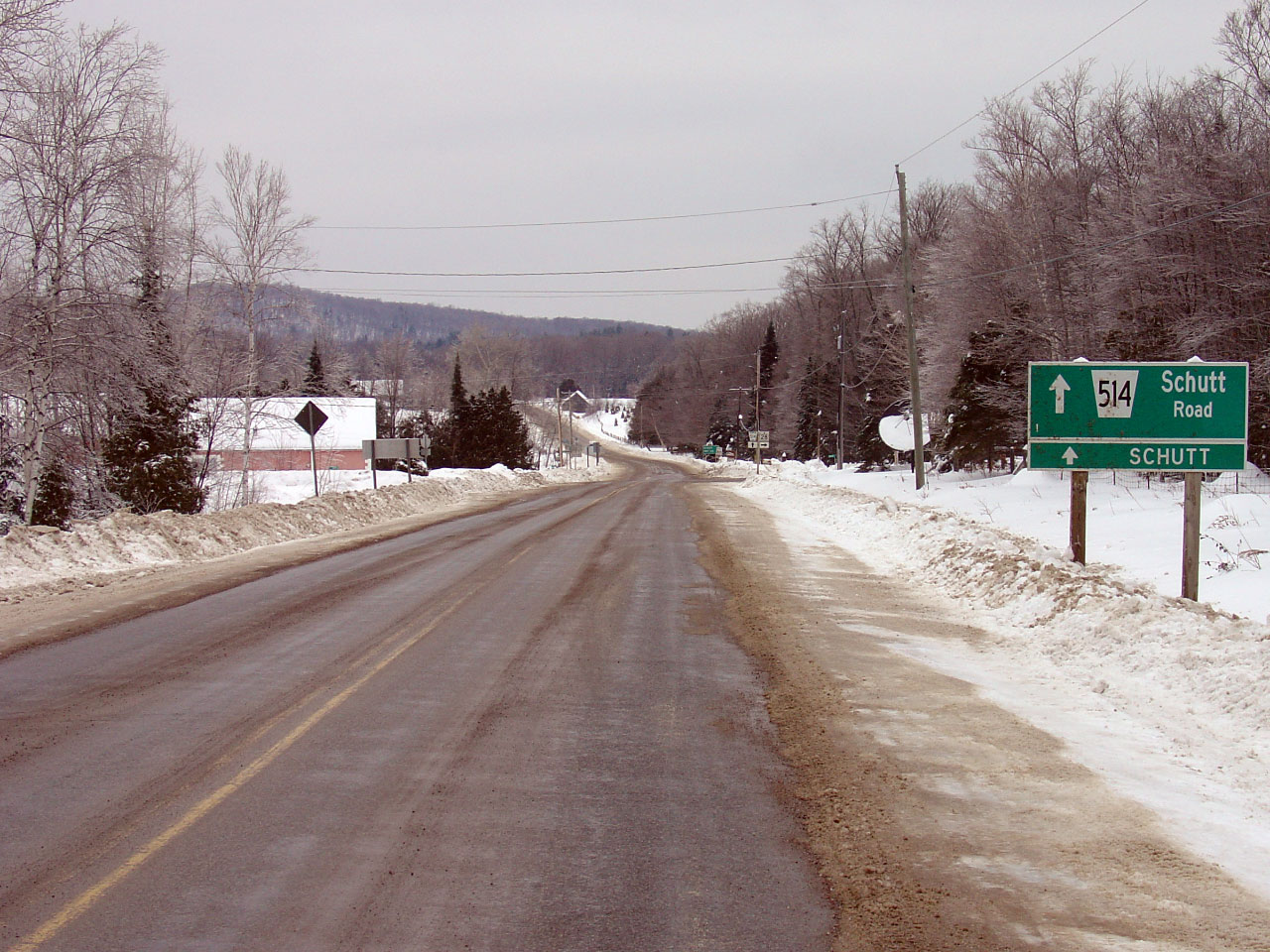
| Township of Brudenell, Lyndoch
and Raglan County of Renfrew |
Approahing the Highway 514 intersection along
Highway 28. Traffic bound for Denbigh must turn right at this
intersection.
Photo taken: December 30th, 2004. |

(720x480)
(1440x960)
|
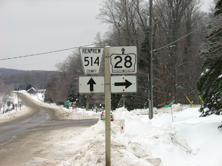
| Township of Brudenell, Lyndoch
and Raglan County of Renfrew |
Junction assembly for the former Highway 514
junction. Rural Renfrew County was hit particularly hard by provincial
downloading: having to take eight secondary highways and a substantial
section of Highway 62.
Photo taken: December 30th, 2004. |
 |
|
Highway 514 departs Highway 28
bearing north bound for Schutt and Highway 515.
Click here for Highway 514 images. |
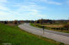
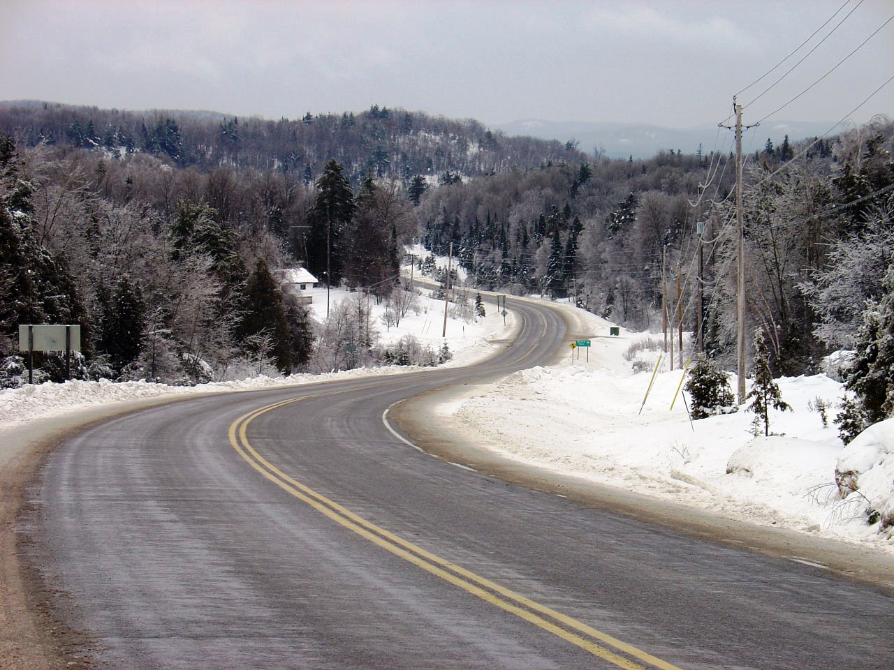
| Township of Brudenell, Lyndoch
and Raglan County of Renfrew |
Easterly view along Highway 28 from the Highway
514 junction. Highway 28 disappears quickly into a valley beyond the
Highway 514 intersection.
Photo taken: May 30th, 2011. |
(720x480)
(1440x960)
(2400x1600) |
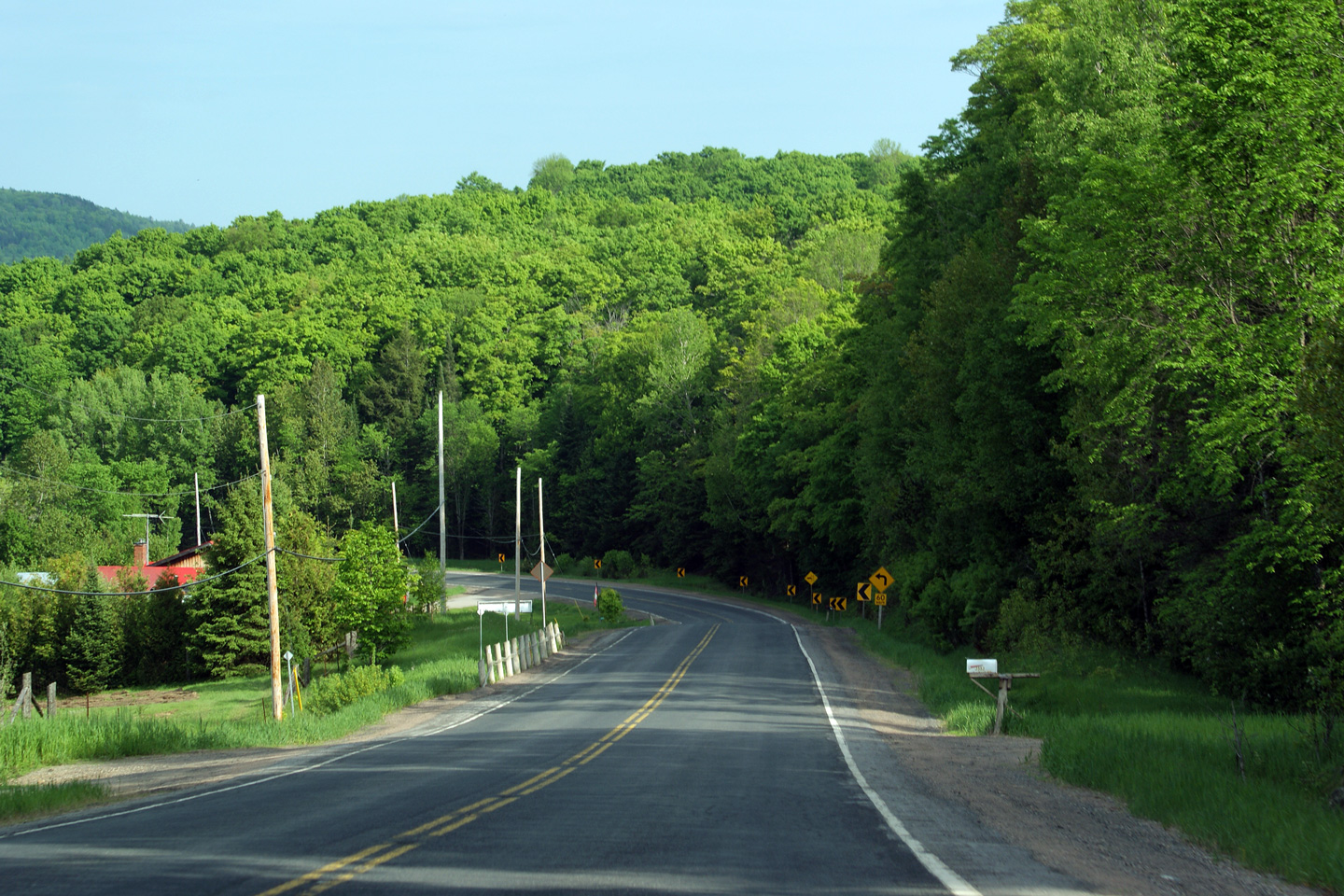
| Township of Brudenell, Lyndoch
and Raglan County of Renfrew |
Easterly view from slightly further east than
the previous photo. Highway 28 descends into a steep valley just
beyond the pictured curve. Notice the chevron's that have been
installed as positive guidance to guide traffic around the pictured curve.
Because the curve is situated just east of a vertical crest curve, the
horizontal curve cannot be seen by the driver at all. In such a
circumstance, it is tremendously important to place positive guidance to
lead drivers around the curve.
Photo taken: May 30th, 2011. |
(720x480)
(1440x960)
(2400x1600) |
| Township of Brudenell, Lyndoch
and Raglan County of Renfrew |
Easterly view as Highway 28 continues to descend
into the valley found just east of Highway 514. At the bottom of this
large valley, there is a small tributary of the Madawaska River.
Photo taken: May 30th, 2011. |
(720x480)
(1440x960)
(2400x1600) |
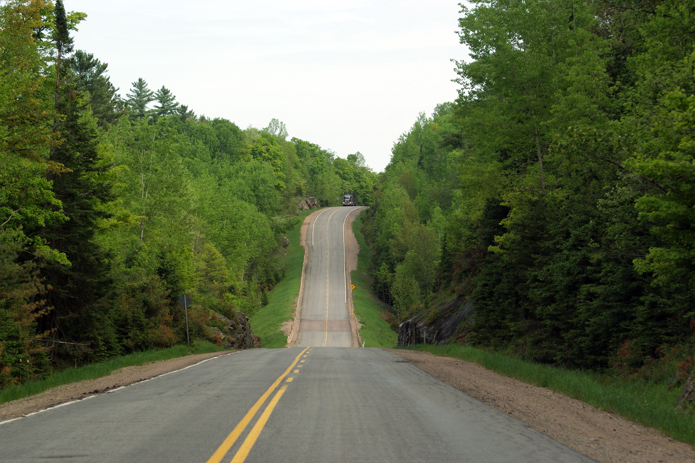
| Township of Brudenell, Lyndoch
and Raglan County of Renfrew |
Easterly view at the bottom of same long hill as
in the previous photos. Notice the disjointed highway alignment that
has been created by the closely spaced vertical crest curve followed by the
vertical sag curve.
Photo taken: May 30th, 2011. |
(720x480)
(1440x960)
(2400x1600) |
| Township of Brudenell, Lyndoch
and Raglan County of Renfrew |
Two views (winter and summer) looking east along a poorly designed vertical
sag curve east of Highway 514.
Upper photo taken: December 30th, 2004.
Lower photo taken: May 30th, 2011. |
(720x480)
(1440x960)

(720x480)
(1440x960)
(2400x1600) |
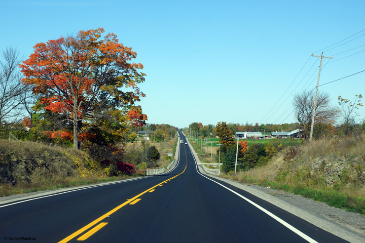
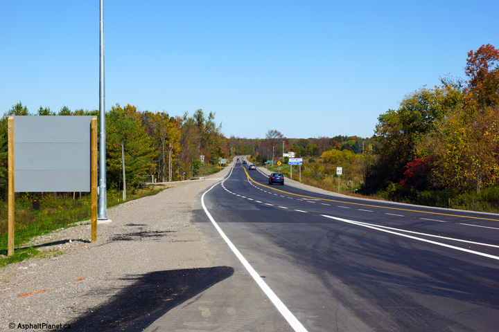
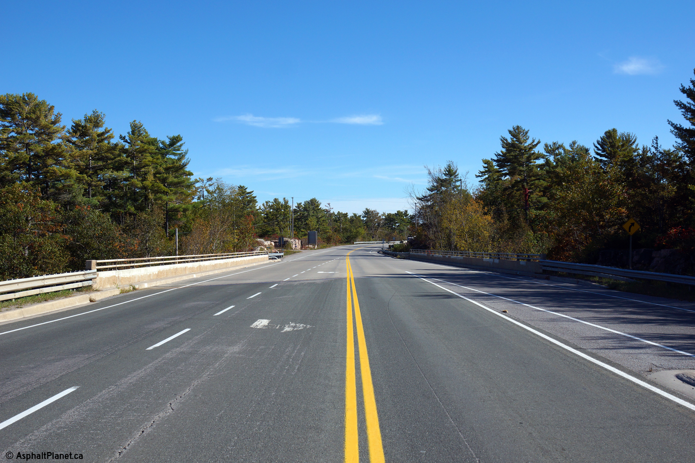
Township of Addinton Highlands
County of Lennox and Addington |
This view looks easterly approaching the first
(and second) of four signs that denote the eastern terminus of Highway 28 at
Highway 41.
Photo taken: May 30th, 2011. |
(720x480)
(1440x960)
(2400x1600) |
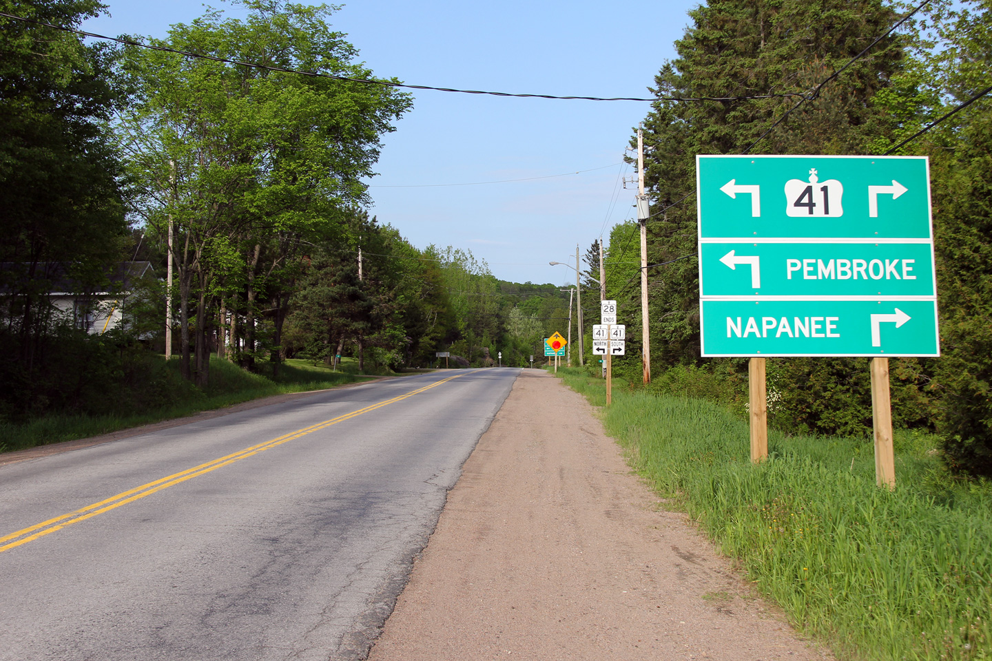
Township of Addinton Highlands
County of Lennox and Addington |
Another easterly view, this time towards the
third of four eastbound signs that denote the Highway 41 junction. The
Highway 41 intersection is obscured by the curve in the highway ahead and
likely catches drivers by surprise. Likely this is why the MTO has
elected to place as many junction signs as they have.
Photo taken: May 30th, 2011. |
(720x480)
(1440x960)
(2400x1600) |
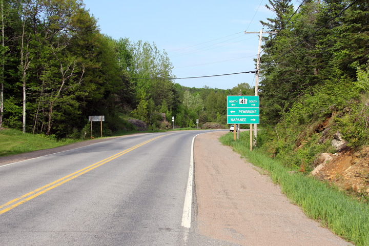
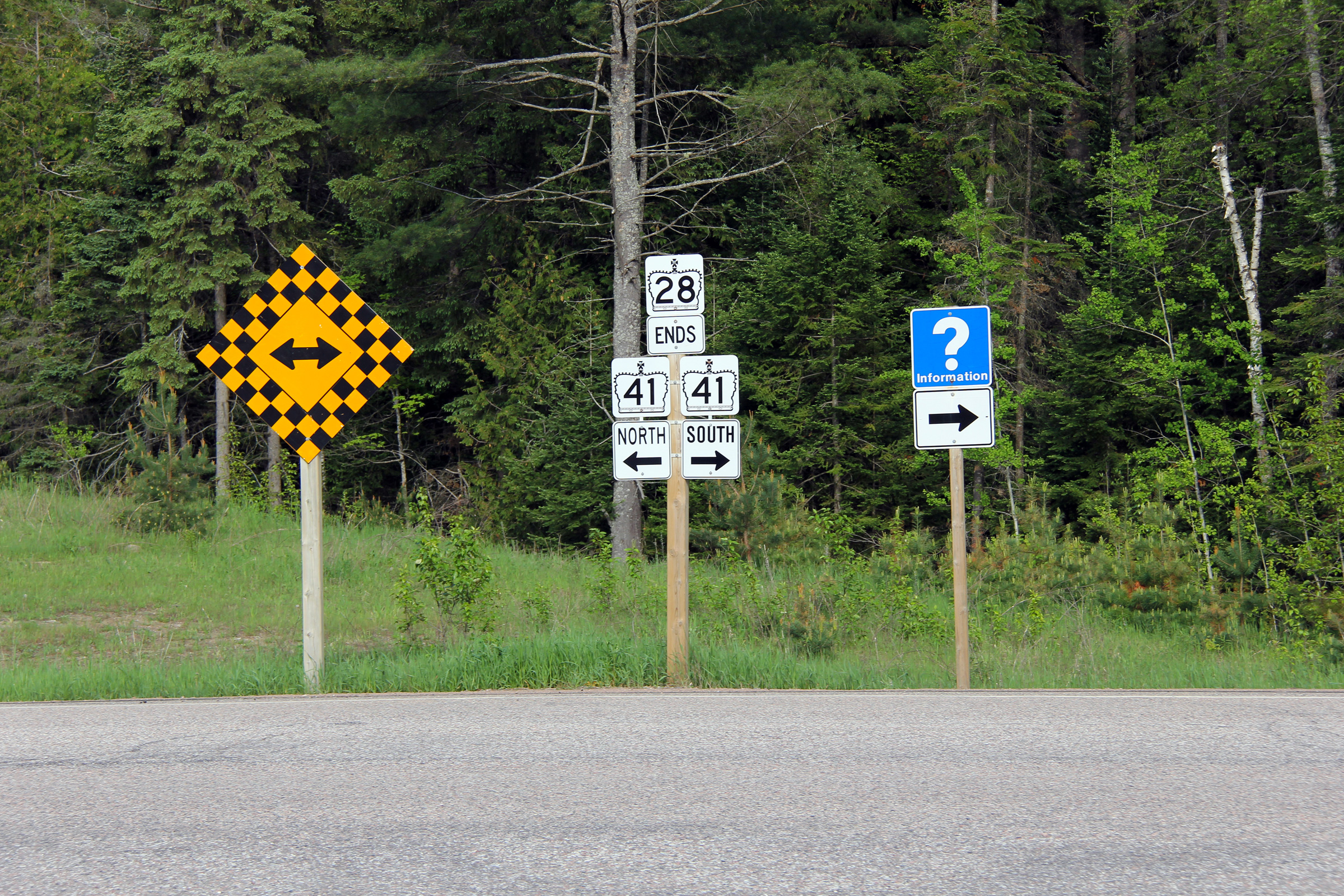
Township of Addinton Highlands
County of Lennox and Addington |
Easterly view along Highway 28 approaching the
Highway 41 junction.
Photo taken: May 30th, 2011. |
(720x480)
(1440x960)
(2400x1600) |
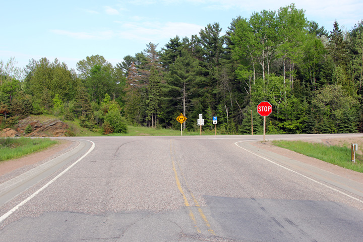
Township of Addinton Highlands
County of Lennox and Addington |
The fourth and final junction assembly for the
Highway 41 junction is found just beyond Highway 41 at the intersection.
Photo taken: May 30th, 2011. |
 (720x480) (720x480)
(1440x960)
(2400x1600) |
|
Highway 41 runs north-south
through Eastern Ontario between Napanee and Pembroke.
Click
here for Highway 41 images. |


 (720x480)
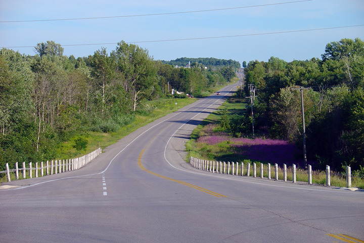


 (720x480)
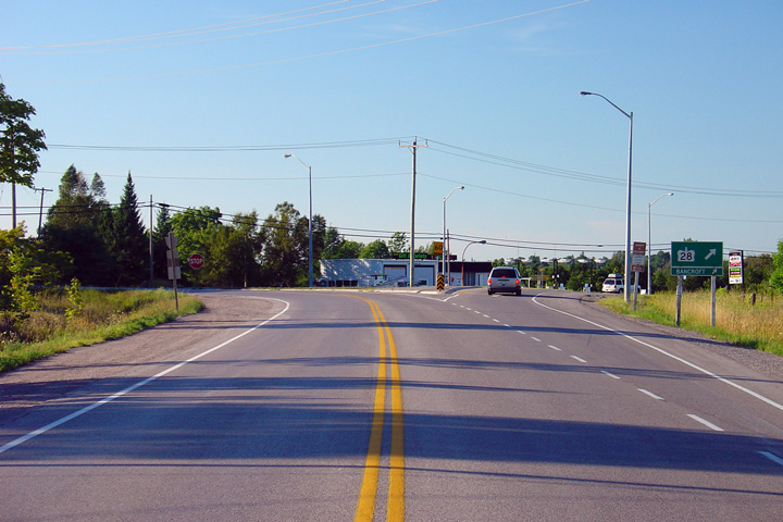


 (720x480)
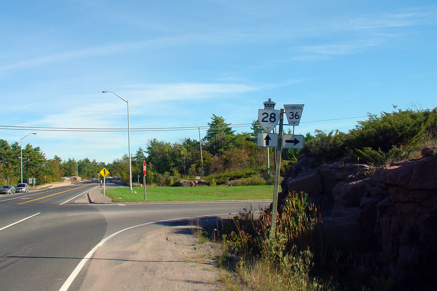


 (720x480)
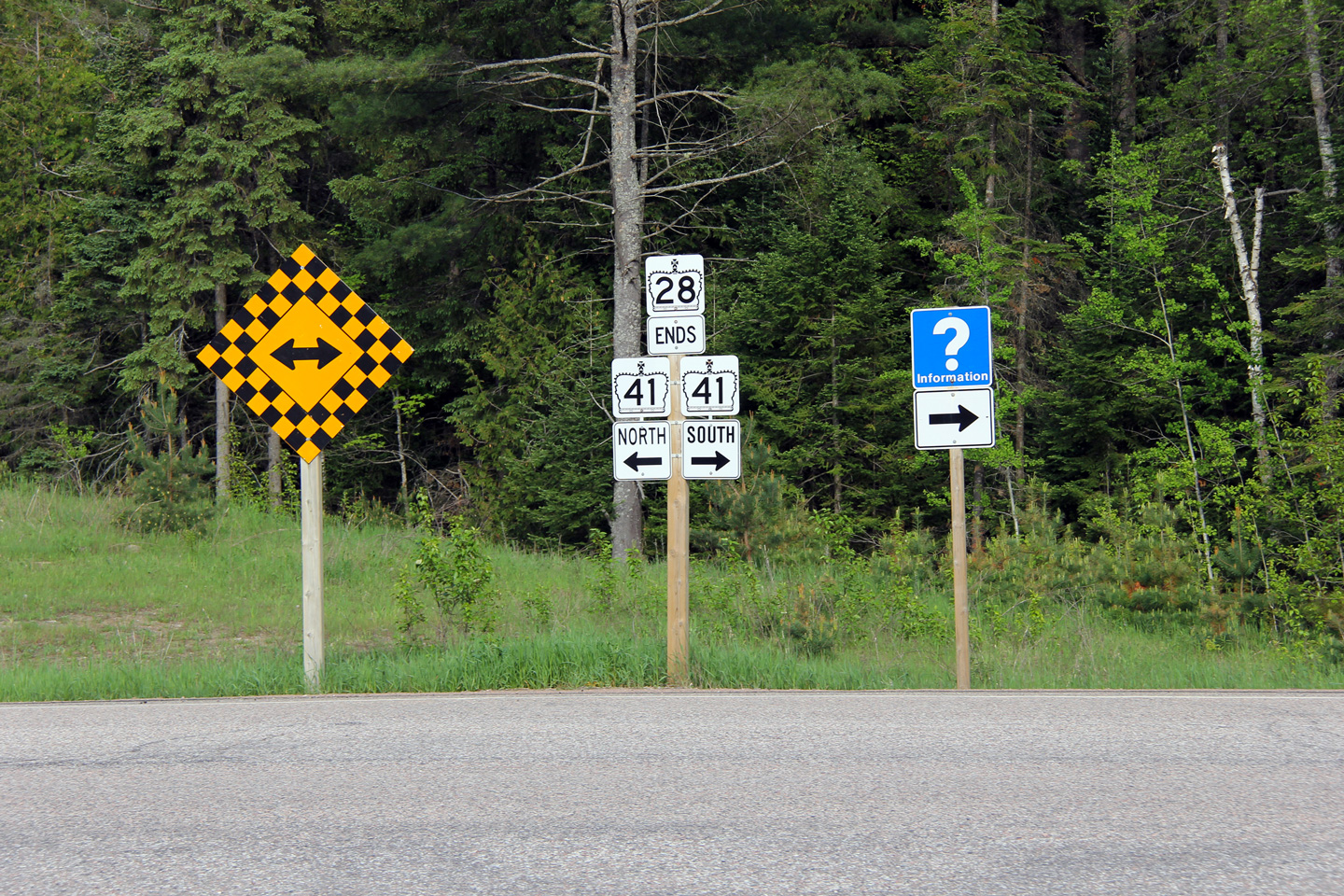