|
Proper Municipality Name |
Photo Description |
Photo |
|
Pictures taken
from driver's perspective appear offset from centre-line pictures: |
North-
Bound |
South-
Bound |
| Warwick - Plympton- Wyoming
Boundary County of Lambton |
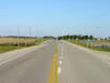
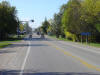
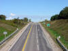
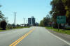
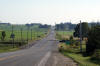
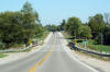
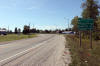
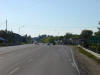
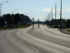
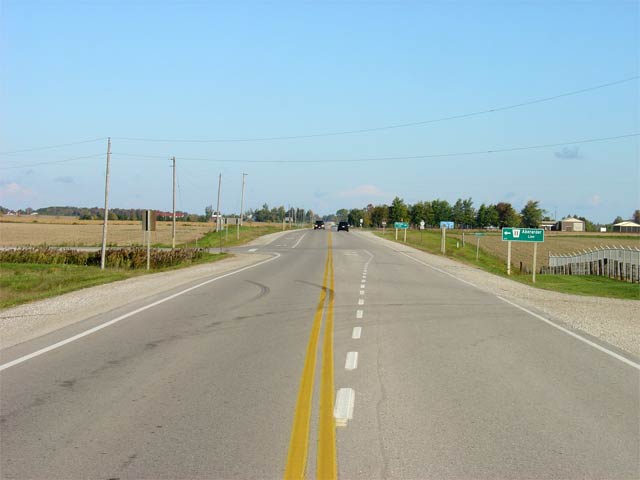
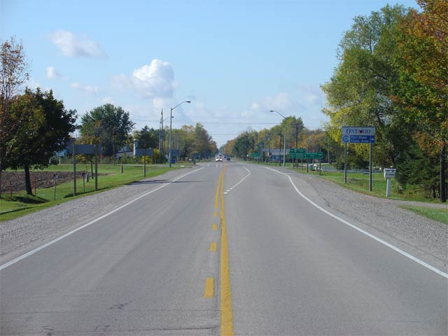
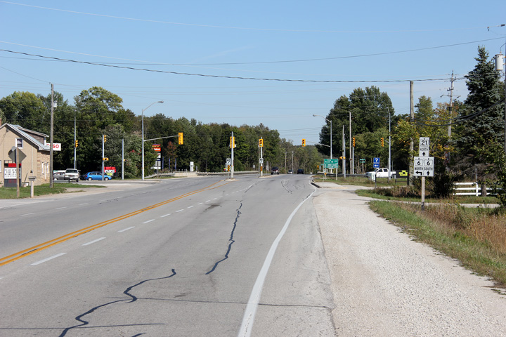
Signage at the southern end of Highway 21 at the south end of the
Highway
402 interchange. Highway 21 continues south through much of rural
Lambton County as County Road 8. Picture taken: April 9th, 2006.
Size: 35kb. |
 |
|
Highway 402 leads east and west of
Highway 402 to London and Sarnia.
Click here for Highway 402 images. |
| Warwick - Plympton- Wyoming
Boundary County of Lambton |
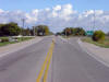
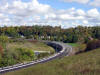
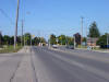
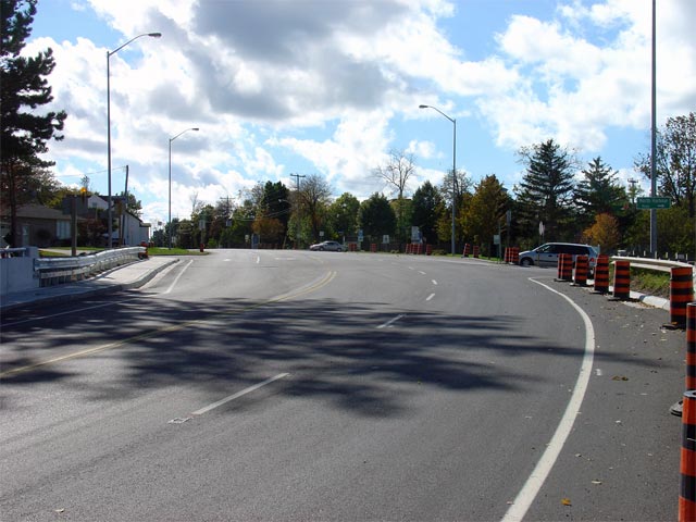
View looking southerly towards the current southern terminus of Highway 21
at the
Highway
402 interchange. Highway 21 meets the 402 at a 5-ramp partial
cloverleaf. Picture taken: April 9th, 2006. Size: 40kb |
 |
| Warwick - Plympton- Wyoming
Boundary County of Lambton |
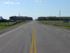
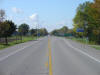
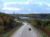
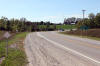
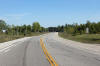
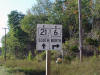
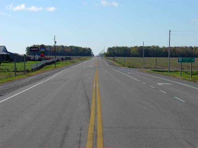
View looking northerly along Highway 21 approaching the Lambton Road 11
intersection. Lambton Road 11 is located roughly 7km north of
Highway
402. Picture taken: October 15th, 2005. Size: 30kb. |
 |
| Warwick - Plympton- Wyoming
Boundary County of Lambton |
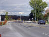
View looking south along Highway 21 at the Lambton Road 11 intersection.
Picture taken: October 15th, 2005. Size: 30kb. |
 |
| Municipality of Lambton Shores
County of Lambton |
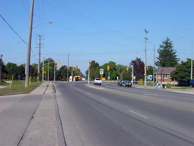
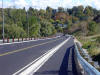
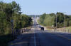
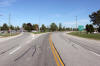
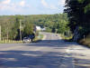
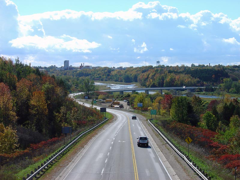
Looking south from the south limits of the Town of Forest. Highway 21
is crossing the Hickory Creek bridge in this photo. Picture taken: October
15th, 2005. Size: 50kb. |
 |
| Municipality of Lambton Shores
County of Lambton |
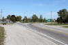
View looking northerly along Highway 21 approaching the
Highway 79 intersection. Picture taken:
October 15th, 2005. Size: 65kb. |
 |
|
Highway 79 leads south from
Northville to Thedford and Bothwell. Click here for Highway 79 images
(Coming Soon!) |
| Municipality of Lambton Shores
County of Lambton |
Looking south towards Highway 79 along
Highway 21. Picture taken: October 15th, 2005. Low-res: 60kb.
High-res: 235kb. |

Low-res
High-res |
| Municipality of South Huron
County of Huron |
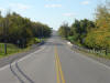
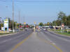
View looking south along Highway 21 from the northern limits of Grand Bend.
Highway 21 is maintained locally throughout Grand Bend as part of a
connecting link agreement. Picture taken: October 15th, 2005. Size:
60kb. |
 |
| Municipality of South Huron
County of Huron |
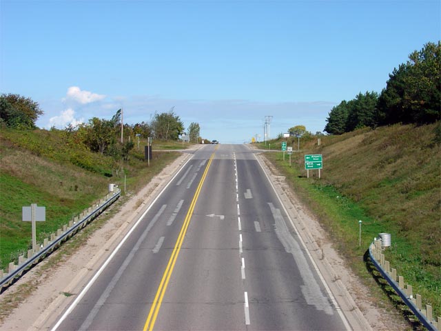
View looking north along Highway 21 at the
Highway 83 intersection. The Highway
83 intersection is located roughly 5km north of Grand Bend's northern
limits and stretches easterly to Exeter before terminating at
Highway 23.
Picture taken: October 15th, 2005. Size: 40kb. |
 |
| Municipality of Bluewater
County of Huron |
View looking south along Highway 21 at the
Highway 83 intersection. Picture taken: October 15th, 2005.
Size: 45kb. |
 |
|
Highway 8 leads east from Goderich to Stratford, Kitchener, and
eventually Hamilton.
Click
here for Highway 8 images. |
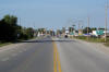
| Town of Goderich |
Looking north from the northern limits of the Goderich connecting link
towards the junction with Harbour Street. Highway 21 has a 4-lane
cross-section throughout much of Goderich. At Harbour Street, the left
most lane defaults as a left-turn lane and all through traffic must keep
right.
Picture taken: October 15th, 2005. Size: 60kb. |
 |
| Town of Goderich |
Looking south into Goderich from the CNR overhead. The Goderich
connecting link agreement begins just on the south side of this
intersection. Goderich is a full-service community of about 7,500
residents. Picture taken: October 15th, 2005. Size: 60kb. |
 |
| Town of Goderich |
Looking north towards the Maitland River bridge from just north of the CN
Railway overhead. Due to the rather deep Maitland River Valley, there
are short climbing lanes on both the northbound and southbound ascent out of
the valley.
Picture taken: October 15th, 2005. Size: 80kb. |
 |
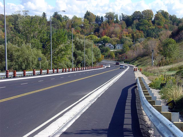
| Town of Goderich |
Looking north along the large scenic bridge over the Maitland River along
Highway 21. This large structure was rehabilitated during the
summer of 2004. This bridge was first constructed in 1961, eliminating
the original narrow structure located a bit to the south of the existing bridge.
Picture taken: October 15th, 2005. Size: 80kb. |
 |
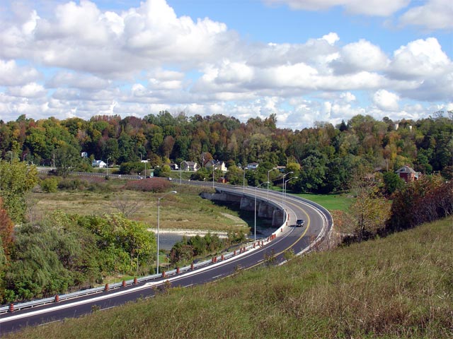
| Township of Ashfield- Colbrone-
Wawanosh County of Huron |
Looking south from an abandoned railway overhead (which now carries the
Goderich-Auburn trail) towards the Maitland River bridge in Goderich.
This large diversion on Highway 21 was completed in 1961. It included
the construction of the Maitland River bridge, an overhead over the CNR and
a subway under the abandoned railway that this picture was taken from.
Picture taken: October 15th, 2005. Size: 90kb. |
 |
| Township of Ashfield- Colbrone-
Wawanosh County of Huron |
Looking north towards the Airport Road intersection just north of Goderich.
Before 1961, Airport Road carried Highway 21 for a short distance west of
this junction. During this time, Highway 21 descended into the
Maitland River Valley via a broad switchback, that featured a narrow subway
under the now abandoned CPR.
Picture taken: October 15th, 2005. Size: 50kb. |
 |
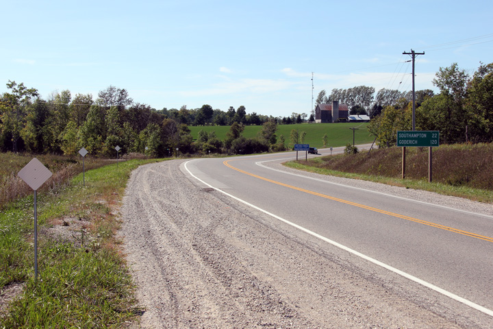
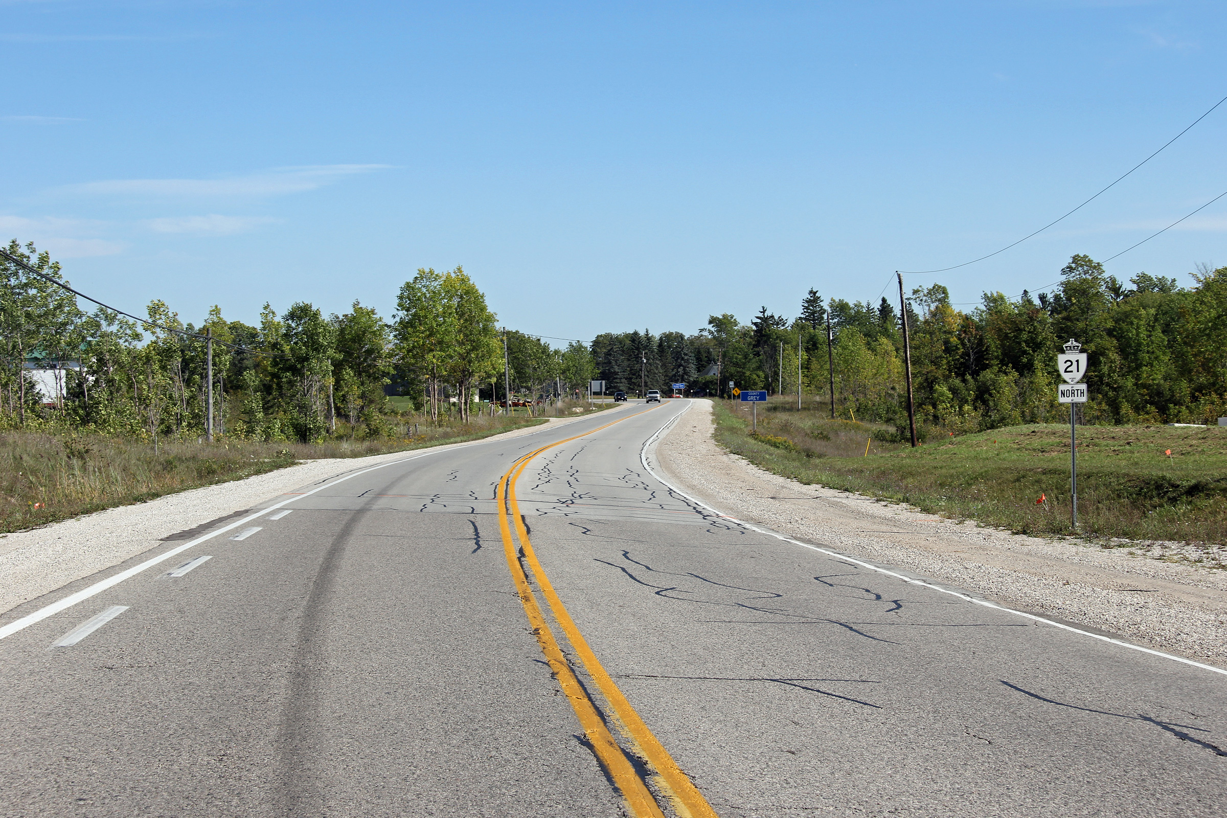
| Township of Ashfield- Colbrone-
Wawanosh County of Huron |
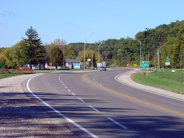
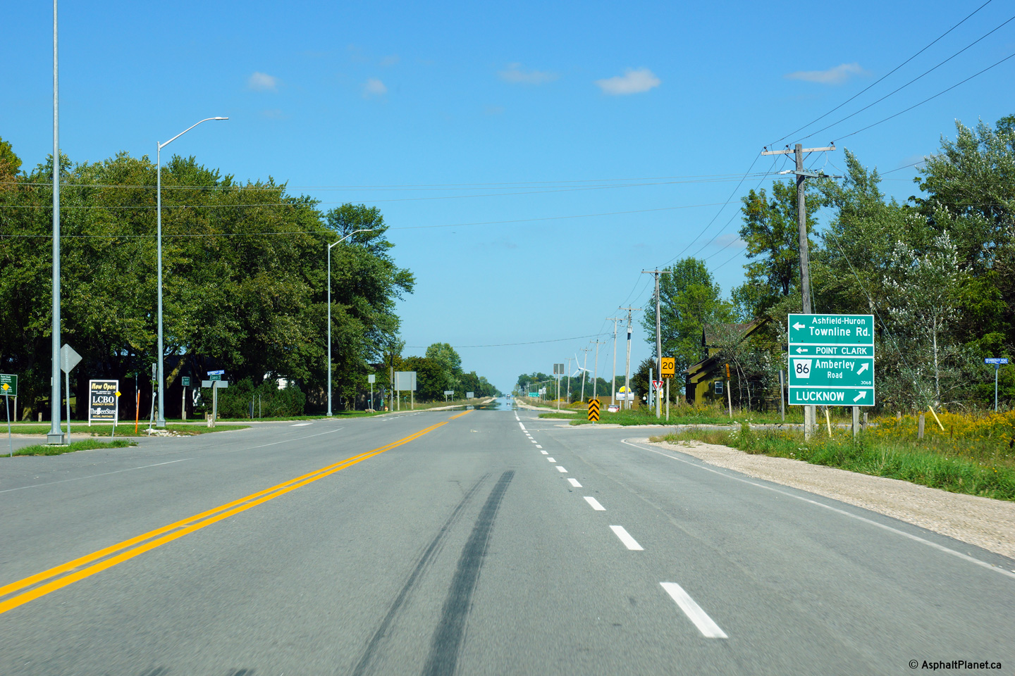
This view looks northerly approaching the Highway 86 intersection.
Photo taken: September 17th, 2013. |

(720x480)
(1440x960)
(2400x1600) |
|
Highway 86 leads east from Highway
21 through Lucknow, Palmerston, and Elmira until it terminates in
Kitchener/Waterloo. Click
here for Highway 86 images. |
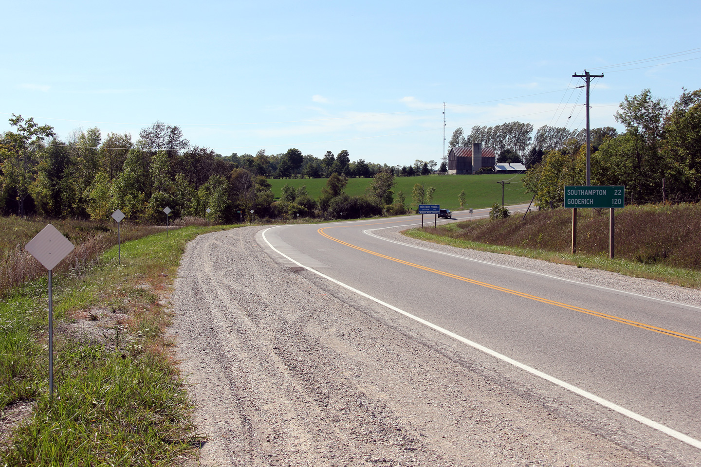
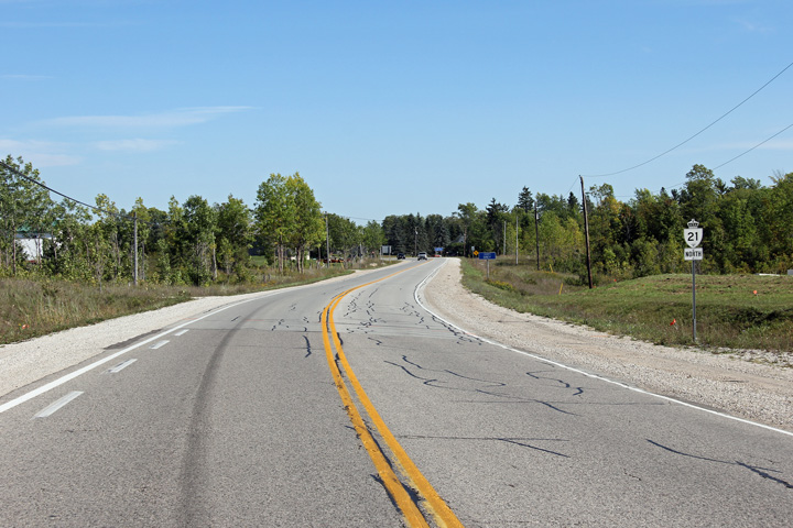
Township of Huron - Kinloss
County of Bruce |
Southerly view approaching the Highway 86 intersection.
Photo taken: September 17th, 2013. |
(720x480)
(1440x960)
(2400x1600) |
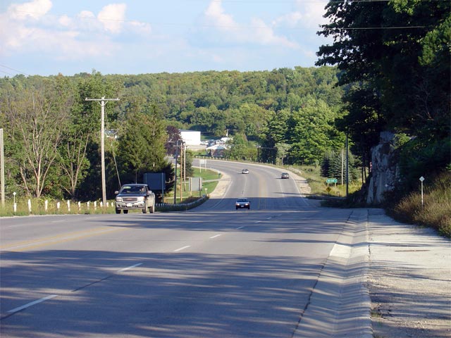
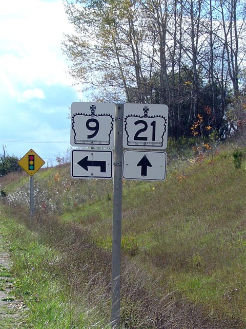
| Municipality of Kincardine
County of Bruce |
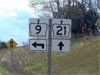
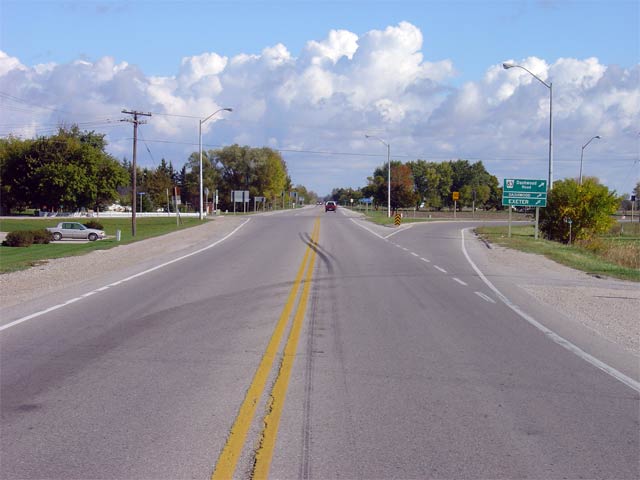
An October storm rolls into the Kincardine area off of Lake Huron at the
Highway 9 junction. This photo looks south towards Highway 9.
Picture taken: October 15th, 2005. Low-res: 70kb. High-res:
260kb. |

Low-res
High-res |
|
Highway 9 leads east from Kincardine to Harriston Orangeville and eventually Newmarket.
Click
here for Highway 9 images. |
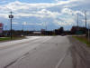
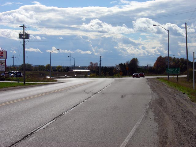
| Municipality of Kincardine
County of Bruce |
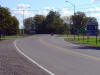
Advanced signage along Highway 21 south approaching the
Highway 9 intersection.
Picture taken: October 15th, 2005. Size: 95kb. |
 |
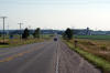
| Municipality of Kincardine
County of Bruce |
View looking southerly along Highway 21 as it nears the Sutton Road
intersection. Before the modern Kincardine By-pass was completed,
Highway 21 followed Sutton Road into the heart of Kincardine. Picture
taken: October 15th, 2005. Low-res: 55kb. High-res: 205kb. |
Low-res
High-res |
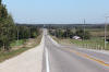
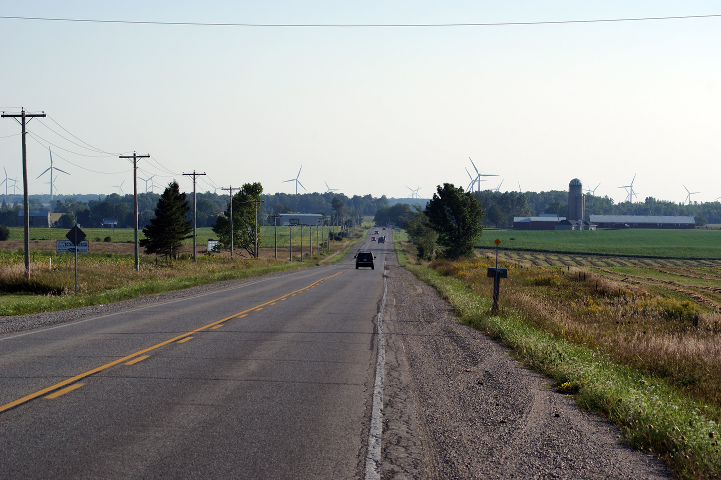
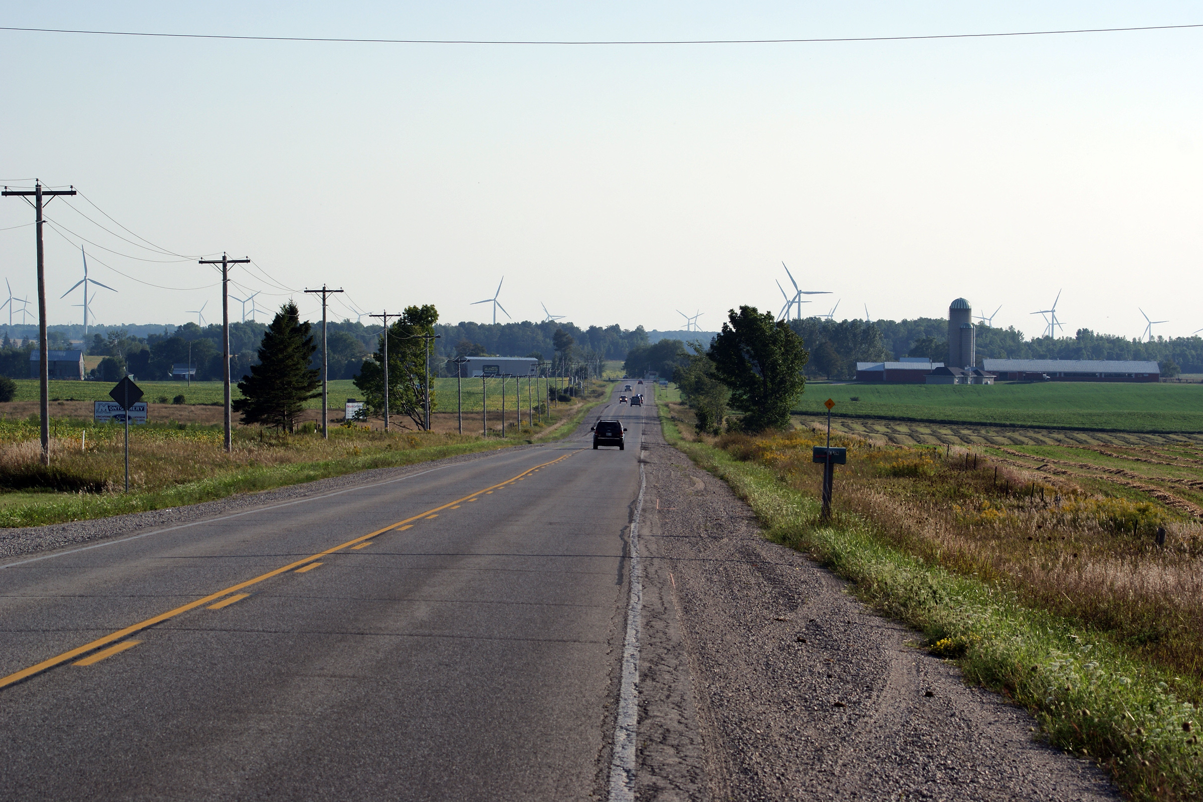
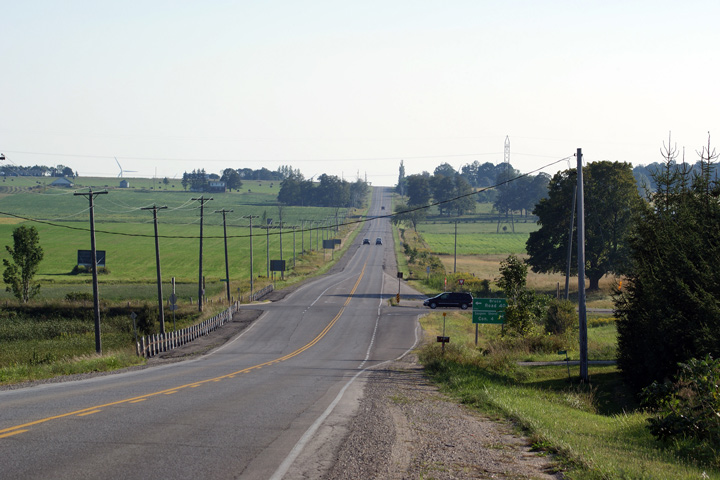
Town of Saugeen Shores
County of Bruce |
This view looks southerly towards North Bruce. Note the shear number
of wind turbines that have been erected along the Highway 21 corridor.
Highway 21 surrounding Bruce Nuclear is a very lucrative spot to build wind
farms due in part to strong prevailing winds, and an existing transmission
network care of Bruce Nuclear.
Photo taken: August 28th, 2010. |
(720x480)
(1440x960)
(2400x1600) |
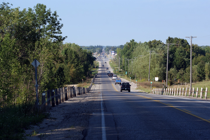
Town of Saugeen Shores
County of Bruce |
This view looks south towards the Bruce Road 40 intersection.
Photo taken: August 28th, 2010. |
(720x480)
(1440x960)
(2400x1600) |
Town of Saugeen Shores
County of Bruce |
Northerly view into Port Elgin from the Bruce County Rail Trail Crossing
(halfway between Concession Road 4 and Concession Road 6).
Photo taken: August 28th, 2010. |
(720x480)
(1440x960)
(2400x1600) |
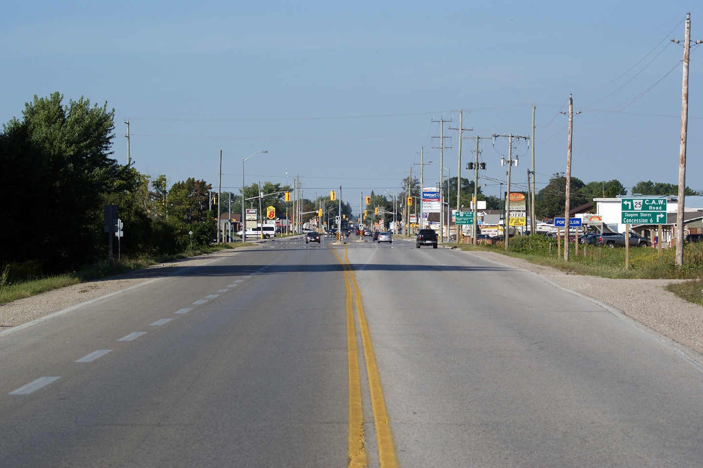
Town of Saugeen Shores
County of Bruce |
Northerly view into the urbanized Port Elgin area at the Bruce Road 25 (CAW
Road) Intersection.
Photo taken: August 28th, 2010. |
(720x480)
(1440x960)
(2400x1600) |
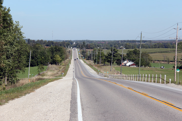
Arran- Elders - South Bruce
Peninsula Boundary
County of Bruce |
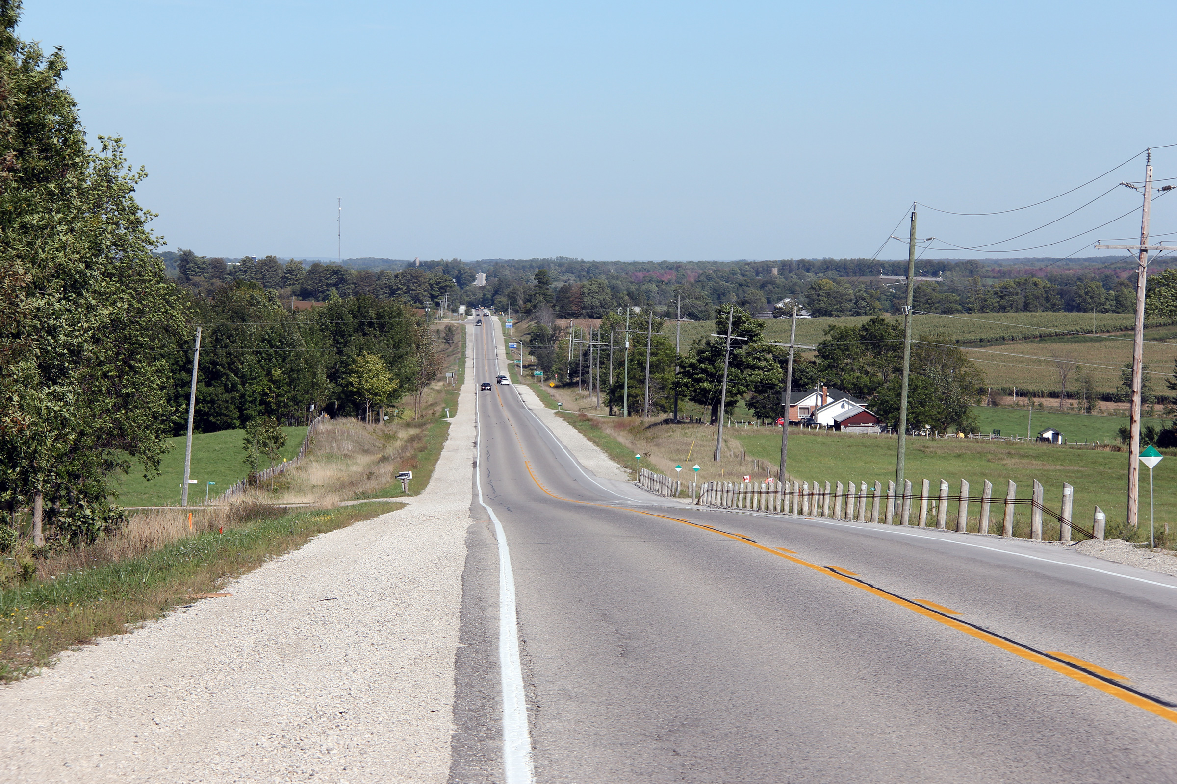
Northerly view along Highway 21 from just north of the Chesley Lake Road
intersection towards Allenford.
Photo taken: September 12th, 2012. |
(720x480)
(1440x960)
(2400x1600) |
Arran- Elders - South Bruce
Peninsula Boundary
County of Bruce |
View looking northerly as Highway 21 passes overtop of the Sauble River.
Click here
for a side shot of this structure, hosted at thekingshighway.ca
Photo taken: September 12th, 2012. |
(720x480)
(1440x960)
(2400x1600) |
Arran- Elders - South Bruce
Peninsula Boundary
County of Bruce |
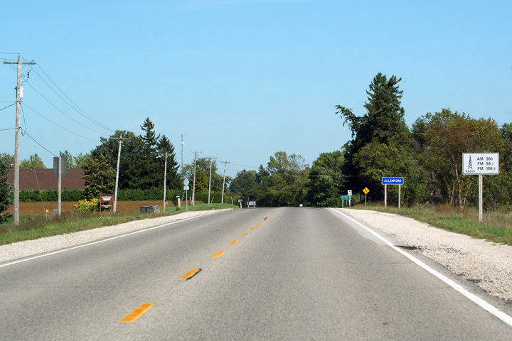
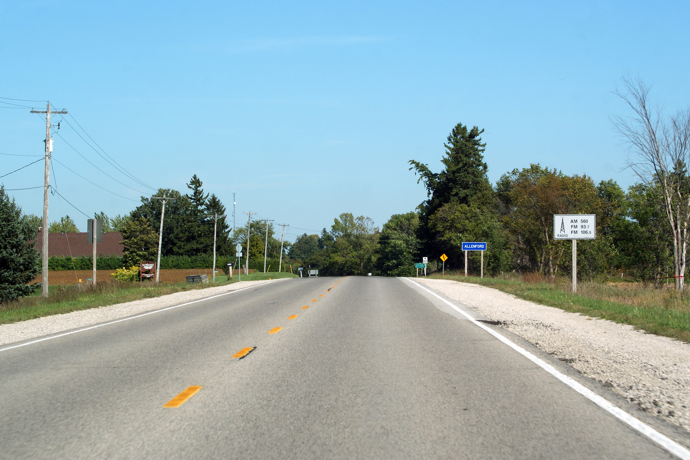
Approaching Allenford looking northerly (easterly) along Highway 21. Notice
the white sign indicating the radio stations that are now in range along
Highway 21. Signs like these are becoming increasingly rare along Ontario's
highways. They are relics from the time that the Ministry of Transportation
had communications under its ministerial umbrella.
Photo taken: September 12th, 2012. |

(720x480)
(1440x960)
(2400x1600) |
Arran- Elders - South Bruce
Peninsula Boundary
County of Bruce |
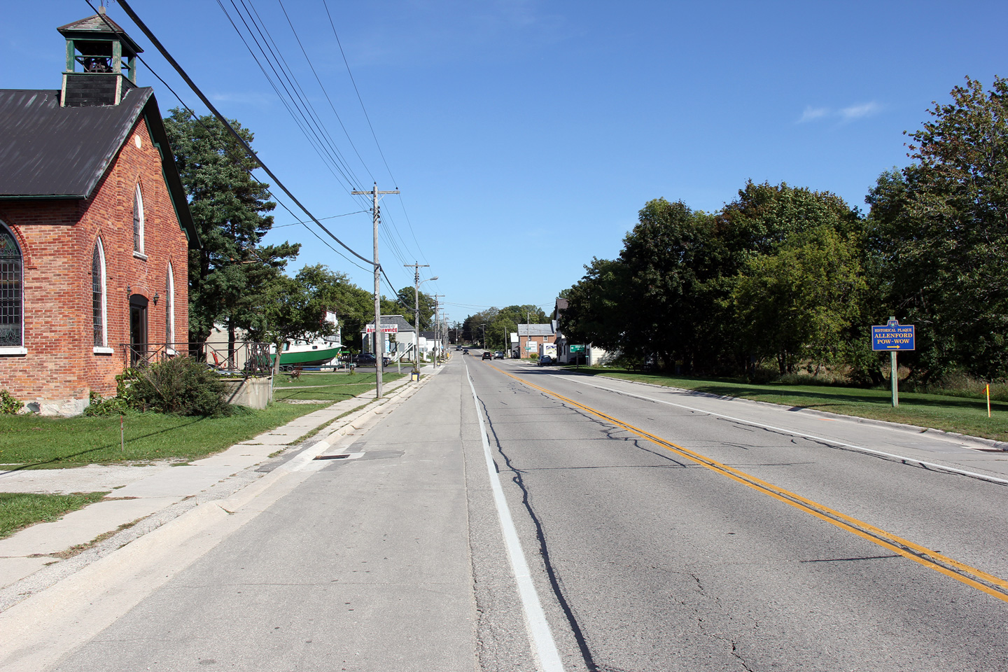
View looking northerly through the small community of Allenford.
Photo taken: September 12th, 2012. |

(720x480)
(1440x960)
(2400x1600) |
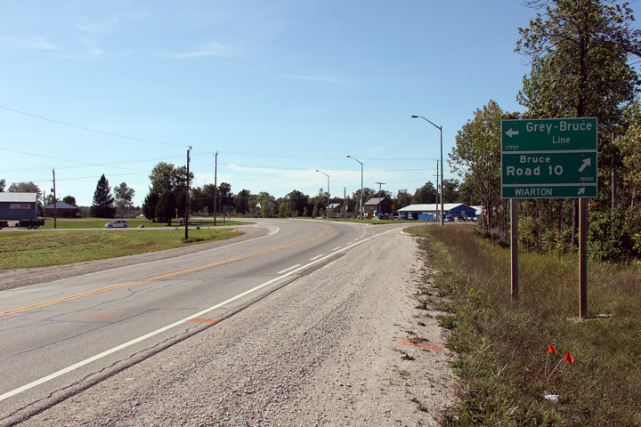
Arran- Elders - South Bruce
Peninsula Boundary
County of Bruce |
This view looks westerly from the Bruce Road 10. Highway 21 is
deceptively long highway.
Photo taken: September 12th, 2012. |
(720x480)
(1440x960)
(2400x1600) |
Arran- Elders - South Bruce
Peninsula Boundary
County of Bruce |
Two views looking northerly along Highway 21 at the Bruce Road 10
intersection. Bruce Road 10 formerly carried the Highway 6 designation
until Highway 6 was re-routed onto Highway 70's former alignment.
Photos taken: September 12th, 2012. |
(720x480)
(1440x960)
(2400x1600)
(720x480)
(1440x960)
(2400x1600) |
Township of Georgian Bluffs
County of Grey |
View looking southerly approaching the Bruce Road 10 intersection.
Photo taken: September 12th, 2012. |
(720x480)
(1440x960)
(2400x1600) |
Township of Georgian Bluffs
County of Grey |
View looking northerly along Highway 21 from the Bruce Road 10 intersection.
Photo taken: September 12th, 2012. |
(720x480)
(1440x960)
(2400x1600) |
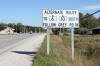
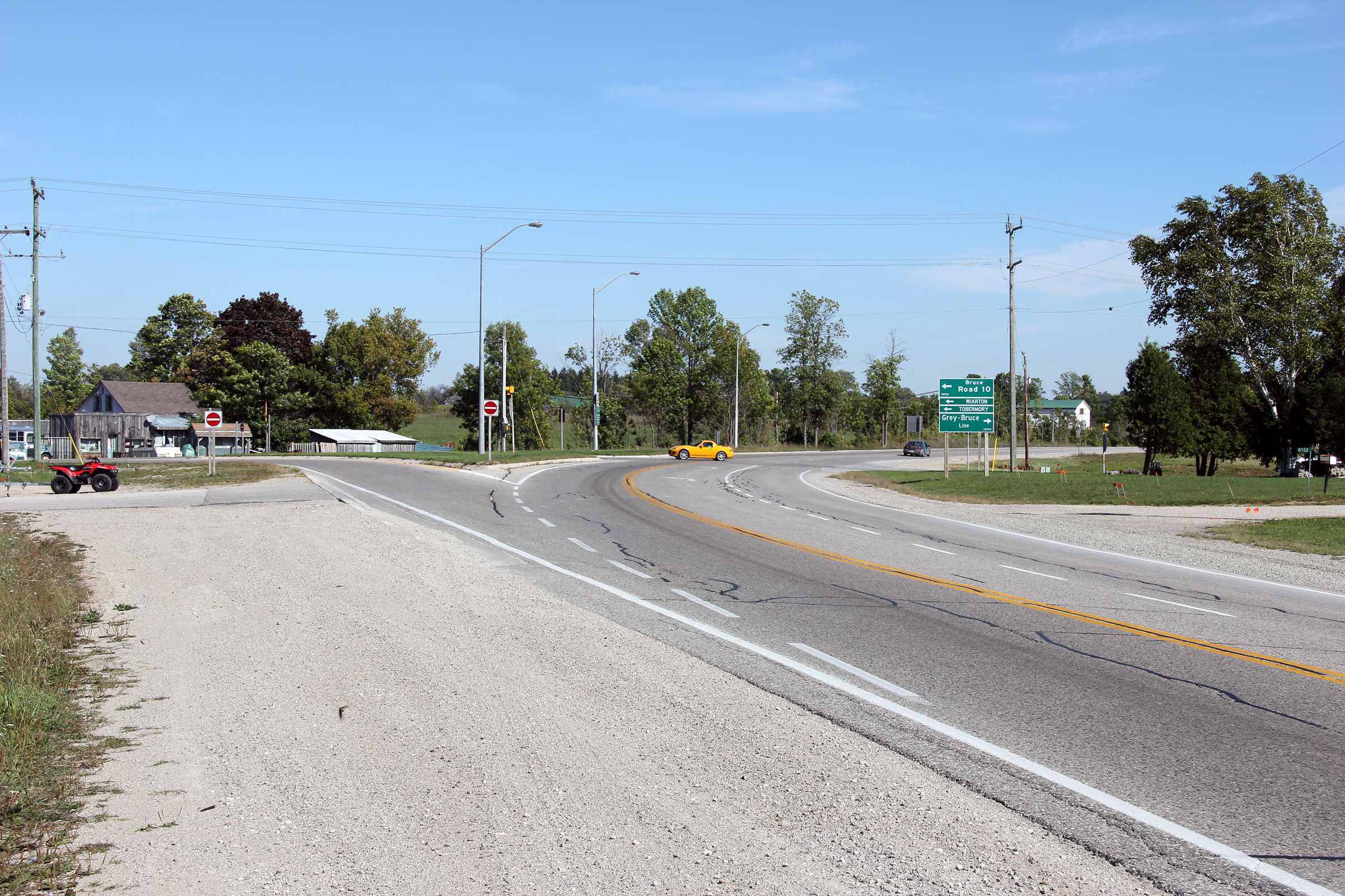
Township of Georgian Bluffs
County of Grey |
This sign directs traffic bound for Highway 6 and 10 south of Owen Sound
to follow Grey Road 18 to by-pass Owen Sound. Grey Road 18 would
make an excellent routing for Highway 6.
Photo taken: September 12th, 2012. |
 (720x480) (720x480)
(1440x960) |
Township of Georgian Bluffs
County of Grey |
This view looks northerly towards Owen Sound approaching the Highway 6-North
junction.
Photo taken: September 12th, 2012. |
(720x480)
(1440x960)
(2400x1600) |
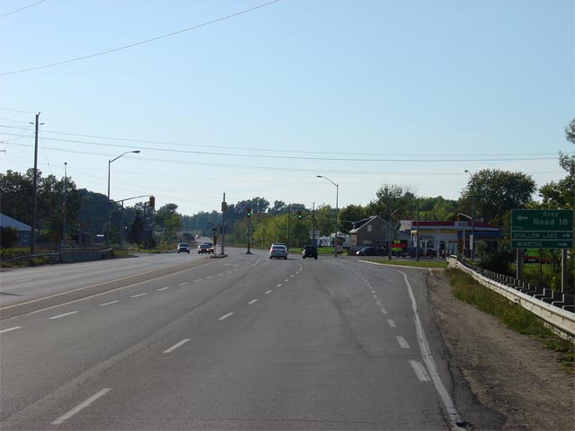
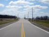
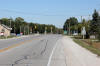
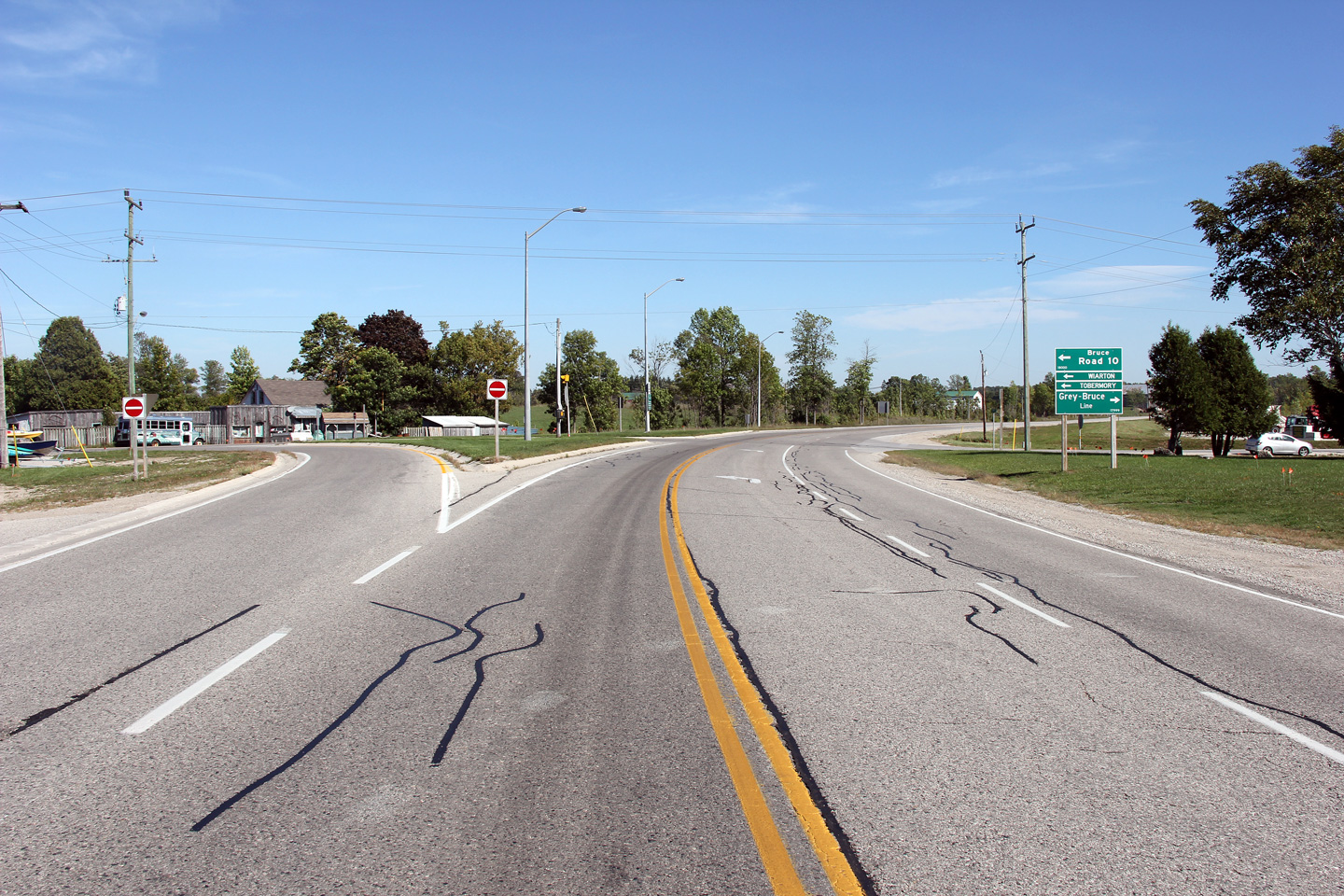
| Township of Georgian Bluffs
County of Grey |
Looking south along Highway 21 towards the western
Highway 6 junction in Springmount.
Interestingly, it would appear that at one time there was a channel for
direct northbound movements along Highway 6,
however, this channel has been removed, replaced with a standard right turn
lane, for reasons unbeknownst to me.
Picture taken: September 18th, 2005. Size: 40kb. |
 |
| Township of Georgian Bluffs
County of Grey |
Junction assembly denoting the western Highway 6/21 split. Before
downloading, Highway 6 continued further west along co-designated with
Highway 21 until Alvanley. Highway 6 then departed northerly along
what is now Bruce Road 10. The current Highway 6 alignment vial
Shallow Lake was at this time part of Highway 70. Click here for
Highway 6 Images (Coming Soon!)
Picture size: 70kb. |
 |
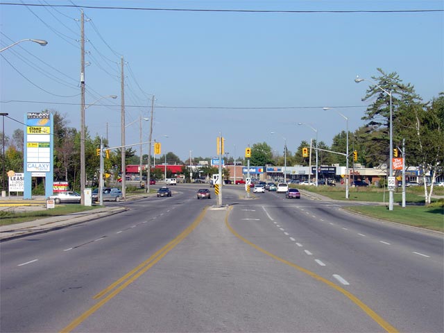
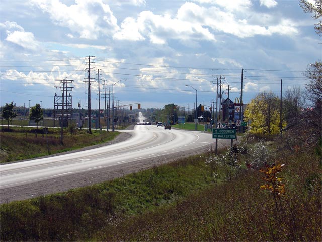
| Township of Georgian Bluffs
County of Grey |
Looking easterly along Highway 6/21 towards Owen Sound. Highway
6/21
has a 4.5 lane (or greater) cross section from the western
6/21 junction easterly to the
Own Sound Town Limits. Picture taken: September 18th, 2005. Size:
70kb. |
 |
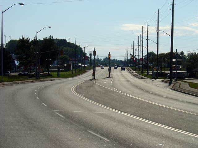
| Township of Georgian Bluffs
County of Grey |
Looking easterly along Highway 6/21 through the Grey County Mall
intersection. Much of Highway 6/21
between Springmount and Owen Sound is surrounded by the pictured type of
suburban commercial development.
Picture taken: September 18th, 2005. Size: 50kb. |
 |
| Township of Georgian Bluffs
County of Grey |
Looking westerly along Highway 6/21 towards the signalized intersection with
the Grey County Mall. This is the only signalized intersection along
Highway 6/21 between Springmount and the Owen
Sound city limits.
Picture taken: September 18th, 2005. Size: 50kb. |
 |
| Township of Georgian Bluffs
County of Grey |
Looking east towards the junction of Nichol's Gully Road along Highway
6/21. Nichol's Gully Road marks the western boundary of the City of Owen Sound.
East of this junction, Highway 6/21 is maintained by the City of Owen Sound
as part of a connecting link agreement.
Picture taken: September 18th, 2005. Size: 45kb. |
 |
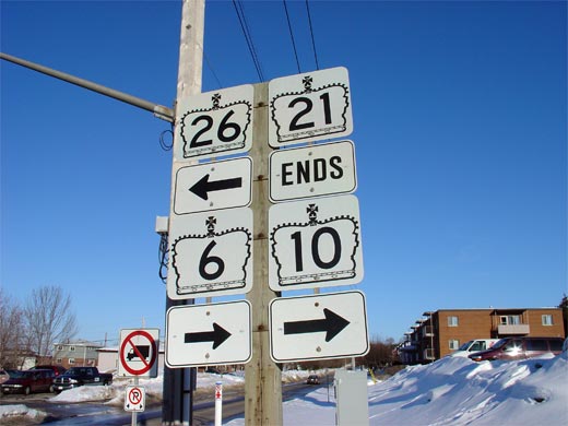
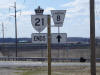
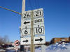
| City of Owen Sound |
Junction assembly denoting the northern terminus of Highway 21 at the
Highway 10/26
junction. Highway 21 shares a common terminus with both Highways
10 and 26.
Click here for Highway 10
Images, and here for Highway 26 Images.
Picture size: 40kb. |
 |


 (720x480)
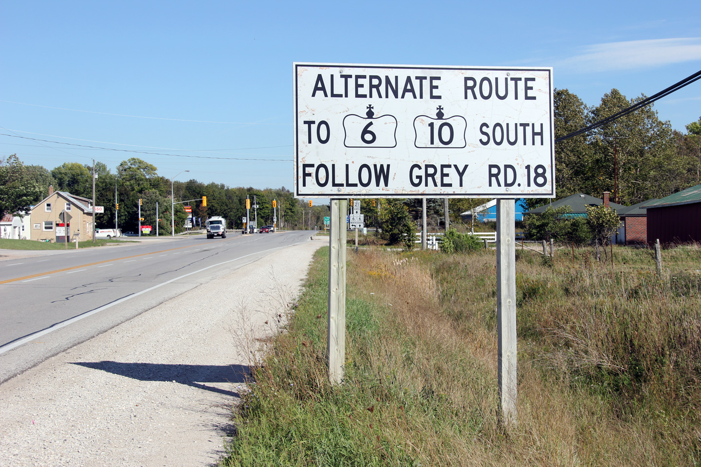